SlideShare a Scribd company logo
1 of 20
Brown, L., Drew, O., Kramer, I., Maranzu, V. and Rouse, C.
Terrestrial Laser Scanning for 3D Building Modelling
Output &
Validation
Data
Processing
Registration
Noise removal
Data
Collection
Leica C10
Site selection
3D Mapping
Available
methods
TLS
The Proposed Work
Available Methods
• Increasing demand for 3D building models
• Range of techniques available (Arayici, 2007; Mill et al., 2013):
• Traditional survey
• Tape measure
• Surveyor’s wheel
• Electronic distance meter
• Total station
• Close range photogrammetry
Terrestrial Laser Scanning
Definition:
“a ground-based, active imaging method that rapidly
acquires accurate, dense 3D point clouds of object
surfaces by laser range-finding” (Lichti, 2015)
Terrestrial Laser Scanning
Three types:
1. Triangulation-based
2. Pulse-based
3. Phase-based
• Over 1,000,000 pps
• Max. range 80m
• Comparable
accuracy
• 10,000-100,000 pps
• Max. range 300m
• 4-10mm accuracy
Terrestrial Laser Scanning
• Rapid acquisition
• Non-invasive
• Day or night operation
Source: rudi.net/files/paper/illustrations/composite.jpg
C10
Pulse-based
Green wavelength: 532nm
Point density: 50,000
Positional accuracy: 4mm
Range: 300m @ 90%
Source: http://hds.leica-geosystems.com
Data Collection
Resolution: 2cm at 20m
Max distance: 4m
Time: 7 minutes per scan
Points collected:
~21 million
Field-of-View:
270° (vertical)
360°(horizontal)
ProcessingRegistrationDatabase
Processing in Cyclone 9.0
Raw Data
• Noise Removal
• 3D Model
• Cloud-to-Cloud
• Add Constraints
Constraints (Control points)
Scan 1 Scan 2
Registered Point-clouds
People
Objects
Shadow
Outside
capture
Errors
Noise Removal
Registered Cleaned
3D Modelling
Output
Output
Object TLS (cm) Observed (cm) Error (cm)
Height
Poster frame 120.0 119.4 -0.6
Wall A 273.0 274.7 1.7
Double door 203.5 203.1 -0.4
Step 16.5 16.6 0.1
Wall B 279.0 278.3 -0.7
Width
Single door 83.5 83.4 -0.1
Double door 161.5 160.6 -0.9
Flower pot 39.5 38.4 -1.1
Step 118.0 117.4 -0.6
Chair 43.5 42.5 -1.0
RMSE 1.0
Validation
Improved Data Collection
• Full coverage
• Additional corridor
• Additional stairs
• Three stations
• Quicker
• Less accurate
• Difficult registration
• Leica P40 Scanner
• Combination of phase-based and pulse-based
• Spatial resolution: 1.2mm
• 1,000,000 pps
• Positional accuracy: 3mm
• Integrated approach
• Multiple scans of varying resolutions
• High-definition targets
• Undertake in morning/at night
• Additional software (SketchUp, AutoCAD)
Future Work
http://www.comptonmoving.com/http://hds.leica-geosystems.com/Bastonero et al., 2014http://www.coroflot.com/
Summary
References
• Arayici, Y., 2007. An approach for real world data modelling with the 3D terrestrial laser scanner for built environment, Automation in
Construction, 16, 816-829.
• Bastonero, P., et al., 2014. Fusion of 3D models derived from TLS and image-based techniques for CH enhanced documentation, ISPRS
Annals of the Photogrammetry, Remote Sensing and Spatial Information Sciences, Volume 2, ISPRS Technical Commission V
Symposium.
• El-Hakim et al., 1997. System for Indoor 3-D Mapping and Virtual Environments, SPIE, 3174, 21-35.
• Feng, Q., 2012. Advantages By Phase-based 3D Laser Scanning Techniques to Underground Construction, International Society for Rock
Mechanics.
• Lee, S.Y., et al., 2013. 3D Data Acquisition for Indoor Assets Using Terrestrial Laser Scanning, ISPRS Annals of the Photogrammetry,
Remote Sensing and Spatial Information Sciences, Volume 2, ISPRS 8th 3DGeoInfo Conference & WG II/2 Workshop, 27-29.
• Lichti, D., 2015. Special Issue "Terrestrial Laser Scanning“, Remote Sensing.
• MENSI, 2012. Technical specifications. Available from: http://mensi.free.fr/english/specsoi.htm
• Mill, T., et al., 2013. Combined 3D building surveying techniques – terrestrial laser scanning (TLS) and total station surveying for BIM data
management purposes, Journal of Civil Engineering and Management, 19, 1, S23-S32.
• Ordonez, C., et al., 2010. Measuring building facades with a low-cost closerange photogrammetry system, Automation in Construction,
19, 6, 742749.
• Williams, K.E., et al., 2012. Accuracy Assessment Of Geo-referencing Methodologies For Terrestrial Laser Scan Site Surveys, ASPRS
Annual Conference, Sacramento, California.

More Related Content

What's hot

Lecture-8-The-GIS-Database-Part-1.ppt
Lecture-8-The-GIS-Database-Part-1.pptLecture-8-The-GIS-Database-Part-1.ppt
Lecture-8-The-GIS-Database-Part-1.pptPrabin Pandit
 
Dgps concept
Dgps conceptDgps concept
Dgps conceptegovindia
 
Global positioning system (gps)
Global positioning system (gps)Global positioning system (gps)
Global positioning system (gps)Gokul Saud
 
Lecture 08 tilted photograph
Lecture 08  tilted photographLecture 08  tilted photograph
Lecture 08 tilted photographSarhat Adam
 
Global Positioning System
Global Positioning System Global Positioning System
Global Positioning System Varun B P
 
Aerial /Drone survey
Aerial /Drone surveyAerial /Drone survey
Aerial /Drone surveyOpenmaps
 
Applications of lidar technology
Applications of lidar technologyApplications of lidar technology
Applications of lidar technologySourabh Jain
 
Basics of Remote Sensing
Basics of Remote SensingBasics of Remote Sensing
Basics of Remote SensingAkash Tikhe
 
Microwave remote sensing
Microwave remote sensingMicrowave remote sensing
Microwave remote sensingRohit Kumar
 
Thermal remote sensing
Thermal remote sensingThermal remote sensing
Thermal remote sensingSakthivel R
 
Flight planning (aerial Photogrammetry)
Flight planning            (aerial Photogrammetry)Flight planning            (aerial Photogrammetry)
Flight planning (aerial Photogrammetry)Mr Amol Ghogare
 

What's hot (20)

Lidar and sensing
Lidar and sensingLidar and sensing
Lidar and sensing
 
LIDAR
LIDARLIDAR
LIDAR
 
1 remote sensing
1 remote sensing1 remote sensing
1 remote sensing
 
70.mobile gis
70.mobile gis70.mobile gis
70.mobile gis
 
Lecture-8-The-GIS-Database-Part-1.ppt
Lecture-8-The-GIS-Database-Part-1.pptLecture-8-The-GIS-Database-Part-1.ppt
Lecture-8-The-GIS-Database-Part-1.ppt
 
Dgps concept
Dgps conceptDgps concept
Dgps concept
 
Global positioning system (gps)
Global positioning system (gps)Global positioning system (gps)
Global positioning system (gps)
 
Geographical Information System
Geographical Information SystemGeographical Information System
Geographical Information System
 
Lecture 08 tilted photograph
Lecture 08  tilted photographLecture 08  tilted photograph
Lecture 08 tilted photograph
 
Global Positioning System
Global Positioning System Global Positioning System
Global Positioning System
 
Aerial /Drone survey
Aerial /Drone surveyAerial /Drone survey
Aerial /Drone survey
 
Applications of lidar technology
Applications of lidar technologyApplications of lidar technology
Applications of lidar technology
 
Basics of Remote Sensing
Basics of Remote SensingBasics of Remote Sensing
Basics of Remote Sensing
 
Microwave remote sensing
Microwave remote sensingMicrowave remote sensing
Microwave remote sensing
 
Thermal remote sensing
Thermal remote sensingThermal remote sensing
Thermal remote sensing
 
introduction-of-GNSS-1
introduction-of-GNSS-1introduction-of-GNSS-1
introduction-of-GNSS-1
 
Stereoscopic parallax
Stereoscopic parallaxStereoscopic parallax
Stereoscopic parallax
 
Flight planning (aerial Photogrammetry)
Flight planning            (aerial Photogrammetry)Flight planning            (aerial Photogrammetry)
Flight planning (aerial Photogrammetry)
 
Introduction to GNSS (1)
Introduction to GNSS (1)Introduction to GNSS (1)
Introduction to GNSS (1)
 
Photogrammetry
PhotogrammetryPhotogrammetry
Photogrammetry
 

Similar to Terrestrial laser scanning

Digital Heritage Documentation Via TLS And Photogrammetry Case Study
Digital Heritage Documentation Via TLS And Photogrammetry Case StudyDigital Heritage Documentation Via TLS And Photogrammetry Case Study
Digital Heritage Documentation Via TLS And Photogrammetry Case Studytheijes
 
Digital Heritage Documentation Via TLS And Photogrammetry Case Study
Digital Heritage Documentation Via TLS And Photogrammetry Case StudyDigital Heritage Documentation Via TLS And Photogrammetry Case Study
Digital Heritage Documentation Via TLS And Photogrammetry Case Studytheijes
 
Civilex Presentation Laser Scanning And Gpr March 2009 Ices
Civilex Presentation Laser Scanning And Gpr  March 2009  IcesCivilex Presentation Laser Scanning And Gpr  March 2009  Ices
Civilex Presentation Laser Scanning And Gpr March 2009 Icesguesta50845
 
Coastway SCAN to BIM Presentation may 25th cita
Coastway SCAN to BIM Presentation may 25th citaCoastway SCAN to BIM Presentation may 25th cita
Coastway SCAN to BIM Presentation may 25th citaCoastway
 
Coastway SCAN to BIM Presentation may 25th cita
Coastway SCAN to BIM Presentation may 25th citaCoastway SCAN to BIM Presentation may 25th cita
Coastway SCAN to BIM Presentation may 25th citaCoastway
 
Laser-beams, spacecraft and archaeology; recent approaches to the recording, ...
Laser-beams, spacecraft and archaeology; recent approaches to the recording, ...Laser-beams, spacecraft and archaeology; recent approaches to the recording, ...
Laser-beams, spacecraft and archaeology; recent approaches to the recording, ...Paul Cripps
 
3d Modelling of Structures using terrestrial laser scanning technique
3d Modelling of Structures using terrestrial laser scanning technique3d Modelling of Structures using terrestrial laser scanning technique
3d Modelling of Structures using terrestrial laser scanning techniqueIJAEMSJORNAL
 
Unsupervised Building Extraction from High Resolution Satellite Images Irresp...
Unsupervised Building Extraction from High Resolution Satellite Images Irresp...Unsupervised Building Extraction from High Resolution Satellite Images Irresp...
Unsupervised Building Extraction from High Resolution Satellite Images Irresp...CSCJournals
 
A visualization-oriented 3D method for efficient computation of urban solar r...
A visualization-oriented 3D method for efficient computation of urban solar r...A visualization-oriented 3D method for efficient computation of urban solar r...
A visualization-oriented 3D method for efficient computation of urban solar r...Jianming Liang
 
3D Laser Scanning for Oil & Gas Facilities
3D Laser Scanning for Oil & Gas Facilities3D Laser Scanning for Oil & Gas Facilities
3D Laser Scanning for Oil & Gas FacilitiesYasser Eldegwy
 
Cnn acuracia remotesensing-08-00329
Cnn acuracia remotesensing-08-00329Cnn acuracia remotesensing-08-00329
Cnn acuracia remotesensing-08-00329Universidade Fumec
 
Geospatial Research At UCL
Geospatial Research At UCLGeospatial Research At UCL
Geospatial Research At UCLJeremy Morley
 
ts06f_01_roberts_baddley_1292
ts06f_01_roberts_baddley_1292ts06f_01_roberts_baddley_1292
ts06f_01_roberts_baddley_1292Matt Baddeley
 
Design Description of a Tentacle Based Scanning System
Design Description of a Tentacle Based Scanning SystemDesign Description of a Tentacle Based Scanning System
Design Description of a Tentacle Based Scanning SystemOyeniyi Samuel
 
PEARC17: Visual exploration and analysis of time series earthquake data
PEARC17: Visual exploration and analysis of time series earthquake dataPEARC17: Visual exploration and analysis of time series earthquake data
PEARC17: Visual exploration and analysis of time series earthquake dataAmit Chourasia
 
3D Scanners and their Economic Feasibility
3D Scanners and their Economic Feasibility3D Scanners and their Economic Feasibility
3D Scanners and their Economic FeasibilityJeffrey Funk
 
Unlocking Precision: How 3d laser scanning survey Revolutionizes Land Surveying
Unlocking Precision: How 3d laser scanning survey Revolutionizes Land SurveyingUnlocking Precision: How 3d laser scanning survey Revolutionizes Land Surveying
Unlocking Precision: How 3d laser scanning survey Revolutionizes Land Surveyingfalconsurveyme
 

Similar to Terrestrial laser scanning (20)

Digital Heritage Documentation Via TLS And Photogrammetry Case Study
Digital Heritage Documentation Via TLS And Photogrammetry Case StudyDigital Heritage Documentation Via TLS And Photogrammetry Case Study
Digital Heritage Documentation Via TLS And Photogrammetry Case Study
 
Digital Heritage Documentation Via TLS And Photogrammetry Case Study
Digital Heritage Documentation Via TLS And Photogrammetry Case StudyDigital Heritage Documentation Via TLS And Photogrammetry Case Study
Digital Heritage Documentation Via TLS And Photogrammetry Case Study
 
Civilex Presentation Laser Scanning And Gpr March 2009 Ices
Civilex Presentation Laser Scanning And Gpr  March 2009  IcesCivilex Presentation Laser Scanning And Gpr  March 2009  Ices
Civilex Presentation Laser Scanning And Gpr March 2009 Ices
 
Coastway SCAN to BIM Presentation may 25th cita
Coastway SCAN to BIM Presentation may 25th citaCoastway SCAN to BIM Presentation may 25th cita
Coastway SCAN to BIM Presentation may 25th cita
 
Coastway SCAN to BIM Presentation may 25th cita
Coastway SCAN to BIM Presentation may 25th citaCoastway SCAN to BIM Presentation may 25th cita
Coastway SCAN to BIM Presentation may 25th cita
 
Laser-beams, spacecraft and archaeology; recent approaches to the recording, ...
Laser-beams, spacecraft and archaeology; recent approaches to the recording, ...Laser-beams, spacecraft and archaeology; recent approaches to the recording, ...
Laser-beams, spacecraft and archaeology; recent approaches to the recording, ...
 
3d Modelling of Structures using terrestrial laser scanning technique
3d Modelling of Structures using terrestrial laser scanning technique3d Modelling of Structures using terrestrial laser scanning technique
3d Modelling of Structures using terrestrial laser scanning technique
 
Unsupervised Building Extraction from High Resolution Satellite Images Irresp...
Unsupervised Building Extraction from High Resolution Satellite Images Irresp...Unsupervised Building Extraction from High Resolution Satellite Images Irresp...
Unsupervised Building Extraction from High Resolution Satellite Images Irresp...
 
A visualization-oriented 3D method for efficient computation of urban solar r...
A visualization-oriented 3D method for efficient computation of urban solar r...A visualization-oriented 3D method for efficient computation of urban solar r...
A visualization-oriented 3D method for efficient computation of urban solar r...
 
3D Laser Scanning for Oil & Gas Facilities
3D Laser Scanning for Oil & Gas Facilities3D Laser Scanning for Oil & Gas Facilities
3D Laser Scanning for Oil & Gas Facilities
 
Scanning Examples
Scanning ExamplesScanning Examples
Scanning Examples
 
Cnn acuracia remotesensing-08-00329
Cnn acuracia remotesensing-08-00329Cnn acuracia remotesensing-08-00329
Cnn acuracia remotesensing-08-00329
 
Geospatial Research At UCL
Geospatial Research At UCLGeospatial Research At UCL
Geospatial Research At UCL
 
ts06f_01_roberts_baddley_1292
ts06f_01_roberts_baddley_1292ts06f_01_roberts_baddley_1292
ts06f_01_roberts_baddley_1292
 
Design Description of a Tentacle Based Scanning System
Design Description of a Tentacle Based Scanning SystemDesign Description of a Tentacle Based Scanning System
Design Description of a Tentacle Based Scanning System
 
PEARC17: Visual exploration and analysis of time series earthquake data
PEARC17: Visual exploration and analysis of time series earthquake dataPEARC17: Visual exploration and analysis of time series earthquake data
PEARC17: Visual exploration and analysis of time series earthquake data
 
3D Scanners and their Economic Feasibility
3D Scanners and their Economic Feasibility3D Scanners and their Economic Feasibility
3D Scanners and their Economic Feasibility
 
3D remote sensing of mines
3D remote sensing of mines 3D remote sensing of mines
3D remote sensing of mines
 
Scanning with drones
Scanning with dronesScanning with drones
Scanning with drones
 
Unlocking Precision: How 3d laser scanning survey Revolutionizes Land Surveying
Unlocking Precision: How 3d laser scanning survey Revolutionizes Land SurveyingUnlocking Precision: How 3d laser scanning survey Revolutionizes Land Surveying
Unlocking Precision: How 3d laser scanning survey Revolutionizes Land Surveying
 

Recently uploaded

The basics of sentences session 2pptx copy.pptx
The basics of sentences session 2pptx copy.pptxThe basics of sentences session 2pptx copy.pptx
The basics of sentences session 2pptx copy.pptxheathfieldcps1
 
Food Chain and Food Web (Ecosystem) EVS, B. Pharmacy 1st Year, Sem-II
Food Chain and Food Web (Ecosystem) EVS, B. Pharmacy 1st Year, Sem-IIFood Chain and Food Web (Ecosystem) EVS, B. Pharmacy 1st Year, Sem-II
Food Chain and Food Web (Ecosystem) EVS, B. Pharmacy 1st Year, Sem-IIShubhangi Sonawane
 
Nutritional Needs Presentation - HLTH 104
Nutritional Needs Presentation - HLTH 104Nutritional Needs Presentation - HLTH 104
Nutritional Needs Presentation - HLTH 104misteraugie
 
1029 - Danh muc Sach Giao Khoa 10 . pdf
1029 -  Danh muc Sach Giao Khoa 10 . pdf1029 -  Danh muc Sach Giao Khoa 10 . pdf
1029 - Danh muc Sach Giao Khoa 10 . pdfQucHHunhnh
 
Beyond the EU: DORA and NIS 2 Directive's Global Impact
Beyond the EU: DORA and NIS 2 Directive's Global ImpactBeyond the EU: DORA and NIS 2 Directive's Global Impact
Beyond the EU: DORA and NIS 2 Directive's Global ImpactPECB
 
Explore beautiful and ugly buildings. Mathematics helps us create beautiful d...
Explore beautiful and ugly buildings. Mathematics helps us create beautiful d...Explore beautiful and ugly buildings. Mathematics helps us create beautiful d...
Explore beautiful and ugly buildings. Mathematics helps us create beautiful d...christianmathematics
 
Grant Readiness 101 TechSoup and Remy Consulting
Grant Readiness 101 TechSoup and Remy ConsultingGrant Readiness 101 TechSoup and Remy Consulting
Grant Readiness 101 TechSoup and Remy ConsultingTechSoup
 
Measures of Dispersion and Variability: Range, QD, AD and SD
Measures of Dispersion and Variability: Range, QD, AD and SDMeasures of Dispersion and Variability: Range, QD, AD and SD
Measures of Dispersion and Variability: Range, QD, AD and SDThiyagu K
 
Advanced Views - Calendar View in Odoo 17
Advanced Views - Calendar View in Odoo 17Advanced Views - Calendar View in Odoo 17
Advanced Views - Calendar View in Odoo 17Celine George
 
Micro-Scholarship, What it is, How can it help me.pdf
Micro-Scholarship, What it is, How can it help me.pdfMicro-Scholarship, What it is, How can it help me.pdf
Micro-Scholarship, What it is, How can it help me.pdfPoh-Sun Goh
 
ICT Role in 21st Century Education & its Challenges.pptx
ICT Role in 21st Century Education & its Challenges.pptxICT Role in 21st Century Education & its Challenges.pptx
ICT Role in 21st Century Education & its Challenges.pptxAreebaZafar22
 
On National Teacher Day, meet the 2024-25 Kenan Fellows
On National Teacher Day, meet the 2024-25 Kenan FellowsOn National Teacher Day, meet the 2024-25 Kenan Fellows
On National Teacher Day, meet the 2024-25 Kenan FellowsMebane Rash
 
TỔNG ÔN TẬP THI VÀO LỚP 10 MÔN TIẾNG ANH NĂM HỌC 2023 - 2024 CÓ ĐÁP ÁN (NGỮ Â...
TỔNG ÔN TẬP THI VÀO LỚP 10 MÔN TIẾNG ANH NĂM HỌC 2023 - 2024 CÓ ĐÁP ÁN (NGỮ Â...TỔNG ÔN TẬP THI VÀO LỚP 10 MÔN TIẾNG ANH NĂM HỌC 2023 - 2024 CÓ ĐÁP ÁN (NGỮ Â...
TỔNG ÔN TẬP THI VÀO LỚP 10 MÔN TIẾNG ANH NĂM HỌC 2023 - 2024 CÓ ĐÁP ÁN (NGỮ Â...Nguyen Thanh Tu Collection
 
Activity 01 - Artificial Culture (1).pdf
Activity 01 - Artificial Culture (1).pdfActivity 01 - Artificial Culture (1).pdf
Activity 01 - Artificial Culture (1).pdfciinovamais
 
microwave assisted reaction. General introduction
microwave assisted reaction. General introductionmicrowave assisted reaction. General introduction
microwave assisted reaction. General introductionMaksud Ahmed
 
ICT role in 21st century education and it's challenges.
ICT role in 21st century education and it's challenges.ICT role in 21st century education and it's challenges.
ICT role in 21st century education and it's challenges.MaryamAhmad92
 
Measures of Central Tendency: Mean, Median and Mode
Measures of Central Tendency: Mean, Median and ModeMeasures of Central Tendency: Mean, Median and Mode
Measures of Central Tendency: Mean, Median and ModeThiyagu K
 
This PowerPoint helps students to consider the concept of infinity.
This PowerPoint helps students to consider the concept of infinity.This PowerPoint helps students to consider the concept of infinity.
This PowerPoint helps students to consider the concept of infinity.christianmathematics
 
Russian Escort Service in Delhi 11k Hotel Foreigner Russian Call Girls in Delhi
Russian Escort Service in Delhi 11k Hotel Foreigner Russian Call Girls in DelhiRussian Escort Service in Delhi 11k Hotel Foreigner Russian Call Girls in Delhi
Russian Escort Service in Delhi 11k Hotel Foreigner Russian Call Girls in Delhikauryashika82
 

Recently uploaded (20)

The basics of sentences session 2pptx copy.pptx
The basics of sentences session 2pptx copy.pptxThe basics of sentences session 2pptx copy.pptx
The basics of sentences session 2pptx copy.pptx
 
Food Chain and Food Web (Ecosystem) EVS, B. Pharmacy 1st Year, Sem-II
Food Chain and Food Web (Ecosystem) EVS, B. Pharmacy 1st Year, Sem-IIFood Chain and Food Web (Ecosystem) EVS, B. Pharmacy 1st Year, Sem-II
Food Chain and Food Web (Ecosystem) EVS, B. Pharmacy 1st Year, Sem-II
 
Nutritional Needs Presentation - HLTH 104
Nutritional Needs Presentation - HLTH 104Nutritional Needs Presentation - HLTH 104
Nutritional Needs Presentation - HLTH 104
 
1029 - Danh muc Sach Giao Khoa 10 . pdf
1029 -  Danh muc Sach Giao Khoa 10 . pdf1029 -  Danh muc Sach Giao Khoa 10 . pdf
1029 - Danh muc Sach Giao Khoa 10 . pdf
 
Beyond the EU: DORA and NIS 2 Directive's Global Impact
Beyond the EU: DORA and NIS 2 Directive's Global ImpactBeyond the EU: DORA and NIS 2 Directive's Global Impact
Beyond the EU: DORA and NIS 2 Directive's Global Impact
 
Explore beautiful and ugly buildings. Mathematics helps us create beautiful d...
Explore beautiful and ugly buildings. Mathematics helps us create beautiful d...Explore beautiful and ugly buildings. Mathematics helps us create beautiful d...
Explore beautiful and ugly buildings. Mathematics helps us create beautiful d...
 
Grant Readiness 101 TechSoup and Remy Consulting
Grant Readiness 101 TechSoup and Remy ConsultingGrant Readiness 101 TechSoup and Remy Consulting
Grant Readiness 101 TechSoup and Remy Consulting
 
Measures of Dispersion and Variability: Range, QD, AD and SD
Measures of Dispersion and Variability: Range, QD, AD and SDMeasures of Dispersion and Variability: Range, QD, AD and SD
Measures of Dispersion and Variability: Range, QD, AD and SD
 
Advanced Views - Calendar View in Odoo 17
Advanced Views - Calendar View in Odoo 17Advanced Views - Calendar View in Odoo 17
Advanced Views - Calendar View in Odoo 17
 
Micro-Scholarship, What it is, How can it help me.pdf
Micro-Scholarship, What it is, How can it help me.pdfMicro-Scholarship, What it is, How can it help me.pdf
Micro-Scholarship, What it is, How can it help me.pdf
 
ICT Role in 21st Century Education & its Challenges.pptx
ICT Role in 21st Century Education & its Challenges.pptxICT Role in 21st Century Education & its Challenges.pptx
ICT Role in 21st Century Education & its Challenges.pptx
 
On National Teacher Day, meet the 2024-25 Kenan Fellows
On National Teacher Day, meet the 2024-25 Kenan FellowsOn National Teacher Day, meet the 2024-25 Kenan Fellows
On National Teacher Day, meet the 2024-25 Kenan Fellows
 
TỔNG ÔN TẬP THI VÀO LỚP 10 MÔN TIẾNG ANH NĂM HỌC 2023 - 2024 CÓ ĐÁP ÁN (NGỮ Â...
TỔNG ÔN TẬP THI VÀO LỚP 10 MÔN TIẾNG ANH NĂM HỌC 2023 - 2024 CÓ ĐÁP ÁN (NGỮ Â...TỔNG ÔN TẬP THI VÀO LỚP 10 MÔN TIẾNG ANH NĂM HỌC 2023 - 2024 CÓ ĐÁP ÁN (NGỮ Â...
TỔNG ÔN TẬP THI VÀO LỚP 10 MÔN TIẾNG ANH NĂM HỌC 2023 - 2024 CÓ ĐÁP ÁN (NGỮ Â...
 
Activity 01 - Artificial Culture (1).pdf
Activity 01 - Artificial Culture (1).pdfActivity 01 - Artificial Culture (1).pdf
Activity 01 - Artificial Culture (1).pdf
 
microwave assisted reaction. General introduction
microwave assisted reaction. General introductionmicrowave assisted reaction. General introduction
microwave assisted reaction. General introduction
 
ICT role in 21st century education and it's challenges.
ICT role in 21st century education and it's challenges.ICT role in 21st century education and it's challenges.
ICT role in 21st century education and it's challenges.
 
Measures of Central Tendency: Mean, Median and Mode
Measures of Central Tendency: Mean, Median and ModeMeasures of Central Tendency: Mean, Median and Mode
Measures of Central Tendency: Mean, Median and Mode
 
This PowerPoint helps students to consider the concept of infinity.
This PowerPoint helps students to consider the concept of infinity.This PowerPoint helps students to consider the concept of infinity.
This PowerPoint helps students to consider the concept of infinity.
 
Asian American Pacific Islander Month DDSD 2024.pptx
Asian American Pacific Islander Month DDSD 2024.pptxAsian American Pacific Islander Month DDSD 2024.pptx
Asian American Pacific Islander Month DDSD 2024.pptx
 
Russian Escort Service in Delhi 11k Hotel Foreigner Russian Call Girls in Delhi
Russian Escort Service in Delhi 11k Hotel Foreigner Russian Call Girls in DelhiRussian Escort Service in Delhi 11k Hotel Foreigner Russian Call Girls in Delhi
Russian Escort Service in Delhi 11k Hotel Foreigner Russian Call Girls in Delhi
 

Terrestrial laser scanning

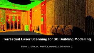
  • 1. Brown, L., Drew, O., Kramer, I., Maranzu, V. and Rouse, C. Terrestrial Laser Scanning for 3D Building Modelling
  • 2. Output & Validation Data Processing Registration Noise removal Data Collection Leica C10 Site selection 3D Mapping Available methods TLS The Proposed Work
  • 3. Available Methods • Increasing demand for 3D building models • Range of techniques available (Arayici, 2007; Mill et al., 2013): • Traditional survey • Tape measure • Surveyor’s wheel • Electronic distance meter • Total station • Close range photogrammetry
  • 4. Terrestrial Laser Scanning Definition: “a ground-based, active imaging method that rapidly acquires accurate, dense 3D point clouds of object surfaces by laser range-finding” (Lichti, 2015)
  • 5. Terrestrial Laser Scanning Three types: 1. Triangulation-based 2. Pulse-based 3. Phase-based • Over 1,000,000 pps • Max. range 80m • Comparable accuracy • 10,000-100,000 pps • Max. range 300m • 4-10mm accuracy
  • 6. Terrestrial Laser Scanning • Rapid acquisition • Non-invasive • Day or night operation Source: rudi.net/files/paper/illustrations/composite.jpg
  • 7. C10 Pulse-based Green wavelength: 532nm Point density: 50,000 Positional accuracy: 4mm Range: 300m @ 90% Source: http://hds.leica-geosystems.com
  • 8. Data Collection Resolution: 2cm at 20m Max distance: 4m Time: 7 minutes per scan Points collected: ~21 million Field-of-View: 270° (vertical) 360°(horizontal)
  • 9. ProcessingRegistrationDatabase Processing in Cyclone 9.0 Raw Data • Noise Removal • 3D Model • Cloud-to-Cloud • Add Constraints
  • 16. Object TLS (cm) Observed (cm) Error (cm) Height Poster frame 120.0 119.4 -0.6 Wall A 273.0 274.7 1.7 Double door 203.5 203.1 -0.4 Step 16.5 16.6 0.1 Wall B 279.0 278.3 -0.7 Width Single door 83.5 83.4 -0.1 Double door 161.5 160.6 -0.9 Flower pot 39.5 38.4 -1.1 Step 118.0 117.4 -0.6 Chair 43.5 42.5 -1.0 RMSE 1.0 Validation
  • 17. Improved Data Collection • Full coverage • Additional corridor • Additional stairs • Three stations • Quicker • Less accurate • Difficult registration
  • 18. • Leica P40 Scanner • Combination of phase-based and pulse-based • Spatial resolution: 1.2mm • 1,000,000 pps • Positional accuracy: 3mm • Integrated approach • Multiple scans of varying resolutions • High-definition targets • Undertake in morning/at night • Additional software (SketchUp, AutoCAD) Future Work http://www.comptonmoving.com/http://hds.leica-geosystems.com/Bastonero et al., 2014http://www.coroflot.com/
  • 20. References • Arayici, Y., 2007. An approach for real world data modelling with the 3D terrestrial laser scanner for built environment, Automation in Construction, 16, 816-829. • Bastonero, P., et al., 2014. Fusion of 3D models derived from TLS and image-based techniques for CH enhanced documentation, ISPRS Annals of the Photogrammetry, Remote Sensing and Spatial Information Sciences, Volume 2, ISPRS Technical Commission V Symposium. • El-Hakim et al., 1997. System for Indoor 3-D Mapping and Virtual Environments, SPIE, 3174, 21-35. • Feng, Q., 2012. Advantages By Phase-based 3D Laser Scanning Techniques to Underground Construction, International Society for Rock Mechanics. • Lee, S.Y., et al., 2013. 3D Data Acquisition for Indoor Assets Using Terrestrial Laser Scanning, ISPRS Annals of the Photogrammetry, Remote Sensing and Spatial Information Sciences, Volume 2, ISPRS 8th 3DGeoInfo Conference & WG II/2 Workshop, 27-29. • Lichti, D., 2015. Special Issue "Terrestrial Laser Scanning“, Remote Sensing. • MENSI, 2012. Technical specifications. Available from: http://mensi.free.fr/english/specsoi.htm • Mill, T., et al., 2013. Combined 3D building surveying techniques – terrestrial laser scanning (TLS) and total station surveying for BIM data management purposes, Journal of Civil Engineering and Management, 19, 1, S23-S32. • Ordonez, C., et al., 2010. Measuring building facades with a low-cost closerange photogrammetry system, Automation in Construction, 19, 6, 742749. • Williams, K.E., et al., 2012. Accuracy Assessment Of Geo-referencing Methodologies For Terrestrial Laser Scan Site Surveys, ASPRS Annual Conference, Sacramento, California.

Editor's Notes

  1. Removed all the areas where the laser saw through the window and the blue areas are where patching has occured