Geospatial data in educational planning
•
0 likes•484 views

This document discusses how geospatial data can be used to improve educational planning. It provides an overview of several projects using geospatial tools, including creating automated atlases and reports, estimating local school-age populations, and using geographically weighted regressions. Three projects are explored in more depth: using isochrones to analyze school catchment areas and travel times, geospatial risk assessment of educational facilities, and optimizing inspector routes. The document promotes collaboration and piloting of these tools to inform decision-making in educational planning.

Recommended
Recommended
More Related Content
Similar to Geospatial data in educational planning
Similar to Geospatial data in educational planning (20)
More from IIEP-UNESCO
More from IIEP-UNESCO (20)
Recently uploaded
Recently uploaded (20)
Geospatial data in educational planning
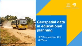
- 1. Geospatial data in educational planning IIEP Development Unit #IIEPdev Guarani, Minas Gerais, Brazil - August 20, 2019 - Rural school bus in Guarani, State of Minas Gerais, Brazil. De Ronaldo Almeida
- 2. Suzanne Grant Lewis Director, IIEP 2
- 3. Our objectives 3 1. Improve EDplanning through the development of tools and methodologies 2. Serve as foresight forum and lab for experimentation 3. Explore unusual data sources, and methods 4. Engage with non-traditional partners Amélie A. Gagnon Senior Programme Specialist Bikalpa Baniya, Intern University of Pennsylvania Germán Vargas Mesa Assistant Programme Specialist Lili Vesserau, Intern HEC Paris/ SciencePo
- 4. Why use geospatial data in educational planning? 4 1. Location is a crucial component of educational planning 2. Geospatial information provides insights that were up to now impossible to gather 3. Decision-making is better informed with geospatial information
- 5. Plan for today 1. Overview of several projects that are ready for publication or for pilot 2. Deeper dive into 3 specific projects with our technical partners 3. Some Hackathon results 4. Forum: Q&A, ideas, and invitations for collaboration
- 6. Overview of key tools and activities 1. Flowchart for school mappings 2. Automatized Atlas and Reports 3. Estimating local school- age populations 4. Geographically-weighted regressions 5. Background papers 6. Training offer
- 7. 7 Technical flowcharts for mapping school locations Some countries have none or partial school maps. Part of our technical cooperation offer is to support ministries to prepare the work and implement it together, regardless of the system currently in place.
- 8. 8 Automatized Atlases and Reports Ministries of education produce high quality, up-to-date statistical yearbooks that reflect the performance of the education system over a school year. The transformation of EMIS information into publishable reports can take a lot of time since it requires extracting countless tables, and generating charts and maps, not to mention producing analytical text. The Dev team created a technical guide on the creation of these reports and Atlases using open-source software.
- 9. 9 Local school-age populations School age-population data is available for large administrative areas, not always allowing for responsive micro-planning. Our new methodology allows for estimating the school-age population at the very local level (100m x 100m), when national data are not available. We can now estimate the proportion of students of specific school-age that will be affected by policies.
- 10. 10 Geographically-weighted regressions Multiple confounding variables and complex interactions doesn’t always make it easy to understand the relation between variables. These relations are mediated by the characteristics of a particular location, and the characteristics of those locations around it. We can use GWR to know where are variable more strongly correlated with others, thus informing policy-making.
- 11. 11 Background papers Ethics and the use of geospatial information for educational planning. Mapping existing radio, TV, cellular and internet networks to asses potential connectivity of the education system to alternative delivery modes.
- 12. 12 Our training offer Self-paced QGIS training manual, with follow-along examples using openly available data. A QGIS module embedded in the IIEP specialized course on school mapping and micro-planning Customized training, i.e. a learning cycle that would focus on using geospatial data to assess equity of access to education.
- 13. Deeper dive on 3 of our favourite tools 1. Isochrones for catchment areas 2. Suitability and risk analysis for educational facilities 3. Rethinking inspection circuits
- 14. 14 Isochrones for catchment areas: how far children live from school? Children and youth that need to walk 30, 60, or 120 minutes to school have very different learning experiences. This methodology can estimate the time learners take to walk to school every day. Implications for school location, transportation, teaching and non-teaching staff deployment and incentives.
- 15. 15 Isochrones for catchment areas: how far children live from school? Several open-source tools exist that can be used to create isochrones. Two main data components: school locations and vector road network (OpenStreetMap). Better the data quality, better the results. GraphHopper was used to create the isochrones and further analysis (share of school aged population covered) was done in QGIS.
- 16. 16 Geospatial risk assessment for existing educational facilities Using national or free open source data allows for mapping different natural hazards and potential risks on the education system. The first step what we are looking into for this project is the exposure of existing schools to different risks and in this case study natural hazard risks.
- 17. 17 Multi-criteria decision analysis tool for suitability of land – for existing and future schools The model is created using a suitability criteria analysis. Criteria within different categories are chosen to base the site suitability and are given a suitability score (between 1 – 4). By undertaking a suitability analysis it allows for weighting of criteria and customization depending on the context. The output is a suitability map which displays locations more or less suitable for building or relocating education facilities.
- 18. 18 Optimizing inspection routes In inspection-related literature, resources and access to schools are always mentioned as reasons for not being able to visit each and every school at the expected frequency. What if we could design inspection systems from scratch, using geospatial data to draw the most optimized inspection routes?
- 19. 19 Optimizing inspection routes Inspector route problem contains several geospatial problems: ● VRP (vehicle routing problem) ○ Fleet management approach ● Simple A to B routing ● Location allocation problem ● Minimum spanning tree analysis ● and some more! Clustering schools and reallocating them between inspectors can bring a more optimized work process. When road network and multi-modal routing is added to the mix, the system can become very complex. Different analysis methods were experimented mostly with QGIS.
- 20. 20
- 22. How to get involved? • Pilot one of our tools in your programmes • Support the development of a tool or plugin • Connect at development@iiep.unesco.org Follow us on Twitter @IIEP_UNESCO @AmelieAGagnon @GermanV_IIEP