The IRENA Global Atlas releases the wind maps of Africa by CENER
•
1 gefällt mir•434 views

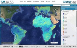
The Spanish Renewable Energy Research Center (CENER – www.cener.com) shares the Africa wind maps displaying the average annual wind speed calculated at 10km resolution and 10 m height over the entire continent for the period 01/2008 – 12/2012. The maps can be accessed at:: http://irena.masdar.ac.ae/?map=422, http://irena.masdar.ac.ae/?map=178, or http://irena.masdar.ac.ae/?map=180 CENER shared the following maps with the Global Atlas so far: Africa, Europe, Central and Latin America and Spain.