Crawley using r to evaluate street stress on park use
Isaac esri living atlas
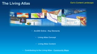
1. The Living Atlas
•ArcGIS Online -Key Elements
•Living Atlas Concept
•Living Atlas Content
•Contributing to the Living Atlas -Community Maps
Esri’sContent Landscape
2. ArcGIS is a Platform
Making mapping and GIS available across an organization
ArcGIS
Knowledge Workers
Professional GIS
WorkAnywhere
Public
Engagement
Executive Access
Enterprise
Integration
ArcGIS Platform
3. The Living Atlas
powered by ArcGIS
ArcGIS Online Overview
•Turnkey solution to create and share interactive maps
•Built to work the way you work
•Instant access to ready-to-use maps and apps
•Create new maps, transforming your data into content-rich maps
•Everyone in your organization is able to access their data from anywhere
•Provides a pure cloud-based solution for content management
4. ArcGIS includes aliving atlas of the worldwith beautiful and authoritative maps on hundreds of topics.
The Living Atlas
powered by ArcGIS
Living Atlas concept
5. . . . Providing a Foundation for Your Work!
Growing Collection of Maps and Layers
Dynamic Imagery
Landscape
Elevation
Living Atlas concept
The Living Atlas
powered by ArcGIS
8. What Content Can you Contribute?
•Imagery –current and high resolution
•Elevation –3 meter DEM or better
•Urban Observatory –City-based themes
•Oceans –Bathymetry & Places
•Hydrography –Streams, watersheds & elevation
•Demographics -* Lifestyle and Business Data
•3D (coming soon) –Structures, Zoning, Trees
•Basemap layers –reference features
Contributing to the Living Atlas
The Living Atlas
powered by ArcGIS
9. •Basemap Layers –
-enhance the current map with Large-Scale content
-replace commercial features with community features
Layers Include:
•Building Polygons
•Parcel Polygons
•Tree Points
•Land Use Polygons
•Airports
•Education
•Medical
•Parks
•etc
•Road Lines
•Administrative Lines
•Campus Features
•Landscape Polygons
•Hard Surface Polygons
•Sports Field Polygons
Contributing to the Living Atlas
The Living Atlas
powered by ArcGIS
10. Benefits of Contributing
•Reach a broad audience with your data in ArcGIS Online
•99.99% Reliable Access to maps with your data
•High-Quality Cartography
•Access authoritative basemaps across your region
•Retain Ownership to your contribution
Contributing to the Living Atlas
The Living Atlas
powered by ArcGIS
11. Partner Content
User Content
Esri Content
Community
Maps
Contributing to the Living Atlas
What’s next?
Contribute your content to
Community Maps
12. Basemap Factory
Commercial
Data
Esri Central Geodatabase
World Topo Map
World Street Map
Canvas Map
Value Added
Services
Basemaps
Other Maps
Contributor
Data
Web Maps
and Apps
Contribution
App
Apply
Submit Data
Data Review
Map Preview
GDB
Contributing to the Living Atlas
The Living Atlas
powered by ArcGIS
13. •How it Works:
Apply
Review
Contributor
Esri
Approve
Upload
Download
Migrate
QA &
Load
Cache
Review
Approve
Transfer Tiles
Blend Tiles in Bundle
Update
Evaluate
“Go Live”
Serve Cache for QA
Prepare Data
Author
QA Affected Bundles
Contributing to the Living Atlas
The Living Atlas
powered by ArcGIS
14. Top Three Community Maps Improvements:
1.Contribution Application
-One-Stop Shop for Community Maps Activities
-Register/ Upload/ Preview Map/ Approve/ Update
2.Participation Agreement
-Online Click-Thru
-Simplified Terms
3.Data Prep Tools
-GeoProcessing Tools for Submitting Data
Contributing to the Living Atlas
The Living Atlas
powered by ArcGIS
15. Community Maps
Contributor App
https://communitymaps.arcgis.com
Contributing to the Living Atlas
The Living Atlas
powered by ArcGIS
16. Data Prep Tools
•Simple to Execute
•Not Data Model Centric
•A La Carte per Layer
•View layers before submission
Contributing to the Living Atlas
The Living Atlas
powered by ArcGIS
17. Resources and Help
•Videos & Tutorials
•Blogs and Newsletters
•Gallery –Tools Download!
•FAQ
•Email us at -communitymaps@esri.com
Contributing to the Living Atlas
The Living Atlas
powered by ArcGIS
18. Thank You!
Do you have questions?
Shane Matthews smatthews@esri.com
or
communitymaps@esri.com
The Living Atlas
Esri’sContent Landscape