SlideShare a Scribd company logo
1 of 37
Download to read offline
The FOUR CORNERS LEGACY
 Monuments, Not Math, Define
     Property Boundaries

  And 1,001 Reasons Why Surveyors
     Plant Pin Gardens Anyway

   Warren D. Ward, CO PLS 25971
           March, 2012
A (property) CORNER is a point of
 reference determined by the survey
              process.
• A monument is the physical object set in the
  ground to identify a corner.
• The above concept is stated in the BLM Manual,
  and codified by many state statutes.
• End result: When a duly licensed surveyor places
  a monument, they have established a legal
  property corner. Subsequent surveyors DO NOT
  have some mystic right of superior math to discard
  previous surveyors’ work. Retracement,
  retracement, retracement!
- Four Corners
  monument
  set in 1875.
- 2009 News
  report that
  the 1875
  stone was off
  by 2.5 miles!
• The true
  history is a
  good example
  of case law
  for surveyors
  to follow
– Some
  surveyors
  practice the
  frustrating
  act of setting
  multiple
  monuments
  for one
  property
  corner, or
  “pin
  gardens”
1,001 reasons
  surveyors
  give for
  planting pin
  gardens,
  despite the
  legal
  precedent that
  discourages
  such
  confusing
  practice.
Have a nice day! In
  other words, may
  your monument
  prevail over some
  other guy’s
  touchscreen.
Deseret News
     Four Corners marker 2 1/2 miles off? Too late


• By Lynn
  Arave
• Published:
  Monday,
  April 20,
  2009
• Laypeople
  easily use
  modern
  GPS
Laypeople can
  easily
  research
  surveying
  history, and
  make the
  wrong
  conclusion
Deseret News
Four Corners Monument is indeed off mark
                              • By Lynn
                                Arave
                              • Published:
                                Thursday,
                                April 23,
                                2009
                              • After
                                surveyors
                                call in to
                                insist that
                                there is no
                                error
PID:     NGS DATA SHEET                       BBCD57


Desi
gnat     FOUR CORNERS 2010
ion:

 Sta
 mpi     COLORADO UTAH ARIZONA NEW MEXICO 1992
 ng:

Stab
         Monument will probably hold position well
ility:


Setti
         Mat foundation or concrete slab other than pavement
 ng:

Desc     THE STATION IS THE CENTER OF AN 8-INCH DIAMETER BRASS USDOI/BLM DISK MARKING
ripti    THE POINT COMMON TO COLORADO, UTAH, ARIZONA, AND NEW MEXICO. IT IS LOCATED
 on:     AT THE NAVAJO NATION'S FOUR CORNERS MONUMENT, MANAGED BY THE NAVAJO
         PARKS AND RECREATION DEPARTMENT, TEL: 928-871-6647. THE FOUR CORNERS
         MONUMENT INSTALLED IN 1992 (NGS PID: AD9256, NOW CONSIDERED DESTROYED) WAS
         REMOVED AND THE DISK RESET IN 2010 DURING RECONSTRUCTION OF THE MONUMENT
         AND VISITOR PLAZA. THE DISK WILL EVENTUALLY BE STAMPED "2010."

Obs
erve     2010-07-07T22:39:00Z
  d:

Sour
         OPUS - page5 1009.28
 ce:
REF_FRAME: NAD_83(CORS96          EPOCH: 2002.000   SOURCE: NAVD88 (Computed using            UNITS:
                                                                                                            SET PROFILE   DETAILS
)                                 0                 GEOID09)                                  m

                                     ± 0.027
      LAT:    36° 59' 56.31568"                                                      UTM 12            SPC 3003(NM W )
                                     m
                                     ± 0.011
      LON:    -109° 2' 42.62051"                                     NORTHING:       4096544.982m      666054.142m
                                     m
                                     ± 0.003                           EASTING:      673944.597m       722137.487m
   ELL HT:    1460.802
                                     m
                                                                CONVERGENCE:         1.17671173°       -0.72935591°
                                     ± 0.015
        X:    -1664599.638                                         POINT SCALE:      0.99997275        1.00005994
                                     m
                                                            COMBINED FACTOR:         0.99974356        0.99983074
                                     ± 0.009
        Y:    -4821995.076
                                     m
                                     ± 0.023
         Z:   3818181.565
                                     m
                                     ± 0.016
ORTHO HT:     1481.544
                                     m
Denver Post
          Four Corners spot is off the mark
• By The
  Associated
  Press
• Published:
  Monday,
  April 20,
  2009
• Updated:
  Thursday,
  April 23,
  2009
Cortez Journal
            On the mark
Four Corners National Monument officials
 dedicate completion of $1M plaza work
                      • By Hope Nealson
                      • Published: Sunday,
                         September, 19, 2010
                      • 18 months after first
                         report, the monument is
                         now correct.
New Mexico
Utah
Arizona
Colorado
Colorado Case Law:
          Monuments, Not Math Define
                  Property!                                                                        •   All monuments in 10-
                                                                                                       Lot subdivision
                                                                                                       otherwise set
•   Morales v. CAMB, a partnership Colorado Court of Appeals, March 22, 2007                           correctly in 1980, and
•   2007 Colo. App. LEXIS 482, 2007 WL 851628                                                          all acreages correct as
•   Boundary dispute; subdivision monuments; monuments vs. calls.                                      reported on 1980 plat.
•   In this boundary dispute between the owners of adjoining subdivision lots, a simple issue      •   Two 1980 monuments
    was presented. The location of the boundary as described on the metes and bounds                   were set in error, or
    descriptions on the subdivision plat, and as shown on the plat map, favors one lot owner.          blunder, by 13’, along
    (Note: Monuments set accurately throughout 1980 subdivision, two corners “off” by 13’)             a 100’ lot line.
                                                                                                   •   Both Lots vacant.
•   The location of subdivision monuments on the ground, placed pursuant to C.R.S. § 38-           •   In 2003, surveyor
    35-105(1), and approximately 13 feet south of the platted line, favors the other lot owner.        during a “replat”
                                                                                                       discovered the
                                                                                                       discrepancy, set two
•   The subdivision plat contains the required surveyor’s certificate attesting that appropriate       new monuments in
    monuments had been placed on the ground. Applying rules of survey interpretation, the              the accurate
    latter owner wins.                                                                                 mathematical
                                                                                                       location, and filed a
•   Monuments prevail over metes and bounds description (sic – see note), even if they are             plat that showed the
    graphically depicted on a subdivision plat map.(emphasis added)(note: Subdivision                  discrepancy.
    Lots are simultaneous conveyance, not metes and bounds).

•   Indeed, in this situation, the monuments are “conclusive.”See Everett v. Lantz, 126 Colo.
    504, 514, 252 P. 2d 103 (1952).
•   This is the holding even if (as here) the plat’s legal description does not “close” if one
    defers to the monuments, implying that the monuments were
    misplaced at the outset. (emphasis added)
U.S. Supreme Court
                        Monuments – Not Math Define Property!
•   U.S. Supreme Court
•   New Mexico v. Colorado, 267 U.S. 30 (1925)
•   No. 12 Original
•   Decided January 26, 1925
•   267 U.S. 30
•    (a) That New Mexico, upon her admission as a state, was bound by the
    previous recognition and adoption of the earlier location by the United
    States, her predecessor, and could not be heard to disavow the boundary
    thus recognized. P. 267 U. S. 41.
•   (b) The effect of this recognition of the earlier location by the United   •   The lengthy, archived
    States was not impaired by the temporary recognition of the later one by       explanation includes
    the General Land Office. Id.                                                   recognition of the
                                                                                   many problems that
•   (c) After Colorado's admission as a state, her right to rely upon the          disrupt an orderly
    boundary previously established could not be impaired by any subsequent        society when survey
    action of the United States. Id.                                               lines and monuments
                                                                                   are changed.
•   (d) New Mexico was bound also by her own recognition and adoption of
    the earlier line upon and after her admission to statehood. Id. .
•   2. The boundary between the States of Colorado and New Mexico is the
    line of the 37th parallel as surveyed and marked by Darling (emphasis
    added) from the Macomb monument westwardly to the 109th Meridian,
    and as surveyed and marked by Major and Preston from the said Macomb
    monument eastwardly to the Preston monument on the 103rd or Cimarron
    Meridian. P. 267 U. S. 39
•   Page 267 U. S. 31
Some of Many Biblical References
• Deuteronomy 19:14: Thou shalt not remove
  thy neighbor’s landmark, which they of old
  time have set….

  – Proverbs 22:28: Remove not the ancient
    landmark, Which thy fathers have set

• Deuteronomy 27:17: Cursed be he that
  removeth his neighbor’s landmark. And all
  the people shall say, Amen.
ASKED CREW CHIEF TO FIND ORIGINAL MONUMENT, HE SAID IT
WASN’T THERE. SET NEW PIN. SAME CREW CHIEF 15 YEARS LATER
AS PLS FINDS ORIGINAL MONUMENT, REJECTS NEW PIN ON PLAT.
ORIGINAL 1970 REBAR NOT GOOD ENOUGH? GREAT JOB OF
       CALCULATING, POOR JOB OF SURVEYING!

More Related Content

Viewers also liked

2013 Education Track, Accessible Training- Leverage In-House Knowledge by Vic...
2013 Education Track, Accessible Training- Leverage In-House Knowledge by Vic...2013 Education Track, Accessible Training- Leverage In-House Knowledge by Vic...
2013 Education Track, Accessible Training- Leverage In-House Knowledge by Vic...GIS in the Rockies
 
2012 GISCO Track, Emerging Technologies for Field Data Capture, Bill Timmins
2012 GISCO Track, Emerging Technologies for Field Data Capture, Bill Timmins2012 GISCO Track, Emerging Technologies for Field Data Capture, Bill Timmins
2012 GISCO Track, Emerging Technologies for Field Data Capture, Bill TimminsGIS in the Rockies
 
2013 Education Track, Building a Spatially Literate, Spatially Savvy and Spat...
2013 Education Track, Building a Spatially Literate, Spatially Savvy and Spat...2013 Education Track, Building a Spatially Literate, Spatially Savvy and Spat...
2013 Education Track, Building a Spatially Literate, Spatially Savvy and Spat...GIS in the Rockies
 
2013 Geospatial Data and Project Management Track, Mobile Big Data by Genie Hays
2013 Geospatial Data and Project Management Track, Mobile Big Data by Genie Hays2013 Geospatial Data and Project Management Track, Mobile Big Data by Genie Hays
2013 Geospatial Data and Project Management Track, Mobile Big Data by Genie HaysGIS in the Rockies
 
2013 Education Track, AmericaView: Who we are and what we can do for you by C...
2013 Education Track, AmericaView: Who we are and what we can do for you by C...2013 Education Track, AmericaView: Who we are and what we can do for you by C...
2013 Education Track, AmericaView: Who we are and what we can do for you by C...GIS in the Rockies
 
2013 Vendor, MapQuest Plugins for Leaflet by Jonathan Harahush
2013 Vendor, MapQuest Plugins for Leaflet by Jonathan Harahush2013 Vendor, MapQuest Plugins for Leaflet by Jonathan Harahush
2013 Vendor, MapQuest Plugins for Leaflet by Jonathan HarahushGIS in the Rockies
 
2013 PLSC Track, Combined Adjusted Factors, Custom Projections and GPS Locali...
2013 PLSC Track, Combined Adjusted Factors, Custom Projections and GPS Locali...2013 PLSC Track, Combined Adjusted Factors, Custom Projections and GPS Locali...
2013 PLSC Track, Combined Adjusted Factors, Custom Projections and GPS Locali...GIS in the Rockies
 
2012 ASPRS Track, Intertidal Coastal Vegetation Mapping, Joe Chuita
2012 ASPRS Track, Intertidal Coastal Vegetation Mapping, Joe Chuita2012 ASPRS Track, Intertidal Coastal Vegetation Mapping, Joe Chuita
2012 ASPRS Track, Intertidal Coastal Vegetation Mapping, Joe ChuitaGIS in the Rockies
 

Viewers also liked (8)

2013 Education Track, Accessible Training- Leverage In-House Knowledge by Vic...
2013 Education Track, Accessible Training- Leverage In-House Knowledge by Vic...2013 Education Track, Accessible Training- Leverage In-House Knowledge by Vic...
2013 Education Track, Accessible Training- Leverage In-House Knowledge by Vic...
 
2012 GISCO Track, Emerging Technologies for Field Data Capture, Bill Timmins
2012 GISCO Track, Emerging Technologies for Field Data Capture, Bill Timmins2012 GISCO Track, Emerging Technologies for Field Data Capture, Bill Timmins
2012 GISCO Track, Emerging Technologies for Field Data Capture, Bill Timmins
 
2013 Education Track, Building a Spatially Literate, Spatially Savvy and Spat...
2013 Education Track, Building a Spatially Literate, Spatially Savvy and Spat...2013 Education Track, Building a Spatially Literate, Spatially Savvy and Spat...
2013 Education Track, Building a Spatially Literate, Spatially Savvy and Spat...
 
2013 Geospatial Data and Project Management Track, Mobile Big Data by Genie Hays
2013 Geospatial Data and Project Management Track, Mobile Big Data by Genie Hays2013 Geospatial Data and Project Management Track, Mobile Big Data by Genie Hays
2013 Geospatial Data and Project Management Track, Mobile Big Data by Genie Hays
 
2013 Education Track, AmericaView: Who we are and what we can do for you by C...
2013 Education Track, AmericaView: Who we are and what we can do for you by C...2013 Education Track, AmericaView: Who we are and what we can do for you by C...
2013 Education Track, AmericaView: Who we are and what we can do for you by C...
 
2013 Vendor, MapQuest Plugins for Leaflet by Jonathan Harahush
2013 Vendor, MapQuest Plugins for Leaflet by Jonathan Harahush2013 Vendor, MapQuest Plugins for Leaflet by Jonathan Harahush
2013 Vendor, MapQuest Plugins for Leaflet by Jonathan Harahush
 
2013 PLSC Track, Combined Adjusted Factors, Custom Projections and GPS Locali...
2013 PLSC Track, Combined Adjusted Factors, Custom Projections and GPS Locali...2013 PLSC Track, Combined Adjusted Factors, Custom Projections and GPS Locali...
2013 PLSC Track, Combined Adjusted Factors, Custom Projections and GPS Locali...
 
2012 ASPRS Track, Intertidal Coastal Vegetation Mapping, Joe Chuita
2012 ASPRS Track, Intertidal Coastal Vegetation Mapping, Joe Chuita2012 ASPRS Track, Intertidal Coastal Vegetation Mapping, Joe Chuita
2012 ASPRS Track, Intertidal Coastal Vegetation Mapping, Joe Chuita
 

More from GIS in the Rockies

GISCO Fall 2018: Bike Network Equity: A GIS and Qualitative Analysis of Ameri...
GISCO Fall 2018: Bike Network Equity: A GIS and Qualitative Analysis of Ameri...GISCO Fall 2018: Bike Network Equity: A GIS and Qualitative Analysis of Ameri...
GISCO Fall 2018: Bike Network Equity: A GIS and Qualitative Analysis of Ameri...GIS in the Rockies
 
GISCO Fall 2018: Colorado 811: Changes and Challenges – Brian Collison
GISCO Fall 2018: Colorado 811: Changes and Challenges – Brian CollisonGISCO Fall 2018: Colorado 811: Changes and Challenges – Brian Collison
GISCO Fall 2018: Colorado 811: Changes and Challenges – Brian CollisonGIS in the Rockies
 
GISCO Fall 2018: Senate Bill 18-167 and GIS – Dave Murray
GISCO Fall 2018: Senate Bill 18-167 and GIS – Dave MurrayGISCO Fall 2018: Senate Bill 18-167 and GIS – Dave Murray
GISCO Fall 2018: Senate Bill 18-167 and GIS – Dave MurrayGIS in the Rockies
 
2018 GIS in the Rockies Workshop: Coordinate Systems and Projections
2018 GIS in the Rockies Workshop: Coordinate Systems and Projections 2018 GIS in the Rockies Workshop: Coordinate Systems and Projections
2018 GIS in the Rockies Workshop: Coordinate Systems and Projections GIS in the Rockies
 
2018 GIS in Emergency Management: Denver Office of Emergency Management Overview
2018 GIS in Emergency Management: Denver Office of Emergency Management Overview2018 GIS in Emergency Management: Denver Office of Emergency Management Overview
2018 GIS in Emergency Management: Denver Office of Emergency Management OverviewGIS in the Rockies
 
2018 GIS in the Rockies Vendor Showcase (Th): The Data Driven Government
2018 GIS in the Rockies Vendor Showcase (Th): The Data Driven Government2018 GIS in the Rockies Vendor Showcase (Th): The Data Driven Government
2018 GIS in the Rockies Vendor Showcase (Th): The Data Driven GovernmentGIS in the Rockies
 
2018 GIS in the Rockies Vendor Showcase (Th): Solving Real World Issues With ...
2018 GIS in the Rockies Vendor Showcase (Th): Solving Real World Issues With ...2018 GIS in the Rockies Vendor Showcase (Th): Solving Real World Issues With ...
2018 GIS in the Rockies Vendor Showcase (Th): Solving Real World Issues With ...GIS in the Rockies
 
2018 GIS in the Rockies Vendor Showcase (Th): ERDAS Imagine What's New and Ti...
2018 GIS in the Rockies Vendor Showcase (Th): ERDAS Imagine What's New and Ti...2018 GIS in the Rockies Vendor Showcase (Th): ERDAS Imagine What's New and Ti...
2018 GIS in the Rockies Vendor Showcase (Th): ERDAS Imagine What's New and Ti...GIS in the Rockies
 
2018 GIS in the Rockies Vendor Showcase (Th): Building High Performance Gover...
2018 GIS in the Rockies Vendor Showcase (Th): Building High Performance Gover...2018 GIS in the Rockies Vendor Showcase (Th): Building High Performance Gover...
2018 GIS in the Rockies Vendor Showcase (Th): Building High Performance Gover...GIS in the Rockies
 
2018 GIS in Recreation: The Making of a Trail
2018 GIS in Recreation: The Making of a Trail2018 GIS in Recreation: The Making of a Trail
2018 GIS in Recreation: The Making of a TrailGIS in the Rockies
 
2018 GIS in Recreation: The Latest Trail Technology Crowdsourcing Maps and Apps
2018 GIS in Recreation: The Latest Trail Technology Crowdsourcing Maps and Apps2018 GIS in Recreation: The Latest Trail Technology Crowdsourcing Maps and Apps
2018 GIS in Recreation: The Latest Trail Technology Crowdsourcing Maps and AppsGIS in the Rockies
 
2018 GIS in the Rockies: Riparian Shrub Assessment of the Mancos River Canyon...
2018 GIS in the Rockies: Riparian Shrub Assessment of the Mancos River Canyon...2018 GIS in the Rockies: Riparian Shrub Assessment of the Mancos River Canyon...
2018 GIS in the Rockies: Riparian Shrub Assessment of the Mancos River Canyon...GIS in the Rockies
 
2018 GIS in Development: Partnerships Lead to Additional Recreational Content...
2018 GIS in Development: Partnerships Lead to Additional Recreational Content...2018 GIS in Development: Partnerships Lead to Additional Recreational Content...
2018 GIS in Development: Partnerships Lead to Additional Recreational Content...GIS in the Rockies
 
2018 GIS in Recreation: Adding Value to Colorado the Beautiful Initiative carr
2018 GIS in Recreation: Adding Value to Colorado the Beautiful Initiative carr2018 GIS in Recreation: Adding Value to Colorado the Beautiful Initiative carr
2018 GIS in Recreation: Adding Value to Colorado the Beautiful Initiative carrGIS in the Rockies
 
2018 GIS in Recreation: A Creek Runs Through It
2018 GIS in Recreation: A Creek Runs Through It2018 GIS in Recreation: A Creek Runs Through It
2018 GIS in Recreation: A Creek Runs Through ItGIS in the Rockies
 
2018 GIS in Recreation: Virtually Touring the National Trails
2018 GIS in Recreation: Virtually Touring the National Trails2018 GIS in Recreation: Virtually Touring the National Trails
2018 GIS in Recreation: Virtually Touring the National TrailsGIS in the Rockies
 
2018 GIS in the Rockies PLSC Track: Turning Towards the Future
2018 GIS in the Rockies PLSC Track: Turning Towards the Future2018 GIS in the Rockies PLSC Track: Turning Towards the Future
2018 GIS in the Rockies PLSC Track: Turning Towards the FutureGIS in the Rockies
 
2018 GIS in the Rockies PLSC: Intro to PLSS
2018 GIS in the Rockies PLSC: Intro to PLSS2018 GIS in the Rockies PLSC: Intro to PLSS
2018 GIS in the Rockies PLSC: Intro to PLSSGIS in the Rockies
 
2018 GIS in the Rockies PLSC Track: Grid to Ground NATRF2022
2018 GIS in the Rockies PLSC Track: Grid to Ground NATRF20222018 GIS in the Rockies PLSC Track: Grid to Ground NATRF2022
2018 GIS in the Rockies PLSC Track: Grid to Ground NATRF2022GIS in the Rockies
 
2018 GIS in Development: USGS and Citizen Science Success and Enhancements fo...
2018 GIS in Development: USGS and Citizen Science Success and Enhancements fo...2018 GIS in Development: USGS and Citizen Science Success and Enhancements fo...
2018 GIS in Development: USGS and Citizen Science Success and Enhancements fo...GIS in the Rockies
 

More from GIS in the Rockies (20)

GISCO Fall 2018: Bike Network Equity: A GIS and Qualitative Analysis of Ameri...
GISCO Fall 2018: Bike Network Equity: A GIS and Qualitative Analysis of Ameri...GISCO Fall 2018: Bike Network Equity: A GIS and Qualitative Analysis of Ameri...
GISCO Fall 2018: Bike Network Equity: A GIS and Qualitative Analysis of Ameri...
 
GISCO Fall 2018: Colorado 811: Changes and Challenges – Brian Collison
GISCO Fall 2018: Colorado 811: Changes and Challenges – Brian CollisonGISCO Fall 2018: Colorado 811: Changes and Challenges – Brian Collison
GISCO Fall 2018: Colorado 811: Changes and Challenges – Brian Collison
 
GISCO Fall 2018: Senate Bill 18-167 and GIS – Dave Murray
GISCO Fall 2018: Senate Bill 18-167 and GIS – Dave MurrayGISCO Fall 2018: Senate Bill 18-167 and GIS – Dave Murray
GISCO Fall 2018: Senate Bill 18-167 and GIS – Dave Murray
 
2018 GIS in the Rockies Workshop: Coordinate Systems and Projections
2018 GIS in the Rockies Workshop: Coordinate Systems and Projections 2018 GIS in the Rockies Workshop: Coordinate Systems and Projections
2018 GIS in the Rockies Workshop: Coordinate Systems and Projections
 
2018 GIS in Emergency Management: Denver Office of Emergency Management Overview
2018 GIS in Emergency Management: Denver Office of Emergency Management Overview2018 GIS in Emergency Management: Denver Office of Emergency Management Overview
2018 GIS in Emergency Management: Denver Office of Emergency Management Overview
 
2018 GIS in the Rockies Vendor Showcase (Th): The Data Driven Government
2018 GIS in the Rockies Vendor Showcase (Th): The Data Driven Government2018 GIS in the Rockies Vendor Showcase (Th): The Data Driven Government
2018 GIS in the Rockies Vendor Showcase (Th): The Data Driven Government
 
2018 GIS in the Rockies Vendor Showcase (Th): Solving Real World Issues With ...
2018 GIS in the Rockies Vendor Showcase (Th): Solving Real World Issues With ...2018 GIS in the Rockies Vendor Showcase (Th): Solving Real World Issues With ...
2018 GIS in the Rockies Vendor Showcase (Th): Solving Real World Issues With ...
 
2018 GIS in the Rockies Vendor Showcase (Th): ERDAS Imagine What's New and Ti...
2018 GIS in the Rockies Vendor Showcase (Th): ERDAS Imagine What's New and Ti...2018 GIS in the Rockies Vendor Showcase (Th): ERDAS Imagine What's New and Ti...
2018 GIS in the Rockies Vendor Showcase (Th): ERDAS Imagine What's New and Ti...
 
2018 GIS in the Rockies Vendor Showcase (Th): Building High Performance Gover...
2018 GIS in the Rockies Vendor Showcase (Th): Building High Performance Gover...2018 GIS in the Rockies Vendor Showcase (Th): Building High Performance Gover...
2018 GIS in the Rockies Vendor Showcase (Th): Building High Performance Gover...
 
2018 GIS in Recreation: The Making of a Trail
2018 GIS in Recreation: The Making of a Trail2018 GIS in Recreation: The Making of a Trail
2018 GIS in Recreation: The Making of a Trail
 
2018 GIS in Recreation: The Latest Trail Technology Crowdsourcing Maps and Apps
2018 GIS in Recreation: The Latest Trail Technology Crowdsourcing Maps and Apps2018 GIS in Recreation: The Latest Trail Technology Crowdsourcing Maps and Apps
2018 GIS in Recreation: The Latest Trail Technology Crowdsourcing Maps and Apps
 
2018 GIS in the Rockies: Riparian Shrub Assessment of the Mancos River Canyon...
2018 GIS in the Rockies: Riparian Shrub Assessment of the Mancos River Canyon...2018 GIS in the Rockies: Riparian Shrub Assessment of the Mancos River Canyon...
2018 GIS in the Rockies: Riparian Shrub Assessment of the Mancos River Canyon...
 
2018 GIS in Development: Partnerships Lead to Additional Recreational Content...
2018 GIS in Development: Partnerships Lead to Additional Recreational Content...2018 GIS in Development: Partnerships Lead to Additional Recreational Content...
2018 GIS in Development: Partnerships Lead to Additional Recreational Content...
 
2018 GIS in Recreation: Adding Value to Colorado the Beautiful Initiative carr
2018 GIS in Recreation: Adding Value to Colorado the Beautiful Initiative carr2018 GIS in Recreation: Adding Value to Colorado the Beautiful Initiative carr
2018 GIS in Recreation: Adding Value to Colorado the Beautiful Initiative carr
 
2018 GIS in Recreation: A Creek Runs Through It
2018 GIS in Recreation: A Creek Runs Through It2018 GIS in Recreation: A Creek Runs Through It
2018 GIS in Recreation: A Creek Runs Through It
 
2018 GIS in Recreation: Virtually Touring the National Trails
2018 GIS in Recreation: Virtually Touring the National Trails2018 GIS in Recreation: Virtually Touring the National Trails
2018 GIS in Recreation: Virtually Touring the National Trails
 
2018 GIS in the Rockies PLSC Track: Turning Towards the Future
2018 GIS in the Rockies PLSC Track: Turning Towards the Future2018 GIS in the Rockies PLSC Track: Turning Towards the Future
2018 GIS in the Rockies PLSC Track: Turning Towards the Future
 
2018 GIS in the Rockies PLSC: Intro to PLSS
2018 GIS in the Rockies PLSC: Intro to PLSS2018 GIS in the Rockies PLSC: Intro to PLSS
2018 GIS in the Rockies PLSC: Intro to PLSS
 
2018 GIS in the Rockies PLSC Track: Grid to Ground NATRF2022
2018 GIS in the Rockies PLSC Track: Grid to Ground NATRF20222018 GIS in the Rockies PLSC Track: Grid to Ground NATRF2022
2018 GIS in the Rockies PLSC Track: Grid to Ground NATRF2022
 
2018 GIS in Development: USGS and Citizen Science Success and Enhancements fo...
2018 GIS in Development: USGS and Citizen Science Success and Enhancements fo...2018 GIS in Development: USGS and Citizen Science Success and Enhancements fo...
2018 GIS in Development: USGS and Citizen Science Success and Enhancements fo...
 

2012 URISA Track, Four Corners Legacy: Monuments, Not Math, Warren Ward

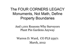
  • 1. The FOUR CORNERS LEGACY Monuments, Not Math, Define Property Boundaries And 1,001 Reasons Why Surveyors Plant Pin Gardens Anyway Warren D. Ward, CO PLS 25971 March, 2012
  • 2. A (property) CORNER is a point of reference determined by the survey process. • A monument is the physical object set in the ground to identify a corner. • The above concept is stated in the BLM Manual, and codified by many state statutes. • End result: When a duly licensed surveyor places a monument, they have established a legal property corner. Subsequent surveyors DO NOT have some mystic right of superior math to discard previous surveyors’ work. Retracement, retracement, retracement!
  • 3. - Four Corners monument set in 1875. - 2009 News report that the 1875 stone was off by 2.5 miles!
  • 4. • The true history is a good example of case law for surveyors to follow
  • 5. – Some surveyors practice the frustrating act of setting multiple monuments for one property corner, or “pin gardens”
  • 6. 1,001 reasons surveyors give for planting pin gardens, despite the legal precedent that discourages such confusing practice.
  • 7. Have a nice day! In other words, may your monument prevail over some other guy’s touchscreen.
  • 8. Deseret News Four Corners marker 2 1/2 miles off? Too late • By Lynn Arave • Published: Monday, April 20, 2009 • Laypeople easily use modern GPS
  • 9. Laypeople can easily research surveying history, and make the wrong conclusion
  • 10. Deseret News Four Corners Monument is indeed off mark • By Lynn Arave • Published: Thursday, April 23, 2009 • After surveyors call in to insist that there is no error
  • 11.
  • 12. PID: NGS DATA SHEET BBCD57 Desi gnat FOUR CORNERS 2010 ion: Sta mpi COLORADO UTAH ARIZONA NEW MEXICO 1992 ng: Stab Monument will probably hold position well ility: Setti Mat foundation or concrete slab other than pavement ng: Desc THE STATION IS THE CENTER OF AN 8-INCH DIAMETER BRASS USDOI/BLM DISK MARKING ripti THE POINT COMMON TO COLORADO, UTAH, ARIZONA, AND NEW MEXICO. IT IS LOCATED on: AT THE NAVAJO NATION'S FOUR CORNERS MONUMENT, MANAGED BY THE NAVAJO PARKS AND RECREATION DEPARTMENT, TEL: 928-871-6647. THE FOUR CORNERS MONUMENT INSTALLED IN 1992 (NGS PID: AD9256, NOW CONSIDERED DESTROYED) WAS REMOVED AND THE DISK RESET IN 2010 DURING RECONSTRUCTION OF THE MONUMENT AND VISITOR PLAZA. THE DISK WILL EVENTUALLY BE STAMPED "2010." Obs erve 2010-07-07T22:39:00Z d: Sour OPUS - page5 1009.28 ce:
  • 13. REF_FRAME: NAD_83(CORS96 EPOCH: 2002.000 SOURCE: NAVD88 (Computed using UNITS: SET PROFILE DETAILS ) 0 GEOID09) m ± 0.027 LAT: 36° 59' 56.31568" UTM 12 SPC 3003(NM W ) m ± 0.011 LON: -109° 2' 42.62051" NORTHING: 4096544.982m 666054.142m m ± 0.003 EASTING: 673944.597m 722137.487m ELL HT: 1460.802 m CONVERGENCE: 1.17671173° -0.72935591° ± 0.015 X: -1664599.638 POINT SCALE: 0.99997275 1.00005994 m COMBINED FACTOR: 0.99974356 0.99983074 ± 0.009 Y: -4821995.076 m ± 0.023 Z: 3818181.565 m ± 0.016 ORTHO HT: 1481.544 m
  • 14. Denver Post Four Corners spot is off the mark • By The Associated Press • Published: Monday, April 20, 2009 • Updated: Thursday, April 23, 2009
  • 15. Cortez Journal On the mark Four Corners National Monument officials dedicate completion of $1M plaza work • By Hope Nealson • Published: Sunday, September, 19, 2010 • 18 months after first report, the monument is now correct.
  • 16.
  • 17.
  • 18.
  • 19.
  • 21. Utah
  • 24.
  • 25.
  • 26.
  • 27.
  • 28.
  • 29.
  • 30.
  • 31.
  • 32. Colorado Case Law: Monuments, Not Math Define Property! • All monuments in 10- Lot subdivision otherwise set • Morales v. CAMB, a partnership Colorado Court of Appeals, March 22, 2007 correctly in 1980, and • 2007 Colo. App. LEXIS 482, 2007 WL 851628 all acreages correct as • Boundary dispute; subdivision monuments; monuments vs. calls. reported on 1980 plat. • In this boundary dispute between the owners of adjoining subdivision lots, a simple issue • Two 1980 monuments was presented. The location of the boundary as described on the metes and bounds were set in error, or descriptions on the subdivision plat, and as shown on the plat map, favors one lot owner. blunder, by 13’, along (Note: Monuments set accurately throughout 1980 subdivision, two corners “off” by 13’) a 100’ lot line. • Both Lots vacant. • The location of subdivision monuments on the ground, placed pursuant to C.R.S. § 38- • In 2003, surveyor 35-105(1), and approximately 13 feet south of the platted line, favors the other lot owner. during a “replat” discovered the discrepancy, set two • The subdivision plat contains the required surveyor’s certificate attesting that appropriate new monuments in monuments had been placed on the ground. Applying rules of survey interpretation, the the accurate latter owner wins. mathematical location, and filed a • Monuments prevail over metes and bounds description (sic – see note), even if they are plat that showed the graphically depicted on a subdivision plat map.(emphasis added)(note: Subdivision discrepancy. Lots are simultaneous conveyance, not metes and bounds). • Indeed, in this situation, the monuments are “conclusive.”See Everett v. Lantz, 126 Colo. 504, 514, 252 P. 2d 103 (1952). • This is the holding even if (as here) the plat’s legal description does not “close” if one defers to the monuments, implying that the monuments were misplaced at the outset. (emphasis added)
  • 33. U.S. Supreme Court Monuments – Not Math Define Property! • U.S. Supreme Court • New Mexico v. Colorado, 267 U.S. 30 (1925) • No. 12 Original • Decided January 26, 1925 • 267 U.S. 30 • (a) That New Mexico, upon her admission as a state, was bound by the previous recognition and adoption of the earlier location by the United States, her predecessor, and could not be heard to disavow the boundary thus recognized. P. 267 U. S. 41. • (b) The effect of this recognition of the earlier location by the United • The lengthy, archived States was not impaired by the temporary recognition of the later one by explanation includes the General Land Office. Id. recognition of the many problems that • (c) After Colorado's admission as a state, her right to rely upon the disrupt an orderly boundary previously established could not be impaired by any subsequent society when survey action of the United States. Id. lines and monuments are changed. • (d) New Mexico was bound also by her own recognition and adoption of the earlier line upon and after her admission to statehood. Id. . • 2. The boundary between the States of Colorado and New Mexico is the line of the 37th parallel as surveyed and marked by Darling (emphasis added) from the Macomb monument westwardly to the 109th Meridian, and as surveyed and marked by Major and Preston from the said Macomb monument eastwardly to the Preston monument on the 103rd or Cimarron Meridian. P. 267 U. S. 39 • Page 267 U. S. 31
  • 34.
  • 35. Some of Many Biblical References • Deuteronomy 19:14: Thou shalt not remove thy neighbor’s landmark, which they of old time have set…. – Proverbs 22:28: Remove not the ancient landmark, Which thy fathers have set • Deuteronomy 27:17: Cursed be he that removeth his neighbor’s landmark. And all the people shall say, Amen.
  • 36. ASKED CREW CHIEF TO FIND ORIGINAL MONUMENT, HE SAID IT WASN’T THERE. SET NEW PIN. SAME CREW CHIEF 15 YEARS LATER AS PLS FINDS ORIGINAL MONUMENT, REJECTS NEW PIN ON PLAT.
  • 37. ORIGINAL 1970 REBAR NOT GOOD ENOUGH? GREAT JOB OF CALCULATING, POOR JOB OF SURVEYING!