SlideShare ist ein Scribd-Unternehmen logo
1 von 16
Downloaden Sie, um offline zu lesen
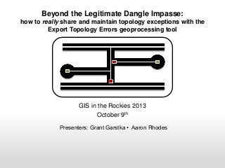
Beyond the Legitimate Dangle Impasse:
how to really share and maintain topology exceptions with the
Export Topology Errors geoprocessing tool

GIS in the Rockies 2013
October 9th
Presenters: Grant Garstka • Aaron Rhodes
Introduction
Legitimate Dangles - line feature
termini, such as cul-de-sacs
“Must Not Have Dangles”
topological rule -- helps to identify
the location of all dangles
While the rule finds dangles, a user
must determine if each dangle is an
error or legitimate dangle
Must Not Have Dangles

A line from one layer must touch lines from the same layer at both
endpoints.
Any endpoint where the line does not touch another line is an error.
Must Not Have Dangles

A line from one layer must touch lines from the same layer at both
endpoints.
Any endpoint where the line does not touch another line is an error.
Case Study
•

Arapahoe County contains 4,096 legitimate dangles

•

CDOT knows there are 4,096 dangles marked as exception and their location,
we do not want to have to ever revisit them.

•

Yet, if we create a new topology for this county’s layer and re-validate all 4,096
legitimate dangles will be flagged again as potential errors

•

This is the legitimate dangle impasse - a huge waste of CDOT resources.
Case Study
This issue is compounded at the state scale

83,000+ miles
of local roads in
the HUTF
inventory

greater than
60,000
legitimate
dangles
statewide
Export Topology Errors --10.1
February 7th. 2013 ArcGIS Resources

Overview

•Exports the errors from a geodatabase
topology to the target geodatabase.
•All information associated with the errors
and exceptions, such as the features
referenced by the error or exception, are
exported.
http://blogs.esri.com/esri/arcgis/2013/02/07/exporttopology-errors/

•Exported feature classes can be accessed
using any license level of ArcGIS.

•The feature classes can be used with the Select by Location dialog box or the
Select Layer By Location tool
•Can be shared with other users who do not have access to the topology itself.
A Perfect Solution?
“the outputs of the Export Topology
Errors tool are standard feature classes,
which enable [the user] to select the
error shapes interactively or through
a query, use those geometries for
subsequent spatial queries, and
share the errors with other users”

“For example, [the co-worker] can...
resolve a Must Not Have Dangles
line error by snapping lines
properly. After she finishes her edits, I
can reintroduce the updated feature
classes into the main geodatabase and
use my Standard or Advanced license
to rebuild the topology, check for
remaining errors, and repeat the
sharing process as needed”

This sounds like the answer to all of our
problems
-From ArcGIS Resources announcing the new tool
(February 7th, 2013)
The Real Problem
topology layers are not selectable and
cannot participate in spatial queries

topology errors are not actually
features, but rather graphical
representations of error locations
the Topology Exception feature class
created from the Export Topology Error
tool cannot be used to create a
selection set in the topology
Tool is geared toward resolving errors and not managing
and tracking exceptions
The Solution
Using MS ACCESS, we can programmatically join a
topology and Export Topology Errors feature class to
update a new topology with known topology exceptions
What you will need
-Personal Geodatabase containing
a) Linear Feature Class
b) New Topology
c) Feature Class from Export Topology
Errors

-MS ACCESS

The result effectively makes the topology layer
selectable by location
The Solution
Each feature contains 2 tables:
• Attribute Table (ObjectID)
• Shape_Index (IndexedObjectId)

ArcCatalog

Topology’s Shape Index Table
ACCESS Objects - Tables
The Solution
1) Design a Query with the following joins:

2) Make it an Update Query with the
following expression:
3) Run!
The Solution
The topology layer is now updated with known
topology exceptions.

T_1_PointError’s Table

When you open the layer in ArcMap again,
only valid topology errors will display!!
The Solution Summary
Create Personal GeoDatabase
Create, validate, and review topology
Export Topology Errors/Exceptions
Make new topology or use Co-workers topology
Open .mdb in MS ACCESS
Join based on X,Y and ObjectID/IndexedObjectID
Run Update Query on “isException”
Re-open ArcMap
Some Issues
•

In MS ACCESS, only change the values in
the tables - not the schema

•

Performance hit in ArcMap on the linear
feature, not the topology?

•

CDOT was moving towards File
GeoDatabases and away from Personal
GeoDatabase.
Questions?

Grant Garstka
Grant.Garstka@state.co.us

Aaron Rhodes
Aaron.Rhodes@state.co.us

Weitere ähnliche Inhalte

Mehr von GIS in the Rockies

2018 GIS in the Rockies Vendor Showcase (Th): Building High Performance Gover...
2018 GIS in the Rockies Vendor Showcase (Th): Building High Performance Gover...2018 GIS in the Rockies Vendor Showcase (Th): Building High Performance Gover...
2018 GIS in the Rockies Vendor Showcase (Th): Building High Performance Gover...GIS in the Rockies
 
2018 GIS in Recreation: The Making of a Trail
2018 GIS in Recreation: The Making of a Trail2018 GIS in Recreation: The Making of a Trail
2018 GIS in Recreation: The Making of a TrailGIS in the Rockies
 
2018 GIS in Recreation: The Latest Trail Technology Crowdsourcing Maps and Apps
2018 GIS in Recreation: The Latest Trail Technology Crowdsourcing Maps and Apps2018 GIS in Recreation: The Latest Trail Technology Crowdsourcing Maps and Apps
2018 GIS in Recreation: The Latest Trail Technology Crowdsourcing Maps and AppsGIS in the Rockies
 
2018 GIS in the Rockies: Riparian Shrub Assessment of the Mancos River Canyon...
2018 GIS in the Rockies: Riparian Shrub Assessment of the Mancos River Canyon...2018 GIS in the Rockies: Riparian Shrub Assessment of the Mancos River Canyon...
2018 GIS in the Rockies: Riparian Shrub Assessment of the Mancos River Canyon...GIS in the Rockies
 
2018 GIS in Development: Partnerships Lead to Additional Recreational Content...
2018 GIS in Development: Partnerships Lead to Additional Recreational Content...2018 GIS in Development: Partnerships Lead to Additional Recreational Content...
2018 GIS in Development: Partnerships Lead to Additional Recreational Content...GIS in the Rockies
 
2018 GIS in Recreation: Adding Value to Colorado the Beautiful Initiative carr
2018 GIS in Recreation: Adding Value to Colorado the Beautiful Initiative carr2018 GIS in Recreation: Adding Value to Colorado the Beautiful Initiative carr
2018 GIS in Recreation: Adding Value to Colorado the Beautiful Initiative carrGIS in the Rockies
 
2018 GIS in Recreation: A Creek Runs Through It
2018 GIS in Recreation: A Creek Runs Through It2018 GIS in Recreation: A Creek Runs Through It
2018 GIS in Recreation: A Creek Runs Through ItGIS in the Rockies
 
2018 GIS in Recreation: Virtually Touring the National Trails
2018 GIS in Recreation: Virtually Touring the National Trails2018 GIS in Recreation: Virtually Touring the National Trails
2018 GIS in Recreation: Virtually Touring the National TrailsGIS in the Rockies
 
2018 GIS in the Rockies PLSC Track: Turning Towards the Future
2018 GIS in the Rockies PLSC Track: Turning Towards the Future2018 GIS in the Rockies PLSC Track: Turning Towards the Future
2018 GIS in the Rockies PLSC Track: Turning Towards the FutureGIS in the Rockies
 
2018 GIS in the Rockies PLSC: Intro to PLSS
2018 GIS in the Rockies PLSC: Intro to PLSS2018 GIS in the Rockies PLSC: Intro to PLSS
2018 GIS in the Rockies PLSC: Intro to PLSSGIS in the Rockies
 
2018 GIS in the Rockies PLSC Track: Grid to Ground NATRF2022
2018 GIS in the Rockies PLSC Track: Grid to Ground NATRF20222018 GIS in the Rockies PLSC Track: Grid to Ground NATRF2022
2018 GIS in the Rockies PLSC Track: Grid to Ground NATRF2022GIS in the Rockies
 
2018 GIS in Development: USGS and Citizen Science Success and Enhancements fo...
2018 GIS in Development: USGS and Citizen Science Success and Enhancements fo...2018 GIS in Development: USGS and Citizen Science Success and Enhancements fo...
2018 GIS in Development: USGS and Citizen Science Success and Enhancements fo...GIS in the Rockies
 
2018 GIS in Development: Semantic Web
2018 GIS in Development: Semantic Web2018 GIS in Development: Semantic Web
2018 GIS in Development: Semantic WebGIS in the Rockies
 
2018 GIS in Development: Look Ma, No Server and Big Data Using Serverless Fun...
2018 GIS in Development: Look Ma, No Server and Big Data Using Serverless Fun...2018 GIS in Development: Look Ma, No Server and Big Data Using Serverless Fun...
2018 GIS in Development: Look Ma, No Server and Big Data Using Serverless Fun...GIS in the Rockies
 
2018 GIS in Development: Grass GIS Striking Terrain Visualizations in the Roc...
2018 GIS in Development: Grass GIS Striking Terrain Visualizations in the Roc...2018 GIS in Development: Grass GIS Striking Terrain Visualizations in the Roc...
2018 GIS in Development: Grass GIS Striking Terrain Visualizations in the Roc...GIS in the Rockies
 
2018 GIS in Development: FOSS4G in the Government (Proof of Concept)
2018 GIS in Development: FOSS4G in the Government (Proof of Concept)2018 GIS in Development: FOSS4G in the Government (Proof of Concept)
2018 GIS in Development: FOSS4G in the Government (Proof of Concept)GIS in the Rockies
 
2018 GIS in Development: Developing a National Map of Subsurface Infrastructure
2018 GIS in Development: Developing a National Map of Subsurface Infrastructure2018 GIS in Development: Developing a National Map of Subsurface Infrastructure
2018 GIS in Development: Developing a National Map of Subsurface InfrastructureGIS in the Rockies
 
2018 ASPRS: Big Data: Utilizing Landsat to Detect Ephemeral Water Sources in ...
2018 ASPRS: Big Data: Utilizing Landsat to Detect Ephemeral Water Sources in ...2018 ASPRS: Big Data: Utilizing Landsat to Detect Ephemeral Water Sources in ...
2018 ASPRS: Big Data: Utilizing Landsat to Detect Ephemeral Water Sources in ...GIS in the Rockies
 
2018 ASPRS: Big Data: Front Range Oblique Photography Available Today
2018 ASPRS: Big Data: Front Range Oblique Photography Available Today2018 ASPRS: Big Data: Front Range Oblique Photography Available Today
2018 ASPRS: Big Data: Front Range Oblique Photography Available TodayGIS in the Rockies
 
2018 ASPRS: Big Data: Classification of Tropical Forest Tree Species Using Hi...
2018 ASPRS: Big Data: Classification of Tropical Forest Tree Species Using Hi...2018 ASPRS: Big Data: Classification of Tropical Forest Tree Species Using Hi...
2018 ASPRS: Big Data: Classification of Tropical Forest Tree Species Using Hi...GIS in the Rockies
 

Mehr von GIS in the Rockies (20)

2018 GIS in the Rockies Vendor Showcase (Th): Building High Performance Gover...
2018 GIS in the Rockies Vendor Showcase (Th): Building High Performance Gover...2018 GIS in the Rockies Vendor Showcase (Th): Building High Performance Gover...
2018 GIS in the Rockies Vendor Showcase (Th): Building High Performance Gover...
 
2018 GIS in Recreation: The Making of a Trail
2018 GIS in Recreation: The Making of a Trail2018 GIS in Recreation: The Making of a Trail
2018 GIS in Recreation: The Making of a Trail
 
2018 GIS in Recreation: The Latest Trail Technology Crowdsourcing Maps and Apps
2018 GIS in Recreation: The Latest Trail Technology Crowdsourcing Maps and Apps2018 GIS in Recreation: The Latest Trail Technology Crowdsourcing Maps and Apps
2018 GIS in Recreation: The Latest Trail Technology Crowdsourcing Maps and Apps
 
2018 GIS in the Rockies: Riparian Shrub Assessment of the Mancos River Canyon...
2018 GIS in the Rockies: Riparian Shrub Assessment of the Mancos River Canyon...2018 GIS in the Rockies: Riparian Shrub Assessment of the Mancos River Canyon...
2018 GIS in the Rockies: Riparian Shrub Assessment of the Mancos River Canyon...
 
2018 GIS in Development: Partnerships Lead to Additional Recreational Content...
2018 GIS in Development: Partnerships Lead to Additional Recreational Content...2018 GIS in Development: Partnerships Lead to Additional Recreational Content...
2018 GIS in Development: Partnerships Lead to Additional Recreational Content...
 
2018 GIS in Recreation: Adding Value to Colorado the Beautiful Initiative carr
2018 GIS in Recreation: Adding Value to Colorado the Beautiful Initiative carr2018 GIS in Recreation: Adding Value to Colorado the Beautiful Initiative carr
2018 GIS in Recreation: Adding Value to Colorado the Beautiful Initiative carr
 
2018 GIS in Recreation: A Creek Runs Through It
2018 GIS in Recreation: A Creek Runs Through It2018 GIS in Recreation: A Creek Runs Through It
2018 GIS in Recreation: A Creek Runs Through It
 
2018 GIS in Recreation: Virtually Touring the National Trails
2018 GIS in Recreation: Virtually Touring the National Trails2018 GIS in Recreation: Virtually Touring the National Trails
2018 GIS in Recreation: Virtually Touring the National Trails
 
2018 GIS in the Rockies PLSC Track: Turning Towards the Future
2018 GIS in the Rockies PLSC Track: Turning Towards the Future2018 GIS in the Rockies PLSC Track: Turning Towards the Future
2018 GIS in the Rockies PLSC Track: Turning Towards the Future
 
2018 GIS in the Rockies PLSC: Intro to PLSS
2018 GIS in the Rockies PLSC: Intro to PLSS2018 GIS in the Rockies PLSC: Intro to PLSS
2018 GIS in the Rockies PLSC: Intro to PLSS
 
2018 GIS in the Rockies PLSC Track: Grid to Ground NATRF2022
2018 GIS in the Rockies PLSC Track: Grid to Ground NATRF20222018 GIS in the Rockies PLSC Track: Grid to Ground NATRF2022
2018 GIS in the Rockies PLSC Track: Grid to Ground NATRF2022
 
2018 GIS in Development: USGS and Citizen Science Success and Enhancements fo...
2018 GIS in Development: USGS and Citizen Science Success and Enhancements fo...2018 GIS in Development: USGS and Citizen Science Success and Enhancements fo...
2018 GIS in Development: USGS and Citizen Science Success and Enhancements fo...
 
2018 GIS in Development: Semantic Web
2018 GIS in Development: Semantic Web2018 GIS in Development: Semantic Web
2018 GIS in Development: Semantic Web
 
2018 GIS in Development: Look Ma, No Server and Big Data Using Serverless Fun...
2018 GIS in Development: Look Ma, No Server and Big Data Using Serverless Fun...2018 GIS in Development: Look Ma, No Server and Big Data Using Serverless Fun...
2018 GIS in Development: Look Ma, No Server and Big Data Using Serverless Fun...
 
2018 GIS in Development: Grass GIS Striking Terrain Visualizations in the Roc...
2018 GIS in Development: Grass GIS Striking Terrain Visualizations in the Roc...2018 GIS in Development: Grass GIS Striking Terrain Visualizations in the Roc...
2018 GIS in Development: Grass GIS Striking Terrain Visualizations in the Roc...
 
2018 GIS in Development: FOSS4G in the Government (Proof of Concept)
2018 GIS in Development: FOSS4G in the Government (Proof of Concept)2018 GIS in Development: FOSS4G in the Government (Proof of Concept)
2018 GIS in Development: FOSS4G in the Government (Proof of Concept)
 
2018 GIS in Development: Developing a National Map of Subsurface Infrastructure
2018 GIS in Development: Developing a National Map of Subsurface Infrastructure2018 GIS in Development: Developing a National Map of Subsurface Infrastructure
2018 GIS in Development: Developing a National Map of Subsurface Infrastructure
 
2018 ASPRS: Big Data: Utilizing Landsat to Detect Ephemeral Water Sources in ...
2018 ASPRS: Big Data: Utilizing Landsat to Detect Ephemeral Water Sources in ...2018 ASPRS: Big Data: Utilizing Landsat to Detect Ephemeral Water Sources in ...
2018 ASPRS: Big Data: Utilizing Landsat to Detect Ephemeral Water Sources in ...
 
2018 ASPRS: Big Data: Front Range Oblique Photography Available Today
2018 ASPRS: Big Data: Front Range Oblique Photography Available Today2018 ASPRS: Big Data: Front Range Oblique Photography Available Today
2018 ASPRS: Big Data: Front Range Oblique Photography Available Today
 
2018 ASPRS: Big Data: Classification of Tropical Forest Tree Species Using Hi...
2018 ASPRS: Big Data: Classification of Tropical Forest Tree Species Using Hi...2018 ASPRS: Big Data: Classification of Tropical Forest Tree Species Using Hi...
2018 ASPRS: Big Data: Classification of Tropical Forest Tree Species Using Hi...
 

Kürzlich hochgeladen

SALESFORCE EDUCATION CLOUD | FEXLE SERVICES
SALESFORCE EDUCATION CLOUD | FEXLE SERVICESSALESFORCE EDUCATION CLOUD | FEXLE SERVICES
SALESFORCE EDUCATION CLOUD | FEXLE SERVICESmohitsingh558521
 
New from BookNet Canada for 2024: BNC CataList - Tech Forum 2024
New from BookNet Canada for 2024: BNC CataList - Tech Forum 2024New from BookNet Canada for 2024: BNC CataList - Tech Forum 2024
New from BookNet Canada for 2024: BNC CataList - Tech Forum 2024BookNet Canada
 
The State of Passkeys with FIDO Alliance.pptx
The State of Passkeys with FIDO Alliance.pptxThe State of Passkeys with FIDO Alliance.pptx
The State of Passkeys with FIDO Alliance.pptxLoriGlavin3
 
Moving Beyond Passwords: FIDO Paris Seminar.pdf
Moving Beyond Passwords: FIDO Paris Seminar.pdfMoving Beyond Passwords: FIDO Paris Seminar.pdf
Moving Beyond Passwords: FIDO Paris Seminar.pdfLoriGlavin3
 
The Ultimate Guide to Choosing WordPress Pros and Cons
The Ultimate Guide to Choosing WordPress Pros and ConsThe Ultimate Guide to Choosing WordPress Pros and Cons
The Ultimate Guide to Choosing WordPress Pros and ConsPixlogix Infotech
 
Unraveling Multimodality with Large Language Models.pdf
Unraveling Multimodality with Large Language Models.pdfUnraveling Multimodality with Large Language Models.pdf
Unraveling Multimodality with Large Language Models.pdfAlex Barbosa Coqueiro
 
Scanning the Internet for External Cloud Exposures via SSL Certs
Scanning the Internet for External Cloud Exposures via SSL CertsScanning the Internet for External Cloud Exposures via SSL Certs
Scanning the Internet for External Cloud Exposures via SSL CertsRizwan Syed
 
A Deep Dive on Passkeys: FIDO Paris Seminar.pptx
A Deep Dive on Passkeys: FIDO Paris Seminar.pptxA Deep Dive on Passkeys: FIDO Paris Seminar.pptx
A Deep Dive on Passkeys: FIDO Paris Seminar.pptxLoriGlavin3
 
Are Multi-Cloud and Serverless Good or Bad?
Are Multi-Cloud and Serverless Good or Bad?Are Multi-Cloud and Serverless Good or Bad?
Are Multi-Cloud and Serverless Good or Bad?Mattias Andersson
 
SIP trunking in Janus @ Kamailio World 2024
SIP trunking in Janus @ Kamailio World 2024SIP trunking in Janus @ Kamailio World 2024
SIP trunking in Janus @ Kamailio World 2024Lorenzo Miniero
 
Advanced Computer Architecture – An Introduction
Advanced Computer Architecture – An IntroductionAdvanced Computer Architecture – An Introduction
Advanced Computer Architecture – An IntroductionDilum Bandara
 
Merck Moving Beyond Passwords: FIDO Paris Seminar.pptx
Merck Moving Beyond Passwords: FIDO Paris Seminar.pptxMerck Moving Beyond Passwords: FIDO Paris Seminar.pptx
Merck Moving Beyond Passwords: FIDO Paris Seminar.pptxLoriGlavin3
 
Connect Wave/ connectwave Pitch Deck Presentation
Connect Wave/ connectwave Pitch Deck PresentationConnect Wave/ connectwave Pitch Deck Presentation
Connect Wave/ connectwave Pitch Deck PresentationSlibray Presentation
 
Transcript: New from BookNet Canada for 2024: Loan Stars - Tech Forum 2024
Transcript: New from BookNet Canada for 2024: Loan Stars - Tech Forum 2024Transcript: New from BookNet Canada for 2024: Loan Stars - Tech Forum 2024
Transcript: New from BookNet Canada for 2024: Loan Stars - Tech Forum 2024BookNet Canada
 
Nell’iperspazio con Rocket: il Framework Web di Rust!
Nell’iperspazio con Rocket: il Framework Web di Rust!Nell’iperspazio con Rocket: il Framework Web di Rust!
Nell’iperspazio con Rocket: il Framework Web di Rust!Commit University
 
Generative AI for Technical Writer or Information Developers
Generative AI for Technical Writer or Information DevelopersGenerative AI for Technical Writer or Information Developers
Generative AI for Technical Writer or Information DevelopersRaghuram Pandurangan
 
Digital Identity is Under Attack: FIDO Paris Seminar.pptx
Digital Identity is Under Attack: FIDO Paris Seminar.pptxDigital Identity is Under Attack: FIDO Paris Seminar.pptx
Digital Identity is Under Attack: FIDO Paris Seminar.pptxLoriGlavin3
 
DSPy a system for AI to Write Prompts and Do Fine Tuning
DSPy a system for AI to Write Prompts and Do Fine TuningDSPy a system for AI to Write Prompts and Do Fine Tuning
DSPy a system for AI to Write Prompts and Do Fine TuningLars Bell
 
The Fit for Passkeys for Employee and Consumer Sign-ins: FIDO Paris Seminar.pptx
The Fit for Passkeys for Employee and Consumer Sign-ins: FIDO Paris Seminar.pptxThe Fit for Passkeys for Employee and Consumer Sign-ins: FIDO Paris Seminar.pptx
The Fit for Passkeys for Employee and Consumer Sign-ins: FIDO Paris Seminar.pptxLoriGlavin3
 
Take control of your SAP testing with UiPath Test Suite
Take control of your SAP testing with UiPath Test SuiteTake control of your SAP testing with UiPath Test Suite
Take control of your SAP testing with UiPath Test SuiteDianaGray10
 

Kürzlich hochgeladen (20)

SALESFORCE EDUCATION CLOUD | FEXLE SERVICES
SALESFORCE EDUCATION CLOUD | FEXLE SERVICESSALESFORCE EDUCATION CLOUD | FEXLE SERVICES
SALESFORCE EDUCATION CLOUD | FEXLE SERVICES
 
New from BookNet Canada for 2024: BNC CataList - Tech Forum 2024
New from BookNet Canada for 2024: BNC CataList - Tech Forum 2024New from BookNet Canada for 2024: BNC CataList - Tech Forum 2024
New from BookNet Canada for 2024: BNC CataList - Tech Forum 2024
 
The State of Passkeys with FIDO Alliance.pptx
The State of Passkeys with FIDO Alliance.pptxThe State of Passkeys with FIDO Alliance.pptx
The State of Passkeys with FIDO Alliance.pptx
 
Moving Beyond Passwords: FIDO Paris Seminar.pdf
Moving Beyond Passwords: FIDO Paris Seminar.pdfMoving Beyond Passwords: FIDO Paris Seminar.pdf
Moving Beyond Passwords: FIDO Paris Seminar.pdf
 
The Ultimate Guide to Choosing WordPress Pros and Cons
The Ultimate Guide to Choosing WordPress Pros and ConsThe Ultimate Guide to Choosing WordPress Pros and Cons
The Ultimate Guide to Choosing WordPress Pros and Cons
 
Unraveling Multimodality with Large Language Models.pdf
Unraveling Multimodality with Large Language Models.pdfUnraveling Multimodality with Large Language Models.pdf
Unraveling Multimodality with Large Language Models.pdf
 
Scanning the Internet for External Cloud Exposures via SSL Certs
Scanning the Internet for External Cloud Exposures via SSL CertsScanning the Internet for External Cloud Exposures via SSL Certs
Scanning the Internet for External Cloud Exposures via SSL Certs
 
A Deep Dive on Passkeys: FIDO Paris Seminar.pptx
A Deep Dive on Passkeys: FIDO Paris Seminar.pptxA Deep Dive on Passkeys: FIDO Paris Seminar.pptx
A Deep Dive on Passkeys: FIDO Paris Seminar.pptx
 
Are Multi-Cloud and Serverless Good or Bad?
Are Multi-Cloud and Serverless Good or Bad?Are Multi-Cloud and Serverless Good or Bad?
Are Multi-Cloud and Serverless Good or Bad?
 
SIP trunking in Janus @ Kamailio World 2024
SIP trunking in Janus @ Kamailio World 2024SIP trunking in Janus @ Kamailio World 2024
SIP trunking in Janus @ Kamailio World 2024
 
Advanced Computer Architecture – An Introduction
Advanced Computer Architecture – An IntroductionAdvanced Computer Architecture – An Introduction
Advanced Computer Architecture – An Introduction
 
Merck Moving Beyond Passwords: FIDO Paris Seminar.pptx
Merck Moving Beyond Passwords: FIDO Paris Seminar.pptxMerck Moving Beyond Passwords: FIDO Paris Seminar.pptx
Merck Moving Beyond Passwords: FIDO Paris Seminar.pptx
 
Connect Wave/ connectwave Pitch Deck Presentation
Connect Wave/ connectwave Pitch Deck PresentationConnect Wave/ connectwave Pitch Deck Presentation
Connect Wave/ connectwave Pitch Deck Presentation
 
Transcript: New from BookNet Canada for 2024: Loan Stars - Tech Forum 2024
Transcript: New from BookNet Canada for 2024: Loan Stars - Tech Forum 2024Transcript: New from BookNet Canada for 2024: Loan Stars - Tech Forum 2024
Transcript: New from BookNet Canada for 2024: Loan Stars - Tech Forum 2024
 
Nell’iperspazio con Rocket: il Framework Web di Rust!
Nell’iperspazio con Rocket: il Framework Web di Rust!Nell’iperspazio con Rocket: il Framework Web di Rust!
Nell’iperspazio con Rocket: il Framework Web di Rust!
 
Generative AI for Technical Writer or Information Developers
Generative AI for Technical Writer or Information DevelopersGenerative AI for Technical Writer or Information Developers
Generative AI for Technical Writer or Information Developers
 
Digital Identity is Under Attack: FIDO Paris Seminar.pptx
Digital Identity is Under Attack: FIDO Paris Seminar.pptxDigital Identity is Under Attack: FIDO Paris Seminar.pptx
Digital Identity is Under Attack: FIDO Paris Seminar.pptx
 
DSPy a system for AI to Write Prompts and Do Fine Tuning
DSPy a system for AI to Write Prompts and Do Fine TuningDSPy a system for AI to Write Prompts and Do Fine Tuning
DSPy a system for AI to Write Prompts and Do Fine Tuning
 
The Fit for Passkeys for Employee and Consumer Sign-ins: FIDO Paris Seminar.pptx
The Fit for Passkeys for Employee and Consumer Sign-ins: FIDO Paris Seminar.pptxThe Fit for Passkeys for Employee and Consumer Sign-ins: FIDO Paris Seminar.pptx
The Fit for Passkeys for Employee and Consumer Sign-ins: FIDO Paris Seminar.pptx
 
Take control of your SAP testing with UiPath Test Suite
Take control of your SAP testing with UiPath Test SuiteTake control of your SAP testing with UiPath Test Suite
Take control of your SAP testing with UiPath Test Suite
 

2013 Tips and Tricks Track, Beyond the Legitimate Dangle Impasse: how to really share and maintain topology exceptions with the Export Topology Errors geoprocessing tool by Grant Garstka

  • 1. Beyond the Legitimate Dangle Impasse: how to really share and maintain topology exceptions with the Export Topology Errors geoprocessing tool GIS in the Rockies 2013 October 9th Presenters: Grant Garstka • Aaron Rhodes
  • 2. Introduction Legitimate Dangles - line feature termini, such as cul-de-sacs “Must Not Have Dangles” topological rule -- helps to identify the location of all dangles While the rule finds dangles, a user must determine if each dangle is an error or legitimate dangle
  • 3. Must Not Have Dangles A line from one layer must touch lines from the same layer at both endpoints. Any endpoint where the line does not touch another line is an error.
  • 4. Must Not Have Dangles A line from one layer must touch lines from the same layer at both endpoints. Any endpoint where the line does not touch another line is an error.
  • 5. Case Study • Arapahoe County contains 4,096 legitimate dangles • CDOT knows there are 4,096 dangles marked as exception and their location, we do not want to have to ever revisit them. • Yet, if we create a new topology for this county’s layer and re-validate all 4,096 legitimate dangles will be flagged again as potential errors • This is the legitimate dangle impasse - a huge waste of CDOT resources.
  • 6. Case Study This issue is compounded at the state scale 83,000+ miles of local roads in the HUTF inventory greater than 60,000 legitimate dangles statewide
  • 7. Export Topology Errors --10.1 February 7th. 2013 ArcGIS Resources Overview •Exports the errors from a geodatabase topology to the target geodatabase. •All information associated with the errors and exceptions, such as the features referenced by the error or exception, are exported. http://blogs.esri.com/esri/arcgis/2013/02/07/exporttopology-errors/ •Exported feature classes can be accessed using any license level of ArcGIS. •The feature classes can be used with the Select by Location dialog box or the Select Layer By Location tool •Can be shared with other users who do not have access to the topology itself.
  • 8. A Perfect Solution? “the outputs of the Export Topology Errors tool are standard feature classes, which enable [the user] to select the error shapes interactively or through a query, use those geometries for subsequent spatial queries, and share the errors with other users” “For example, [the co-worker] can... resolve a Must Not Have Dangles line error by snapping lines properly. After she finishes her edits, I can reintroduce the updated feature classes into the main geodatabase and use my Standard or Advanced license to rebuild the topology, check for remaining errors, and repeat the sharing process as needed” This sounds like the answer to all of our problems -From ArcGIS Resources announcing the new tool (February 7th, 2013)
  • 9. The Real Problem topology layers are not selectable and cannot participate in spatial queries topology errors are not actually features, but rather graphical representations of error locations the Topology Exception feature class created from the Export Topology Error tool cannot be used to create a selection set in the topology Tool is geared toward resolving errors and not managing and tracking exceptions
  • 10. The Solution Using MS ACCESS, we can programmatically join a topology and Export Topology Errors feature class to update a new topology with known topology exceptions What you will need -Personal Geodatabase containing a) Linear Feature Class b) New Topology c) Feature Class from Export Topology Errors -MS ACCESS The result effectively makes the topology layer selectable by location
  • 11. The Solution Each feature contains 2 tables: • Attribute Table (ObjectID) • Shape_Index (IndexedObjectId) ArcCatalog Topology’s Shape Index Table ACCESS Objects - Tables
  • 12. The Solution 1) Design a Query with the following joins: 2) Make it an Update Query with the following expression: 3) Run!
  • 13. The Solution The topology layer is now updated with known topology exceptions. T_1_PointError’s Table When you open the layer in ArcMap again, only valid topology errors will display!!
  • 14. The Solution Summary Create Personal GeoDatabase Create, validate, and review topology Export Topology Errors/Exceptions Make new topology or use Co-workers topology Open .mdb in MS ACCESS Join based on X,Y and ObjectID/IndexedObjectID Run Update Query on “isException” Re-open ArcMap
  • 15. Some Issues • In MS ACCESS, only change the values in the tables - not the schema • Performance hit in ArcMap on the linear feature, not the topology? • CDOT was moving towards File GeoDatabases and away from Personal GeoDatabase.