SlideShare a Scribd company logo
1 of 85
Download to read offline
AdB Adige – CUDAM - Difesa idrogeologica e bilancio idrico nel bacino dell’Adige


                GEOFRAME


                    Prof. Riccardo Rigon
                   Ing. Andrea Antonello
                   Ing. Silvia Franceschi
                  Ing. Davide Giacomelli


              Trento, 17 gennaio 2007
AdB Adige – CUDAM - Difesa idrogeologica e bilancio idrico nel bacino dell’Adige


         NUOVO ADIGE MODEL

                               Contents
The Nuovo Adige model is a hydrologicaI model:

 working in continuous;
 with real time data acquired from database;
 fit to simulate low water periods on the whole
basin;
 calculating water balance;
 built on international standards (CUAHSI,
OPENMI).
AdB Adige – CUDAM - Difesa idrogeologica e bilancio idrico nel bacino dell’Adige


                       DECISION MAKING


                                                         EVALUATION OF STRATEGIES THROUGH
                                                          EVALUATION OF STRATEGIES THROUGH
                                                         MODELS
                                                            EVALUATION OF STRATEGIES THROUGH
                                                          MODELS
                                                            MODELS


DATA INTERPRETATION                                        STRATEGIES FOR POLICY MAKERS
 DATA INTERPRETATION                                        STRATEGIES FOR POLICY MAKERS
   DATA INTERPRETATION                                        STRATEGIES FOR POLICY MAKERS
AdB Adige – CUDAM - Difesa idrogeologica e bilancio idrico nel bacino dell’Adige


            HYDROLOGICAL MODELS
Equations                    Parameters                                   Data


Mass, momentum               Equation’s
and energy                   constant. In time!                            Forcings and
conservation.                                                              observables
                             In space they are
Chemical                     heteorgeneous
transformations
AdB Adige – CUDAM - Difesa idrogeologica e bilancio idrico nel bacino dell’Adige


                HYDROLOGICAL MODELS
Equations                        Parameters                                   Data


Mass, momentum                   Equation’s
and energy                       constant. In time!                            Forcings and
conservation.                                                                  observables
                                 In space they are
Chemical                         heteorgeneous
transformations


                                                                               Data Assimilation.
                                 Calibration,
Numerics,
                                                                               Data Models.
                                 derivation from
boundary and
                                                                               Tools for Analysis.
                                 proxies
initial conditions
AdB Adige – CUDAM - Difesa idrogeologica e bilancio idrico nel bacino dell’Adige


HYDROLOGICAL SUBMODELS

                                                   Evapotranspiration
Rainfall


                                                  Reservoirs
                                                      and
Snow
                                                  withdrawals


                     Runoff and Routing
AdB Adige – CUDAM - Difesa idrogeologica e bilancio idrico nel bacino dell’Adige


                USER’S POINT OF VIEW


     EASY


 Interacting in the
simplest way in line
with the complexity
  of the problem
AdB Adige – CUDAM - Difesa idrogeologica e bilancio idrico nel bacino dell’Adige


                USER’S POINT OF VIEW


                                             OPEN
     EASY
                                            SOURCE


 Interacting in the
                                        NOT bound to
simplest way in line
                                         closed and
with the complexity
                                          reserved
  of the problem
                                        architectures
AdB Adige – CUDAM - Difesa idrogeologica e bilancio idrico nel bacino dell’Adige


                USER’S POINT OF VIEW


                                             OPEN
     EASY                                                                                 FLEXIBLE
                                            SOURCE


 Interacting in the                                                                     A system that
                                        NOT bound to
simplest way in line                                                                    can evolve in
                                         closed and
with the complexity                                                                      time if new
                                          reserved
  of the problem                                                                         demand are
                                        architectures
                                                                                         manifested
AdB Adige – CUDAM - Difesa idrogeologica e bilancio idrico nel bacino dell’Adige


FLEXIBILITY from modeling point of view
means allowing new models integration, by the
way the knowledge of dynamics increases or
new numeric methods are defined, with no
change on EXTERNAL system structure (i.e.
Implementing “plug-ins” method)
AdB Adige – CUDAM - Difesa idrogeologica e bilancio idrico nel bacino dell’Adige


                        COMPONENTS
                                                                              external
users                                 web                                     database


                                Interfaces
                        (Java/udig/JGrass/BeeGIS)


   Analysis                                                                   Models
Tools (UNITN/R)                                                           (UNITN/OpenMI)


                        Database
          (PostgresSQL/PostGIS/HSQL/H2/CUAHSI)
AdB Adige – CUDAM - Difesa idrogeologica e bilancio idrico nel bacino dell’Adige


                         GLOSSARY


•   JGrass – Is GIS platform developed by CUDAM,
    Hydrologis and ICENS, E’ la piattaforma GIS
    sviluppata da CUDAM, Hydrologis e ICENS,
    GRASS and ESRI compatible. All data and
    model interface development is based upon
    JGRASS 3.0 standards
AdB Adige – CUDAM - Difesa idrogeologica e bilancio idrico nel bacino dell’Adige


                            GLOSSARY

•   CUAHSI - Consortium of Universities for the
    Advancement of Hydrologic Science (representing
    more than one hundred United States universities)
    provides web services, tools, standards and
    procedures that enhance access to more and better
    data for hydrologic analysis. CUDAM is CUAHSI
    international member. Nuovo Adige is developed
    upon consortium specifications.
AdB Adige – CUDAM - Difesa idrogeologica e bilancio idrico nel bacino dell’Adige


                          GLOSSARY


• OPENMI - I a set of specification for models
  integration. Originally developed in the HarmonIT
  EU project (DHI and Wallingfort software, among
  others).
  All model OpenMI compliant can be connected and
  used
AdB Adige – CUDAM - Difesa idrogeologica e bilancio idrico nel bacino dell’Adige


                         GLOSSARY

• PostgreSQL/PostGIS            is an Open Source
  relational database including geographic
  extensions (i.e. the management of geometric
  features)


• Arc Hydro, is the database archietecture
  adopted by CUAHSI as base of its hydrological
  data management system.
AdB Adige – CUDAM - Difesa idrogeologica e bilancio idrico nel bacino dell’Adige


                       GLOSSARIO


• DSpace     - Is the DIGITAL archive developed by
 MIT for the management of several (non
 geographic data sets)
AdB Adige – CUDAM - Difesa idrogeologica e bilancio idrico nel bacino dell’Adige


Nuovo Adige Implements the concept of
AdB Adige – CUDAM - Difesa idrogeologica e bilancio idrico nel bacino dell’Adige


  FROM CUAHSI PROJECT
AdB Adige – CUDAM - Difesa idrogeologica e bilancio idrico nel bacino dell’Adige


  FROM CUAHSI PROJECT


                                                              Hydrovolume


                                                              Geovolume


                                                                                   From Maidment, 2006
AdB Adige – CUDAM - Difesa idrogeologica e bilancio idrico nel bacino dell’Adige


          FROM CUAHSI PROJECT


Residence time
 distribution


                        Discharge rating curve                                             From Maidment, 2006
AdB Adige – CUDAM - Bilancio idrico di superficie di primo livello


                                     J-HYDRO:
                                The network structure


Resolution level 5
Resolution level 4
Resolution level 3
Resolution level 2
Resolution level 1
AdB Adige – CUDAM - Bilancio idrico di superficie di primo livello


                                     J-HYDRO:
                                The network structure


Resolution level 4
Resolution level 3
Resolution level 2
Resolution level 1
AdB Adige – CUDAM - Bilancio idrico di superficie di primo livello


                                     J-HYDRO:
                                The network structure


Resolution level 3
Resolution level 2
Resolution level 1
AdB Adige – CUDAM - Bilancio idrico di superficie di primo livello


                                     J-HYDRO:
                                The network structure


Resolution level 2
Resolution level 1
AdB Adige – CUDAM - Bilancio idrico di superficie di primo livello


                                     J-HYDRO:
                                The network structure


Resolution level 1
AdB Adige – CUDAM - Bilancio idrico di superficie di primo livello


            Database
  (PostgresSQL/PostGIS/CUAHSI)

Netnode related to network and basins
AdB Adige – CUDAM - Bilancio idrico di superficie di primo livello


               Database
     (PostgresSQL/PostGIS/CUAHSI)

Time series are linked to monitoring points:
AdB Adige – CUDAM - Bilancio idrico di superficie di primo livello


                                      Database
                            (PostgresSQL/PostGIS/CUAHSI)


Summary of all monitoring
points in database
AdB Adige – CUDAM - Bilancio idrico di superficie di primo livello


                                       Database
                             (PostgresSQL/PostGIS/CUAHSI)

                                                                                  Wind velocity (id=217)
        Rainfall (id=216)


                                              Lasa
Temperature (id=219)
                                                                                 Wind direction (id=218)


            An example of time series linked to a monitoring
            point, extracted from database
AdB Adige – CUDAM - Bilancio idrico di superficie di primo livello


                Database
      (PostgresSQL/PostGIS/CUAHSI)


   Tools have been developed to
   managing insertion and creation of
   geometries and time series data,
   necessary to models’ run:

• Geometries insertion;
• Positioning of cross sections;
• Lake intersections;
• Computation of water withdrawal;
• Time series updating.
AdB Adige – CUDAM - Bilancio idrico di superficie di primo livello


                             Database
                   (PostgresSQL/PostGIS/CUAHSI)

                          GEOMETRIES INSERTION


• Copying geometries from shapefiles to database tables;
• Extracting topological nodes from net geometries;
• Creating links between different geometries (nets, net nodes,basins).
AdB Adige – CUDAM - Bilancio idrico di superficie di primo livello


                        Database
              (PostgresSQL/PostGIS/CUAHSI)

            POSITIONING OF CROSS SECTIONS


• Finding intersections between network and CROSS sections;
• Computation of new nodes progressive distance, and network updating;
• Copying new informations to analysis tables.
AdB Adige – CUDAM - Bilancio idrico di superficie di primo livello


                   Database
         (PostgresSQL/PostGIS/CUAHSI)

              LAKE INTERSECTIONS


• Finding intersections between network and lake geometries;
• Labeling intake nodes and outtake nodes;
• Copying new node informations to node tables.
AdB Adige – CUDAM - Bilancio idrico di superficie di primo livello


                      Database
            (PostgresSQL/PostGIS/CUAHSI)

      COMPUTATION OF WATER WITHDRAWAL


• Evaluating maximum available discharge to withdrawal, for
different destination uses and different time periods.
AdB Adige – CUDAM - Bilancio idrico di superficie di primo livello


              Database
    (PostgresSQL/PostGIS/CUAHSI)

           TIME SERIES UPDATING


• Rewriting input file to SQL;
• Linking time series to related monitoring points;
• Creating new metadata.
AdB Adige – CUDAM - Difesa idrogeologica e bilancio idrico nel bacino dell’Adige


                Models (UNITN/OpenMI)
AdB Adige – CUDAM - Difesa idrogeologica e bilancio idrico nel bacino dell’Adige


                Models (UNITN/OpenMI)
Models (UNITN/OpenMI)


The approach to hydrological modeling is different for peripheral zones
of Adige basin, where natural outflow is preponderant, and for main
river channels where instead is fundamental to consider artificial
works:
    Basin peripheral area: a Rainfall-Runoff model (called GEOcuencas) is



used;
    Main river: a 1D routing model is used for discharge evaluation,



counting both natural and artificial intakes and withdrawals, if there
are.
Modelli (UNITN/OpenMI)


                              Evapotranspiration
Meteo Forcing


                              Reservoirs
                                  and
  Snow
                              withdrawals


                Runoff and Routing
Models (UNITN/OpenMI)


                         •Kriging rainfall spatial interpolation
Meteo Forcing            Temperature spatial interpolation
                         


                                 Evapotranspiration evaluation model
                             


 Evapotranspiration


                     Snow height evaluation on different quote layers model
Snow             


                                          Partitioning rainfall/infiltration model
                                      
        Infiltration


                                              Geomorphological runoff model
          Runoff                          
Models (UNITN/OpenMI): the digital watershed


Hydrological modeling data automatically extracted from DB are:

    geometries (network structure)



    time series (hydrometers and weather stations)



    withdrawals data



    reservoirs data



The hydrological model can be run in any of the critical points in the basin:


• nodes: points in basin like: hydrometers, artificial reservoirs, lakes, points where you
want to evaluate discharge;
    macrobasins: areas marked by drainage divides and a node, o located between two



consecutive nodes;
    basic basins: basic hydrologic unit; with surface < 2 km2.

Models (UNITN/OpenMI): dynamic database

Geometries for model execution are created for any single simulation, thanks to a
hierarchical numbering scheme, based on Pfafstetter numbering scheme (Verdin and
Verdin, 1999).


In this way one can extract upstream elements, starting from current net Pfafstetter
number, so you can navigate the whole network and build related basins. Then
macrobasins are created, closed on the node selected by the user for current
simulation.
Modelli (UNITN/OpenMI): network geometries creation
Models (UNITN/OpenMI): selecting closure nodes
Models (UNITN/OpenMI): viewing macro basins
Models (UNITN/OpenMI): macro basins


non active nodes
Meteo Forcing Needed and Managed


Meteorological data used by models are:
    rainfall



    temperature



    pressure



    moisture



    wind velocity



    solar radiation



These data are evaluated on basic basins.
Meteo Forcing
Snow


Distributed model splits any basic basin (max area 5 km2) in altitude



layers and bands;
    evaluates stored rain water depth and possible snow melting;



Create a filter between measured rain water and hydrological model,



modifying model input
Runoff
Routing


•Routing model solves Saint Venant equations, and sets the
required hydrodynamic 1D parameters;
Numerical integration of 1D model uses difference finite



scheme;
The initial condition is given by uniform flow upon the whole



domain;
Boundary conditions are defined upstream/downstream



depending on flow regime;
Generic cross sections could be used;



Intakes and withdrawals are evaluated;

Routing: intakes and withdrawals


                              withdrawal: to Montecatini
                              channel
Routing: intakes and withdrawals


                                   intake to Adige from
                                   Montecatini channel

                                   withdrawal from Adige
                                   to Biffis channel
Routing: intakes and withdrawals
Routing: longitudinal profile


Villa Lagarina                                   Marco
User Interfaces
                      (Java/JGRASS)


Open Source GIS developed by CUDAM and Department of
Civil and Environmental Engineering of University of Trento,
collaborating with HydroloGIS
User Interfaces
                             (Java/JGRASS)


•Open Source GIS developed by CUDAM and Department of Civil and
Environmental Engineering of University of Trento, in collaboration with
HydroloGIS
•Mainly targeted environmental analysis, joins a user friendly interface and a
complex analysis engine, partially developed on purpose, partially derived
from GRASS
User Interfaces
                             (Java/JGRASS)


•Open Source GIS developed by CUDAM and Department of Civil and
Environmental Engineering of University of Trento, in collaboration with
HydroloGIS
•Mainly targeted environmental analysis, joins a user friendly interface and a
complex analysis engine, partially developed on purpose, partially derived from
GRASS
Displays vector data from database

INTERFACCIA GRAFICA: JGrass
                        User Interface (JGRASS)


      LAYERS VIEW


DATABASE CONNECTION
User Interface (JGRASS)


 ATTRIBUTE
TABLE VIEW
User Interface (JGRASS)


•Open Source GIS developed by CUDAM and Department of Civil and
Environmental Engineering of University of Trento, in collaboration with HydroloGIS
•Dedicated mainly to environmental analysis, joins a user friendly interface and a
complex analysis engine, partially developed on purpose, partially derived from
GRASS
•Displays vector data from database
Displays several different data (not in DB) like shapefiles, rasters, DEM,



satellite images…
User Interface (JGRASS)


•Open Source GIS developed by CUDAM and Department of Civil and
Environmental Engineering of University of Trento, in collaboration with HydroloGIS
•Dedicated mainly to environmental analysis, joins a user friendly interface and a
complex analysis engine, partially developed on purpose, partially derived from
GRASS
•Displays vector data from database
•Displays several different data (not in DB) like shapefiles, rasters, DEM, satellite
images…
•Sets closure point, to evaluate flood hydrograph
User Interface (JGRASS)


•Open Source GIS developed by CUDAM and Department of Civil and
Environmental Engineering of University of Trento, in collaboration with
HydroloGIS
•Dedicated mainly to environmental analysis, joins a user friendly interface and a
complex analysis engine, partially developed on purpose, partially derived from
GRASS
•Displays vector data from database
•Displays several different data (not in DB) like shapefiles, rasters, DEM, satellite
images…
•Sets closure point, to evaluate flood hydrograph
•Rules models’ run
•Sets models are going to be used
User Interface (JGRASS)


•Open Source GIS developed by CUDAM and Department of Civil and
Environmental Engineering of University of Trento, in collaboration with
HydroloGIS
•Dedicated mainly to environmental analysis, joins a user friendly interface
and a complex analysis engine, partially developed on purpose, partially
derived from GRASS
•Displays vector data from database
•Displays several different data (not in DB) like shapefiles, rasters, DEM,
satellite images…
•Sets closure point, to evaluate flood hydrograph
•Rules models’ run
•Sets models are going to be used
•Turning on/off monitoring points like reservoirs and hydrometers
•Setting simulation parameters
User Interface (JGRASS): setting simulation parameters
User Interfaces (JGRASS)


•Open Source GIS developed by CUDAM and Department of Civil and Environmental
Engineering of University of Trento, in collaboration with HydroloGIS
•Dedicated mainly to environmental analysis, joins a user friendly interface and a
complex analysis engine, partially developed on purpose, partially derived from
GRASS
•Displays vector data from database
•Displays several different data (not in DB) like shapefiles, rasters, DEM, satellite
images…
•Sets closure point, to evaluate flood hydrograph
•Rules models’ run
•Sets models are going to be used
•Turning on/off monitoring points like reservoirs and hydrometers
•Setting simulation parameters
•Viewing simulation result
Possible simulation saving in both HSQL and PostgreSQL/Postgis database

User Interface (JGRASS): simulation run


     Viewing simulation result:
 Measured and forecasting discharge
    Rainfall and snow contribution
Routing: flood hydrograph in Villa Lagarina


       12/09/2007 - 14-09/2007
Routing: Leno intake
Routing: Montecatini withdrawal
Routing: uniform flow profile
Routing: activation of intakes and withdrawals


                      Leno intake
Routing: activation of intakes and withdrawals


                                        Montecatini withdrawal
                      Leno intake
Routing: activation of intakes and withdrawals


                                        Montecatini withdrawal
                      Leno intake
Snow
MODELS INTEGRATION
OpenMi: standard way to models integration



Possible changing models for the same computation



 Managing temporal cycle directly from JGrass



Possible different languages models integration: Java, Fortran, C


Possible run of several OpenMi compliant models (Sobek, HecRAS, Mike 11...)

Thank you!

More Related Content

Similar to NewAGEImplementsGEOFRAME

Session2.4 pp5 sašo šantl_mca approach
Session2.4 pp5 sašo šantl_mca approachSession2.4 pp5 sašo šantl_mca approach
Session2.4 pp5 sašo šantl_mca approach
SHAREPROJECT
 
Gis based-hydrological-modeling.-a-comparative-study-of-hec-hms-and-the-xinan...
Gis based-hydrological-modeling.-a-comparative-study-of-hec-hms-and-the-xinan...Gis based-hydrological-modeling.-a-comparative-study-of-hec-hms-and-the-xinan...
Gis based-hydrological-modeling.-a-comparative-study-of-hec-hms-and-the-xinan...
Sikandar Ali
 
Farhana Ahmed "Learning from our futures"
Farhana Ahmed "Learning from our futures"Farhana Ahmed "Learning from our futures"
Farhana Ahmed "Learning from our futures"
Arjen Zegwaard
 
111018 geo sif_aq_interop
111018 geo sif_aq_interop111018 geo sif_aq_interop
111018 geo sif_aq_interop
Rudolf Husar
 
Microgrid & renewable integration at burbank water & power
Microgrid & renewable integration at burbank water & powerMicrogrid & renewable integration at burbank water & power
Microgrid & renewable integration at burbank water & power
Schneider Electric
 
T. Peters - NHAZCA Open Day
T. Peters - NHAZCA Open DayT. Peters - NHAZCA Open Day
T. Peters - NHAZCA Open Day
NHAZCA
 
T. Peters - NHAZCA Open Day
T. Peters - NHAZCA Open DayT. Peters - NHAZCA Open Day
T. Peters - NHAZCA Open Day
alfredorocca
 

Similar to NewAGEImplementsGEOFRAME (20)

Groundwater Modeling and GIS
Groundwater Modeling and GISGroundwater Modeling and GIS
Groundwater Modeling and GIS
 
Session2.4 pp5 sašo šantl_mca approach
Session2.4 pp5 sašo šantl_mca approachSession2.4 pp5 sašo šantl_mca approach
Session2.4 pp5 sašo šantl_mca approach
 
Gis based-hydrological-modeling.-a-comparative-study-of-hec-hms-and-the-xinan...
Gis based-hydrological-modeling.-a-comparative-study-of-hec-hms-and-the-xinan...Gis based-hydrological-modeling.-a-comparative-study-of-hec-hms-and-the-xinan...
Gis based-hydrological-modeling.-a-comparative-study-of-hec-hms-and-the-xinan...
 
Design and Simulation of a Water Supply System for Eramala Panchayat
Design and Simulation of a Water Supply System for Eramala PanchayatDesign and Simulation of a Water Supply System for Eramala Panchayat
Design and Simulation of a Water Supply System for Eramala Panchayat
 
Rob Bernard: IT Solutions For A Low Carbon Economy
Rob Bernard: IT Solutions For A Low Carbon EconomyRob Bernard: IT Solutions For A Low Carbon Economy
Rob Bernard: IT Solutions For A Low Carbon Economy
 
Deltas
DeltasDeltas
Deltas
 
Dam Break Analysis of Peringalkuthu Dam, Thrissur Using HEC-RAS
Dam Break Analysis of Peringalkuthu Dam, Thrissur Using HEC-RASDam Break Analysis of Peringalkuthu Dam, Thrissur Using HEC-RAS
Dam Break Analysis of Peringalkuthu Dam, Thrissur Using HEC-RAS
 
18 - DSS_NIH_Presentation-Sep-17
18 - DSS_NIH_Presentation-Sep-1718 - DSS_NIH_Presentation-Sep-17
18 - DSS_NIH_Presentation-Sep-17
 
IMDC´s Web Based DSS for IWRM
IMDC´s Web Based DSS for IWRMIMDC´s Web Based DSS for IWRM
IMDC´s Web Based DSS for IWRM
 
journal of engineering and applied science 18.pdf
journal of engineering and applied science 18.pdfjournal of engineering and applied science 18.pdf
journal of engineering and applied science 18.pdf
 
journal of applied science and engineering.pdf
journal of applied science and engineering.pdfjournal of applied science and engineering.pdf
journal of applied science and engineering.pdf
 
Study and development of a distributed hydrologic model, WetSpa, applied to t...
Study and development of a distributed hydrologic model, WetSpa, applied to t...Study and development of a distributed hydrologic model, WetSpa, applied to t...
Study and development of a distributed hydrologic model, WetSpa, applied to t...
 
Integrating biophysical and socioeconomic model outputs
Integrating biophysical and socioeconomic model outputs Integrating biophysical and socioeconomic model outputs
Integrating biophysical and socioeconomic model outputs
 
Farhana Ahmed "Learning from our futures"
Farhana Ahmed "Learning from our futures"Farhana Ahmed "Learning from our futures"
Farhana Ahmed "Learning from our futures"
 
111018 geo sif_aq_interop
111018 geo sif_aq_interop111018 geo sif_aq_interop
111018 geo sif_aq_interop
 
IRJET- Survey of Digital Watermarking Techniques and its Application
IRJET- Survey of Digital Watermarking Techniques and its ApplicationIRJET- Survey of Digital Watermarking Techniques and its Application
IRJET- Survey of Digital Watermarking Techniques and its Application
 
Microgrid & renewable integration at burbank water & power
Microgrid & renewable integration at burbank water & powerMicrogrid & renewable integration at burbank water & power
Microgrid & renewable integration at burbank water & power
 
T. Peters - NHAZCA Open Day
T. Peters - NHAZCA Open DayT. Peters - NHAZCA Open Day
T. Peters - NHAZCA Open Day
 
T. Peters - NHAZCA Open Day
T. Peters - NHAZCA Open DayT. Peters - NHAZCA Open Day
T. Peters - NHAZCA Open Day
 
T. Peters - NHAZCA Open Day
T. Peters - NHAZCA Open DayT. Peters - NHAZCA Open Day
T. Peters - NHAZCA Open Day
 

More from Riccardo Rigon

More from Riccardo Rigon (20)

Models for hazards mapping
Models for hazards mappingModels for hazards mapping
Models for hazards mapping
 
A short introduction to some hydrological extreme phenomena
A short introduction to some hydrological extreme phenomenaA short introduction to some hydrological extreme phenomena
A short introduction to some hydrological extreme phenomena
 
EvaporAzione
EvaporAzioneEvaporAzione
EvaporAzione
 
Francesco Serafin
Francesco Serafin Francesco Serafin
Francesco Serafin
 
Meledrio
MeledrioMeledrio
Meledrio
 
Lisbon talk for SteepStreams
Lisbon talk  for SteepStreamsLisbon talk  for SteepStreams
Lisbon talk for SteepStreams
 
Grids implementation
Grids implementationGrids implementation
Grids implementation
 
Grids
GridsGrids
Grids
 
Some photos from the field
Some photos from the fieldSome photos from the field
Some photos from the field
 
Virtual water fem 07032017
Virtual water fem 07032017Virtual water fem 07032017
Virtual water fem 07032017
 
Dalton Prize Lecture 2017 by Dani Or
Dalton Prize Lecture 2017 by Dani OrDalton Prize Lecture 2017 by Dani Or
Dalton Prize Lecture 2017 by Dani Or
 
Projecting Climate Change Impacts on Water Resources in Regions of Complex To...
Projecting Climate Change Impacts on Water Resources in Regions of Complex To...Projecting Climate Change Impacts on Water Resources in Regions of Complex To...
Projecting Climate Change Impacts on Water Resources in Regions of Complex To...
 
The modern flood forecasting
The modern flood forecastingThe modern flood forecasting
The modern flood forecasting
 
La moderna previsione delle piene
La moderna previsione delle pieneLa moderna previsione delle piene
La moderna previsione delle piene
 
Hydrological Extremes and Human societies
Hydrological Extremes and Human societies Hydrological Extremes and Human societies
Hydrological Extremes and Human societies
 
The Science of Water Transport and Floods from Theory to Relevant Application...
The Science of Water Transport and Floods from Theory to Relevant Application...The Science of Water Transport and Floods from Theory to Relevant Application...
The Science of Water Transport and Floods from Theory to Relevant Application...
 
The Science of Water Transport and Floods from Theory to Relevant Applications
The Science of Water Transport and Floods from Theory to Relevant ApplicationsThe Science of Water Transport and Floods from Theory to Relevant Applications
The Science of Water Transport and Floods from Theory to Relevant Applications
 
Climaware at the end
Climaware at the endClimaware at the end
Climaware at the end
 
Hymod model for catchments
Hymod model for catchmentsHymod model for catchments
Hymod model for catchments
 
Egu2017 pico
Egu2017 picoEgu2017 pico
Egu2017 pico
 

Recently uploaded

Seal of Good Local Governance (SGLG) 2024Final.pptx
Seal of Good Local Governance (SGLG) 2024Final.pptxSeal of Good Local Governance (SGLG) 2024Final.pptx
Seal of Good Local Governance (SGLG) 2024Final.pptx
negromaestrong
 
1029 - Danh muc Sach Giao Khoa 10 . pdf
1029 -  Danh muc Sach Giao Khoa 10 . pdf1029 -  Danh muc Sach Giao Khoa 10 . pdf
1029 - Danh muc Sach Giao Khoa 10 . pdf
QucHHunhnh
 
Beyond the EU: DORA and NIS 2 Directive's Global Impact
Beyond the EU: DORA and NIS 2 Directive's Global ImpactBeyond the EU: DORA and NIS 2 Directive's Global Impact
Beyond the EU: DORA and NIS 2 Directive's Global Impact
PECB
 
Russian Escort Service in Delhi 11k Hotel Foreigner Russian Call Girls in Delhi
Russian Escort Service in Delhi 11k Hotel Foreigner Russian Call Girls in DelhiRussian Escort Service in Delhi 11k Hotel Foreigner Russian Call Girls in Delhi
Russian Escort Service in Delhi 11k Hotel Foreigner Russian Call Girls in Delhi
kauryashika82
 
1029-Danh muc Sach Giao Khoa khoi 6.pdf
1029-Danh muc Sach Giao Khoa khoi  6.pdf1029-Danh muc Sach Giao Khoa khoi  6.pdf
1029-Danh muc Sach Giao Khoa khoi 6.pdf
QucHHunhnh
 
The basics of sentences session 3pptx.pptx
The basics of sentences session 3pptx.pptxThe basics of sentences session 3pptx.pptx
The basics of sentences session 3pptx.pptx
heathfieldcps1
 

Recently uploaded (20)

2024-NATIONAL-LEARNING-CAMP-AND-OTHER.pptx
2024-NATIONAL-LEARNING-CAMP-AND-OTHER.pptx2024-NATIONAL-LEARNING-CAMP-AND-OTHER.pptx
2024-NATIONAL-LEARNING-CAMP-AND-OTHER.pptx
 
Advanced Views - Calendar View in Odoo 17
Advanced Views - Calendar View in Odoo 17Advanced Views - Calendar View in Odoo 17
Advanced Views - Calendar View in Odoo 17
 
Seal of Good Local Governance (SGLG) 2024Final.pptx
Seal of Good Local Governance (SGLG) 2024Final.pptxSeal of Good Local Governance (SGLG) 2024Final.pptx
Seal of Good Local Governance (SGLG) 2024Final.pptx
 
1029 - Danh muc Sach Giao Khoa 10 . pdf
1029 -  Danh muc Sach Giao Khoa 10 . pdf1029 -  Danh muc Sach Giao Khoa 10 . pdf
1029 - Danh muc Sach Giao Khoa 10 . pdf
 
Sociology 101 Demonstration of Learning Exhibit
Sociology 101 Demonstration of Learning ExhibitSociology 101 Demonstration of Learning Exhibit
Sociology 101 Demonstration of Learning Exhibit
 
Mixin Classes in Odoo 17 How to Extend Models Using Mixin Classes
Mixin Classes in Odoo 17  How to Extend Models Using Mixin ClassesMixin Classes in Odoo 17  How to Extend Models Using Mixin Classes
Mixin Classes in Odoo 17 How to Extend Models Using Mixin Classes
 
Beyond the EU: DORA and NIS 2 Directive's Global Impact
Beyond the EU: DORA and NIS 2 Directive's Global ImpactBeyond the EU: DORA and NIS 2 Directive's Global Impact
Beyond the EU: DORA and NIS 2 Directive's Global Impact
 
Russian Escort Service in Delhi 11k Hotel Foreigner Russian Call Girls in Delhi
Russian Escort Service in Delhi 11k Hotel Foreigner Russian Call Girls in DelhiRussian Escort Service in Delhi 11k Hotel Foreigner Russian Call Girls in Delhi
Russian Escort Service in Delhi 11k Hotel Foreigner Russian Call Girls in Delhi
 
Ecological Succession. ( ECOSYSTEM, B. Pharmacy, 1st Year, Sem-II, Environmen...
Ecological Succession. ( ECOSYSTEM, B. Pharmacy, 1st Year, Sem-II, Environmen...Ecological Succession. ( ECOSYSTEM, B. Pharmacy, 1st Year, Sem-II, Environmen...
Ecological Succession. ( ECOSYSTEM, B. Pharmacy, 1st Year, Sem-II, Environmen...
 
Explore beautiful and ugly buildings. Mathematics helps us create beautiful d...
Explore beautiful and ugly buildings. Mathematics helps us create beautiful d...Explore beautiful and ugly buildings. Mathematics helps us create beautiful d...
Explore beautiful and ugly buildings. Mathematics helps us create beautiful d...
 
1029-Danh muc Sach Giao Khoa khoi 6.pdf
1029-Danh muc Sach Giao Khoa khoi  6.pdf1029-Danh muc Sach Giao Khoa khoi  6.pdf
1029-Danh muc Sach Giao Khoa khoi 6.pdf
 
Food Chain and Food Web (Ecosystem) EVS, B. Pharmacy 1st Year, Sem-II
Food Chain and Food Web (Ecosystem) EVS, B. Pharmacy 1st Year, Sem-IIFood Chain and Food Web (Ecosystem) EVS, B. Pharmacy 1st Year, Sem-II
Food Chain and Food Web (Ecosystem) EVS, B. Pharmacy 1st Year, Sem-II
 
Python Notes for mca i year students osmania university.docx
Python Notes for mca i year students osmania university.docxPython Notes for mca i year students osmania university.docx
Python Notes for mca i year students osmania university.docx
 
Nutritional Needs Presentation - HLTH 104
Nutritional Needs Presentation - HLTH 104Nutritional Needs Presentation - HLTH 104
Nutritional Needs Presentation - HLTH 104
 
Basic Civil Engineering first year Notes- Chapter 4 Building.pptx
Basic Civil Engineering first year Notes- Chapter 4 Building.pptxBasic Civil Engineering first year Notes- Chapter 4 Building.pptx
Basic Civil Engineering first year Notes- Chapter 4 Building.pptx
 
Holdier Curriculum Vitae (April 2024).pdf
Holdier Curriculum Vitae (April 2024).pdfHoldier Curriculum Vitae (April 2024).pdf
Holdier Curriculum Vitae (April 2024).pdf
 
microwave assisted reaction. General introduction
microwave assisted reaction. General introductionmicrowave assisted reaction. General introduction
microwave assisted reaction. General introduction
 
Z Score,T Score, Percential Rank and Box Plot Graph
Z Score,T Score, Percential Rank and Box Plot GraphZ Score,T Score, Percential Rank and Box Plot Graph
Z Score,T Score, Percential Rank and Box Plot Graph
 
The basics of sentences session 3pptx.pptx
The basics of sentences session 3pptx.pptxThe basics of sentences session 3pptx.pptx
The basics of sentences session 3pptx.pptx
 
Measures of Dispersion and Variability: Range, QD, AD and SD
Measures of Dispersion and Variability: Range, QD, AD and SDMeasures of Dispersion and Variability: Range, QD, AD and SD
Measures of Dispersion and Variability: Range, QD, AD and SD
 

NewAGEImplementsGEOFRAME

  • 1. AdB Adige – CUDAM - Difesa idrogeologica e bilancio idrico nel bacino dell’Adige GEOFRAME Prof. Riccardo Rigon Ing. Andrea Antonello Ing. Silvia Franceschi Ing. Davide Giacomelli Trento, 17 gennaio 2007
  • 2. AdB Adige – CUDAM - Difesa idrogeologica e bilancio idrico nel bacino dell’Adige NUOVO ADIGE MODEL Contents The Nuovo Adige model is a hydrologicaI model:  working in continuous;  with real time data acquired from database;  fit to simulate low water periods on the whole basin;  calculating water balance;  built on international standards (CUAHSI, OPENMI).
  • 3. AdB Adige – CUDAM - Difesa idrogeologica e bilancio idrico nel bacino dell’Adige DECISION MAKING EVALUATION OF STRATEGIES THROUGH EVALUATION OF STRATEGIES THROUGH MODELS EVALUATION OF STRATEGIES THROUGH MODELS MODELS DATA INTERPRETATION STRATEGIES FOR POLICY MAKERS DATA INTERPRETATION STRATEGIES FOR POLICY MAKERS DATA INTERPRETATION STRATEGIES FOR POLICY MAKERS
  • 4. AdB Adige – CUDAM - Difesa idrogeologica e bilancio idrico nel bacino dell’Adige HYDROLOGICAL MODELS Equations Parameters Data Mass, momentum Equation’s and energy constant. In time! Forcings and conservation. observables In space they are Chemical heteorgeneous transformations
  • 5. AdB Adige – CUDAM - Difesa idrogeologica e bilancio idrico nel bacino dell’Adige HYDROLOGICAL MODELS Equations Parameters Data Mass, momentum Equation’s and energy constant. In time! Forcings and conservation. observables In space they are Chemical heteorgeneous transformations Data Assimilation. Calibration, Numerics, Data Models. derivation from boundary and Tools for Analysis. proxies initial conditions
  • 6. AdB Adige – CUDAM - Difesa idrogeologica e bilancio idrico nel bacino dell’Adige HYDROLOGICAL SUBMODELS Evapotranspiration Rainfall Reservoirs and Snow withdrawals Runoff and Routing
  • 7. AdB Adige – CUDAM - Difesa idrogeologica e bilancio idrico nel bacino dell’Adige USER’S POINT OF VIEW EASY Interacting in the simplest way in line with the complexity of the problem
  • 8. AdB Adige – CUDAM - Difesa idrogeologica e bilancio idrico nel bacino dell’Adige USER’S POINT OF VIEW OPEN EASY SOURCE Interacting in the NOT bound to simplest way in line closed and with the complexity reserved of the problem architectures
  • 9. AdB Adige – CUDAM - Difesa idrogeologica e bilancio idrico nel bacino dell’Adige USER’S POINT OF VIEW OPEN EASY FLEXIBLE SOURCE Interacting in the A system that NOT bound to simplest way in line can evolve in closed and with the complexity time if new reserved of the problem demand are architectures manifested
  • 10. AdB Adige – CUDAM - Difesa idrogeologica e bilancio idrico nel bacino dell’Adige FLEXIBILITY from modeling point of view means allowing new models integration, by the way the knowledge of dynamics increases or new numeric methods are defined, with no change on EXTERNAL system structure (i.e. Implementing “plug-ins” method)
  • 11. AdB Adige – CUDAM - Difesa idrogeologica e bilancio idrico nel bacino dell’Adige COMPONENTS external users web database Interfaces (Java/udig/JGrass/BeeGIS) Analysis Models Tools (UNITN/R) (UNITN/OpenMI) Database (PostgresSQL/PostGIS/HSQL/H2/CUAHSI)
  • 12. AdB Adige – CUDAM - Difesa idrogeologica e bilancio idrico nel bacino dell’Adige GLOSSARY • JGrass – Is GIS platform developed by CUDAM, Hydrologis and ICENS, E’ la piattaforma GIS sviluppata da CUDAM, Hydrologis e ICENS, GRASS and ESRI compatible. All data and model interface development is based upon JGRASS 3.0 standards
  • 13. AdB Adige – CUDAM - Difesa idrogeologica e bilancio idrico nel bacino dell’Adige GLOSSARY • CUAHSI - Consortium of Universities for the Advancement of Hydrologic Science (representing more than one hundred United States universities) provides web services, tools, standards and procedures that enhance access to more and better data for hydrologic analysis. CUDAM is CUAHSI international member. Nuovo Adige is developed upon consortium specifications.
  • 14. AdB Adige – CUDAM - Difesa idrogeologica e bilancio idrico nel bacino dell’Adige GLOSSARY • OPENMI - I a set of specification for models integration. Originally developed in the HarmonIT EU project (DHI and Wallingfort software, among others). All model OpenMI compliant can be connected and used
  • 15. AdB Adige – CUDAM - Difesa idrogeologica e bilancio idrico nel bacino dell’Adige GLOSSARY • PostgreSQL/PostGIS is an Open Source relational database including geographic extensions (i.e. the management of geometric features) • Arc Hydro, is the database archietecture adopted by CUAHSI as base of its hydrological data management system.
  • 16. AdB Adige – CUDAM - Difesa idrogeologica e bilancio idrico nel bacino dell’Adige GLOSSARIO • DSpace - Is the DIGITAL archive developed by MIT for the management of several (non geographic data sets)
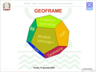
  • 17. AdB Adige – CUDAM - Difesa idrogeologica e bilancio idrico nel bacino dell’Adige Nuovo Adige Implements the concept of
  • 18. AdB Adige – CUDAM - Difesa idrogeologica e bilancio idrico nel bacino dell’Adige FROM CUAHSI PROJECT
  • 19. AdB Adige – CUDAM - Difesa idrogeologica e bilancio idrico nel bacino dell’Adige FROM CUAHSI PROJECT Hydrovolume Geovolume From Maidment, 2006
  • 20. AdB Adige – CUDAM - Difesa idrogeologica e bilancio idrico nel bacino dell’Adige FROM CUAHSI PROJECT Residence time distribution Discharge rating curve From Maidment, 2006
  • 21. AdB Adige – CUDAM - Bilancio idrico di superficie di primo livello J-HYDRO: The network structure Resolution level 5 Resolution level 4 Resolution level 3 Resolution level 2 Resolution level 1
  • 22. AdB Adige – CUDAM - Bilancio idrico di superficie di primo livello J-HYDRO: The network structure Resolution level 4 Resolution level 3 Resolution level 2 Resolution level 1
  • 23. AdB Adige – CUDAM - Bilancio idrico di superficie di primo livello J-HYDRO: The network structure Resolution level 3 Resolution level 2 Resolution level 1
  • 24. AdB Adige – CUDAM - Bilancio idrico di superficie di primo livello J-HYDRO: The network structure Resolution level 2 Resolution level 1
  • 25. AdB Adige – CUDAM - Bilancio idrico di superficie di primo livello J-HYDRO: The network structure Resolution level 1
  • 26. AdB Adige – CUDAM - Bilancio idrico di superficie di primo livello Database (PostgresSQL/PostGIS/CUAHSI) Netnode related to network and basins
  • 27. AdB Adige – CUDAM - Bilancio idrico di superficie di primo livello Database (PostgresSQL/PostGIS/CUAHSI) Time series are linked to monitoring points:
  • 28. AdB Adige – CUDAM - Bilancio idrico di superficie di primo livello Database (PostgresSQL/PostGIS/CUAHSI) Summary of all monitoring points in database
  • 29. AdB Adige – CUDAM - Bilancio idrico di superficie di primo livello Database (PostgresSQL/PostGIS/CUAHSI) Wind velocity (id=217) Rainfall (id=216) Lasa Temperature (id=219) Wind direction (id=218) An example of time series linked to a monitoring point, extracted from database
  • 30. AdB Adige – CUDAM - Bilancio idrico di superficie di primo livello Database (PostgresSQL/PostGIS/CUAHSI) Tools have been developed to managing insertion and creation of geometries and time series data, necessary to models’ run: • Geometries insertion; • Positioning of cross sections; • Lake intersections; • Computation of water withdrawal; • Time series updating.
  • 31. AdB Adige – CUDAM - Bilancio idrico di superficie di primo livello Database (PostgresSQL/PostGIS/CUAHSI) GEOMETRIES INSERTION • Copying geometries from shapefiles to database tables; • Extracting topological nodes from net geometries; • Creating links between different geometries (nets, net nodes,basins).
  • 32. AdB Adige – CUDAM - Bilancio idrico di superficie di primo livello Database (PostgresSQL/PostGIS/CUAHSI) POSITIONING OF CROSS SECTIONS • Finding intersections between network and CROSS sections; • Computation of new nodes progressive distance, and network updating; • Copying new informations to analysis tables.
  • 33. AdB Adige – CUDAM - Bilancio idrico di superficie di primo livello Database (PostgresSQL/PostGIS/CUAHSI) LAKE INTERSECTIONS • Finding intersections between network and lake geometries; • Labeling intake nodes and outtake nodes; • Copying new node informations to node tables.
  • 34. AdB Adige – CUDAM - Bilancio idrico di superficie di primo livello Database (PostgresSQL/PostGIS/CUAHSI) COMPUTATION OF WATER WITHDRAWAL • Evaluating maximum available discharge to withdrawal, for different destination uses and different time periods.
  • 35. AdB Adige – CUDAM - Bilancio idrico di superficie di primo livello Database (PostgresSQL/PostGIS/CUAHSI) TIME SERIES UPDATING • Rewriting input file to SQL; • Linking time series to related monitoring points; • Creating new metadata.
  • 36. AdB Adige – CUDAM - Difesa idrogeologica e bilancio idrico nel bacino dell’Adige Models (UNITN/OpenMI)
  • 37. AdB Adige – CUDAM - Difesa idrogeologica e bilancio idrico nel bacino dell’Adige Models (UNITN/OpenMI)
  • 38. Models (UNITN/OpenMI) The approach to hydrological modeling is different for peripheral zones of Adige basin, where natural outflow is preponderant, and for main river channels where instead is fundamental to consider artificial works: Basin peripheral area: a Rainfall-Runoff model (called GEOcuencas) is  used; Main river: a 1D routing model is used for discharge evaluation,  counting both natural and artificial intakes and withdrawals, if there are.
  • 39. Modelli (UNITN/OpenMI) Evapotranspiration Meteo Forcing Reservoirs and Snow withdrawals Runoff and Routing
  • 40. Models (UNITN/OpenMI) •Kriging rainfall spatial interpolation Meteo Forcing Temperature spatial interpolation  Evapotranspiration evaluation model  Evapotranspiration Snow height evaluation on different quote layers model Snow  Partitioning rainfall/infiltration model  Infiltration Geomorphological runoff model Runoff 
  • 41. Models (UNITN/OpenMI): the digital watershed Hydrological modeling data automatically extracted from DB are: geometries (network structure)  time series (hydrometers and weather stations)  withdrawals data  reservoirs data  The hydrological model can be run in any of the critical points in the basin: • nodes: points in basin like: hydrometers, artificial reservoirs, lakes, points where you want to evaluate discharge; macrobasins: areas marked by drainage divides and a node, o located between two  consecutive nodes; basic basins: basic hydrologic unit; with surface < 2 km2. 
  • 42. Models (UNITN/OpenMI): dynamic database Geometries for model execution are created for any single simulation, thanks to a hierarchical numbering scheme, based on Pfafstetter numbering scheme (Verdin and Verdin, 1999). In this way one can extract upstream elements, starting from current net Pfafstetter number, so you can navigate the whole network and build related basins. Then macrobasins are created, closed on the node selected by the user for current simulation.
  • 43. Modelli (UNITN/OpenMI): network geometries creation
  • 47. Models (UNITN/OpenMI): macro basins non active nodes
  • 48. Meteo Forcing Needed and Managed Meteorological data used by models are: rainfall  temperature  pressure  moisture  wind velocity  solar radiation  These data are evaluated on basic basins.
  • 50. Snow Distributed model splits any basic basin (max area 5 km2) in altitude  layers and bands; evaluates stored rain water depth and possible snow melting;  Create a filter between measured rain water and hydrological model,  modifying model input
  • 52. Routing •Routing model solves Saint Venant equations, and sets the required hydrodynamic 1D parameters; Numerical integration of 1D model uses difference finite  scheme; The initial condition is given by uniform flow upon the whole  domain; Boundary conditions are defined upstream/downstream  depending on flow regime; Generic cross sections could be used;  Intakes and withdrawals are evaluated; 
  • 53. Routing: intakes and withdrawals withdrawal: to Montecatini channel
  • 54. Routing: intakes and withdrawals intake to Adige from Montecatini channel withdrawal from Adige to Biffis channel
  • 55. Routing: intakes and withdrawals
  • 57. User Interfaces (Java/JGRASS) Open Source GIS developed by CUDAM and Department of Civil and Environmental Engineering of University of Trento, collaborating with HydroloGIS
  • 58. User Interfaces (Java/JGRASS) •Open Source GIS developed by CUDAM and Department of Civil and Environmental Engineering of University of Trento, in collaboration with HydroloGIS •Mainly targeted environmental analysis, joins a user friendly interface and a complex analysis engine, partially developed on purpose, partially derived from GRASS
  • 59. User Interfaces (Java/JGRASS) •Open Source GIS developed by CUDAM and Department of Civil and Environmental Engineering of University of Trento, in collaboration with HydroloGIS •Mainly targeted environmental analysis, joins a user friendly interface and a complex analysis engine, partially developed on purpose, partially derived from GRASS Displays vector data from database 
  • 60. INTERFACCIA GRAFICA: JGrass User Interface (JGRASS) LAYERS VIEW DATABASE CONNECTION
  • 61. User Interface (JGRASS) ATTRIBUTE TABLE VIEW
  • 63. User Interface (JGRASS) •Open Source GIS developed by CUDAM and Department of Civil and Environmental Engineering of University of Trento, in collaboration with HydroloGIS •Dedicated mainly to environmental analysis, joins a user friendly interface and a complex analysis engine, partially developed on purpose, partially derived from GRASS •Displays vector data from database Displays several different data (not in DB) like shapefiles, rasters, DEM,  satellite images…
  • 66. User Interface (JGRASS) •Open Source GIS developed by CUDAM and Department of Civil and Environmental Engineering of University of Trento, in collaboration with HydroloGIS •Dedicated mainly to environmental analysis, joins a user friendly interface and a complex analysis engine, partially developed on purpose, partially derived from GRASS •Displays vector data from database •Displays several different data (not in DB) like shapefiles, rasters, DEM, satellite images… •Sets closure point, to evaluate flood hydrograph
  • 68. User Interface (JGRASS) •Open Source GIS developed by CUDAM and Department of Civil and Environmental Engineering of University of Trento, in collaboration with HydroloGIS •Dedicated mainly to environmental analysis, joins a user friendly interface and a complex analysis engine, partially developed on purpose, partially derived from GRASS •Displays vector data from database •Displays several different data (not in DB) like shapefiles, rasters, DEM, satellite images… •Sets closure point, to evaluate flood hydrograph •Rules models’ run •Sets models are going to be used
  • 70. User Interface (JGRASS) •Open Source GIS developed by CUDAM and Department of Civil and Environmental Engineering of University of Trento, in collaboration with HydroloGIS •Dedicated mainly to environmental analysis, joins a user friendly interface and a complex analysis engine, partially developed on purpose, partially derived from GRASS •Displays vector data from database •Displays several different data (not in DB) like shapefiles, rasters, DEM, satellite images… •Sets closure point, to evaluate flood hydrograph •Rules models’ run •Sets models are going to be used •Turning on/off monitoring points like reservoirs and hydrometers
  • 71. User Interface (JGRASS) •Open Source GIS developed by CUDAM and Department of Civil and Environmental Engineering of University of Trento, in collaboration with HydroloGIS •Dedicated mainly to environmental analysis, joins a user friendly interface and a complex analysis engine, partially developed on purpose, partially derived from GRASS •Displays vector data from database •Displays several different data (not in DB) like shapefiles, rasters, DEM, satellite images… •Sets closure point, to evaluate flood hydrograph •Rules models’ run •Sets models are going to be used •Turning on/off monitoring points like reservoirs and hydrometers •Setting simulation parameters
  • 72. User Interface (JGRASS): setting simulation parameters
  • 73. User Interfaces (JGRASS) •Open Source GIS developed by CUDAM and Department of Civil and Environmental Engineering of University of Trento, in collaboration with HydroloGIS •Dedicated mainly to environmental analysis, joins a user friendly interface and a complex analysis engine, partially developed on purpose, partially derived from GRASS •Displays vector data from database •Displays several different data (not in DB) like shapefiles, rasters, DEM, satellite images… •Sets closure point, to evaluate flood hydrograph •Rules models’ run •Sets models are going to be used •Turning on/off monitoring points like reservoirs and hydrometers •Setting simulation parameters •Viewing simulation result Possible simulation saving in both HSQL and PostgreSQL/Postgis database 
  • 74. User Interface (JGRASS): simulation run Viewing simulation result: Measured and forecasting discharge Rainfall and snow contribution
  • 75. Routing: flood hydrograph in Villa Lagarina 12/09/2007 - 14-09/2007
  • 79. Routing: activation of intakes and withdrawals
  • 80. Routing: activation of intakes and withdrawals Leno intake
  • 81. Routing: activation of intakes and withdrawals Montecatini withdrawal Leno intake
  • 82. Routing: activation of intakes and withdrawals Montecatini withdrawal Leno intake
  • 83. Snow
  • 84. MODELS INTEGRATION OpenMi: standard way to models integration  Possible changing models for the same computation  Managing temporal cycle directly from JGrass  Possible different languages models integration: Java, Fortran, C Possible run of several OpenMi compliant models (Sobek, HecRAS, Mike 11...) 