This document provides a listing of 43 projects completed by the author between 1990-1999 as a Surveyor/Navigator and Project Surveyor/Senior Environmental Surveyor. The projects involve offshore, land and swamp terrain and include installation of metocean systems, pipeline route surveys, location surveys, topographical surveys and environmental surveys across Nigeria, supporting oil and gas operations.
News Release: Lakeland Resources Commences Field Program at Riou Lake (Octob...
Projects_Oku_Resume
1. Project Listing
1
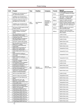
S/N Project Year Position Company Terrain
Special
Challenges/Comments
1
Installation and commissioning of 2
No. Squall Warning System.
2004 -
Present
Head Metocean
Team
Shell Nigeria
Exploration and
Production,
Nigeria
(SNEPCo)
Swamp
For oil tanker offloading and loading
operations.
2
Installation and commissioning of
Niger Delta Tidal monitoring System.
Swamp
Tidal monitoring within the Niger
delta region – enhances swamp
operations, e.g. dredging etc.
3
Installation of Metocean System on
Sea Eagle FPSO in the EA field.
Offshore
Support for aviation and marine
operations within the EA field.
4
Installation and commissioning the
Aviation Weather monitoring system.
Land and
Swamp
Support of aviation operations within
the Niger Delta region (Osubi air-strip,
Forcados and Tunu in Delta State of
Nigeria).
5
AUV Survey of OGGS pipeline EA field
to Bonny Terminal.
Offshore
Major Gas supply line from the EA
field to the NLNG project.
6
Implementation of the Web based
Metocean Weather Forecasting
System
Offshore
Support for marine and aviation
operations within the Bonga and EA
fields of Nigeria.
7
Blue Peg positioning and well fix for
Santa Babara AYND-1location.
2001 -
2004
Metocean
Advisor/Surveyor
SPDC Port
Harcourt Nigeria
Swamp
Location Surveys
8
As-built survey of Soku GP-Soku F/S
condensate export line.
Pipeline Route survey
9
Blue Peg positioning and Wellfix for
Santa Babara ARNA-2 Location.
Location Surveys
10 PI/FP NW-1 Flowline (Near Awoba) Pipeline Route survey
11
Blue Peg positioning and Wellfix for
Nembe VCLT-1 Location.
Location Surveys
12
FP Survey of Soku-Ekulama AGG
Pipeline ROW
Pipeline Route survey
13
Detail Survey & Grid levelling of
Belema Town Sandfill project.
Topographical Survey
14
Detail Survey of Nembe VCLT-1
Loc.& As-Built Survey of Nemc-30 F/L
ROW
Topographical Survey
15
Detail Survey/Grid Levelling of
Nembe VRLX-1 Loc & As-Built Survey
of F/L ROW
Topographical Survey
16
Detail Survey/Grid Levelling of
Nembe UTLX-2 Loc & As-Built Survey
of F/L ROW
Topographical Survey
17
Preliminary Investigation of Nembe
Creek SW-1X Location
Location Survey
18
Full Preparation Survey of Walterkiri-
1X Location & Flowline ROW
Location Survey
19
As-Built Survey of Nembe Crk 32,57
& 06 Flowlines & Flowstation
Pipeline Route survey
20
As-Built Survey and Grid Levelling of
Nun River Accomodation site
Topographical Survey
21
As-Built Survey of Various Pipelines /
Deliverylines in Nembe Crk and 8”
Odeama Crk Deliveryline(EPRS).
Pipeline Route survey
22 Well fix at Santa Babara AMMY-1 Location Surveys
23 DSGL/FP of Hilton site at Ekulama Topographical Survey
24
AB survey of 8" Soku Delivery Line.
(EPRS)
Pipeline Route survey
25
AB survey of 24" Tora - San
Batolomew Trunkline. (EPRS)
Pipeline Route survey
26
Detail Survey & Grid levelling of Kula
Town Sandfill project.
Topographical Survey
27
As-Built Survey and Grid Levelling of
Nembe Creek Accomodation site
Pipeline Route survey
28
As-Built Survey of 10" Santa Barbara
Delivery Line Construction
Pipeline Route survey
29
Construction & As-Built Survey of
4"Santa Barbara Well-1 Flow Line
Pipeline Route survey
30
Construction & As-Built Survey of 2 x
4" Santa Barbara Well-4 Flow Line
Pipeline Route survey
31
Construction & As-Built Survey of 2 x
6" Santa Barbara Well-6 Flow Line
Pipeline Route survey
32
Construction & As-Built Survey of 2 x
4" Santa Barbara Well-7 Flow Line
Pipeline Route survey
33
Construction & As-Built Survey of 2 x
4" Santa Barbara Well-8 Flow Line
Pipeline Route survey
34
Construction & As-Built Survey of 2 x
4" Santa Barbara Well-9 Flow Line
Pipeline Route survey
2. Project Listing
2
35
Construction & As-Built Survey of 4"
& 6" Soku Well-48 Flow Line
Pipeline Route survey
36
Construction & As-Built Survey of 4"
Nembe Well-62 Flow Line
Pipeline Route survey
37
Construction & As-Built Survey of 4"
Nembe Well-63 Flow Line
Pipeline Route survey
38
Construction & As-Built Survey of 4"
Nembe Well-64 Flow Line
Pipeline Route survey
39 Belema AGG Pipeline Route survey
40 24" Nemebe - Soku AGG Pipeline Route survey
41 6" Egbolom-Soku Flowstation Bulkline Pipeline Route survey
42
16" Okoroba-Soku Flowstation
Bulkline
Pipeline Route survey
43
Metocean Reference Document for
the Gulf of Mexico
2000 -
2001
Metocean
Analyst/Surveyor
Shell Int. E & P
Rijswijk
Offshore
Team member on the Gulf of Mexico
Sea State study and analysis.
44
Kuwait and Iran oil field reservoir
study.
Land
Updated the field reservoir predictions
using Remote Sensing.
45
Metocean Reference Document for
the Gulf of Guinea.
Offshore
Sea state studies for the Nigerian EA
field.
46
28”Nembe creek – Cawthorn Channel
Trunk line Right of Way (ROW)
1994 -
1999
Project
Surveyor/Senior
Environmental
Surveyor
Shell Petroleum
Development
Company
(Nigeria) Ltd
(SPDC)
Swamp Major pipeline for oil export.
47
San Bartholomeo cathodic protection
survey
Swamp Special survey technology were used.
48
Eastern Gas Gathering surveys
(Phase I)
Land/
Swamp
Surveys for the evacuation of gas to
NLNG at Bonny.
49 Associated Gas Gathering surveys.
Land/
Swamp
The first of its kind done in support of
gas flaring reduction in Nigeria.
50
New field development of Santa
Babara flowstation and facilities.
Swamp
New swamp mobile flowstation. First
of its kind in Nigeria.
51 Mbiama sand dump volume
Land Engineering Surveys
52 Imo River SMTQ-41-5
53 Aba Gas P/L Net Work
54 Imo River SYTM-1
55 Aba Gas P/L Net Work
56 Apara 7 & 9 F/L Re-route
57 C. P. site at Rumuekpe
58 Imo River SGTM-3
59 Etelebou Campsite
60 MiniNta 1 and 3 addtional area
61
Imo River SXTP-2 SGTM-3 SMTQ-4 &
5
62 Uzuaku-1 location
63 Rumuomasi Market
64
Cawth Chan, Alakiri Flowline
Replacement
65 Iko Town Fish factory
66 Bonny TLLV-2 Blue Peg
67
AB of 14/18" TNP at Orashi River
(land sctn.)
68 Elelenwa-14
69 Agbada TNP - Mbodo Encroachment
70 Ikpele-IX Location
71 Nun River - 17
72 Ozuaku-1 Location
73 Obigbo 4 North location
74 KI Car park
75 Apara 9 Flowline
76
8" Nkali D/L,12" Imo Riv/Ebubu,
NNPC P/L
77 Aluu market
78
TNPL Nkpoku Manifold
Enchroachment
79 Apara-Trans Amadi 6" Gasline
3. Project Listing
3
80 Mapping of Apara/Akpor flowlines
81 Agbada Well-6 Location
82
8" HP Gasline Obigbo North - IA
Gasline
83 Proposed Sand Dump Yenagoa Land
Environmental Surveys
84 Elelabio and Kala-Elela Gbaran Field Swamp
85 Oguta Loc-4 Access Road Utu River Land
86
18" Assa - Rumuekpe T/L (Ihuaba
section)
Land
87 Buguma Creek Well-8 Swamp
88 Agbada Well 58 and Sand Dump Area Land
89 8" Etelebou D/L by Well - 7 Land
90 Imo River well 28 Land
91
Okordia Rumiekpe T/L (Ihuowo
section)
Land
92
16"Nun R/Kolo Cr T/L Agiamagbene
Section
Swamp
93
10" Diebu Crk D/Line-Oporoma
Section
1994 -
1999
Project
Surveyor/Senior
Environmental
Surveyor
Shell Petroleum
Development
Company
(Nigeria) Ltd
(SPDC)
Swamp
Environmental Surveys
94 10" Diebu Cr D/L-Enwari Section Swamp
95 Krakama-11 Flowline Swamp
96 Nun River Flare Site Swamp
97
10" Diebu Crk D/Line-Agidigbene
Section
Swamp
98 Diebu creek 10 Swamp
99 Diebu creek 12 Swamp
100
Odeama creek fstn (identification of
villages)
Land
101
Waste Pit Umuechem Well-17 Access
Road
Land
102
around Mbiama Microwave Station
A/Rd.
Land
103 Survey of Ulagbe and Kpala Creeks Swamp
104
Survey of Owobena Swamp
Okporowo
Swamp
105
Akaramini Section 14"
Okordia/R'ekpe TNP
Land
106 Elelenwa Community Sec. School Land
107
Survey of Area around Buguma Main
Manifold
Land
108 Survey of Akaramini Village Land
109 Survey of Gbaran Access Road Swamp
110 Survey of Utu Nwaodefaocha Swamp Swamp
111
Assa/R'ekpe T/L at Ihuaba (Section
3)
Land
112
Assa/Rumuekpe T/L at Ihuaba
(Section 1)
Land
113 Kolo Creek Manifold Swamp
114
Claims of Umu-Nwankwonta
Obeakpu
Land
115 Obigbo N Loc 5 & 10 in Obigbo Field Land
116
PS Survey of Nun River T/L at Agbura
Bush
Swamp
117
Pollution of 28" TNP Rumuapu Rd
(Eneka Sctn.)
Land
118
Blockade Survey Kolo Crk-R'ekpe P/L
Okporowo
Swamp
119 PS Survey of Obele Location-3 Land
120 Survey of Odidele Lake Gbaran Field Swamp
121
Blockade Survey of Okoto Swamp in
Nun River
Swamp
122 Blkd Mbiama Microwave Station Land
123 Blkd Survey of Owobena Swamp Swamp
124 Blockade Survey of XYVD-1 Location Land
125 Residual Dumps on TNP (Obelle) Land
4. Project Listing
4
126 PS Survey of 16" ECTL (Abalamabie) Land
127
PS along 14"
Ikarama/Okordia/R'Ekpe F/Line
Land
128 PS Obelle Well-3 Impacted Areas Land
129 Orubiri flowstation Swamp
130 Ikarama Manifold Swamp
131
10" Diebu crk/Nun River D/L
(Akanibabau)
Swamp
132 Otamini Loaction 5 & 6 Access road Land
133 Obigbo well 25 Land
134 Obigbo well 28 Land
135 Onyoma Access road (Nun River) Land
136
Rumuekpe /Nkpoku (Km 4306 TNP
Adibawa)
Land
137 Nembe Well-5 Swamp
138 Profile Of Water Way Swamp
139 Blockade survey of Oodu Atebe creek Swamp
140 DS of Okrika Hospital cottage Swamp
141
Blockade survey of Santa Barbara
South-1X
Swamp
142 DS of Otuasega cottage hospital Swamp
143
Spillage survey of 28" Cawthorne
Channel T/L
1994 -
1999
Project
Surveyor/Senior
Environmental
Surveyor
Shell Petroleum
Development
Company
(Nigeria) Ltd
(SPDC)
Swamp
Environmental Surveys
144 DS of SMF at Adibawa JK Swamp
145
Blockade survey of Adibawa main
access (okuba)
Swamp
146
Blockade survey of Adibawa main
access (Akie)
Swamp
147 Blockade survey of Awama Creek Swamp
148
Blockade survey of area in Etelebou
(site 1)
Swamp
149
Blockade survey of area in Etelebou
(site 2)
Swamp
150
Spillage survey of Adibawa NE 1
flowline
Swamp
151
Spillage survey of Adibawa well 25S
flowline
Swamp
152
Blockade survey of Adibawa main
access (Edegbebiri)
Swamp
153 Adibawa Main Access Ishiada Swamp
154 12" Adibawa D/L Egberi Swamp
155 12" Adibawa D/L Obuafe Swamp
156 BP1 Near Oshika Community Swamp
157 Okoto swamp update. Swamp
158 Ubie Well 4 Access Road Swamp
159 Adibawa Main Acc. Akara Swp. Swamp
160 Bonny Tank farm Swamp
161 R'kpe/Bomu TNP Rumuji Sec. Swamp
162 Elelabio & Kala Elela Swp G'ran Swamp
163 Asuwe F/land Nun Rv/R'kpe TNP Swamp
164 Okoroba 1 Access Slot Swamp
165 Ubie well 10 flowline(Oja swamp) Swamp
167 Angiamagbene Swamp
168 Nembe Creek Flowlines Swamp
169 Krakrama F/S Swamp
170 Akaso 10L Caw. Ch. 11 Swamp
171 Abama & Otoyo Village Swamp
172 Owobou Swamp Swamp
173 Sambreiro River Crossing Swamp
174 Imo River 3 Flowstation Land
5. Project Listing
5
175 Ubie -S.E. location road site iii. Swamp
176 Isimiri Flowstation Land
177 Elelenwo Manifold Land
178 Etelebou Flowstation Swamp
179 Belema Flowstation Swamp
180 Ibaa Splil Site Swamp
181 8" Isimiri Delivery Line Swamp
182 Ubie -S.E. location road site i. Swamp
183 Odaha & Lala Swamp Swamp
184 Diebu Creek Loc 14 Access slot Swamp
185 Ubie Main Access Road Swamp
186 Osiaga Swamp Swamp
187 Ubie -S.E. location road site IV. Swamp
188 Okoroman Swamp Swamp
189 Ubie Location 8 Swamp
190 Assa 1 Location Land
191 Opobo Boat Yard Land
192 Adibawa Location 2 Land
193 Obuafe Creek-C Land
194 Obuafe Creek-C Land
195 Akpurukpu Farmland Land
196 Adibawa Location 4 Land
197 6" Adibawa NE Bulkline Land
198 Adibawa Flare Pit
1994 -
1999
Project
Surveyor/Senior
Environmental
Surveyor
Shell Petroleum
Development
Company
(Nigeria) Ltd
(SPDC)
Land
Environmental Surveys
199 Adibawa Location 14 Land
200 Alakiri Flowstation Land
201 Areas Around Mbiama Land
202 Imo River 57L Land
203 Areas Around Uruama Land
204 Ugbaliede 6 Land
205 Areas Around Oyigba Land
206 Areas Around Imo River Location 1 Land
207
3D OtumaraEscravos Transition
Zone.
1990 -
1993
Surveyor/
Navigator
Schlumberger
Geco-Prakla
Limited, Nigeria
Shallow
Marine
First Shallow Marine Seismic data
acquisition for Shell Nigeria.
208
3D Imo River/Nkali Prospect (Party
677)
Land First 3D Seismic Crew in Nigeria.
209 3D Gbaran/Ubie Prospect (Party 103) Swamp
One of the biggest Gas reservoirs in
Nigeria.
210 3D Egbema Prospect (Party 105) Land
Use of new survey technologies
during the prospect.
211
3D Ugheli/Uzere (UGUZ) Prospect
(Party 114)
Land/
Swamp
Use of GPS technology to set out the
prospect area.
212 Cross River State Zoo
1989
Pupil Surveyor
Aniyom Survey
Nig. Limited
Land
Perimeter, Topographical, and Layout
surveys for Cross Rivers State
Housing Corporation.
213
Survey of Landed property for
Barrister Kanu Agabi
Land
Property surveys in Ikom and Ogoja
areas of Cross Rivers State.