SlideShare ist ein Scribd-Unternehmen logo
1 von 25
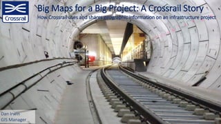
Big Maps for a Big Project: A Crossrail Story
How Crossrail uses and shares geographic information on an infrastructure project
Dan Irwin
GIS Manager
• Overview
– What is Crossrail?
– Challenges
– Where does GIS fit in?
Agenda
• Information Management
– Architecture
– Master Data Models
– Data Federation
• Sharing
– Rationale
– Benefits
– Lessons Learned
OVERVIEW
Section 1:
4
120yrs
Operational Lifetime
24Trains per hour in
Central Section
200mlong trains
200mn
Passenger Journeys /
annum
£15bnbudget
12Tb
Total Capacity
50M
GIS Features
500K
Assets
3M
Documents
2M
Drawings / Models
Overview: What is Crossrail?
Overview: Challenges - Engineering
6
Overview: Challenges - Accuracy
British National Grid - not accurate enough
London Survey Grid50cm
Overview: Challenges - Contractual
Overview: How does GIS fit in?
CDE
Instrumentation
& Monitoring
System
Enterprise
Content
Management
System
Access
Management
System
Asset
Management
System
Business
Reporting &
Dash-boarding
CAD
Management
System
Business
Analytics
Geographic
Information
System
GIS
Instrumentation
& Monitoring
System
Enterprise
Content
Management
System
Access
Management
System
Asset
Management
System
Business
Reporting &
Dashboarding
CAD
Management
System
Business
Analytics
GIS
Instrumentation
& Monitoring
System
Enterprise
Content
Management
System
Access
Management
System
Asset
Management
System
Business
Reporting &
Dash-boarding
CAD
Management
System
Business
Analytics
Master Data
Management
Federated
Database
Architecture
INFORMATION MANAGEMENT
Section 2:
Information Management: Architecture
Spatial Database
•Oracle Enterprise RDBMS + Spatial
•SDE
Extract-Transform-Load Tools
•FME + Geo-Processing
•Files, Databases, Web Services, APIs
Web Applications
•Portal for ArcGIS
•Web App Builder (Dev Edition)
Information Systems
•CAD / BIM (Projectwise)
•Documentation (Enterprise Bridge)
Public Facing Content
•ArcGIS Online
•Open Data Portal / Living Atlas
Information Management: Master Data Model
`
Information Management: Data Federation
Unit
Prop
EMS_BEFORE_INSERT_UPDATE EMS_AFTER_INSERT_UPDATE
UTL_MAIL
Information Management: Data Federation
Information Management: What about BIM?
Documentation workflows:
• NEC3Contract Management (£8.3bn)
• Asset Breakdown Structure (ABS)
• Crossrail Management System (CMS)
• Document Management System
• Assurance reporting
• Materials compliance system
• Project Technical Requests
• Observation reporting
• Snagging
• Automatic pdf drawings from
ProjectWise
• Observation reporting
• Contract deliverables
• 90% of data in 3 linked databases
CAD workflows:
• CAD user tools
• CAD QC/QA
• User Management Tools
• Customised BS1192 Workflow
GIS workflows:
• Land Management
• Asset Information Models
• Asset Protection Engineering
• Integration with CAD
GIS
Mapping
(Spatial) (Relational)
Data &
Documents
3D – 5D
Models
(Object-
orientated)
Information Management: What about BIM?
Docs
Models
GIS
SHARING
Section 3:
Sharing: Rationale
• Accessibility
• Collaboration
• Integrated Delivery
• Better Decision Making
Data,Information,Knowledge
Traditional
Process
Lifecycle Information Management
Sharing: Stakeholders
Public Access (~250k)
Third Parties
(~5,000)
Internal Staff (~500)
GI Power Users
(~10)
GIS Team (4)
Sharing: Near You
Sharing: Open Data Portal
Sharing: Benefits
General Benefits
Simplicity
Interoperability
Accessibility
ROI
Tunnel Boring
Land & Property
Claim Reports
75% time saving: £90k / annum
80% time saving: £120k
5,000 hours / annum20% time saving
Sharing: Lessons Learned
• Location Matters
– Continual Evolution
– Integration
– Masters of Where
• IT / IM Strategies
– Infrastructure
– Cloud Evolution
– Security
• Data
– Interoperability
– 3D
– Handover
Sharing: Learning Legacy
• 12 Themes and Topic Areas
– Project and Programme Management
– Procurement
– Authorisations and Consents
– Land and Property
– Health and Safety
– Environment
– Engineering
– Operations
– Talent and Resources
– External Affairs
– Innovation
– Information Management and Technology
http://learninglegacy.crossrail.co.uk/
Sharing: Geocentric Railway
• Focus
– Why location matters
– Actualised benefits realisation
– Case Studies
• Participants
– Client (TfL, Crossrail 2, Network Rail, HS2)
– Contractor (Skanska, Mott Macdonald)
– GIS Practitioners
• Available Now!
– https://resource.esriuk.com/the-geo-centric-
railway/
Thank You for your time!
Questions?

Weitere ähnliche Inhalte

Was ist angesagt?

Data Architecture for Data Governance
Data Architecture for Data GovernanceData Architecture for Data Governance
Data Architecture for Data GovernanceDATAVERSITY
 
Data Architecture Strategies: The Rise of the Graph Database
Data Architecture Strategies: The Rise of the Graph DatabaseData Architecture Strategies: The Rise of the Graph Database
Data Architecture Strategies: The Rise of the Graph DatabaseDATAVERSITY
 
Data Architecture Strategies: Building an Enterprise Data Strategy – Where to...
Data Architecture Strategies: Building an Enterprise Data Strategy – Where to...Data Architecture Strategies: Building an Enterprise Data Strategy – Where to...
Data Architecture Strategies: Building an Enterprise Data Strategy – Where to...DATAVERSITY
 
Designing modern dw and data lake
Designing modern dw and data lakeDesigning modern dw and data lake
Designing modern dw and data lakepunedevscom
 
Google BigQuery Best Practices
Google BigQuery Best PracticesGoogle BigQuery Best Practices
Google BigQuery Best PracticesMatillion
 
Data-Ed Webinar: Data Quality Engineering
Data-Ed Webinar: Data Quality EngineeringData-Ed Webinar: Data Quality Engineering
Data-Ed Webinar: Data Quality EngineeringDATAVERSITY
 
Chapter 5: Data Development
Chapter 5: Data Development Chapter 5: Data Development
Chapter 5: Data Development Ahmed Alorage
 
Using a Semantic and Graph-based Data Catalog in a Modern Data Fabric
Using a Semantic and Graph-based Data Catalog in a Modern Data FabricUsing a Semantic and Graph-based Data Catalog in a Modern Data Fabric
Using a Semantic and Graph-based Data Catalog in a Modern Data FabricCambridge Semantics
 
Introduction to Data Management Maturity Models
Introduction to Data Management Maturity ModelsIntroduction to Data Management Maturity Models
Introduction to Data Management Maturity ModelsKingland
 
How to Easily Read and Write CityGML Data (Without Coding)
How to Easily Read and Write CityGML Data (Without Coding)How to Easily Read and Write CityGML Data (Without Coding)
How to Easily Read and Write CityGML Data (Without Coding)Safe Software
 
Building a Data Strategy – Practical Steps for Aligning with Business Goals
Building a Data Strategy – Practical Steps for Aligning with Business GoalsBuilding a Data Strategy – Practical Steps for Aligning with Business Goals
Building a Data Strategy – Practical Steps for Aligning with Business GoalsDATAVERSITY
 
Bridging Between CAD & GIS: 8 Ways to Automate Data Integration
Bridging Between CAD & GIS: 8 Ways to Automate Data IntegrationBridging Between CAD & GIS: 8 Ways to Automate Data Integration
Bridging Between CAD & GIS: 8 Ways to Automate Data IntegrationSafe Software
 
An Introduction to MapBox
An Introduction to MapBoxAn Introduction to MapBox
An Introduction to MapBoxMatt Yeh
 
RDBMS to Graph
RDBMS to GraphRDBMS to Graph
RDBMS to GraphNeo4j
 
Capability Model_Data Governance
Capability Model_Data GovernanceCapability Model_Data Governance
Capability Model_Data GovernanceSteve Novak
 
Five Things to Consider About Data Mesh and Data Governance
Five Things to Consider About Data Mesh and Data GovernanceFive Things to Consider About Data Mesh and Data Governance
Five Things to Consider About Data Mesh and Data GovernanceDATAVERSITY
 
IAO-Intel: An Ontology of Information Artifacts in the Intelligence Domain
IAO-Intel: An Ontology of Information Artifacts in the Intelligence DomainIAO-Intel: An Ontology of Information Artifacts in the Intelligence Domain
IAO-Intel: An Ontology of Information Artifacts in the Intelligence DomainBarry Smith
 

Was ist angesagt? (20)

Data Architecture for Data Governance
Data Architecture for Data GovernanceData Architecture for Data Governance
Data Architecture for Data Governance
 
Ebook - The Guide to Master Data Management
Ebook - The Guide to Master Data Management Ebook - The Guide to Master Data Management
Ebook - The Guide to Master Data Management
 
Data Architecture Strategies: The Rise of the Graph Database
Data Architecture Strategies: The Rise of the Graph DatabaseData Architecture Strategies: The Rise of the Graph Database
Data Architecture Strategies: The Rise of the Graph Database
 
Graph based data models
Graph based data modelsGraph based data models
Graph based data models
 
Data Architecture Strategies: Building an Enterprise Data Strategy – Where to...
Data Architecture Strategies: Building an Enterprise Data Strategy – Where to...Data Architecture Strategies: Building an Enterprise Data Strategy – Where to...
Data Architecture Strategies: Building an Enterprise Data Strategy – Where to...
 
Designing modern dw and data lake
Designing modern dw and data lakeDesigning modern dw and data lake
Designing modern dw and data lake
 
Google BigQuery Best Practices
Google BigQuery Best PracticesGoogle BigQuery Best Practices
Google BigQuery Best Practices
 
Data-Ed Webinar: Data Quality Engineering
Data-Ed Webinar: Data Quality EngineeringData-Ed Webinar: Data Quality Engineering
Data-Ed Webinar: Data Quality Engineering
 
Chapter 5: Data Development
Chapter 5: Data Development Chapter 5: Data Development
Chapter 5: Data Development
 
Using a Semantic and Graph-based Data Catalog in a Modern Data Fabric
Using a Semantic and Graph-based Data Catalog in a Modern Data FabricUsing a Semantic and Graph-based Data Catalog in a Modern Data Fabric
Using a Semantic and Graph-based Data Catalog in a Modern Data Fabric
 
Introduction to Data Management Maturity Models
Introduction to Data Management Maturity ModelsIntroduction to Data Management Maturity Models
Introduction to Data Management Maturity Models
 
How to Easily Read and Write CityGML Data (Without Coding)
How to Easily Read and Write CityGML Data (Without Coding)How to Easily Read and Write CityGML Data (Without Coding)
How to Easily Read and Write CityGML Data (Without Coding)
 
Building a Data Strategy – Practical Steps for Aligning with Business Goals
Building a Data Strategy – Practical Steps for Aligning with Business GoalsBuilding a Data Strategy – Practical Steps for Aligning with Business Goals
Building a Data Strategy – Practical Steps for Aligning with Business Goals
 
Bridging Between CAD & GIS: 8 Ways to Automate Data Integration
Bridging Between CAD & GIS: 8 Ways to Automate Data IntegrationBridging Between CAD & GIS: 8 Ways to Automate Data Integration
Bridging Between CAD & GIS: 8 Ways to Automate Data Integration
 
An Introduction to MapBox
An Introduction to MapBoxAn Introduction to MapBox
An Introduction to MapBox
 
RDBMS to Graph
RDBMS to GraphRDBMS to Graph
RDBMS to Graph
 
Building-a-Data-Lake-on-AWS
Building-a-Data-Lake-on-AWSBuilding-a-Data-Lake-on-AWS
Building-a-Data-Lake-on-AWS
 
Capability Model_Data Governance
Capability Model_Data GovernanceCapability Model_Data Governance
Capability Model_Data Governance
 
Five Things to Consider About Data Mesh and Data Governance
Five Things to Consider About Data Mesh and Data GovernanceFive Things to Consider About Data Mesh and Data Governance
Five Things to Consider About Data Mesh and Data Governance
 
IAO-Intel: An Ontology of Information Artifacts in the Intelligence Domain
IAO-Intel: An Ontology of Information Artifacts in the Intelligence DomainIAO-Intel: An Ontology of Information Artifacts in the Intelligence Domain
IAO-Intel: An Ontology of Information Artifacts in the Intelligence Domain
 

Ähnlich wie Crossrail - Big Maps for a Big Project - Smart Infrastructure - Esri UK Annual Conference 2018

Introduction of super map gis 10i bitcc technology jayson
Introduction of super map gis 10i bitcc technology jaysonIntroduction of super map gis 10i bitcc technology jayson
Introduction of super map gis 10i bitcc technology jaysonGeoMedeelel
 
RICS CPD Day London - Steven Eglinton - Geospatial BIM
RICS CPD Day London - Steven Eglinton - Geospatial BIMRICS CPD Day London - Steven Eglinton - Geospatial BIM
RICS CPD Day London - Steven Eglinton - Geospatial BIMGeoEnable Limited
 
Case Studies On Gis Fm Integration
Case Studies On Gis Fm IntegrationCase Studies On Gis Fm Integration
Case Studies On Gis Fm IntegrationJohn Przybyla
 
New paradigm for national mapping organization
New paradigm for national mapping organizationNew paradigm for national mapping organization
New paradigm for national mapping organizationEsri India
 
Neo4j GraphTalks - Einführung in Graphdatenbanken
Neo4j GraphTalks - Einführung in GraphdatenbankenNeo4j GraphTalks - Einführung in Graphdatenbanken
Neo4j GraphTalks - Einführung in GraphdatenbankenNeo4j
 
CAD GIS Integration Workshop
CAD GIS Integration WorkshopCAD GIS Integration Workshop
CAD GIS Integration WorkshopAndrew Bashfield
 
Daniel Irwin - Crossrail: Future-Proofing Railway Asset Management
Daniel Irwin - Crossrail: Future-Proofing Railway Asset ManagementDaniel Irwin - Crossrail: Future-Proofing Railway Asset Management
Daniel Irwin - Crossrail: Future-Proofing Railway Asset ManagementGeoEnable Limited
 
Integrating GIS utility data in the UK
Integrating GIS utility data in the UKIntegrating GIS utility data in the UK
Integrating GIS utility data in the UKAntArch
 
Fiatech 2014 - Big BIM Implementation, Zuhair Haddad
Fiatech 2014 - Big BIM Implementation, Zuhair HaddadFiatech 2014 - Big BIM Implementation, Zuhair Haddad
Fiatech 2014 - Big BIM Implementation, Zuhair HaddadCCT International
 
Unleashing the Power of Data Interoperability - UMass Amherst
Unleashing the Power of Data Interoperability - UMass AmherstUnleashing the Power of Data Interoperability - UMass Amherst
Unleashing the Power of Data Interoperability - UMass AmherstSafe Software
 
Leveraging ArcGIS Platform & CityEngine for GIS based Master Plans
Leveraging ArcGIS Platform & CityEngine for GIS based Master PlansLeveraging ArcGIS Platform & CityEngine for GIS based Master Plans
Leveraging ArcGIS Platform & CityEngine for GIS based Master PlansEsri India
 
Optimizing Your Supply Chain with Neo4j
Optimizing Your Supply Chain with Neo4jOptimizing Your Supply Chain with Neo4j
Optimizing Your Supply Chain with Neo4jNeo4j
 
Transport for London - London's Operations Digital Twin
Transport for London - London's Operations Digital TwinTransport for London - London's Operations Digital Twin
Transport for London - London's Operations Digital TwinNeo4j
 
GIS Mobile Apps for Highways - Wiltshire Council
GIS Mobile Apps for Highways - Wiltshire CouncilGIS Mobile Apps for Highways - Wiltshire Council
GIS Mobile Apps for Highways - Wiltshire CouncilEsri UK
 
IMGS Geospatial User Group 2014: GeoMedia 2014
IMGS Geospatial User Group 2014: GeoMedia 2014IMGS Geospatial User Group 2014: GeoMedia 2014
IMGS Geospatial User Group 2014: GeoMedia 2014IMGS
 
Crowd sourcing gis for global urban area mapping
Crowd sourcing gis for global urban area mappingCrowd sourcing gis for global urban area mapping
Crowd sourcing gis for global urban area mappingHiroyuki Miyazaki
 
“Increase Value of IT Services Through Application Portfolio Management” deli...
“Increase Value of IT Services Through Application Portfolio Management” deli...“Increase Value of IT Services Through Application Portfolio Management” deli...
“Increase Value of IT Services Through Application Portfolio Management” deli...KBIZEAU
 
GraphTalks Stuttgart - Einführung in Graphdatenbanken und Neo4j
GraphTalks Stuttgart - Einführung in Graphdatenbanken und Neo4jGraphTalks Stuttgart - Einführung in Graphdatenbanken und Neo4j
GraphTalks Stuttgart - Einführung in Graphdatenbanken und Neo4jNeo4j
 

Ähnlich wie Crossrail - Big Maps for a Big Project - Smart Infrastructure - Esri UK Annual Conference 2018 (20)

Introduction of super map gis 10i bitcc technology jayson
Introduction of super map gis 10i bitcc technology jaysonIntroduction of super map gis 10i bitcc technology jayson
Introduction of super map gis 10i bitcc technology jayson
 
RICS CPD Day London - Steven Eglinton - Geospatial BIM
RICS CPD Day London - Steven Eglinton - Geospatial BIMRICS CPD Day London - Steven Eglinton - Geospatial BIM
RICS CPD Day London - Steven Eglinton - Geospatial BIM
 
Case Studies On Gis Fm Integration
Case Studies On Gis Fm IntegrationCase Studies On Gis Fm Integration
Case Studies On Gis Fm Integration
 
New paradigm for national mapping organization
New paradigm for national mapping organizationNew paradigm for national mapping organization
New paradigm for national mapping organization
 
Neo4j GraphTalks - Einführung in Graphdatenbanken
Neo4j GraphTalks - Einführung in GraphdatenbankenNeo4j GraphTalks - Einführung in Graphdatenbanken
Neo4j GraphTalks - Einführung in Graphdatenbanken
 
Hawaii Pacific GIS Conference 2012: LiDAR for Intrastructure and Terrian Mapp...
Hawaii Pacific GIS Conference 2012: LiDAR for Intrastructure and Terrian Mapp...Hawaii Pacific GIS Conference 2012: LiDAR for Intrastructure and Terrian Mapp...
Hawaii Pacific GIS Conference 2012: LiDAR for Intrastructure and Terrian Mapp...
 
CAD GIS Integration Workshop
CAD GIS Integration WorkshopCAD GIS Integration Workshop
CAD GIS Integration Workshop
 
Daniel Irwin - Crossrail: Future-Proofing Railway Asset Management
Daniel Irwin - Crossrail: Future-Proofing Railway Asset ManagementDaniel Irwin - Crossrail: Future-Proofing Railway Asset Management
Daniel Irwin - Crossrail: Future-Proofing Railway Asset Management
 
Integrating GIS utility data in the UK
Integrating GIS utility data in the UKIntegrating GIS utility data in the UK
Integrating GIS utility data in the UK
 
Fiatech 2014 - Big BIM Implementation, Zuhair Haddad
Fiatech 2014 - Big BIM Implementation, Zuhair HaddadFiatech 2014 - Big BIM Implementation, Zuhair Haddad
Fiatech 2014 - Big BIM Implementation, Zuhair Haddad
 
Unleashing the Power of Data Interoperability - UMass Amherst
Unleashing the Power of Data Interoperability - UMass AmherstUnleashing the Power of Data Interoperability - UMass Amherst
Unleashing the Power of Data Interoperability - UMass Amherst
 
Leveraging ArcGIS Platform & CityEngine for GIS based Master Plans
Leveraging ArcGIS Platform & CityEngine for GIS based Master PlansLeveraging ArcGIS Platform & CityEngine for GIS based Master Plans
Leveraging ArcGIS Platform & CityEngine for GIS based Master Plans
 
Optimizing Your Supply Chain with Neo4j
Optimizing Your Supply Chain with Neo4jOptimizing Your Supply Chain with Neo4j
Optimizing Your Supply Chain with Neo4j
 
Transport for London - London's Operations Digital Twin
Transport for London - London's Operations Digital TwinTransport for London - London's Operations Digital Twin
Transport for London - London's Operations Digital Twin
 
GIS Mobile Apps for Highways - Wiltshire Council
GIS Mobile Apps for Highways - Wiltshire CouncilGIS Mobile Apps for Highways - Wiltshire Council
GIS Mobile Apps for Highways - Wiltshire Council
 
IMGS Geospatial User Group 2014: GeoMedia 2014
IMGS Geospatial User Group 2014: GeoMedia 2014IMGS Geospatial User Group 2014: GeoMedia 2014
IMGS Geospatial User Group 2014: GeoMedia 2014
 
Crowd sourcing gis for global urban area mapping
Crowd sourcing gis for global urban area mappingCrowd sourcing gis for global urban area mapping
Crowd sourcing gis for global urban area mapping
 
“Increase Value of IT Services Through Application Portfolio Management” deli...
“Increase Value of IT Services Through Application Portfolio Management” deli...“Increase Value of IT Services Through Application Portfolio Management” deli...
“Increase Value of IT Services Through Application Portfolio Management” deli...
 
GraphTalks Stuttgart - Einführung in Graphdatenbanken und Neo4j
GraphTalks Stuttgart - Einführung in Graphdatenbanken und Neo4jGraphTalks Stuttgart - Einführung in Graphdatenbanken und Neo4j
GraphTalks Stuttgart - Einführung in Graphdatenbanken und Neo4j
 
Trimble, TILOS & The Future
Trimble, TILOS & The FutureTrimble, TILOS & The Future
Trimble, TILOS & The Future
 

Mehr von Esri UK

Welsh Conference 2023 - The Road Ahead
Welsh Conference 2023 - The Road AheadWelsh Conference 2023 - The Road Ahead
Welsh Conference 2023 - The Road AheadEsri UK
 
Welsh Conference 2023 Opening Plenary
Welsh Conference 2023 Opening PlenaryWelsh Conference 2023 Opening Plenary
Welsh Conference 2023 Opening PlenaryEsri UK
 
Solving sustainability challenges with geospatial information
Solving sustainability challenges with geospatial informationSolving sustainability challenges with geospatial information
Solving sustainability challenges with geospatial informationEsri UK
 
Streamlining the design and operation of infrastructure in Wales
Streamlining the design and operation of infrastructure in WalesStreamlining the design and operation of infrastructure in Wales
Streamlining the design and operation of infrastructure in WalesEsri UK
 
Ecological monitoring in Wales: data capture in the ERAMMP field survey
Ecological monitoring in Wales: data capture in the ERAMMP field surveyEcological monitoring in Wales: data capture in the ERAMMP field survey
Ecological monitoring in Wales: data capture in the ERAMMP field surveyEsri UK
 
Planning a brighter future with a GIS of the World
Planning a brighter future with a GIS of the WorldPlanning a brighter future with a GIS of the World
Planning a brighter future with a GIS of the WorldEsri UK
 
Help create a national walking network
Help create a national walking networkHelp create a national walking network
Help create a national walking networkEsri UK
 
Bringing ArcGIS spatial analysis to bear on IoT data
Bringing ArcGIS spatial analysis to bear on IoT dataBringing ArcGIS spatial analysis to bear on IoT data
Bringing ArcGIS spatial analysis to bear on IoT dataEsri UK
 
How climate data can help address the climate challenge
How climate data can help address the climate challengeHow climate data can help address the climate challenge
How climate data can help address the climate challengeEsri UK
 
Esri UK Road Ahead Welsh Conference
Esri UK Road Ahead Welsh ConferenceEsri UK Road Ahead Welsh Conference
Esri UK Road Ahead Welsh ConferenceEsri UK
 
Sweet - Esri UK
Sweet - Esri UKSweet - Esri UK
Sweet - Esri UKEsri UK
 
Enhance your maps with arcade - Esri UK
Enhance your maps with arcade - Esri UKEnhance your maps with arcade - Esri UK
Enhance your maps with arcade - Esri UKEsri UK
 
Get Further by Being Mobile – A Look at Advanced Mobile Techniques in the Arc...
Get Further by Being Mobile – A Look at Advanced Mobile Techniques in the Arc...Get Further by Being Mobile – A Look at Advanced Mobile Techniques in the Arc...
Get Further by Being Mobile – A Look at Advanced Mobile Techniques in the Arc...Esri UK
 
Arcadis - Improving Ground Engineering Data Flows - Smart Infrastructure - AC18
Arcadis - Improving Ground Engineering Data Flows - Smart Infrastructure - AC18Arcadis - Improving Ground Engineering Data Flows - Smart Infrastructure - AC18
Arcadis - Improving Ground Engineering Data Flows - Smart Infrastructure - AC18Esri UK
 
Using Jupyter Notebooks - Developers Forum - AC18
Using Jupyter Notebooks - Developers Forum - AC18Using Jupyter Notebooks - Developers Forum - AC18
Using Jupyter Notebooks - Developers Forum - AC18Esri UK
 
I Didn't Know You Could Do That -Technical - AC18
I Didn't Know You Could Do That -Technical - AC18I Didn't Know You Could Do That -Technical - AC18
I Didn't Know You Could Do That -Technical - AC18Esri UK
 
All About Angular and ArcGIS - Developers Forum - AC18
All About Angular and ArcGIS - Developers Forum - AC18All About Angular and ArcGIS - Developers Forum - AC18
All About Angular and ArcGIS - Developers Forum - AC18Esri UK
 
What's New in the Javascript API - Developers Forum - AC18
What's New in the Javascript API - Developers Forum - AC18What's New in the Javascript API - Developers Forum - AC18
What's New in the Javascript API - Developers Forum - AC18Esri UK
 
GIS Under the Radar - Smart Education - Higher - AC18
GIS Under the Radar - Smart Education - Higher - AC18GIS Under the Radar - Smart Education - Higher - AC18
GIS Under the Radar - Smart Education - Higher - AC18Esri UK
 
Switching Your Teaching to ArcGIS Pro - Smart Education - Higher - AC18
Switching Your Teaching to ArcGIS Pro - Smart Education - Higher - AC18Switching Your Teaching to ArcGIS Pro - Smart Education - Higher - AC18
Switching Your Teaching to ArcGIS Pro - Smart Education - Higher - AC18Esri UK
 

Mehr von Esri UK (20)

Welsh Conference 2023 - The Road Ahead
Welsh Conference 2023 - The Road AheadWelsh Conference 2023 - The Road Ahead
Welsh Conference 2023 - The Road Ahead
 
Welsh Conference 2023 Opening Plenary
Welsh Conference 2023 Opening PlenaryWelsh Conference 2023 Opening Plenary
Welsh Conference 2023 Opening Plenary
 
Solving sustainability challenges with geospatial information
Solving sustainability challenges with geospatial informationSolving sustainability challenges with geospatial information
Solving sustainability challenges with geospatial information
 
Streamlining the design and operation of infrastructure in Wales
Streamlining the design and operation of infrastructure in WalesStreamlining the design and operation of infrastructure in Wales
Streamlining the design and operation of infrastructure in Wales
 
Ecological monitoring in Wales: data capture in the ERAMMP field survey
Ecological monitoring in Wales: data capture in the ERAMMP field surveyEcological monitoring in Wales: data capture in the ERAMMP field survey
Ecological monitoring in Wales: data capture in the ERAMMP field survey
 
Planning a brighter future with a GIS of the World
Planning a brighter future with a GIS of the WorldPlanning a brighter future with a GIS of the World
Planning a brighter future with a GIS of the World
 
Help create a national walking network
Help create a national walking networkHelp create a national walking network
Help create a national walking network
 
Bringing ArcGIS spatial analysis to bear on IoT data
Bringing ArcGIS spatial analysis to bear on IoT dataBringing ArcGIS spatial analysis to bear on IoT data
Bringing ArcGIS spatial analysis to bear on IoT data
 
How climate data can help address the climate challenge
How climate data can help address the climate challengeHow climate data can help address the climate challenge
How climate data can help address the climate challenge
 
Esri UK Road Ahead Welsh Conference
Esri UK Road Ahead Welsh ConferenceEsri UK Road Ahead Welsh Conference
Esri UK Road Ahead Welsh Conference
 
Sweet - Esri UK
Sweet - Esri UKSweet - Esri UK
Sweet - Esri UK
 
Enhance your maps with arcade - Esri UK
Enhance your maps with arcade - Esri UKEnhance your maps with arcade - Esri UK
Enhance your maps with arcade - Esri UK
 
Get Further by Being Mobile – A Look at Advanced Mobile Techniques in the Arc...
Get Further by Being Mobile – A Look at Advanced Mobile Techniques in the Arc...Get Further by Being Mobile – A Look at Advanced Mobile Techniques in the Arc...
Get Further by Being Mobile – A Look at Advanced Mobile Techniques in the Arc...
 
Arcadis - Improving Ground Engineering Data Flows - Smart Infrastructure - AC18
Arcadis - Improving Ground Engineering Data Flows - Smart Infrastructure - AC18Arcadis - Improving Ground Engineering Data Flows - Smart Infrastructure - AC18
Arcadis - Improving Ground Engineering Data Flows - Smart Infrastructure - AC18
 
Using Jupyter Notebooks - Developers Forum - AC18
Using Jupyter Notebooks - Developers Forum - AC18Using Jupyter Notebooks - Developers Forum - AC18
Using Jupyter Notebooks - Developers Forum - AC18
 
I Didn't Know You Could Do That -Technical - AC18
I Didn't Know You Could Do That -Technical - AC18I Didn't Know You Could Do That -Technical - AC18
I Didn't Know You Could Do That -Technical - AC18
 
All About Angular and ArcGIS - Developers Forum - AC18
All About Angular and ArcGIS - Developers Forum - AC18All About Angular and ArcGIS - Developers Forum - AC18
All About Angular and ArcGIS - Developers Forum - AC18
 
What's New in the Javascript API - Developers Forum - AC18
What's New in the Javascript API - Developers Forum - AC18What's New in the Javascript API - Developers Forum - AC18
What's New in the Javascript API - Developers Forum - AC18
 
GIS Under the Radar - Smart Education - Higher - AC18
GIS Under the Radar - Smart Education - Higher - AC18GIS Under the Radar - Smart Education - Higher - AC18
GIS Under the Radar - Smart Education - Higher - AC18
 
Switching Your Teaching to ArcGIS Pro - Smart Education - Higher - AC18
Switching Your Teaching to ArcGIS Pro - Smart Education - Higher - AC18Switching Your Teaching to ArcGIS Pro - Smart Education - Higher - AC18
Switching Your Teaching to ArcGIS Pro - Smart Education - Higher - AC18
 

Kürzlich hochgeladen

CRM Contender Series: HubSpot vs. Salesforce
CRM Contender Series: HubSpot vs. SalesforceCRM Contender Series: HubSpot vs. Salesforce
CRM Contender Series: HubSpot vs. SalesforceBrainSell Technologies
 
SensoDat: Simulation-based Sensor Dataset of Self-driving Cars
SensoDat: Simulation-based Sensor Dataset of Self-driving CarsSensoDat: Simulation-based Sensor Dataset of Self-driving Cars
SensoDat: Simulation-based Sensor Dataset of Self-driving CarsChristian Birchler
 
How to submit a standout Adobe Champion Application
How to submit a standout Adobe Champion ApplicationHow to submit a standout Adobe Champion Application
How to submit a standout Adobe Champion ApplicationBradBedford3
 
Unveiling the Future: Sylius 2.0 New Features
Unveiling the Future: Sylius 2.0 New FeaturesUnveiling the Future: Sylius 2.0 New Features
Unveiling the Future: Sylius 2.0 New FeaturesŁukasz Chruściel
 
Taming Distributed Systems: Key Insights from Wix's Large-Scale Experience - ...
Taming Distributed Systems: Key Insights from Wix's Large-Scale Experience - ...Taming Distributed Systems: Key Insights from Wix's Large-Scale Experience - ...
Taming Distributed Systems: Key Insights from Wix's Large-Scale Experience - ...Natan Silnitsky
 
Intelligent Home Wi-Fi Solutions | ThinkPalm
Intelligent Home Wi-Fi Solutions | ThinkPalmIntelligent Home Wi-Fi Solutions | ThinkPalm
Intelligent Home Wi-Fi Solutions | ThinkPalmSujith Sukumaran
 
SpotFlow: Tracking Method Calls and States at Runtime
SpotFlow: Tracking Method Calls and States at RuntimeSpotFlow: Tracking Method Calls and States at Runtime
SpotFlow: Tracking Method Calls and States at Runtimeandrehoraa
 
Simplifying Microservices & Apps - The art of effortless development - Meetup...
Simplifying Microservices & Apps - The art of effortless development - Meetup...Simplifying Microservices & Apps - The art of effortless development - Meetup...
Simplifying Microservices & Apps - The art of effortless development - Meetup...Rob Geurden
 
Catch the Wave: SAP Event-Driven and Data Streaming for the Intelligence Ente...
Catch the Wave: SAP Event-Driven and Data Streaming for the Intelligence Ente...Catch the Wave: SAP Event-Driven and Data Streaming for the Intelligence Ente...
Catch the Wave: SAP Event-Driven and Data Streaming for the Intelligence Ente...confluent
 
PREDICTING RIVER WATER QUALITY ppt presentation
PREDICTING  RIVER  WATER QUALITY  ppt presentationPREDICTING  RIVER  WATER QUALITY  ppt presentation
PREDICTING RIVER WATER QUALITY ppt presentationvaddepallysandeep122
 
Call Us🔝>༒+91-9711147426⇛Call In girls karol bagh (Delhi)
Call Us🔝>༒+91-9711147426⇛Call In girls karol bagh (Delhi)Call Us🔝>༒+91-9711147426⇛Call In girls karol bagh (Delhi)
Call Us🔝>༒+91-9711147426⇛Call In girls karol bagh (Delhi)jennyeacort
 
GOING AOT WITH GRAALVM – DEVOXX GREECE.pdf
GOING AOT WITH GRAALVM – DEVOXX GREECE.pdfGOING AOT WITH GRAALVM – DEVOXX GREECE.pdf
GOING AOT WITH GRAALVM – DEVOXX GREECE.pdfAlina Yurenko
 
Dealing with Cultural Dispersion — Stefano Lambiase — ICSE-SEIS 2024
Dealing with Cultural Dispersion — Stefano Lambiase — ICSE-SEIS 2024Dealing with Cultural Dispersion — Stefano Lambiase — ICSE-SEIS 2024
Dealing with Cultural Dispersion — Stefano Lambiase — ICSE-SEIS 2024StefanoLambiase
 
Sending Calendar Invites on SES and Calendarsnack.pdf
Sending Calendar Invites on SES and Calendarsnack.pdfSending Calendar Invites on SES and Calendarsnack.pdf
Sending Calendar Invites on SES and Calendarsnack.pdf31events.com
 
A healthy diet for your Java application Devoxx France.pdf
A healthy diet for your Java application Devoxx France.pdfA healthy diet for your Java application Devoxx France.pdf
A healthy diet for your Java application Devoxx France.pdfMarharyta Nedzelska
 
Balasore Best It Company|| Top 10 IT Company || Balasore Software company Odisha
Balasore Best It Company|| Top 10 IT Company || Balasore Software company OdishaBalasore Best It Company|| Top 10 IT Company || Balasore Software company Odisha
Balasore Best It Company|| Top 10 IT Company || Balasore Software company Odishasmiwainfosol
 
Post Quantum Cryptography – The Impact on Identity
Post Quantum Cryptography – The Impact on IdentityPost Quantum Cryptography – The Impact on Identity
Post Quantum Cryptography – The Impact on Identityteam-WIBU
 
英国UN学位证,北安普顿大学毕业证书1:1制作
英国UN学位证,北安普顿大学毕业证书1:1制作英国UN学位证,北安普顿大学毕业证书1:1制作
英国UN学位证,北安普顿大学毕业证书1:1制作qr0udbr0
 
Ahmed Motair CV April 2024 (Senior SW Developer)
Ahmed Motair CV April 2024 (Senior SW Developer)Ahmed Motair CV April 2024 (Senior SW Developer)
Ahmed Motair CV April 2024 (Senior SW Developer)Ahmed Mater
 

Kürzlich hochgeladen (20)

CRM Contender Series: HubSpot vs. Salesforce
CRM Contender Series: HubSpot vs. SalesforceCRM Contender Series: HubSpot vs. Salesforce
CRM Contender Series: HubSpot vs. Salesforce
 
SensoDat: Simulation-based Sensor Dataset of Self-driving Cars
SensoDat: Simulation-based Sensor Dataset of Self-driving CarsSensoDat: Simulation-based Sensor Dataset of Self-driving Cars
SensoDat: Simulation-based Sensor Dataset of Self-driving Cars
 
How to submit a standout Adobe Champion Application
How to submit a standout Adobe Champion ApplicationHow to submit a standout Adobe Champion Application
How to submit a standout Adobe Champion Application
 
Unveiling the Future: Sylius 2.0 New Features
Unveiling the Future: Sylius 2.0 New FeaturesUnveiling the Future: Sylius 2.0 New Features
Unveiling the Future: Sylius 2.0 New Features
 
Taming Distributed Systems: Key Insights from Wix's Large-Scale Experience - ...
Taming Distributed Systems: Key Insights from Wix's Large-Scale Experience - ...Taming Distributed Systems: Key Insights from Wix's Large-Scale Experience - ...
Taming Distributed Systems: Key Insights from Wix's Large-Scale Experience - ...
 
Intelligent Home Wi-Fi Solutions | ThinkPalm
Intelligent Home Wi-Fi Solutions | ThinkPalmIntelligent Home Wi-Fi Solutions | ThinkPalm
Intelligent Home Wi-Fi Solutions | ThinkPalm
 
SpotFlow: Tracking Method Calls and States at Runtime
SpotFlow: Tracking Method Calls and States at RuntimeSpotFlow: Tracking Method Calls and States at Runtime
SpotFlow: Tracking Method Calls and States at Runtime
 
Hot Sexy call girls in Patel Nagar🔝 9953056974 🔝 escort Service
Hot Sexy call girls in Patel Nagar🔝 9953056974 🔝 escort ServiceHot Sexy call girls in Patel Nagar🔝 9953056974 🔝 escort Service
Hot Sexy call girls in Patel Nagar🔝 9953056974 🔝 escort Service
 
Simplifying Microservices & Apps - The art of effortless development - Meetup...
Simplifying Microservices & Apps - The art of effortless development - Meetup...Simplifying Microservices & Apps - The art of effortless development - Meetup...
Simplifying Microservices & Apps - The art of effortless development - Meetup...
 
Catch the Wave: SAP Event-Driven and Data Streaming for the Intelligence Ente...
Catch the Wave: SAP Event-Driven and Data Streaming for the Intelligence Ente...Catch the Wave: SAP Event-Driven and Data Streaming for the Intelligence Ente...
Catch the Wave: SAP Event-Driven and Data Streaming for the Intelligence Ente...
 
PREDICTING RIVER WATER QUALITY ppt presentation
PREDICTING  RIVER  WATER QUALITY  ppt presentationPREDICTING  RIVER  WATER QUALITY  ppt presentation
PREDICTING RIVER WATER QUALITY ppt presentation
 
Call Us🔝>༒+91-9711147426⇛Call In girls karol bagh (Delhi)
Call Us🔝>༒+91-9711147426⇛Call In girls karol bagh (Delhi)Call Us🔝>༒+91-9711147426⇛Call In girls karol bagh (Delhi)
Call Us🔝>༒+91-9711147426⇛Call In girls karol bagh (Delhi)
 
GOING AOT WITH GRAALVM – DEVOXX GREECE.pdf
GOING AOT WITH GRAALVM – DEVOXX GREECE.pdfGOING AOT WITH GRAALVM – DEVOXX GREECE.pdf
GOING AOT WITH GRAALVM – DEVOXX GREECE.pdf
 
Dealing with Cultural Dispersion — Stefano Lambiase — ICSE-SEIS 2024
Dealing with Cultural Dispersion — Stefano Lambiase — ICSE-SEIS 2024Dealing with Cultural Dispersion — Stefano Lambiase — ICSE-SEIS 2024
Dealing with Cultural Dispersion — Stefano Lambiase — ICSE-SEIS 2024
 
Sending Calendar Invites on SES and Calendarsnack.pdf
Sending Calendar Invites on SES and Calendarsnack.pdfSending Calendar Invites on SES and Calendarsnack.pdf
Sending Calendar Invites on SES and Calendarsnack.pdf
 
A healthy diet for your Java application Devoxx France.pdf
A healthy diet for your Java application Devoxx France.pdfA healthy diet for your Java application Devoxx France.pdf
A healthy diet for your Java application Devoxx France.pdf
 
Balasore Best It Company|| Top 10 IT Company || Balasore Software company Odisha
Balasore Best It Company|| Top 10 IT Company || Balasore Software company OdishaBalasore Best It Company|| Top 10 IT Company || Balasore Software company Odisha
Balasore Best It Company|| Top 10 IT Company || Balasore Software company Odisha
 
Post Quantum Cryptography – The Impact on Identity
Post Quantum Cryptography – The Impact on IdentityPost Quantum Cryptography – The Impact on Identity
Post Quantum Cryptography – The Impact on Identity
 
英国UN学位证,北安普顿大学毕业证书1:1制作
英国UN学位证,北安普顿大学毕业证书1:1制作英国UN学位证,北安普顿大学毕业证书1:1制作
英国UN学位证,北安普顿大学毕业证书1:1制作
 
Ahmed Motair CV April 2024 (Senior SW Developer)
Ahmed Motair CV April 2024 (Senior SW Developer)Ahmed Motair CV April 2024 (Senior SW Developer)
Ahmed Motair CV April 2024 (Senior SW Developer)
 

Crossrail - Big Maps for a Big Project - Smart Infrastructure - Esri UK Annual Conference 2018

  • 1. Big Maps for a Big Project: A Crossrail Story How Crossrail uses and shares geographic information on an infrastructure project Dan Irwin GIS Manager
  • 2. • Overview – What is Crossrail? – Challenges – Where does GIS fit in? Agenda • Information Management – Architecture – Master Data Models – Data Federation • Sharing – Rationale – Benefits – Lessons Learned
  • 4. 4 120yrs Operational Lifetime 24Trains per hour in Central Section 200mlong trains 200mn Passenger Journeys / annum £15bnbudget 12Tb Total Capacity 50M GIS Features 500K Assets 3M Documents 2M Drawings / Models Overview: What is Crossrail?
  • 6. 6 Overview: Challenges - Accuracy British National Grid - not accurate enough London Survey Grid50cm
  • 8. Overview: How does GIS fit in? CDE Instrumentation & Monitoring System Enterprise Content Management System Access Management System Asset Management System Business Reporting & Dash-boarding CAD Management System Business Analytics Geographic Information System GIS Instrumentation & Monitoring System Enterprise Content Management System Access Management System Asset Management System Business Reporting & Dashboarding CAD Management System Business Analytics GIS Instrumentation & Monitoring System Enterprise Content Management System Access Management System Asset Management System Business Reporting & Dash-boarding CAD Management System Business Analytics Master Data Management Federated Database Architecture
  • 10. Information Management: Architecture Spatial Database •Oracle Enterprise RDBMS + Spatial •SDE Extract-Transform-Load Tools •FME + Geo-Processing •Files, Databases, Web Services, APIs Web Applications •Portal for ArcGIS •Web App Builder (Dev Edition) Information Systems •CAD / BIM (Projectwise) •Documentation (Enterprise Bridge) Public Facing Content •ArcGIS Online •Open Data Portal / Living Atlas
  • 15. Information Management: What about BIM? Documentation workflows: • NEC3Contract Management (£8.3bn) • Asset Breakdown Structure (ABS) • Crossrail Management System (CMS) • Document Management System • Assurance reporting • Materials compliance system • Project Technical Requests • Observation reporting • Snagging • Automatic pdf drawings from ProjectWise • Observation reporting • Contract deliverables • 90% of data in 3 linked databases CAD workflows: • CAD user tools • CAD QC/QA • User Management Tools • Customised BS1192 Workflow GIS workflows: • Land Management • Asset Information Models • Asset Protection Engineering • Integration with CAD GIS Mapping (Spatial) (Relational) Data & Documents 3D – 5D Models (Object- orientated)
  • 16. Information Management: What about BIM? Docs Models GIS
  • 18. Sharing: Rationale • Accessibility • Collaboration • Integrated Delivery • Better Decision Making Data,Information,Knowledge Traditional Process Lifecycle Information Management
  • 19. Sharing: Stakeholders Public Access (~250k) Third Parties (~5,000) Internal Staff (~500) GI Power Users (~10) GIS Team (4)
  • 20. Sharing: Near You Sharing: Open Data Portal
  • 21. Sharing: Benefits General Benefits Simplicity Interoperability Accessibility ROI Tunnel Boring Land & Property Claim Reports 75% time saving: £90k / annum 80% time saving: £120k 5,000 hours / annum20% time saving
  • 22. Sharing: Lessons Learned • Location Matters – Continual Evolution – Integration – Masters of Where • IT / IM Strategies – Infrastructure – Cloud Evolution – Security • Data – Interoperability – 3D – Handover
  • 23. Sharing: Learning Legacy • 12 Themes and Topic Areas – Project and Programme Management – Procurement – Authorisations and Consents – Land and Property – Health and Safety – Environment – Engineering – Operations – Talent and Resources – External Affairs – Innovation – Information Management and Technology http://learninglegacy.crossrail.co.uk/
  • 24. Sharing: Geocentric Railway • Focus – Why location matters – Actualised benefits realisation – Case Studies • Participants – Client (TfL, Crossrail 2, Network Rail, HS2) – Contractor (Skanska, Mott Macdonald) – GIS Practitioners • Available Now! – https://resource.esriuk.com/the-geo-centric- railway/
  • 25. Thank You for your time! Questions?