SlideShare ist ein Scribd-Unternehmen logo
1 von 63
Downloaden Sie, um offline zu lesen
Mineral Exploration – Drilling, Sampling & Data Quality Assurance Manual
1
October 2014
Mineral Exploration – Drilling, Sampling & Data Quality Assurance Manual
2
This Quality Assurance Manual defines a number of Operating Procedures that provide the minimum
technical requirements for work carried out on hard rock tin exploration programmes in Perak State,
Malaysia, relating to the:-
• drilling of core or non – core drill holes,
• surveying of drill hole collar locations and down hole surveys,
• sampling of drilling chips and sampling and logging of drill core,
• sampling for rock density,
• storage and transport for rock density,
• sample preparation in the field and in the laboratory,
• use of duplicate samples,
• validation and storage of assay results and geological data in a computer database,
• basic environmental considerations, and
• handling of potentially hazardous materials.
Responsibility for Amendments and Updates
All amendments and updates to this Quality Assurance Manual are to be first approved by the Exploration
Manager and made by personnel specifically assigned to amend the Quality Management System.
Definitions
All definitions of technical terms related to the Operating Procedures in this Quality Assurance Manual
conform to the definitions in the “Glossary of Geology”, Bates RL and Jackson JA, US Geological Survey
(Copyright American Geological Institute, ISBN 0-913312-15-0), or have been defined specifically by
project staff.
Distribution
The distribution of the final Quality Assurance Manual will be in protected electronic format and will be in
available in ‘read-only’ format to all authorised personnel.
List of Standardised Codes
A list of standardised codes for ‘approved suppliers’ is given, including:
Mineral Exploration – Drilling, Sampling & Data Quality Assurance Manual
3
Drilling companies,
Analytical laboratories,
Survey contractors,
Geophysical contractors,
Colour codes,
Proportions of ‘sample recovered’,
Rock codes,
Key minerals,
Sample moisture classes, and
Sample hardness classes.
These standardised codes contain the minimum number of entries required. They should be used during
the completion of the Drill Hole Geology Log to ensure that geology is mapped and logged in a standard
and unambiguous system that simplifies the database.
Compulsory Information
The portions of the Drill Hole Geology Log that need always to be completed are marked with an asterisk
at the top of the relevant entry box. Information like azimuth type, major or minor shade colour or key
minerals could perhaps be considered as not compulsory.
The Use of Flowcharts
The implementation of a quality management system requires that everyone in the organisation is aware
of the quality objectives and the procedures in operation for the achievement of the quality objectives.
However, while it may be expected of professional personnel that they make use of detailed written and
formal procedures as reference material, they cannot be expected to use these continuously or on a daily
basis. Both Standards Australia and the Standards Association of New Zealand recommend the use of flow
charts as a means of presenting quality control information in a more readable and psychologically easy-
to-absorb format.
Flow charts have been created to provide an overview of each existing procedure.
LIST OF OPERATING PROCEDURES
These constitute Operating Procedures that are regularly reviewed and amended or extended where
necessary. They should be seen as the ‘accepted’ Operating Procedures that conform to quality policy and
explain ‘how things are done using best practice’. The flow charts exist in addition to the written
procedures and, although they contain less detail, are the easiest to use in the day-to-day work
environment.
Mineral Exploration – Drilling, Sampling & Data Quality Assurance Manual
4
Procedure Title Page
Procedure 1 Initiating A Drilling Programme (Core or Non-Core) 5
Procedure 2 Additional Requirements When Initiating An RC Drilling Programme 8
Procedure 3 Additional Requirements When Initiating A Diamond Drilling Programme 11
Procedure 4 Executing An RC Drilling Programme 13
Procedure 5 Completing An RC Drill Hole 16
Procedure 6 Field Sample Preparation Protocol For Use During RC Drilling 19
Procedure 7 Executing A Diamond Drilling Programme 23
Procedure 8 Completing A Diamond Drill Hole 26
Procedure 9 Logging Of Diamond Drill Core Samples 28
Procedure 10 Field Sample Preparation Protocol For Use During Diamond Drilling 31
Procedure 11 Sample Storage, Dispatch and Transport 34
Procedure 12 The Use of Duplicate Samples In Intra-Lab And Inter-Lab Check 37
Sampling
Procedure 13 Laboratory Sample Preparation Protocol 40
Procedure 14 Surveying Of Drill Hole Locations 44
Procedure 15 Sampling For Rock Density 46
Procedure 16 Photographing Diamond Drill Core 49
Procedure 17 Data Handling, Reporting And Validation 52
Procedure18 Environmental Considerations 55
Procedure 19 Sampling, Processing, Dispatch And Storage Of Samples 58
Containing Potentially Hazardous Materials
Procedure 20 Standard Backups Of The Computerised Drill Hole Database 61
Mineral Exploration – Drilling, Sampling & Data Quality Assurance Manual
5
PROCEDURE 1 INITIATING A DRILLING PROGRAMME (CORE OR NON-CORE)
RELEASE DATE July 2014
OBJECTIVE Establish and maintain a standardised system for the initiation of a drilling
Programme at an identified hard-rock tin deposit.
RESPONSIBILITY Project Geologist
SIGN OFF Exploration Manager
Before a drilling programme is started, it is necessary to think through the complete sequence of events
that has to be carried out. If problem areas are recognised, the need for expensive corrections at a later
stage is avoided.
Prior to the start of any type of drilling programme, the responsible person for the project, or a portion of
the project, shall define with the Exploration Manager, or the Project Manager:
• terms and requirements for the drilling programme which shall be incorporated into a tender invitation
to at least three approved contractors.
• selection of a drilling contractor from the list of approved contractors, and agreement of commercial
and operating terms of a drilling contract with the selected contractor.
• the standardised numbering code to be used for drill hole identification, consisting of a unique two-
letter code identifying the project area, a unique two-letter code identifying the type of drilling, and a
four digit hole number starting with 0001.
• a list of standardised names or numbering codes to be used for areas and sub-areas , related to the
lease numbers as per the Department of Mines tenement plans.
• a list of standardised names or numbering codes to be used for contract drilling companies, survey
contractors, geophysical contractors, etc.
• the standardised drill hole diameters, clearly stating whether these are in millimetres or inches, and
providing a written account of the size of the drill hole diameters to the contract drilling crew(s).
• the grid that is to be used for all drill hole collar coordinates, indicating which of the coordinates axes is
designated as the X and the Y axis.
• a list of standardised geological and lithological logging codes to be used on the standard forms printed
for the Drill Hole Geology Log,
• a list of standardised codes to be used for qualitatively estimating the key minerals or rock types
observed in the total volume of the drilling interval (for example, a legend is printed on the form,
explaining class intervals, eg. 25% SM = SM).
Mineral Exploration – Drilling, Sampling & Data Quality Assurance Manual
6
• a list of standardised codes to be used for describing the major observations that are to be noted as
part of the EOH comment on the Drill Hole Geology Log,
and shall:
• verify all codes that have been decided upon, with the database administrator to ensure that they do
not clash with already existing drill hole identification numbers.
• verify whether the drill holes are to be drilled vertically, at a standard dip and azimuth or, depending on
local geology, and in the latter case, compile a comprehensive list of hole identification numbers,
coordinates and designed dip and azimuth directions (defined as magnetic or grid) which are handed to
the geologists assigned to the programme and the drilling crew before the start of the drilling
programme.
• verbally explain the standardised logging codes and the procedures for recording drill hole information
to the geologists assigned to the programme.
• ensure that all the procedures or relevant proportions of the procedures for recording drill hole
information is explained verbally to the drilling crews on the project site and that a written record of
these procedures is issued to the drilling crews at the time the drilling contract is awarded.
• ensure that minimum sample quality standards are defined, according to the procedure as described in
Procedure 12 ‘The use of duplicate samples in intra-lab and inter-lab check sampling’, and explained to
the geologists assigned to the programme.
• ensure that all necessary supplies for the drilling, sampling and logging at the drilling site have been
purchased or ordered timely in advance and are available to the geologists assigned to the programme.
• ensure that geologists who are new to the project receive a verbal explanation of the relevant details of
all standardised geological and lithological logging codes and procedures for recording drill hole
information and are requested to sign off the corresponding portion of the Field Camp Induction Register,
and
• in case of drilling in an exploration area, and that the pastoral owner of the area has been notified in
advance of the location and timing of the drilling programme and has been provided with a map clearly
indicating the drilling locations and the size of the affected area as per requirements of the Department
of Mines.
Mineral Exploration – Drilling, Sampling & Data Quality Assurance Manual
7
PROCEDURE 1: INITIATING A DRILL PROGRAMME
Issue Tender Invitations
& Select Drilling
Contractor
Agreement of
Drilling Contract
OBTAIN CODES
Drill Hole Numbering
Lithological Drilling Company
Geological
Other Contractors
Area & Sub-Area
VERIFY
Inform Pastoral
Owner
Logging Procedure
With Geologist
Field Camp
Inductions
Logging Procedure
With Drill Crew
Codes & Numbering
Grid Coordinates
To Be Used
Hole Dips &
Azimuths
Sample Quality
Standards- (P12)
All Supplies At
Drill Site
Mineral Exploration – Drilling, Sampling & Data Quality Assurance Manual
8
PROCEDURE 2 ADDITIONAL REQUIREMENTS WHEN INITIATING AN RC DRILLING PROGRAMME
RELEASE DATE July 2014
OBJECTIVE Establish & maintain a standardised system for starting an RC drilling
Programme.
RESPONSIBILITY Project Geologist
SIGN OFF Exploration Manager
A requirement specific to the use of dual-pipe reverse circulation drilling with a down-the-hole face
hammer bit (RC drilling) is that drill hole samples are generated simultaneously and specific
measurements may need to be taken at the moment when the material from the drill hole intersection is
recovered from the hole.
Prior to the start of an RC drilling program, the responsible person for the project, or a portion of the
project, shall define with the Exploration Manager, or Project Manager:
• a list of standardised codes to be used for qualitatively estimating the sample recovered from the total
volume of the drilling interval.
• a list of standardised names or numbering codes for colours that may be used to describe the
recovered sample material from a drilling interval.
• a list of standardised codes to be used for quantitatively estimating the sample moisture.
• a list of standardised codes to be used for quantitatively estimating the sample hardness.
and shall ensure that:
• minimum sample quality standards are defined and explained to any geologist and sampler assigned to
the sampling programme, and that a written record of these procedures is issued to the geologist and
that this is noted on the Field Camp Induction Register.
• all the procedures or relevant portions of the standardised sampling procedures explained verbally to
the drilling and sampling crews on the project site, that a written record of these procedures is issued to
the drilling crews and that this is noted in the Field Camp Induction Register.
• the standardised codes for drill hole identification number, geological and lithological logging, colours
describing recovered material, qualitative estimates for sample recovery, moisture, hardness and the
standardised codes for EOH comments are used on all the standard forms printed for the Sample Register
and the Drill Hole Geology Log.
Mineral Exploration – Drilling, Sampling & Data Quality Assurance Manual
9
• a series of printed unique sample numbers occurs on the Sample Register forms and that the calico
sample bags are pre-printed with the same series of unique sample numbers, verifying that no numbers
are missing on the printed calico bags.
• the calico bags are placed in order by the sampler before drilling of a hole has started.
• sufficient sieves and buckets, and an adequate water supply, are available to sieve drilling chips and
permit geological logging as detailed in the Drill Hole Geology Log.
• a sufficient number of plastic chip tray sample holders covering 20m intervals are available so that
logging of chips and subsequent checking, referencing and re-logging can be carried out if required, and,
• as a minimum, the end-of-hole sample is preserved in a plastic chip tray (other samples may be
preserved at the discretion of the geologist).
Mineral Exploration – Drilling, Sampling & Data Quality Assurance Manual
10
PROCEDURE 2: ADDITIOINAL REQUIREMENTS WHEN INITIATING AN RC
DRILLING PROGRAMME
Plastic Chip Trays
Sieves & Buckets
Calico Bags
Plastic Bags
Water
OBTAIN CODES
Sample recovery
Sample Hardness Additional Colours
Sample Moisture
ENSURE
EOH Sample in
Chip Tray
Correct Numbers on
Bags & Register
Inform Pastoral
Owner
Logging Procedure
With Geologist
Correct
Codes & Numbering
Unique Drill
Hole Numbers
All Supplies At
Drill Site
PROCEDURE 1
PLUS...
Mineral Exploration – Drilling, Sampling & Data Quality Assurance Manual
11
PROCEDURE 3 ADDITIONAL REQUIREMENTS WHEN INITIATING A DIAMOND DRILLING
PROGRAMME
RELEASE DATE July 2014
OBJECTIVE Establish and maintain a standardised system for starting a diamond
drilling programme.
RESPONSIBILITY Project Geologist
SIGN OFF Exploration Manager
Several requirements are specific to the use of diamond drilling, particularly the fact that core recovery
has to be monitored carefully, the orientation of the core may have to be measured and the core has to
be stored securely before being transported to a base camp and sampled.
Prior to the start of diamond drilling, or any other core drilling programme, the responsible person for the
project, or a portion of the project shall:
• define with the Exploration Manager the selection of a drilling contractor from the list of approved
contractors, and agree commercial and operating terms of drilling contract with the selected contractor.
• define with the Exploration Manager the standardised geological and lithological logging codes to be
used for the project. These codes shall be used on the standard forms printed for the Drill Hole Geology
Log,
• ensure that a sufficient number of empty core trays of relevant length, a Soil Colour Chart (for example,
as defined by the standard GSA Soil Colour Chart), geologists hammer, geologists hand lens, pocket tape
measure, core blocks (painted wooden core markers or plastic markers), paint marking pens, Drill Hole
Geology Log forms and material for capping of the completed diamond drill holes are available on site,
and
• ensure that a suitable SLR camera, tripod and lighting (if required) is available at the base camp for
photographing of core.
Mineral Exploration – Drilling, Sampling & Data Quality Assurance Manual
12
PROCEDURE 3: ADDITIONAL REQUIREMENTS WHEN INITIATING A DIAMOND
DRILLING PROGRAMME
Additional
Lithological Code
ENSURE
Logging Materials
Available
Core Trays
Available
Paint Marking Pens
Available
Core Blocks
Available
Monitoring of
Core Recovery
Measurement of
Core Orientation
Secure Storage
of Core
SLR Camera
Available
Hole Capping
Material Available
Additional
Geological Code
PROCEDURE 1
PLUS...
Mineral Exploration – Drilling, Sampling & Data Quality Assurance Manual
13
PROCEDURE 4 EXECUTING AN RC DRILLING PROGRAMME
RELEASE DATE July 2014
OBJECTIVE Establish and maintain a standardised system for starting an RC drilling
programme.
RESPONSIBILITY Project Geologist
SIGN OFF Exploration Manager
RC drilling usually creates a drill hole with a diameter of approximately 12.5cm to 13.5cm and drill hole
samples with large amounts of material may be produced. The drilling may also produce a large amount
of dust or may intersect the water table, which has immediate consequences for the sampling. Care must
be taken that the sample sequence does not get mixed up as samples are taken at the same time as the
drilling proceeds.
During the execution of a dual-pipe reverse circulation drilling with a down-the-hole face hammer bit (RC
drilling) and other non-coring drilling programs, the responsible person for the day to day supervision of
the drilling operations should:
• remain at the drill site throughout the completion of the drilling program to observe and record drilling
progress, supervise continuous chip sampling and liaise with the drilling crew.
• continuously monitor the RC sampling of the selected interval, in meters, of the RC composites using
the cyclone unit (for example a rig-mounted cyclone unit) to ensure that sample contamination due to
clogging up of the unit does not occur.
and shall ensure that:
• the drilling rods, down-the-hole hammer bit and the sampling system are effectively cleaned by regular
air flushing, as required, as the drilling proceeds.
• no excessive amounts of drilling dust or fines are lost from the recovered sample airstream during
drilling.
• when drilling under or wet conditions, the sample cyclone unit is regularly cleaned of material that is
clogged up inside the cyclone.
• the drilling crew makes a note of the intersection of cavities, and of all information regarding hole
casing and consumables, on the Driller’s log.
• a sufficient amount of essential materials for the collection logging and labelling of the RC chip samples
and the capping of the completed RC drill holes, including sufficient forms of the Sample Register and Drill
Mineral Exploration – Drilling, Sampling & Data Quality Assurance Manual
14
Hole Geology Log, are available at the drilling site at any time during the drilling programme to complete
the targets set for the day.
• the drill hole number, project name, drilling contractor name are clearly legible on the Sample Register.
• the drill hole number, project name, deposit name, lease name, collar coordinates, grid name and
units, hole dip and azimuth, drilling contractor details, drilling date, name of geologist (initials and full
surname) name of the sampler (initials and full surname) and the type of drilling technique are clearly
legible on the Drill Hole Geology Log.
• the drill hole number marked on the Sample Register is the same as the drill hole number on the Drill
Hole Geology Log.
• the depth intervals, using a ‘depth from’ and ‘depth to’ in meters with an accuracy of >0.1m, are clearly
marked on the Sample Register and the Drill Hole Geology Log, taking care that at least the first depth
interval and the last depth interval are clearly marked so that the intermediate intervals and the relative
positions of the intervals that were sampled in duplicate, can be back-calculated.
• additional pages of the Drill Hole Geology Log are clearly numbered and have the drill hole number
clearly marked,
• the depth to the water table, if reached, is noted on the Drill Hole Geology Log.
• the unique sample numbers corresponding to each drill hole intersection are repeated on the Drill
Hole geology Log, enabling a visual crosscheck with the Sample Register.
• sampling is carried out according to the standard procedures defined by Procedure 6, ‘Field sample
preparation procedure for use during RC drilling’.
• the drill hole number and depth interval markings are continually validated and the sample number
allocated to each drilling interval for the plastic bag and the calico sample bags remain correct as
indicated in the Sample Register and correspond with the number written on the Drill Hole Geology Log.
• the standardized codes for estimating the sample recovered from the total volume of the drilling
interval are regularly indicated on the Drill Hole Geology Log, taking care that this estimate is carried out
on a dry hard sample with minimal loss due to drilling under wet conditions or under conditions that
produce a large amount of dust, and
• if significant quantities of fibrous minerals or any other potentially hazardous materials are intersected,
the hole will be immediately stopped, hole collar capped, and sample material treated with appropriate
cautionary safeguards (see also Procedures 11 & 19).
Mineral Exploration – Drilling, Sampling & Data Quality Assurance Manual
15
PROCEDURE 4: EXECUTING A RC DIAMOND DRILLING PROGRAMME
ENSURE
Hazardous Minerals
Recorded (P11 & 19)
Cavities RecordedWater Table
Intersection Logged
Used Consumables
Recorded on Drillers Log
Sampling System
Remains Clean
Dust/Fines
Minimised
Cyclone Regularly
Cleaned
Sample Numbers
Continually Validated
Sample Numbers
on Register & Log
RESPONSIBLE PERSON MUST...
Supervise Drill Site
Monitor Sampling
Procedure
Drill Hole & Details
Recorded
Logging/Sampling
Consumables Supplied
Sample Depth
Intervals Marked
Mineral Exploration – Drilling, Sampling & Data Quality Assurance Manual
16
PROCEDURE 5 COMPLETING A RC DRILL HOLE
RELEASE DATE July 2014
OBJECTIVE Establish and maintain a standardised system for accurate collection and
logging of RC drill hole samples.
RESPONSIBILITY Project Geologist/Field Supervisor
SIGN OFF Exploration Manager
After the completion of an RC drill hole, and a drill hole from other non-coring drilling programmes, the
responsible person for the day to day supervision of the drilling operations shall ensure that:
• all plastic bags are stored in a continuous series next to the drill hole cutting pile in such a manner that
the total length of the hole can be seen from the sample rows and checked with the EOH marking written
on the Sample Register and the Drill Hole Geology Log.
• the last sample number marked on the Sample Register is the last sample put in the plastic bags.
• all duplicate samples have been marked properly on the Sample Register and their markings
correspond exactly with the samples marked on the Drill Hole Geology Log.
• an EOH comment and a visual estimation of the location of the mineralised intervals is written on the
Drill Hole Geology Log.
• the time taken to drill the hole is noted on the Drill Hole Geology Log.
• any type of down hole geophysical logging completed in the hole is marked on the Drill Hole Geology
Log if this has taken place shortly after drilling and, if there has been a considerable time lapse and the
Drill Hole Geology Log has been computer-processed into a Drilling Log on the computer database, it is
added to the database as part of the Drilling Log.
• the completed drill hole is plugged at the collar with a concrete plug as approved by the Department of
Mines, and the area around the drill hole is backfilled with any residual material from the area around the
cyclone or splitter and compacted into a mound to avoid infiltration of surface water into the drill hole.
• a Pin Flag, clearly marked with a drill hole number, nominal drill hole coordinates and the final depth
drilled, is firmly anchored in a visible position next to the drill hole location, and the drill hole number on
the Pin Flag is verified against the Sample Register and the Drill Hole Geology Log.
• transport of the calico sample bags to the field camp is carried out immediately after RC drilling has
been completed or at the end of each day (note that further sample transport is carried out according to
Procedure 11 ‘Sample storage, dispatch and transport’).
Mineral Exploration – Drilling, Sampling & Data Quality Assurance Manual
17
• an Analytical Submission Sheet, as provided by the laboratory of choice¹, is completed, taking care that
the sample type, preparation requirements, analyses required, a description of special instructions,
sample disposal instructions and the name of the person to whom the analytical results have to be
forwarded, are clearly indicated on the sheet.
• the calico sample bags are dispatched to the laboratory for chemical analysis in the correct order, and
as soon as possible after the completion of the drilling program, but preferably regular intervals, by the
correct means of transport, according to what is described in procedure 11 ‘Sample storage, transport
and dispatch’.
• a copy of the Analytical Submission Sheet is dispatched together with the samples to the laboratory,
the original is sent by mail to Head Office and a copy is stored in the field base camp.
¹ The laboratory should be fully ISO-accredited and part of a reputable company such as ALS Chemex. ALS
operate a laboratory at Selangor in Malaysia.
ALS Technichem (M) Sdn Bhd (Headquarters)
9 Jln Astaka U8/84,
Seksyen U8, Bukit Jelutong
40150 Shah Alam,
Selangor D. E., MALAYSIA
Phone: +60-3-7845 8257
Fax: +60-3-7845 8258
Email: info@alsglobal.com.my
Mineral Exploration – Drilling, Sampling & Data Quality Assurance Manual
18
PROCEDURE 5: COMPLETING A RC DRILL HOLE
COMPLETE GEOLOGICAL LOG
& SAMPLE REGISTER
Mark
Duplicate Samples
Record Mineralised
Intervals
Comment on
End of Hole
Log Geophysical
Features
ENSURE
Analytical Submission
Sheet Completed
Area Around Drill
Hole Backfilled
Calico Sample Bags
to Laboratory
Drill Hole Pinflagged
Plastic Sample Bags
Stored in Series
Drill Hole
Plugging CompletedSamples Dispatched
RESPONSIBLE PERSON MUST...
Calico Sample Bags
to Field Camp
Record
Drill Time
Mineral Exploration – Drilling, Sampling & Data Quality Assurance Manual
19
PROCEDURE 6 FIELD SAMPLE PREPARATION PROTOCOL FOR USE DURING RC DRILLING
RELEASE DATE July 2014
OBJECTIVE Establish and maintain a standardised system for uncontaminated and
representative sampling of RC drill hole samples.
RESPONSIBILITY Project Geologist/Field Supervisor
SIGN OFF Exploration Manager
Usually the sampling of an RC drill hole is mainly aimed at providing material for a laboratory assay. A
field sample preparation protocol must be designed in such a way that the sampling accuracy is
continuously monitored so that any sampling error can be minimised.
During the course of the RC sampling program, the responsible person for the project, or a portion of the
project, shall ensure that:
• all splitting, bagging and labelling of RC drill hole samples is done by company personnel and according
to the standardised sampling procedures.
• all sample bags are pre-numbered before the daily drilling program is started.
• the standard drilling interval, defined before the drilling program has started, is used as the drilling
interval for all holes, however the geologist may allow this to be changed at any time, if this is required.
• sufficient supplies of materials for all sampling operations are available on site, including plastic sample
bags of a sufficient size for holding20kg to 25kg of material.
• the execution of the sampling procedures is monitored continuously, and that it is regularly checked
that the automatic cyclone units and other sampling equipment are not clogged or obstructed in any way.
• the sampling quality is monitored continuously by taking field duplicates under identical conditions and
at the same time as the original samples.
• the sampling quality is monitored continuously by inserting field duplicates as part of the routine
sample flow.
• the drill hole number is clearly marked on the Sample Register.
• sample depths recorded are relative to the ground surface at the drill hole collar.
• each sample interval is clearly marked next to a unique sample number as it appears on the Sample
Register.
• intervals interpreted as cavities are clearly marked with the capitals “NR” (no recovery) on the Drill
Hole Geology Log and the word ‘cavity’ is inserted in the space reserved for comments.
Mineral Exploration – Drilling, Sampling & Data Quality Assurance Manual
20
• no sample numbers are allocated to any full interval that is marked as a cavity, instead it must be
verified that the next sample interval is allocated the next unique sequential sample number on the
Sample Register, and that this number corresponds with the sample number marked next to the sample
interval on the Drill Hole Geology Log (this ensures that a continuous numbered sample sequence is
maintained for samples submitted to the laboratory).
• the sample number on the sample bags is identical to the corresponding sample number in the Sample
Register, and is also identical to the corresponding sample number on the Drill Hole Geology Log,
during dry drilling conditions:
• the total sample from the drilling interval as recovered from the cyclone unit (approximately 20kg to
25kg for a one-metre interval) is split, using the three-tier splitter, into an approximately 2kg assay sub-
sample, taking care that the sample is evenly distributed over the top portion of the splitter and the full
width of the splitter is being used and no chutes are clogged up or blocked.
• the assay sub-sample is stored in a small calico sample bag and the remainder of the total cyclone
sample is stored in the plastic bag.
• a field duplicate sample is taken by splitting the total remainder over the two-tier splitter, taking care
that the sample is evenly distributed over the top portion of the splitter and the full width of the splitter is
being used and no chutes are clogged up or blocked.
• the splitter is cleaned by drilling offsiders (crew not directly conducting the drilling operation) regularly
between sample intervals by air blasts or by ‘hammering’ on the side of the three-tier splitter.
during very moist or wet drilling conditions:
• the cyclone unit is regularly cleaned by the drilling offsiders by hand, if required, and the three-tier
splitter is regularly cleaned by blasts of compressed air.
• the total wet sample from the cyclone unit is captured in a large plastic bag and grab sampled by hand,
aiming at obtaining approximately two kg of material from different depths in the plastic bags (trying to
cover all depths evenly).
• when a duplicate sample is to be taken, a second grab bag sample using the same grab bag sampling
method , is taken by hand.
• intervals that have been grab sampled by hand are clearly marked with a capital “G” on the Sample
Register and on the Drill Hole Geology Log.
• after grab sampling the plastic bags are left on site to dry out for subsequent re-crushing and re-
sampling if necessary,
Mineral Exploration – Drilling, Sampling & Data Quality Assurance Manual
21
and that:
• intervals selected for taking field duplicate samples are selected according to the procedure as
described in Procedure 12 ‘The use of duplicate samples in intra-lab and inter-lab check sampling’.
• not more than eight to ten small sample bags are placed inside a plastic bag that is marked with a
listing of the smaller sample bags that are included.
• all plastic sample bags are closed and sealed using a wire tie, and
• the presence of fibrous minerals or any other potentially dangerous material is recorded separately , in
capitals, on the Drill Hole Geology Log, and any samples taken from such intervals will be clearly marked
on the Analytical Submission Sheet.
Mineral Exploration – Drilling, Sampling & Data Quality Assurance Manual
22
PROCEDURE 6: FIELD SAMPLING PREPARATION PROTOCOL FOR USE DURING
RC DRILLING
DRY WET
RESPONSIBLE PERSON MUST...
PREPARATION &
ADMINISTRATION
All Sampling
Procedures Followed
Accurate Field
Duplicates Taken
Sampling Equipment
Clean and Clear
Cavities Marked
on Log
Sampling Equipment
Available
Sample Depths
Accurately Recorded
Sample Numbers
Verified
Drill Hole Number on
Sample Register
Sample Bags
Prenumbered
NOTE: Dangerous Materials to be Recorded Separately in Capitals
on Drill Hole Geology Log and Analytical Submission Sheet
Bags Sealed
Using Wire Tie
8-10 Samples
Per Plastic Bag
Rest of Sample
Left to Dry
2kg Grab Sample
Marked “G”
2kg sub-sample
calico bag
Rest of Sample
in Plastic Bag
Total Sample in
Plastic Bag
Field Duplicate
Taken – P12
20kg – 25kg
sample split
Mineral Exploration – Drilling, Sampling & Data Quality Assurance Manual
23
PROCEDURE 7 EXECUTING A DIAMOND DRILL PROGRAMME
RELEASE DATE July 2014
OBJECTIVE Establish and maintain a standardised system for accurate collection and
logging of RC drill hole samples.
RESPONSIBILITY Project Geologist/Field Supervisor
SIGN OFF Exploration Manager
The main aim of diamond drilling is to provide a core sample of the intersected lithology. An accurate
measurement is needed of the depth of the intersection, and the spatial orientation of the core may also
have to be determined.
During the execution of a diamond drilling programme, or other core drilling programmes, and in the case
of an extension of pre-collared drill holes, the responsible person for the day to day supervision of the
drilling operations shall ensure that:
• regular visits are made to the drill site during the process of the drilling program to observe and record
drilling progress, core recovery, storage of core into the core trays by contract drilling personnel and liaise
with the drilling crew.
• each core tray is labelled with the drill hole number, the depth intervals, and an arrow indicating the
down hole direction, starting at the lower left hand corner of the tray.
• core samples are retrieved from the core barrel by the drilling crew in such a manner that the core is
pushed out of the core barrel with the minimum amount of air pressure, in a smooth and gradual manner
so that during this process no core is unnecessarily damaged or broken.
• core samples retrieved from the barrel are immediately transferred to the core trays in such a manner
that the integrity of the core sequence is maintained, and so that no core is lost, damaged or broken.
• driller induced core breaks are marked with an “X” on either side.
• the contract drilling crew records all cavities in excess of 0.05m and the depth of the cavity is clearly
marked on the Driller’s Log and on a core block stored in the core tray.
• discrepancies with regard to cavities are resolved with the contract drilling crew as soon as possible.
• core samples stored in the core trays in the vicinity of the drill hole, shall be left undisturbed during
completion of the drilling programme until such time as transport to the field camp is arranged.
• the drill hole number, project name, deposit name, drilling contractor name, grid name and units, collar
coordinates, dip and azimuth of the hole and depth of pre-collar are clearly legible on the Drill Hole
Geology Log.
Mineral Exploration – Drilling, Sampling & Data Quality Assurance Manual
24
• the drilling date, name of the driller (with initials), the drilling rig type and drilling equipment (for
example HQ triple tube) with the drill core diameter stated in millimetres is clearly recorded on the Drill
Hole Geology Log.
• the depth of the water table, if reached, is clearly recorded in metres on the Drill Hole Geology Log.
• transport of diamond drill core to the field base camp is carried out as soon as logistically possible after
core has been stored into full core trays by the contract drilling crew (note that further transport is
carried out according to Procedure 11, ‘Sample storage, dispatch and transport’).
• logging of the core samples takes place either at the drill hole site or at the field base camp.
• if the logging takes place at the drill hole site, that sufficient water is available for logging purposes and
the name of the geologist logging the hole is clearly recorded on the Drill Hole Geology Log.
at the end of the day of the drilling programme,
• the core recovery and the RQD (if required) is measured and discussed with the drilling crew.
• the core trays are covered if they are at the drilling site overnight.
• the ‘hours worked’ and ‘hours drilled’ for that day are copied from the Driller’s Log and clearly marked
on the Drill Hole Geology Log,
• the total drilling interval completed, in metres, is copied from the Driller’s Log and clearly marked on
the Drill Hole Geology Log,
• the completed pages of the Drill Hole Geology Log are collected at the field base camp,
• the driller’s report for the day is presented to the geologist for authorisation, and,
at the end of each week during the core drilling programme,
• the collected pages of the Sample Register and the Drill Hole Geology Log are copied, the copies are
kept at the field base camp and the originals are sent to Head Office.
Mineral Exploration – Drilling, Sampling & Data Quality Assurance Manual
25
PROCEDURE 7: EXECUTING A DIAMOND DRILLING PROGRAMME
WEEKLY
Original Copy
ENSURE
Core Trays Labelled
Logging of Core
ASAP
Regular Visits to Drill
Site
Core to Field Camp
ASAP
AT THE END
OF EACH DAY...
Complete Geological
Log Pages
Core Trays Covered
Core Recovery &
RQD Measured
Hours Worked &
Drilled Confirmed
Water Table Depth
Noted
Geologist to Authorise
Driller Daily Reports
RESPONSIBLE PERSON MUST...
Driller Induced Core
Breaks Marked ‘X’
Satisfactory
Handling of Core
Sample Register & Geological Log
Copied
Head Office Field Camp
Geology Log Details
Completed
Cavities >0.05m on
Log
Mineral Exploration – Drilling, Sampling & Data Quality Assurance Manual
26
PROCEDURE 8 COMPLETING A DIAMOND DRILL HOLE
RELEASE DATE July 2014
OBJECTIVE Establish and maintain a standardised system for the completion of a diamond
drill hole.
RESPONSIBILITY Project Geologist/Field Supervisor
SIGN OFF Exploration Manager
After the completion of a diamond drill hole, and a drill hole from other core drilling programmes, the
responsible person for the day to day supervision of the drilling operations shall ensure that:
• the start and completion date of the hole is clearly legible on the Drill Hole Geology Log.
• the final drill hole depth, if necessary also the final depth of the diamond drill hole corrected by
subtracting the pre-collar depth, is clearly recorded in metres on the Drill Hole Geology Log.
• an EOH comment and, if relevant, a visual estimation of the location of the mineralised intervals, is
clearly legible on the Drill Hole Geology Log.
• any type of downhole geophysical logging completed in the hole is marked on the Drill Hole Geology
Log if this has taken place shortly after drilling and, if there has been a considerable time lapse and the
Drill Hole Geology Log has been computer-processed into a Drilling Log and put on the computer
database, it is added to the database as part of the Drilling Log.
• the drill hole number and final depth are marked clearly on a Pin Flag which is placed into the soil next
to the collar location.
• the completed drill hole is plugged at the collar with a concrete plug of a type approved by the
Department of Mines.
• the plug is buried under sand or soil, and
• the drilling crew has cleared the site, taking care that the requirements related to drill holes as
described in Procedure 18 ‘Environmental considerations’ have been adhered to.
Mineral Exploration – Drilling, Sampling & Data Quality Assurance Manual
27
PROCEDURE 8: COMPLETING A DIAMOND DRILL HOLE
ENSURE
Drill Hole Plugged EOH &
Mineralisation
Comment
Site Cleared (P 18)
Geophysical Logging
on Geology Log
Drilling Dates on
Geology Log
Depth on
Geology Log
RESPONSIBLE PERSON MUST...
Hole Pin Flagged
Mineral Exploration – Drilling, Sampling & Data Quality Assurance Manual
28
PROCEDURE 9 LOGGING OF DIAMOND DRILL CORE SAMPLES
RELEASE DATE July 2014
OBJECTIVE Establish and maintain a standardised system for the accurate logging of diamond
drill core.
RESPONSIBILITY Project Geologist/Field Supervisor
SIGN OFF Exploration Manager
Diamond drilling creates core with a pre-selected diameter and is carried out under close supervision of
experienced drillers who know how to optimise core recovery. Good communication between the driller
and geologist who examines and samples the core is essential. The geologist logging the core must
investigate all broken pieces of core, describe why the core was not in one piece and note the missing
portions of the core and the reasons why this has occurred.
If drill core has not been logged on site, the logging, preparation and dispatch of core samples for
analysis, and the dispatch of the original Drill Hole Geology Logs to Head Office shall be carried out as
soon as possible after completion of the hole. The responsible person for the day to day supervision of
the drill core logging shall ensure that:
• the core is studied in detail, cleaned with water where needed, and ‘matched’ over the full length of
the core trays to ensure that no core has obviously been lost.
• the full length of the core is checked against the total depth on the Drill Hole Geology Log.
• cavity intervals noted by the contract drilling crew on Driller’s Log sheets and/or on core blocks in the
core trays are marked clearly on the Drill Hole Geology Log with it’s from depth and to depth, and marked
as ‘cavity, nil recovery’,
• no core is destroyed or broken except in cases when it is necessary to break selected portions of the
core to obtain fresh surfaces for logging and mapping; and if core has to be broken to fit into the core
trays (care is taken that no pieces of core are lost).
• driller induced core breaks are marked with an “X” on either side.
• core recoveries, if not yet fully measured at the drilling site at the end of the day, are measured in
metres, using a pocket measuring tape and recorded to a precision of 0.01m, and the percentage core
recoveries and RQD are calculated and marked clearly on the Drill Hole Geology Log.
• the core is washed so that the structures and rock textures are clearly visible.
• orientation lines are drawn (in blue paint marker) on the lower (down hole) side of the core, based on
the orientation marks produced during drilling, with arrows indicating the down hole direction.
Mineral Exploration – Drilling, Sampling & Data Quality Assurance Manual
29
• intersections of relevant lithological units are measured in metres with a measuring tape and recorded
to the nearest core marker with a precision of 0.01m and logged by ‘depth from’ and ‘depth to’ and noted
clearly on the Drill Hole Geology Log.
• a ‘saw cut line’ is marked on the core (in black paint marker), as determined by the logging geologist,
but generally bisecting any cross-structures in the core.
• a concise summary lithological and geological description of each lithological unit is written on the Drill
Hole Geology Log.
• after the summary descriptions are completed, additional details on geology, lithology stratigraphy,
mineralogy, discontinuity’s, codes for mineralisation, weathering, alteration, hardness, colour, cavities,
texture, water table recorded on the Driller’s Log or state of the core, as required for each measured
intersection, are logged clearly legible on the Drill Hole Geology Log.
• structural and lithological features are marked in red on the core.
• additional pages of the Drill Hole Geology Log are clearly numbered and include the drill hole number.
• the presence of fibrous minerals or any other potentially dangerous material is recorded separately, in
capitals, on the Drill Hole Geology Log, and any samples taken from such intervals will be clearly marked
on the Analytical Submission Sheet, and precautions taken as per Procedures 11 and 19, and
• the full core is photograph, prior to sawing and sampling of the core being carried out, as described in
Procedure 17 ‘Photographing diamond drill Core’.
After logging of the drill core has been completed, the responsible person for the day to day supervision
of the drill core logging shall, as soon as possible, ensure that:
• the pages of the Drill Hole Geology Log for each drill hole are complete and are sorted in order.
• a photocopy of the complete Drill Hole Geology Log of each hole is made, the copy is kept at the field
base camp and the original is mailed to the Head Office, and
• a section profile of the diamond drill hole is completed if required (for example, this is usually not
required for metallurgical or geotechnical drill holes).
Mineral Exploration – Drilling, Sampling & Data Quality Assurance Manual
30
PROCEDURE 9: LOGGING OF DIAMOND DRILL CORE SAMPLES
Colour
Texture
Lithology
Structure
Hardness
Alteration
Weathering
Mineralogy
Geotechnics Original Copy
CHECK
Length of core
Cavity Intervals
ENSURE
Additional Details
Recorded
Induced Breaks
Marked
Structures Marked
on Core
Orientation Lines
Drawn
Core is Washed
RESPONSIBLE PERSON MUST...
Driller Core Breaks
Marked ‘X’
Core is Intact
Geological Log Copied
Head Office Field Camp
Hazardous Materials
Marked in Capitals
Core to be
Photographed (P 17)
Core Recovery
is Measured
Saw Cut Line
Marked
Lithology Intersections
Marked
Summary Description
of Lithologies
Mineral Exploration – Drilling, Sampling & Data Quality Assurance Manual
31
PROCEDURE 10 FIELD SAMPLE PREPARATION PROTOCOL FOR USE DURING DIAMOND DRILLING
RELEASE DATE July 2014
OBJECTIVE Establish and maintain a standardised system for the uncontaminated and
representative sampling of diamond drill core samples.
RESPONSIBILITY Project Geologist/Field Supervisor
SIGN OFF Exploration Manager
The drilling of a diamond drill hole provides a core sample of the intersected lithology and the core needs
to have been marked up with the orientation and saw cut lines, have structural and lithological features
marked, be photographed in full, and fully logged, before sampling may take place. Unless there are
special circumstances to do so, a portion of the core (usually half) must always be kept, properly stored in
the original tray. The geologist who samples the core must make a note of each occasion when pieces of
core are further broken up during sampling.
After logging and photographing of the drill core has been completed, the responsible person for the
day to day supervision of the drill core logging shall, as soon as possible, ensure that:
• the Drill Hole Geology Log for each drill hole is complete and all its pages are sorted in order.
• the core is sawn in half, or quartered, with a water-lubricated diamond saw over its full length, taking
care that no core is lost and that the water lubrication of the saw blade is continuously operating,
especially if fibrous minerals are expected or observed in the core, and no rock dust isgenerated during
sawing,
• if the core is too soft to be cut with a diamond saw, the core is carefully cut in half by hand with a
suitable cutting tool, for example a knife or handsaw.
• starting from the top of the hole, the required sampling intervals of the half core (or quarter core)
relevant to a lithological unit but not exceeding a pre-selected sample length, are selected and the start
point and end point of each sampling interval is marked with a black felt pen on the other half of the core,
or on the core blocks.
• the selected sampling intervals are sawn off, and the piece of core is put in its entirety in a plastic
sample bag, or broken carefully into smaller sections, taking care that no core material is lost during
breaking and that all core material is transferred to the plastic sample bag.
• the plastic sample bag is labelled with a unique sample number.
• the unique sample numbers are clearly marked on the Drill Hole Geology Log next to the depth of the
intersection.
Mineral Exploration – Drilling, Sampling & Data Quality Assurance Manual
32
• the Analytical Submission Sheet, as provided by the laboratory of choice, is completed, taking care that
the sample type, preparation requirements, analyses required, sample disposal instructions, a description
of special instructions and the name of the person to whom the analytical results have to be forwarded,
are clearly indicated on the sheet, and
• a copy of the Analytical Submission Sheet is dispatched together with the samples to the laboratory, a
copy is sent by mail to Head Office and the original is stored in the field base camp.
Note: If the core samples are crushed before being bagged and submitted for analysis, or if quarter core is
sent in, it is recommended that duplicate samples are inserted as described in Procedure 12 ‘The use of
duplicate samples in intra-lab and inter-lab check sampling’.
Mineral Exploration – Drilling, Sampling & Data Quality Assurance Manual
33
PROCEDURE 10: FIELD SAMPLING PREPARATION PROTOCOL FOR USE DURING
DURING DIAMOND DRILLING
Original Copy Copy
ENSURE
Geological Log is
Complete
Duplicates if
Required
Core is Sawn
in Half
Submission Sheet
Completed
Sample numbers
on Geological Log
RESPONSIBLE PERSON MUST...
Sample Bags
Labelled
Sampling Intervals
Selected & Marked
Submission Sheet Copied
Head OfficeField Camp
Samples Cut
& Bagged
With Samples
Mineral Exploration – Drilling, Sampling & Data Quality Assurance Manual
34
PROCEDURE 11 SAMPLE STORAGE, DISPATCH AND TRANSPORT
RELEASE DATE July 2014
OBJECTIVE Establish and maintain a standardised system that maintains a high integrity, for
the storage, dispatch and transport of drilling samples.
RESPONSIBILITY Project Geologist/Field Supervisor
SIGN OFF Exploration Manager
Improper storage, mix-up of sample numbers or damage of samples during transport result in erroneous
data values which may not be recognised during data validation. Standards for storage, dispatch,
transport and adequate sample tracking are required.
The responsible person for the day to day supervision of the drilling operations shall ensure that:
• all samples from a drilling program are kept for further reference until such time as the Project
Manager gives written permission for the samples to be discarded.
• RC samples, stored in the plastic bags as recovered from the drill hole intersection, remain stored at
the drilling site, near to the collar location, sorted by drilling depth in such a manner that the drilling
succession and the total depth of the hole can be easily seen from the order of the sample bags, until
such time as they can be transported by vehicle to a ‘sample farm’.
• at the sample farm, the RC samples will remain stored on the ground, sorted in the same manner by
drilling depth.
• during the transport of RC sample bags, care is taken that the bags remain properly sealed, that no
sample material is damaged or lost, and that contamination of any damaged sample bags does not occur.
• core samples remain stored in the core trays at the drilling site, covered by a lid, and they are
transported, by vehicle, from the drill site to a field camp as soon as possible after completion of the
diamond drill hole.
• during transport the core trays remain fitted with the lid to prevent damage or spillage during
transport.
• core samples remain stored in the core trays at the field camp and are stacked in a dry and secure
place, preferably in a covered core shed.
• during transport of crushed or uncrushed drill core samples that are stored in poly-weave sample bags,
the same rules as for the transport and damage of the RC sample bags apply.
• logging, sampling and bagging of core samples is as up to date as possible, to ensure that batches of
samples can be dispatched regularly to the laboratory, with batches preferably consisting of
approximately 300 samples (or one day’s drilling).
Mineral Exploration – Drilling, Sampling & Data Quality Assurance Manual
35
• an Analytical Submission Sheet provided by the laboratory is fully completed, a copy is sent in with the
sample batch, a copy is faxed/scanned/emailed to the laboratory and a copy is faxed/scanned/emailed to
the personnel specifically assigned to the data validation process at Head Office.
• the analytical Submission Sheet is clearly marked with a telephone number, fax number (or e-mail
address) and name of the geologist who has dispatched the samples and should be contacted in case
there are discrepancies or damage to sample bags has occurred, and
• samples containing fibrous minerals or other potentially hazardous materials shall be clearly marked on
sample bags.
Mineral Exploration – Drilling, Sampling & Data Quality Assurance Manual
36
PROCEDURE 11: SAMPLE STORAGE, DISPATCH & TRANSPORT
RC SAMPLES CORE SAMPLES
Original Copy Copy
Trays Kept
Dry & Secure
Stored in Order at
Collar & Sample Farm
RESPONSIBLE PERSON MUST...
Transported
Carefully
Submission Sheet Completed & Copied
Head OfficeField Camp
Stored in Core Tray
With Samples
Logging, Sampling & Bagging Up To Date
NOTE: Dangerous Materials to be Recorded Separately in Capitals
on Drill Hole Geology Log and Analytical Submission Sheet
Mineral Exploration – Drilling, Sampling & Data Quality Assurance Manual
37
PROCEDURE 12 THE USE OF DUPLICATE SAMPLES IN INTRA_LAB AND INTER_LAB CHECK SAMPLING
RELEASE DATE July 2014
OBJECTIVE Establish and maintain a standardised system for the monitoring of sampling
quality.
RESPONSIBILITY Project Geologist/Field Supervisor
SIGN OFF Exploration Manager
Procedures for monitoring sampling quality and sample representivity are based on the use of duplicate
field samples (intra-lab check analysis). This may be extended by monitoring the analytical representivity,
by having a portion of the samples also analysed at one or more different laboratories (inter-lab check
analysis).
The responsible person for the day to day supervision of the drilling, logging and sampling programme
shall ensure that:
• all sample bags are pre-numbered before the daily drilling program is started.
while, in the case of field duplicate samples which are routinely inserted in the sample sequence during
RC drilling to assess sampling precision:
• field duplicate samples are inserted at the ratio of one field duplicate sample in each series of 20
samples, avoiding as much as possible that field duplicate samples are taken from the first three metres
of each drill hole,
• each field duplicate sample is allocated the next unique sequential sample number following the
sample of which it is a duplicate, on the Sample Register.
• each interval selected as a field duplicate sample is clearly marked with a capital “D” in the appropriate
column on the Sample Register and on the Drill Hole Geology Log.
while, in case of laboratory pulp duplicate samples (‘pulp repeats’) which are routinely inserted in the
laboratory assay sequence during the original analytical run by the laboratory itself, to monitor possible
analytical drift and determine the analytical precision. (or may be re-submitted by the company to the
laboratory at a later date, to assess the analytical precision):
• laboratory pulp duplicate samples are generally selected, pseudo-randomly, at the ratio of one
duplicate in each series of 20 samples, unless there is a specific reason for taking more or less pulp
duplicates.
Mineral Exploration – Drilling, Sampling & Data Quality Assurance Manual
38
• if laboratory pulp duplicate samples are re-submitted to the laboratory at a later date by the company,
the pulp duplicates are re-packed in sealed new paper or plastic sample packets, are randomised and
then assigned a new unique sequential sample number.
• if laboratory pulp duplicate samples are re-submitted to the laboratory at a later date by the company,
at least one of the pulp duplicate samples ( at a rate of one out of 5,000 samples) is subjected to a particle
size analysis (screening test) to check laboratory comminution criteria,
and in general:
• field duplicate and pulp duplicate samples are bagged and labelled in the same manner as ordinary
samples.
• the results of the field duplicate and laboratory duplicate samples are stored in a separate database, or
are readily available in a separate spreadsheet, and are flagged with the calendar date of the analysis, so
that the check can be done for changes over time, and
• for larger projects, a portion of the laboratory pulp duplicates ( for example 2% or more) is analysed at
a different analytical laboratory as an independent check on the overall sampling quality.
• In addition to duplicate samples one blank (such as clean unmineralised granite with no tin content)
sample or one tin standard (purchased from a supplier of internationally-recognised standards) sample
should be randomly inserted into a block of 20 samples as a check on analytical precision and cleaning of
mills and other equipment at the laboratory.
Note: if diamond core samples are used that have not been crushed in the field are submitted for
analysis, no duplicate samples are used. If sore samples have been crushed before being bagged and
submitted for analysis (or if quarter core is sent in), it is recommended that duplicate samples are
inserted as described in procedure 12 ‘The use of duplicate samples in intra-lab and inter-lab check
sampling’.
Mineral Exploration – Drilling, Sampling & Data Quality Assurance Manual
39
PROCEDURE 12: THE USE OF DUPLICATE SAMPLES IN INTRA-LAB AND INTER_LAB
CHECKING
DRILL DUPLICATE
SAMPLES
All Bags
Pre-Numbered
Duplicates Taken
Ratio 1:20
Duplicate Intervals
Marked ‘D’
RESPONSIBLE PERSON MUST...
Duplicates
Numbered
LAB PULP
SAMPLES
ALL DUPLICATE
SAMPLES
2% of Samples to
Different Laboratory
Results Stored in
Separate Database
Bagged & Labelled as
Field Samples
Duplicates Taken
Ratio 1:20
1:5,000 Samples for
Particle Size AnalysisIf Re-Submitted Then
Re-Numbered
Mineral Exploration – Drilling, Sampling & Data Quality Assurance Manual
40
PROCEDURE 13 LABORATORY SAMPLE PREPARATION PROTOCOL
RELEASE DATE July 2014
OBJECTIVE Establish and maintain a standardised system for the uncontaminated and
representative sampling, sub-sampling and routing analysis of
Anaconda drill hole samples from laterite nickel deposits at the
Laboratory
RESPONSIBILITY Project Geologist/Field Supervisor
SIGN OFF Exploration Manager
Modern analytical laboratories are well-equipped to ensure that sources of error are adequately
monitored. A good laboratory produces the results of its internal control procedures to the client on a
regular basis. It is the company’s responsibility to ensure that the laboratory receives sufficient
information to be able to carry out an accurate analysis, and that adequate communication has been
established with the laboratory.
The field sample preparation protocol is designed to monitor sample quality at the project site. The
laboratory sample preparation protocol is designed to ensure continued quality control during drying,
crushing, pulverising, analysis and reporting at the laboratory. Errors that may occur in the laboratory are
mix-up of sample numbers, incorrect drying or storing procedures, contamination during crushing and
pulverising, drift of the analytical instruments over a period of time, errors in converting a read-out
measurement value to a concentration, or incorrect reading of displays. The responsible person for the
dispatch of samples to the analytical laboratory, shall ensure that:
• the Analytical Submission Sheet has been fully completed as described in procedure 11 ‘Sample
storage, transport and dispatch’, and relevant details are provided to enable the laboratory to carry out
the required work.
• if possible, a routine set of instructions has been defined in agreement with the laboratory (see above),
or specific instructions are given with regard to:
• sorting samples and priority for analysis.
• sample drying period or minimum drying temperature.
• crushing equipment, duration of crushing and method of sample splitting, for example type and size of
riffle splitter,
• pulverising equipment, duration of pulverising, method of sub-sampling.
• portion of sample that should pass a selected sieve or particle size (given in millimetres or microns),
• discarding or storage of sample rejects.
Mineral Exploration – Drilling, Sampling & Data Quality Assurance Manual
41
• analytical methods.
• reporting by the laboratory of the size of the analytical batch.
• routine laboratory procedure for the insertion of laboratory blanks, standards and pulp duplicate
samples.
• method/description of preferred sample digest.
• minimum weight of sub-sample for analysis.
• requested accuracy of visual read-out of sample weight, in number of digits.
• use of internal sample tracking system, for example using bar code system.
• preferred method of analysis, and
• preferred method of reporting of assay results.
The responsible person for the management of the drilling program shall visit the analytical laboratory at
least once, at the start of the drilling programme, and ensure that the routine laboratory sample
preparation protocol consists of the following:
• after arrival at the laboratory, the calico sampling bags are sorted in numerical order and processed
sequentially, in laboratory batches that do not exceed 500 samples (including internal laboratory
duplicates).
• the samples are checked against the description of the Analytical Submission Sheet and any
discrepancies or missing samples are immediately reported to the person who dispatched the samples, as
marked on the Analytical Submission Sheet.
• the calico sampling bags are stacked next to each other, taking care that the bags are not placed upon
each other, in racks in a drying oven for a period of at least 12 hours at a temperature of 100° C to 110°C.
• after drying the samples are left to cool for at least 20 to 30 minutes in the laboratory area where
comminution is carried out
• samples that contain particles larger than 10mm are crushed through a laboratory crusher to reduce
the maximum particle size to 50mm, in crushing stages as many times as necessary until the full sample
passes 10mm.
• during crushing of the sample, laboratory personnel makes use of the required protective clothing.
• in between samples, the crusher is vacuum cleaned, and any remaining dust is removed by compressed
air and, if relevant, the jaw crusher aperture is minimised.
• the full sample which weighs approximately 1.5kg to 2kg, is put into a LM5 ring mill pulveriser that
operates with a 22kg pulverising puck.
Mineral Exploration – Drilling, Sampling & Data Quality Assurance Manual
42
• at the start of each batch of samples, the pulveriser is cleaned with a barren quartz wash.
• in between samples, the pulverised is vacuum cleaned and any remaining dust is removed by
compressed air,
• pulverisation is carried out until 90% of the sample passes through a 75 µm screen.
•.during pulverising of the sample, laboratory personnel make use of the required protective clothing.
• after pulverising, a sample is manually scooped out of the pulveriser bowl by using a paper sample
packet as a scoop, with two or three scoops usually needed to fill a 200 gram paper sample packet.
• the sample remainder (residue) is replaced in the calico bag and stored for three months at the
laboratory before being discarded,
• a bar code number is allocated to the sample by the computerised in-house laboratory management
system and printed on a sticker that is attached to the sample packet.
• the packet is stored at 90°C (and therefore desiccated) until a portion of the sample is weighed from
the packet using a balance with a read-out display showing 3 decimal places.
• the target weight of the sub-sample is 0.4g and the actual weight, accepted with a 10% tolerance, is
stored in the computerised in-house laboratory management system.
• the sample is subjected to a hot mixed-acid total digest consisting of three heating stages and using
four acids (HClO4, HCl, HNO3, HF).
• unless the analytical Submission Sheet specifies different requirements, the elements Sn, W, As, Cu, Zn,
Fe, S are determined using the Inductively Coupled Plasma Optical Emission Spectroscopy method
(ICPOES).
• the laboratory internal quality system generates assay batches of 30 samples containing 2 random pulp
duplicate samples and 2 duplicate samples.
• a blank is run at the start of every job and after each series of 90 samples.
• the automatic ICPOES machine carries out at least one calibration measurement, using six reference
materials including in-house reference materials manufactured from company sample rejects, during
each batch,
• if incorrect results are suspected, a decision to partially or fully re-run the ICP batch is taken.
• samples which return unexpected high values are routinely re-assayed, and
• assay results are sent to the company in the form of Excel spreadsheets ready for validation and
insertion into the database, and in the form of paper print-outs.
Mineral Exploration – Drilling, Sampling & Data Quality Assurance Manual
43
PROCEDURE 13: LABORATORY SAMPLE PREPARATION PROTOCOL
PROCEDURE AGREED
WITH LAB
REGARDING....
Analytical Methods
Pulverising
Reporting
Sample Sieving
Sample Drying
Sample Crushing
Sample Splitting
Method Of Digest
Blanks, Standards
& Duplicates
RESPONSIBLE PERSON MUST...
Complete Analytical
Submission Sheet (P 11)
Sample Rejects
Mineral Exploration – Drilling, Sampling & Data Quality Assurance Manual
44
PROCEDURE 14 SURVEYING OF DRILL HOLE LOCATIONS
RELEASE DATE July 2014
OBJECTIVE Establish and maintain a standardised system for the accurate location of drill
hole collar positions.
RESPONSIBILITY Project Geologist
SIGN OFF Exploration Manager
The accuracy of drill hole collar survey data is an important factor in a resource estimation study or a
banker’s due diligence investigation.
The responsible person for the day to day supervision of the drilling operations shall ensure that:
• before drilling is started, the position of the collar as given in the coordinates of the grid system that is
being used, is checked against the map and against at least one survey peg.
• the services of a licensed surveyor are used to verify the collar locations of the drill holes (if possible,
against a fixed National Survey Mark).
• the field technique used for mapping the drill hole locations is clearly described in the surveyor’s
report.
• the accuracy of the technique in the horizontal and the vertical planes are clearly stated in the
surveyor’s report,
• if the collar locations are verified against a digital terrain map (DTM), the accuracy of the DTM in the
horizontal and the vertical planes are stated, and also if these have been verified against a National
Survey Mark, and
• if a Digital-GPS based survey system is used, the accuracy level as reported by the manufacturer of the
equipment and the confidence level of the statistical estimate used, are clearly stated in the surveyor’s
report.
Mineral Exploration – Drilling, Sampling & Data Quality Assurance Manual
45
PROCEDURE 14: SURVEYING OF DRILL HOLE LOCATIONS
ENSURE
Accuracy of Technique
Reported
Field Technique Used
is Described
Accuracy
ofEquipment
Reported
Collar Checked
Before Drilling
Licensed Surveyor
Used
RESPONSIBLE PERSON MUST...
Mineral Exploration – Drilling, Sampling & Data Quality Assurance Manual
46
PROCEDURE 15 SAMPLING FOR ROCK DENSITY
RELEASE DATE July 2014
OBJECTIVE Establish and maintain a standardised system for the accurate measurement of
the rock density at the tin deposit under exploration.
RESPONSIBILITY Project Geologist/Field Supervisor
SIGN OFF Exploration Manager
Lack of rock density data is a common negative factor in a resource estimation study or a banker’s due
diligence investigation.
The responsible person for the day to day supervision of the drilling operations shall ensure that:
• the rock density of the major rock types is established on a number of selected pieces of core that are
carefully sawn with a water-lubricated diamond saw (or, if relevant, cut by hand with a suitable cutting
tool) into tube-shaped portions, with the ends as close as possible to a ‘square cut’ and taking care that
no portion of the tube-shaped portion is lost, and each tube-shaped portion is put into separate plastic
bags for dispatch to the laboratory.
• care is taken that the tube-shaped samples of drill core do not contain any cavities or vughs, and if the
portions consist of porous material, the laboratory carrying out the rock density measurements is
requested to apply a wax coating to the core portions before measurements are carried out.
• if density measurements are possible inside a trench or a trial pit, accurate measurements are done of
a number of rock samples using the sand replacement method according to Australian Standard AS
1289.5.3.1-1993 for fine-grained and medium grained soils.
• if density measurements are done according to Australian Standard AS 1289.5.3.1-1993, they are
carried out by a person who is properly trained to take the measurements according to this standard.
• if density measurements are done according to Australian Standard AS 1289.5.3.1-1993, the related
calibration of the sample kits, excavation of the sample, measurements of soil moisture and the
calculation of dry densities are carried out by, or under the supervision of, the same trained person.
• if density measurements are possible inside a trench or trial pit, additional accurate measurements
may be done of a number of rock samples using the Nuclear Densometer method according to Australian
Standard AS 1289.5.8.1-1995.
• if density measurements are done according to Australian Standard AS 1289.5.8.1-1995, the related
calibration of the nuclear surface moisture-density gauge, excavation of the probe test hole,
measurements of soil moisture and calculation of the moisture correction factors and dry densities, are
carried out by, or under the supervision of, the same licensed person, and
Mineral Exploration – Drilling, Sampling & Data Quality Assurance Manual
47
• if density measurements are done using a ‘Caldweld’ bucket drilling rig, the corrected dry density is
calculated according to the formula
d = m / v
where d = corrected dry density,
m = weight of the wet sample in kg,
v = volume of the wet sample in m³,
* volume v, is calculated using a measuring tape to obtain the length of the sample down the hole and
using the nominal hole diameter.
* weight m, is corrected for moisture with the average moisture content of the samples taken as 5kg
moisture per 500kg material, and
* the drilling, sampling and weighting of the sample, using a calibrated digital scale with a read-out
showing kilograms with an accuracy of 2 decimals, is continuously checked by a geologist.
Mineral Exploration – Drilling, Sampling & Data Quality Assurance Manual
48
PROCEDURE 15: SAMPLING FOR ROCK DENSITY
ENSURE
Nuclear Densometer
Method is to
AS1289.5.8.1-1995
Wax Coating on
Porous Lithologies
‘Caldwell’ Corrected
Dry Density d=m/v
Core Prepared
Correctly
No Cavities or
Vughs
RESPONSIBLE PERSON MUST...
Sand Replacement
Method is to
AS1289.5.3.1-1993
Mineral Exploration – Drilling, Sampling & Data Quality Assurance Manual
49
PROCEDURE 16 PHOTOGRAPHING DIAMOND DRILL CORE
RELEASE DATE July 2014
OBJECTIVE Establish and maintain a standardised system for obtaining a representative
photographic record of diamond drill core.
RESPONSIBILITY Project Geologist/Field Supervisor
SIGN OFF Exploration Manager
It is advantageous to retain an unambiguous record of the geology and lithology intersected by diamond
drill holes. It is best to carry out the photographing of the core as soon as possible after the hole has been
completed, but after full mark up of the core.
The responsible person for the day to day supervision of the drill core logging shall ensure that:
• the core shall be photographed in a clean (washed) but intact and undisturbed state, prior to logging,
sampling or sawing of the core, both ‘wet’ and ‘dry’.
• a full photographic record of all diamond drill core, as stored in the original core tray, is obtained.
• a suitable digital camera with a lens suitable for obtaining full-frame photographs from a minimum
distance of approximately one metre is used.
• a graduated scale card is clearly visible on all photographs.
• if it is important that the true colours of the materials shown in the photographs can be judged from
the picture, or if an additional check for possible exposure problems is to be included, it is recommended
to show a relevant page of a Soil Colour Chart (for example, the standard GSA Soil Colour Chart) as the
reference card.
• the hole number, ‘from depth’, ‘to depth’ and core tray number, as marked on the core tray, is clearly
visible on all photographs.
• the ‘date drilled’ and ‘date photographed’ are also marked on the core tray and are clearly visible on all
photographs.
• photographing takes place in adequate lighting conditions, preferably outside a shaded core yard in a
place with sunshine but during the period from early morning to mid-morning, or in mid-afternoon,
avoiding harsh light from a sun that is directly overhead or angled late afternoon sunlight with unsuitable
colouring conditions.
• each full frame photograph should ideally contain the picture of a full core tray, angled from above and
fully exposed to sunlight so that shadows on the core are avoided.
Mineral Exploration – Drilling, Sampling & Data Quality Assurance Manual
50
• the completion of the taking of the photographic record is recorded on the last page of the Drill Hole
Geology Log.
• if necessary, close-ups of specific features may be added, provided they also include a clearly visible
title board and scale card.
• the location of each close-up photographs, with a brief description, is marked next to the relevant drill
hole intersection, on the Drill Hole Geology Log.
• two prints are obtained of each frame.
• for each drill hole, one complete set of photographs is stored in a suitable file system, as a back-up at
Head Office, and the other complete sets of photographs is kept for use at the base camp, and
• halved core should be re-photographed after sawing, freshly sawn face up.
Mineral Exploration – Drilling, Sampling & Data Quality Assurance Manual
51
PROCEDURE 16: PHOTOGRAPHING DIAMOND CORE
Prints & Digital copies Digital Copies Only
ENSURE
Photographic Record
on Geology Log
Halved Core
Re-Photographed
SLR or Good Quality
HD Camera is Used
RESPONSIBLE PERSON MUST...
Head Office Field Camp
Hole Number, Date &
Depth Visible
Core Cleaned &
Undisturbed
Full Core Photographed
Before Sawing
If Necessary-Soil
Colour Chart Shown
Scale Card Visible on
All Photos
Adequate Lighting
Process Digital Images and Make
Both Digital and Print Copies.
Mineral Exploration – Drilling, Sampling & Data Quality Assurance Manual
52
PROCEDURE 17 DATA HANDLING, REPORTING AND VALIDATION
RELEASE DATE July 2014
OBJECTIVE Establish and maintain a standardised system for the accurate recording and
storage of assay data.
RESPONSIBILITY Database Manager
SIGN OFF Senior Resource Geologist
When the assay results are received from the laboratory, they need to be carefully scrutinised before
they may be accepted as valid and stored in the database. This is done at Head Office by personnel
specifically assigned to the data validation process. Validation includes checking the results from
standards, blanks and duplicate samples and the occurrence of outliers or extreme values. All data must
go through the validation process before it may be entered into the database. Only one central validated
database exists at Head Office, and local databases that exist in the field may not be used to update the
central database.
The responsible person for checking the analytical results received from the laboratory shall ensure that:
• assay results are received from the analytical laboratory, by email or on CD, in the form of Excel
spreadsheets (chemical analysis data files).
• a printed original signed copy of the chemical analysis data sheets, as received from the analytical
laboratory, are filed.
• the Drill Hole Geology Logs, the relevant data from the Sample Register and the relevant assay data are
plotted together on drill hole sections, compared and validated.
• the validity of each laboratory analysis is checked, extreme values or outlier values are considered and
compared with the Drill Hole Geology Log and the Sample Register and, if necessary, after communication
with the analytical laboratory, samples are re-analysed, treated or removed from the database.
• a basic descriptive statistical analysis of the assay values of the key economic elements, sampling
intersection length and moisture % is carried out , unless the number of samples is less than 100 samples;
if this is the case the samples are combined with the next batch received from the laboratory before the
descriptive statistical analysis is done; the statistical analysis provides values for, as relevant, the
arithmetic mean, median, mode, standard deviation, variance, coefficients of variation, and minimum and
maximum values, and these are used as a first check whether a mix-up of sample numbers may have
occurred.
• further statistical analysis includes scatter plots, QQ-plots, regression line trends and correlation
coefficients of field duplicate sample s and laboratory pulp repeats.
Mineral Exploration – Drilling, Sampling & Data Quality Assurance Manual
53
• the results of the statistical analysis are used to judge whether the repeatability of field duplicate
samples is acceptable (check for sampling precision).
• the results of the statistical analysis are used to judge whether the repeatability of pulp duplicate
samples is acceptable (additional check for sampling precision and laboratory bias).
• the validated assay data file is flagged as correct in the Database Validation Register, with mention of
the date this is done and the name and initials of the responsible person.
• a final check is done that the validated assay data file is correctly formatted and is then entered into
the computer database in its entirety, and
• regular computer backups are done according to Procedure 20 ‘Standard back-ups of the computerised
drill hole database’.
Mineral Exploration – Drilling, Sampling & Data Quality Assurance Manual
54
PROCEDURE 17: DATA HANDLING, REPORTING AND VALIDATION
ENSURE
Validity of Lab
Analysis Checked
Data File
Loaded
Results in Excel File
Format
Drill Sections
Constructed
RESPONSIBLE PERSON MUST...
Validated Assay
Data File Flagged
Descriptive
Statistical Analysis
Regular Computer
Back Ups (P 20)
Printed Original
Signed Copy Filed
Mineral Exploration – Drilling, Sampling & Data Quality Assurance Manual
55
PROCEDURE 18 ENVIRONMENTAL CONSIDERATIONS
RELEASE DATE July 2014
OBJECTIVE Establish and maintain a standardised system for the prevention of
unnecessary environmental damage and the rehabilitation and
revegetation of the land during and after exploration activities.
RESPONSIBILITY Project Geologist/Field Supervisor
SIGN OFF Exploration Manager
When an exploration or a mining project is finished, the land surface has to be rehabilitated and left in a
condition suitable for natural revegetation. The damage to the environment is greatly minimised if a
number of simple rules are followed during the course of the exploration and drilling programme.
Prior to the start of the field operations, the responsible person for the project, or a portion of the
project, shall ensure that:
with regard to vehicle tracks and grid lines:
• a basic field map of the area is defined, showing all existing station tracks or existing grid lines that have
already been cleared.
• all vehicles stay as much as possible on existing tracks and grid lines to avoid damage to the vegetation
and the soil profile as well as unnecessary soil compaction, and no short cuts through the bush are taken
where alternative tracks or grid lines exist.
• when land is cleared or existing tracks are modified, sufficient communication with the landowner or
pastoralist exists, to ensure that preferred options of access are selected.
• all vehicles avoid unnecessary damage to existing tracks and grid lines when ground conditions are
damp or wet, and damaged tracks are repaired as soon as possible.
• when new grid lines are to be cleared or new tracks are established, unnecessary damage is avoided to
vegetation and to areas sensitive to rapid erosion such as watercourses and dunes.
• the maximum width of grid lines is near to the minimum width required for the passage of drilling
equipment.
• cleared vegetation is pushed into windrows for respreading if required.
• where grid lines enter from main roads, an ‘angled entrance’ is used so that the entire length of the
grid line is not visible from the main road.
• permission is obtained from the landowner or pastoralist if a grid line passes through an existing fence
line, and
Mineral Exploration – Drilling, Sampling & Data Quality Assurance Manual
56
• a vegetation barrier is erected at the start of the grid line to prevent access by vehicles, when a grid line
is no longer used after it has been rehabilitated.
with regard to the clearing of bush:
• clearing is undertaken using a scrub above the surface to prevent damage to the soil micro flora and to
minimise surface erosion.
• areas that are cleared by mistake, are immediately recovered with stockpiled vegetation.
• no clearing takes place during wet conditions and evaluation contour lines are followed as much as
possible to avoid the creation of unvegetated steep slopes.
• clearing between pegs avoids established vegetation as much as possible.
• no clearing of established trees (over 4m in height) occurs unless part of a resource drill out.
with regard to drillholes:
• all discarded drilling parts, consumables or materials or materials are removed from the drill site by the
contract drilling crew as soon as the drill hole has been completed.
• plastic casing is removed from the drill site as soon as possible after the drill hole has been completed.
• all sample bags stored at the drill site are stored at a sample farm as soon as possible after the drill hole
has been completed, and
• all completed drill holes are plugged with concrete plugs of a type approved by the Department of
Mines.
with regard to trenches, adits and trial pits:
• all trenches and trial pits are rehabilitated in a manner as specified in the Notice of Intent accepted by
the department of Mines.
• care is taken that no hydrocarbon oil spills occur from vehicles or tanks, and that any leakage or
spillage of paint is avoided, and if so, contaminated soil is removed and disposed of by the part
responsible, and
• all non-organic rubbish is removed from each trench or trial pit area, or all non-organic rubbish is
treated according to what is stipulated by the relevant environmental regulation or law regarding
environmental rehabilitation.
Mineral Exploration – Drilling, Sampling & Data Quality Assurance Manual
57
PROCEDURE 18: ENVIRONMENTAL CONSIDERATIONS
All Drill Holes
Plugged
No Clearing of Trees
> 1m
All Non-Organic
Rubbish Removed
Sample Bags Stored
at Sample farm
ENSURE
Communication
With Landowner
Grid Line From Road
Angled
Field Maps Defined
Damaged Tracks
Repaired
RESPONSIBLE PERSON MUST...
Cleared Vegetation
Saved & Re-Spread
Minimum Width
Possible Cleared
Vegetation Barrier
at Start of Grid Line
Vehicles Stay on
Tracks
Clearing of
Brush
Drill Holes Trenches, Adits
& Trial Pits
Rehabilitated as per
NOI
All Consumables
Removed From SiteScrub Rake Used
Elevation Contour
Lines Followed
Plastic Casing
Removed From Site Contaminated Soil
Removed
No Clearing in Wet
Conditions
Mineral Exploration – Drilling, Sampling & Data Quality Assurance Manual
58
PROCEDURE 19 SAMPLING, PROCESSING, DISPATCH AND STORING OF SAMPLES CONTAINING
POTENTIALLY HAZARDOUS MATERIALS
RELEASE DATE July 2014
OBJECTIVE Establish and maintain a protocol for sampling, handling, dispatch and storage of
samples containing potentially hazardous materials.
RESPONSIBILITY Project Geologist/Field Supervisor
SIGN OFF Exploration Manager
During the drilling of tin and other deposits it is possible that radioactive (uraniferous) minerals may be
encountered. In drilling in Nickel deposits, particularly laterites, fibrous serpentine minerals may be
found.
Radioactive minerals may give off gamma radiation in addition to alpha and beta particles, which like
airborne asbestos fibres present a potential hazard to health (through ingestion into the lungs), and the
occurrence of any radioactive or fibrous minerals, encountered during drilling or trial pit operations
should be treated with extreme caution. The responsible person for the day to day supervision of the
operations should:
• establish whether the occurrence of potentially hazardous material is limited in volume (i.e. avein, or
thin intercept).
• continuously monitor samples as they come to surface and record any potentially hazardous material
on the Drill Hole Geology Log and the Sample Register.
• stop and immediately cap any drill hole if the amount of potentially hazardous material in any one
metre sample exceeds 20% of the volume of that sample.
• advise all personnel at the drilling site of the presence of the potentially hazardous material.
• suspend drilling operations unless all people in the vicinity of the drilling rig are wearing properly fitted
P1 respirators.
and shall ensure that:
• where possible, all workers on the drilling site work upwind of the cyclone and splitter.
• windows of all vehicles are closed during drilling.
• a limited number of personnel handle the sample, and that they wear rubber gloves, class P1
disposable respirators complying with AS 1716-1991, and safety spectacles.
Mineral Exploration – Drilling, Sampling & Data Quality Assurance Manual
59
• the class P1 respirators are worn in an accordance with AS 1715-1991, which includes ensuring that all
staff required to wear respirators know how to fit them properly.
• logging of the drill hole is undertaken at the time of drilling.
• all crew shower and wash their hair immediately after their shift.
• any work clothes are washed daily to ensure the removal of all dust particles.
• eating, drinking and smoking are not permitted unless drilling operations have ceased and all personnel
have washed their faces and hands.
• any large plastic sample bag containing the potentially hazardous material is immediately sealed and
marked as containing such.
• samples dispatched to the laboratory are clearly marked as containing the potentially hazardous
material, and
• the Sample Submission Sheet also identifies samples containing the potentially hazardous material.
Mineral Exploration – Drilling, Sampling & Data Quality Assurance Manual
60
PROCEDURE 19: SAMPLING, PROCESSING, DISPATCH AND STORING
OF SAMPLES CONTAINING POTENTIALLY HAZARDOUS MATERIALS
ENSURE
All Work Clothes
Washed
Advise All Personnel
No Eating/Drinking/
Smoking
Respirators Are
Worn
All Crew Shower
at Shift End
RESPONSIBLE PERSON MUST...
Establish Occurrence
of Material
Continuously
Monitor Samples
Hole is Sealed &
Marked
Nature of Materials
on Submission Sheet
Stop Hole if Material
Exceeds > 20%
Safety Clothing
Worn
All Personnel are
Upwind of Cyclone
Hole is Logged
When Drilled
Vehicle Windows
are closed
Mineral Exploration – Drilling, Sampling & Data Quality Assurance Manual
61
PROCEDURE 20 STANDARD BACKUPS OF THE COMPUTERISED DRILL HOLE DATABASE
RELEASE DATE July 2014
OBJECTIVE Establish and maintain a standardised system for the timely backup of the
computerised drill hole database.
RESPONSIBILITY Database Manager
SIGN OFF Senior Resource Geologist
The geological and assay database is the main intellectual asset of the Company, upon which most
investment decisions are made. It is therefore imperative that the integrity and accuracy of the database
is kept at the highest standard possible at all times. The database is stored on a local hard drive/SSD with
access granted to the database manager, senior resource geologist and resource geologists.
The database is copied on a weekly, or on an as is basis, to the public network drive, where all exploration
department geologists may have access to the data.
The IT department backs up the local and network drives that house the database, on a daily basis.
Reports are received by the Database Manager on the success (or otherwise) of the daily backup. If the
backup has failed, or it is otherwise deemed to be unsatisfactory, the database is recorded onto a
CD/DVD/BDR (depending on size), and held in the exploration department. In periods where there are
large volumes of data being added to the database, additional copies need to be backed up onto hard
media daily, or at least twice weekly.
The database manager shall ensure that:
• The database is copied on a weekly (or on an as required basis) to the public network drive.
• in the event of a backup failure notification, the database should be recorded onto hard media as soon
as possible,
• in times of large volumes of data being added to the database, the database is recorded on to hard
media on a daily or twice weekly basis as deemed necessary.
• the database is recorded onto hard media and digital media prior to transfer of data to site, equipment
change, or other hardware modifications, and
• a copy of the database, current to within a week of any given date, is held “off site”.
Mineral Exploration – Drilling, Sampling & Data Quality Assurance Manual
62
PROCEDURE 20: STANDARD BACKUPS OF THE COMPUTERISED DRILL HOLE
DATABASE
ENSURE
Database copied
weekly-to public
drive
DATABASE MANAGER MUST...
Database onto
CD/DVD/BDR when
transferred to site
Up to date Database
Stored Offsite
Backup systems and
Multiple copies on
hard media
Database onto
CD/DVD/BDR prior
to equipment /
hardware change
Mineral Exploration – Drilling, Sampling & Data Quality Assurance Manual
63
Document compiled July 2014.
Author/Editor: Dr N.G. Le Boutillier.
This version 20/10/2014.
Revision Version 1.00

Weitere ähnliche Inhalte

Was ist angesagt?

Mineral exploration
Mineral explorationMineral exploration
Mineral explorationHarsha Hegde
 
Ore deposits (contact metamorphism)
Ore deposits (contact metamorphism)Ore deposits (contact metamorphism)
Ore deposits (contact metamorphism)knowledge
 
Metallogenic Epoch and Province
Metallogenic Epoch and Province Metallogenic Epoch and Province
Metallogenic Epoch and Province Nikhil Sherekar
 
Prospecting and Exploration -
Prospecting and Exploration -Prospecting and Exploration -
Prospecting and Exploration -MuhammadZikria8
 
"Granites" Classification, Petrogenesis and Tectonic Descrimination
"Granites" Classification, Petrogenesis and Tectonic Descrimination"Granites" Classification, Petrogenesis and Tectonic Descrimination
"Granites" Classification, Petrogenesis and Tectonic DescriminationSamir Kumar Barik
 
Chhattisgarh basin
Chhattisgarh basinChhattisgarh basin
Chhattisgarh basinPramoda Raj
 
Sampling techniques
Sampling techniquesSampling techniques
Sampling techniquesPramoda Raj
 
PROCESSES OF FORMATION OF ORE DEPOSIT
PROCESSES OF FORMATION OF ORE DEPOSITPROCESSES OF FORMATION OF ORE DEPOSIT
PROCESSES OF FORMATION OF ORE DEPOSITGauhati University
 
Ore texture and paragenesis krishanu
Ore texture and paragenesis krishanuOre texture and paragenesis krishanu
Ore texture and paragenesis krishanukrishanunath1
 
Economic geology - Genetic classification of ores
Economic geology - Genetic classification of oresEconomic geology - Genetic classification of ores
Economic geology - Genetic classification of oresAbdelMonem Soltan
 
SKARN DEPOSITS
SKARN DEPOSITSSKARN DEPOSITS
SKARN DEPOSITSVICTOR OBI
 
Geochemical anomalies in drainage sediments
Geochemical anomalies in drainage sedimentsGeochemical anomalies in drainage sediments
Geochemical anomalies in drainage sedimentsPramoda Raj
 
Geological criteria in exploration
Geological criteria in explorationGeological criteria in exploration
Geological criteria in explorationAnanthu Prakash
 
Drilling and core logging
Drilling and core loggingDrilling and core logging
Drilling and core loggingPramoda Raj
 
UNFC concept & teminology.ppt
UNFC concept & teminology.pptUNFC concept & teminology.ppt
UNFC concept & teminology.pptVenkat Ramana
 
Geological mapping in Exploration Geology( surface and subsurface)
Geological mapping in Exploration Geology( surface and subsurface)Geological mapping in Exploration Geology( surface and subsurface)
Geological mapping in Exploration Geology( surface and subsurface)HARITHA ANIL KUMAR
 

Was ist angesagt? (20)

Mineral exploration
Mineral explorationMineral exploration
Mineral exploration
 
Ore deposits (contact metamorphism)
Ore deposits (contact metamorphism)Ore deposits (contact metamorphism)
Ore deposits (contact metamorphism)
 
Metallogenic Epoch and Province
Metallogenic Epoch and Province Metallogenic Epoch and Province
Metallogenic Epoch and Province
 
Prospecting and Exploration -
Prospecting and Exploration -Prospecting and Exploration -
Prospecting and Exploration -
 
Ore Microscopy 2012
Ore Microscopy 2012Ore Microscopy 2012
Ore Microscopy 2012
 
Topic 4 metamorphic ore deposits
Topic 4 metamorphic ore depositsTopic 4 metamorphic ore deposits
Topic 4 metamorphic ore deposits
 
"Granites" Classification, Petrogenesis and Tectonic Descrimination
"Granites" Classification, Petrogenesis and Tectonic Descrimination"Granites" Classification, Petrogenesis and Tectonic Descrimination
"Granites" Classification, Petrogenesis and Tectonic Descrimination
 
Chhattisgarh basin
Chhattisgarh basinChhattisgarh basin
Chhattisgarh basin
 
Lead And Zinc Deposits
Lead And Zinc DepositsLead And Zinc Deposits
Lead And Zinc Deposits
 
Sampling techniques
Sampling techniquesSampling techniques
Sampling techniques
 
PROCESSES OF FORMATION OF ORE DEPOSIT
PROCESSES OF FORMATION OF ORE DEPOSITPROCESSES OF FORMATION OF ORE DEPOSIT
PROCESSES OF FORMATION OF ORE DEPOSIT
 
Ore texture and paragenesis krishanu
Ore texture and paragenesis krishanuOre texture and paragenesis krishanu
Ore texture and paragenesis krishanu
 
Sedimentary ore deposit environments
Sedimentary ore deposit environmentsSedimentary ore deposit environments
Sedimentary ore deposit environments
 
Economic geology - Genetic classification of ores
Economic geology - Genetic classification of oresEconomic geology - Genetic classification of ores
Economic geology - Genetic classification of ores
 
SKARN DEPOSITS
SKARN DEPOSITSSKARN DEPOSITS
SKARN DEPOSITS
 
Geochemical anomalies in drainage sediments
Geochemical anomalies in drainage sedimentsGeochemical anomalies in drainage sediments
Geochemical anomalies in drainage sediments
 
Geological criteria in exploration
Geological criteria in explorationGeological criteria in exploration
Geological criteria in exploration
 
Drilling and core logging
Drilling and core loggingDrilling and core logging
Drilling and core logging
 
UNFC concept & teminology.ppt
UNFC concept & teminology.pptUNFC concept & teminology.ppt
UNFC concept & teminology.ppt
 
Geological mapping in Exploration Geology( surface and subsurface)
Geological mapping in Exploration Geology( surface and subsurface)Geological mapping in Exploration Geology( surface and subsurface)
Geological mapping in Exploration Geology( surface and subsurface)
 

Ähnlich wie Mineral Exploration QAM

Download-manuals-ground water-manual-gw-volume4fieldmanualgeo-hydrologypartvii
 Download-manuals-ground water-manual-gw-volume4fieldmanualgeo-hydrologypartvii Download-manuals-ground water-manual-gw-volume4fieldmanualgeo-hydrologypartvii
Download-manuals-ground water-manual-gw-volume4fieldmanualgeo-hydrologypartviihydrologyproject001
 
Jorc code table_1_report_template
Jorc code table_1_report_templateJorc code table_1_report_template
Jorc code table_1_report_templateDafield Ramadhany
 
Ali Khidr CV
Ali Khidr CVAli Khidr CV
Ali Khidr CVAli Khidr
 
1st poster example of core analysis program
1st poster example of core analysis program1st poster example of core analysis program
1st poster example of core analysis programDr. Arzu Javadova
 
Download-manuals-ground water-manual-gw-volume4fieldmanualgeo-hydrologypartiii
 Download-manuals-ground water-manual-gw-volume4fieldmanualgeo-hydrologypartiii Download-manuals-ground water-manual-gw-volume4fieldmanualgeo-hydrologypartiii
Download-manuals-ground water-manual-gw-volume4fieldmanualgeo-hydrologypartiiihydrologyproject001
 
ATEF CV Updated in June 2015
ATEF CV Updated in June 2015ATEF CV Updated in June 2015
ATEF CV Updated in June 2015Atef Farouk
 
Petroleum drilling fundamentals course content
Petroleum drilling fundamentals course contentPetroleum drilling fundamentals course content
Petroleum drilling fundamentals course contentSigve Hamilton Aspelund
 
Oil & Gas Disciplines
Oil & Gas DisciplinesOil & Gas Disciplines
Oil & Gas DisciplinesFidan Aliyeva
 
Center for Sustainable Shale Development 15 Performance Standards
Center for Sustainable Shale Development 15 Performance StandardsCenter for Sustainable Shale Development 15 Performance Standards
Center for Sustainable Shale Development 15 Performance StandardsMarcellus Drilling News
 
Systematic Exploration for Coal Deposits (Stephen Mac).pdf
Systematic Exploration for Coal Deposits (Stephen Mac).pdfSystematic Exploration for Coal Deposits (Stephen Mac).pdf
Systematic Exploration for Coal Deposits (Stephen Mac).pdfJhonnyPearanda1
 
Petronas exploration guidelines
Petronas exploration guidelinesPetronas exploration guidelines
Petronas exploration guidelinesEaswaran Kanason
 
Laubsher cave mining handbook de beers version
Laubsher  cave mining handbook de beers versionLaubsher  cave mining handbook de beers version
Laubsher cave mining handbook de beers versionJULIO QUISPE
 
International Reporting Standards with particular reference to sampling techn...
International Reporting Standards with particular reference to sampling techn...International Reporting Standards with particular reference to sampling techn...
International Reporting Standards with particular reference to sampling techn...roger_dixon
 

Ähnlich wie Mineral Exploration QAM (20)

Download-manuals-ground water-manual-gw-volume4fieldmanualgeo-hydrologypartvii
 Download-manuals-ground water-manual-gw-volume4fieldmanualgeo-hydrologypartvii Download-manuals-ground water-manual-gw-volume4fieldmanualgeo-hydrologypartvii
Download-manuals-ground water-manual-gw-volume4fieldmanualgeo-hydrologypartvii
 
Napesco Geotechnical Service Profile
Napesco Geotechnical Service ProfileNapesco Geotechnical Service Profile
Napesco Geotechnical Service Profile
 
Sdo15 brochure
Sdo15 brochureSdo15 brochure
Sdo15 brochure
 
Jorc code table_1_report_template
Jorc code table_1_report_templateJorc code table_1_report_template
Jorc code table_1_report_template
 
Ali Khidr CV
Ali Khidr CVAli Khidr CV
Ali Khidr CV
 
1st poster example of core analysis program
1st poster example of core analysis program1st poster example of core analysis program
1st poster example of core analysis program
 
RHI Capability Summary
RHI Capability SummaryRHI Capability Summary
RHI Capability Summary
 
Download-manuals-ground water-manual-gw-volume4fieldmanualgeo-hydrologypartiii
 Download-manuals-ground water-manual-gw-volume4fieldmanualgeo-hydrologypartiii Download-manuals-ground water-manual-gw-volume4fieldmanualgeo-hydrologypartiii
Download-manuals-ground water-manual-gw-volume4fieldmanualgeo-hydrologypartiii
 
ATEF CV Updated in June 2015
ATEF CV Updated in June 2015ATEF CV Updated in June 2015
ATEF CV Updated in June 2015
 
Petroleum drilling fundamentals course content
Petroleum drilling fundamentals course contentPetroleum drilling fundamentals course content
Petroleum drilling fundamentals course content
 
IADC AHernandezdef2001
IADC AHernandezdef2001IADC AHernandezdef2001
IADC AHernandezdef2001
 
Oil & Gas Disciplines
Oil & Gas DisciplinesOil & Gas Disciplines
Oil & Gas Disciplines
 
Austin Okwordu CV PDF
Austin Okwordu CV PDFAustin Okwordu CV PDF
Austin Okwordu CV PDF
 
Center for Sustainable Shale Development 15 Performance Standards
Center for Sustainable Shale Development 15 Performance StandardsCenter for Sustainable Shale Development 15 Performance Standards
Center for Sustainable Shale Development 15 Performance Standards
 
Systematic Exploration for Coal Deposits (Stephen Mac).pdf
Systematic Exploration for Coal Deposits (Stephen Mac).pdfSystematic Exploration for Coal Deposits (Stephen Mac).pdf
Systematic Exploration for Coal Deposits (Stephen Mac).pdf
 
Petronas exploration guidelines
Petronas exploration guidelinesPetronas exploration guidelines
Petronas exploration guidelines
 
Laubsher cave mining handbook de beers version
Laubsher  cave mining handbook de beers versionLaubsher  cave mining handbook de beers version
Laubsher cave mining handbook de beers version
 
ME_CV1
ME_CV1ME_CV1
ME_CV1
 
Sopaqu
SopaquSopaqu
Sopaqu
 
International Reporting Standards with particular reference to sampling techn...
International Reporting Standards with particular reference to sampling techn...International Reporting Standards with particular reference to sampling techn...
International Reporting Standards with particular reference to sampling techn...
 

Mineral Exploration QAM

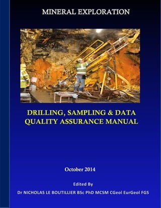
  • 1. Mineral Exploration – Drilling, Sampling & Data Quality Assurance Manual 1 October 2014
  • 2. Mineral Exploration – Drilling, Sampling & Data Quality Assurance Manual 2 This Quality Assurance Manual defines a number of Operating Procedures that provide the minimum technical requirements for work carried out on hard rock tin exploration programmes in Perak State, Malaysia, relating to the:- • drilling of core or non – core drill holes, • surveying of drill hole collar locations and down hole surveys, • sampling of drilling chips and sampling and logging of drill core, • sampling for rock density, • storage and transport for rock density, • sample preparation in the field and in the laboratory, • use of duplicate samples, • validation and storage of assay results and geological data in a computer database, • basic environmental considerations, and • handling of potentially hazardous materials. Responsibility for Amendments and Updates All amendments and updates to this Quality Assurance Manual are to be first approved by the Exploration Manager and made by personnel specifically assigned to amend the Quality Management System. Definitions All definitions of technical terms related to the Operating Procedures in this Quality Assurance Manual conform to the definitions in the “Glossary of Geology”, Bates RL and Jackson JA, US Geological Survey (Copyright American Geological Institute, ISBN 0-913312-15-0), or have been defined specifically by project staff. Distribution The distribution of the final Quality Assurance Manual will be in protected electronic format and will be in available in ‘read-only’ format to all authorised personnel. List of Standardised Codes A list of standardised codes for ‘approved suppliers’ is given, including:
  • 3. Mineral Exploration – Drilling, Sampling & Data Quality Assurance Manual 3 Drilling companies, Analytical laboratories, Survey contractors, Geophysical contractors, Colour codes, Proportions of ‘sample recovered’, Rock codes, Key minerals, Sample moisture classes, and Sample hardness classes. These standardised codes contain the minimum number of entries required. They should be used during the completion of the Drill Hole Geology Log to ensure that geology is mapped and logged in a standard and unambiguous system that simplifies the database. Compulsory Information The portions of the Drill Hole Geology Log that need always to be completed are marked with an asterisk at the top of the relevant entry box. Information like azimuth type, major or minor shade colour or key minerals could perhaps be considered as not compulsory. The Use of Flowcharts The implementation of a quality management system requires that everyone in the organisation is aware of the quality objectives and the procedures in operation for the achievement of the quality objectives. However, while it may be expected of professional personnel that they make use of detailed written and formal procedures as reference material, they cannot be expected to use these continuously or on a daily basis. Both Standards Australia and the Standards Association of New Zealand recommend the use of flow charts as a means of presenting quality control information in a more readable and psychologically easy- to-absorb format. Flow charts have been created to provide an overview of each existing procedure. LIST OF OPERATING PROCEDURES These constitute Operating Procedures that are regularly reviewed and amended or extended where necessary. They should be seen as the ‘accepted’ Operating Procedures that conform to quality policy and explain ‘how things are done using best practice’. The flow charts exist in addition to the written procedures and, although they contain less detail, are the easiest to use in the day-to-day work environment.
  • 4. Mineral Exploration – Drilling, Sampling & Data Quality Assurance Manual 4 Procedure Title Page Procedure 1 Initiating A Drilling Programme (Core or Non-Core) 5 Procedure 2 Additional Requirements When Initiating An RC Drilling Programme 8 Procedure 3 Additional Requirements When Initiating A Diamond Drilling Programme 11 Procedure 4 Executing An RC Drilling Programme 13 Procedure 5 Completing An RC Drill Hole 16 Procedure 6 Field Sample Preparation Protocol For Use During RC Drilling 19 Procedure 7 Executing A Diamond Drilling Programme 23 Procedure 8 Completing A Diamond Drill Hole 26 Procedure 9 Logging Of Diamond Drill Core Samples 28 Procedure 10 Field Sample Preparation Protocol For Use During Diamond Drilling 31 Procedure 11 Sample Storage, Dispatch and Transport 34 Procedure 12 The Use of Duplicate Samples In Intra-Lab And Inter-Lab Check 37 Sampling Procedure 13 Laboratory Sample Preparation Protocol 40 Procedure 14 Surveying Of Drill Hole Locations 44 Procedure 15 Sampling For Rock Density 46 Procedure 16 Photographing Diamond Drill Core 49 Procedure 17 Data Handling, Reporting And Validation 52 Procedure18 Environmental Considerations 55 Procedure 19 Sampling, Processing, Dispatch And Storage Of Samples 58 Containing Potentially Hazardous Materials Procedure 20 Standard Backups Of The Computerised Drill Hole Database 61
  • 5. Mineral Exploration – Drilling, Sampling & Data Quality Assurance Manual 5 PROCEDURE 1 INITIATING A DRILLING PROGRAMME (CORE OR NON-CORE) RELEASE DATE July 2014 OBJECTIVE Establish and maintain a standardised system for the initiation of a drilling Programme at an identified hard-rock tin deposit. RESPONSIBILITY Project Geologist SIGN OFF Exploration Manager Before a drilling programme is started, it is necessary to think through the complete sequence of events that has to be carried out. If problem areas are recognised, the need for expensive corrections at a later stage is avoided. Prior to the start of any type of drilling programme, the responsible person for the project, or a portion of the project, shall define with the Exploration Manager, or the Project Manager: • terms and requirements for the drilling programme which shall be incorporated into a tender invitation to at least three approved contractors. • selection of a drilling contractor from the list of approved contractors, and agreement of commercial and operating terms of a drilling contract with the selected contractor. • the standardised numbering code to be used for drill hole identification, consisting of a unique two- letter code identifying the project area, a unique two-letter code identifying the type of drilling, and a four digit hole number starting with 0001. • a list of standardised names or numbering codes to be used for areas and sub-areas , related to the lease numbers as per the Department of Mines tenement plans. • a list of standardised names or numbering codes to be used for contract drilling companies, survey contractors, geophysical contractors, etc. • the standardised drill hole diameters, clearly stating whether these are in millimetres or inches, and providing a written account of the size of the drill hole diameters to the contract drilling crew(s). • the grid that is to be used for all drill hole collar coordinates, indicating which of the coordinates axes is designated as the X and the Y axis. • a list of standardised geological and lithological logging codes to be used on the standard forms printed for the Drill Hole Geology Log, • a list of standardised codes to be used for qualitatively estimating the key minerals or rock types observed in the total volume of the drilling interval (for example, a legend is printed on the form, explaining class intervals, eg. 25% SM = SM).
  • 6. Mineral Exploration – Drilling, Sampling & Data Quality Assurance Manual 6 • a list of standardised codes to be used for describing the major observations that are to be noted as part of the EOH comment on the Drill Hole Geology Log, and shall: • verify all codes that have been decided upon, with the database administrator to ensure that they do not clash with already existing drill hole identification numbers. • verify whether the drill holes are to be drilled vertically, at a standard dip and azimuth or, depending on local geology, and in the latter case, compile a comprehensive list of hole identification numbers, coordinates and designed dip and azimuth directions (defined as magnetic or grid) which are handed to the geologists assigned to the programme and the drilling crew before the start of the drilling programme. • verbally explain the standardised logging codes and the procedures for recording drill hole information to the geologists assigned to the programme. • ensure that all the procedures or relevant proportions of the procedures for recording drill hole information is explained verbally to the drilling crews on the project site and that a written record of these procedures is issued to the drilling crews at the time the drilling contract is awarded. • ensure that minimum sample quality standards are defined, according to the procedure as described in Procedure 12 ‘The use of duplicate samples in intra-lab and inter-lab check sampling’, and explained to the geologists assigned to the programme. • ensure that all necessary supplies for the drilling, sampling and logging at the drilling site have been purchased or ordered timely in advance and are available to the geologists assigned to the programme. • ensure that geologists who are new to the project receive a verbal explanation of the relevant details of all standardised geological and lithological logging codes and procedures for recording drill hole information and are requested to sign off the corresponding portion of the Field Camp Induction Register, and • in case of drilling in an exploration area, and that the pastoral owner of the area has been notified in advance of the location and timing of the drilling programme and has been provided with a map clearly indicating the drilling locations and the size of the affected area as per requirements of the Department of Mines.
  • 7. Mineral Exploration – Drilling, Sampling & Data Quality Assurance Manual 7 PROCEDURE 1: INITIATING A DRILL PROGRAMME Issue Tender Invitations & Select Drilling Contractor Agreement of Drilling Contract OBTAIN CODES Drill Hole Numbering Lithological Drilling Company Geological Other Contractors Area & Sub-Area VERIFY Inform Pastoral Owner Logging Procedure With Geologist Field Camp Inductions Logging Procedure With Drill Crew Codes & Numbering Grid Coordinates To Be Used Hole Dips & Azimuths Sample Quality Standards- (P12) All Supplies At Drill Site
  • 8. Mineral Exploration – Drilling, Sampling & Data Quality Assurance Manual 8 PROCEDURE 2 ADDITIONAL REQUIREMENTS WHEN INITIATING AN RC DRILLING PROGRAMME RELEASE DATE July 2014 OBJECTIVE Establish & maintain a standardised system for starting an RC drilling Programme. RESPONSIBILITY Project Geologist SIGN OFF Exploration Manager A requirement specific to the use of dual-pipe reverse circulation drilling with a down-the-hole face hammer bit (RC drilling) is that drill hole samples are generated simultaneously and specific measurements may need to be taken at the moment when the material from the drill hole intersection is recovered from the hole. Prior to the start of an RC drilling program, the responsible person for the project, or a portion of the project, shall define with the Exploration Manager, or Project Manager: • a list of standardised codes to be used for qualitatively estimating the sample recovered from the total volume of the drilling interval. • a list of standardised names or numbering codes for colours that may be used to describe the recovered sample material from a drilling interval. • a list of standardised codes to be used for quantitatively estimating the sample moisture. • a list of standardised codes to be used for quantitatively estimating the sample hardness. and shall ensure that: • minimum sample quality standards are defined and explained to any geologist and sampler assigned to the sampling programme, and that a written record of these procedures is issued to the geologist and that this is noted on the Field Camp Induction Register. • all the procedures or relevant portions of the standardised sampling procedures explained verbally to the drilling and sampling crews on the project site, that a written record of these procedures is issued to the drilling crews and that this is noted in the Field Camp Induction Register. • the standardised codes for drill hole identification number, geological and lithological logging, colours describing recovered material, qualitative estimates for sample recovery, moisture, hardness and the standardised codes for EOH comments are used on all the standard forms printed for the Sample Register and the Drill Hole Geology Log.
  • 9. Mineral Exploration – Drilling, Sampling & Data Quality Assurance Manual 9 • a series of printed unique sample numbers occurs on the Sample Register forms and that the calico sample bags are pre-printed with the same series of unique sample numbers, verifying that no numbers are missing on the printed calico bags. • the calico bags are placed in order by the sampler before drilling of a hole has started. • sufficient sieves and buckets, and an adequate water supply, are available to sieve drilling chips and permit geological logging as detailed in the Drill Hole Geology Log. • a sufficient number of plastic chip tray sample holders covering 20m intervals are available so that logging of chips and subsequent checking, referencing and re-logging can be carried out if required, and, • as a minimum, the end-of-hole sample is preserved in a plastic chip tray (other samples may be preserved at the discretion of the geologist).
  • 10. Mineral Exploration – Drilling, Sampling & Data Quality Assurance Manual 10 PROCEDURE 2: ADDITIOINAL REQUIREMENTS WHEN INITIATING AN RC DRILLING PROGRAMME Plastic Chip Trays Sieves & Buckets Calico Bags Plastic Bags Water OBTAIN CODES Sample recovery Sample Hardness Additional Colours Sample Moisture ENSURE EOH Sample in Chip Tray Correct Numbers on Bags & Register Inform Pastoral Owner Logging Procedure With Geologist Correct Codes & Numbering Unique Drill Hole Numbers All Supplies At Drill Site PROCEDURE 1 PLUS...
  • 11. Mineral Exploration – Drilling, Sampling & Data Quality Assurance Manual 11 PROCEDURE 3 ADDITIONAL REQUIREMENTS WHEN INITIATING A DIAMOND DRILLING PROGRAMME RELEASE DATE July 2014 OBJECTIVE Establish and maintain a standardised system for starting a diamond drilling programme. RESPONSIBILITY Project Geologist SIGN OFF Exploration Manager Several requirements are specific to the use of diamond drilling, particularly the fact that core recovery has to be monitored carefully, the orientation of the core may have to be measured and the core has to be stored securely before being transported to a base camp and sampled. Prior to the start of diamond drilling, or any other core drilling programme, the responsible person for the project, or a portion of the project shall: • define with the Exploration Manager the selection of a drilling contractor from the list of approved contractors, and agree commercial and operating terms of drilling contract with the selected contractor. • define with the Exploration Manager the standardised geological and lithological logging codes to be used for the project. These codes shall be used on the standard forms printed for the Drill Hole Geology Log, • ensure that a sufficient number of empty core trays of relevant length, a Soil Colour Chart (for example, as defined by the standard GSA Soil Colour Chart), geologists hammer, geologists hand lens, pocket tape measure, core blocks (painted wooden core markers or plastic markers), paint marking pens, Drill Hole Geology Log forms and material for capping of the completed diamond drill holes are available on site, and • ensure that a suitable SLR camera, tripod and lighting (if required) is available at the base camp for photographing of core.
  • 12. Mineral Exploration – Drilling, Sampling & Data Quality Assurance Manual 12 PROCEDURE 3: ADDITIONAL REQUIREMENTS WHEN INITIATING A DIAMOND DRILLING PROGRAMME Additional Lithological Code ENSURE Logging Materials Available Core Trays Available Paint Marking Pens Available Core Blocks Available Monitoring of Core Recovery Measurement of Core Orientation Secure Storage of Core SLR Camera Available Hole Capping Material Available Additional Geological Code PROCEDURE 1 PLUS...
  • 13. Mineral Exploration – Drilling, Sampling & Data Quality Assurance Manual 13 PROCEDURE 4 EXECUTING AN RC DRILLING PROGRAMME RELEASE DATE July 2014 OBJECTIVE Establish and maintain a standardised system for starting an RC drilling programme. RESPONSIBILITY Project Geologist SIGN OFF Exploration Manager RC drilling usually creates a drill hole with a diameter of approximately 12.5cm to 13.5cm and drill hole samples with large amounts of material may be produced. The drilling may also produce a large amount of dust or may intersect the water table, which has immediate consequences for the sampling. Care must be taken that the sample sequence does not get mixed up as samples are taken at the same time as the drilling proceeds. During the execution of a dual-pipe reverse circulation drilling with a down-the-hole face hammer bit (RC drilling) and other non-coring drilling programs, the responsible person for the day to day supervision of the drilling operations should: • remain at the drill site throughout the completion of the drilling program to observe and record drilling progress, supervise continuous chip sampling and liaise with the drilling crew. • continuously monitor the RC sampling of the selected interval, in meters, of the RC composites using the cyclone unit (for example a rig-mounted cyclone unit) to ensure that sample contamination due to clogging up of the unit does not occur. and shall ensure that: • the drilling rods, down-the-hole hammer bit and the sampling system are effectively cleaned by regular air flushing, as required, as the drilling proceeds. • no excessive amounts of drilling dust or fines are lost from the recovered sample airstream during drilling. • when drilling under or wet conditions, the sample cyclone unit is regularly cleaned of material that is clogged up inside the cyclone. • the drilling crew makes a note of the intersection of cavities, and of all information regarding hole casing and consumables, on the Driller’s log. • a sufficient amount of essential materials for the collection logging and labelling of the RC chip samples and the capping of the completed RC drill holes, including sufficient forms of the Sample Register and Drill
  • 14. Mineral Exploration – Drilling, Sampling & Data Quality Assurance Manual 14 Hole Geology Log, are available at the drilling site at any time during the drilling programme to complete the targets set for the day. • the drill hole number, project name, drilling contractor name are clearly legible on the Sample Register. • the drill hole number, project name, deposit name, lease name, collar coordinates, grid name and units, hole dip and azimuth, drilling contractor details, drilling date, name of geologist (initials and full surname) name of the sampler (initials and full surname) and the type of drilling technique are clearly legible on the Drill Hole Geology Log. • the drill hole number marked on the Sample Register is the same as the drill hole number on the Drill Hole Geology Log. • the depth intervals, using a ‘depth from’ and ‘depth to’ in meters with an accuracy of >0.1m, are clearly marked on the Sample Register and the Drill Hole Geology Log, taking care that at least the first depth interval and the last depth interval are clearly marked so that the intermediate intervals and the relative positions of the intervals that were sampled in duplicate, can be back-calculated. • additional pages of the Drill Hole Geology Log are clearly numbered and have the drill hole number clearly marked, • the depth to the water table, if reached, is noted on the Drill Hole Geology Log. • the unique sample numbers corresponding to each drill hole intersection are repeated on the Drill Hole geology Log, enabling a visual crosscheck with the Sample Register. • sampling is carried out according to the standard procedures defined by Procedure 6, ‘Field sample preparation procedure for use during RC drilling’. • the drill hole number and depth interval markings are continually validated and the sample number allocated to each drilling interval for the plastic bag and the calico sample bags remain correct as indicated in the Sample Register and correspond with the number written on the Drill Hole Geology Log. • the standardized codes for estimating the sample recovered from the total volume of the drilling interval are regularly indicated on the Drill Hole Geology Log, taking care that this estimate is carried out on a dry hard sample with minimal loss due to drilling under wet conditions or under conditions that produce a large amount of dust, and • if significant quantities of fibrous minerals or any other potentially hazardous materials are intersected, the hole will be immediately stopped, hole collar capped, and sample material treated with appropriate cautionary safeguards (see also Procedures 11 & 19).
  • 15. Mineral Exploration – Drilling, Sampling & Data Quality Assurance Manual 15 PROCEDURE 4: EXECUTING A RC DIAMOND DRILLING PROGRAMME ENSURE Hazardous Minerals Recorded (P11 & 19) Cavities RecordedWater Table Intersection Logged Used Consumables Recorded on Drillers Log Sampling System Remains Clean Dust/Fines Minimised Cyclone Regularly Cleaned Sample Numbers Continually Validated Sample Numbers on Register & Log RESPONSIBLE PERSON MUST... Supervise Drill Site Monitor Sampling Procedure Drill Hole & Details Recorded Logging/Sampling Consumables Supplied Sample Depth Intervals Marked
  • 16. Mineral Exploration – Drilling, Sampling & Data Quality Assurance Manual 16 PROCEDURE 5 COMPLETING A RC DRILL HOLE RELEASE DATE July 2014 OBJECTIVE Establish and maintain a standardised system for accurate collection and logging of RC drill hole samples. RESPONSIBILITY Project Geologist/Field Supervisor SIGN OFF Exploration Manager After the completion of an RC drill hole, and a drill hole from other non-coring drilling programmes, the responsible person for the day to day supervision of the drilling operations shall ensure that: • all plastic bags are stored in a continuous series next to the drill hole cutting pile in such a manner that the total length of the hole can be seen from the sample rows and checked with the EOH marking written on the Sample Register and the Drill Hole Geology Log. • the last sample number marked on the Sample Register is the last sample put in the plastic bags. • all duplicate samples have been marked properly on the Sample Register and their markings correspond exactly with the samples marked on the Drill Hole Geology Log. • an EOH comment and a visual estimation of the location of the mineralised intervals is written on the Drill Hole Geology Log. • the time taken to drill the hole is noted on the Drill Hole Geology Log. • any type of down hole geophysical logging completed in the hole is marked on the Drill Hole Geology Log if this has taken place shortly after drilling and, if there has been a considerable time lapse and the Drill Hole Geology Log has been computer-processed into a Drilling Log on the computer database, it is added to the database as part of the Drilling Log. • the completed drill hole is plugged at the collar with a concrete plug as approved by the Department of Mines, and the area around the drill hole is backfilled with any residual material from the area around the cyclone or splitter and compacted into a mound to avoid infiltration of surface water into the drill hole. • a Pin Flag, clearly marked with a drill hole number, nominal drill hole coordinates and the final depth drilled, is firmly anchored in a visible position next to the drill hole location, and the drill hole number on the Pin Flag is verified against the Sample Register and the Drill Hole Geology Log. • transport of the calico sample bags to the field camp is carried out immediately after RC drilling has been completed or at the end of each day (note that further sample transport is carried out according to Procedure 11 ‘Sample storage, dispatch and transport’).
  • 17. Mineral Exploration – Drilling, Sampling & Data Quality Assurance Manual 17 • an Analytical Submission Sheet, as provided by the laboratory of choice¹, is completed, taking care that the sample type, preparation requirements, analyses required, a description of special instructions, sample disposal instructions and the name of the person to whom the analytical results have to be forwarded, are clearly indicated on the sheet. • the calico sample bags are dispatched to the laboratory for chemical analysis in the correct order, and as soon as possible after the completion of the drilling program, but preferably regular intervals, by the correct means of transport, according to what is described in procedure 11 ‘Sample storage, transport and dispatch’. • a copy of the Analytical Submission Sheet is dispatched together with the samples to the laboratory, the original is sent by mail to Head Office and a copy is stored in the field base camp. ¹ The laboratory should be fully ISO-accredited and part of a reputable company such as ALS Chemex. ALS operate a laboratory at Selangor in Malaysia. ALS Technichem (M) Sdn Bhd (Headquarters) 9 Jln Astaka U8/84, Seksyen U8, Bukit Jelutong 40150 Shah Alam, Selangor D. E., MALAYSIA Phone: +60-3-7845 8257 Fax: +60-3-7845 8258 Email: info@alsglobal.com.my
  • 18. Mineral Exploration – Drilling, Sampling & Data Quality Assurance Manual 18 PROCEDURE 5: COMPLETING A RC DRILL HOLE COMPLETE GEOLOGICAL LOG & SAMPLE REGISTER Mark Duplicate Samples Record Mineralised Intervals Comment on End of Hole Log Geophysical Features ENSURE Analytical Submission Sheet Completed Area Around Drill Hole Backfilled Calico Sample Bags to Laboratory Drill Hole Pinflagged Plastic Sample Bags Stored in Series Drill Hole Plugging CompletedSamples Dispatched RESPONSIBLE PERSON MUST... Calico Sample Bags to Field Camp Record Drill Time
  • 19. Mineral Exploration – Drilling, Sampling & Data Quality Assurance Manual 19 PROCEDURE 6 FIELD SAMPLE PREPARATION PROTOCOL FOR USE DURING RC DRILLING RELEASE DATE July 2014 OBJECTIVE Establish and maintain a standardised system for uncontaminated and representative sampling of RC drill hole samples. RESPONSIBILITY Project Geologist/Field Supervisor SIGN OFF Exploration Manager Usually the sampling of an RC drill hole is mainly aimed at providing material for a laboratory assay. A field sample preparation protocol must be designed in such a way that the sampling accuracy is continuously monitored so that any sampling error can be minimised. During the course of the RC sampling program, the responsible person for the project, or a portion of the project, shall ensure that: • all splitting, bagging and labelling of RC drill hole samples is done by company personnel and according to the standardised sampling procedures. • all sample bags are pre-numbered before the daily drilling program is started. • the standard drilling interval, defined before the drilling program has started, is used as the drilling interval for all holes, however the geologist may allow this to be changed at any time, if this is required. • sufficient supplies of materials for all sampling operations are available on site, including plastic sample bags of a sufficient size for holding20kg to 25kg of material. • the execution of the sampling procedures is monitored continuously, and that it is regularly checked that the automatic cyclone units and other sampling equipment are not clogged or obstructed in any way. • the sampling quality is monitored continuously by taking field duplicates under identical conditions and at the same time as the original samples. • the sampling quality is monitored continuously by inserting field duplicates as part of the routine sample flow. • the drill hole number is clearly marked on the Sample Register. • sample depths recorded are relative to the ground surface at the drill hole collar. • each sample interval is clearly marked next to a unique sample number as it appears on the Sample Register. • intervals interpreted as cavities are clearly marked with the capitals “NR” (no recovery) on the Drill Hole Geology Log and the word ‘cavity’ is inserted in the space reserved for comments.
  • 20. Mineral Exploration – Drilling, Sampling & Data Quality Assurance Manual 20 • no sample numbers are allocated to any full interval that is marked as a cavity, instead it must be verified that the next sample interval is allocated the next unique sequential sample number on the Sample Register, and that this number corresponds with the sample number marked next to the sample interval on the Drill Hole Geology Log (this ensures that a continuous numbered sample sequence is maintained for samples submitted to the laboratory). • the sample number on the sample bags is identical to the corresponding sample number in the Sample Register, and is also identical to the corresponding sample number on the Drill Hole Geology Log, during dry drilling conditions: • the total sample from the drilling interval as recovered from the cyclone unit (approximately 20kg to 25kg for a one-metre interval) is split, using the three-tier splitter, into an approximately 2kg assay sub- sample, taking care that the sample is evenly distributed over the top portion of the splitter and the full width of the splitter is being used and no chutes are clogged up or blocked. • the assay sub-sample is stored in a small calico sample bag and the remainder of the total cyclone sample is stored in the plastic bag. • a field duplicate sample is taken by splitting the total remainder over the two-tier splitter, taking care that the sample is evenly distributed over the top portion of the splitter and the full width of the splitter is being used and no chutes are clogged up or blocked. • the splitter is cleaned by drilling offsiders (crew not directly conducting the drilling operation) regularly between sample intervals by air blasts or by ‘hammering’ on the side of the three-tier splitter. during very moist or wet drilling conditions: • the cyclone unit is regularly cleaned by the drilling offsiders by hand, if required, and the three-tier splitter is regularly cleaned by blasts of compressed air. • the total wet sample from the cyclone unit is captured in a large plastic bag and grab sampled by hand, aiming at obtaining approximately two kg of material from different depths in the plastic bags (trying to cover all depths evenly). • when a duplicate sample is to be taken, a second grab bag sample using the same grab bag sampling method , is taken by hand. • intervals that have been grab sampled by hand are clearly marked with a capital “G” on the Sample Register and on the Drill Hole Geology Log. • after grab sampling the plastic bags are left on site to dry out for subsequent re-crushing and re- sampling if necessary,
  • 21. Mineral Exploration – Drilling, Sampling & Data Quality Assurance Manual 21 and that: • intervals selected for taking field duplicate samples are selected according to the procedure as described in Procedure 12 ‘The use of duplicate samples in intra-lab and inter-lab check sampling’. • not more than eight to ten small sample bags are placed inside a plastic bag that is marked with a listing of the smaller sample bags that are included. • all plastic sample bags are closed and sealed using a wire tie, and • the presence of fibrous minerals or any other potentially dangerous material is recorded separately , in capitals, on the Drill Hole Geology Log, and any samples taken from such intervals will be clearly marked on the Analytical Submission Sheet.
  • 22. Mineral Exploration – Drilling, Sampling & Data Quality Assurance Manual 22 PROCEDURE 6: FIELD SAMPLING PREPARATION PROTOCOL FOR USE DURING RC DRILLING DRY WET RESPONSIBLE PERSON MUST... PREPARATION & ADMINISTRATION All Sampling Procedures Followed Accurate Field Duplicates Taken Sampling Equipment Clean and Clear Cavities Marked on Log Sampling Equipment Available Sample Depths Accurately Recorded Sample Numbers Verified Drill Hole Number on Sample Register Sample Bags Prenumbered NOTE: Dangerous Materials to be Recorded Separately in Capitals on Drill Hole Geology Log and Analytical Submission Sheet Bags Sealed Using Wire Tie 8-10 Samples Per Plastic Bag Rest of Sample Left to Dry 2kg Grab Sample Marked “G” 2kg sub-sample calico bag Rest of Sample in Plastic Bag Total Sample in Plastic Bag Field Duplicate Taken – P12 20kg – 25kg sample split
  • 23. Mineral Exploration – Drilling, Sampling & Data Quality Assurance Manual 23 PROCEDURE 7 EXECUTING A DIAMOND DRILL PROGRAMME RELEASE DATE July 2014 OBJECTIVE Establish and maintain a standardised system for accurate collection and logging of RC drill hole samples. RESPONSIBILITY Project Geologist/Field Supervisor SIGN OFF Exploration Manager The main aim of diamond drilling is to provide a core sample of the intersected lithology. An accurate measurement is needed of the depth of the intersection, and the spatial orientation of the core may also have to be determined. During the execution of a diamond drilling programme, or other core drilling programmes, and in the case of an extension of pre-collared drill holes, the responsible person for the day to day supervision of the drilling operations shall ensure that: • regular visits are made to the drill site during the process of the drilling program to observe and record drilling progress, core recovery, storage of core into the core trays by contract drilling personnel and liaise with the drilling crew. • each core tray is labelled with the drill hole number, the depth intervals, and an arrow indicating the down hole direction, starting at the lower left hand corner of the tray. • core samples are retrieved from the core barrel by the drilling crew in such a manner that the core is pushed out of the core barrel with the minimum amount of air pressure, in a smooth and gradual manner so that during this process no core is unnecessarily damaged or broken. • core samples retrieved from the barrel are immediately transferred to the core trays in such a manner that the integrity of the core sequence is maintained, and so that no core is lost, damaged or broken. • driller induced core breaks are marked with an “X” on either side. • the contract drilling crew records all cavities in excess of 0.05m and the depth of the cavity is clearly marked on the Driller’s Log and on a core block stored in the core tray. • discrepancies with regard to cavities are resolved with the contract drilling crew as soon as possible. • core samples stored in the core trays in the vicinity of the drill hole, shall be left undisturbed during completion of the drilling programme until such time as transport to the field camp is arranged. • the drill hole number, project name, deposit name, drilling contractor name, grid name and units, collar coordinates, dip and azimuth of the hole and depth of pre-collar are clearly legible on the Drill Hole Geology Log.
  • 24. Mineral Exploration – Drilling, Sampling & Data Quality Assurance Manual 24 • the drilling date, name of the driller (with initials), the drilling rig type and drilling equipment (for example HQ triple tube) with the drill core diameter stated in millimetres is clearly recorded on the Drill Hole Geology Log. • the depth of the water table, if reached, is clearly recorded in metres on the Drill Hole Geology Log. • transport of diamond drill core to the field base camp is carried out as soon as logistically possible after core has been stored into full core trays by the contract drilling crew (note that further transport is carried out according to Procedure 11, ‘Sample storage, dispatch and transport’). • logging of the core samples takes place either at the drill hole site or at the field base camp. • if the logging takes place at the drill hole site, that sufficient water is available for logging purposes and the name of the geologist logging the hole is clearly recorded on the Drill Hole Geology Log. at the end of the day of the drilling programme, • the core recovery and the RQD (if required) is measured and discussed with the drilling crew. • the core trays are covered if they are at the drilling site overnight. • the ‘hours worked’ and ‘hours drilled’ for that day are copied from the Driller’s Log and clearly marked on the Drill Hole Geology Log, • the total drilling interval completed, in metres, is copied from the Driller’s Log and clearly marked on the Drill Hole Geology Log, • the completed pages of the Drill Hole Geology Log are collected at the field base camp, • the driller’s report for the day is presented to the geologist for authorisation, and, at the end of each week during the core drilling programme, • the collected pages of the Sample Register and the Drill Hole Geology Log are copied, the copies are kept at the field base camp and the originals are sent to Head Office.
  • 25. Mineral Exploration – Drilling, Sampling & Data Quality Assurance Manual 25 PROCEDURE 7: EXECUTING A DIAMOND DRILLING PROGRAMME WEEKLY Original Copy ENSURE Core Trays Labelled Logging of Core ASAP Regular Visits to Drill Site Core to Field Camp ASAP AT THE END OF EACH DAY... Complete Geological Log Pages Core Trays Covered Core Recovery & RQD Measured Hours Worked & Drilled Confirmed Water Table Depth Noted Geologist to Authorise Driller Daily Reports RESPONSIBLE PERSON MUST... Driller Induced Core Breaks Marked ‘X’ Satisfactory Handling of Core Sample Register & Geological Log Copied Head Office Field Camp Geology Log Details Completed Cavities >0.05m on Log
  • 26. Mineral Exploration – Drilling, Sampling & Data Quality Assurance Manual 26 PROCEDURE 8 COMPLETING A DIAMOND DRILL HOLE RELEASE DATE July 2014 OBJECTIVE Establish and maintain a standardised system for the completion of a diamond drill hole. RESPONSIBILITY Project Geologist/Field Supervisor SIGN OFF Exploration Manager After the completion of a diamond drill hole, and a drill hole from other core drilling programmes, the responsible person for the day to day supervision of the drilling operations shall ensure that: • the start and completion date of the hole is clearly legible on the Drill Hole Geology Log. • the final drill hole depth, if necessary also the final depth of the diamond drill hole corrected by subtracting the pre-collar depth, is clearly recorded in metres on the Drill Hole Geology Log. • an EOH comment and, if relevant, a visual estimation of the location of the mineralised intervals, is clearly legible on the Drill Hole Geology Log. • any type of downhole geophysical logging completed in the hole is marked on the Drill Hole Geology Log if this has taken place shortly after drilling and, if there has been a considerable time lapse and the Drill Hole Geology Log has been computer-processed into a Drilling Log and put on the computer database, it is added to the database as part of the Drilling Log. • the drill hole number and final depth are marked clearly on a Pin Flag which is placed into the soil next to the collar location. • the completed drill hole is plugged at the collar with a concrete plug of a type approved by the Department of Mines. • the plug is buried under sand or soil, and • the drilling crew has cleared the site, taking care that the requirements related to drill holes as described in Procedure 18 ‘Environmental considerations’ have been adhered to.
  • 27. Mineral Exploration – Drilling, Sampling & Data Quality Assurance Manual 27 PROCEDURE 8: COMPLETING A DIAMOND DRILL HOLE ENSURE Drill Hole Plugged EOH & Mineralisation Comment Site Cleared (P 18) Geophysical Logging on Geology Log Drilling Dates on Geology Log Depth on Geology Log RESPONSIBLE PERSON MUST... Hole Pin Flagged
  • 28. Mineral Exploration – Drilling, Sampling & Data Quality Assurance Manual 28 PROCEDURE 9 LOGGING OF DIAMOND DRILL CORE SAMPLES RELEASE DATE July 2014 OBJECTIVE Establish and maintain a standardised system for the accurate logging of diamond drill core. RESPONSIBILITY Project Geologist/Field Supervisor SIGN OFF Exploration Manager Diamond drilling creates core with a pre-selected diameter and is carried out under close supervision of experienced drillers who know how to optimise core recovery. Good communication between the driller and geologist who examines and samples the core is essential. The geologist logging the core must investigate all broken pieces of core, describe why the core was not in one piece and note the missing portions of the core and the reasons why this has occurred. If drill core has not been logged on site, the logging, preparation and dispatch of core samples for analysis, and the dispatch of the original Drill Hole Geology Logs to Head Office shall be carried out as soon as possible after completion of the hole. The responsible person for the day to day supervision of the drill core logging shall ensure that: • the core is studied in detail, cleaned with water where needed, and ‘matched’ over the full length of the core trays to ensure that no core has obviously been lost. • the full length of the core is checked against the total depth on the Drill Hole Geology Log. • cavity intervals noted by the contract drilling crew on Driller’s Log sheets and/or on core blocks in the core trays are marked clearly on the Drill Hole Geology Log with it’s from depth and to depth, and marked as ‘cavity, nil recovery’, • no core is destroyed or broken except in cases when it is necessary to break selected portions of the core to obtain fresh surfaces for logging and mapping; and if core has to be broken to fit into the core trays (care is taken that no pieces of core are lost). • driller induced core breaks are marked with an “X” on either side. • core recoveries, if not yet fully measured at the drilling site at the end of the day, are measured in metres, using a pocket measuring tape and recorded to a precision of 0.01m, and the percentage core recoveries and RQD are calculated and marked clearly on the Drill Hole Geology Log. • the core is washed so that the structures and rock textures are clearly visible. • orientation lines are drawn (in blue paint marker) on the lower (down hole) side of the core, based on the orientation marks produced during drilling, with arrows indicating the down hole direction.
  • 29. Mineral Exploration – Drilling, Sampling & Data Quality Assurance Manual 29 • intersections of relevant lithological units are measured in metres with a measuring tape and recorded to the nearest core marker with a precision of 0.01m and logged by ‘depth from’ and ‘depth to’ and noted clearly on the Drill Hole Geology Log. • a ‘saw cut line’ is marked on the core (in black paint marker), as determined by the logging geologist, but generally bisecting any cross-structures in the core. • a concise summary lithological and geological description of each lithological unit is written on the Drill Hole Geology Log. • after the summary descriptions are completed, additional details on geology, lithology stratigraphy, mineralogy, discontinuity’s, codes for mineralisation, weathering, alteration, hardness, colour, cavities, texture, water table recorded on the Driller’s Log or state of the core, as required for each measured intersection, are logged clearly legible on the Drill Hole Geology Log. • structural and lithological features are marked in red on the core. • additional pages of the Drill Hole Geology Log are clearly numbered and include the drill hole number. • the presence of fibrous minerals or any other potentially dangerous material is recorded separately, in capitals, on the Drill Hole Geology Log, and any samples taken from such intervals will be clearly marked on the Analytical Submission Sheet, and precautions taken as per Procedures 11 and 19, and • the full core is photograph, prior to sawing and sampling of the core being carried out, as described in Procedure 17 ‘Photographing diamond drill Core’. After logging of the drill core has been completed, the responsible person for the day to day supervision of the drill core logging shall, as soon as possible, ensure that: • the pages of the Drill Hole Geology Log for each drill hole are complete and are sorted in order. • a photocopy of the complete Drill Hole Geology Log of each hole is made, the copy is kept at the field base camp and the original is mailed to the Head Office, and • a section profile of the diamond drill hole is completed if required (for example, this is usually not required for metallurgical or geotechnical drill holes).
  • 30. Mineral Exploration – Drilling, Sampling & Data Quality Assurance Manual 30 PROCEDURE 9: LOGGING OF DIAMOND DRILL CORE SAMPLES Colour Texture Lithology Structure Hardness Alteration Weathering Mineralogy Geotechnics Original Copy CHECK Length of core Cavity Intervals ENSURE Additional Details Recorded Induced Breaks Marked Structures Marked on Core Orientation Lines Drawn Core is Washed RESPONSIBLE PERSON MUST... Driller Core Breaks Marked ‘X’ Core is Intact Geological Log Copied Head Office Field Camp Hazardous Materials Marked in Capitals Core to be Photographed (P 17) Core Recovery is Measured Saw Cut Line Marked Lithology Intersections Marked Summary Description of Lithologies
  • 31. Mineral Exploration – Drilling, Sampling & Data Quality Assurance Manual 31 PROCEDURE 10 FIELD SAMPLE PREPARATION PROTOCOL FOR USE DURING DIAMOND DRILLING RELEASE DATE July 2014 OBJECTIVE Establish and maintain a standardised system for the uncontaminated and representative sampling of diamond drill core samples. RESPONSIBILITY Project Geologist/Field Supervisor SIGN OFF Exploration Manager The drilling of a diamond drill hole provides a core sample of the intersected lithology and the core needs to have been marked up with the orientation and saw cut lines, have structural and lithological features marked, be photographed in full, and fully logged, before sampling may take place. Unless there are special circumstances to do so, a portion of the core (usually half) must always be kept, properly stored in the original tray. The geologist who samples the core must make a note of each occasion when pieces of core are further broken up during sampling. After logging and photographing of the drill core has been completed, the responsible person for the day to day supervision of the drill core logging shall, as soon as possible, ensure that: • the Drill Hole Geology Log for each drill hole is complete and all its pages are sorted in order. • the core is sawn in half, or quartered, with a water-lubricated diamond saw over its full length, taking care that no core is lost and that the water lubrication of the saw blade is continuously operating, especially if fibrous minerals are expected or observed in the core, and no rock dust isgenerated during sawing, • if the core is too soft to be cut with a diamond saw, the core is carefully cut in half by hand with a suitable cutting tool, for example a knife or handsaw. • starting from the top of the hole, the required sampling intervals of the half core (or quarter core) relevant to a lithological unit but not exceeding a pre-selected sample length, are selected and the start point and end point of each sampling interval is marked with a black felt pen on the other half of the core, or on the core blocks. • the selected sampling intervals are sawn off, and the piece of core is put in its entirety in a plastic sample bag, or broken carefully into smaller sections, taking care that no core material is lost during breaking and that all core material is transferred to the plastic sample bag. • the plastic sample bag is labelled with a unique sample number. • the unique sample numbers are clearly marked on the Drill Hole Geology Log next to the depth of the intersection.
  • 32. Mineral Exploration – Drilling, Sampling & Data Quality Assurance Manual 32 • the Analytical Submission Sheet, as provided by the laboratory of choice, is completed, taking care that the sample type, preparation requirements, analyses required, sample disposal instructions, a description of special instructions and the name of the person to whom the analytical results have to be forwarded, are clearly indicated on the sheet, and • a copy of the Analytical Submission Sheet is dispatched together with the samples to the laboratory, a copy is sent by mail to Head Office and the original is stored in the field base camp. Note: If the core samples are crushed before being bagged and submitted for analysis, or if quarter core is sent in, it is recommended that duplicate samples are inserted as described in Procedure 12 ‘The use of duplicate samples in intra-lab and inter-lab check sampling’.
  • 33. Mineral Exploration – Drilling, Sampling & Data Quality Assurance Manual 33 PROCEDURE 10: FIELD SAMPLING PREPARATION PROTOCOL FOR USE DURING DURING DIAMOND DRILLING Original Copy Copy ENSURE Geological Log is Complete Duplicates if Required Core is Sawn in Half Submission Sheet Completed Sample numbers on Geological Log RESPONSIBLE PERSON MUST... Sample Bags Labelled Sampling Intervals Selected & Marked Submission Sheet Copied Head OfficeField Camp Samples Cut & Bagged With Samples
  • 34. Mineral Exploration – Drilling, Sampling & Data Quality Assurance Manual 34 PROCEDURE 11 SAMPLE STORAGE, DISPATCH AND TRANSPORT RELEASE DATE July 2014 OBJECTIVE Establish and maintain a standardised system that maintains a high integrity, for the storage, dispatch and transport of drilling samples. RESPONSIBILITY Project Geologist/Field Supervisor SIGN OFF Exploration Manager Improper storage, mix-up of sample numbers or damage of samples during transport result in erroneous data values which may not be recognised during data validation. Standards for storage, dispatch, transport and adequate sample tracking are required. The responsible person for the day to day supervision of the drilling operations shall ensure that: • all samples from a drilling program are kept for further reference until such time as the Project Manager gives written permission for the samples to be discarded. • RC samples, stored in the plastic bags as recovered from the drill hole intersection, remain stored at the drilling site, near to the collar location, sorted by drilling depth in such a manner that the drilling succession and the total depth of the hole can be easily seen from the order of the sample bags, until such time as they can be transported by vehicle to a ‘sample farm’. • at the sample farm, the RC samples will remain stored on the ground, sorted in the same manner by drilling depth. • during the transport of RC sample bags, care is taken that the bags remain properly sealed, that no sample material is damaged or lost, and that contamination of any damaged sample bags does not occur. • core samples remain stored in the core trays at the drilling site, covered by a lid, and they are transported, by vehicle, from the drill site to a field camp as soon as possible after completion of the diamond drill hole. • during transport the core trays remain fitted with the lid to prevent damage or spillage during transport. • core samples remain stored in the core trays at the field camp and are stacked in a dry and secure place, preferably in a covered core shed. • during transport of crushed or uncrushed drill core samples that are stored in poly-weave sample bags, the same rules as for the transport and damage of the RC sample bags apply. • logging, sampling and bagging of core samples is as up to date as possible, to ensure that batches of samples can be dispatched regularly to the laboratory, with batches preferably consisting of approximately 300 samples (or one day’s drilling).
  • 35. Mineral Exploration – Drilling, Sampling & Data Quality Assurance Manual 35 • an Analytical Submission Sheet provided by the laboratory is fully completed, a copy is sent in with the sample batch, a copy is faxed/scanned/emailed to the laboratory and a copy is faxed/scanned/emailed to the personnel specifically assigned to the data validation process at Head Office. • the analytical Submission Sheet is clearly marked with a telephone number, fax number (or e-mail address) and name of the geologist who has dispatched the samples and should be contacted in case there are discrepancies or damage to sample bags has occurred, and • samples containing fibrous minerals or other potentially hazardous materials shall be clearly marked on sample bags.
  • 36. Mineral Exploration – Drilling, Sampling & Data Quality Assurance Manual 36 PROCEDURE 11: SAMPLE STORAGE, DISPATCH & TRANSPORT RC SAMPLES CORE SAMPLES Original Copy Copy Trays Kept Dry & Secure Stored in Order at Collar & Sample Farm RESPONSIBLE PERSON MUST... Transported Carefully Submission Sheet Completed & Copied Head OfficeField Camp Stored in Core Tray With Samples Logging, Sampling & Bagging Up To Date NOTE: Dangerous Materials to be Recorded Separately in Capitals on Drill Hole Geology Log and Analytical Submission Sheet
  • 37. Mineral Exploration – Drilling, Sampling & Data Quality Assurance Manual 37 PROCEDURE 12 THE USE OF DUPLICATE SAMPLES IN INTRA_LAB AND INTER_LAB CHECK SAMPLING RELEASE DATE July 2014 OBJECTIVE Establish and maintain a standardised system for the monitoring of sampling quality. RESPONSIBILITY Project Geologist/Field Supervisor SIGN OFF Exploration Manager Procedures for monitoring sampling quality and sample representivity are based on the use of duplicate field samples (intra-lab check analysis). This may be extended by monitoring the analytical representivity, by having a portion of the samples also analysed at one or more different laboratories (inter-lab check analysis). The responsible person for the day to day supervision of the drilling, logging and sampling programme shall ensure that: • all sample bags are pre-numbered before the daily drilling program is started. while, in the case of field duplicate samples which are routinely inserted in the sample sequence during RC drilling to assess sampling precision: • field duplicate samples are inserted at the ratio of one field duplicate sample in each series of 20 samples, avoiding as much as possible that field duplicate samples are taken from the first three metres of each drill hole, • each field duplicate sample is allocated the next unique sequential sample number following the sample of which it is a duplicate, on the Sample Register. • each interval selected as a field duplicate sample is clearly marked with a capital “D” in the appropriate column on the Sample Register and on the Drill Hole Geology Log. while, in case of laboratory pulp duplicate samples (‘pulp repeats’) which are routinely inserted in the laboratory assay sequence during the original analytical run by the laboratory itself, to monitor possible analytical drift and determine the analytical precision. (or may be re-submitted by the company to the laboratory at a later date, to assess the analytical precision): • laboratory pulp duplicate samples are generally selected, pseudo-randomly, at the ratio of one duplicate in each series of 20 samples, unless there is a specific reason for taking more or less pulp duplicates.
  • 38. Mineral Exploration – Drilling, Sampling & Data Quality Assurance Manual 38 • if laboratory pulp duplicate samples are re-submitted to the laboratory at a later date by the company, the pulp duplicates are re-packed in sealed new paper or plastic sample packets, are randomised and then assigned a new unique sequential sample number. • if laboratory pulp duplicate samples are re-submitted to the laboratory at a later date by the company, at least one of the pulp duplicate samples ( at a rate of one out of 5,000 samples) is subjected to a particle size analysis (screening test) to check laboratory comminution criteria, and in general: • field duplicate and pulp duplicate samples are bagged and labelled in the same manner as ordinary samples. • the results of the field duplicate and laboratory duplicate samples are stored in a separate database, or are readily available in a separate spreadsheet, and are flagged with the calendar date of the analysis, so that the check can be done for changes over time, and • for larger projects, a portion of the laboratory pulp duplicates ( for example 2% or more) is analysed at a different analytical laboratory as an independent check on the overall sampling quality. • In addition to duplicate samples one blank (such as clean unmineralised granite with no tin content) sample or one tin standard (purchased from a supplier of internationally-recognised standards) sample should be randomly inserted into a block of 20 samples as a check on analytical precision and cleaning of mills and other equipment at the laboratory. Note: if diamond core samples are used that have not been crushed in the field are submitted for analysis, no duplicate samples are used. If sore samples have been crushed before being bagged and submitted for analysis (or if quarter core is sent in), it is recommended that duplicate samples are inserted as described in procedure 12 ‘The use of duplicate samples in intra-lab and inter-lab check sampling’.
  • 39. Mineral Exploration – Drilling, Sampling & Data Quality Assurance Manual 39 PROCEDURE 12: THE USE OF DUPLICATE SAMPLES IN INTRA-LAB AND INTER_LAB CHECKING DRILL DUPLICATE SAMPLES All Bags Pre-Numbered Duplicates Taken Ratio 1:20 Duplicate Intervals Marked ‘D’ RESPONSIBLE PERSON MUST... Duplicates Numbered LAB PULP SAMPLES ALL DUPLICATE SAMPLES 2% of Samples to Different Laboratory Results Stored in Separate Database Bagged & Labelled as Field Samples Duplicates Taken Ratio 1:20 1:5,000 Samples for Particle Size AnalysisIf Re-Submitted Then Re-Numbered
  • 40. Mineral Exploration – Drilling, Sampling & Data Quality Assurance Manual 40 PROCEDURE 13 LABORATORY SAMPLE PREPARATION PROTOCOL RELEASE DATE July 2014 OBJECTIVE Establish and maintain a standardised system for the uncontaminated and representative sampling, sub-sampling and routing analysis of Anaconda drill hole samples from laterite nickel deposits at the Laboratory RESPONSIBILITY Project Geologist/Field Supervisor SIGN OFF Exploration Manager Modern analytical laboratories are well-equipped to ensure that sources of error are adequately monitored. A good laboratory produces the results of its internal control procedures to the client on a regular basis. It is the company’s responsibility to ensure that the laboratory receives sufficient information to be able to carry out an accurate analysis, and that adequate communication has been established with the laboratory. The field sample preparation protocol is designed to monitor sample quality at the project site. The laboratory sample preparation protocol is designed to ensure continued quality control during drying, crushing, pulverising, analysis and reporting at the laboratory. Errors that may occur in the laboratory are mix-up of sample numbers, incorrect drying or storing procedures, contamination during crushing and pulverising, drift of the analytical instruments over a period of time, errors in converting a read-out measurement value to a concentration, or incorrect reading of displays. The responsible person for the dispatch of samples to the analytical laboratory, shall ensure that: • the Analytical Submission Sheet has been fully completed as described in procedure 11 ‘Sample storage, transport and dispatch’, and relevant details are provided to enable the laboratory to carry out the required work. • if possible, a routine set of instructions has been defined in agreement with the laboratory (see above), or specific instructions are given with regard to: • sorting samples and priority for analysis. • sample drying period or minimum drying temperature. • crushing equipment, duration of crushing and method of sample splitting, for example type and size of riffle splitter, • pulverising equipment, duration of pulverising, method of sub-sampling. • portion of sample that should pass a selected sieve or particle size (given in millimetres or microns), • discarding or storage of sample rejects.
  • 41. Mineral Exploration – Drilling, Sampling & Data Quality Assurance Manual 41 • analytical methods. • reporting by the laboratory of the size of the analytical batch. • routine laboratory procedure for the insertion of laboratory blanks, standards and pulp duplicate samples. • method/description of preferred sample digest. • minimum weight of sub-sample for analysis. • requested accuracy of visual read-out of sample weight, in number of digits. • use of internal sample tracking system, for example using bar code system. • preferred method of analysis, and • preferred method of reporting of assay results. The responsible person for the management of the drilling program shall visit the analytical laboratory at least once, at the start of the drilling programme, and ensure that the routine laboratory sample preparation protocol consists of the following: • after arrival at the laboratory, the calico sampling bags are sorted in numerical order and processed sequentially, in laboratory batches that do not exceed 500 samples (including internal laboratory duplicates). • the samples are checked against the description of the Analytical Submission Sheet and any discrepancies or missing samples are immediately reported to the person who dispatched the samples, as marked on the Analytical Submission Sheet. • the calico sampling bags are stacked next to each other, taking care that the bags are not placed upon each other, in racks in a drying oven for a period of at least 12 hours at a temperature of 100° C to 110°C. • after drying the samples are left to cool for at least 20 to 30 minutes in the laboratory area where comminution is carried out • samples that contain particles larger than 10mm are crushed through a laboratory crusher to reduce the maximum particle size to 50mm, in crushing stages as many times as necessary until the full sample passes 10mm. • during crushing of the sample, laboratory personnel makes use of the required protective clothing. • in between samples, the crusher is vacuum cleaned, and any remaining dust is removed by compressed air and, if relevant, the jaw crusher aperture is minimised. • the full sample which weighs approximately 1.5kg to 2kg, is put into a LM5 ring mill pulveriser that operates with a 22kg pulverising puck.
  • 42. Mineral Exploration – Drilling, Sampling & Data Quality Assurance Manual 42 • at the start of each batch of samples, the pulveriser is cleaned with a barren quartz wash. • in between samples, the pulverised is vacuum cleaned and any remaining dust is removed by compressed air, • pulverisation is carried out until 90% of the sample passes through a 75 µm screen. •.during pulverising of the sample, laboratory personnel make use of the required protective clothing. • after pulverising, a sample is manually scooped out of the pulveriser bowl by using a paper sample packet as a scoop, with two or three scoops usually needed to fill a 200 gram paper sample packet. • the sample remainder (residue) is replaced in the calico bag and stored for three months at the laboratory before being discarded, • a bar code number is allocated to the sample by the computerised in-house laboratory management system and printed on a sticker that is attached to the sample packet. • the packet is stored at 90°C (and therefore desiccated) until a portion of the sample is weighed from the packet using a balance with a read-out display showing 3 decimal places. • the target weight of the sub-sample is 0.4g and the actual weight, accepted with a 10% tolerance, is stored in the computerised in-house laboratory management system. • the sample is subjected to a hot mixed-acid total digest consisting of three heating stages and using four acids (HClO4, HCl, HNO3, HF). • unless the analytical Submission Sheet specifies different requirements, the elements Sn, W, As, Cu, Zn, Fe, S are determined using the Inductively Coupled Plasma Optical Emission Spectroscopy method (ICPOES). • the laboratory internal quality system generates assay batches of 30 samples containing 2 random pulp duplicate samples and 2 duplicate samples. • a blank is run at the start of every job and after each series of 90 samples. • the automatic ICPOES machine carries out at least one calibration measurement, using six reference materials including in-house reference materials manufactured from company sample rejects, during each batch, • if incorrect results are suspected, a decision to partially or fully re-run the ICP batch is taken. • samples which return unexpected high values are routinely re-assayed, and • assay results are sent to the company in the form of Excel spreadsheets ready for validation and insertion into the database, and in the form of paper print-outs.
  • 43. Mineral Exploration – Drilling, Sampling & Data Quality Assurance Manual 43 PROCEDURE 13: LABORATORY SAMPLE PREPARATION PROTOCOL PROCEDURE AGREED WITH LAB REGARDING.... Analytical Methods Pulverising Reporting Sample Sieving Sample Drying Sample Crushing Sample Splitting Method Of Digest Blanks, Standards & Duplicates RESPONSIBLE PERSON MUST... Complete Analytical Submission Sheet (P 11) Sample Rejects
  • 44. Mineral Exploration – Drilling, Sampling & Data Quality Assurance Manual 44 PROCEDURE 14 SURVEYING OF DRILL HOLE LOCATIONS RELEASE DATE July 2014 OBJECTIVE Establish and maintain a standardised system for the accurate location of drill hole collar positions. RESPONSIBILITY Project Geologist SIGN OFF Exploration Manager The accuracy of drill hole collar survey data is an important factor in a resource estimation study or a banker’s due diligence investigation. The responsible person for the day to day supervision of the drilling operations shall ensure that: • before drilling is started, the position of the collar as given in the coordinates of the grid system that is being used, is checked against the map and against at least one survey peg. • the services of a licensed surveyor are used to verify the collar locations of the drill holes (if possible, against a fixed National Survey Mark). • the field technique used for mapping the drill hole locations is clearly described in the surveyor’s report. • the accuracy of the technique in the horizontal and the vertical planes are clearly stated in the surveyor’s report, • if the collar locations are verified against a digital terrain map (DTM), the accuracy of the DTM in the horizontal and the vertical planes are stated, and also if these have been verified against a National Survey Mark, and • if a Digital-GPS based survey system is used, the accuracy level as reported by the manufacturer of the equipment and the confidence level of the statistical estimate used, are clearly stated in the surveyor’s report.
  • 45. Mineral Exploration – Drilling, Sampling & Data Quality Assurance Manual 45 PROCEDURE 14: SURVEYING OF DRILL HOLE LOCATIONS ENSURE Accuracy of Technique Reported Field Technique Used is Described Accuracy ofEquipment Reported Collar Checked Before Drilling Licensed Surveyor Used RESPONSIBLE PERSON MUST...
  • 46. Mineral Exploration – Drilling, Sampling & Data Quality Assurance Manual 46 PROCEDURE 15 SAMPLING FOR ROCK DENSITY RELEASE DATE July 2014 OBJECTIVE Establish and maintain a standardised system for the accurate measurement of the rock density at the tin deposit under exploration. RESPONSIBILITY Project Geologist/Field Supervisor SIGN OFF Exploration Manager Lack of rock density data is a common negative factor in a resource estimation study or a banker’s due diligence investigation. The responsible person for the day to day supervision of the drilling operations shall ensure that: • the rock density of the major rock types is established on a number of selected pieces of core that are carefully sawn with a water-lubricated diamond saw (or, if relevant, cut by hand with a suitable cutting tool) into tube-shaped portions, with the ends as close as possible to a ‘square cut’ and taking care that no portion of the tube-shaped portion is lost, and each tube-shaped portion is put into separate plastic bags for dispatch to the laboratory. • care is taken that the tube-shaped samples of drill core do not contain any cavities or vughs, and if the portions consist of porous material, the laboratory carrying out the rock density measurements is requested to apply a wax coating to the core portions before measurements are carried out. • if density measurements are possible inside a trench or a trial pit, accurate measurements are done of a number of rock samples using the sand replacement method according to Australian Standard AS 1289.5.3.1-1993 for fine-grained and medium grained soils. • if density measurements are done according to Australian Standard AS 1289.5.3.1-1993, they are carried out by a person who is properly trained to take the measurements according to this standard. • if density measurements are done according to Australian Standard AS 1289.5.3.1-1993, the related calibration of the sample kits, excavation of the sample, measurements of soil moisture and the calculation of dry densities are carried out by, or under the supervision of, the same trained person. • if density measurements are possible inside a trench or trial pit, additional accurate measurements may be done of a number of rock samples using the Nuclear Densometer method according to Australian Standard AS 1289.5.8.1-1995. • if density measurements are done according to Australian Standard AS 1289.5.8.1-1995, the related calibration of the nuclear surface moisture-density gauge, excavation of the probe test hole, measurements of soil moisture and calculation of the moisture correction factors and dry densities, are carried out by, or under the supervision of, the same licensed person, and
  • 47. Mineral Exploration – Drilling, Sampling & Data Quality Assurance Manual 47 • if density measurements are done using a ‘Caldweld’ bucket drilling rig, the corrected dry density is calculated according to the formula d = m / v where d = corrected dry density, m = weight of the wet sample in kg, v = volume of the wet sample in m³, * volume v, is calculated using a measuring tape to obtain the length of the sample down the hole and using the nominal hole diameter. * weight m, is corrected for moisture with the average moisture content of the samples taken as 5kg moisture per 500kg material, and * the drilling, sampling and weighting of the sample, using a calibrated digital scale with a read-out showing kilograms with an accuracy of 2 decimals, is continuously checked by a geologist.
  • 48. Mineral Exploration – Drilling, Sampling & Data Quality Assurance Manual 48 PROCEDURE 15: SAMPLING FOR ROCK DENSITY ENSURE Nuclear Densometer Method is to AS1289.5.8.1-1995 Wax Coating on Porous Lithologies ‘Caldwell’ Corrected Dry Density d=m/v Core Prepared Correctly No Cavities or Vughs RESPONSIBLE PERSON MUST... Sand Replacement Method is to AS1289.5.3.1-1993
  • 49. Mineral Exploration – Drilling, Sampling & Data Quality Assurance Manual 49 PROCEDURE 16 PHOTOGRAPHING DIAMOND DRILL CORE RELEASE DATE July 2014 OBJECTIVE Establish and maintain a standardised system for obtaining a representative photographic record of diamond drill core. RESPONSIBILITY Project Geologist/Field Supervisor SIGN OFF Exploration Manager It is advantageous to retain an unambiguous record of the geology and lithology intersected by diamond drill holes. It is best to carry out the photographing of the core as soon as possible after the hole has been completed, but after full mark up of the core. The responsible person for the day to day supervision of the drill core logging shall ensure that: • the core shall be photographed in a clean (washed) but intact and undisturbed state, prior to logging, sampling or sawing of the core, both ‘wet’ and ‘dry’. • a full photographic record of all diamond drill core, as stored in the original core tray, is obtained. • a suitable digital camera with a lens suitable for obtaining full-frame photographs from a minimum distance of approximately one metre is used. • a graduated scale card is clearly visible on all photographs. • if it is important that the true colours of the materials shown in the photographs can be judged from the picture, or if an additional check for possible exposure problems is to be included, it is recommended to show a relevant page of a Soil Colour Chart (for example, the standard GSA Soil Colour Chart) as the reference card. • the hole number, ‘from depth’, ‘to depth’ and core tray number, as marked on the core tray, is clearly visible on all photographs. • the ‘date drilled’ and ‘date photographed’ are also marked on the core tray and are clearly visible on all photographs. • photographing takes place in adequate lighting conditions, preferably outside a shaded core yard in a place with sunshine but during the period from early morning to mid-morning, or in mid-afternoon, avoiding harsh light from a sun that is directly overhead or angled late afternoon sunlight with unsuitable colouring conditions. • each full frame photograph should ideally contain the picture of a full core tray, angled from above and fully exposed to sunlight so that shadows on the core are avoided.
  • 50. Mineral Exploration – Drilling, Sampling & Data Quality Assurance Manual 50 • the completion of the taking of the photographic record is recorded on the last page of the Drill Hole Geology Log. • if necessary, close-ups of specific features may be added, provided they also include a clearly visible title board and scale card. • the location of each close-up photographs, with a brief description, is marked next to the relevant drill hole intersection, on the Drill Hole Geology Log. • two prints are obtained of each frame. • for each drill hole, one complete set of photographs is stored in a suitable file system, as a back-up at Head Office, and the other complete sets of photographs is kept for use at the base camp, and • halved core should be re-photographed after sawing, freshly sawn face up.
  • 51. Mineral Exploration – Drilling, Sampling & Data Quality Assurance Manual 51 PROCEDURE 16: PHOTOGRAPHING DIAMOND CORE Prints & Digital copies Digital Copies Only ENSURE Photographic Record on Geology Log Halved Core Re-Photographed SLR or Good Quality HD Camera is Used RESPONSIBLE PERSON MUST... Head Office Field Camp Hole Number, Date & Depth Visible Core Cleaned & Undisturbed Full Core Photographed Before Sawing If Necessary-Soil Colour Chart Shown Scale Card Visible on All Photos Adequate Lighting Process Digital Images and Make Both Digital and Print Copies.
  • 52. Mineral Exploration – Drilling, Sampling & Data Quality Assurance Manual 52 PROCEDURE 17 DATA HANDLING, REPORTING AND VALIDATION RELEASE DATE July 2014 OBJECTIVE Establish and maintain a standardised system for the accurate recording and storage of assay data. RESPONSIBILITY Database Manager SIGN OFF Senior Resource Geologist When the assay results are received from the laboratory, they need to be carefully scrutinised before they may be accepted as valid and stored in the database. This is done at Head Office by personnel specifically assigned to the data validation process. Validation includes checking the results from standards, blanks and duplicate samples and the occurrence of outliers or extreme values. All data must go through the validation process before it may be entered into the database. Only one central validated database exists at Head Office, and local databases that exist in the field may not be used to update the central database. The responsible person for checking the analytical results received from the laboratory shall ensure that: • assay results are received from the analytical laboratory, by email or on CD, in the form of Excel spreadsheets (chemical analysis data files). • a printed original signed copy of the chemical analysis data sheets, as received from the analytical laboratory, are filed. • the Drill Hole Geology Logs, the relevant data from the Sample Register and the relevant assay data are plotted together on drill hole sections, compared and validated. • the validity of each laboratory analysis is checked, extreme values or outlier values are considered and compared with the Drill Hole Geology Log and the Sample Register and, if necessary, after communication with the analytical laboratory, samples are re-analysed, treated or removed from the database. • a basic descriptive statistical analysis of the assay values of the key economic elements, sampling intersection length and moisture % is carried out , unless the number of samples is less than 100 samples; if this is the case the samples are combined with the next batch received from the laboratory before the descriptive statistical analysis is done; the statistical analysis provides values for, as relevant, the arithmetic mean, median, mode, standard deviation, variance, coefficients of variation, and minimum and maximum values, and these are used as a first check whether a mix-up of sample numbers may have occurred. • further statistical analysis includes scatter plots, QQ-plots, regression line trends and correlation coefficients of field duplicate sample s and laboratory pulp repeats.
  • 53. Mineral Exploration – Drilling, Sampling & Data Quality Assurance Manual 53 • the results of the statistical analysis are used to judge whether the repeatability of field duplicate samples is acceptable (check for sampling precision). • the results of the statistical analysis are used to judge whether the repeatability of pulp duplicate samples is acceptable (additional check for sampling precision and laboratory bias). • the validated assay data file is flagged as correct in the Database Validation Register, with mention of the date this is done and the name and initials of the responsible person. • a final check is done that the validated assay data file is correctly formatted and is then entered into the computer database in its entirety, and • regular computer backups are done according to Procedure 20 ‘Standard back-ups of the computerised drill hole database’.
  • 54. Mineral Exploration – Drilling, Sampling & Data Quality Assurance Manual 54 PROCEDURE 17: DATA HANDLING, REPORTING AND VALIDATION ENSURE Validity of Lab Analysis Checked Data File Loaded Results in Excel File Format Drill Sections Constructed RESPONSIBLE PERSON MUST... Validated Assay Data File Flagged Descriptive Statistical Analysis Regular Computer Back Ups (P 20) Printed Original Signed Copy Filed
  • 55. Mineral Exploration – Drilling, Sampling & Data Quality Assurance Manual 55 PROCEDURE 18 ENVIRONMENTAL CONSIDERATIONS RELEASE DATE July 2014 OBJECTIVE Establish and maintain a standardised system for the prevention of unnecessary environmental damage and the rehabilitation and revegetation of the land during and after exploration activities. RESPONSIBILITY Project Geologist/Field Supervisor SIGN OFF Exploration Manager When an exploration or a mining project is finished, the land surface has to be rehabilitated and left in a condition suitable for natural revegetation. The damage to the environment is greatly minimised if a number of simple rules are followed during the course of the exploration and drilling programme. Prior to the start of the field operations, the responsible person for the project, or a portion of the project, shall ensure that: with regard to vehicle tracks and grid lines: • a basic field map of the area is defined, showing all existing station tracks or existing grid lines that have already been cleared. • all vehicles stay as much as possible on existing tracks and grid lines to avoid damage to the vegetation and the soil profile as well as unnecessary soil compaction, and no short cuts through the bush are taken where alternative tracks or grid lines exist. • when land is cleared or existing tracks are modified, sufficient communication with the landowner or pastoralist exists, to ensure that preferred options of access are selected. • all vehicles avoid unnecessary damage to existing tracks and grid lines when ground conditions are damp or wet, and damaged tracks are repaired as soon as possible. • when new grid lines are to be cleared or new tracks are established, unnecessary damage is avoided to vegetation and to areas sensitive to rapid erosion such as watercourses and dunes. • the maximum width of grid lines is near to the minimum width required for the passage of drilling equipment. • cleared vegetation is pushed into windrows for respreading if required. • where grid lines enter from main roads, an ‘angled entrance’ is used so that the entire length of the grid line is not visible from the main road. • permission is obtained from the landowner or pastoralist if a grid line passes through an existing fence line, and
  • 56. Mineral Exploration – Drilling, Sampling & Data Quality Assurance Manual 56 • a vegetation barrier is erected at the start of the grid line to prevent access by vehicles, when a grid line is no longer used after it has been rehabilitated. with regard to the clearing of bush: • clearing is undertaken using a scrub above the surface to prevent damage to the soil micro flora and to minimise surface erosion. • areas that are cleared by mistake, are immediately recovered with stockpiled vegetation. • no clearing takes place during wet conditions and evaluation contour lines are followed as much as possible to avoid the creation of unvegetated steep slopes. • clearing between pegs avoids established vegetation as much as possible. • no clearing of established trees (over 4m in height) occurs unless part of a resource drill out. with regard to drillholes: • all discarded drilling parts, consumables or materials or materials are removed from the drill site by the contract drilling crew as soon as the drill hole has been completed. • plastic casing is removed from the drill site as soon as possible after the drill hole has been completed. • all sample bags stored at the drill site are stored at a sample farm as soon as possible after the drill hole has been completed, and • all completed drill holes are plugged with concrete plugs of a type approved by the Department of Mines. with regard to trenches, adits and trial pits: • all trenches and trial pits are rehabilitated in a manner as specified in the Notice of Intent accepted by the department of Mines. • care is taken that no hydrocarbon oil spills occur from vehicles or tanks, and that any leakage or spillage of paint is avoided, and if so, contaminated soil is removed and disposed of by the part responsible, and • all non-organic rubbish is removed from each trench or trial pit area, or all non-organic rubbish is treated according to what is stipulated by the relevant environmental regulation or law regarding environmental rehabilitation.
  • 57. Mineral Exploration – Drilling, Sampling & Data Quality Assurance Manual 57 PROCEDURE 18: ENVIRONMENTAL CONSIDERATIONS All Drill Holes Plugged No Clearing of Trees > 1m All Non-Organic Rubbish Removed Sample Bags Stored at Sample farm ENSURE Communication With Landowner Grid Line From Road Angled Field Maps Defined Damaged Tracks Repaired RESPONSIBLE PERSON MUST... Cleared Vegetation Saved & Re-Spread Minimum Width Possible Cleared Vegetation Barrier at Start of Grid Line Vehicles Stay on Tracks Clearing of Brush Drill Holes Trenches, Adits & Trial Pits Rehabilitated as per NOI All Consumables Removed From SiteScrub Rake Used Elevation Contour Lines Followed Plastic Casing Removed From Site Contaminated Soil Removed No Clearing in Wet Conditions
  • 58. Mineral Exploration – Drilling, Sampling & Data Quality Assurance Manual 58 PROCEDURE 19 SAMPLING, PROCESSING, DISPATCH AND STORING OF SAMPLES CONTAINING POTENTIALLY HAZARDOUS MATERIALS RELEASE DATE July 2014 OBJECTIVE Establish and maintain a protocol for sampling, handling, dispatch and storage of samples containing potentially hazardous materials. RESPONSIBILITY Project Geologist/Field Supervisor SIGN OFF Exploration Manager During the drilling of tin and other deposits it is possible that radioactive (uraniferous) minerals may be encountered. In drilling in Nickel deposits, particularly laterites, fibrous serpentine minerals may be found. Radioactive minerals may give off gamma radiation in addition to alpha and beta particles, which like airborne asbestos fibres present a potential hazard to health (through ingestion into the lungs), and the occurrence of any radioactive or fibrous minerals, encountered during drilling or trial pit operations should be treated with extreme caution. The responsible person for the day to day supervision of the operations should: • establish whether the occurrence of potentially hazardous material is limited in volume (i.e. avein, or thin intercept). • continuously monitor samples as they come to surface and record any potentially hazardous material on the Drill Hole Geology Log and the Sample Register. • stop and immediately cap any drill hole if the amount of potentially hazardous material in any one metre sample exceeds 20% of the volume of that sample. • advise all personnel at the drilling site of the presence of the potentially hazardous material. • suspend drilling operations unless all people in the vicinity of the drilling rig are wearing properly fitted P1 respirators. and shall ensure that: • where possible, all workers on the drilling site work upwind of the cyclone and splitter. • windows of all vehicles are closed during drilling. • a limited number of personnel handle the sample, and that they wear rubber gloves, class P1 disposable respirators complying with AS 1716-1991, and safety spectacles.
  • 59. Mineral Exploration – Drilling, Sampling & Data Quality Assurance Manual 59 • the class P1 respirators are worn in an accordance with AS 1715-1991, which includes ensuring that all staff required to wear respirators know how to fit them properly. • logging of the drill hole is undertaken at the time of drilling. • all crew shower and wash their hair immediately after their shift. • any work clothes are washed daily to ensure the removal of all dust particles. • eating, drinking and smoking are not permitted unless drilling operations have ceased and all personnel have washed their faces and hands. • any large plastic sample bag containing the potentially hazardous material is immediately sealed and marked as containing such. • samples dispatched to the laboratory are clearly marked as containing the potentially hazardous material, and • the Sample Submission Sheet also identifies samples containing the potentially hazardous material.
  • 60. Mineral Exploration – Drilling, Sampling & Data Quality Assurance Manual 60 PROCEDURE 19: SAMPLING, PROCESSING, DISPATCH AND STORING OF SAMPLES CONTAINING POTENTIALLY HAZARDOUS MATERIALS ENSURE All Work Clothes Washed Advise All Personnel No Eating/Drinking/ Smoking Respirators Are Worn All Crew Shower at Shift End RESPONSIBLE PERSON MUST... Establish Occurrence of Material Continuously Monitor Samples Hole is Sealed & Marked Nature of Materials on Submission Sheet Stop Hole if Material Exceeds > 20% Safety Clothing Worn All Personnel are Upwind of Cyclone Hole is Logged When Drilled Vehicle Windows are closed
  • 61. Mineral Exploration – Drilling, Sampling & Data Quality Assurance Manual 61 PROCEDURE 20 STANDARD BACKUPS OF THE COMPUTERISED DRILL HOLE DATABASE RELEASE DATE July 2014 OBJECTIVE Establish and maintain a standardised system for the timely backup of the computerised drill hole database. RESPONSIBILITY Database Manager SIGN OFF Senior Resource Geologist The geological and assay database is the main intellectual asset of the Company, upon which most investment decisions are made. It is therefore imperative that the integrity and accuracy of the database is kept at the highest standard possible at all times. The database is stored on a local hard drive/SSD with access granted to the database manager, senior resource geologist and resource geologists. The database is copied on a weekly, or on an as is basis, to the public network drive, where all exploration department geologists may have access to the data. The IT department backs up the local and network drives that house the database, on a daily basis. Reports are received by the Database Manager on the success (or otherwise) of the daily backup. If the backup has failed, or it is otherwise deemed to be unsatisfactory, the database is recorded onto a CD/DVD/BDR (depending on size), and held in the exploration department. In periods where there are large volumes of data being added to the database, additional copies need to be backed up onto hard media daily, or at least twice weekly. The database manager shall ensure that: • The database is copied on a weekly (or on an as required basis) to the public network drive. • in the event of a backup failure notification, the database should be recorded onto hard media as soon as possible, • in times of large volumes of data being added to the database, the database is recorded on to hard media on a daily or twice weekly basis as deemed necessary. • the database is recorded onto hard media and digital media prior to transfer of data to site, equipment change, or other hardware modifications, and • a copy of the database, current to within a week of any given date, is held “off site”.
  • 62. Mineral Exploration – Drilling, Sampling & Data Quality Assurance Manual 62 PROCEDURE 20: STANDARD BACKUPS OF THE COMPUTERISED DRILL HOLE DATABASE ENSURE Database copied weekly-to public drive DATABASE MANAGER MUST... Database onto CD/DVD/BDR when transferred to site Up to date Database Stored Offsite Backup systems and Multiple copies on hard media Database onto CD/DVD/BDR prior to equipment / hardware change
  • 63. Mineral Exploration – Drilling, Sampling & Data Quality Assurance Manual 63 Document compiled July 2014. Author/Editor: Dr N.G. Le Boutillier. This version 20/10/2014. Revision Version 1.00