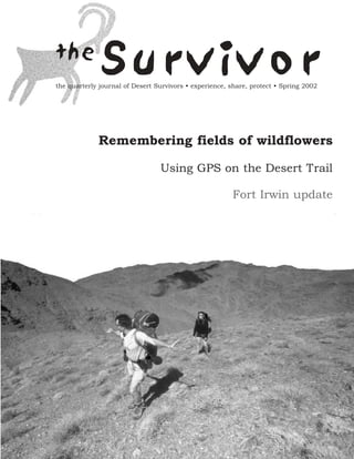
Spring 2002 The Survivior Newsletter ~ Desert Survivors
1. the
Survivor
the quarterly journal of Desert Survivors • experience, share, protect • Spring 2002
Remembering fields of wildflowers
Using GPS on the Desert Trail
Fort Irwin update
2. Letter from the Editor
By Jessica Rothhaar, Communications Director
W
elcome to the new Survivor. This beautiful new format was created by DS member Hall Newbegin, who says he has been
itching to do it for years. Hall put his all into this redesign, and I think it really shows. Thank you Hall! Thanks also to
Eric Rorer for providing many of the photographs that help give this issue its distinctive look, and to all those who con-
tributed articles and additional photographs to this issue: Cathy Luchetti, Len Finegold, Chris Schiller, Jeff Comstock, Dave
McMullen, George Huxtable, Dave Holten, Peter Ruddock, Janet Johnson, Paul Menkes, Bob Ellis, Bob Hallstrom and Steve Tabor.
I hope this new format will inspire you, too, to write, photograph or draw for the Survivor. The Survivor is always thirsty for original
desert-related content: poetry, prose, issue updates, trip reports, nature writing, gear reviews, book reviews, music reviews, pho-
tographs and B&W line drawings. Whatever your special passion or expertise, I encourage you to share it with your fellow desert
lovers in the Survivor. Share your opinions too; we will start printing and responding to letters to the Editor and to the DS Board.
Let us know what you think.
What I really hope is that that this new-look Survivor will be the beginning of a renaissance in our unique and wonderful organiza-
tion.
Since 1978, Desert Survivors has been at the forefront of desert protection advocacy in California. We lead more desert wilderness
outings than any other organization in the United States. We introduce scores of people to the beauty and fragility of the desert
every year. We teach people how to tread more lightly on the earth. We foster involvement and develop leadership. We are a com-
munity.
Yet, our membership is declining rather than growing. Since dues, trip donations and extraordinary donations from members
account for virtually all of our income, this means that we are heading toward red ink. Extraordinary grants and donations have so
far kept the wolf from the door, but we have to start looking at systemic solutions such as an increase in membership fees or trip
donations, or an annual fundraising drive.
Our long-term survival depends on growing our membership. A Membership Survey and Task Force last year identified a variety of
options. One of these was last month’s Green Tortoise bus trip, which was organized by Dave Burch in response to survey findings
that many members are discouraged from going on trips because of the long drives. Thirty four people participated on the trip,
including six new members and several members who said they hadn’t been on a trip in years. Everyone had a blast and we will defi-
nitely do it again.
Other priorities identified by the Task Force last year were to improve our communications (the Survivor and the website), and to do
more outreach in Southern California and Nevada. Lacking paid staff to implement all of our great ideas, we haven’t moved forward
as quickly as we would have liked; nothing happens in Desert Survivors unless individual members give the time to make it happen.
The bus trip and the Survivor redesign are a start. My next priority as Communications Director is to take up the long-stalled website
redesign; please contact me if you would like to help out with that or the regional outreach.
How to reach us:
Managing Editor: Jessica Rothhaar.... (510) 525-4921, JesseRoth@aol.com
Designer: Hall Newbegin...... (510) 845-1418, hall@juniperridge.com
Membership Inquiries: Steve Tabor........... (510) 769-1706, SteveTabor@aol.com
Submissions and Letters
Articles should be 1000 words or less and are subject to editing. Letters to the Editor should be 200 or fewer words and are subject
to editing. Articles and letters should be emailed to JesseRoth@aol.com; please include your full name, city and state of residence and
phone number. Photos, maps and line drawings should be mailed to Hall Newbegin, 3032 Tremont Street, Berkeley, CA 94703; they
will be returned to you if you include your name and address. Please identify people and locations shown in your photographs.
Cover photo: Rupert and Christen Essinger enjoying the sunshine and views as they ascend Orocopia Peak
photo by Eric Rorer
2 The Survivor Spring 2002
3. Fields of Flowers, Fields of Sand
F E AT U R E S
R e m e m b e r i n g t h e Wi l d f l o w e r Ye a r s
by Steve Tabor, Alameda, CA
Dave McMullen
Wildflowers in the foothills of the Coso range, Spring 1998
M
y March 2002 trip to the Soda Mountains was a sober- canyon the blooms were everywhere. So dense was the growth that
ing experience. There were no forbs blooming, no wild- we found ourselves trampling flowers with every other step; they
flowers. Hardly any shrubs were leafed out. Only a sin- were impossible to avoid. Primroses of many kinds, sunflowers,
gle brittlebush showed blooms. Even the largest of the beavertail Spanish needles, Eriophyllum, Penstemon and many others grew
cactus were shriveled and dying. We picked up a chuckwalla lizard wall-to-wall across the wash. Trying to avoid trampling them was
that barely moved. It had lost all body fat and its skin was turning useless.
black. Its eyes blinked, but it did not respond to touch. We poured
water into my hand and tried to get it to drink, but it could not. Later in March, we saw more flowers at Kelso Dunes on the last
Such were the results of a waterless winter. Virtually no rain had hike of our Spring Desert Trail Relay. The backside of the dunes
fallen in the past twelve months. This was drought, even for the and Cottonwood Wash had been soaked by late rains that had
desert. seeped into the sand. Kangaroo rats were active in the dunes, as
were fringe-toed lizards, both benefiting from the insect bloom
Yet, all around us was evidence of a banner year for flowers, the brought forth by the moisture. As we strode the water-compacted
winter of 2000-2001. That was a great flower year! The dry stalks sand, we could see snow banks at high elevations in the nearby
of the previous year's brown-eyed primrose and sunflowers were Granite and Providence Mountains, snow that would nourish the
everywhere. The dried flowers of last year's brittle brush still pinyon pine and juniper trees and cactus that grew there.
waved, a foot above the present year's meager offering.
Everywhere in the California desert, 2001 had been a great spring But the best wildflower year I’ve ever seen was the spring of 1998.
season for flowers. That year, El Nino brought the rains early. It started raining in the
desert on Thanksgiving the previous year and, from then on, rain
That year, good rains in February and March had brought a reli- came to the desert in the classic flower-year fashion, at least one
able bloom. On President's Day Weekend of that year, I led a good soaking rain per month, evenly spaced. In addition, many of
group across the Sheephole Wilderness north of Joshua Tree. the rains were warm ones, prompting an early bloom in February.
Flowers were sparse on the fans and in the open, but in one Soil moisture slowly accumulated, and the subsurface never dried
The Survivor Spring 2002 3
4. out. Seeds that had been laying around in the desert for a genera- identification book did not look like the same plant. Most of the
F E AT U R E S
tion now had a chance to sprout. And sprout they did, starting species mentioned previously were there, joined by pink masses of
early and ending late. sand verbena trailing across the sand. Even where dune buggies
did donuts at Dumont Dunes, wildflowers grew so large, even the
In January 1998, in Maniobra Valley south of Joshua Tree, Marck jaded off-roaders couldn't help but notice.
Menke and I trailed behind the group on my Orocopia Mountains
trip, doing a vegetation survey. At one point, I found Marck Good wildflower years are usually followed by several poor years.
sprawled on the ground examining a host of sprouts barely an 1984, 1988, 1993, 1998 and 2001 were all good years. The years in
inch high. The whole wash was carpeted with them. We counted between often showed no blooms at all, as rainfall swung on and
ten or a dozen per square foot, all vying for sunlight, glorying in
off, going elsewhere or not even making it over the coastal ranges
the damp desert sand, sending down roots. All across the desert, and the Sierra. The fields of flowers that we walked through in
it was like this. These were the sprouts that later produced "theValjean Valley in 1998 were dry as a bone in 1999. In March of
greatest desert bloom in thirty-five years,” in a flower year that
that year, there were lots of dead dry stalks from the 1998 wild-
even made the New York Times. flower show, but there was no greenery, no forbs and not much in
the way of leafed-out shrubbery either.
By President's Day in the Sheephole In 1999, after a year-long drought on
Wilderness, the desert was a carpet of The desert lilies were the most Cima Dome, we'd seen a skinny, very
green sprouts several inches high. The amazing - single plants three hungry, somewhat dazed jackrabbit,
best blooms were in small patches of feet high with stalks as thick emaciated from a lack of greenery,
sand, which held moisture the longest, in as my wrist. wounded by the ebb and flow of life and
the spaces between the grains. The moisture.
Sheephole has a reputation for being
some of the lowest, most barren, least sheltered of any of the It will likely be a long time before we again see flower years like
Mojave Desert's Wilderness Areas, but in this year its wildflowers 1998 and 2001. I tell my hikers not to go to the desert looking for
were superb. wildflowers, but instead to look for good geology, good rock expo-
sures and landforms, the inert stuff that will always be there. To
March trips to the Marble and Granite Mountains, in the southern experience the desert's sense of space and time and open possibili-
Mojave, also had great flowers. Coming out of the Granites in ty, to enjoy the lack of civilization's constraints and the absence of
Bull Canyon, they were especially good. Blue Canterbury bells, its phony propaganda and false values. To avoid its jaded self-
yellow primroses and orange fiddlenecks grew on both terraces importance and its lack of worthwhile goals. Go there to escape
and hillsides. Below us in the gulch, a babbling brook ran out of the "American Dream" and its programmed waste of time and
the mountains toward Kelso Dunes. I've never seen the stream effort and of life.
running that strong, or even leaving the mountains, before or
since. I urge desert hikers to let the wildflowers fend for themselves. If
they're there, you can marvel when you find them. That way, they
The best blooms I saw in 1998 were in Valjean Valley in early become even more valuable, like a hidden gem that you don't
April. Here, the flowers were most developed. Individual plants expect to find. Desert wildflowers are a rarity. They won't be there
had many blooms, and they were huge. The desert lilies were the every year. But like that single brittlebush in this year's Soda
most amazing - single plants three feet high with stalks as thick as Mountains, they will catch your eye enabling you to marvel. Don't
my wrist. The little eight-inch spindly stalk shown in my flower worry, they'll be back. We just don't know when.
Janet Johnson
4 The Survivor Spring 2002
5. The Woman was Incredulous
F E AT U R E S
By Bob Hallstrom, Pittsburg, CA
The woman was incredulous. "You went to the desert!?! What did you do for entertainment?" My
wife and I had just returned from a few days spent burrowing as deep into the desert as we could
manage. We marveled at the scenery, the colored rock, the sunrise and set, and the scattered silver-
gray puffs of plants that looked like they hadn't done any useful photosynthesis in years. We tried
to comprehend the silence and the star show at night, the solitude , and the subtle but persistent
hint of danger. We slept in the back of our pick-up, drank water want your money.
from a jerry can, and cooked simple meals over a camp stove.
He doesn't need you.
Both of us attempted to stretch our finite minds to absorb the
infinite scale of the place. Then we returned home exhausted but But if the time is right and the whiskey good, he just might decide
enthralled and renewed. to talk. If you are smart, you will shut up and listen.
My wife's friend doesn't do things like this. I admit I rarely under- You may have to sort through some strange stories, because a lone
stand the activities that excite her, but I don't remember asking her imagination can wander into some funny places. But be patient
to explain her passion for these. However she was determined to and he will begin to teach you some of the workings of man's
get some justification from us for the week we had just expended. mind.
Why did we go to the desert? He will know nothing of TV or recent movies, and he mostly
reads old books. But since experience comes from things done
Where do I start? wrong, he can speak from authority.
Let me tell you of a man I met once. Some day you may cross Let him talk. If you pay attention you will gain something impor-
paths with one like him, but don't be surprised if you are tempted tant that the others always miss. Do not dismiss the man as they
to ignore him. Most everyone does. do, for he offers insight you cannot find anywhere else.
He is an odd little man. He keeps to himself. The Mojave Desert doesn't need you either.
Like the stray cat that comes to your back door, you cannot just Most people ignore the desert while passing through at 85 mph.
reach out to him or he will cut and run. They are going somewhere else and the desert is not a destination
to them; it is just in the way.
You may find he has a wall around him. If by chance he lets you
through this wall you will find another, and perhaps a third. Like Others come to the desert with their toys. They tear around on
all walls, their purpose is to keep people away. This man has his motorcycles or dune buggies. They gather in large groups, leave
reasons for the walls, for the protection they offer, but you proba- the lights on, and make lots of noise. They go into the desert
bly will not learn of these. without letting the desert into them.
His hands are rough and scarred, and his muscles taunt. He may A few lucky ones crawl away from the crowds and find solitude,
be as old as he appears, but it is hard to tell. The wrinkles on his darkness, and silence. They find colors and clouds, alien plants and
face tell their tale, and his eyes have a permanent squint from too stark beauty. They are not comfortable, for the desert is both too
many hours spent in the sun. hot and too cold, and it certainly is not soft. But they are spell-
bound. They shut up and listen. and learn things they cannot learn
Look into those eyes and you will know someone lives in there. anywhere else.
They speak of time and thought and finally, wisdom. Watch them
transform from wary to warm without any other change in his fea- Refreshed and infused with new perspective, they can go home to
tures. From his perch at the periphery of the crowd he pretends to suburbs and cities, to jobs and tedious people. Perhaps they don't
be somewhere else, but those eyes miss nothing. wish to spend all their time with this odd little man, but they are
glad to have met him.
He may have failed at everything, or he may have simply left suc-
cess behind to be by himself. Never good at following directions, "What did you do for entertainment?"
he can invent anything he needs. You cannot offer to pay him in
order to gain some measure of control over him, for he doesn't Sorry, but if you have to ask…
The Survivor Spring 2002 5
6. F E AT U R E S
Ever wonder what it would be like to be injured,
alone and in the middle of nowhere? In September
of 2001, veteran Desert Survivor trip leader Dave
McMullen fell down a steep hillside and badly
injured his ankle. He managed to hobble his way
to an abadoned 19th century ranch site with shade
and running water - what follows is the second
installment of his story....
Peril In The
Panamints: Part 2
Dave McMullen
By Dave McMullen, Berkeley, CA
Isolation. After a lousy night, a self evaluation first thing Sunday morning made it clear I was
going nowhere in a hurry. My ankle would bear no weight without excruciating pain, and it was
swelling prominently. Bruises were developing around the joint and down toward my toes.
Between me and transportation was nine miles of steep rocky elevation. Standing told me all I
needed to know: there was no way I could hike back to the car. I had planned to be home
Monday night, 36 hours away. Assuming a search and rescue call hole. I realized this was a good sign that my internal systems were
would be made either late Monday night or first thing Tuesday working. The nausea went away, and I felt more clear headed, too.
morning, I expected some sort of contact with Park Service per- My appetite returned as well, so I drank heartily, nibbled on some
sonnel by Tuesday afternoon. That meant I would have to wait at trail mix and dried fruit, and rested in the shade of a fig tree.
least 56 hours before outside assistance would arrive.
Wilderness survival classes teach that, when lost and awaiting res-
Would they know where to look? Yes, because I left an itinerary cue, it’s good to take steps to facilitate your own rescue through
behind with my wife, Diane, and several friends, with information signaling or marking your location. That is why flashlights, mir-
about my intended routes, destinations, and return time. This inci- rors, and whistles should be included in emergency kits. So I
dent shows how important it is to do that, and how important it is resolved to try and bring attention to myself. Every hour I blew
to stick to the plan. my storm whistle as loudly as possible, pumping out three quick
blasts, pausing to listen for a response, and repeating it two more
56 hours didn't seem like a long time, especially in my condition. I times. I also located a clear space away from the trees and
was grateful to have sustained only a sprain in the fall. Besides, my stretched out my space blanket with its reflective side up in bright
supplies were in good stead. There was food for a day of strenu- sunshine to attract the attention of passing planes. Whenever I
ous activity, with some extra rations for just such an occasion. I heard a small low-flying plane overhead, I came out from under
had a fairly well stocked first aid kit containing painkillers, anti- the canopy of leaves and stood near the space blanket waving my
inflammatory medications, and compression wrapping. I had a t-shirt over my head.
warm sleeping bag, with a pad to rest on, along with good rain
gear and warm clothes in case cold weather set in. I had survival This wasn’t that effective. Only two low flying planes passed over
items as well, including a space blanket, matches, knife, flashlight, the ranch in the three days I was there, and neither saw me. It
reflective surface, loud whistle, and water treatment gear. turns out that my reflective tarp isn't that reflective after all.
Having been folded and rolled innumerable times, the silver sur-
The location was excellent too, being supplied with a good source face has become a mass of wrinkles and creases, and reflects light
of water and plenty of shade, courtesy of all the fruit trees surviv- diffusely. Diffused light does not get the attention of people in
ing there. airplanes; only a brightly reflected intense light will stand out from
the surface enough for that.
But the constant throbbing pain, and the painkillers and anti-
inflammatories on an empty stomach, left me nauseous in the Tranquility. That Sunday was a beautiful day at the ranch. The
morning. I drank some water and tried eating some crackers and air was still, the sky cloudless, and the temperature was very warm.
sausage, but that only made it worse. I hoped that this wasn't a As I lay there, birds would come and go through the trees, picking
sign of some internal injury and monitored this closely. Soon at the fruit, scratching the ground for bugs to eat, and drinking
however the call of nature overtook me, and I had to dig a cat from the stream. The tranquility was palpable.
6 The Survivor Spring 2002
7. I located my camp directly beneath the limbs of a large fig tree, lines, getting larger and darker as they began to stack up against
F E AT U R E S
where I would have plenty of shade all day. The tree's branches the peaks. Around 5 p.m., thunder rumbled down the rocky
arched outward and downward, leaving open shady spaces beneath mountain sides and the sky above was completely covered.
a canopy of leaves. After tossing out the twigs, small rocks, ripe Lightning flashes followed by thunder increased in frequency, and
figs and burro turds, I had enough space to stretch out completely. by 6 p.m. light rain began to fall at Hungry Bill's Ranch. I
retrieved my tarp, put on rain gear, covered everything and waited
By lunch time my spirits were high. I'd overcome the nausea, it out.
soaked my ankle in the creek again, applied a compression wrap,
and made regular blasts on my whistle. I was enjoying the solitude My position under the tree wasn't the best for avoiding rain. A
and wishing I could get a better look at the birds winging about. funnel effect seemed to direct water right to my bed. I moved
As I rested contentedly, the steady drone of a low flying single some branches around but this only made matters worse, so I relo-
engine plane pierced my dream. cated to a more protected spot and waited it out. The rain
stopped just after sunset and I was able to unwrap everything and
I put on my boots and hobbled into the clearing. Shading my eyes, rebuild my bedroom. Sleep that night was restful and unbroken.
I spotted a plane, then took off my t-shirt and waved it back and
forth over my head until the plane disappeared from view. Alone Stuck in Paradise. Monday's routine was similar. I had another
in the silence afterward, I wondered if the effort had been worth soak in the creek and rewrapped the compression tape. I nibbled
it. I later discovered that it’s better to lie down if you want to be a bit of food, though I wasn’t hungry. I drank water regularly, and
seen from a plane. A member of the Mountain Rescue Group kept my leg elevated as much as possible. During the heat of the
told me that, from the air, standing people cast shadows and blend day, I placed a wet wash cloth over my elevated ankle to cool it
into the landscape, and so end up looking like rocks or trees. through evaporation; that worked very well.
First Storm. By late afternoon, large billowy clouds had formed Between my fig tree and the creek were some grape vines with
along the peaks up canyon. Small clouds drifted along the ridge clusters of ripe fruit. I gathered a few grapes to eat and found
Dave McMullen
Before the fall: view from the Panamint Crest, Prickly Poppies in foreground
The Survivor Spring 2002 7
8. them very sweet indeed. The fig trees were loaded with fruit the to the wind as it blew though the trees and over the canyon walls.
F E AT U R E S
size of large cherries and very flavorful. What a paradise to be
stuck in! Fresh cool water, ripe fruit, peace and quiet, with shade Becoming Impatient. Tuesday morning broke fair and clear. By
and soft ground to rest on. The desert isn't always so accommo- lunch time, I half expected Park Rangers to come walking up the
dating. canyon. Certain that search and rescue actions were taking place, I
prepared all my gear for quick departure and spent the early after-
Second Storm. Late that afternoon, clouds again started blowing noon watching small clouds drift by. No-one came, but around 4
from the southeast and piling up against the Panamint peaks. By 4 p.m. I heard the drone of a single engine plane and again per-
p.m. the sky was black with thunder heads, and lightning was again formed my rescue dance. The plane made a turn, doubled back
unleashed up canyon. The rain started, light at first, then heavier; over the canyon, and then turned and flew directly down canyon.
the temperature dropped as a strong wind began pouring down I found out later it had indeed been searching for me, but had not
the canyon. I slipped on my thermal underwear, donned rain spotted me.
clothes, and secured my gear by
putting everything into the The afternoon dragged on. I
pack, wrapping it in the tarp ambulated a bit and discovered
and sitting on top of the bun- that my ankle could bear a
dle. A very uncomfortable small amount of weight, but
position for a sprained ankle, the uneven ground was brutal
but one I was forced to hold for on it. I gathered up some
several hours. apples that looked ripe and
found some fallen walnuts as
Soon large drops were falling well. They were the worst
through the leafy canopy and apples I have ever tasted. Pithy
figs, knocked off by the rain, and entirely without sweetness.
Dave McMullen
were dropping down on my The nuts were delicious but
head. I passed the time count- small and required great
ing seconds between lightning patience and labor to extract
flashes and thunder claps. At from the shells. My lunch
one mile for every five seconds, consisted of these nuts, fresh
I calculated the strikes at two grapes, fresh figs, cheese, and a
Apple tree at Hungry Bill’s ranch
miles away. They got closer and bit of sausage.
then suddenly were right on top
of me: less than one second between flash and clap. After a par- Hoping company would arrive for dinner, I put off eating again
ticularly loud one, the skies opened up and poured down hail. until sunset. That's when it became clear to me there would be no
rescuers hiking up the canyon that day. I prepared for another
Ripping through the leaves, bringing down small branches and night and felt positive tomorrow would be my time to leave.
more fruit, the hail storm lasted over ten minutes. It was followed
by more heavy rain. Water began to puddle in my once cozy Rescue. At 2:00 a.m. the call of nature woke me. While watering
alcove. Strong gusts of wind, like ocean waves, charged down the a bush, I was treated to a most amazing sight. All clouds had
canyon, making the fig tree bend and sway. After two hours of evaporated, leaving a star studded sky naked from horizon to hori-
this, it began to get very dark. I had visions of staying up all night zon. There wasn't the slightest breeze and a waning moon, just
in the rain. Occasionally I could see through the branches and past full, illuminated the landscape in every direction through a
became aware the storm stretched completely across the valley. I freshly washed crystal clear atmosphere.
saw lightning bolts striking all around the Black Mountains, cloud
to cloud, and cloud to ground. I stayed there for awhile drinking it all in. What a weekend it had
been: injury, isolation, storms, anticipation of rescue, spotter plane
A dismal thought entered my head. What a pity it would be to flying overhead,. And now this magnificent beauty. I sighed, trun-
have survived the fall and two days alone, only to be struck by dled back to my bag and began to drift off to sleep.
lightning. The potential for a flash flood came to mind as well. I
started to watch the creek and plan for a retreat. I stayed my In that half awake, half asleep limbo, a noise began to insinuate
ground, but checked the creek twice. It wasn’t rising and, more itself into my consciousness. "That's the sound you have to listen
importantly, it wasn’t running muddy. At 7:30 p.m. the rain for in the morning when they come to get you," I heard a voice
stopped and the lightning moved out to the east and north. saying. "That's the sound I have to listen for in the morning when
they come to get me," I repeated as the noise continued. "Yes,
I lay down on my tarp again. Staring into the dark, I realized it that's the sound you have to listen for when they come to get you
was about the time my absence would be noticed. A sinking feel- in the morning," the voice confirmed. "OK, that's the sound I
ing crept up on me. My wife would be worried, as would Grant, have to listen for...", I started to tell myself once more. Then it hit
whose 4WD I had borrowed. I wished I could somehow reassure me. That's the sound. That's the sound!
them I was okay. Hoping the best for them, I dozed off, listening
8 The Survivor Spring 2002
9. I sat upright in the darkness under the tree and listened. Yes, that the cause of it.
F E AT U R E S
was the sound of a helicopter somewhere up canyon, and it was
getting louder. I pulled my boots on, grabbed my headlamp and They took me to Ballarat, where Sgt. Randy Nixon of the Inyo
hobbled out into the moonlight. Looking west I saw the running County Sheriff ’s Search and Rescue team welcomed me and imme-
lights of a helicopter in the air, with a comically dim spotlight diately set up a satellite phone for me to call my wife. It was
making slow sweeps back and forth across the canyon floor. around 3:30 a.m., but Sgt. Nixon knew Diane would be glad to get
my call.
I turned on the head lamp and flashed a quick SOS in the copter’s
direction. It stopped sweeping and made a direct line toward me, Epilogue. What you have read is only half the story. There's a
flew over my head, then did a U-turn just down canyon and head- whole other tale of people waiting for me to return, their fears,
ed back more slowly. As it passed over again, someone threw out hopes, and decisions when I didn't. There's all the telephone calls,
a red glow stick, then the copter turned around and headed down the waiting for news, and wondering what's happened. I am eter-
canyon once more. I wondered if they were leaving. But they nally grateful to those who came forward and helped Diane: Grant
turned around a third time and slowly began to descend. I hob- Blocher, my brother Sam, sister-in-law Penny, and my step son
bled back to my gear and prepared for departure. Aaron. Also, I am grateful to BLM ranger Ron Stormo, and
DVNP ranger David Brenner for braving the washed out road up
Flight Out. The flight out of the canyon was remarkable. In the Pleasant Canyon to locate Grant's truck and initiate search and res-
light of the near full moon I could see both walls of Johnson cue efforts. Thanks also go out to the Inyo County Sheriff ’s
Canyon as we flew up and over Panamint Pass. The entire crest of Department search and rescue people, especially Sgt. Nixon, and
the Panamint Mountains was lit up as we crossed over, and I could to the helicopter crew from Vandenberg Air Force Base. Others
see Telescope Peak in the distance. The flight had a bittersweet helped too, in indirect ways. I am thankful to you all, and feel
quality for me. I was rescued, and that was good. But a helicopter grateful to have discovered a wide base of support in my life.
was violating the remote and tranquil wilderness I love, and I was
Dave McMullen
View north from Porter Peak on the Panamint Cres t
The Survivor Spring 2002 9
10. TRIP REPORTS
San Rafael Swell Carcamp
May 7-13, 2001; SE Utah
Dave Holten
canyon. The guidebook called for an outcropping on a side canyon
By Cathy Luchetti, Oakland, CA to point the way out, but which one? Outcroppings towered every-
T
en people met at Justensen Flats, east of Salina, Utah. where. Huge hoodoos threw goblin shadows. A dizzying array of
The weather was clear and brisk, the 7000-plus elevation miner's cairns prompted false starts.
just high enough for a scattering of snow atop the scat-
tered scrub junipers. The last five hikers came from the Bay Area "Up here!" someone cried.
in a Ford Explorer, top-heavy as a Columbian bus under a totter- "This way!"
ing mass of duffels and packs. Camp that night was flooded by "No, over here."
moonlight and a small herd of wild mustangs.
The route up quickly turned Class 5. Hikers clung like bees to the
Day One: Leader Dave Holten woke us politely at 6 a.m. by fid- steep rocks, unable to advance, trying to edge back down, blinded
dling around with his vehicle, then walked from tent to tent, mak- by sweat and the first stirrings of anxiety. A rock like an anvil
ing encouraging sounds. By 8 a.m., all were ready for the "moder- crashed down the cliff and crunched onto one hiker's knee.
ate" day hike: a mere ten-mile warm-up into Coal Wash, followed Exhausted but energized, we finally found a route out. This was
by a steep, downhill scramble. To exit, we would orienteer back up adventure! Rugged, unexpected, and beautiful. If this hike was
a steep canyon wall using Steve Allen's guidebook, The San Rafael moderate, what, we wondered, would tomorrow bring? "Killer
Swell. day!" one hiker exclaimed. "Yikes!" "Hot. Very hot."
We headed toward the western side of the Swell and eagerly Day Two: This day’s hike took us down Devil's Canyon to the base
tracked across the stone "blocks," threading our way through of the impressive San Rafael Knob. An 1100-foot vertical summit
hoodoos, pinnacles, and spires to the lip of a steep talus slope. with unsurpassed views, the Knob was scrabble, scree, loose boul-
Awed silence ensued as we gazed down the vertical descent, until ders and intense hiking, particularly toward the top.
we finally spotted a narrow chimney that everyone could manage.
Butts wedged and soles locked, we inched down the crusty sand- En route, the group splashed into a slot canyon so dark the murky
stone. At the bottom, a water-cut gorge divided into the main water looked too deep to cross. One hiker poked his walking stick
10 The Survivor Spring 2002
11. in, noting, "Really deep." We tried to
TRIP REPORTS
inch around, and some started clam-
bering up the canyon walls on rocks
too slippery for traction. Finally,
one hiker plunged in barefoot,
expecting to sink, but landed ankle-
deep in shallow water. A half hour
lost, but prompting much, much
laughter.
Toward the peak of the Knob, one
person slid ten feet straight down a
rock face while two climbers inched
along a sheer sandstone cliff, head-
ing for the top, searching delicately
for footing and wondering if they
could edge their way back down, or
Dave Holten
had they gone too far? Finally sum-
miting, they were surprised to find
an old mining road that wound its
way to the top. We could have
walked up the backside. group hiked four miles down a steep gorge from Swasey's Cabin,
stopping to admire a 120-foot arch that towered overhead, its
Day Three: Dave Holten's pickup coughed and grumbled, forcing
graceful curves reflected in a glimmering pool of water. Suddenly,
him to drive to Price for repairs, leaving Steve, Lasta, and Dave as
the sky clenched up. Thunder muttered and occasional lightning lit
leaders. They devised a "Brunch Walk" to the Rochester petro-
the clouds. A spatter of rain danced overhead, sprinkling us as
glyphs, an amazing sandstone panel overlooking Muddy Creek, just
well as the dead mice floating in Sulphur Spring's cattle tank.
past the Spanish Trail. Carved images danced over the soft, beige
Carefully, Steve T. lowered a branch over the basin to provide an
rock. Figures twined, hunted, jumped, gathered, capered, and
escape route for future trapped mice.
stared out with haunting eyes. Far below, a van-sized rock near the
Muddy River Canyon sported a 20th century glyph: images of That night, camping on the Reef, the Ford Explorer group discov-
children, carved to look like gingerbread cookies. ered that they were nearly out of gas. One hiker stood up and
claimed responsibility.
From the petroglyphs, we backtracked toward our camp at the foot
of Capital Reef, which rose up like a dorsal fin from the ocean of "My name is J. I am a bad judge of travel distances and I am here
gray sage that stretched from horizon to horizon. Part of the to get better." Such honesty was deeply appreciated and the car
returned--nearly to Moab--to fill up.
That night seemed magical, particu-
larly the Gift of the Corral.
Our camp was off Highway 24
between Green River and
Hanksville. To the east lay the snow
covered La Sal Mountains behind
Moab. Behind us rose the San Rafael
Reef, the eastern edge of the San
Rafael Swell, an explosion of verti-
cally formed strata. Its miles of
flatiron walls looked like giant reptil-
ian backplates thrust up from the
sand. Jannet, seated on a blue oil-
cloth tarp, needed scissors to open a
bag of Tasty Bites. "Scissors," she
mused. "I wish I had scissors….."
Dave Holten
Suddenly Geri leaped up, pointing to
the old corral. "Look!" There, stuck
in the gate, was a brand new pair of
Lasta Tomasevich mugs for the camera pink-handled scissors! Jannet tried
The Survivor Spring 2002 11
12. wishing for more useful items, but the moment had passed. Day Five: Our hike wandered down Upper Knotted Rope
TRIP REPORTS
Canyon, a narrow, beautiful canyon with a tremendous overlook.
Yet magic hung in the air. A huge moon shone white over the To the southwest we admired Wingate striped walls, buttes, and
desert, drawing out packs of coyotes on lonesome midnight mesas. Recent mining activity dotted the cliffs with small black
prowls. mine apertures, looking like Indian cliff dwellings cut into the
Wingate. Ahead was Wayne’s Wiggle, a steep chimney scramble
Day Four: A 12-mile loop walk through Iron Wash and Ernie that twisted through the rock. The canyon was named for a knot-
Canyon, twisting down the backside of the reef, threading our way ted rope that used to hang through the Wiggle. There was no rope
through towering walls of varnished Moenkope and Chinle rock left, but plenty of wiggle was still necessary to ascend. The top
formations. Cottonwood and tamarisk stood out vividly. House- was partially blocked by a boulder and an overhang, but everyone
sized boulders were flung down the sides of the mesas, under- managed to shinny up and, later, back down. From the top, we
mined by the collapse of crumbling rock beneath. Buttery yellow gazed out over the snow-covered Henry Mountains, the last
carnetite talus shedded down from the huge mesas above, bearing "newly discovered" range in the country: a carnival of bright
little loads of uranium. A huge amphitheater loomed over the Navajo and Wingate, streaks of red and white, banded and layered.
bottom of the canyon, an awesome sight. One hiker, speeding
downhill, suddenly stumbled into what appeared to be a huge bad- Day 6: More beauty? More? On this day we circumnavigated the
ger hole. Other holes appeared; no one else fell in. talus slopes of Temple Mountain on an 8-mile hike. "The sun is
in heat," said David M. Huge core samples had been plucked out
Hoodoo Arch descended into a mini Grand Canyon, a tumble of of the earth like hair follicles, using huge mining equipment that is
monolithic ascents and steep cliffs. Cottonwoods rustled gently, no longer in evidence. On the backside are two cabins, still livable
bright green against the banded red and white rocks bordering the save for their caved-in roofs. Recent mineral sampling has gone
Muddy River. on; patents can only be continued by demonstrating "improve-
ments."
Dave S.: "That Arch opening looks like the state of Nevada"
Dave H: "Well, I'm homesick." If you like weathered sandstone and granite, windblown hoodoos,
outcrops of red sandstone, cactus studded vistas, great massifs,
volcanic scree a hundred million years old and incredible vistas,
this is the trip: Utah at its best. As Steve Thaw quoted John Muir:
This is holy land, and you should saunter through it.
Afton Canyon Bike Trip
November 10-12, 2001; Mojave Preserve, CA
By Jeff Comstock, Stockton, CA
I
caught a ride with my friend Steve Perry. After securing my
bike and gear, we struck a course from Lathrop to Santa
Nella. All travelers know that this can only mean one thing:
Anderson’s Split Pea Soup. I passed on the pea soup and contem-
plated what Jedediah Smith might have ordered. I went with the
Cowboy Omelet, flapjacks and black coffee. Back in Steve’s truck,
we fueled up and headed south.
I have always liked the trip down I-5; I wondered how it would
have looked one or two hundred years ago. We took Steve’s top-
secret short cut and were heading out across Highway 58 in no
time. Just east of Tehachapi we passed Twenty Mule Team Borax.
Steve says boron is used in rocket fuel, but it just reminds me of
my Grandma’s kitchen.
Looking at all the Joshua trees, it is easy to see where those Indian
stick figures in the petroglyphs came from.
At Barstow we stopped at the local expedition outfitter, Von’s
Supermarket. Some things go without saying, like "M&M’s melt in
mouth, not in your hand." The M&M people have no obligation to
Dave Holten
tell you things like, "melts in your mouth, a hot oven, and the
desert, not in your hand." I bought a big bag of trail mix, the kind
12 The Survivor Spring 2002
13. with M&M’s. there were pumps, generators and wells. The pumps fed numerous
TRIP REPORTS
sprinklers that watered two endless rows of tamarisk trees. We
Upon arrival at the Afton Canyon campground on Friday night, I passed a camp of tree trimmers keeping the trees neater then any-
was immediately struck with the fabulous turnout. Every spot was thing you will see on the banks of the Jordan.
taken, the grills were busy, the beers were cold, but there was no
talk of tackling the desert, nor anything that looked like a bicycle. We took turns tagging along in Steve’s truck and near sundown, we
People kept pointing up and talking about a meteor shower and made camp. Dinner was kicked off with some kind of chorizo
Leo the Lion. We parked in a spot for day campers, popped up weenies that added a smoky 40wt flavor to our excessive bounty of
the camper and crashed out. chicken. With full bellies, a Reeses cup and a bottle of wine, every-
one was ready to take a nap.
After a good night’s sleep I was awakened by the roar of a loco-
motive – wow, it was really close. Looking around the camp- Sometime around 1 a.m. the show began. It is hard to describe a
ground, we could see the Mojave River and a big railroad trestle. meteor shower of this magnitude. Comet 55P/Tempel-Tuttle was
Once across the river, the tracks ran out into the desert and gradu- sprinkling her dust, and this Leonid display was a good one. Four
ally disappeared in the east. and five abreast streaking this
Bob and Bill showed up; we way and that. Their speed was
were now a party of four. In the sand, a bicycle is pretty much useless incredible and, against the
clear desert sky, it was breath-
Later, while waiting for the car taking. The finale was a very
shuttle, I noticed a group of Boy Scouts and a leader at the trestle. bright light shooting northwest and leaving what looked like a
As a train roared by I was shocked to see the leader pick up a rock vapor trail across the night.
and bean a boxcar. I think the kids saw it the same way I did,
because they all looked at him like he was an idiot. Before going back to bed we all acted like ten year olds and ran up
to the tracks as a train blew past at full speed. It was thrilling. I was
I had wondered if a bicycle could cross a desert, and soon found tired and slept like a stone.
the answer. In the sand, a bicycle is pretty much useless; we would
travel to Kelso Station alongside the Union Pacific main track. All Sunday was a day of perfect weather. We made excellent time and
rail traffic between Las Vegas and California passes on this single followed our indefatigable guide Bill Spreng into Kelso Station.
track, including trains from Salt Lake City. Here we learned the railroad secret to making flat pennies. Put
them on the track when the train is parked, rather than in the path
Over the next two days, I would spend a great deal of time look- of a speeding locomotive. (I never figured that out as a kid, so I
ing at and thinking about trains. figured I would pass it along.)
Heading east from Barstow are two major tracks. One is the Packing the bikes, getting refreshed and harassing tourists, we left
Burlington Northern Santa Fe; Interstate 40 was built next to this the station and drove to the old Kaiser Vulcan Mine. The road up
track and you can race the trains all the way past the Stateline. The to the mine was in pretty good shape and soon we were parked on
other one splits northeast at Yermo and is all Union Pacific; this a nice concrete slab that was once a building. The mine closed
would be our route for the next 50 miles. We saw many of UP’s soon after WWII due to high amounts of sulfur in the ore. Even
"hot shots" ripping by at 75 mph. Hot shots are the high priority though it has been 50 years, the piles of tailings still look neat and
trains, usually double-stacked containers of surprising length. We tidy. Give this place another couple million years and it will look
even saw a train of empty car haulers go "in the hole"(onto a sid- like new.
ing), while a hot shot "held the main." While the train of empties
was parked on the siding, they chatted with Steve and even gave We took a hike to the bottom of the pit and checked it out. It was
him one of the famous blue plastic water bottles that litter the strange. The bottom was about the size of a football field: one end
tracks. I think Steve’s bottle was the first in recorded history to be was swampy and wet, full of cattails; the other end was under a
recycled. few feet of clear water with lots of green plants that looked like
angel-hair pasta. The part we could walk on was blanketed with
The bike ride was primarily on the service road that was right next soft, thick, white stuff. Beats me what it was, but I kept my hands
to the tracks. It was sort of paved, with lots of crushed rock, away from it and was glad I had my cheap boots on. It was no sur-
called ballast, that spilled over from the tracks. Most of the prise to see tamarisk trees growing here. After some pictures, we
crushed rock was granite and looked very sharp, but no tires were hiked back to camp for bagels and coffee. I finished off my
punctured. Some of the rock was rich with ore and as black as crushed, melted globs of M&M trail mix.
coal; I wondered which mine it came from. Some sections of the
road were sand and gravel washboard. I had long wondered what As the sun rose higher, we could see the ribbon of rail stretching
the railroads did with all that federal subsidy money, but in the across the horizon, past Kelso Station, heading west behind the
desert, they spend plenty. The rails were converted into "ribbon Kelso dunes and back to Afton Canyon. Everyone quiet with his
rails," welded into one continuous rail. The rocks and ties were own thoughts, we packed up and headed home.
under constant care with numerous inspection markers only a
month or two old. To keep the sand from burying the tracks, Thanks to trip leader Bob Lyon for a great weekend.
The Survivor Spring 2002 13
14. TRIP REPORTS
Escape From Trona Backpack
Feb 14-24, 2002; SE California, near Death Valley NP
11 day, 114 mile backpack across the unprotected wildlands threatened by Ft. Irwin’s expansion (also see article on page 27)
Avawatz Peak with back-
packs, and uttered the
words "Trona" and "Baker"
in the same sentence
dozens of times (most
often shortened as "T to
B" ).
The desert is dry this
Spring. Little or no rain has
fallen there in a couple of
months. As a result, we saw
few annuals on our hike;
no flowers and very little
greenery even in the peren-
nials and shrubs. Several
times I was reminded of
Bob Ellis
the movie "O Brother,
Where Art Thou?" with its
At the peak of 5000’ Quail Moutain with views of the Panamints and Telescope Peak landscape of sepia-tints.
The desert was still hiber-
By Bob Ellis, Berkeley, CA nating. O Spring, Where Art Thou?
A
ll but four Desert Survivor members refused to take part
in the first Trona to Baker 114-mile relay backpack / day- Logistics: Our method worked well for us and may prove useful
hike extravaganza. Bill Harper, John Hiatt, Ingrid to others. We were not certain of water sources along the way and
Crickmore and I didn’t refuse. All the rest of you missed out on a were worried about burros attacking cached food and water drops.
great trip. At the end our feet were sore, but our minds, hearts and We wanted to trade off carrying less weight in return for setting
stomachs were full - especially after the date shakes and Greek sal- out more caches. We split the 114-mile route into eleven day-long
ads at the Mad Greek in Baker. sections, each from 8 to 14 miles long depending upon hiking con-
ditions. The first five days would take us from Trona across the
This was a walking journey along a political and social borderland. Slate and Panamint Ranges to the end of the Owlshead Road.
At all times we were bounded on the south by military bases (first Three days before the hike we cached water and food at the
the Navy’s China Lake Range B, then the Air Force-used Leach Newman Cabin in Golar Wash to be picked up the second night.
Lake bombing area and then the Army’s Fort Irwin tank base). For The day before the hike we left two vehicles at the end of the
the most part, where we stepped and to our north was wilderness Owlshead Road containing all food and water for the last six days
(either proposed or protected BLM wilderness or Death Valley of the trip. Then we drove a third car back to the Trona hospitality
National Park wilderness). At times the peacefulness of the day center, our point of departure.
was replaced with the aggressive sounds and antics of sky-war-
riors. We hiked faster than expected and, with the incentive of a dramat-
ic rain shower, arrived at the Owlshead Road after only four days.
We crossed five mountain ranges: the Slates, the Panamints, the A flat tire on one of the vehicles provoked a trip to Baker for a
Quails, the Owlsheads, and the Avawatz. We hiked 17,000 feet fix, after which we shuttled one of the cars two days down the
uphill and 17,200 feet downhill. We started with a crossing of the road to Owl Lake Pass. Then we backpacked the length of the
Searles Lake playa and ended with a crossing of the Silver Lake Quail Mountains, stopping above the burro-trashed Quail Springs.
playa. We encountered 9 burros, 5 humans, 1 gopher snake, and 1 After looking at the next two sections, we decided to day-hike each
golf ball. We watched airplanes swoop and dive while firing their one as they had some dirt road sections and we were ready for a
guns, tanks trailing dust plumes, and the moon just missing Jupiter break from carrying packs. We shuttled the cars in morning and
and Saturn. We joined a small group of those who have walked the evening and arrived at the base of the Avawatz at Sheep Creek
entire length of the Bowling Alley, traversed over the top of the cabin at the end of the eighth day.
14 The Survivor Spring 2002
15. We left a car at the powerline road by
TRIP REPORTS
Silver Lake and started up Sheep Creek
canyon for a two-day backpack up 4,500
feet over Avawatz Peak. We were accom-
panied the first day by Tom Budlong and
Marty Dickes, who then shuttled our
remaining car to the powerline road
(thanks, guys). As we left the Avawatz
Mountains on Saturday, we survived an
afternoon of dust blowing directly out
of Fort Irwin. By early evening we
arrived at the shores of Silver Lake for
our last camp. A day hike down the
length of the playa past the old Tonopah
and Tidewater railroad grade got us to
the Mad Greek in time for lunch.
Bob Ellis
We wound up doing one four-day back-
pack with a midway cache, two two-day
backpacks and three dayhikes. Our packs Mysterious markings on the Silver Lake Playa
were never too heavy and we didn’t have
Irwin and the whole southern Death Valley area.
to carry much dried food. The downside was many hours spent
shuttling the cars. At the end we were sorry we couldn’t keep
4) Crossing the Avawatz - two rugged canyons for approach and
going.
retreat, terrific 360 degree views on the peak and ridgeline, and an
unknown spring and narrows.
Highlights:
5) Bill Harper’s new mileage record for backpacking with flip-
1) Crossing the Slate Range - views of southern Panamint Valley
flops.
and the unknown playa near Wingate Pass in China Lake Range B.
Letters to send:
2) Crossing Wingate Wash - a vast open valley dappled with pass-
ing cloud shadows.
1) BLM Ridgecrest Office - Quail Springs is trashed by burros. It
is a mudhole with no remaining riparian vegetation. It needs to be
3) Crossing the Quail Mountains - Quail Peak, the surprising high-
fenced with a drinker outside for burros.
point, with views of the rock strewn Granite Mountains in Fort
2) US Army, Fort Irwin - Excessive dust
emissions for hours on Saturday
February 23, 2002. Fort Irwin is the sec-
ond largest source of particulate pollu-
tion in California.
3) US Senators Dianne Feinstein and
Barbara Boxer - We traveled through
three spectacular potential wilderness
areas: the Slate Range proposed wilder-
ness, the Death Valley Strip WSA, and
the Avawatz Mountains WSA. Our on-
the-ground experience convinced us
these are worthy of permanent wilder-
ness protection.
Bob Ellis
4) BLM Ridgecrest Office - Briggs Mine
Exploration proposal. We viewed the
impacts of the Briggs Mine from the top
Wide open hiking down Wingate Wash of the Slate Range. The tremendous
The Survivor Spring 2002 15
16. visual landscape of the Panamint Valley must be protected against started.
TRIP REPORTS
further desecration.
We camped at Santa Rosa Flat, west of Panamint Valley, on March
"Or perhaps walking should be called movement, not travel, for one can walk 16. Early next morning, we drove out in the dark toward Hunter
in circles or travel around the world immobilized in a seat, and a certain kind Mountain and the starting point of our hike. We passed the
of wanderlust can only be assuaged by the acts of the body itself in motion, Grapevine Canyon Road junction with the headlights still on and
not the motion of the car, boat, or plane. It is the movement as well as the continued toward a much needed early start of the hike.
sights going by that seems to make things happen in the mind, and this is what
makes walking ambiguous and endlessly fertile; it is both means and end, After a few curves, we came to a large two to three foot high
travel and destination." frozen snow pack sprawled across the road. This clearly could not
-Rebecca Solnit, Wanderlust - A History of Walking be crossed by the Jeep, but we could shovel it down, drive across
it, and then continue on if no further drifts lay ahead. Leaving the
We feel mighty proud and mighty lucky to have walked our walk, vehicle idling, we walked ahead, initially encouraged by some clear
thought our thoughts; now we are starting to talk it. Our connec- areas of dry roadbed. Walking further, though, the snow pack
tion with this land has been forged with our feet. We are designing reappeared in even higher drifts covering the landscape. We were
our trip patch at this very moment. Look for possible future discouraged by the fact that we had an important decision to make
pedestrian adventures: Keeler to Bullfrog, Rhyolite to Rachael? so early in the process; you expect to make the important decisions
later in the day, not this soon!
Rather than abort the hike, we decided to back the Jeep down to
the Grapevine Canyon Road junction and start the hike there. We
knew this would add 11.6 miles to the hike (5.8 miles each way) for
what would now be a 30 mile "day" hike. We had plenty of food
and water, daytime temperatures were mild, and the weather fore-
cast was clear. This initial foray had cost us some time, but it was
just getting light and we were anxious to get our feet on the
ground. It was a spectacular morning in the high desert. The sun
was sparkling across the snow, the air was dry, and the sky was a
blue dome. We moved quickly across the hard, crusted snow con-
Bob Ellis
fident that we could quickly knock off the extra 5.8 miles along
the road to where the hike was to have started.
Bob Ellis at an old Miner’s cabin in the Avawatz Mtns.
The amount of snow on the ground increased as we went along,
To view more pictures from this trip, visit Bob Ellis’s website: now well over four feet high and reflecting brightly in the morning
http://home.earthlink.net/~bobellisds/TronaToBaker/TtoBMainP sun. After about two hours, the crusted snow started to lose its
age.htm strength and our footsteps became deeper. As we reached the
originally planned starting point, we were pleased that we had aver-
aged over two miles per hour, but the continued softening of the
Hiking Hunter Mountain Snow Pack snow in only mid-morning sun was now laboring our stride. We
March 16, 2001; Death Valley National Park, CA crossed a barbed wire fence in a northeast direction down through
the competing rounded tops of the Hunter Mountain complex.
[Ed Note: On this trip George and friend were coming in from the With 7.5 minute topos, compass, and GPS for fine tuning, we
west (Saline Valley Road) to connect up with the Desert Trail route weaved up and down, taking in the views over Cottonwood
in Marble and Cottonwood Canyons.] Canyon and Panamint Butte to the east and the limestone walls
above Sand Flat to the north. As we lost elevation the snow began
by George "Grubstake" Huxtable, San Mateo, CA to subside. It was now slushy, causing us to pull our feet directly
P
ete and I planned this spring trip to Death Valley NP as an up and out of deep footsteps before making the next step. Our
18 mile dayhike, knowing that it would require several feet were still dry, but our outer socks and pant legs were soaked
hours of night hiking and more than a few thousand feet from the calf down.
of elevation gain. The route would start along the Hunter
Mountain Road, 5.8 miles north of the junction with Grapevine Just two miles from our planned starting point, 7.8 miles from the
Canyon Road, and thread us around the backside of Hunter car, the elevation began to drop dramatically and another decision
Mountain, down to the junction with the top of Dead Horse had to be made. Although we had made good time for the first
Canyon, into the Cottonwood drainage, over to Marble Canyon, 5.8 miles, we had lost time in the soft snow since then. We knew
up to Harris Hill, and then along the ridgeline back to where we the snow would continue to subside and be absent completely at
16 The Survivor Spring 2002