New york sea level
•
0 likes•1,119 views

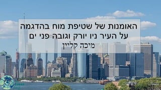
האומנות של שטיפת מוח בהדגמה על העיר ניו יורק וגובה פני ים מיכה קליין

Recommended
More Related Content
What's hot
What's hot (19)
Similar to New york sea level
Similar to New york sea level (20)
More from Anochi.com.
More from Anochi.com. (20)
Recently uploaded
Recently uploaded (20)
New york sea level
- 1. בהדגמה מוח שטיפת של האומנות פני וגובה יורק ניו העיר עלים קליין מיכה
- 2. הלפיד לראש עד מקרקע הפסל גובה93מטר NYC Sea Level to rise 6 feet by 2100 החירות פסל יורק ניו של סימלה זה מתוך,הוא בלבד העופרת פסל גובה46מטר, הבסיס גובה47מטר. ב שפורסמה לכתבה-2015הכותרת תחת: הזאת התמונה צורפה לכתבה מצב מתארת התמונהשל כ-80במפלס עלייה מטר הים פני.
- 3. החירות לפסל סמוך ממוקם יורק ניו של הגאות מד יורק בניו הגאות מד נתוניבשנים1993-2021.במפלס עלייה כל ניכרת לא אלה בשנים הים פני. (מקור:(Sea Level Trends - NOAA Tides & Currents
- 4. מאז הגאות במד המדידות נתוני1855 • צצ הקודם בגרף שהוצג כפי,ב-25הים פני במפלס עלייה אין האחרונות השנים
- 5. land velocity about The Battery, New York tide gauge location, GPS antenna of NYBP. (image from geodesy.unr.edu). בשנים הגאות מד באזור קרקע שקיעת של מדידות2011-2020 Boretti Alberto 2020 absolute and relative sea-level rise in the New York City area by measurements from tide gauges and satellite global positioning system . Journal of Ocean Engineering and Science Available online 1 June 2020 NY City GNSS subsidence is -2.151 to -3.076 mm/yr. ( (לוויני ניווט באמצעות NY City absolute sea level rate of rise is 0.7 to 1.0 mm/yr. מראות הלוויניות המדידות של קרקע שקיעת2-3 מ"מ/מיקום באזור שנה הגאות מד. מד כי ראינו הקודם בגרף הגאות"רושם"של עליה כמעט3מ"מ/מאז שנה 1850. מכאן,מפלס עליית רוב הנמדדת הים,מקורה קרקע בשקיעת.
- 6. מסקנה: של הגאות במד הנרשמת העלייה עיקר קרקע בשקיעת מקורה יורק ניו.
- 7. "התחזיות" היםפניבגובהעליה(באינצ'ים) הים פני גובה של הליניארית העלייה המשך, כ של מירבית לעלייה יביא-25ס"שנת עד מ2100
- 8. לשנת התחזיות מיפוי2100 בשנת גאות בזמן המוצף השטח 2100 בשנת המוצף השטח2100,בזמן סערה,שלה החזרה שתקופת ל אחת מתרחשת-100שנה, בשנת המוצף השטח2050,בזמן סערה,שלה החזרה שתקופת ל אחת מתרחשת-100שנה
- 9. ...from the official report: “Potential areas that could be impacted by the 100-year flood in the 2020s, 2050s, 2080s, and 2100 based on projections of the high-estimate 90th percentile NPCC2 sea level rise scenario. Map developed using the static approach.”
- 10. 120בשטח נראה שזה כפי הים פני בגובה עלייה שנות
- 11. היסטוריה קצת ועכשיו The Manatus Map, from 1639, is the first depiction of Manhattan as an island. Windmills are shown in Lower Manhattan. The Hudson River was then called the Noort River by the Dutch. משנת מנהטן מפת1639
- 12. Mannahatta as seen from above Brooklyn, looking to the north. The island was once home to forests, ponds, streams and salt marshes. Copyright Markley Boyer/Courtesy of the American ... תמונה עיבוד בעזרת'לתאר ניתן ההתיישבות לפני מנהטן את. האי בדרום החוף לצורת לב שימו.
- 13. בשנים החוף קווי השתנות: 1650,1800,1965,1980. מאז,1650,הים את ומייבש הולך האדם.
- 14. A historical aerial comparison: the Manhattan waterfront in 1954; and, 50 years later, Battery Park City, built on landfill (AERIAL ARCHIVES/ALAMY STOCK PHOTO) השינוי תהליך הדגמת.תצלומים השוואת1954,2004 1954 2004
- 15. לסיכום,ש השטח מרבית"אמור"מוצף להיות בעתיד,בעבר ייבש שהאדם השטח הוא.