
Empfohlen
Empfohlen
Weitere ähnliche Inhalte
Was ist angesagt?
Was ist angesagt? (20)
Andere mochten auch
Andere mochten auch (20)
Ähnlich wie Miners REA presentation
Ähnlich wie Miners REA presentation (20)
Kürzlich hochgeladen
Kürzlich hochgeladen (20)
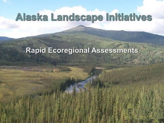
Miners REA presentation
- 2. Unprecedented and widespread environmental and human influences are shaping ecological conditions across public lands. Rapid Ecoregional Assessment The Issue……..
- 3. Wildfire Weeds and insect infestations Energy development Urban growth Climate change Rapid Ecoregional Assessment • • • • •
- 6. Rapid Ecoregional Assessment In 2010 BLM initiated a number of REAs to improve the understanding of the existing condition of these landscapes, and how conditions may be altered by ongoing environmental changes and land use demands.
- 7. • determine ecological values, conditions, and trends within large, regionally connected areas that have similar environmental characteristics • “all” lands but “regional” resources • “rapid” because: • they synthesize existing information, rather than conduct research or collect new data • completed within 18-24 months Rapid Ecoregional Assessment What is an Rapid Ecoregional Assessment?
- 8. Rapid Ecoregional Assessments Monitoring for Adaptive Management Science Integration Field Implementation Ecoregional Direction Rapid Ecoregional Assessment Landscape Approach for managing public lands
- 9. • • • • • Help managers address problems. Provide information that will be integrated into future management action. Improve understanding for the conditions of the resources within the ecoregion. Provides solutions to management questions. Aid in identifying regional priority areas for conservation of native plant, wildlife, and fish communities and other ecosystem resources. Establish baseline information for long-term monitoring of regional ecological components. Aid in identifying areas within the ecoregions where development activities may be directed to minimize effects upon important native plant and animal communities and other ecosystem resources or services, Rapid Ecoregional Assessment • •
- 10. Management Questions (MQs) Conservation Elements (CEs) Change Agents (CAs) Rapid Ecoregional Assessment • • •
- 11. • Identify “regional” issues faced by land and other resource managers. • Provide a clear direction; they help focus the work effort to the problems at hand. • Help identify data needs and provide context to issues; there is no reason to collect non-relevant data. Rapid Ecoregional Assessment 1) Management Questions: Ecoregional assessments are driven and guided by management questions (MQs), which:
- 12. • • • • • 1. Which species makes up the largest share of subsistence harvests? 2. What is the socio economic profile for each community within the ecoregion? 3. Where are current and planed oil/gas activities and where do they overlap with CEs? 4. What habitats support terrestrial species of concern? 5. What suitable habitat for caribou would be available with climate change? 6. Where do CAs and CEs overlap? Rapid Ecoregional Assessment •
- 13. • Existing vegetation communities. • Current occupied habitats for identified species. • Areas that are comparatively ecologically intact and areas that are comparatively disturbed. • Regionally significant terrestrial vegetation and aquatic ecosystems • Regionally significant species and species assemblages. Rapid Ecoregional Assessment REAs geospatially describe the location of “Conservation Elements”:
- 17. Map their current distribution
- 19. Agreements Partner: Alaska Natural Heritage Program Directing Body: Assessment Management Team (AMT) Expert Review: Technical Team Rapid Ecoregional Assessment BLM Project Lead
- 20. • What do we want to develop, restore and conserve; where; at what scale; and with what trade-offs? • How should we organize ourselves, at every level of the organization, to accomplish this? • How should we engage our state, federal and NGO partners, at every level, to accomplish this? Rapid Ecoregional Assessment At the conclusion of these landscape assessments Three basic and interrelated questions we should be asking…..