

Empfohlen
Empfohlen
Weitere ähnliche Inhalte
Ähnlich wie Crowd-sourcing for Disaster Response Through OpenStreetMap
Ähnlich wie Crowd-sourcing for Disaster Response Through OpenStreetMap (20)
Mehr von Kate Chapman
Mehr von Kate Chapman (17)
Kürzlich hochgeladen
Kürzlich hochgeladen (20)
Crowd-sourcing for Disaster Response Through OpenStreetMap
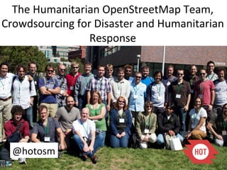
- 1. The Humanitarian OpenStreetMap Team, Crowdsourcing for Disaster and Humanitarian Response @hotosm
- 2. What is OpenStreetMap? A web project to create a free and open map of the entire world
- 3. History * Founded in the United Kingdom in 2004 by Steve Coast * Ordnance Survey Data was Expensive to Use * July 2005 the First Mapping Party Takes Place
- 4. Why do we need a free world map?
- 5. Why do we need a Humanitarian OpenStreetMap Team?
- 6. What is the Humanitarian OpenStreetMap Team? An organization working to promote the use of open data and volunteered geographic information within the humanitarian and development contexts
- 7. OSM and Crisis Response in Haiti Port-au-Prince Before 28 Days Later http://vimeo.com/ 9182869
- 9. High level imagery timely released under an “attribution only” license Google//GeoEye DigitalGlobe World Bank (ImageCAT GFDRR), SpotImage CIA Raw imagery processed into tiles to be made available in OSM editors (potlatch, merkator & josm) Hundreds traced 24/7 over base map features, humanitarian features (camps) & also damages Incentive for sharing restricted vector data sets Foster quality of field collection activities
- 10. Database import compatible with OSM license (CC-SA. OdbL). PREPAREDNESS : only public domain data from UNJLC/LogCluster deployment Sept/Oct 2008 Cyclone Response- Haiti REPONSE: Base map layers (MINUSTAH/ CNIGS), Health Facility (PAHO), Haiti damage assessment: ITHACA & UNOSAT….
- 11. Community 640 mappers 24/7 month Capacity building to other VCT through crisis camp; marginal
- 12. Coordination ** Advise using OSM ** Plan training/ surveys
- 13. Training-
- 14. Surveying
- 16. Training/ Surveys and Community Building Haiti - Gonaives
- 17. Support materials HOT Hardware kit, / OSM Kit / Guides/ Training
- 19. HOT/COSMHA & International Organization of Migration (IOM) WMS: http://haiti.dbsgeo.com/wms/
- 20. Hurricane shelter and exposure mapping
- 21. Baseline mapping and capacity building in Saint Marc
- 25. Tap Tap Map
- 26. Soley Leve
- 29. How to get data?
- 30. Helping Groups Already Mapping
- 33. Mapping 2 Villages in a week, with and without Imagery
- 36. With GPS
- 37. What sf Some the he Data Needs to be What if iome of of t data private needs to be private? CC-‐BY Ka^e Tegtmeyer
- 38. Each has a Unique Iden^fier
- 40. Other results we could not have guessed!
- 42. Con^nuing to Make the Technology Their Own
- 45. >?,)7&/,,&@#?*A,#&%/,*.&&/'0%&,* .&&/'0%&,*!"#$%#&'()*12#-,3*()*+,#$*4(/$3*5()3'&'()6*78(/,*(9*:;:*<,#)-*:8(//,8&:=* !"#$%#&'()*+,-%$&-* 7B#?,*8(<?#/'-()*
- 47. Na^onal Disaster Management Agency (BNPB) Regional Disaster Management Agency (BPBD) United Na^ons Office for Coordina^on of Humanitarian Affairs World Bank AusAID – Australia-‐Indonesia Facility for Disaster Reduc^on Humanitarian OpenStreetMap Team University of Indonesia
- 48. 267 Villages 3 Maps for Each Village Lots and lots of prinCng… Lots and lots of students
- 58. Impor^ng of Data and Tracing of Satellite Imagery for Somalia
- 59. Samoa Simula^on
- 60. Responders
- 61. Victory
- 62. Draft Workflow for Satellite Imagery and OSM Data Draft Imagery Release Process from USG Lead Federal Agencies to VTCs under the NEXTVIEW License ! EQ 8.4 in Sumatra @ 1336 GMT! USG requests satellite vendors for imagery VTC!Request!Schema! under NextView or! 1. Supported!Operation! license! 2. Geographic!Bounds! 3. Temporal!Bounds! Humanitarian 4. Reason!for!Use. What LFA requests that OpenStreetMap HOT create vectors for analytical problem needs to Team (HOT) DG and GeoEye post-EQ imagery and be solved?! requests imagery collect imagery of damage, IDs key AOIs ! 5. License!for!derived! from Broker! remand! affected AOI ! works. Will the data be a public or orivste good?! 6. Partners. Who will Broker ensures benefit?! request is valid ! 7. Objective: how will the data be used to do what! remand! Broker forwards NGA receives imagery request to LFA! VTC!Request!Evaluation! from DG and/or Criteria! GeoEye! 1. Goverment Interest. Is the request in the interest of the LFA evaluates USG?! requests against VTC 2. Gap. What information criteria! gap will be filled?! 3. Trust. Does the USG trust this VTC with data?! LFA forwards request remand! 4. Host nation. Does the to NGA! host nation have issues with