This document discusses how land use varies in urban areas. It begins by defining key terms like "land use" and "function". It then explains how land use can be predicted in cities based on models like the Burgess and Hoyt urban land use models. Specifically, it describes the typical land uses found in different areas of cities, including the central business district (CBD), old inner cities, industrial areas, inner and outer suburbs, and the rural-urban fringe. It provides details on the characteristics and problems associated with each of these urban land use zones. The purpose is to help students understand the variety of functions in urban areas and be able to analyze land use patterns in cities.
2. Syllabus
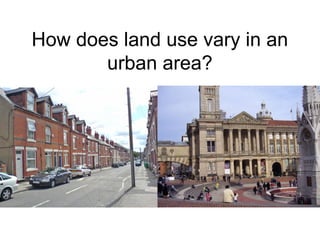
Key idea
Urban areas have a variety of functions and
land uses
Specification content
Students should gain an appreciation of
different functional parts of a settlement
including locations of CBD, inner city, suburbs
and rural-urban fringe.
4. Lesson Objectives
• All will understand what
we mean by the terms
land use and function.
• Most will understand
how urban areas have a
variety of functions.
• Some will be able to use
maps to predict the
characteristics and
locations of some areas.
5. Key Terms
• What does the term “land
use” mean?
The types of buildings or
other features that are
found in an area, e.g.
terraced housing, banks,
industrial estates, roads,
parks.
• What does the term
“function” mean?
The purpose of an area, e.g.
for residential use,
recreation or shopping.
6. Predicting how land use changes
in an urban area
• In every town and city land use varies from
one area to the next. In some areas, shops
and offices dominate, others are used for
housing, industry or recreation.
• In Britain, we can predict what land use will
be found in different areas of cities just by
looking at a map. This is because cities such as
Birmingham or Manchester have often grown
in a very similar way.
7. Urban land use models
A model is a simplified
version of reality.
These diagrams show the
land use patterns that you
might expect to find in a
city in an MEDC.
The land use of a real city
would never exactly
correspond to the patterns
suggested by Burgess and
Hoyt - why not?
8. CBD characteristics
• Centre of city - most accessible part
• Road and rail routes converge
• Prime site for several types of land
use
• Very competitive – high land values
• Limited space
• Tall buildings
Users:
• Commercial centre
• large department stores and
specialist shops which have a high
turnover, high profit margin or
large threshold population
• banks, offices
• Little residential
Problems:
• Congestion – which reduces
accessibility and attractiveness to
shop or work
10. Old inner city areas
• Most inner city areas developed
along with industry in 19th
Century
• Rural urban migration led to demand
for low cost housing
• Housing built as close as possible
together – high density, grid iron
• Poorer quality housing
• 1960s tower blocks, old industrial
buildings
• Few amenities – indoor toilet,
bathroom, running water, sewerage
or electricity, gardens or open space
• Problems: damp, overcrowding, lack
of sanitation, pollution
• Run down
• Some newer housing and industry
where derelict land has been cleared
and redeveloped e.g. London
Docklands.
11. Industry
• Large factories were
build on the nearest
available land to the
town centre
• Next to canals
• And railways – transport
bulky raw materials and
processed goods
• Besides rivers – source
of power, washing,
cooling, waste disposal
• Near land that could be
used to house the large
umbers of workers
• Factories forced to
close due to:
• Lack of space for
expansion /
modernisation
• Narrow congested roads
• Some have been left
empty
• Some bulldozed to leave
large areas of derelict
land – brownfield site
13. Attempts to improve
living conditions:
1960s – slum clearance
and building high rise
flats (urban
redevelopment)
Improving existing
properties – urban
renewal
Highgate
14. Inner Suburbs
• Developed during the
inter-war period.
• Grew due to the
introduction of public
transport and use of
car.
• Outward growth = urban
sprawl.
• Many interwar houses
were semi-detached,
with bay windows, front
and back gardens
15. Outer suburbs
• Private housing estates are
characterised by low
density, high quality housing
• Large, detached
• Land is cheaper
• Close enough for people to
commute to city centre
• Modern amenities – central
heating, double glazing,
bathrooms, kitchen
• Large gardens to both rear
and front of property
• Double garage
• Middle class
• More pleasant, greener
environment, less crime or
pollution
16. Rural –Urban fringe
• After 1960s urban
sprawl continued
with land on rural-
urban fringe being
used for:
• Modern housing
estates or outer-city
council housing
• New industrial or
trading estates.
17. Your task
• Look at the O.S map of Birmingham and
the photos on your handout. Complete
the activities on the sheet.
18.
19. Homework
Draw a simple sketch map of Birmingham to show the
different land uses in different areas (retail,
residential, industrial, etc)
20. Lesson Objectives
• All will understand what
we mean by the terms
land use and function.
• Most will understand
how urban areas have a
variety of functions.
• Some will be able to use
maps to predict the
characteristics and
locations of some areas.
21. Plenary - In which area of a city are you
most likely to…
• Get your car stolen?
• See a fox at night?
• See a Porsche car parked?
• Have a school with good exam grades?
• Have people complaining about noise from their
neighbours?
• See empty McDonalds wrappers?
• Be able to buy milk at 10.30 at night?
• Be able to catch a bus to visit friends anywhere in
the city?
• See a police car with it's blue lights flashing?
• Be able to buy drugs?