Wikimaps nordic kickoff Helsinki 28 February 2014
•
3 gefällt mir•7,109 views

The document summarizes a Wikimaps Nordic kickoff event held in Helsinki, Finland. It discusses the participatory commons project and how GLAM institutions could collaborate with Wikimedia to georeference and enrich map collections. Attendees provided feedback on desired Wikimaps functionalities and how their organizations could participate through uploading content, organizing events, or providing expertise. The document outlines potential task groups and working methods for the collaborative project going forward.

Empfohlen
Empfohlen
Weitere ähnliche Inhalte
Was ist angesagt?
Was ist angesagt? (20)
Ähnlich wie Wikimaps nordic kickoff Helsinki 28 February 2014
Ähnlich wie Wikimaps nordic kickoff Helsinki 28 February 2014 (20)
Kürzlich hochgeladen
Kürzlich hochgeladen (20)
Wikimaps nordic kickoff Helsinki 28 February 2014
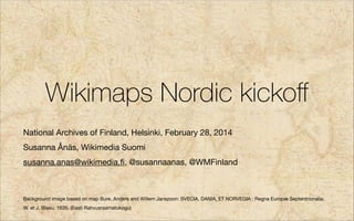
- 1. Wikimaps Nordic kickoff National Archives of Finland, Helsinki, February 28, 2014 Susanna Ånäs, Wikimedia Suomi susanna.anas@wikimedia.fi, @susannaanas, @WMFinland ! ! Background image based on map Bure, Anders and Willem Janszoon: SVECIA, DANIA, ET NORVEGIA : Regna Europæ Septentrionalia. W. et J. Blaeu, 1635. (Eesti Rahvusraamatukogu)
- 8. How it could work
- 19. Wikimaps Nordic Wikimedia chapters GLAMs How to make use of Wikimaps? Wikimedia Norge Wikimedia Suomi Tinkering and hacking! Developing the tools! Activities with the public! Wikimedia Sverige Wikimedia Eesti Collaborative projects with the partners! Wikimedia Danmark
- 20. Survey questions to GLAM participants
- 21. What functionalities would you expect Wikimaps to offer? Making georeferenced maps or aerial images with help from the users Connecting maps to time, places, photographs, information by the users A platform for serving old maps / a place to find old maps Creating digital maps from scanned maps with help from the users Enriching the maps with more information from the users A place for creating maps from different information sources 9 8 7 6 5 4 3 2 1 0
- 22. What activities would you like the Wikimaps Nordic project to include? Cooperation in opening map collections. Strategic support. Collaborative projects with other Nordic GLAMs. Documentation and recommendations for open maps. Peer advice. Local events with the public Other 8 6 4 2 0
- 23. How would you be able to participate?
- 24. Opening content / staff time for organizing the content DIGISAM, SWEDISH OPENSTREETMAP OPENSTREETMAP NATIONAL LAND NATIONAL ARCHIVES IN FINLAND ESTONIA SURVEY OF FINLAND A LIBRARY IN LINKED DATA SWEDISH NATIONAL NATIONAL LIBRARY ESTONIA FINLAND HERITAGE BOARD OF FINLAND BRAGES A NORWEGIAN PRESSARKIV ORGANIZATION FORENINGEN HISTORISK ATLAS HELSINKI WALKS AN ORGANIZATION IN NATIONAL ARCHIVES HELSINKI OF FINLAND NATIONAL BOARD OF NATIONAL MUSEUM ANTIQUITIES OF DENMARK
- 25. Organizing events / staff time / resources / space DIGISAM, SWEDISH OPENSTREETMAP OPENSTREETMAP NATIONAL LAND NATIONAL ARCHIVES IN FINLAND ESTONIA SURVEY OF FINLAND A LIBRARY IN LINKED DATA SWEDISH NATIONAL NATIONAL LIBRARY ESTONIA FINLAND HERITAGE BOARD OF FINLAND BRAGES A NORWEGIAN PRESSARKIV ORGANIZATION FORENINGEN HISTORISK ATLAS HELSINKI WALKS AN ORGANIZATION IN NATIONAL ARCHIVES HELSINKI OF FINLAND NATIONAL BOARD OF NATIONAL MUSEUM ANTIQUITIES OF DENMARK
- 26. Offering expert advice / expert staff time DIGISAM, SWEDISH OPENSTREETMAP OPENSTREETMAP NATIONAL LAND NATIONAL ARCHIVES IN FINLAND ESTONIA SURVEY OF FINLAND A LIBRARY IN LINKED DATA SWEDISH NATIONAL NATIONAL LIBRARY ESTONIA FINLAND HERITAGE BOARD OF FINLAND BRAGES A NORWEGIAN PRESSARKIV ORGANIZATION FORENINGEN HISTORISK ATLAS HELSINKI WALKS AN ORGANIZATION IN NATIONAL ARCHIVES HELSINKI OF FINLAND NATIONAL BOARD OF NATIONAL MUSEUM ANTIQUITIES OF DENMARK
- 27. How do you expect Wikimaps to benefit your organization?
- 28. How do you expect Wikimaps to benefit your organization? Our task is to make more cultural heritage material accessible and used digitally, anything supporting this goal is a good thing for us. More Open Data is more business opportunities ;-) No idea :) But I'm sure it could benefit our community, education of our children etc. Help to publish the old aerial imagery It would bring more users to the maplibrary Expose our collections to new customers. Promotes research and education. Justifies our digitization efforts. We have lots of projects concerning open data. Wikimaps could be beneficial to these ongoing and upcoming projects. By creating an open data application for georeferencing map collections - by crowd-sourcers Better support for geodata in wikipedia/wikidata. Bridging gap between OpenStreetmap, open geodata from the Norwegian mapping authority (Kartverket), better support for/better understanding of how to integrate georeferenced photos and maps. People, perhaps earlier uninterested, groups would find new interest on local history (Helsinki). Digitization of maps Open access to digital maps Crowdsourced metadata around our maps. A stronger focus on "all things geo"
- 29. Ways of working
- 30. Every First Tuesday of the Month l work Loca Wikimaps Nordic rojects tent p Con 15:00 CET pment develo re al co- tructu rnation Infras Inte Designers & Developers 17:00 CET
- 33. Opening map collections to Wikimedia Commons
- 34. Batch upload
- 35. Metadata
- 37. iD for old maps
- 38. Wikimaps blog & site
- 39. Wikimaps Warper
- 40. Map search
- 41. Historical gazetteers & changing administrative borders Academic collaboration
- 42. The Pan-Nordic map project
- 43. The Baltic Sea Lapland The First World War Napoleonic Wars
- 44. Wiki Loves Maps Planning the hackathon
- 45. The aerial images case study
- 46. Maps & stories
- 47. Acknowledgements Jan Ainali, Tim Alder, Michael Andersen, Ole Andersen, John Andersson, Johanna Berg, Erlend Bjørtvedt, Jerry Clough, André Costa, Maarten Dammers, Vladimir Elistratov, Tom Elliott, Dan Entous, David Evans, Katie Filbert, Barbara Fischer, Arun Ganesh, Quim Gil, Mark Graham, Andrew Gray, Karl Grossner, Harald Groven, Muki Haklay, Sumana Harihareswara, David Haskiya, Tuukka Hastrup, Dan Michael Olsen Heggø, Chris Helenius, Outi Hermans, Vesa Hongisto, Eero Hyvönen, Leif Isaksen, Lesley Kadish, Kati Katajisto, Tomi Kauppinen, Esa-Pekka Keskitalo, István Kecskeméti, Laura Kolbe, Hay Kranen, Shekhar Krishnan, Tiina Kruup, Heli Laaksonen, Jaak Laineste, Lauri Leht, Jyrki Lehtinen, Hugo Lopez, Lars Lundqvist, Mikel Maron, Jeff Meyer, Arend Oudman, Jessica Parlandvon Essen, Vahur Puik, Pekka Sarkola, Humphrey Southall, Jon Harald Søby, Henrik Sørensen, Jarosław Tuszyński, Erik Uus, Raul Veede, Juha Vilhomaa, Denny Vrandečić, Jacob Wang, Rob Warren, Tim Waters, Kathy Weimer and many more
- 48. More info, contact http://wikimaps.wikimedia.fi http://commons.wikimedia.org/wiki/Commons:Wikimaps https://www.facebook.com/groups/wikimaps/ Susanna Ånäs, Wikimedia Suomi susanna.anas@wikimedia.fi, @susannaanas, @WMFinland
- 49. More info, contact http://wikimaps.wikimedia.fi http://commons.wikimedia.org/wiki/Commons:Wikimaps https://www.facebook.com/groups/wikimaps/ Susanna Ånäs, Wikimedia Suomi susanna.anas@wikimedia.fi, @susannaanas, @WMFinland