
Empfohlen
Empfohlen
Weitere ähnliche Inhalte
Was ist angesagt?
Was ist angesagt? (20)
Ähnlich wie Environmental Site Design
Ähnlich wie Environmental Site Design (20)
Environmental Site Design
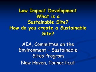
- 1. Low Impact Development What is a Sustainable Site? How do you create a Sustainable Site? AIA, Committee on the Environment – Sustainable Sites Program New Haven, Connecticut
- 2. Presenter Background Nationally recognized expert in Low Impact Development (Regulations and Applications) Licensed Professional Engineer (CT) Holds IECA certifications as CPESC & CPSWQ Over 27 years in the Land Development Field and 10 years working with Low Impact Development 9/8/2010 Copyright Trinkaus Engineering
- 3. What are problems with current development philosophy? Developments not respecting the natural land form, forcing the site to “fit” the development program Excessive land clearing, Massive amounts of earthwork, Significant erosion & sedimentation issues, Difficulty stabilizing the site, 9/8/2010 Copyright Trinkaus Engineering
- 4. What are problems with current development philosophy? Stormwater Issues Large, interconnected impervious areas, Handling of stormwater is an “afterthought” in the design process, Excessive use of structural systems, Analyze for changes in peak rate only, Emphasis on large, infrequent storm events, No consideration of water quality impacts 9/8/2010 Copyright Trinkaus Engineering
- 5. What constitutes a Sustainable Site? Preservation of Natural Resources Development which respects the Natural Land Form Minimize site clearing & grading Rainfall is a resource to be embraced and reused Stormwater management is an integral part of the site design 9/8/2010 Copyright Trinkaus Engineering
- 6. What constitutes a Sustainable Site? Focus of stormwater management: Groundwater Recharge (Volumetric Reduction) Water Quality (Remove Pollutants from the stormwater) Source Control (Treat runoff where it is first generated) Implement “Treatment Train” approach to stormwater 9/8/2010 Copyright Trinkaus Engineering
- 7. How do we create a Sustainable Site? Implement Low Impact Development Design Strategies 9/8/2010 Copyright Trinkaus Engineering
- 8. What is Low Impact Development? LID is an ecologically friendly approach to site development and storm water management that aims to mitigate development impacts to land, water, and air. The approach emphasizes the integration of site design and planning techniques that conserve natural systems and hydrologic functions on a site. 9/8/2010 Copyright Trinkaus Engineering
- 9. How does Low Impact Development work? To manage rainfall at the source using uniformly distributed decentralized micro-scale controls. LID’s goal is to mimic a site’s predevelopment hydrology by using design techniques that infiltrate, filter, store, evaporate, and detain runoff close to its source HYDROLOGIC TRANSPARENCY 9/8/2010 Copyright Trinkaus Engineering
- 10. What is Hydrologic Transparency? The use of LID design strategies and storm water treatment systems for a development scenario which yields hydrologic conditions matching or in extremely close proximity to the hydrologic conditions of the natural site prior to development. 9/8/2010 Copyright Trinkaus Engineering
- 11. Low Impact Development Five Basic Tools Encourage Conservation Measures Reduce Impervious Areas Slow Runoff by using landscape features Use Multiple measures to reduce and cleanse runoff Pollution Prevention 9/8/2010 Copyright Trinkaus Engineering
- 12. Regulatory Requirements (sample site) Open Space Subdivision Total Site Area = 104.50 acres 15% site area (roads) = -15.67 acres Utility Easement = -5.12 acres 50% of Wetlands = -10.83 acres 50% of 25% slopes = -6.12 acres NET AREA = 66.76 acres Allowable Density = 66.76/1.9513 = 34.2 lots (85,000 sq.ft. = 1.9513 acres) 9/8/2010 Copyright Trinkaus Engineering
- 13. A Typical Layout Is this realistic? 9/8/2010 Copyright Trinkaus Engineering
- 14. What is Environmental Site Design? Environmental Site Design (ESD) is considered part of Low Impact Development Design Tools It was development in Maryland to complement the 2000 Stormwater Management Design Manual for the State of Maryland The ESD approach is to design a site which protects the natural resources on a site and maintains the hydrologic characteristics of the site. 9/8/2010 Copyright Trinkaus Engineering
- 15. Environmental Site Design The largest benefit of LID can be achieved by implementing Environmental Site Design Concepts Preservation of critical natural resources Places development on land most suitable for development Helps match pre-development hydrology 9/8/2010 Copyright Trinkaus Engineering
- 16. ESD Site Assessment – Primary Conservation Areas Inland Wetlands & Watercourses Vernal Pools Steep Slopes (>25%) 100-year Floodway and Floodplain Upland Soil Types with Moderate to High infiltration rates (Class A & B Soils) 9/8/2010 Copyright Trinkaus Engineering
- 17. ESD Site Assessment – Secondary Conservation Areas Upland areas adjacent to wetlands, watercourses, & vernal pools (variable distance – suggested min. 25- 50’) Habitat for sensitive species Scenic views and areas Vegetation systems, unusual tree species Existing drainage patterns 9/8/2010 Copyright Trinkaus Engineering
- 18. Why should we protect these resources? Undisturbed woodlands provide great filtering of overland flow, reduces runoff by rainfall interception by canopy, provides evapotranspiration, carbon storage Wetlands provide trapping of TSS, and attenuation of nutrients – provide denitrification of Nitrogen, recharge groundwater 9/8/2010 Copyright Trinkaus Engineering
- 19. Why should we protect these resources? Restricting construction on Steep Slopes reduces soil disturbance, reduces or eliminates erosion & sedimentation issues, does not create stabilization issues Well Drained soils have the ability to infiltrate large amounts of runoff – dense development on them should be minimized 9/8/2010 Copyright Trinkaus Engineering
- 20. Why should we protect these resources? Significant trees and unusual portions of the site topography all provide natural (habitat) and aesthetic benefits to the end users and should be preserved 9/8/2010 Copyright Trinkaus Engineering
- 21. ESD Site Assessment Process Obtain Accurate Topographic information Obtain delineation of inland wetlands & watercourses by soil scientist Determine presence of vernal pools or other sensitive environmental areas (swamps, marshes, ponds, flood prone areas, etc.) 9/8/2010 Copyright Trinkaus Engineering
- 22. ESD Site Assessment Process Determination of upland soil types in the field by soil scientist Determine the general infiltration rates of the soils (NRCS data) Define steep slopes (>25%) 9/8/2010 Copyright Trinkaus Engineering
- 23. ESD Site Assessment Process Determine generalized types of vegetation (meadows, brush, deciduous woods, evergreen woods, etc) Determine existing drainage patterns on the site 9/8/2010 Copyright Trinkaus Engineering
- 24. Site Analysis Process Remove wetland/watercourse/vernal pools from potential development area Remove the upland area immediately adjacent to wetland/watercourse systems to preserve the biological integrity (width of area will vary, suggested 25 - 50’, could be larger depending upon quality of wetland) 9/8/2010 Copyright Trinkaus Engineering
- 25. Wetlands, Soils & Watershed Boundaries 9/8/2010 Copyright Trinkaus Engineering
- 26. Site Analysis Process Remove 25% slopes from development area Highlight those soil areas with moderate to fast infiltration rates (Soil Class A and B) Highlight unusual vegetative features on the site (i.e. 200 yr old Oak tree in the middle of a field, Ridge line, unusual scenic vista) 9/8/2010 Copyright Trinkaus Engineering
- 27. Slopes and Vegetation 9/8/2010 Copyright Trinkaus Engineering
- 28. Results of Site Analysis Through the protection of the environmentally sensitive features noted previously, you will have determined the optimum area for development NEXT STEP Evaluate hydrologic patterns and think about how storm water will be handled on the site as part of the site design 9/8/2010 Copyright Trinkaus Engineering
- 29. Developable Area 9/8/2010 Copyright Trinkaus Engineering
- 30. LID Design Strategies Applied Preserve Large Portions of Site Reduce Connected Impervious Areas Increase Time of Concentration by using landscape features Use Multiple measures to reduce and cleanse runoff at the source Remove Pollutants from Storm Water 9/8/2010 Copyright Trinkaus Engineering
- 31. LID Techniques Apply Open Space or Cluster Development to preserve large contiguous portions of the site Layout the geometry of the road to follow the existing contours How you will convey stormwater to the discharge point? How will you meet Groundwater Recharge & Water Quality requirements? What treatment systems are available to meet these requirements that will work on the site? 9/8/2010 Copyright Trinkaus Engineering
- 32. Road & Lot Layout Road layout follows ex. contours, lots are located within “developable area” Large extents of property Density is protected as Open Space concentrated on Class 24 Lots – 64+ acres of C soils, minimal preserved Open Space density on Class B soils 9/8/2010 Copyright Trinkaus Engineering
- 33. Stormwater Discharge Points Intermittent stream Stormwater discharge points to maintain pre- 24 Lots – 64+ acres of development drainage preserved Open Space patterns Intermittent stream 9/8/2010 Copyright Trinkaus Engineering
- 34. Stormwater Conveyance Conventional curb & gutter Vegetated swales along both sides of road 24 Lots – 64+ acres of preserved Open Space 9/8/2010 Copyright Trinkaus Engineering
- 35. LID Techniques Minimize direct impacts to wetlands & watercourses Can you disconnect proposed impervious areas on the site? Layout building lots to have construction (House, driveway, well, sewage disposal system) on land most suitable for development Implement “Site Fingerprinting” to minimize land clearing & soil disturbance Minimize soil compaction by limiting the area of grading. Consider specifying measures to address soil compaction, if unavoidable 9/8/2010 Copyright Trinkaus Engineering
- 36. Site Layout – LID Source Controls Impervious area disconnection – driveway runoff as overland flow across 75’ of vegetated surface Site Fingerprinting – defined clearing area as percentage of lot area 24 Lots – 64+ acres of Meadow filter strip with Bioretention systems for preserved Open Space Micro-berm at edge of roof drains development envelope 9/8/2010 Copyright Trinkaus Engineering
- 37. Hydrologic Issues Groundwater Recharge Bioretention for roof drains Infiltration Trenches Impervious Area Disconnection Water Quality Constructed Wetland Subsurface Gravel Wetlands Vegetated swales & Level Spreader 9/8/2010 Copyright Trinkaus Engineering
- 38. LID Treatment Systems Constructed Wetland System w/forebay & vegetated outlet swale to wetland Linear vegetated level spreader Subsurface flow gravel wetland w/forebay & vegetated outlet swale to 24 Lots – 64+ acres of wetland preserved Open Space Infiltration trenches for driveway runoff 9/8/2010 Copyright Trinkaus Engineering
- 39. LID Treatment Systems 9/8/2010 Copyright Trinkaus Engineering
- 40. What Does the Project Look Like? Ridge top is part of 60% of the site preserved Open Space in center as Open Space of loop road 9/8/2010 Copyright Trinkaus Engineering
- 41. What Does the Project Look Like? When you consider the woods which remain on the lots, over 76% of the site remains undisturbed 9/8/2010 Copyright Trinkaus Engineering
- 42. Actual Design Meadow filter strip Rain Garden for roof drains Defined tree clearing limits (site fingerprinting) 9/8/2010 Copyright Trinkaus Engineering
- 43. Actual Design Storm Water Controls for lots: Utilize “site fingerprinting” to minimize the extent of clearing on each lot Utilize rain gardens for roof drains on every lot (sized for Water Quality Volume) Utilize a “meadow” filter strip with a 3” ‘micro-berm’ below the lawn area on each lot to filter overland runoff & encourage infiltration 9/8/2010 Copyright Trinkaus Engineering
- 44. Actual Design Limit development to mild & moderate slope areas Preserve steep slopes 9/8/2010 Copyright Trinkaus Engineering
- 45. Hydrologic Issues Conclusion Pre-development infiltration rates are met Water quality goal of 80% TSS removal will be met, other pollutants also reduced Pre-development Tc is closely approximated by the use of vegetated swales and treatment systems that will increase Tc (gravel wetlands, level spreader) Pre-development peak rates are matched for post-development conditions 9/8/2010 Copyright Trinkaus Engineering
- 46. Other Sustainable Benefits of ESD A resource for reductions of atmospheric carbon dioxide A resource for the long term storage of carbon 9/8/2010 Copyright Trinkaus Engineering
- 47. The Carbon Cycle 9/8/2010 Copyright Trinkaus Engineering
- 48. Mixed Northern Hardwood Forests 9/8/2010 Copyright Trinkaus Engineering
- 49. Where is Carbon stored? Forest – all above & below ground portions of live trees Soils – mineral horizons to a depth of 1 meter Forest Floor – all dead organic matter above mineral/sod horizons, including litter humus & coarse woody debris Understory Vegetation – all live vegetation which are not tree (shrubs, herbaceous species) 9/8/2010 Copyright Trinkaus Engineering
- 50. Well Established Forest w/understory layers 9/8/2010 Copyright Trinkaus Engineering
- 51. Carbon Dioxide Storage in Trees Green WT above gnd: Wg=(0.25)(D)(D)H Green WT (total w/roots): Wgt=120%*Wg Dry WT: Wd=72.5%*Wgt Weight of Carbon Stored: Wc=Wd * 50% Weight of Carbon Dioxide stored: Wco=Wd*3.6663 Weight of Carbon Dioxide stored per year: W = Wco/20 9/8/2010 Copyright Trinkaus Engineering
- 52. Example: 20yr old tree, 10” DBH, 30’ height Green WT above gnd: Wg=(0.25)(10)(10)30 = 750 lb Green WT (total w/roots): Wgt=1.20 * 750 = 900 lb Dry WT: Wd=0.725 * 900 = 625.5 lb Weight of Carbon: Wc=625.5 *0.5 = 312.75 lb Weight of Carbon Dioxide: Wco=312.75*3.6663 = 1146.6 lb Weight of Carbon Dioxide/year: W = 1146.6/20 = 57.3 lbs/yr 9/8/2010 Copyright Trinkaus Engineering
- 53. Actual Site Conditions In NE U.S. – Mixed Northern Hardwoods have an average density of 100 trees/acre 100 * 57.33 lb = 5,733 lbs of carbon dioxide sequestered per acre/yr. 64 acres * 5,733 = 366,912 lbs per site area Assume trees grow to 100 years, then a total of 29,352,960 lbs (14,676 tons) of carbon dioxide will be sequestered from this site in the trees within the Open Space 9/8/2010 Copyright Trinkaus Engineering
- 54. Carbon Storage in the Soils Both Organic and Inorganic carbon will be stored in the soils Undisturbed soils will store more carbon than disturbed soils NE soils will store 144,703 lbs/acre of carbon over the typical lifecycle of a mixed hardwood forest 9/8/2010 Copyright Trinkaus Engineering
- 55. Actual Site Conditions 64 acres * 144,703 lb/ac = 9,260,992 lbs (4,630.5 tons) Between storage in trees and soils, the open space on this parcel will store 19,306 tons of carbon over the lifecycle of the forest (100 years) 9/8/2010 Copyright Trinkaus Engineering
- 56. Vegetated LID Treatment Systems Bioretention systems, constructed wetlands, and vegetated swales will provide additional sources to sequester carbon Plants have large stem or leaf areas, having high rates of photosynthesis (retaining carbon in the plant material) Plants are fast growing, thus having high need for carbon (high capacity for sequestering) 9/8/2010 Copyright Trinkaus Engineering
- 57. LID Vegetated Systems 9/8/2010 Copyright Trinkaus Engineering
- 58. Conclusion Preservation of large extents of undisturbed woodlands and native soils will continue to provide valuable resources for sequestering of carbon in the environment The utilization of vegetated LID treatment systems provide additional sources for the storage of carbon 9/8/2010 Copyright Trinkaus Engineering
- 59. Contact Information Steve Trinkaus, PE, CPESC, CPSWQ Trinkaus Engineering, LLC 114 Hunters Ridge Road Southbury, CT 06488 203-264-4558, Fax: 203-264-4559 Email: strinkaus@earthlink.net Website: http://www.trinkausengineering.com 9/8/2010 Copyright Trinkaus Engineering
- 60. QUESTIONS?? 9/8/2010 Copyright Trinkaus Engineering