SlideShare ist ein Scribd-Unternehmen logo
1 von 71
Overview of Watershed Assessment and Modeling Data
(A i WMT i f ti )(Accessing WMT information)
Hala Flores PE Richard FisherHala Flores, P.E Richard Fisher
Rapid Stream Assessment Protocolsp
Janis Markusic Christopher Victoria
Overview of SPSC Design Guidelines and Calculator
Hala Flores, P.E
HBAM Meetingeet g
February 28th, 2011
Ron Bowen, P.E.
Anne Arundel County Stormwater Management Practices
and Procedures Manual
__________________________________________________
Chapter 11 Appendices 11.6
11 3 Li k t i d /i f ti
11 3 8 D t t f P bli W k t h d
11.3. Links to required resources/information
11.3.8. Department of Public Works watershed
management tool
htt // i ld t / /http://gis-world.aacounty.org/wers/
Anne Arundel County
Watershed Management ToolWatershed Management Tool
(WMT)(WMT)
Stream AssessmentStream Assessment
-- Physical HabitatPhysical Habitat
-- Biological ConditionsBiological Conditions
-- MorphologyMorphology
-- Problem Area InventoryProblem Area Inventory
Erosion,Erosion, HeadcutHeadcut, Dumpsites, Deficient, Dumpsites, Deficient
Buffers, Infrastructure Impacts.Buffers, Infrastructure Impacts.
-- Stream Crossings (H&H)Stream Crossings (H&H)Stream Crossings (H&H)Stream Crossings (H&H)
-- Landscape (Imperviousness)Landscape (Imperviousness)
2 000 estimated2 000 estimated milesmiles
Anne Arundel County
2,000 estimated2,000 estimated milesmiles
ofof nonnon--tidal waterwaystidal waterways
P i l (S d W l d )Perennial (Streams and Wetlands)
Ephemeral and Intermittent
Pond/Lake/Floodway
Other
BIOLOGICAL CONDITIONS
B hi I d f Bi iBenthic Index for Biotic
Integrity (BIBI) Score
Number of Samples - 376p
- 5%
- 23%Fair
Good
23%
- 49%
Fair
Poor
- 23%Very Poor
DEGRADED MORPHOLOGY
Example of F and G channels – Highly Instablep g y
Erosion  ‐‐ Patuxent River Watershed Headcut  ‐‐ South River Watershed
Stream Reach Priority 
for Restoration
Overall Rating
Best Condition
Worst Condition
Anne Arundel County
Watershed Management Tool (WMT)Watershed Management Tool (WMT)
Restoration Indicators Preservation Indicators
Analysis and ModelingAnalysis and Modeling
--HydrologyHydrology(Runoff and Discharge)(Runoff and Discharge) -- Pollutant Load AnalysisPollutant Load Analysis
-- Landscape AnalysisLandscape Analysis
Subwatershed 
Priority y
for Restoration
Overall Rating
Best Condition
Worst Condition
Subwatershed 
Priority fory
Preservation
Lowest Priority for Preservation
Highest Priority for Preservation
WERS Mapping Application Tour
Stream Assessment Protocol: an
overviewoverview
Anne Arundel County
Department of Public WorksDepartment of Public Works
Bureau of Engineering
Watershed, Ecosystem, and Restoration Services
Ecological Assessment ProgramEcological Assessment Program
Introduction
• Regulatory Triggers
G l W h d Ch i i• General Watershed Characterization
– Land Use and Imperviousness
– Drainage Area and Bankfull Indicator Determination
G l St Ch t i ti• General Stream Characterization
– Rosgen Level II Classification (pebble count, slope determination,
valley type, etc.)
• Lateral Stability DeterminationLateral Stability Determination
– BEHI and NBS Evaluation
– Bank armoring and localized versus widespread issues
• Vertical Stability DeterminationVertical Stability Determination
– Incision Ratio
– Headcuts, control points, depositional features
• Overall Reach Stability Determinationy
– Includes a variety of trend and reach-level evaluations
Regulatory TriggersRegulatory Triggers
• The use of the Stream Assessment Protocol is triggered by a finding of an
“i d f ll” i h f d i i if O b k Fl d“inadequate outfall” in the context of determining if Overbank Flood
Protection is required due to the impact of a given development site.
• Once such an “inadequate outfall” finding is made, a downstream analysis
iis necessary.
• This method is applied only to a “…clearly defined open channel…”
(Section 7.2.2.D.II; Chapter 7, p. 7.4)
• The assessment reach comprises the channel from “…the outfall(s) from
the site and progress[es] to the Point(s) of Investigation (POI).” (Section
7.2, Chapter 7, p. 7.2)
• See the Procedures and Practices Manual for details on what constitutes an
adequate or inadequate outfall and on how to establish the POI.
This is a field-based assessment! You must leave the office to apply it correctly!
Watershed
Characterization
Standard Header Items
•Watershed Date DrainageWatershed, Date, Drainage
Area, etc.
Watershed Characterization
•Should be mostly an office
exercise
•Land use and land cover are
the primary items to
determine, both in the basin,
and adjacent to the reach of
interest
•DA calculation needed for
bankfull determinationbankfull determination
•Significant land uses that
may impact stream stability
conditions
Stream
Characterization and
Classification
•Rosgen Level II
Classification is basicClassification is basic
characterization
•Not discussed in detail here
•All standard work, all
found in Rosgen (1996):
Width, depth, slope, D50,
sinuosity, W/D ratio,
entrenchment, etc.
•Bankfull channel dimensions
using known regional
relationships developed by
others are necessary forothers are necessary for
Rosgen classification
You can find
these
relationships
within thewithin the
document or in
other
references…
…and they are easily used in a spreadsheet to
h h l h i icompute these channel characteristics.
Lateral Stability
DeterminationDetermination
•Lateral stability. What is it?
Side to side movement of stream
channel which is a function ofchannel, which is a function of
two major influences:
•A streambank’s characteristics
that make it resistant to erosion
•The work done on the bank of
interest related to the hydraulic
characteristics of the overall
channel (Near Bank Stress) Done on dominant bank( )
•How are these two opposing
forces evaluated? Using
Rosgen’s BEHI and NBS ratings
Done on dominant bank
within the assessment
reach.
If two bank types are
t d ll threpresented equally, the
higher BEHI and/or
NBS rating (i.e.—more
unstable) is used.)
BEHI
Forms
Near Bank Stress Field Key
Vertical Stabilityy
Determination
•Primary determination using
the Incision Ratiothe Incision Ratio
•Also used presence of the
following:
•Head Cuts
•Depositional Features
•Bed Control
•Taken together, these features
i i i h i i lgive insight into vertical
stability
Depositional Features
Head CutsHead Cuts
Grade Control
Overall Reach
Stabilityy
Determination
•Stream Sensitivity, Sediment Supply,
and Recovery Potentialy
•From Rosgen (1996)
•Evolution Stability Sequence
•Evolution Stability Trend
•Overall Reach StabilityOverall Reach Stability
Stream Evolution Scenarios (2 of
9 in SAP manual)
Final Steps
• Using weight of evidence, a finding of
either 1) localized or widespread
i bili 2) bl di i iinstability or 2) stable conditions is
made for the assessment reach
• Report is produced for the assessment
h h d ib h bilireach that describes the stability
conditions observed
• Photodocumentation is a required
f hiaspect of this report
Links
Guidance Documents:
• Stream Assessment Protocols:
http://www aacounty org/DPW/Watershed/DownstreamAdequacyProtocols cfmhttp://www.aacounty.org/DPW/Watershed/DownstreamAdequacyProtocols.cfm
• Stormwater Practices and Procedures Manual:
http://www.aacounty.org/PlanZone/Resources/Practices_Procedures_Manual.pdf
GIS/M i Li kGIS/Mapping Links:
• AA County Watershed Mapping Application:
http://gis-world.aacounty.org/wers/
• GIS Hydro:
http://www.gishydro.umd.edu/ Information Links
• US Fish and Wildlife CBFO:US Fish and Wildlife CBFO:
http://www.fws.gov/chesapeakebay/stream.html
• DNR Rosgen Spreadsheets:
http://www.dnr.state.oh.us/soilandwater/water/streammorphology/default/tabid/9188/Defaulhttp://www.dnr.state.oh.us/soilandwater/water/streammorphology/default/tabid/9188/Defaul
t.aspx
SPSC – What are they?
SPSC are open-channel conveyance structures that
convert, through attenuation pools and a sand
seepage filter s rface storm flo to shalloseepage filter, surface storm flow to shallow
groundwater flow.
Wetland Seepage System
Perennial Application
Step Pool Storm Conveyance
Ephemeral Application
Types of BMPs
Pipe
Conveyance
i i
Receiving
Stream
Micro Practice
(Off-line)
Pipe
Conveyance
Receiving
Stream
Macro Practice
(On-line)
A shift in Paradigm
Receiving
SPSC
Conveyance
SPSC Integrated System
Receiving
Stream
A, ??
STEP POOL STORM CONVEYANCE FOR EPHEMERAL OUTFALLS
B, 32% The physical characteristics of the SPSC channel
are best characterized by the Rosgen A or B stream
classification types, where “bedform occurs as a
step/pool, cascading channel which often stores
large amounts of sediment in the pools associated
with debris dams” (Rosgen, 1996).
WETLAND SEEPAGE RESTORATION TECHNIQUE FOR PERRENIAL STREAMS
DA, 28%
SPSC – Can be designed to provide:
- Safe 100-year Conveyance
- Attenuation
- Energy DissipationEnergy Dissipation
- Water Quality Treatment
Hard Engineering Solutions for conveyance
Not so hard!Not so hard!
Expensive restorations that don’t work and don’t provide water quality benefits
Harvesting the taming powers of the floodplain
Before Restoration – Rosgen G Channel
Any size floodplain bench is better
than a hardened wall
After Restoration – Rosgen B Channel
The larger and more accessible theThe larger and more accessible the
floodplain is, the more sustainable the
restoration
Hard Engineering Solutions for conveyance
Not so hard!
Conventional upland BMPs do not necessarily 
correlate with a stable downstream!
Stormwater detention ponds
are wet structures that are
often used to capture and
detain stormwater runoff
from residential and
Erosion and Headcut 
Inventory
o es de t a a d
commercial areas.
Impervious Area Draining to BMP
Less than 20%
20%< and >50%
More than 75%
50%< and >75%
Undesired Consequences of Peak Detention
Potential Effect of Cumulative Detention Basins on Downstream Conditions
• Longer duration of higher flows
• Cumulative effect will increase peak discharge downstream
g g
Stormwater Management Best Management Practices
(BMPs)( )
SPSC
Infiltration Conditional on underlying soil conditionsInfiltration Conditional on underlying soil conditions
Filtration Sized for 100% CreditS ed o 00% C ed t
Wetland Creation Seepage berm designWetland Creation Seepage berm design
Wet Ponds Function of Seepage berm
design
Extended Detention Outflow is discharged as shallow
groundwater seeps
Implementation of SPSC Systems
1- As an outfall or stream retrofit techniqueq
2- As mitigation for development2 As mitigation for development
Structural BMP
Or
P t f th ESD T iPart of the ESD Train
Functional Components of Step Pool
Storm Conveyance (SPSC)
Functional Components of Step Pool
Storm Conveyance (SPSC)
Design Water Surface
Riffle Boulder Pools
Riffle Cobble
Sand/Wood Chip
Footer Boulders
Pools = 0% Slope
Geotextile
Other Geometric Configurations (Wetland Seepage)Other Geometric Configurations (Wetland Seepage)
Mapping the SPSC Horizontal Alignment
Difference in Elevation = 40 ft
Straight Length = 100 ft           Slope = 40%
Difference in Elevation = 40 ft, Cascade Heights = 25 ft
Meandering Length = 220 ft           Overall Slope = 18%
Length at 5% slope = 100‐150 ft
Mapping the SPSC Vertical Alignment
In the event that the proposed SPSC connects to an incised downstream channel, the elevation of the floodplain p p , p
terrace shall be used as the downstream elevation.  An in‐stream weir design with a top of weir elevation set at the 
floodplain terrace is required at the tie‐in location.
Notes and Preliminary Assumptions:
Maximum slope = 5%
Minimum length of pool = 12 ft
Maximum length of riffle = 10 ft
Depth of filter media is minimum 18 inches below the lowest structure
L pool
L Riffle
Depth of pool is minimum 18 inches
Un‐armored Pool side slopes shall be laid back at 3H:1V 
Special attention to paid at the inflow and outflow tie in locations
Silica Cobbles
1 ft (typ.)
(12 ft min.)(10 ft max.)
Boulders
hf Typical
(18 in. min.)
In‐stream 
Boulders
In‐stream 100 – Year floodplain may 
inundate last SPSC structure
Sand/Wood Chip Mix
d ( ffl )d ( l) df (riffle)
Existing Ground
Filter Fabric
df (pool)
min 18 inches
Sand Mix “Sandbags from E&S 
phase maybe left in place”
Mapping the SPSC Vertical Alignment
‐ Cascade and Weir boulders maybe placed at a maximum (1V:1H) slope
‐ Cascades shall not be more than 5 ft in height at any single location
‐ Cascades shall be followed by three consecutive pools
Boulders
Cascade 
Max 10ft @ 50% Slope
Pool #1 Pool #2 Pool #3
Silica
Cobbles
Boulders
hf cascade
(per design)
hf (Typical)
hf (Typical)
Existing Ground
Filter Fabric
Sand/Wood Chip 
Cascade Profile – Three Pools following Cascade
Mix
g
Design the typical cross‐section for the riffle/cascade
Design Criteria:Design Criteria:
‐ Conveyance shall be designed to address the 100‐year Peak Discharge
1959,
2
3
2
22
2
Chow
DW
RadiusHydraulic
SolutionalMathematic
WD
Area
=
=
,
83 22
DW
y
+
Q =        (1.49/n) (A) (Rh)2/3 (S)1/2 Must be > or =  Q 100
W (8 ft min.)
D
Where:
Q        = 100 year ultimate flow (cfs)
1.49 = conversion factor
n = Manning’s n, determined by USDA, 2006 equation
A = cross‐section area of a riffle channel, which for a parabola = 2/3(W)(D),
Riffle Section through Boulder
2 x d50
n = D1/6/ (21.6 log (D/d50)+14),  (USDA, 2006).
A cross section area of a riffle channel, which for a parabola   2/3(W)(D), 
where W is top constructed width (ft) and D is the constructed depth (ft)
Rh = hydraulic radius (ft), calculated using Chow 1959 relationship for parabolas
S = average slope over entire length of project (ft/ft)
V =  velocity in the riffle channel (ft/sec), V = Q/A
Riffle Section through Cobble
( g ( ) ) ( )
Where:
n = Manning’s n, use 0.05 for cascades.
D = depth of water in the riffle channel associated with unmanaged 
100‐year Q design, ft., 
d50 = cobble size, ft 
Design the typical cross‐section for the riffle/cascade
Checking for Super Critical Flow:g p
gD
V
Fr =‐ Froude Number exceeding 1 indicates the flow is supercritical
‐ Froude Number = 1 indicates that the flow is critical
‐ Froude Number less than 1 indicates the flow is subcritical
To reduce the Froude number
1‐ Widen channel
2‐ Decrease Slope
Checking/Sizing the Riffle Cobbles
Use a trial D0 = 6 inches Actual Velocity  Must be < Maximum Allowable Velocity
( ) FormulaIsbashDgCVelocityAllowableMaximum
w
ws 5.0
0
5.0
2 ×⎟⎟
⎠
⎞
⎜⎜
⎝
⎛ −
×××=
γ
γγ
0 y y
Where:
C            = 0.86 for prevailing supercritical flow 
1.2 for prevailing subcritical flow
g             = 32.2 ft/sec2
γ stone density (lb/ft3)γs                  = stone density (lb/ft3)
Γw               = water density (lb/ft3)
D50             = cobble stone diameter (ft)
NRCS 2007
Designing the Rock Weir and pool
‐The Rock Weir shall be placed in a curvilinear manner to deflect the flow to the
center of the pool
A A’
Ineffective Flow 
Areas
Flow
B B’
Flow
Additional Stability Features at the Transition from Riffle Section 
to Pool Section
Additional Stability Features at the Transition from Riffle Section 
to Pool Sectionto Pool Sectionto Pool Section
The pretreatment, recharge, and water quality sizing criteria presented in the Anne Arundel
C SPSC id li f ll l l h S f M l d’ i i f i l
Designing the water quality sand filter system
County SPSC guidelines follow closely the State of Maryland’s criteria for a typical stormwater
filtering device.
2000, MDECriteriaSizingFiltering
dxWQ
A
fv
f = 2000,
)(
MDECriteriaSizingFiltering
tdhK
A
fff
f
+
2 x d
W (8 ft min.)
D
hf (18 inch min.)
df (riffle)
Sand/Woodchip Mix
2 x d50
Df  (18 in min.)
Wsand (2 ft min.)
Sand/Woodchip Mix
Pool Cross Section
df (pool)
18 inches min.
Riffle Weir Cross Section through Cobble
sand ( )
Silica Cobbles
L pool
(10 ft min.)(10 ft max.)
Boulders
hf Typical
L Riffle
In‐stream Boulders
Sand/Wood Chip Mix
1 ft (typ.)
hf Typical
(18 in. min.)
In‐stream 100 – Year floodplain may 
inundate last SPSC structure
Typical Profile – Alternating Pools and Riffles
df (riffle)
Existing Ground
Filter Fabric
df (pool)
min 18 inches
Sand Mix “Sandbags from E&S 
phase maybe left in place”
Footer boulder shall extend 6 inches below the lowest 
point in the excavated pool
Checking Storage/Quantity Management
Th d SPSC ill ti f k t flThe proposed SPSC will satisfy peak management flow 
requirements if two conditions are met:
a‐ First, adequate storage volume within the pools 
and sand/woodchip voids shall be provided to meet 
the required storage volume/quantity managementthe required storage volume/quantity management 
for the project 
b Second it must be demonstrated that the designb‐ Second, it must be demonstrated that the design 
renders the hydraulic power equivalent to the 
predevelopment/desired hydraulic power through 
the proposed energy dissipation pools.
Checking Storage/Quantity Management
a‐ First, adequate storage volume within the pools and , q g p
sand/woodchip voids shall be provided to meet the required 
storage volume/quantity management for the project 
Vin = Qpost /Ain
Storage Volume in Pools
Design Water Surface Elevation
Din
Dout2
Dout3
Dout1
Driffle
L
out3
Df
Storage Volume in Voids
Df x L x Wsand x Porosity
Sand/Woodchip mix
Porosity = 30%
Df (Average filter bed area= (Driifle +Dpool)/2
Checking Storage/Quantity Management
b‐ Second, it must be demonstrated that the design renders the , g
hydraulic power equivalent to the predevelopment/desired 
hydraulic power through the proposed energy dissipation pools.
E Di i i
(Potential + Kinetic + Static) Energies SPSC entrance = 
(Potential + Kinetic + Static) Energies SPSC outlet + Head loss within SPSCsystem
‐ Energy Dissipation =
Post 
Development 
Pre
Development 
Energy
p
Energy
SPSC Design Guidelines
i h kliDesign Checklist
Inspection Checklist
SPSC – FAQ
Can SPSC systems be used to provide water quality credit?
SPSC systems can be designed as micro or macro systems.  When designed as macro 
systems, they are treated as structural practices and can provide water quality via 
filtration above the ESD to the MEP criteria When designed as a micro system theyfiltration above the ESD to the MEP criteria.  When designed as a micro system, they 
behave as an ESD filtering device.
Can SPSC systems be used to provide quantity management?Can SPSC systems be used to provide quantity management?
SPSC systems will provide runoff attenuation via storage within the pools and voids 
within the substrate.   HOWEVER……..
SPSC – FAQ
What type of maintenance access is required for SPSC 
systems?
The intend behind the vehicular access requirement is to allow the County access toThe intend behind the vehicular access requirement is to allow the County access to 
public structures for routine maintenance and in the event of structural failure to 
perform necessary fixes.   
• Probability of future utilization of access road‐ Delicate balance
• Considering relaxing current policy of requiring vehicular access to all weirs to 
requiring access to the any point throughout SPSC and existence of sufficient public 
easement around the system to allow the County future access if needed.
SPSC Design Calculator
Innovative Outfall &Innovative Outfall &
Stream RestorationStream Restoration
Riva 400Riva 400 -- Constructed in Dec 2009Constructed in Dec 2009
Techniques:Techniques:
Step Pool StormStep Pool Stormpp
Conveyance (SPSC)Conveyance (SPSC)
Riva 400 Before Restoration (2004)Riva 400 Before Restoration (2004)
ConveyanceConveyance
StabilityStability
HabitatHabitatHabitatHabitat
Water QualityWater Quality 61
Central Sanitation FacilityCentral Sanitation Facility
S h G l R iS h G l R i
Before RestorationBefore Restoration
Stretch Goal RequirementsStretch Goal Requirements
Public ProjectPublic Project
Drainage Area = 94 AcresDrainage Area = 94 Acres
Impervious Treated = 23 AcresImpervious Treated = 23 AcresImpervious Treated 23 AcresImpervious Treated 23 Acres
Total Project cost = $700,000Total Project cost = $700,000
After RestorationAfter Restoration
Length of Stream Restored = 0.5 milesLength of Stream Restored = 0.5 miles
Acres of Wetlands created =Acres of Wetlands created =
Project equivalent to 13,650 rainProject equivalent to 13,650 rainj q ,j q ,
barrels at $1,365,000barrels at $1,365,000
or 190 bioretention facilities, at theor 190 bioretention facilities, at the
cost of $20 000/each or $3 800 000cost of $20 000/each or $3 800 000
62
cost of $20,000/each or $3,800,000cost of $20,000/each or $3,800,000
Before RestorationBefore Restoration
Saefern Outfall RestorationSaefern Outfall Restoration
Steep Slope ApplicationSteep Slope Applicationp p ppp p pp
Community ProjectCommunity Project
After RestorationAfter Restoration
After RestorationAfter RestorationAfter RestorationAfter Restoration
63
Construction Access = Substrate Filter Fill
SeepageSeepage BermsBermsConstruction of the substrate filter fill (Sand compost mix)
Immediately after construction
One year after construction
Six Year Evolution to Forest Ecosystem
Contact Information
Janis Markusic Christopher Victoria
Program Manager Environmental Scientist
pwmark02@aacounty.org pwvict16@aacounty.org
Anne Arundel County Department of Public Works
Watershed, Ecosystem, and Restoration Services
Ecological Assessment ProgramEcological Assessment Program
2662 Riva Road
Annapolis, Maryland 21401
410.222.4240410.222.4240
Contact Information
Hala Flores, P.E. Richard Fisher
Program Manager Environmental Scientist
Hala.flores@aacounty.org rfisher@aacounty.org
Anne Arundel County Department of Public Works
Watershed, Ecosystem, and Restoration Services
Ecological Assessment ProgramEcological Assessment Program
2662 Riva Road
Annapolis, Maryland 21401
410.222.4240410.222.4240

Weitere ähnliche Inhalte

Was ist angesagt?

Download-manuals-ground water-manual-gw-volume1fieldmanualhisparti
 Download-manuals-ground water-manual-gw-volume1fieldmanualhisparti Download-manuals-ground water-manual-gw-volume1fieldmanualhisparti
Download-manuals-ground water-manual-gw-volume1fieldmanualhispartihydrologyproject001
 
Dam Breach Analysis: Large and Small
Dam Breach Analysis: Large and SmallDam Breach Analysis: Large and Small
Dam Breach Analysis: Large and SmallCDM Smith
 
MellowDGSFinalProPaperSept2016
MellowDGSFinalProPaperSept2016MellowDGSFinalProPaperSept2016
MellowDGSFinalProPaperSept2016John Mellow
 
Storm Water manual
Storm Water manualStorm Water manual
Storm Water manualgscplanning
 
TERS Presentation
TERS PresentationTERS Presentation
TERS Presentationhtgcd
 
SAWS - Development of Brackish Groundwater Desalination Project
SAWS - Development of Brackish Groundwater Desalination ProjectSAWS - Development of Brackish Groundwater Desalination Project
SAWS - Development of Brackish Groundwater Desalination ProjectThe Texas Network, LLC
 
Modelling extreme conditions for wave overtopping at Weymouth - Oliver Way (H...
Modelling extreme conditions for wave overtopping at Weymouth - Oliver Way (H...Modelling extreme conditions for wave overtopping at Weymouth - Oliver Way (H...
Modelling extreme conditions for wave overtopping at Weymouth - Oliver Way (H...Stephen Flood
 
Morphometric Analysis and prioritization of watersheds of Mahanadi River Basi...
Morphometric Analysis and prioritization of watersheds of Mahanadi River Basi...Morphometric Analysis and prioritization of watersheds of Mahanadi River Basi...
Morphometric Analysis and prioritization of watersheds of Mahanadi River Basi...RINKU MEENA
 
Groundwater Experiences in Maharashtra -- GSDA
Groundwater Experiences in Maharashtra -- GSDAGroundwater Experiences in Maharashtra -- GSDA
Groundwater Experiences in Maharashtra -- GSDAIndia Water Portal
 
How new fish passage development can mitigate the impacts of the Don Sahong H...
How new fish passage development can mitigate the impacts of the Don Sahong H...How new fish passage development can mitigate the impacts of the Don Sahong H...
How new fish passage development can mitigate the impacts of the Don Sahong H...Peter Hawkins
 
Professional Geologist Work Experience
Professional Geologist Work ExperienceProfessional Geologist Work Experience
Professional Geologist Work ExperienceWilliamOlsenPG
 
Task 4 tm_main_draft_20130524
Task 4 tm_main_draft_20130524Task 4 tm_main_draft_20130524
Task 4 tm_main_draft_20130524vidya priya
 
Desired Future Condition (DFC) Presentation
Desired Future Condition (DFC) PresentationDesired Future Condition (DFC) Presentation
Desired Future Condition (DFC) Presentationhtgcd
 
Introduction to the U.S. Geological Survey and USGS-GCD Cooperative Studies, ...
Introduction to the U.S. Geological Survey and USGS-GCD Cooperative Studies, ...Introduction to the U.S. Geological Survey and USGS-GCD Cooperative Studies, ...
Introduction to the U.S. Geological Survey and USGS-GCD Cooperative Studies, ...Texas Alliance of Groundwater Districts
 

Was ist angesagt? (20)

Welcome
WelcomeWelcome
Welcome
 
8. Flow and Form
8. Flow and Form8. Flow and Form
8. Flow and Form
 
Download-manuals-ground water-manual-gw-volume1fieldmanualhisparti
 Download-manuals-ground water-manual-gw-volume1fieldmanualhisparti Download-manuals-ground water-manual-gw-volume1fieldmanualhisparti
Download-manuals-ground water-manual-gw-volume1fieldmanualhisparti
 
Wetland Law and Compliance
Wetland Law and ComplianceWetland Law and Compliance
Wetland Law and Compliance
 
Dam Breach Analysis: Large and Small
Dam Breach Analysis: Large and SmallDam Breach Analysis: Large and Small
Dam Breach Analysis: Large and Small
 
9 greg mc carty-svi_choptank
9   greg mc carty-svi_choptank9   greg mc carty-svi_choptank
9 greg mc carty-svi_choptank
 
F05833644
F05833644F05833644
F05833644
 
SeniorThesis2
SeniorThesis2SeniorThesis2
SeniorThesis2
 
MellowDGSFinalProPaperSept2016
MellowDGSFinalProPaperSept2016MellowDGSFinalProPaperSept2016
MellowDGSFinalProPaperSept2016
 
Storm Water manual
Storm Water manualStorm Water manual
Storm Water manual
 
TERS Presentation
TERS PresentationTERS Presentation
TERS Presentation
 
SAWS - Development of Brackish Groundwater Desalination Project
SAWS - Development of Brackish Groundwater Desalination ProjectSAWS - Development of Brackish Groundwater Desalination Project
SAWS - Development of Brackish Groundwater Desalination Project
 
Modelling extreme conditions for wave overtopping at Weymouth - Oliver Way (H...
Modelling extreme conditions for wave overtopping at Weymouth - Oliver Way (H...Modelling extreme conditions for wave overtopping at Weymouth - Oliver Way (H...
Modelling extreme conditions for wave overtopping at Weymouth - Oliver Way (H...
 
Morphometric Analysis and prioritization of watersheds of Mahanadi River Basi...
Morphometric Analysis and prioritization of watersheds of Mahanadi River Basi...Morphometric Analysis and prioritization of watersheds of Mahanadi River Basi...
Morphometric Analysis and prioritization of watersheds of Mahanadi River Basi...
 
Groundwater Experiences in Maharashtra -- GSDA
Groundwater Experiences in Maharashtra -- GSDAGroundwater Experiences in Maharashtra -- GSDA
Groundwater Experiences in Maharashtra -- GSDA
 
How new fish passage development can mitigate the impacts of the Don Sahong H...
How new fish passage development can mitigate the impacts of the Don Sahong H...How new fish passage development can mitigate the impacts of the Don Sahong H...
How new fish passage development can mitigate the impacts of the Don Sahong H...
 
Professional Geologist Work Experience
Professional Geologist Work ExperienceProfessional Geologist Work Experience
Professional Geologist Work Experience
 
Task 4 tm_main_draft_20130524
Task 4 tm_main_draft_20130524Task 4 tm_main_draft_20130524
Task 4 tm_main_draft_20130524
 
Desired Future Condition (DFC) Presentation
Desired Future Condition (DFC) PresentationDesired Future Condition (DFC) Presentation
Desired Future Condition (DFC) Presentation
 
Introduction to the U.S. Geological Survey and USGS-GCD Cooperative Studies, ...
Introduction to the U.S. Geological Survey and USGS-GCD Cooperative Studies, ...Introduction to the U.S. Geological Survey and USGS-GCD Cooperative Studies, ...
Introduction to the U.S. Geological Survey and USGS-GCD Cooperative Studies, ...
 

Ähnlich wie 20110311 hbam spsc outfall channel presentation

Hydrology and hydraulics for design design
Hydrology and hydraulics for design designHydrology and hydraulics for design design
Hydrology and hydraulics for design designavirup naskar
 
Engineered Nanoparticles in Food: Implications for Food Safety and Consumer H...
Engineered Nanoparticles in Food: Implications for Food Safety and Consumer H...Engineered Nanoparticles in Food: Implications for Food Safety and Consumer H...
Engineered Nanoparticles in Food: Implications for Food Safety and Consumer H...Nebraska Water Center
 
Urbanization and Baseflow Impacts - Evidence-based Water Budget Management an...
Urbanization and Baseflow Impacts - Evidence-based Water Budget Management an...Urbanization and Baseflow Impacts - Evidence-based Water Budget Management an...
Urbanization and Baseflow Impacts - Evidence-based Water Budget Management an...Robert Muir
 
ASFPM_2010_unique_approach_f
ASFPM_2010_unique_approach_fASFPM_2010_unique_approach_f
ASFPM_2010_unique_approach_fDanee McGee
 
Lecture 3-Water Resources Monitoring.ppt
Lecture 3-Water Resources Monitoring.pptLecture 3-Water Resources Monitoring.ppt
Lecture 3-Water Resources Monitoring.pptLawrence Omai
 
Towards a Methodology for Assessment of Internationally Shared Aquifers (IWC5...
Towards a Methodology for Assessment of Internationally Shared Aquifers (IWC5...Towards a Methodology for Assessment of Internationally Shared Aquifers (IWC5...
Towards a Methodology for Assessment of Internationally Shared Aquifers (IWC5...Iwl Pcu
 
Download-manuals-ground water-manual-gw-volume8operationmanualdataprocessing...
 Download-manuals-ground water-manual-gw-volume8operationmanualdataprocessing... Download-manuals-ground water-manual-gw-volume8operationmanualdataprocessing...
Download-manuals-ground water-manual-gw-volume8operationmanualdataprocessing...hydrologyproject001
 
Moving Towards Resilience in Vermont
Moving Towards Resilience in VermontMoving Towards Resilience in Vermont
Moving Towards Resilience in VermontRPO America
 
Urban Flood Risk Mapping - Tiered Vulnerability Assessment in Risk Mitigation...
Urban Flood Risk Mapping - Tiered Vulnerability Assessment in Risk Mitigation...Urban Flood Risk Mapping - Tiered Vulnerability Assessment in Risk Mitigation...
Urban Flood Risk Mapping - Tiered Vulnerability Assessment in Risk Mitigation...Robert Muir
 
Managing a Wild and Scenic River - The Wild and Scenic Rivers Act and Compreh...
Managing a Wild and Scenic River - The Wild and Scenic Rivers Act and Compreh...Managing a Wild and Scenic River - The Wild and Scenic Rivers Act and Compreh...
Managing a Wild and Scenic River - The Wild and Scenic Rivers Act and Compreh...rshimoda2014
 
Mh sw optimisation of g&d stations network of maharashtra
Mh sw optimisation of g&d stations network of maharashtraMh sw optimisation of g&d stations network of maharashtra
Mh sw optimisation of g&d stations network of maharashtrahydrologyproject0
 
Welland River Floodplain Mapping - Round 2 Public Information Presentation
Welland River Floodplain Mapping - Round 2 Public Information PresentationWelland River Floodplain Mapping - Round 2 Public Information Presentation
Welland River Floodplain Mapping - Round 2 Public Information PresentationMichael Reles
 
2013 GISCO Track, Utilizing GIS to Locate Environmental and Recreation Stream...
2013 GISCO Track, Utilizing GIS to Locate Environmental and Recreation Stream...2013 GISCO Track, Utilizing GIS to Locate Environmental and Recreation Stream...
2013 GISCO Track, Utilizing GIS to Locate Environmental and Recreation Stream...GIS in the Rockies
 
SENN 2014 Water Resources Assessment-140203.ppt
SENN 2014 Water Resources Assessment-140203.pptSENN 2014 Water Resources Assessment-140203.ppt
SENN 2014 Water Resources Assessment-140203.pptPintuSaha6
 
Integration of the MODFLOW Lak7 package in the FREEWAT GIS modelling environment
Integration of the MODFLOW Lak7 package in the FREEWAT GIS modelling environmentIntegration of the MODFLOW Lak7 package in the FREEWAT GIS modelling environment
Integration of the MODFLOW Lak7 package in the FREEWAT GIS modelling environmentMassimiliano Cannata
 
Professional Project
Professional ProjectProfessional Project
Professional ProjectSara Gerlitz
 
Introduction to Biohabitats presentation public meeting number one 02 11-21
Introduction to Biohabitats presentation public meeting number one 02 11-21Introduction to Biohabitats presentation public meeting number one 02 11-21
Introduction to Biohabitats presentation public meeting number one 02 11-21Fairfax County
 
PosterPresentation_FSU_May13
PosterPresentation_FSU_May13PosterPresentation_FSU_May13
PosterPresentation_FSU_May13Trent Sherman
 
Day 1 neno kukuric igrac - methodology
Day 1 neno kukuric   igrac - methodologyDay 1 neno kukuric   igrac - methodology
Day 1 neno kukuric igrac - methodologygroundwatercop
 

Ähnlich wie 20110311 hbam spsc outfall channel presentation (20)

Hydrology and hydraulics for design design
Hydrology and hydraulics for design designHydrology and hydraulics for design design
Hydrology and hydraulics for design design
 
Engineered Nanoparticles in Food: Implications for Food Safety and Consumer H...
Engineered Nanoparticles in Food: Implications for Food Safety and Consumer H...Engineered Nanoparticles in Food: Implications for Food Safety and Consumer H...
Engineered Nanoparticles in Food: Implications for Food Safety and Consumer H...
 
Urbanization and Baseflow Impacts - Evidence-based Water Budget Management an...
Urbanization and Baseflow Impacts - Evidence-based Water Budget Management an...Urbanization and Baseflow Impacts - Evidence-based Water Budget Management an...
Urbanization and Baseflow Impacts - Evidence-based Water Budget Management an...
 
ASFPM_2010_unique_approach_f
ASFPM_2010_unique_approach_fASFPM_2010_unique_approach_f
ASFPM_2010_unique_approach_f
 
Lecture 3-Water Resources Monitoring.ppt
Lecture 3-Water Resources Monitoring.pptLecture 3-Water Resources Monitoring.ppt
Lecture 3-Water Resources Monitoring.ppt
 
Towards a Methodology for Assessment of Internationally Shared Aquifers (IWC5...
Towards a Methodology for Assessment of Internationally Shared Aquifers (IWC5...Towards a Methodology for Assessment of Internationally Shared Aquifers (IWC5...
Towards a Methodology for Assessment of Internationally Shared Aquifers (IWC5...
 
File287
File287File287
File287
 
Download-manuals-ground water-manual-gw-volume8operationmanualdataprocessing...
 Download-manuals-ground water-manual-gw-volume8operationmanualdataprocessing... Download-manuals-ground water-manual-gw-volume8operationmanualdataprocessing...
Download-manuals-ground water-manual-gw-volume8operationmanualdataprocessing...
 
Moving Towards Resilience in Vermont
Moving Towards Resilience in VermontMoving Towards Resilience in Vermont
Moving Towards Resilience in Vermont
 
Urban Flood Risk Mapping - Tiered Vulnerability Assessment in Risk Mitigation...
Urban Flood Risk Mapping - Tiered Vulnerability Assessment in Risk Mitigation...Urban Flood Risk Mapping - Tiered Vulnerability Assessment in Risk Mitigation...
Urban Flood Risk Mapping - Tiered Vulnerability Assessment in Risk Mitigation...
 
Managing a Wild and Scenic River - The Wild and Scenic Rivers Act and Compreh...
Managing a Wild and Scenic River - The Wild and Scenic Rivers Act and Compreh...Managing a Wild and Scenic River - The Wild and Scenic Rivers Act and Compreh...
Managing a Wild and Scenic River - The Wild and Scenic Rivers Act and Compreh...
 
Mh sw optimisation of g&d stations network of maharashtra
Mh sw optimisation of g&d stations network of maharashtraMh sw optimisation of g&d stations network of maharashtra
Mh sw optimisation of g&d stations network of maharashtra
 
Welland River Floodplain Mapping - Round 2 Public Information Presentation
Welland River Floodplain Mapping - Round 2 Public Information PresentationWelland River Floodplain Mapping - Round 2 Public Information Presentation
Welland River Floodplain Mapping - Round 2 Public Information Presentation
 
2013 GISCO Track, Utilizing GIS to Locate Environmental and Recreation Stream...
2013 GISCO Track, Utilizing GIS to Locate Environmental and Recreation Stream...2013 GISCO Track, Utilizing GIS to Locate Environmental and Recreation Stream...
2013 GISCO Track, Utilizing GIS to Locate Environmental and Recreation Stream...
 
SENN 2014 Water Resources Assessment-140203.ppt
SENN 2014 Water Resources Assessment-140203.pptSENN 2014 Water Resources Assessment-140203.ppt
SENN 2014 Water Resources Assessment-140203.ppt
 
Integration of the MODFLOW Lak7 package in the FREEWAT GIS modelling environment
Integration of the MODFLOW Lak7 package in the FREEWAT GIS modelling environmentIntegration of the MODFLOW Lak7 package in the FREEWAT GIS modelling environment
Integration of the MODFLOW Lak7 package in the FREEWAT GIS modelling environment
 
Professional Project
Professional ProjectProfessional Project
Professional Project
 
Introduction to Biohabitats presentation public meeting number one 02 11-21
Introduction to Biohabitats presentation public meeting number one 02 11-21Introduction to Biohabitats presentation public meeting number one 02 11-21
Introduction to Biohabitats presentation public meeting number one 02 11-21
 
PosterPresentation_FSU_May13
PosterPresentation_FSU_May13PosterPresentation_FSU_May13
PosterPresentation_FSU_May13
 
Day 1 neno kukuric igrac - methodology
Day 1 neno kukuric   igrac - methodologyDay 1 neno kukuric   igrac - methodology
Day 1 neno kukuric igrac - methodology
 

Mehr von Theodore Scott

Green Infrastructure Presentation to EPA staff 12/1/11
Green Infrastructure Presentation to EPA staff 12/1/11Green Infrastructure Presentation to EPA staff 12/1/11
Green Infrastructure Presentation to EPA staff 12/1/11Theodore Scott
 
2011 10 25 congressional briefing tes presentation
2011 10 25 congressional briefing tes presentation2011 10 25 congressional briefing tes presentation
2011 10 25 congressional briefing tes presentationTheodore Scott
 
2011 6 14 Home Builders of MD Environmental Site Design Introduction
2011 6 14 Home Builders of MD Environmental Site Design Introduction2011 6 14 Home Builders of MD Environmental Site Design Introduction
2011 6 14 Home Builders of MD Environmental Site Design IntroductionTheodore Scott
 
Maryland Environmental Site Design Presentation
Maryland Environmental Site Design PresentationMaryland Environmental Site Design Presentation
Maryland Environmental Site Design PresentationTheodore Scott
 
Environmental Site Design (ESD) Presentation
Environmental Site Design (ESD) PresentationEnvironmental Site Design (ESD) Presentation
Environmental Site Design (ESD) PresentationTheodore Scott
 
Managing Stormwater Management for Property Managers Sw Maintenance
Managing Stormwater Management for Property Managers Sw MaintenanceManaging Stormwater Management for Property Managers Sw Maintenance
Managing Stormwater Management for Property Managers Sw MaintenanceTheodore Scott
 
SUSTAINABLE SITES: Integrating Stormwater Management into Site Design
SUSTAINABLE SITES: Integrating Stormwater Management into Site DesignSUSTAINABLE SITES: Integrating Stormwater Management into Site Design
SUSTAINABLE SITES: Integrating Stormwater Management into Site DesignTheodore Scott
 
UNDERGROUND DETENTION: OUT OF SIGHT AND OUT OF MIND, UNTIL...
UNDERGROUND DETENTION:   OUT OF SIGHT AND OUT OF MIND, UNTIL...UNDERGROUND DETENTION:   OUT OF SIGHT AND OUT OF MIND, UNTIL...
UNDERGROUND DETENTION: OUT OF SIGHT AND OUT OF MIND, UNTIL...Theodore Scott
 
GREEN METRICS AND STORMWATER MANAGEMENT DESIGN
GREEN METRICS AND STORMWATER MANAGEMENT DESIGNGREEN METRICS AND STORMWATER MANAGEMENT DESIGN
GREEN METRICS AND STORMWATER MANAGEMENT DESIGNTheodore Scott
 
Storm Con 2008 LID Presentation LID
Storm Con 2008 LID Presentation LIDStorm Con 2008 LID Presentation LID
Storm Con 2008 LID Presentation LIDTheodore Scott
 

Mehr von Theodore Scott (10)

Green Infrastructure Presentation to EPA staff 12/1/11
Green Infrastructure Presentation to EPA staff 12/1/11Green Infrastructure Presentation to EPA staff 12/1/11
Green Infrastructure Presentation to EPA staff 12/1/11
 
2011 10 25 congressional briefing tes presentation
2011 10 25 congressional briefing tes presentation2011 10 25 congressional briefing tes presentation
2011 10 25 congressional briefing tes presentation
 
2011 6 14 Home Builders of MD Environmental Site Design Introduction
2011 6 14 Home Builders of MD Environmental Site Design Introduction2011 6 14 Home Builders of MD Environmental Site Design Introduction
2011 6 14 Home Builders of MD Environmental Site Design Introduction
 
Maryland Environmental Site Design Presentation
Maryland Environmental Site Design PresentationMaryland Environmental Site Design Presentation
Maryland Environmental Site Design Presentation
 
Environmental Site Design (ESD) Presentation
Environmental Site Design (ESD) PresentationEnvironmental Site Design (ESD) Presentation
Environmental Site Design (ESD) Presentation
 
Managing Stormwater Management for Property Managers Sw Maintenance
Managing Stormwater Management for Property Managers Sw MaintenanceManaging Stormwater Management for Property Managers Sw Maintenance
Managing Stormwater Management for Property Managers Sw Maintenance
 
SUSTAINABLE SITES: Integrating Stormwater Management into Site Design
SUSTAINABLE SITES: Integrating Stormwater Management into Site DesignSUSTAINABLE SITES: Integrating Stormwater Management into Site Design
SUSTAINABLE SITES: Integrating Stormwater Management into Site Design
 
UNDERGROUND DETENTION: OUT OF SIGHT AND OUT OF MIND, UNTIL...
UNDERGROUND DETENTION:   OUT OF SIGHT AND OUT OF MIND, UNTIL...UNDERGROUND DETENTION:   OUT OF SIGHT AND OUT OF MIND, UNTIL...
UNDERGROUND DETENTION: OUT OF SIGHT AND OUT OF MIND, UNTIL...
 
GREEN METRICS AND STORMWATER MANAGEMENT DESIGN
GREEN METRICS AND STORMWATER MANAGEMENT DESIGNGREEN METRICS AND STORMWATER MANAGEMENT DESIGN
GREEN METRICS AND STORMWATER MANAGEMENT DESIGN
 
Storm Con 2008 LID Presentation LID
Storm Con 2008 LID Presentation LIDStorm Con 2008 LID Presentation LID
Storm Con 2008 LID Presentation LID
 

Kürzlich hochgeladen

AMBER GRAIN EMBROIDERY | Growing folklore elements | Root-based materials, w...
AMBER GRAIN EMBROIDERY | Growing folklore elements |  Root-based materials, w...AMBER GRAIN EMBROIDERY | Growing folklore elements |  Root-based materials, w...
AMBER GRAIN EMBROIDERY | Growing folklore elements | Root-based materials, w...BarusRa
 
NO1 Trending kala jadu Love Marriage Black Magic Punjab Powerful Black Magic ...
NO1 Trending kala jadu Love Marriage Black Magic Punjab Powerful Black Magic ...NO1 Trending kala jadu Love Marriage Black Magic Punjab Powerful Black Magic ...
NO1 Trending kala jadu Love Marriage Black Magic Punjab Powerful Black Magic ...Amil baba
 
Verified Trusted Call Girls Adugodi💘 9352852248 Good Looking standard Profil...
Verified Trusted Call Girls Adugodi💘 9352852248  Good Looking standard Profil...Verified Trusted Call Girls Adugodi💘 9352852248  Good Looking standard Profil...
Verified Trusted Call Girls Adugodi💘 9352852248 Good Looking standard Profil...kumaririma588
 
Captivating Charm: Exploring Marseille's Hillside Villas with Our 3D Architec...
Captivating Charm: Exploring Marseille's Hillside Villas with Our 3D Architec...Captivating Charm: Exploring Marseille's Hillside Villas with Our 3D Architec...
Captivating Charm: Exploring Marseille's Hillside Villas with Our 3D Architec...Yantram Animation Studio Corporation
 
Top Rated Pune Call Girls Saswad ⟟ 6297143586 ⟟ Call Me For Genuine Sex Serv...
Top Rated  Pune Call Girls Saswad ⟟ 6297143586 ⟟ Call Me For Genuine Sex Serv...Top Rated  Pune Call Girls Saswad ⟟ 6297143586 ⟟ Call Me For Genuine Sex Serv...
Top Rated Pune Call Girls Saswad ⟟ 6297143586 ⟟ Call Me For Genuine Sex Serv...Call Girls in Nagpur High Profile
 
Punjabi Housewife Call Girls Service Gomti Nagar \ 9548273370 Indian Call Gir...
Punjabi Housewife Call Girls Service Gomti Nagar \ 9548273370 Indian Call Gir...Punjabi Housewife Call Girls Service Gomti Nagar \ 9548273370 Indian Call Gir...
Punjabi Housewife Call Girls Service Gomti Nagar \ 9548273370 Indian Call Gir...nagunakhan
 
Top Rated Pune Call Girls Koregaon Park ⟟ 6297143586 ⟟ Call Me For Genuine S...
Top Rated  Pune Call Girls Koregaon Park ⟟ 6297143586 ⟟ Call Me For Genuine S...Top Rated  Pune Call Girls Koregaon Park ⟟ 6297143586 ⟟ Call Me For Genuine S...
Top Rated Pune Call Girls Koregaon Park ⟟ 6297143586 ⟟ Call Me For Genuine S...Call Girls in Nagpur High Profile
 
The history of music videos a level presentation
The history of music videos a level presentationThe history of music videos a level presentation
The history of music videos a level presentationamedia6
 
VIP Russian Call Girls in Gorakhpur Deepika 8250192130 Independent Escort Ser...
VIP Russian Call Girls in Gorakhpur Deepika 8250192130 Independent Escort Ser...VIP Russian Call Girls in Gorakhpur Deepika 8250192130 Independent Escort Ser...
VIP Russian Call Girls in Gorakhpur Deepika 8250192130 Independent Escort Ser...Suhani Kapoor
 
Recommendable # 971589162217 # philippine Young Call Girls in Dubai By Marina...
Recommendable # 971589162217 # philippine Young Call Girls in Dubai By Marina...Recommendable # 971589162217 # philippine Young Call Girls in Dubai By Marina...
Recommendable # 971589162217 # philippine Young Call Girls in Dubai By Marina...home
 
Design Inspiration for College by Slidesgo.pptx
Design Inspiration for College by Slidesgo.pptxDesign Inspiration for College by Slidesgo.pptx
Design Inspiration for College by Slidesgo.pptxTusharBahuguna2
 
The_Canvas_of_Creative_Mastery_Newsletter_April_2024_Version.pdf
The_Canvas_of_Creative_Mastery_Newsletter_April_2024_Version.pdfThe_Canvas_of_Creative_Mastery_Newsletter_April_2024_Version.pdf
The_Canvas_of_Creative_Mastery_Newsletter_April_2024_Version.pdfAmirYakdi
 
Booking open Available Pune Call Girls Nanded City 6297143586 Call Hot India...
Booking open Available Pune Call Girls Nanded City  6297143586 Call Hot India...Booking open Available Pune Call Girls Nanded City  6297143586 Call Hot India...
Booking open Available Pune Call Girls Nanded City 6297143586 Call Hot India...Call Girls in Nagpur High Profile
 
VIP Call Girls Service Mehdipatnam Hyderabad Call +91-8250192130
VIP Call Girls Service Mehdipatnam Hyderabad Call +91-8250192130VIP Call Girls Service Mehdipatnam Hyderabad Call +91-8250192130
VIP Call Girls Service Mehdipatnam Hyderabad Call +91-8250192130Suhani Kapoor
 
Kurla Call Girls Pooja Nehwal📞 9892124323 ✅ Vashi Call Service Available Nea...
Kurla Call Girls Pooja Nehwal📞 9892124323 ✅  Vashi Call Service Available Nea...Kurla Call Girls Pooja Nehwal📞 9892124323 ✅  Vashi Call Service Available Nea...
Kurla Call Girls Pooja Nehwal📞 9892124323 ✅ Vashi Call Service Available Nea...Pooja Nehwal
 
Petrosains Drama Competition (PSDC).pptx
Petrosains Drama Competition (PSDC).pptxPetrosains Drama Competition (PSDC).pptx
Petrosains Drama Competition (PSDC).pptxIgnatiusAbrahamBalin
 
SCRIP Lua HTTP PROGRACMACION PLC WECON CA
SCRIP Lua HTTP PROGRACMACION PLC  WECON CASCRIP Lua HTTP PROGRACMACION PLC  WECON CA
SCRIP Lua HTTP PROGRACMACION PLC WECON CANestorGamez6
 
VIP College Call Girls Gorakhpur Bhavna 8250192130 Independent Escort Service...
VIP College Call Girls Gorakhpur Bhavna 8250192130 Independent Escort Service...VIP College Call Girls Gorakhpur Bhavna 8250192130 Independent Escort Service...
VIP College Call Girls Gorakhpur Bhavna 8250192130 Independent Escort Service...Suhani Kapoor
 

Kürzlich hochgeladen (20)

AMBER GRAIN EMBROIDERY | Growing folklore elements | Root-based materials, w...
AMBER GRAIN EMBROIDERY | Growing folklore elements |  Root-based materials, w...AMBER GRAIN EMBROIDERY | Growing folklore elements |  Root-based materials, w...
AMBER GRAIN EMBROIDERY | Growing folklore elements | Root-based materials, w...
 
NO1 Trending kala jadu Love Marriage Black Magic Punjab Powerful Black Magic ...
NO1 Trending kala jadu Love Marriage Black Magic Punjab Powerful Black Magic ...NO1 Trending kala jadu Love Marriage Black Magic Punjab Powerful Black Magic ...
NO1 Trending kala jadu Love Marriage Black Magic Punjab Powerful Black Magic ...
 
Verified Trusted Call Girls Adugodi💘 9352852248 Good Looking standard Profil...
Verified Trusted Call Girls Adugodi💘 9352852248  Good Looking standard Profil...Verified Trusted Call Girls Adugodi💘 9352852248  Good Looking standard Profil...
Verified Trusted Call Girls Adugodi💘 9352852248 Good Looking standard Profil...
 
Captivating Charm: Exploring Marseille's Hillside Villas with Our 3D Architec...
Captivating Charm: Exploring Marseille's Hillside Villas with Our 3D Architec...Captivating Charm: Exploring Marseille's Hillside Villas with Our 3D Architec...
Captivating Charm: Exploring Marseille's Hillside Villas with Our 3D Architec...
 
Top Rated Pune Call Girls Saswad ⟟ 6297143586 ⟟ Call Me For Genuine Sex Serv...
Top Rated  Pune Call Girls Saswad ⟟ 6297143586 ⟟ Call Me For Genuine Sex Serv...Top Rated  Pune Call Girls Saswad ⟟ 6297143586 ⟟ Call Me For Genuine Sex Serv...
Top Rated Pune Call Girls Saswad ⟟ 6297143586 ⟟ Call Me For Genuine Sex Serv...
 
Punjabi Housewife Call Girls Service Gomti Nagar \ 9548273370 Indian Call Gir...
Punjabi Housewife Call Girls Service Gomti Nagar \ 9548273370 Indian Call Gir...Punjabi Housewife Call Girls Service Gomti Nagar \ 9548273370 Indian Call Gir...
Punjabi Housewife Call Girls Service Gomti Nagar \ 9548273370 Indian Call Gir...
 
Top Rated Pune Call Girls Koregaon Park ⟟ 6297143586 ⟟ Call Me For Genuine S...
Top Rated  Pune Call Girls Koregaon Park ⟟ 6297143586 ⟟ Call Me For Genuine S...Top Rated  Pune Call Girls Koregaon Park ⟟ 6297143586 ⟟ Call Me For Genuine S...
Top Rated Pune Call Girls Koregaon Park ⟟ 6297143586 ⟟ Call Me For Genuine S...
 
The history of music videos a level presentation
The history of music videos a level presentationThe history of music videos a level presentation
The history of music videos a level presentation
 
Call Girls Service Mukherjee Nagar @9999965857 Delhi 🫦 No Advance VVIP 🍎 SER...
Call Girls Service Mukherjee Nagar @9999965857 Delhi 🫦 No Advance  VVIP 🍎 SER...Call Girls Service Mukherjee Nagar @9999965857 Delhi 🫦 No Advance  VVIP 🍎 SER...
Call Girls Service Mukherjee Nagar @9999965857 Delhi 🫦 No Advance VVIP 🍎 SER...
 
VIP Russian Call Girls in Gorakhpur Deepika 8250192130 Independent Escort Ser...
VIP Russian Call Girls in Gorakhpur Deepika 8250192130 Independent Escort Ser...VIP Russian Call Girls in Gorakhpur Deepika 8250192130 Independent Escort Ser...
VIP Russian Call Girls in Gorakhpur Deepika 8250192130 Independent Escort Ser...
 
Recommendable # 971589162217 # philippine Young Call Girls in Dubai By Marina...
Recommendable # 971589162217 # philippine Young Call Girls in Dubai By Marina...Recommendable # 971589162217 # philippine Young Call Girls in Dubai By Marina...
Recommendable # 971589162217 # philippine Young Call Girls in Dubai By Marina...
 
escort service sasti (*~Call Girls in Prasad Nagar Metro❤️9953056974
escort service sasti (*~Call Girls in Prasad Nagar Metro❤️9953056974escort service sasti (*~Call Girls in Prasad Nagar Metro❤️9953056974
escort service sasti (*~Call Girls in Prasad Nagar Metro❤️9953056974
 
Design Inspiration for College by Slidesgo.pptx
Design Inspiration for College by Slidesgo.pptxDesign Inspiration for College by Slidesgo.pptx
Design Inspiration for College by Slidesgo.pptx
 
The_Canvas_of_Creative_Mastery_Newsletter_April_2024_Version.pdf
The_Canvas_of_Creative_Mastery_Newsletter_April_2024_Version.pdfThe_Canvas_of_Creative_Mastery_Newsletter_April_2024_Version.pdf
The_Canvas_of_Creative_Mastery_Newsletter_April_2024_Version.pdf
 
Booking open Available Pune Call Girls Nanded City 6297143586 Call Hot India...
Booking open Available Pune Call Girls Nanded City  6297143586 Call Hot India...Booking open Available Pune Call Girls Nanded City  6297143586 Call Hot India...
Booking open Available Pune Call Girls Nanded City 6297143586 Call Hot India...
 
VIP Call Girls Service Mehdipatnam Hyderabad Call +91-8250192130
VIP Call Girls Service Mehdipatnam Hyderabad Call +91-8250192130VIP Call Girls Service Mehdipatnam Hyderabad Call +91-8250192130
VIP Call Girls Service Mehdipatnam Hyderabad Call +91-8250192130
 
Kurla Call Girls Pooja Nehwal📞 9892124323 ✅ Vashi Call Service Available Nea...
Kurla Call Girls Pooja Nehwal📞 9892124323 ✅  Vashi Call Service Available Nea...Kurla Call Girls Pooja Nehwal📞 9892124323 ✅  Vashi Call Service Available Nea...
Kurla Call Girls Pooja Nehwal📞 9892124323 ✅ Vashi Call Service Available Nea...
 
Petrosains Drama Competition (PSDC).pptx
Petrosains Drama Competition (PSDC).pptxPetrosains Drama Competition (PSDC).pptx
Petrosains Drama Competition (PSDC).pptx
 
SCRIP Lua HTTP PROGRACMACION PLC WECON CA
SCRIP Lua HTTP PROGRACMACION PLC  WECON CASCRIP Lua HTTP PROGRACMACION PLC  WECON CA
SCRIP Lua HTTP PROGRACMACION PLC WECON CA
 
VIP College Call Girls Gorakhpur Bhavna 8250192130 Independent Escort Service...
VIP College Call Girls Gorakhpur Bhavna 8250192130 Independent Escort Service...VIP College Call Girls Gorakhpur Bhavna 8250192130 Independent Escort Service...
VIP College Call Girls Gorakhpur Bhavna 8250192130 Independent Escort Service...
 

20110311 hbam spsc outfall channel presentation

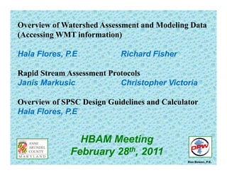
  • 1. Overview of Watershed Assessment and Modeling Data (A i WMT i f ti )(Accessing WMT information) Hala Flores PE Richard FisherHala Flores, P.E Richard Fisher Rapid Stream Assessment Protocolsp Janis Markusic Christopher Victoria Overview of SPSC Design Guidelines and Calculator Hala Flores, P.E HBAM Meetingeet g February 28th, 2011 Ron Bowen, P.E.
  • 2.
  • 3. Anne Arundel County Stormwater Management Practices and Procedures Manual __________________________________________________ Chapter 11 Appendices 11.6 11 3 Li k t i d /i f ti 11 3 8 D t t f P bli W k t h d 11.3. Links to required resources/information 11.3.8. Department of Public Works watershed management tool htt // i ld t / /http://gis-world.aacounty.org/wers/
  • 4. Anne Arundel County Watershed Management ToolWatershed Management Tool (WMT)(WMT) Stream AssessmentStream Assessment -- Physical HabitatPhysical Habitat -- Biological ConditionsBiological Conditions -- MorphologyMorphology -- Problem Area InventoryProblem Area Inventory Erosion,Erosion, HeadcutHeadcut, Dumpsites, Deficient, Dumpsites, Deficient Buffers, Infrastructure Impacts.Buffers, Infrastructure Impacts. -- Stream Crossings (H&H)Stream Crossings (H&H)Stream Crossings (H&H)Stream Crossings (H&H) -- Landscape (Imperviousness)Landscape (Imperviousness)
  • 5. 2 000 estimated2 000 estimated milesmiles Anne Arundel County 2,000 estimated2,000 estimated milesmiles ofof nonnon--tidal waterwaystidal waterways P i l (S d W l d )Perennial (Streams and Wetlands) Ephemeral and Intermittent Pond/Lake/Floodway Other
  • 6. BIOLOGICAL CONDITIONS B hi I d f Bi iBenthic Index for Biotic Integrity (BIBI) Score Number of Samples - 376p - 5% - 23%Fair Good 23% - 49% Fair Poor - 23%Very Poor
  • 7. DEGRADED MORPHOLOGY Example of F and G channels – Highly Instablep g y Erosion  ‐‐ Patuxent River Watershed Headcut  ‐‐ South River Watershed
  • 9. Anne Arundel County Watershed Management Tool (WMT)Watershed Management Tool (WMT) Restoration Indicators Preservation Indicators Analysis and ModelingAnalysis and Modeling --HydrologyHydrology(Runoff and Discharge)(Runoff and Discharge) -- Pollutant Load AnalysisPollutant Load Analysis -- Landscape AnalysisLandscape Analysis
  • 11. Subwatershed  Priority fory Preservation Lowest Priority for Preservation Highest Priority for Preservation
  • 13. Stream Assessment Protocol: an overviewoverview Anne Arundel County Department of Public WorksDepartment of Public Works Bureau of Engineering Watershed, Ecosystem, and Restoration Services Ecological Assessment ProgramEcological Assessment Program
  • 14. Introduction • Regulatory Triggers G l W h d Ch i i• General Watershed Characterization – Land Use and Imperviousness – Drainage Area and Bankfull Indicator Determination G l St Ch t i ti• General Stream Characterization – Rosgen Level II Classification (pebble count, slope determination, valley type, etc.) • Lateral Stability DeterminationLateral Stability Determination – BEHI and NBS Evaluation – Bank armoring and localized versus widespread issues • Vertical Stability DeterminationVertical Stability Determination – Incision Ratio – Headcuts, control points, depositional features • Overall Reach Stability Determinationy – Includes a variety of trend and reach-level evaluations
  • 15. Regulatory TriggersRegulatory Triggers • The use of the Stream Assessment Protocol is triggered by a finding of an “i d f ll” i h f d i i if O b k Fl d“inadequate outfall” in the context of determining if Overbank Flood Protection is required due to the impact of a given development site. • Once such an “inadequate outfall” finding is made, a downstream analysis iis necessary. • This method is applied only to a “…clearly defined open channel…” (Section 7.2.2.D.II; Chapter 7, p. 7.4) • The assessment reach comprises the channel from “…the outfall(s) from the site and progress[es] to the Point(s) of Investigation (POI).” (Section 7.2, Chapter 7, p. 7.2) • See the Procedures and Practices Manual for details on what constitutes an adequate or inadequate outfall and on how to establish the POI.
  • 16. This is a field-based assessment! You must leave the office to apply it correctly!
  • 17. Watershed Characterization Standard Header Items •Watershed Date DrainageWatershed, Date, Drainage Area, etc. Watershed Characterization •Should be mostly an office exercise •Land use and land cover are the primary items to determine, both in the basin, and adjacent to the reach of interest •DA calculation needed for bankfull determinationbankfull determination •Significant land uses that may impact stream stability conditions
  • 18. Stream Characterization and Classification •Rosgen Level II Classification is basicClassification is basic characterization •Not discussed in detail here •All standard work, all found in Rosgen (1996): Width, depth, slope, D50, sinuosity, W/D ratio, entrenchment, etc. •Bankfull channel dimensions using known regional relationships developed by others are necessary forothers are necessary for Rosgen classification
  • 19. You can find these relationships within thewithin the document or in other references…
  • 20. …and they are easily used in a spreadsheet to h h l h i icompute these channel characteristics.
  • 21. Lateral Stability DeterminationDetermination •Lateral stability. What is it? Side to side movement of stream channel which is a function ofchannel, which is a function of two major influences: •A streambank’s characteristics that make it resistant to erosion •The work done on the bank of interest related to the hydraulic characteristics of the overall channel (Near Bank Stress) Done on dominant bank( ) •How are these two opposing forces evaluated? Using Rosgen’s BEHI and NBS ratings Done on dominant bank within the assessment reach. If two bank types are t d ll threpresented equally, the higher BEHI and/or NBS rating (i.e.—more unstable) is used.)
  • 23. Vertical Stabilityy Determination •Primary determination using the Incision Ratiothe Incision Ratio •Also used presence of the following: •Head Cuts •Depositional Features •Bed Control •Taken together, these features i i i h i i lgive insight into vertical stability
  • 25. Overall Reach Stabilityy Determination •Stream Sensitivity, Sediment Supply, and Recovery Potentialy •From Rosgen (1996) •Evolution Stability Sequence •Evolution Stability Trend •Overall Reach StabilityOverall Reach Stability
  • 26. Stream Evolution Scenarios (2 of 9 in SAP manual)
  • 27. Final Steps • Using weight of evidence, a finding of either 1) localized or widespread i bili 2) bl di i iinstability or 2) stable conditions is made for the assessment reach • Report is produced for the assessment h h d ib h bilireach that describes the stability conditions observed • Photodocumentation is a required f hiaspect of this report
  • 28. Links Guidance Documents: • Stream Assessment Protocols: http://www aacounty org/DPW/Watershed/DownstreamAdequacyProtocols cfmhttp://www.aacounty.org/DPW/Watershed/DownstreamAdequacyProtocols.cfm • Stormwater Practices and Procedures Manual: http://www.aacounty.org/PlanZone/Resources/Practices_Procedures_Manual.pdf GIS/M i Li kGIS/Mapping Links: • AA County Watershed Mapping Application: http://gis-world.aacounty.org/wers/ • GIS Hydro: http://www.gishydro.umd.edu/ Information Links • US Fish and Wildlife CBFO:US Fish and Wildlife CBFO: http://www.fws.gov/chesapeakebay/stream.html • DNR Rosgen Spreadsheets: http://www.dnr.state.oh.us/soilandwater/water/streammorphology/default/tabid/9188/Defaulhttp://www.dnr.state.oh.us/soilandwater/water/streammorphology/default/tabid/9188/Defaul t.aspx
  • 29. SPSC – What are they? SPSC are open-channel conveyance structures that convert, through attenuation pools and a sand seepage filter s rface storm flo to shalloseepage filter, surface storm flow to shallow groundwater flow. Wetland Seepage System Perennial Application Step Pool Storm Conveyance Ephemeral Application
  • 30. Types of BMPs Pipe Conveyance i i Receiving Stream Micro Practice (Off-line) Pipe Conveyance Receiving Stream Macro Practice (On-line) A shift in Paradigm Receiving SPSC Conveyance SPSC Integrated System Receiving Stream
  • 31. A, ?? STEP POOL STORM CONVEYANCE FOR EPHEMERAL OUTFALLS B, 32% The physical characteristics of the SPSC channel are best characterized by the Rosgen A or B stream classification types, where “bedform occurs as a step/pool, cascading channel which often stores large amounts of sediment in the pools associated with debris dams” (Rosgen, 1996).
  • 32. WETLAND SEEPAGE RESTORATION TECHNIQUE FOR PERRENIAL STREAMS DA, 28%
  • 33. SPSC – Can be designed to provide: - Safe 100-year Conveyance - Attenuation - Energy DissipationEnergy Dissipation - Water Quality Treatment
  • 34. Hard Engineering Solutions for conveyance Not so hard!Not so hard!
  • 35. Expensive restorations that don’t work and don’t provide water quality benefits
  • 36. Harvesting the taming powers of the floodplain Before Restoration – Rosgen G Channel Any size floodplain bench is better than a hardened wall After Restoration – Rosgen B Channel The larger and more accessible theThe larger and more accessible the floodplain is, the more sustainable the restoration
  • 37. Hard Engineering Solutions for conveyance Not so hard!
  • 38. Conventional upland BMPs do not necessarily  correlate with a stable downstream! Stormwater detention ponds are wet structures that are often used to capture and detain stormwater runoff from residential and Erosion and Headcut  Inventory o es de t a a d commercial areas. Impervious Area Draining to BMP Less than 20% 20%< and >50% More than 75% 50%< and >75%
  • 39. Undesired Consequences of Peak Detention Potential Effect of Cumulative Detention Basins on Downstream Conditions • Longer duration of higher flows • Cumulative effect will increase peak discharge downstream g g
  • 40. Stormwater Management Best Management Practices (BMPs)( ) SPSC Infiltration Conditional on underlying soil conditionsInfiltration Conditional on underlying soil conditions Filtration Sized for 100% CreditS ed o 00% C ed t Wetland Creation Seepage berm designWetland Creation Seepage berm design Wet Ponds Function of Seepage berm design Extended Detention Outflow is discharged as shallow groundwater seeps
  • 41. Implementation of SPSC Systems 1- As an outfall or stream retrofit techniqueq 2- As mitigation for development2 As mitigation for development Structural BMP Or P t f th ESD T iPart of the ESD Train
  • 42. Functional Components of Step Pool Storm Conveyance (SPSC) Functional Components of Step Pool Storm Conveyance (SPSC) Design Water Surface Riffle Boulder Pools Riffle Cobble Sand/Wood Chip Footer Boulders Pools = 0% Slope Geotextile
  • 43. Other Geometric Configurations (Wetland Seepage)Other Geometric Configurations (Wetland Seepage)
  • 44. Other Geometric Configurations (Wetland Seepage)Other Geometric Configurations (Wetland Seepage)
  • 46. Mapping the SPSC Vertical Alignment In the event that the proposed SPSC connects to an incised downstream channel, the elevation of the floodplain p p , p terrace shall be used as the downstream elevation.  An in‐stream weir design with a top of weir elevation set at the  floodplain terrace is required at the tie‐in location. Notes and Preliminary Assumptions: Maximum slope = 5% Minimum length of pool = 12 ft Maximum length of riffle = 10 ft Depth of filter media is minimum 18 inches below the lowest structure L pool L Riffle Depth of pool is minimum 18 inches Un‐armored Pool side slopes shall be laid back at 3H:1V  Special attention to paid at the inflow and outflow tie in locations Silica Cobbles 1 ft (typ.) (12 ft min.)(10 ft max.) Boulders hf Typical (18 in. min.) In‐stream  Boulders In‐stream 100 – Year floodplain may  inundate last SPSC structure Sand/Wood Chip Mix d ( ffl )d ( l) df (riffle) Existing Ground Filter Fabric df (pool) min 18 inches Sand Mix “Sandbags from E&S  phase maybe left in place”
  • 47. Mapping the SPSC Vertical Alignment ‐ Cascade and Weir boulders maybe placed at a maximum (1V:1H) slope ‐ Cascades shall not be more than 5 ft in height at any single location ‐ Cascades shall be followed by three consecutive pools Boulders Cascade  Max 10ft @ 50% Slope Pool #1 Pool #2 Pool #3 Silica Cobbles Boulders hf cascade (per design) hf (Typical) hf (Typical) Existing Ground Filter Fabric Sand/Wood Chip  Cascade Profile – Three Pools following Cascade Mix g
  • 48. Design the typical cross‐section for the riffle/cascade Design Criteria:Design Criteria: ‐ Conveyance shall be designed to address the 100‐year Peak Discharge 1959, 2 3 2 22 2 Chow DW RadiusHydraulic SolutionalMathematic WD Area = = , 83 22 DW y + Q =        (1.49/n) (A) (Rh)2/3 (S)1/2 Must be > or =  Q 100 W (8 ft min.) D Where: Q        = 100 year ultimate flow (cfs) 1.49 = conversion factor n = Manning’s n, determined by USDA, 2006 equation A = cross‐section area of a riffle channel, which for a parabola = 2/3(W)(D), Riffle Section through Boulder 2 x d50 n = D1/6/ (21.6 log (D/d50)+14),  (USDA, 2006). A cross section area of a riffle channel, which for a parabola   2/3(W)(D),  where W is top constructed width (ft) and D is the constructed depth (ft) Rh = hydraulic radius (ft), calculated using Chow 1959 relationship for parabolas S = average slope over entire length of project (ft/ft) V =  velocity in the riffle channel (ft/sec), V = Q/A Riffle Section through Cobble ( g ( ) ) ( ) Where: n = Manning’s n, use 0.05 for cascades. D = depth of water in the riffle channel associated with unmanaged  100‐year Q design, ft.,  d50 = cobble size, ft 
  • 49. Design the typical cross‐section for the riffle/cascade Checking for Super Critical Flow:g p gD V Fr =‐ Froude Number exceeding 1 indicates the flow is supercritical ‐ Froude Number = 1 indicates that the flow is critical ‐ Froude Number less than 1 indicates the flow is subcritical To reduce the Froude number 1‐ Widen channel 2‐ Decrease Slope
  • 50. Checking/Sizing the Riffle Cobbles Use a trial D0 = 6 inches Actual Velocity  Must be < Maximum Allowable Velocity ( ) FormulaIsbashDgCVelocityAllowableMaximum w ws 5.0 0 5.0 2 ×⎟⎟ ⎠ ⎞ ⎜⎜ ⎝ ⎛ − ×××= γ γγ 0 y y Where: C            = 0.86 for prevailing supercritical flow  1.2 for prevailing subcritical flow g             = 32.2 ft/sec2 γ stone density (lb/ft3)γs                  = stone density (lb/ft3) Γw               = water density (lb/ft3) D50             = cobble stone diameter (ft) NRCS 2007
  • 53. The pretreatment, recharge, and water quality sizing criteria presented in the Anne Arundel C SPSC id li f ll l l h S f M l d’ i i f i l Designing the water quality sand filter system County SPSC guidelines follow closely the State of Maryland’s criteria for a typical stormwater filtering device. 2000, MDECriteriaSizingFiltering dxWQ A fv f = 2000, )( MDECriteriaSizingFiltering tdhK A fff f + 2 x d W (8 ft min.) D hf (18 inch min.) df (riffle) Sand/Woodchip Mix 2 x d50 Df  (18 in min.) Wsand (2 ft min.) Sand/Woodchip Mix Pool Cross Section df (pool) 18 inches min. Riffle Weir Cross Section through Cobble sand ( ) Silica Cobbles L pool (10 ft min.)(10 ft max.) Boulders hf Typical L Riffle In‐stream Boulders Sand/Wood Chip Mix 1 ft (typ.) hf Typical (18 in. min.) In‐stream 100 – Year floodplain may  inundate last SPSC structure Typical Profile – Alternating Pools and Riffles df (riffle) Existing Ground Filter Fabric df (pool) min 18 inches Sand Mix “Sandbags from E&S  phase maybe left in place” Footer boulder shall extend 6 inches below the lowest  point in the excavated pool
  • 54. Checking Storage/Quantity Management Th d SPSC ill ti f k t flThe proposed SPSC will satisfy peak management flow  requirements if two conditions are met: a‐ First, adequate storage volume within the pools  and sand/woodchip voids shall be provided to meet  the required storage volume/quantity managementthe required storage volume/quantity management  for the project  b Second it must be demonstrated that the designb‐ Second, it must be demonstrated that the design  renders the hydraulic power equivalent to the  predevelopment/desired hydraulic power through  the proposed energy dissipation pools.
  • 55. Checking Storage/Quantity Management a‐ First, adequate storage volume within the pools and , q g p sand/woodchip voids shall be provided to meet the required  storage volume/quantity management for the project  Vin = Qpost /Ain Storage Volume in Pools Design Water Surface Elevation Din Dout2 Dout3 Dout1 Driffle L out3 Df Storage Volume in Voids Df x L x Wsand x Porosity Sand/Woodchip mix Porosity = 30% Df (Average filter bed area= (Driifle +Dpool)/2
  • 56. Checking Storage/Quantity Management b‐ Second, it must be demonstrated that the design renders the , g hydraulic power equivalent to the predevelopment/desired  hydraulic power through the proposed energy dissipation pools. E Di i i (Potential + Kinetic + Static) Energies SPSC entrance =  (Potential + Kinetic + Static) Energies SPSC outlet + Head loss within SPSCsystem ‐ Energy Dissipation = Post  Development  Pre Development  Energy p Energy
  • 58. SPSC – FAQ Can SPSC systems be used to provide water quality credit? SPSC systems can be designed as micro or macro systems.  When designed as macro  systems, they are treated as structural practices and can provide water quality via  filtration above the ESD to the MEP criteria When designed as a micro system theyfiltration above the ESD to the MEP criteria.  When designed as a micro system, they  behave as an ESD filtering device. Can SPSC systems be used to provide quantity management?Can SPSC systems be used to provide quantity management? SPSC systems will provide runoff attenuation via storage within the pools and voids  within the substrate.   HOWEVER……..
  • 59. SPSC – FAQ What type of maintenance access is required for SPSC  systems? The intend behind the vehicular access requirement is to allow the County access toThe intend behind the vehicular access requirement is to allow the County access to  public structures for routine maintenance and in the event of structural failure to  perform necessary fixes.    • Probability of future utilization of access road‐ Delicate balance • Considering relaxing current policy of requiring vehicular access to all weirs to  requiring access to the any point throughout SPSC and existence of sufficient public  easement around the system to allow the County future access if needed.
  • 61. Innovative Outfall &Innovative Outfall & Stream RestorationStream Restoration Riva 400Riva 400 -- Constructed in Dec 2009Constructed in Dec 2009 Techniques:Techniques: Step Pool StormStep Pool Stormpp Conveyance (SPSC)Conveyance (SPSC) Riva 400 Before Restoration (2004)Riva 400 Before Restoration (2004) ConveyanceConveyance StabilityStability HabitatHabitatHabitatHabitat Water QualityWater Quality 61
  • 62. Central Sanitation FacilityCentral Sanitation Facility S h G l R iS h G l R i Before RestorationBefore Restoration Stretch Goal RequirementsStretch Goal Requirements Public ProjectPublic Project Drainage Area = 94 AcresDrainage Area = 94 Acres Impervious Treated = 23 AcresImpervious Treated = 23 AcresImpervious Treated 23 AcresImpervious Treated 23 Acres Total Project cost = $700,000Total Project cost = $700,000 After RestorationAfter Restoration Length of Stream Restored = 0.5 milesLength of Stream Restored = 0.5 miles Acres of Wetlands created =Acres of Wetlands created = Project equivalent to 13,650 rainProject equivalent to 13,650 rainj q ,j q , barrels at $1,365,000barrels at $1,365,000 or 190 bioretention facilities, at theor 190 bioretention facilities, at the cost of $20 000/each or $3 800 000cost of $20 000/each or $3 800 000 62 cost of $20,000/each or $3,800,000cost of $20,000/each or $3,800,000
  • 63. Before RestorationBefore Restoration Saefern Outfall RestorationSaefern Outfall Restoration Steep Slope ApplicationSteep Slope Applicationp p ppp p pp Community ProjectCommunity Project After RestorationAfter Restoration After RestorationAfter RestorationAfter RestorationAfter Restoration 63
  • 64. Construction Access = Substrate Filter Fill
  • 65. SeepageSeepage BermsBermsConstruction of the substrate filter fill (Sand compost mix)
  • 66.
  • 68. One year after construction
  • 69. Six Year Evolution to Forest Ecosystem
  • 70. Contact Information Janis Markusic Christopher Victoria Program Manager Environmental Scientist pwmark02@aacounty.org pwvict16@aacounty.org Anne Arundel County Department of Public Works Watershed, Ecosystem, and Restoration Services Ecological Assessment ProgramEcological Assessment Program 2662 Riva Road Annapolis, Maryland 21401 410.222.4240410.222.4240
  • 71. Contact Information Hala Flores, P.E. Richard Fisher Program Manager Environmental Scientist Hala.flores@aacounty.org rfisher@aacounty.org Anne Arundel County Department of Public Works Watershed, Ecosystem, and Restoration Services Ecological Assessment ProgramEcological Assessment Program 2662 Riva Road Annapolis, Maryland 21401 410.222.4240410.222.4240