Natural Disaster in Uttarakhand
•Als PPTX, PDF herunterladen•
19 gefällt mir•11,684 views


Empfohlen
Weitere ähnliche Inhalte
Was ist angesagt?
Was ist angesagt? (20)
Andere mochten auch
Andere mochten auch (20)
Ähnlich wie Natural Disaster in Uttarakhand
Ähnlich wie Natural Disaster in Uttarakhand (20)
Natural Disaster in Uttarakhand
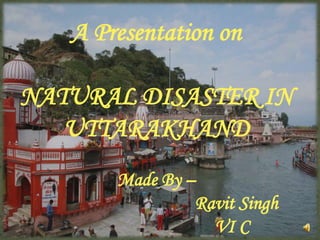
- 1. A Presentation on NATURAL DISASTER IN UTTARAKHAND Made By – Ravit Singh VI C 1
- 2. Overview of Uttarakhand Flooding in Uttrakhand Uttarakhand flood: Disaster natural but damage man-made? Consequences Rescue and relief operations. Causes of the disaster 2
- 3. Overview of Uttarakhand •Uttarakhand has a total area of 53,484 km² of which 93% is mountainous and 64% is covered by forest. • Two of India's largest rivers, the Ganges and the Yamuna, originate in the glaciers of Uttarakhand. 3
- 4. •The Rudraprayag district, home to the Kedarnath shrine, has seen eight major monsoon-related disasters in the last 34 years. 4
- 5. • It is well know as the "Land of the Gods“. •Uttrakhand is well known for its chota char dham. 5
- 6. Photographs of Kedarnath from 1882 – 1883 The following collection of photographs were taken from 1882 and are in the archives of the Geological Survey of India 6
- 7. FLOODING IN UTTRAKHAND… From 15 to 18 June 2013, Indian state of Uttrakhand and adjoining area received heavy rainfall, which was about 375 percent more than the benchmark rainfall during a normal monsoon. 16th and 17th June,2013 The Day of Destruction happened in history of 7 UTTRAKHAND
- 8. The massive rainfall and cloud burst events were happening at multiple places, including in Bhagirathi basin, Badrinath region, other places. This lead to melting of Chorabari Glacier at the height of 3800 metres, and eruption of the Mandakini River which led to heavy floods near Kedar Dome, Rudraprayag district, Uttarakhand, Himachal Pradesh.is It considered to be the largest natural disaster after tsunami occurred in 2004. 8
- 9. Uttarakhand flood: Disaster natural but damage man made? Melting of glaciers. More than 220 power and mining projects are running in 14 river valleys in Uttrakhand. Currently 70 dams exist in the Char dham area alone.The dam constructions involve blasting of hills which increase the risk of land slides. 9
- 10. The death count is assumed to be thousands as the the conditions in kedar valley are very adverse. Photos: Kedarnath temple before and after the Uttarakhand floods 10
- 11. CONSEQUENCES:HUMAN LOSS • According to the official records 400 houses were destroyed and 265 were damaged. • 4,200 villages were victims of the floods . • 6,000 people were dead, 10,000 were injured and 1,00,000 were stuck in the valley. 11
- 12. CONSEQUENCES:ECONOMIC LOSS • Major roads,telephone towers were destroyed due to which communication with the outer world was lost. • 20,000 crores loss was reported,which may be in the form of destruction of houses roads,cars etc. 12
- 13. RESCUE AND RELIEF OPERATION • The Army, Air Force, Navy, Indo-Tibetan Border Police (ITBP), Border Security Force, National Disaster Response Force (NDRF), Public Works Department and local administrations worked together for quick rescue operations. • Several thousand soldiers were deployed for the rescue missions. • Helicopters were used to rescue people, but due to the rough terrain, heavy fog and rainfall, maneuvering them was a challenge. 13
- 14. • Indian army showed extreme levels of courage in saving the people in spite of the helicopter crash occurred during the mission-operation Rahat. 14
- 15. How to reduce such disaster • Protecting the environment can only be the way to reduce the risk of such disasters. • Keeping a check on illegal constructions and on deforestation. 15
- 16. Causes of the disaster Who is Responsible for this Man or Nature ?? Natural Reason...? Man Made Reasons….? From 14 to 17 June 2013, Indian state However, the true causes of the of uttrakhand and near by are received epic tragedy is growth of tourism heavy rainfall. and unplanned construction. Due to Continuous Rain the Chorabari Global Warming Glacier melted and this triggered the flooding of the Mandakini rivers. 16
- 18. • Thanks to the Indian Army Officers who helped in conducting the rescue missions. 18
- 19. 19