
Empfohlen
Empfohlen
Weitere ähnliche Inhalte
Was ist angesagt?
Was ist angesagt? (18)
Andere mochten auch
Andere mochten auch (9)
Ähnlich wie Reconstructing Water Levels in the Lake Michigan Basin from Embayed Lakes
Ähnlich wie Reconstructing Water Levels in the Lake Michigan Basin from Embayed Lakes (20)
Mehr von SERC at Carleton College
Mehr von SERC at Carleton College (20)
Reconstructing Water Levels in the Lake Michigan Basin from Embayed Lakes
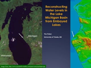
- 1. Reconstructing Water Levels in the Lake Michigan Basin from Embayed Lakes Tim Fisher Michigan University of Toledo, OH Wisconsin Image from: http://www.savannah-weather.com/poes/extra/michigan.jpg
- 2. 2003 1974 How do you make investments?
- 3. Embayed Lakes Outline Location Michigan Lake Level History Geomorphic Evidence Sedimentologic Evidence Working with cores & geomorphic data to generate a lake level curve Eolian sand as a LL proxy Images from Google Maps
- 5. L Strandlines of glacial Lake Chicago Nip iss ing Calume t Glenwood Michigan Lake Level History
- 6. Late glacial & Holocene lake levels in the Lake Michigan basin 14 C Fisher (2002) modified from Hansel et al. (1985)
- 7. Two Creeks Site Logs in lake sediment and overlying till Dated at 11,850 14 C yr BP or 13,600 cal yr BP till Lac . till
- 8. >5 0 s ta tm p s /<0 . 1k m 2 14 C D u es 8 12 0 ±10 0 B P 8 3 2 0 ±7 0 B P 8 3 2 0 ±7 0 B P Olson site 8 3 8 0 ±10 0 B P ~9300 cal yr BP Olsen site in Lake Michigan, 26 m depth Chrzastowski et al. (1991)
- 9. Late glacial & Holocene lake levels in the Lake Michigan basin Fisher (2002) modified from Hansel et al. (1985)
- 10. NBS Cause of Nipissing transgression is uplift of the North Bay sill (NBS)
- 11. Late glacial & Holocene lake levels in the Lake Michigan basin Fisher (2002) modified from Hansel et al. (1985)
- 12. Platte Embayment, Sleeping Bear Dunes, MI
- 13. strandplain
- 14. New beach ridge ~1986
- 15. Thompson with peels Todd Thompson, IGS
- 16. Calendar years 1 2 3 4 5 Distance landwards from modern shoreline (km) Elevation (m) Thompson & Baedke (GSA Bull 1997)
- 17. New ridge ~1985 2011 Lake Michigan relative lake level curve Composite Baedke and Thompson, JGLR 2000
- 18. ? Amber Boudreau’s UT MS thesis
- 21. Baedke & Thompson, 2000
- 22. Coring Targets Shallow Barrier-dune Wetland Lake Michigan Complex Lake Michigan Barrier-dune Small Lake Complex Big lake records preserved in a little lake’s sediment:
- 23. DEM of Study area
- 24. Kelly Weyer Amber Boudreau (nee Lahners) In review
- 25. Field Methods RV Perforator Coring Tube Piston
- 27. Fisher et al. 2007
- 28. Fisher et al. 2007
- 29. Laminated mud marl peat peat Laminated marl ? Fisher et al. 2007 (J Paleolim)
- 30. Silver Lake lithostratigraphic logs Fisher et al. 2007 (J. Paleolim)
- 31. Stony Lake Contact Lake Michigan Barrier-dune embayed lake Small Lake Complex i Gyttja Model of contact Silver Lake Contact Gyttja Marl Peat
- 32. Fisher et al. 2012 J. Paleolim
- 34. Figure 6. Contour map of ICE-3G global postglacial r ebound–derived velocities in the Great Lakes area. Contour interval—3 cm/century. From Mainville & Craymer (2005) GSA Bull Figure 7. Contour map of vertical velocities derived from water level gauges over the Great Lakes surrounded with ICE-3G–derived velocities. Contour inter val—3 cm/century.
- 35. peat gyttja Hamlin Pentwater Silver Stony White
- 36. Active sand sheet Cabins at great prices! Hansen et al. (Aeol R) Exhumed forest
- 37. Niveo-aeolian activity, Silver Lake State Park, MI
- 38. Evidence of Active Sand on the Dunes
- 40. 140 100 144 152 156 75 160 160R % 164 50 168 172 176 25 179 179R 209 Sand in Core SL01-5 0 223 225 1 2 3 4 5 phi 235 244
- 41. sand curve compared to Baedke & Thompson (2000) curve Fisher & Loope, 2005
- 42. Toleston
- 44. Hanes, 2010
- 45. Hanes, 2010
- 46. Summary Lake levels at embayed lakes can be reconstructed by: -Strandline geomorphology -Drowned Subaerial deposits -Lacustrine deposits
- 47. References Fisher, T. G., and Loope, W. L. 2004. Lake-level variability in Silver Lake, Michigan: A response to fluctuations in lake levels of Lake Michigan. Michigan Academician 35, 373-385. Fisher, T. G., and Loope, W. L. 2005. Aeolian sand preserved in Silver lake: A reliable signal of Holocene high stands of Lake Michigan. The Holocene 15, 1072-1078. Fisher, T. G., Loope, W. L., Pierce, W. C., and Jol, H. M. 2007. Big lake records preserved in a little lake’s sediment: an example form Silver Lake, Michigan, USA. Journal of Paleolimnology 37, 365-382. Fisher, T. G., Weyer, K. A., Boudreau, A. M., Martin-Hayden, J. M., Krantz, D. E., and Breckenridge, A. 2012. Constraining Holocene lake levels and coastal dune activity in the Lake Michigan basin. Journal of Paleolimnology 47, 373-390. Hansen, E. C., Fisher, T. G., Arbogast, A. F., and Bateman, M. D. 2010. Geomorphic history of low-perched, transgressive dune complexes along the southeastern shore of Lake Michigan. Aeolian Research 1, 111-127. Timmons, E. A., Fisher, T. G., Hansen, E. C., Eiasman, E., Daly, T., and Kashgarian, M. 2007. Elucidating eolian dune history from lacustrine sand records in the Lake Michigan coastal zone, USA. The Holocene 17, 789-801.
Hinweis der Redaktion
- More documentation of the active sand and snow. The upper right photo shows snow on top of fresh sand, which is on top of a frozen crest of sand. The lower left shows a similar sequence, but we didn’t dig down to the frozen crest and note there are more snow layers in the top layer.
- The following are pictures documenting the deposition of sand on the lake ice of Lake Michigan showing that the sand is indeed blowing on the lake. Here you can see the dunes in the background with the sand along with some snow deposited here on the ice
- Radiocarbon dates were obtained from 3 locations throughout the unit to aid in comparison to the Baedke and Thompson curve. When these results were compared to the Baedke and Thompson curve, there appeared to be a positive correlation between high lake levels and high sand percents.