SlideShare a Scribd company logo
1 of 36
Download to read offline
Summer 2011

                                    PRODUCT
                                    CATALOG
              BASE MAP DATA

           ENERGY MAP DATA

      LAND & LEASE MAP DATA
The Energy Industry’s Most Trusted Resource
      for Quality Digital Mapping Data


        © Petroleum Geographics Corporation 2011
OUR DATA PRODUCTS ARE COMPATIBLE WITH:

        PETRA                GEOGRAPHIX
        KINGDOM SMT          ESRI
        MAPINFO              AUTOCAD
        SURFER               MICROSTATION
        ROCKWORKS            GOOGLE EARTH

         OR OUR FREE IPDM PROGRAM
               (Call for details)


             Please Visit Our Website:

  WWW.PETROLEUMGEOGRAPHICS.COM

To Request Samples, a Demo or to Place an Order
         Please call us at 877-747-0650
TABLE OF CONTENTS


About Our Company                           Page 3
PGC Base Map Data                           Page 4
       PGC National Land Grid               Pages 5, 6, & 7
       PGC Texas Land Grid                  Page 8
       PGC Subsection Surveys               Page 9
       PGC Culture Data                     Page 10
       PCG Digital Topos                    Page 11
       PCG Aerial Photos                    Pages 12 & 13
       PCG Elevation Data                   Page 14
       PGC Offshore GOM                     Page 15
PGC Land & Lease Map Data                   Page 16
       PGC BLM & State Oil & Gas Leases     Pages 17,18,19
       PGC BLM Mineral Leases.              Pages 20 & 21
       PGC Surface Land Ownership Data      Page 22
       PGC Geothermal Leases.               Pages 23 & 24
       PGC Wind Energy Leases               Pages 25 & 26
PGC Energy Map Data                         Page 27
       PGC Natural Gas /Oil Pipeline Data   Page 28
       PGC Pipeline Facility Data           Page 29
       PGC Oil & Gas Well Data              Page 30
       PGC Electricity Transmission Data    Page 31
       PGC Wind Energy Data                 Page 32
       PGC Other Renewable Energy Data      Page 33
PGC Industry Professional Digital Maps      Page 34
ABOUT OUR COMPANY

    Petroleum Geographics Corporation began in 2003 with
a team of dedicated experts committed to bringing a higher
quality standard to the energy industry and providing vital
and necessary digital mapping data at a fair price. We bring
over 30 years of combined GIS experience and know how
to ensure the data you are looking for is available when you
want it and in the format you require.
                                         You may have no-
                                         ticed the Internet
                                         has become the most
                                         popular research tool
                                         today, and conse-
                                         quently has often
                                         times become an
                                         avenue for obtaining
                                         GIS datasets. What
                                         is usually discovered,
however is that these datasets can be unreliable, outdated,
and geospatially incorrect. We are passionately committed
to educating customers about the value of using PGC prod-
ucts as compared to public domain datasets. We encourage
challenging questions and appreciate true professionalism.
At Petroleum Geographics we ensure that all resources (pub-
lic, private, government, etc) are relied on in order to pro-
vide you the very best available data. We research, compare,
verify and validate. We strive to ensure the data is seamless,
has appropriate and up-to-date attributes, and always
possesses the highest level of geospatial accuracy. We are
driven by the needs of our clients and therefore our
offerings have been shaped by the industry itself. We wel-
come comparisons with our competitors and strive to always
be the leader. We look forward to serving you and your com-
pany and being an integral part of your success.
                            Page 3
BASE MAP DATA


 NATIONAL LAND GRID


 TEXAS LAND SURVEY


 SUBSECTION SURVEYS


 CULTURE DATA


 DIGITAL TOPOS


 AERIAL PHOTOS


 ELEVATION DATA


 OFFSHORE GOM


       Page 4
NATIONAL LAND GRID
   Land Grid, as it is commonly called, but more formally
referred to as Public Land Survey System data (PLSS), is
the fabric of mapping projects in the energy industry. PGC
National Land Grid provides coverage for all 30 states in the
U.S. that utilize a PLSS system.
   In addition, PGC National Land Grid can be customized
to include similar land data coverage in Texas, and also the
popular Marcellus Shale and eastern states of Pennsylvania,
West Virginia, and New York, Tennessee, and Kentucky.
    PGC prides itself on providing a cost-effective, highest
quality 1:24,000 scale dataset that is updated and maintained
to be consistent with changes in the industry.
                                                PGC’s
                                                National
                                                Land Grid
                                                has sur-
                                                passed the
                                                comptition
                                                to become
                                                the premier
                                                product in
                                                the industry.
   We’re recognized by many companies as the data provider
of choice. Customers enjoy our versatile formats and our
flexibility in customizing the data for their uses and geo-
graphical areas.
   Experience has shown us that professionals who have
interest in using PLSS data usually ask a few common
questions in determining how to go about acquiring the data:


                            Page 5
NATIONAL LAND GRID
How does your “land grid” data differ from other vendors?

   Very few vendors provide a uniform nationwide land
grid. Most have been in business for decades and have larger
organizations, and thus need to charge more for the product.
They never considered that the paper maps they digitized
years ago would be replaced by newer digital PLSS sources
that have become more accurate through the use of GPS
and modern surveying techniques. It has been counter-
productive for these vendors to try and incorporate new
and current sources of information, while attempting not to
abandon their older product and the associated higher costs.
   To illustrate an example, the U.S. Bureau of Land Manage-
ment (BLM) manages land throughout the U.S. and has the
largest public oil and gas leasing program that exists. The
BLM has created industry-standard PLSS and the legal de-
scriptions that define the oil and gas leases, which fit
precisely within the BLM PLSS dataset and its subsequent
Lots, Tracts, and Aliquots. It is not possible to retrofit the
leases to an older version of the PLSS. While a different
vendor may even concede this and attempt to incorporate
this new data in an effort to “update” their data, they are still
charging customers the same old high prices. In addition,
oil and gas well locations are described according to the new
PLSS sources and even old wells have had new footage calls
assigned. One can easily verify this by simply negating the
footage call and use the official latitude/longitude of the well
point in conjunction with aerial photography.
   At PGC, we welcome the opportunity for you to send us
an area from another vendor and we’ll show you a live demo
comparison of the datasets.


                               Page 6
NATIONAL LAND GRID
Isn’t PLSS data available on the internet and, if so, why
should I purchase from PGC?

   First, one cannot acquire a complete nationwide 1:24,000
PLSS on the Internet, or from a public agency for that matter.
We know this firsthand because we are always keeping abreast
of new sources of information so that our data is the most up
to date.
   Second, much of the downloadable data involves very
tedious, time-intensive data manipulation to edit geometry
and to standardize attributes. For example, we can show a live
demo to you of an apples-to-apples comparison of the free
GCDB BLM Land Grid and our cleaned, enhanced version,
and you’ll immediately see the difference.
   In some cases there is so much data available you don’t
know which to use. For example, in one state we found 5 dif-
ferent sources of 1:24,000 PLSS on the Internet. Using PGC,
you’ll have the assurance of knowing that we’ve not only seen
the 5 sources, but that we already evaluated them to deter-
mine if they are worthy of integrating into PGC National
Land Grid. Another worthwhile point is that with PGC Na-
tional Land Grid is standardized. The data structure, attri-
butes, and topology is consistent across the entire dataset and
we’ve created a special label attribute for every polygon.
   Take into account our complete nationwide coverage, our
data cleaning and enhancement, thorough research
performed, standardization of the dataset, low costs, it will be
apparent PGC National Land Grid is the solution.


                            Page 7
TEXAS LAND SURVEY
   The Texas Land Survey system is quite in contrast with the
more straightforward PLSS, however the Texas Land Survey
data is synonymous with the term “Land Grid” as it serves as
the fabric for mapping projects in Texas.
   PGC Texas Land Survey is a 1:24,000 statewide coverage
that consists of Abstracts, Survey Names, Survey Numbers,
Blocks, and Subdivision data. All entities of the data are pro-
vided as separate layers and each layer is attributed with
corresponding names and numbers. In addition, we provide a
special unique layer that combines all of the data entities and
the attribute text is neatly displayed so as not to overlap.


PGC Texas Land Survey is derived from the General Land
Office (GLO) in Texas and is updated on a continual basis as
changes are mandated by the GLO.
   The industry has welcomed PGC Texas Land Survey as it
has been a refreshing product offering in comparison to the
higher costs from competing vendors. Customers enjoy our
versatile formats and our flexibility in delivering the data by
county, railroad district, or statewide. PGC Texas Land Survey
can also be packaged with PGC National Land Grid for
complete base map coverage.


                            Page 8
SUBSECTION SURVEYS
PGC Subsection Data is comprised of Aliquots/Lots/Tracts
and is a further delineation of the PLSS Land Grid. This de-
tailed layer of information is a necessity when mapping land
and leases. It is also extremely useful as a prospecting tool.
When used with PGC Lease Map Data, customers have the
ability to identify and pinpoint aliquot/lot/tract legal descrip-
tions of parcels that are not currently leased on federal and
state lands.
   The data is also useful in helping locate parcels residing on
fee lands. While several land professionals often overlook the
value and function of subsection data, savvy prospectors are
using it to gain a competitive advantage in the energy leasing
arena.


PGC Subsection Data is an enhanced dataset originally
obtained from the BLM GCDB data. It is much more user-
friendly and has many different value-added features in com-
parison to what can be found through the public domain.


                             Page 9
CULTURE DATA
 PGC Culture Data is a nationwide dataset containing infor-
mation such as roads, rivers, streams, lakes, railroads, city, and
county boundaries. Other unique cultural datasets can be pro-
vided such as census boundaries, school zones, Indian reser-
vations, and more. PGC Culture Data is a perfect complement
to PGC National Land Grid, PGC Texas Land Survey and
PGC National WellBase. PGC Culture Data can be purchased
by County, Statewide, or Nationwide.


Isn’t Culture Data one of those easy datasets you can obtain
through public sources such as the U.S. Census Bureau?

   It is of the utmost importance to distinguish between our
customized formats which are ready-to-load in specific soft-
ware programs vs. data from the public domain. Our data
customized formats include enhanced text placement and
labeling, as well as the development of convenient, specified
thematic layers that can be turned on or off.
   Our customers understand the tremendous time-savings
value of high quality presentation maps that are instantly at
their fingertips at a low cost as compared to the data cleanup
and processing that is required in manipulating similar data
from the public domain. We welcome the opportunity to pro-
vide you a live demo to show you the difference.


                            Page 10
DIGITAL TOPOS


    Digital topographic data are also referred to as DRGs (Digi-
tal Raster Graphics). They are scanned 1:24,000 Scale USGS
7.5 minute Topographic Maps. These are the same highly
detailed maps that many of us have used for hiking and other
outdoor recreational activities.
    PGC Digital Topo allows you to easily import these Topo
Maps into your mapping project and overlay this useful in-
formation with your other data sets. PGC removes the map
collars, removes the unsightly “black areas” of no data, and
projects the Topo Maps into your desired map projection/co-
ordinate system so it can blend seamlessly into your project in
any mapping software.
    PGC Digital Topo is available by the USGS Quadrangle,
County, State, or Nationwide. Special package discounts are
available for statewide and nationwide datasets.


                            Page 11
AERIAL PHOTOS
PGC Aerial Photography is comprised of an archived
geospatial library of county-based USDA NAIP True Color
and Color Infrared, 1 and 2-Meter Resolution Aerial Photos
flown between 2005 and present. PGC provides two differ-
ent aerial photography products, Customized and Unpro-
cessed. Each serves a very different purpose as the following
explains:

  What is the advantage of purchasing PGC Customized Aerial
Photography?

   PGC Aerial Photography is delivered as GeoTiff image
format and is delivered on DVDs or External Hard Drives.
The data is customized to accommodate customer-defined
map projections/coordinate systems. Clients find this a key
benefit as many mapping programs do not permit the user
to re-project raster image files. Counties are delivered into a
neatly partitioned series of smaller, indexed (doqq - quarter
quad) files so images sizes are manageable in any mapping
program. This is important to note because many mapping
programs are limited by size limits on raster image files.
   PGC Aerial Photography is displayed in a seamless fash-
ion. PGC can also deliver custom areas of interest based on
Quadrangles or Lat/Long Coordinates. This is a great option
to cover Basins and Large Areas of Interest at very affordable
costs.


                            Page 12
AERIAL PHOTOS
I just need the raw data that can be downloaded from the USDA
website. Why would I purchase the PGC Unprocessed Aerial
Photography?

   Since we can quickly deliver any part of our NAIP Aerial
Photography archive, it saves customers a tremendous amount
of time that they would otherwise spend researching to see if
the data exists and then spending the time downloading data.
Even with the fastest of Internet connections individual coun-
ties can often take several hours to download. For example, if
a customer desires to obtain NAIP Aerial Photography for the
state of Oklahoma they would need to order 77 counties from
the USDA website and then download all the data for each
county individually. PGC provides a discounted price for the
“raw” NAIP Aerial Photography so
professionals can easily factor the “time vs. cost” equation and
come out ahead.


                            Page 13
ELEVATION DATA


    PGC provides contour and elevation information derived
from the USGS National Elevation Dataset (NED). PGC
Elevation Data are available nationwide(except for Alaska)
at resolutions of 1 arc-second (approx. 30 meters) and 1/3
arc-second (approx. 10 meters). Users of PGC Elevation Data
have the ability to perform detailed analysis of any terrain in
the U.S., and users also enjoy the freedom to create their own
contour intervals, hill shades, line of sight profiles, and views-
heds.
    Data can be provided by 7.5 Minute Topo Quadrangle and
projected into your desired coordinate system/map projection
to blend seamlessly into your project.
    PGC Elevation Data can be delivered in a variety of formats
for import directly into GeoGraphix, Petra, Kingdom SMT,
Surfer, AutoCad, ESRI, and MapInfo. Call today or contact
us to get prices for Quadrangles or Custom Areas of Interest
including Counties, Lat/Long Areas, Basins, etc.
    If you do not require custom projected elevation data and
simply want the raw NED data you can purchase the entire
U.S. dataset or individual statewide bundles.

                             Page 14
OFFSHORE GOM
   PGC Offshore Gulf of Mexico Data (GOM) includes both
federal and state water geographic coverage. Information for
the federal waters is derived from the Bureau of Ocean Energy
Management, Regulation & Enforcement.
   Data for the federal waters includes 5,8, and 10 year lease
boundaries, pipelines, blocks, shipping lanes, oil and gas plat-
forms, and oil and gas well information.


   Data for the state waters for the states of Texas, Louisiana,
and Mississippi includes blocks, oil and gas well data, and
pipelines. PGC Offshore Gulf of Mexico Data is provided in
ready-to-load formats where customers can integrate offshore
data seamlessly into a variety of mapping programs.


                            Page 15
LAND & LEASE MAP DATA


BLM & STATE OIL & GAS LEASES


BLM MINERAL LEASES


SURFACE LAND OWNERSHIP DATA


GEOTHERMAL LEASES


WIND ENERGY LEASES


          Page 16
BLM & STATE OIL & GAS LEASES
   PGC Lease Map Data™ is comprised of map layers that
represent the industry’s most comprehensive offering of
GIS formatted Bureau of Land Management and State Trust
Lands oil and gas lease data available. Areas of coverage
include:

• Bureau of Land Management (BLM) oil and gas lease map
data for the states of Colorado, Wyoming, Montana, North
Dakota, Utah, New Mexico, Nevada, California, Arizona,
Idaho, Washington and Oregon.
• State Trust Lands oil and gas lease map data for the states
of Oklahoma, Colorado, Wyoming, Montana, North Dakota,
New Mexico, and Utah.

   Using proprietary technology, Petroleum GeoGraphics has
precisely mapped legal land descriptions of federal BLM and
State Trust ownership and leases to official BLM PLSS Surveys,
Lots, Tracts, and Aliquots. Integrating public information
from several premier resources including the powerful BLM
LR2000 database, and also state trust land records, PGC Lease
Map Data™ provides a convenient one-stop shop for federal
and state oil and gas lease data in the western United States.
   Data includes valuable attribute information such as full
Land Legal Description, Acreage, Owner Type and Name,
Case Type, Disposition and Action Type and Dates, Lease
Status, Cost per Acre, Serial Number, Commodity Type, and
Expiration Dates.


                           Page 17
BLM & STATE OIL & GAS LEASES
Benefits of PGC Lease Map Data™:

• Simple to use – load one easy map layer.
• Precise geographic representation of the BLM LR2000 and
state trust land records
• Quickly evaluate federal and state parcels to determine land
status and use
• Eliminate the need for time-consuming BLM and state land
records research
• Analyze competitive lease situations and scenarios
• Don’t have to rely on the federal & state web sites which can
be very slow, not active, out of date, difficult to use, and
inaccurate.

                          T23N R117W


                            Page 18
BLM & STATE OIL & GAS LEASES
   PGC Lease Map Data™ can be delivered on a statewide,
county, or even on a township/range basis, and subscriptions
are available for customers desiring updates. Customers with
statewide annual subscriptions will additionally receive valu-
able supplemental reference datasets such as Stewardship/
Surface Ownership, State and Federal Subsurface Mineral
Ownership, BLM Units, Wilderness Study Areas, Areas of
Critical Concern, and National Conservation Areas. These
supplemental datasets provide users the ability to identify land
that is not leased, as well as mitigate risk and maximize invest-
ment potential. PGC Lease Map Data™ is updated in a timely
fashion after the results are declared from each of the corre-
sponding state BLM or state trust oil and gas lease auction.
   For easy to use, cost effective, highly accurate federal BLM
LR2000 and state trust land oil and gas lease data, PGC Lease
Map Data™ is the premier tool.

Can’t I download this from the Internet?

   There is not public source which will provide GIS data rep-
resenting current active and pending BLM and State Leases.
The BLM website has downloadable information that they will
actually concede is not consistent with the true BLM LR2000
record system. The information is out of date and does not
include several pieces of key attribute information, such as the
company who possesses the lease, to name just one. Also, the
downloadable data does not include the state lands lease infor-
mation, which in many cases is very complex, and should not
be overlooked if one is considering leasing public lands. PGC
Lease Map Data is truly a unique, accurate, updated dataset
that serves as a one-stop shop for public lease data.


                            Page 19
BLM MINERAL LEASES
   PGC Mineral Lease Map Data™ is comprised of map
layers that represent the industry’s most comprehensive
offering of GIS formatted Bureau of Land Management
Potash, Coal, and other Mineral Leases. Areas of coverage
include:

• Bureau of Land Management (BLM) mineral lease map data
for the states of Colorado, Wyoming, Montana, North Dakota,
Utah, New Mexico, Nevada, California, Arizona, Idaho.

Using proprietary technology, Petroleum GeoGraphics has
precisely mapped legal land descriptions of federal BLM
ownership and leases to official BLM PLSS Surveys, Lots,
Tracts, and Aliquots. Integrating public information from
several premier resources including the powerful BLM
LR2000 database, PGC Mineral Lease Map Data™ provides a
convenient one-stop shop for Potash, Coal, and other mineral
lease data in the western United States. Data includes
valuable attribute information such as full Land Legal
Description, Acreage, Owner Type and Name, Case Type,
Disposition and Action Type and Dates, Lease Status, Cost per
Acre, Serial Number, Commodity Type, and Expiration Dates.


                          Page 20
BLM MINERAL LEASES
Benefits of PGC Mineral Lease Map Data:

• Simple to use – load one easy map layer.
• Precise geographic representation of the BLM LR2000 re-
cords
• Quickly evaluate federal parcels to determine land status and
use
• Eliminate the need for time-consuming BLM land records
research
• Analyze competitive lease situations and scenarios
• Don’t have to rely on the federal web sites which can be very
slow, not active, out of date, difficult to use, and inaccurate.

   PGC Mineral Lease Map Data can be delivered on a state-
wide, county, or even on a township/range basis, and subscrip-
tions are available for customers desiring updates. Customers
with statewide annual subscriptions will additionally receive
valuable supplemental reference datasets such as Section
Township Grid, Stewardship/Surface Ownership, State and
Federal Subsurface Mineral Ownership, BLM Units, Wilder-
ness Study Areas, Areas of Critical Concern, and National
Conservation Areas.
   These supplemental datasets provide users the ability to
identify land that is not leased, as well as mitigate risk and
maximize investment potential.
   PGC Mineral Lease Map Data is updated in a timely fash-
ion after the results are declared from each of the correspond-
ing state BLM offices.
   For easy to use, cost effective, highly accurate federal BLM
LR2000 Potash, Coal, and other mineral lease data, PGC Min-
eral Lease Map Data is the premier tool.


                            Page 21
SURFACE LAND OWNERSHIP
   PGC Surface Land Ownership Data represents the larg-
est geographic coverage of digitally mapped surface owner
property commercially available. Data attributes may include
Owner Name, Address, Lat/Long Polygon Centroid, and
APN# (Assessor Property Number).
   Also known as parcel data or cadastral data, PGC Surface
Land Ownership Data is helpful in all phases of land work,
exploration, and production. Customers can save countless
hours of land record research and digitizing. PGC Surface
Land Ownership Data is an excellent complement to PGC
National Land Grid and PGC Lease Map Data since it allows
customers to see firsthand the private land ownership infor-
mation that surrounds the BLM and State Lands leases. PGC
Surface Land Ownership Data is also especially useful when
doing projects in Texas or the Appalachian Basin, since in
these regions the majority of the land is private. Data is typi-
cally provided ESRI® Shape File format, but we can customiza-
tions can be made to suit specific requests.

Can I get this information directly from the County Assessor?

   A client recently needed 4 contiguous counties of land
ownership in Texas. He had called all four county offices,
and one county office had no digital information, the second
county office had an AutoCad file that was not georeferenced,
the third county office had GIS data available for a cost, and
the fourth county office had a free GIS dataset. The customer
purchased all 4 counties from us because we had complete
coverage, the data was available in GIS format with universally
consistent attributes, and we had statistics about what the da-
tasets contained. Our cost are fair and reasonable because it is
based on the difficulty of developing or acquiring the data.
                            Page 22
GEOTHERMAL LEASES
   PGC Geothermal Lease Map Data is comprised of map lay-
ers that represent the industry’s most comprehensive offering
of GIS formatted Bureau of Land Management Geothermal
Leases. Areas of coverage include:

• Bureau of Land Management (BLM) renewable geothermal
map data for the states of Colorado, Wyoming, Montana,
North Dakota, Utah, New Mexico, Nevada, California, Ari-
zona, and Idaho.


   Using proprietary technology, Petroleum GeoGraphics has
precisely mapped legal land descriptions of federal BLM
ownership and leases to official BLM PLSS Surveys, Lots,
Tracts, and Aliquots. Integrating public information from sev-
eral premier resources including the powerful BLM LR2000
database, PGC Geothermal Lease Map Data provides a conve-
nient one-stop shop for federal Geothermal lease data in the
western United States. Data includes valuable attribute infor-
mation such as full Land Legal Description, Acreage, Owner
Type and Name, Case Type, Disposition and Action Type and
Dates, Lease Status, Cost per Acre, Serial Number, Commod-
ity Type, and Expiration Dates.
                           Page 23
GEOTHERMAL LEASES
Benefits of PGC Renewable Lease Map Data:

• Simple to use – load one easy map layer.
• Precise geographic representation of the BLM LR2000 re-
cords
• Quickly evaluate federal parcels to determine land status and
use
• Eliminate the need for time-consuming BLM land records
research
• Analyze competitive lease situations and scenarios
• Don’t have to rely on the federal web sites which can be very
slow, not active, out of date, difficult to use, and inaccurate.

   PGC Renewable Lease Map Data can be delivered on a
statewide, county, or even on a township/range basis, and
subscriptions are available for customers desiring updates.
Customers with statewide annual subscriptions will addition-
ally receive valuable supplemental reference datasets such as
Section Township Grid, Stewardship/Surface Ownership, State
and Federal Subsurface Mineral Ownership, BLM Units, Wil-
derness Study Areas, Areas of Critical Concern, and National
Conservation Areas.
   These supplemental datasets provide users the ability to
identify land that is not leased, as well as mitigate risk and
maximize investment potential. PGC Geothermal Lease Map
Data is updated in a timely fashion after the results are de-
clared from each of the corresponding state BLM office.
   For easy to use, cost effective, highly accurate federal BLM
LR2000 geothermal lease data, PGC Geothermal Lease Map
Data™ is the premier tool.


                            Page 24
WIND ENERGY LEASES
   PGC Wind Energy Lease Map Data is comprised of map
layers that represent the industry’s most comprehensive
offering of GIS formatted Bureau of Land Management Wind
Energy Leases. Areas of coverage include:

• Bureau of Land Management (BLM) wind energy map data
for the states of Colorado, Wyoming, Montana, North Dakota,
Utah, New Mexico, Nevada, California, Arizona, and Idaho.


   Using proprietary technology, Petroleum GeoGraphics has
precisely mapped legal land descriptions of federal BLM
ownership and leases to official BLM PLSS Surveys, Lots,
Tracts, and Aliquots. Integrating public information from
several premier resources including the powerful BLM
LR2000 database, PGC Wind Energy Map Data provides a
convenient one-stop shop for federal Wind Energy lease data
in the western United States. Data includes valuable attribute
information such as full Land Legal Description, Acreage,
Owner Type and Name, Case Type, Disposition and Action
Type and Dates, Lease Status, Cost per Acre, Serial Number,
Commodity Type, and Expiration Dates.
                           Page 25
WIND ENERGY LEASES
Benefits of PGC Renewable Lease Map Data:

• Simple to use – load one easy map layer.
• Precise geographic representation of the BLM LR2000 re-
cords
• Quickly evaluate federal parcels to determine land status and
use
• Eliminate the need for time-consuming BLM land records
research
• Analyze competitive lease situations and scenarios
• Don’t have to rely on the federal web sites which can be very
slow, not active, out of date, difficult to use, and inaccurate.

   PGC Wind EnergyLease Map Data can be delivered on
a statewide, county, or even on a township/range basis, and
subscriptions are available for customers desiring updates.
Customers with statewide annual subscriptions will addition-
ally receive valuable supplemental reference datasets such as
Section Township Grid, Stewardship/Surface Ownership, State
and Federal Subsurface Mineral Ownership, BLM Units, Wil-
derness Study Areas, Areas of Critical Concern, and National
Conservation Areas. These supplemental datasets provide
users the ability to identify land that is not leased, as well as
mitigate risk and maximize investment potential. PGC Wind
Energy Lease Map Data is updated in a timely fashion after the
results are declared from each of the corresponding state BLM
office.
   For easy to use, cost effective, highly accurate federal BLM
LR2000 Wind Energy lease data, PGC Wind Energy Lease
Map Data is the premier tool.


                            Page 26
ENERGY MAP DATA


NATURAL GAS & OIL PIPELINES


PIPELINE FACILITY DATA


OIL & GAS WELL DATA


ELECTRICITY TRANSMISSION


WIND ENERGY DATA


OTHER RENEWABLE ENERGY


          Page 27
NATURAL GAS & OIL PIPELINES
    Accurately locating pipelines and the surrounding energy
infrastructure has become more important than ever. The
need for pipeline information is used in many industries for
many purposes such as safety compliance, competitor analy-
sis, right-of-way planning, proposed routes, open season
opportunities, oil and gas exploration, infrastructure integrity,
security, and more.
    PGC Pipeline Data will provided you the most reliable
GIS pipeline information supported by rich, up to date and
relevant attributes, to ensure your work output is the very best
it can be.


   PGC Pipeline Data is comprised of Natural Gas, Liquids,
Crude Oil, Refined Products, and CO2 Pipelines in the
United States, Canada, and Mexico. Data coverage includes
FERC Interstate, Intrastate, and Gathering Systems.
Attributes associated with PGC Pipeline Data include owner,
operator, pipeline diameter, operational status, and more.


                            Page 28
PIPELINE FACILITY DATA


   Facility data will help your pipeline maps represent a more
clear picture of the surrounding infrastructure and Petroleum
Geographics has put a lot of man hours into researching this
information from various resources.

   Standard infrastructure facilities associated with Natural
Gas and Liquids Pipelines include Gas Storage Facilities, Gas
Processing Plants, LNG Import/Export Terminals, Gas Com-
pressor Stations and Gas Markets & Hubs and more.

  Standard infrastructure facilities associated with Crude Oil
and Refined Products Pipelines include Crude Oil Refineries.

   Additional supporting pipeline infrastructure facilities
can be provided with PGC Pipeline Data such as Crude and
refined Terminals, Crude Pumping Stations, and
Petrochemical Plants.


                           Page 29
OIL & GAS WELL DATA

   PGC National WellBase is a nationwide oil and gas well
location and header database that consists of information
derived from state oil and gas regulatory agencies. Data
coverage includes 35 different states. PGC has organized and
formatted the data for ease of use with any mapping program.

   PGC National WellBase information includes such fields
as: API number, well status, operator name, surface location,
well name, well number, elevation, total depth, field name,
completion, and plug dates, and more.

   PGC National WellBase is customized to load into specific
geology and mapping programs. Data is available by county,
statewide, and nationwide.


                              Page 30
ELECTRICITY TRANSMISSION


   Need to know where the electricity transmission lines are
located? Want to see the locations of the electrical substations
and power plants? PGC Electricity Transmission Data pro-
vides you the 115KV and greater lines, along with the power
plants fueled by various resources, and the associated hard-
to-find substation location data.

   Electricity transmission data has become a critical need
for industry professionals in today’s world. PGC Electricity
Transmission Data provides a geographic illustration of how
and where power travels.

   Valuable opportunities abound by discovering existing
right-of-ways created by the construction of these lines and
facilities. Energy professionals in the renewable, oil and gas,
and mining industries utilize PGC Electricity Transmission
Data as a rich resource in increasing the output of their plan-
ning and work production.


                            Page 31
WIND ENERGY DATA

   Those of us working in the wind industry know the value
of this renewable energy resource and the future potential it
provides. When deciding optimal locations for placing wind
turbines or wind farms, you seek to find data that will show
you wind strengths at vertical increments above the ground.
PGC Wind Energy Data will provide you this information so
you can maximize the power output of your locations.

   Additional, PGC Wind Energy Data is valuable in assisting
you in researching the potential market to discover where the
current wind farms are located and what the associated MW
outputs are. Besides the geographic location of current wind
farms and wind turbines, information is provided on current
owners, start dates, and energy output.


                           Page 32
OTHER RENEWABLE ENERGY


   When it comes to renewable energy we often think of wind
turbines adding power to the electricity grid. The good, and
often overlooked news is that there are several renewable
resources in our country and PGC Other Renewable Energy
Data is comprised of GIS map information including bio-
mass, ethanol, biodiesel, bird seed oil, geothermal, methane
recovery and solar energy.

   You can learn everything from the locations of plants that
produce ethanol and biodiesel to the areas of the country
where geothermal power and solar energy have the highest
potential for energy output. This data is perfect for those
wishing to learn more about the future of energy and it addi-
tionally makes a great supplement to your current energy data
for investments and exploration.


                          Page 33
IPDM

   PGC Industry Professional Digital Maps (IPDM) is the ideal tool
for industry professionals who desire to make customized digital
maps. PGC IPDM is easy to use and does not require use of GIS
software. To get started, simply choose any of PGC’s products and
indicate the geographic area you are interested in (County, State(s)
or U.S. Coverage). Users will be able to do the following:

•    Turn on and off layers of information at will
•    Point & click to see specific information about the map feature
•    Zoom in and out dynamically, adjusting for scale
•    Export to PDF, JPEG, PPT, or other file type
•    Print unlimited copies, up to size 11” X 17”

Executives, Marketing, Finance, Legal professionals, Investors, and
business partners use PGC IPDM to do the following:

1.   Make strategic and informed business decisions
2.   Analyze information
3.   Professional presentations
4.   Capitalize on potential opportunities


                               Page 34
OUR DATA PRODUCTS ARE COMPATIBLE WITH:

        PETRA                GEOGRAPHIX
        KINGDON SMT          ESRI
        MAPINFO              AUTOCAD
        SURFER               MICROSTATION
        ROCKWORKS            GOOGLE EARTH

         OR OUR FREE IPDM PROGRAM
               (Call for details)


             Please Visit Our Website:

  WWW.PETROLEUMGEOGRAPHICS.COM

To Request Samples, a Demo or to Place an Order
         Please call us at 877-747-0650

More Related Content

Similar to Pgc Products

The second revolution
The second revolutionThe second revolution
The second revolutionAndrew Zolnai
 
Golden Age of Geospatial Data Science
Golden Age of Geospatial Data ScienceGolden Age of Geospatial Data Science
Golden Age of Geospatial Data ScienceGeorge Percivall
 
Optimizing Your Supply Chain with Neo4j
Optimizing Your Supply Chain with Neo4jOptimizing Your Supply Chain with Neo4j
Optimizing Your Supply Chain with Neo4jNeo4j
 
SDSC Technology Forum: Increasing the Impact of High Resolution Topography Da...
SDSC Technology Forum: Increasing the Impact of High Resolution Topography Da...SDSC Technology Forum: Increasing the Impact of High Resolution Topography Da...
SDSC Technology Forum: Increasing the Impact of High Resolution Topography Da...OpenTopography Facility
 
Cloud beyond the obvious, an approach for innovation
Cloud beyond the obvious, an approach for innovationCloud beyond the obvious, an approach for innovation
Cloud beyond the obvious, an approach for innovationChristian Verstraete
 
GIS in the Rockies Geospatial Revolution
GIS in the Rockies Geospatial RevolutionGIS in the Rockies Geospatial Revolution
GIS in the Rockies Geospatial RevolutionPeter Batty
 
NDGISUC2017 - New Lidar Technologies for 3DEP
NDGISUC2017 - New Lidar Technologies for 3DEPNDGISUC2017 - New Lidar Technologies for 3DEP
NDGISUC2017 - New Lidar Technologies for 3DEPNorth Dakota GIS Hub
 
7 Habits for Big Data in Production - keynote Big Data London Nov 2018
7 Habits for Big Data in Production - keynote Big Data London Nov 20187 Habits for Big Data in Production - keynote Big Data London Nov 2018
7 Habits for Big Data in Production - keynote Big Data London Nov 2018Ellen Friedman
 
BIG Data & Hadoop Applications in Logistics
BIG Data & Hadoop Applications in LogisticsBIG Data & Hadoop Applications in Logistics
BIG Data & Hadoop Applications in LogisticsSkillspeed
 
GIS Use in Map, Chart, and Data Production
GIS Use in Map, Chart, and Data ProductionGIS Use in Map, Chart, and Data Production
GIS Use in Map, Chart, and Data ProductionEsri
 
Hitachi solution-profile-achieving-decisions-faster-in-oil-and-gas
Hitachi solution-profile-achieving-decisions-faster-in-oil-and-gasHitachi solution-profile-achieving-decisions-faster-in-oil-and-gas
Hitachi solution-profile-achieving-decisions-faster-in-oil-and-gasHitachi Vantara
 
Transmission Distribution World September 2010 - Spatial Data Accuracy
Transmission  Distribution World September 2010 - Spatial Data AccuracyTransmission  Distribution World September 2010 - Spatial Data Accuracy
Transmission Distribution World September 2010 - Spatial Data AccuracyJustin Eldridge
 
Don Talend Geospatial Rural Utility Mobile Mapping Article
Don Talend Geospatial Rural Utility Mobile Mapping ArticleDon Talend Geospatial Rural Utility Mobile Mapping Article
Don Talend Geospatial Rural Utility Mobile Mapping ArticleDon Talend
 
Esri News for Telecommunications 2013 newsletter
Esri News for Telecommunications 2013 newsletterEsri News for Telecommunications 2013 newsletter
Esri News for Telecommunications 2013 newsletterEsri
 
Joep Luijten.pdf
Joep Luijten.pdfJoep Luijten.pdf
Joep Luijten.pdfGokhul2
 
Steve Jenkins - Business Opportunities for Big Data in the Enterprise
Steve Jenkins - Business Opportunities for Big Data in the Enterprise Steve Jenkins - Business Opportunities for Big Data in the Enterprise
Steve Jenkins - Business Opportunities for Big Data in the Enterprise WeAreEsynergy
 
FlightlineGeo_ESRI_Newsletter_winter2014
FlightlineGeo_ESRI_Newsletter_winter2014FlightlineGeo_ESRI_Newsletter_winter2014
FlightlineGeo_ESRI_Newsletter_winter2014Devon Humphrey
 
5G Network and Telecom Costs | What's Next for Canada
5G Network and Telecom Costs | What's Next for Canada5G Network and Telecom Costs | What's Next for Canada
5G Network and Telecom Costs | What's Next for Canadapaul young cpa, cga
 
Green Button in Ontario - A presentation to the Young Professionals in Energy
Green Button in Ontario - A presentation to the Young Professionals in EnergyGreen Button in Ontario - A presentation to the Young Professionals in Energy
Green Button in Ontario - A presentation to the Young Professionals in EnergyMaRS Discovery District
 

Similar to Pgc Products (20)

The second revolution
The second revolutionThe second revolution
The second revolution
 
Golden Age of Geospatial Data Science
Golden Age of Geospatial Data ScienceGolden Age of Geospatial Data Science
Golden Age of Geospatial Data Science
 
Optimizing Your Supply Chain with Neo4j
Optimizing Your Supply Chain with Neo4jOptimizing Your Supply Chain with Neo4j
Optimizing Your Supply Chain with Neo4j
 
SDSC Technology Forum: Increasing the Impact of High Resolution Topography Da...
SDSC Technology Forum: Increasing the Impact of High Resolution Topography Da...SDSC Technology Forum: Increasing the Impact of High Resolution Topography Da...
SDSC Technology Forum: Increasing the Impact of High Resolution Topography Da...
 
Cloud beyond the obvious, an approach for innovation
Cloud beyond the obvious, an approach for innovationCloud beyond the obvious, an approach for innovation
Cloud beyond the obvious, an approach for innovation
 
GIS in the Rockies Geospatial Revolution
GIS in the Rockies Geospatial RevolutionGIS in the Rockies Geospatial Revolution
GIS in the Rockies Geospatial Revolution
 
NDGISUC2017 - New Lidar Technologies for 3DEP
NDGISUC2017 - New Lidar Technologies for 3DEPNDGISUC2017 - New Lidar Technologies for 3DEP
NDGISUC2017 - New Lidar Technologies for 3DEP
 
7 Habits for Big Data in Production - keynote Big Data London Nov 2018
7 Habits for Big Data in Production - keynote Big Data London Nov 20187 Habits for Big Data in Production - keynote Big Data London Nov 2018
7 Habits for Big Data in Production - keynote Big Data London Nov 2018
 
BIG Data & Hadoop Applications in Logistics
BIG Data & Hadoop Applications in LogisticsBIG Data & Hadoop Applications in Logistics
BIG Data & Hadoop Applications in Logistics
 
GIS Use in Map, Chart, and Data Production
GIS Use in Map, Chart, and Data ProductionGIS Use in Map, Chart, and Data Production
GIS Use in Map, Chart, and Data Production
 
Hitachi solution-profile-achieving-decisions-faster-in-oil-and-gas
Hitachi solution-profile-achieving-decisions-faster-in-oil-and-gasHitachi solution-profile-achieving-decisions-faster-in-oil-and-gas
Hitachi solution-profile-achieving-decisions-faster-in-oil-and-gas
 
Transmission Distribution World September 2010 - Spatial Data Accuracy
Transmission  Distribution World September 2010 - Spatial Data AccuracyTransmission  Distribution World September 2010 - Spatial Data Accuracy
Transmission Distribution World September 2010 - Spatial Data Accuracy
 
Don Talend Geospatial Rural Utility Mobile Mapping Article
Don Talend Geospatial Rural Utility Mobile Mapping ArticleDon Talend Geospatial Rural Utility Mobile Mapping Article
Don Talend Geospatial Rural Utility Mobile Mapping Article
 
Esri News for Telecommunications 2013 newsletter
Esri News for Telecommunications 2013 newsletterEsri News for Telecommunications 2013 newsletter
Esri News for Telecommunications 2013 newsletter
 
Joep Luijten.pdf
Joep Luijten.pdfJoep Luijten.pdf
Joep Luijten.pdf
 
Steve Jenkins - Business Opportunities for Big Data in the Enterprise
Steve Jenkins - Business Opportunities for Big Data in the Enterprise Steve Jenkins - Business Opportunities for Big Data in the Enterprise
Steve Jenkins - Business Opportunities for Big Data in the Enterprise
 
FlightlineGeo_ESRI_Newsletter_winter2014
FlightlineGeo_ESRI_Newsletter_winter2014FlightlineGeo_ESRI_Newsletter_winter2014
FlightlineGeo_ESRI_Newsletter_winter2014
 
Ssgc Case Study Ibm
Ssgc Case Study   IbmSsgc Case Study   Ibm
Ssgc Case Study Ibm
 
5G Network and Telecom Costs | What's Next for Canada
5G Network and Telecom Costs | What's Next for Canada5G Network and Telecom Costs | What's Next for Canada
5G Network and Telecom Costs | What's Next for Canada
 
Green Button in Ontario - A presentation to the Young Professionals in Energy
Green Button in Ontario - A presentation to the Young Professionals in EnergyGreen Button in Ontario - A presentation to the Young Professionals in Energy
Green Button in Ontario - A presentation to the Young Professionals in Energy
 

Pgc Products

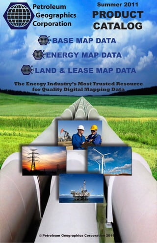
  • 1. Summer 2011 PRODUCT CATALOG BASE MAP DATA ENERGY MAP DATA LAND & LEASE MAP DATA The Energy Industry’s Most Trusted Resource for Quality Digital Mapping Data © Petroleum Geographics Corporation 2011
  • 2. OUR DATA PRODUCTS ARE COMPATIBLE WITH: PETRA GEOGRAPHIX KINGDOM SMT ESRI MAPINFO AUTOCAD SURFER MICROSTATION ROCKWORKS GOOGLE EARTH OR OUR FREE IPDM PROGRAM (Call for details) Please Visit Our Website: WWW.PETROLEUMGEOGRAPHICS.COM To Request Samples, a Demo or to Place an Order Please call us at 877-747-0650
  • 3. TABLE OF CONTENTS About Our Company Page 3 PGC Base Map Data Page 4 PGC National Land Grid Pages 5, 6, & 7 PGC Texas Land Grid Page 8 PGC Subsection Surveys Page 9 PGC Culture Data Page 10 PCG Digital Topos Page 11 PCG Aerial Photos Pages 12 & 13 PCG Elevation Data Page 14 PGC Offshore GOM Page 15 PGC Land & Lease Map Data Page 16 PGC BLM & State Oil & Gas Leases Pages 17,18,19 PGC BLM Mineral Leases. Pages 20 & 21 PGC Surface Land Ownership Data Page 22 PGC Geothermal Leases. Pages 23 & 24 PGC Wind Energy Leases Pages 25 & 26 PGC Energy Map Data Page 27 PGC Natural Gas /Oil Pipeline Data Page 28 PGC Pipeline Facility Data Page 29 PGC Oil & Gas Well Data Page 30 PGC Electricity Transmission Data Page 31 PGC Wind Energy Data Page 32 PGC Other Renewable Energy Data Page 33 PGC Industry Professional Digital Maps Page 34
  • 4. ABOUT OUR COMPANY Petroleum Geographics Corporation began in 2003 with a team of dedicated experts committed to bringing a higher quality standard to the energy industry and providing vital and necessary digital mapping data at a fair price. We bring over 30 years of combined GIS experience and know how to ensure the data you are looking for is available when you want it and in the format you require. You may have no- ticed the Internet has become the most popular research tool today, and conse- quently has often times become an avenue for obtaining GIS datasets. What is usually discovered, however is that these datasets can be unreliable, outdated, and geospatially incorrect. We are passionately committed to educating customers about the value of using PGC prod- ucts as compared to public domain datasets. We encourage challenging questions and appreciate true professionalism. At Petroleum Geographics we ensure that all resources (pub- lic, private, government, etc) are relied on in order to pro- vide you the very best available data. We research, compare, verify and validate. We strive to ensure the data is seamless, has appropriate and up-to-date attributes, and always possesses the highest level of geospatial accuracy. We are driven by the needs of our clients and therefore our offerings have been shaped by the industry itself. We wel- come comparisons with our competitors and strive to always be the leader. We look forward to serving you and your com- pany and being an integral part of your success. Page 3
  • 5. BASE MAP DATA NATIONAL LAND GRID TEXAS LAND SURVEY SUBSECTION SURVEYS CULTURE DATA DIGITAL TOPOS AERIAL PHOTOS ELEVATION DATA OFFSHORE GOM Page 4
  • 6. NATIONAL LAND GRID Land Grid, as it is commonly called, but more formally referred to as Public Land Survey System data (PLSS), is the fabric of mapping projects in the energy industry. PGC National Land Grid provides coverage for all 30 states in the U.S. that utilize a PLSS system. In addition, PGC National Land Grid can be customized to include similar land data coverage in Texas, and also the popular Marcellus Shale and eastern states of Pennsylvania, West Virginia, and New York, Tennessee, and Kentucky. PGC prides itself on providing a cost-effective, highest quality 1:24,000 scale dataset that is updated and maintained to be consistent with changes in the industry. PGC’s National Land Grid has sur- passed the comptition to become the premier product in the industry. We’re recognized by many companies as the data provider of choice. Customers enjoy our versatile formats and our flexibility in customizing the data for their uses and geo- graphical areas. Experience has shown us that professionals who have interest in using PLSS data usually ask a few common questions in determining how to go about acquiring the data: Page 5
  • 7. NATIONAL LAND GRID How does your “land grid” data differ from other vendors? Very few vendors provide a uniform nationwide land grid. Most have been in business for decades and have larger organizations, and thus need to charge more for the product. They never considered that the paper maps they digitized years ago would be replaced by newer digital PLSS sources that have become more accurate through the use of GPS and modern surveying techniques. It has been counter- productive for these vendors to try and incorporate new and current sources of information, while attempting not to abandon their older product and the associated higher costs. To illustrate an example, the U.S. Bureau of Land Manage- ment (BLM) manages land throughout the U.S. and has the largest public oil and gas leasing program that exists. The BLM has created industry-standard PLSS and the legal de- scriptions that define the oil and gas leases, which fit precisely within the BLM PLSS dataset and its subsequent Lots, Tracts, and Aliquots. It is not possible to retrofit the leases to an older version of the PLSS. While a different vendor may even concede this and attempt to incorporate this new data in an effort to “update” their data, they are still charging customers the same old high prices. In addition, oil and gas well locations are described according to the new PLSS sources and even old wells have had new footage calls assigned. One can easily verify this by simply negating the footage call and use the official latitude/longitude of the well point in conjunction with aerial photography. At PGC, we welcome the opportunity for you to send us an area from another vendor and we’ll show you a live demo comparison of the datasets. Page 6
  • 8. NATIONAL LAND GRID Isn’t PLSS data available on the internet and, if so, why should I purchase from PGC? First, one cannot acquire a complete nationwide 1:24,000 PLSS on the Internet, or from a public agency for that matter. We know this firsthand because we are always keeping abreast of new sources of information so that our data is the most up to date. Second, much of the downloadable data involves very tedious, time-intensive data manipulation to edit geometry and to standardize attributes. For example, we can show a live demo to you of an apples-to-apples comparison of the free GCDB BLM Land Grid and our cleaned, enhanced version, and you’ll immediately see the difference. In some cases there is so much data available you don’t know which to use. For example, in one state we found 5 dif- ferent sources of 1:24,000 PLSS on the Internet. Using PGC, you’ll have the assurance of knowing that we’ve not only seen the 5 sources, but that we already evaluated them to deter- mine if they are worthy of integrating into PGC National Land Grid. Another worthwhile point is that with PGC Na- tional Land Grid is standardized. The data structure, attri- butes, and topology is consistent across the entire dataset and we’ve created a special label attribute for every polygon. Take into account our complete nationwide coverage, our data cleaning and enhancement, thorough research performed, standardization of the dataset, low costs, it will be apparent PGC National Land Grid is the solution. Page 7
  • 9. TEXAS LAND SURVEY The Texas Land Survey system is quite in contrast with the more straightforward PLSS, however the Texas Land Survey data is synonymous with the term “Land Grid” as it serves as the fabric for mapping projects in Texas. PGC Texas Land Survey is a 1:24,000 statewide coverage that consists of Abstracts, Survey Names, Survey Numbers, Blocks, and Subdivision data. All entities of the data are pro- vided as separate layers and each layer is attributed with corresponding names and numbers. In addition, we provide a special unique layer that combines all of the data entities and the attribute text is neatly displayed so as not to overlap. PGC Texas Land Survey is derived from the General Land Office (GLO) in Texas and is updated on a continual basis as changes are mandated by the GLO. The industry has welcomed PGC Texas Land Survey as it has been a refreshing product offering in comparison to the higher costs from competing vendors. Customers enjoy our versatile formats and our flexibility in delivering the data by county, railroad district, or statewide. PGC Texas Land Survey can also be packaged with PGC National Land Grid for complete base map coverage. Page 8
  • 10. SUBSECTION SURVEYS PGC Subsection Data is comprised of Aliquots/Lots/Tracts and is a further delineation of the PLSS Land Grid. This de- tailed layer of information is a necessity when mapping land and leases. It is also extremely useful as a prospecting tool. When used with PGC Lease Map Data, customers have the ability to identify and pinpoint aliquot/lot/tract legal descrip- tions of parcels that are not currently leased on federal and state lands. The data is also useful in helping locate parcels residing on fee lands. While several land professionals often overlook the value and function of subsection data, savvy prospectors are using it to gain a competitive advantage in the energy leasing arena. PGC Subsection Data is an enhanced dataset originally obtained from the BLM GCDB data. It is much more user- friendly and has many different value-added features in com- parison to what can be found through the public domain. Page 9
  • 11. CULTURE DATA PGC Culture Data is a nationwide dataset containing infor- mation such as roads, rivers, streams, lakes, railroads, city, and county boundaries. Other unique cultural datasets can be pro- vided such as census boundaries, school zones, Indian reser- vations, and more. PGC Culture Data is a perfect complement to PGC National Land Grid, PGC Texas Land Survey and PGC National WellBase. PGC Culture Data can be purchased by County, Statewide, or Nationwide. Isn’t Culture Data one of those easy datasets you can obtain through public sources such as the U.S. Census Bureau? It is of the utmost importance to distinguish between our customized formats which are ready-to-load in specific soft- ware programs vs. data from the public domain. Our data customized formats include enhanced text placement and labeling, as well as the development of convenient, specified thematic layers that can be turned on or off. Our customers understand the tremendous time-savings value of high quality presentation maps that are instantly at their fingertips at a low cost as compared to the data cleanup and processing that is required in manipulating similar data from the public domain. We welcome the opportunity to pro- vide you a live demo to show you the difference. Page 10
  • 12. DIGITAL TOPOS Digital topographic data are also referred to as DRGs (Digi- tal Raster Graphics). They are scanned 1:24,000 Scale USGS 7.5 minute Topographic Maps. These are the same highly detailed maps that many of us have used for hiking and other outdoor recreational activities. PGC Digital Topo allows you to easily import these Topo Maps into your mapping project and overlay this useful in- formation with your other data sets. PGC removes the map collars, removes the unsightly “black areas” of no data, and projects the Topo Maps into your desired map projection/co- ordinate system so it can blend seamlessly into your project in any mapping software. PGC Digital Topo is available by the USGS Quadrangle, County, State, or Nationwide. Special package discounts are available for statewide and nationwide datasets. Page 11
  • 13. AERIAL PHOTOS PGC Aerial Photography is comprised of an archived geospatial library of county-based USDA NAIP True Color and Color Infrared, 1 and 2-Meter Resolution Aerial Photos flown between 2005 and present. PGC provides two differ- ent aerial photography products, Customized and Unpro- cessed. Each serves a very different purpose as the following explains: What is the advantage of purchasing PGC Customized Aerial Photography? PGC Aerial Photography is delivered as GeoTiff image format and is delivered on DVDs or External Hard Drives. The data is customized to accommodate customer-defined map projections/coordinate systems. Clients find this a key benefit as many mapping programs do not permit the user to re-project raster image files. Counties are delivered into a neatly partitioned series of smaller, indexed (doqq - quarter quad) files so images sizes are manageable in any mapping program. This is important to note because many mapping programs are limited by size limits on raster image files. PGC Aerial Photography is displayed in a seamless fash- ion. PGC can also deliver custom areas of interest based on Quadrangles or Lat/Long Coordinates. This is a great option to cover Basins and Large Areas of Interest at very affordable costs. Page 12
  • 14. AERIAL PHOTOS I just need the raw data that can be downloaded from the USDA website. Why would I purchase the PGC Unprocessed Aerial Photography? Since we can quickly deliver any part of our NAIP Aerial Photography archive, it saves customers a tremendous amount of time that they would otherwise spend researching to see if the data exists and then spending the time downloading data. Even with the fastest of Internet connections individual coun- ties can often take several hours to download. For example, if a customer desires to obtain NAIP Aerial Photography for the state of Oklahoma they would need to order 77 counties from the USDA website and then download all the data for each county individually. PGC provides a discounted price for the “raw” NAIP Aerial Photography so professionals can easily factor the “time vs. cost” equation and come out ahead. Page 13
  • 15. ELEVATION DATA PGC provides contour and elevation information derived from the USGS National Elevation Dataset (NED). PGC Elevation Data are available nationwide(except for Alaska) at resolutions of 1 arc-second (approx. 30 meters) and 1/3 arc-second (approx. 10 meters). Users of PGC Elevation Data have the ability to perform detailed analysis of any terrain in the U.S., and users also enjoy the freedom to create their own contour intervals, hill shades, line of sight profiles, and views- heds. Data can be provided by 7.5 Minute Topo Quadrangle and projected into your desired coordinate system/map projection to blend seamlessly into your project. PGC Elevation Data can be delivered in a variety of formats for import directly into GeoGraphix, Petra, Kingdom SMT, Surfer, AutoCad, ESRI, and MapInfo. Call today or contact us to get prices for Quadrangles or Custom Areas of Interest including Counties, Lat/Long Areas, Basins, etc. If you do not require custom projected elevation data and simply want the raw NED data you can purchase the entire U.S. dataset or individual statewide bundles. Page 14
  • 16. OFFSHORE GOM PGC Offshore Gulf of Mexico Data (GOM) includes both federal and state water geographic coverage. Information for the federal waters is derived from the Bureau of Ocean Energy Management, Regulation & Enforcement. Data for the federal waters includes 5,8, and 10 year lease boundaries, pipelines, blocks, shipping lanes, oil and gas plat- forms, and oil and gas well information. Data for the state waters for the states of Texas, Louisiana, and Mississippi includes blocks, oil and gas well data, and pipelines. PGC Offshore Gulf of Mexico Data is provided in ready-to-load formats where customers can integrate offshore data seamlessly into a variety of mapping programs. Page 15
  • 17. LAND & LEASE MAP DATA BLM & STATE OIL & GAS LEASES BLM MINERAL LEASES SURFACE LAND OWNERSHIP DATA GEOTHERMAL LEASES WIND ENERGY LEASES Page 16
  • 18. BLM & STATE OIL & GAS LEASES PGC Lease Map Data™ is comprised of map layers that represent the industry’s most comprehensive offering of GIS formatted Bureau of Land Management and State Trust Lands oil and gas lease data available. Areas of coverage include: • Bureau of Land Management (BLM) oil and gas lease map data for the states of Colorado, Wyoming, Montana, North Dakota, Utah, New Mexico, Nevada, California, Arizona, Idaho, Washington and Oregon. • State Trust Lands oil and gas lease map data for the states of Oklahoma, Colorado, Wyoming, Montana, North Dakota, New Mexico, and Utah. Using proprietary technology, Petroleum GeoGraphics has precisely mapped legal land descriptions of federal BLM and State Trust ownership and leases to official BLM PLSS Surveys, Lots, Tracts, and Aliquots. Integrating public information from several premier resources including the powerful BLM LR2000 database, and also state trust land records, PGC Lease Map Data™ provides a convenient one-stop shop for federal and state oil and gas lease data in the western United States. Data includes valuable attribute information such as full Land Legal Description, Acreage, Owner Type and Name, Case Type, Disposition and Action Type and Dates, Lease Status, Cost per Acre, Serial Number, Commodity Type, and Expiration Dates. Page 17
  • 19. BLM & STATE OIL & GAS LEASES Benefits of PGC Lease Map Data™: • Simple to use – load one easy map layer. • Precise geographic representation of the BLM LR2000 and state trust land records • Quickly evaluate federal and state parcels to determine land status and use • Eliminate the need for time-consuming BLM and state land records research • Analyze competitive lease situations and scenarios • Don’t have to rely on the federal & state web sites which can be very slow, not active, out of date, difficult to use, and inaccurate. T23N R117W Page 18
  • 20. BLM & STATE OIL & GAS LEASES PGC Lease Map Data™ can be delivered on a statewide, county, or even on a township/range basis, and subscriptions are available for customers desiring updates. Customers with statewide annual subscriptions will additionally receive valu- able supplemental reference datasets such as Stewardship/ Surface Ownership, State and Federal Subsurface Mineral Ownership, BLM Units, Wilderness Study Areas, Areas of Critical Concern, and National Conservation Areas. These supplemental datasets provide users the ability to identify land that is not leased, as well as mitigate risk and maximize invest- ment potential. PGC Lease Map Data™ is updated in a timely fashion after the results are declared from each of the corre- sponding state BLM or state trust oil and gas lease auction. For easy to use, cost effective, highly accurate federal BLM LR2000 and state trust land oil and gas lease data, PGC Lease Map Data™ is the premier tool. Can’t I download this from the Internet? There is not public source which will provide GIS data rep- resenting current active and pending BLM and State Leases. The BLM website has downloadable information that they will actually concede is not consistent with the true BLM LR2000 record system. The information is out of date and does not include several pieces of key attribute information, such as the company who possesses the lease, to name just one. Also, the downloadable data does not include the state lands lease infor- mation, which in many cases is very complex, and should not be overlooked if one is considering leasing public lands. PGC Lease Map Data is truly a unique, accurate, updated dataset that serves as a one-stop shop for public lease data. Page 19
  • 21. BLM MINERAL LEASES PGC Mineral Lease Map Data™ is comprised of map layers that represent the industry’s most comprehensive offering of GIS formatted Bureau of Land Management Potash, Coal, and other Mineral Leases. Areas of coverage include: • Bureau of Land Management (BLM) mineral lease map data for the states of Colorado, Wyoming, Montana, North Dakota, Utah, New Mexico, Nevada, California, Arizona, Idaho. Using proprietary technology, Petroleum GeoGraphics has precisely mapped legal land descriptions of federal BLM ownership and leases to official BLM PLSS Surveys, Lots, Tracts, and Aliquots. Integrating public information from several premier resources including the powerful BLM LR2000 database, PGC Mineral Lease Map Data™ provides a convenient one-stop shop for Potash, Coal, and other mineral lease data in the western United States. Data includes valuable attribute information such as full Land Legal Description, Acreage, Owner Type and Name, Case Type, Disposition and Action Type and Dates, Lease Status, Cost per Acre, Serial Number, Commodity Type, and Expiration Dates. Page 20
  • 22. BLM MINERAL LEASES Benefits of PGC Mineral Lease Map Data: • Simple to use – load one easy map layer. • Precise geographic representation of the BLM LR2000 re- cords • Quickly evaluate federal parcels to determine land status and use • Eliminate the need for time-consuming BLM land records research • Analyze competitive lease situations and scenarios • Don’t have to rely on the federal web sites which can be very slow, not active, out of date, difficult to use, and inaccurate. PGC Mineral Lease Map Data can be delivered on a state- wide, county, or even on a township/range basis, and subscrip- tions are available for customers desiring updates. Customers with statewide annual subscriptions will additionally receive valuable supplemental reference datasets such as Section Township Grid, Stewardship/Surface Ownership, State and Federal Subsurface Mineral Ownership, BLM Units, Wilder- ness Study Areas, Areas of Critical Concern, and National Conservation Areas. These supplemental datasets provide users the ability to identify land that is not leased, as well as mitigate risk and maximize investment potential. PGC Mineral Lease Map Data is updated in a timely fash- ion after the results are declared from each of the correspond- ing state BLM offices. For easy to use, cost effective, highly accurate federal BLM LR2000 Potash, Coal, and other mineral lease data, PGC Min- eral Lease Map Data is the premier tool. Page 21
  • 23. SURFACE LAND OWNERSHIP PGC Surface Land Ownership Data represents the larg- est geographic coverage of digitally mapped surface owner property commercially available. Data attributes may include Owner Name, Address, Lat/Long Polygon Centroid, and APN# (Assessor Property Number). Also known as parcel data or cadastral data, PGC Surface Land Ownership Data is helpful in all phases of land work, exploration, and production. Customers can save countless hours of land record research and digitizing. PGC Surface Land Ownership Data is an excellent complement to PGC National Land Grid and PGC Lease Map Data since it allows customers to see firsthand the private land ownership infor- mation that surrounds the BLM and State Lands leases. PGC Surface Land Ownership Data is also especially useful when doing projects in Texas or the Appalachian Basin, since in these regions the majority of the land is private. Data is typi- cally provided ESRI® Shape File format, but we can customiza- tions can be made to suit specific requests. Can I get this information directly from the County Assessor? A client recently needed 4 contiguous counties of land ownership in Texas. He had called all four county offices, and one county office had no digital information, the second county office had an AutoCad file that was not georeferenced, the third county office had GIS data available for a cost, and the fourth county office had a free GIS dataset. The customer purchased all 4 counties from us because we had complete coverage, the data was available in GIS format with universally consistent attributes, and we had statistics about what the da- tasets contained. Our cost are fair and reasonable because it is based on the difficulty of developing or acquiring the data. Page 22
  • 24. GEOTHERMAL LEASES PGC Geothermal Lease Map Data is comprised of map lay- ers that represent the industry’s most comprehensive offering of GIS formatted Bureau of Land Management Geothermal Leases. Areas of coverage include: • Bureau of Land Management (BLM) renewable geothermal map data for the states of Colorado, Wyoming, Montana, North Dakota, Utah, New Mexico, Nevada, California, Ari- zona, and Idaho. Using proprietary technology, Petroleum GeoGraphics has precisely mapped legal land descriptions of federal BLM ownership and leases to official BLM PLSS Surveys, Lots, Tracts, and Aliquots. Integrating public information from sev- eral premier resources including the powerful BLM LR2000 database, PGC Geothermal Lease Map Data provides a conve- nient one-stop shop for federal Geothermal lease data in the western United States. Data includes valuable attribute infor- mation such as full Land Legal Description, Acreage, Owner Type and Name, Case Type, Disposition and Action Type and Dates, Lease Status, Cost per Acre, Serial Number, Commod- ity Type, and Expiration Dates. Page 23
  • 25. GEOTHERMAL LEASES Benefits of PGC Renewable Lease Map Data: • Simple to use – load one easy map layer. • Precise geographic representation of the BLM LR2000 re- cords • Quickly evaluate federal parcels to determine land status and use • Eliminate the need for time-consuming BLM land records research • Analyze competitive lease situations and scenarios • Don’t have to rely on the federal web sites which can be very slow, not active, out of date, difficult to use, and inaccurate. PGC Renewable Lease Map Data can be delivered on a statewide, county, or even on a township/range basis, and subscriptions are available for customers desiring updates. Customers with statewide annual subscriptions will addition- ally receive valuable supplemental reference datasets such as Section Township Grid, Stewardship/Surface Ownership, State and Federal Subsurface Mineral Ownership, BLM Units, Wil- derness Study Areas, Areas of Critical Concern, and National Conservation Areas. These supplemental datasets provide users the ability to identify land that is not leased, as well as mitigate risk and maximize investment potential. PGC Geothermal Lease Map Data is updated in a timely fashion after the results are de- clared from each of the corresponding state BLM office. For easy to use, cost effective, highly accurate federal BLM LR2000 geothermal lease data, PGC Geothermal Lease Map Data™ is the premier tool. Page 24
  • 26. WIND ENERGY LEASES PGC Wind Energy Lease Map Data is comprised of map layers that represent the industry’s most comprehensive offering of GIS formatted Bureau of Land Management Wind Energy Leases. Areas of coverage include: • Bureau of Land Management (BLM) wind energy map data for the states of Colorado, Wyoming, Montana, North Dakota, Utah, New Mexico, Nevada, California, Arizona, and Idaho. Using proprietary technology, Petroleum GeoGraphics has precisely mapped legal land descriptions of federal BLM ownership and leases to official BLM PLSS Surveys, Lots, Tracts, and Aliquots. Integrating public information from several premier resources including the powerful BLM LR2000 database, PGC Wind Energy Map Data provides a convenient one-stop shop for federal Wind Energy lease data in the western United States. Data includes valuable attribute information such as full Land Legal Description, Acreage, Owner Type and Name, Case Type, Disposition and Action Type and Dates, Lease Status, Cost per Acre, Serial Number, Commodity Type, and Expiration Dates. Page 25
  • 27. WIND ENERGY LEASES Benefits of PGC Renewable Lease Map Data: • Simple to use – load one easy map layer. • Precise geographic representation of the BLM LR2000 re- cords • Quickly evaluate federal parcels to determine land status and use • Eliminate the need for time-consuming BLM land records research • Analyze competitive lease situations and scenarios • Don’t have to rely on the federal web sites which can be very slow, not active, out of date, difficult to use, and inaccurate. PGC Wind EnergyLease Map Data can be delivered on a statewide, county, or even on a township/range basis, and subscriptions are available for customers desiring updates. Customers with statewide annual subscriptions will addition- ally receive valuable supplemental reference datasets such as Section Township Grid, Stewardship/Surface Ownership, State and Federal Subsurface Mineral Ownership, BLM Units, Wil- derness Study Areas, Areas of Critical Concern, and National Conservation Areas. These supplemental datasets provide users the ability to identify land that is not leased, as well as mitigate risk and maximize investment potential. PGC Wind Energy Lease Map Data is updated in a timely fashion after the results are declared from each of the corresponding state BLM office. For easy to use, cost effective, highly accurate federal BLM LR2000 Wind Energy lease data, PGC Wind Energy Lease Map Data is the premier tool. Page 26
  • 28. ENERGY MAP DATA NATURAL GAS & OIL PIPELINES PIPELINE FACILITY DATA OIL & GAS WELL DATA ELECTRICITY TRANSMISSION WIND ENERGY DATA OTHER RENEWABLE ENERGY Page 27
  • 29. NATURAL GAS & OIL PIPELINES Accurately locating pipelines and the surrounding energy infrastructure has become more important than ever. The need for pipeline information is used in many industries for many purposes such as safety compliance, competitor analy- sis, right-of-way planning, proposed routes, open season opportunities, oil and gas exploration, infrastructure integrity, security, and more. PGC Pipeline Data will provided you the most reliable GIS pipeline information supported by rich, up to date and relevant attributes, to ensure your work output is the very best it can be. PGC Pipeline Data is comprised of Natural Gas, Liquids, Crude Oil, Refined Products, and CO2 Pipelines in the United States, Canada, and Mexico. Data coverage includes FERC Interstate, Intrastate, and Gathering Systems. Attributes associated with PGC Pipeline Data include owner, operator, pipeline diameter, operational status, and more. Page 28
  • 30. PIPELINE FACILITY DATA Facility data will help your pipeline maps represent a more clear picture of the surrounding infrastructure and Petroleum Geographics has put a lot of man hours into researching this information from various resources. Standard infrastructure facilities associated with Natural Gas and Liquids Pipelines include Gas Storage Facilities, Gas Processing Plants, LNG Import/Export Terminals, Gas Com- pressor Stations and Gas Markets & Hubs and more. Standard infrastructure facilities associated with Crude Oil and Refined Products Pipelines include Crude Oil Refineries. Additional supporting pipeline infrastructure facilities can be provided with PGC Pipeline Data such as Crude and refined Terminals, Crude Pumping Stations, and Petrochemical Plants. Page 29
  • 31. OIL & GAS WELL DATA PGC National WellBase is a nationwide oil and gas well location and header database that consists of information derived from state oil and gas regulatory agencies. Data coverage includes 35 different states. PGC has organized and formatted the data for ease of use with any mapping program. PGC National WellBase information includes such fields as: API number, well status, operator name, surface location, well name, well number, elevation, total depth, field name, completion, and plug dates, and more. PGC National WellBase is customized to load into specific geology and mapping programs. Data is available by county, statewide, and nationwide. Page 30
  • 32. ELECTRICITY TRANSMISSION Need to know where the electricity transmission lines are located? Want to see the locations of the electrical substations and power plants? PGC Electricity Transmission Data pro- vides you the 115KV and greater lines, along with the power plants fueled by various resources, and the associated hard- to-find substation location data. Electricity transmission data has become a critical need for industry professionals in today’s world. PGC Electricity Transmission Data provides a geographic illustration of how and where power travels. Valuable opportunities abound by discovering existing right-of-ways created by the construction of these lines and facilities. Energy professionals in the renewable, oil and gas, and mining industries utilize PGC Electricity Transmission Data as a rich resource in increasing the output of their plan- ning and work production. Page 31
  • 33. WIND ENERGY DATA Those of us working in the wind industry know the value of this renewable energy resource and the future potential it provides. When deciding optimal locations for placing wind turbines or wind farms, you seek to find data that will show you wind strengths at vertical increments above the ground. PGC Wind Energy Data will provide you this information so you can maximize the power output of your locations. Additional, PGC Wind Energy Data is valuable in assisting you in researching the potential market to discover where the current wind farms are located and what the associated MW outputs are. Besides the geographic location of current wind farms and wind turbines, information is provided on current owners, start dates, and energy output. Page 32
  • 34. OTHER RENEWABLE ENERGY When it comes to renewable energy we often think of wind turbines adding power to the electricity grid. The good, and often overlooked news is that there are several renewable resources in our country and PGC Other Renewable Energy Data is comprised of GIS map information including bio- mass, ethanol, biodiesel, bird seed oil, geothermal, methane recovery and solar energy. You can learn everything from the locations of plants that produce ethanol and biodiesel to the areas of the country where geothermal power and solar energy have the highest potential for energy output. This data is perfect for those wishing to learn more about the future of energy and it addi- tionally makes a great supplement to your current energy data for investments and exploration. Page 33
  • 35. IPDM PGC Industry Professional Digital Maps (IPDM) is the ideal tool for industry professionals who desire to make customized digital maps. PGC IPDM is easy to use and does not require use of GIS software. To get started, simply choose any of PGC’s products and indicate the geographic area you are interested in (County, State(s) or U.S. Coverage). Users will be able to do the following: • Turn on and off layers of information at will • Point & click to see specific information about the map feature • Zoom in and out dynamically, adjusting for scale • Export to PDF, JPEG, PPT, or other file type • Print unlimited copies, up to size 11” X 17” Executives, Marketing, Finance, Legal professionals, Investors, and business partners use PGC IPDM to do the following: 1. Make strategic and informed business decisions 2. Analyze information 3. Professional presentations 4. Capitalize on potential opportunities Page 34
  • 36. OUR DATA PRODUCTS ARE COMPATIBLE WITH: PETRA GEOGRAPHIX KINGDON SMT ESRI MAPINFO AUTOCAD SURFER MICROSTATION ROCKWORKS GOOGLE EARTH OR OUR FREE IPDM PROGRAM (Call for details) Please Visit Our Website: WWW.PETROLEUMGEOGRAPHICS.COM To Request Samples, a Demo or to Place an Order Please call us at 877-747-0650