Suche senden
Hochladen
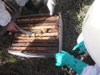
Pr240813 07
•
Als PPT, PDF herunterladen
•
0 gefällt mir
•
130 views
S
sau2013
Folgen
Melden
Teilen
Melden
Teilen
1 von 29
Jetzt herunterladen
Empfohlen
Photos
Photos
igrant
Map and GIS Data for 21st Century Research
Map and GIS Data for 21st Century Research
University of Connecticut Libraries Map and Geographic Information Center - MAGIC
Esriuk_track7_king edward vi _garry simmons
Esriuk_track7_king edward vi _garry simmons
Esri UK
Gis
Gis
nayakslideshare
Wmpid phases rf1_8x11 aerial photo
Wmpid phases rf1_8x11 aerial photo
Theresa Wagaman
Photos
Photos
Noeleen
Year 8 geography landscapes and landforms final
Year 8 geography landscapes and landforms final
terracelibrary
Ch. 1.2--Geographer's Tools
Ch. 1.2--Geographer's Tools
John Hext
GEOG101 Chapter 2 Lecture
GEOG101 Chapter 2 Lecture
rsmithharfordedu
Airphotos Online, Landview, And Using Digital Info
Airphotos Online, Landview, And Using Digital Info
Eli Sagor
GEOGRAPHY YEAR 9 SKILLS - MAPS
GEOGRAPHY YEAR 9 SKILLS - MAPS
George Dumitrache
Geography tools
Geography tools
Profesora Geografía e Historia IES
Contours
Contours
Noeleen
Os symbols sheet25k
Os symbols sheet25k
Guerillateacher
6 figure grid references
6 figure grid references
Noeleen
Drawing Sketch Maps of O.S. Maps and Aerial Photographs
Drawing Sketch Maps of O.S. Maps and Aerial Photographs
Aisling O Connor
Scale and distance
Scale and distance
Noeleen
The geographer’s tools
The geographer’s tools
Aaron Carn
Map symbols
Map symbols
Noeleen
Reading maps of different kinds
Reading maps of different kinds
Padma Lalitha
Principle of aerial photography and types.ppt
Principle of aerial photography and types.ppt
srinivas2036
Map Skills Revision
Map Skills Revision
whiskeyhj
Theme symbols and motifs
Theme symbols and motifs
Guerillateacher
Pr240813 06
Pr240813 06
sau2013
Pr240813 05
Pr240813 05
sau2013
Pr240813 04
Pr240813 04
sau2013
Pr240813 03
Pr240813 03
sau2013
Pr240813 02
Pr240813 02
sau2013
Pr240813 01
Pr240813 01
sau2013
Weitere ähnliche Inhalte
Andere mochten auch
GEOG101 Chapter 2 Lecture
GEOG101 Chapter 2 Lecture
rsmithharfordedu
Airphotos Online, Landview, And Using Digital Info
Airphotos Online, Landview, And Using Digital Info
Eli Sagor
GEOGRAPHY YEAR 9 SKILLS - MAPS
GEOGRAPHY YEAR 9 SKILLS - MAPS
George Dumitrache
Geography tools
Geography tools
Profesora Geografía e Historia IES
Contours
Contours
Noeleen
Os symbols sheet25k
Os symbols sheet25k
Guerillateacher
6 figure grid references
6 figure grid references
Noeleen
Drawing Sketch Maps of O.S. Maps and Aerial Photographs
Drawing Sketch Maps of O.S. Maps and Aerial Photographs
Aisling O Connor
Scale and distance
Scale and distance
Noeleen
The geographer’s tools
The geographer’s tools
Aaron Carn
Map symbols
Map symbols
Noeleen
Reading maps of different kinds
Reading maps of different kinds
Padma Lalitha
Principle of aerial photography and types.ppt
Principle of aerial photography and types.ppt
srinivas2036
Map Skills Revision
Map Skills Revision
whiskeyhj
Theme symbols and motifs
Theme symbols and motifs
Guerillateacher
Andere mochten auch
(15)
GEOG101 Chapter 2 Lecture
GEOG101 Chapter 2 Lecture
Airphotos Online, Landview, And Using Digital Info
Airphotos Online, Landview, And Using Digital Info
GEOGRAPHY YEAR 9 SKILLS - MAPS
GEOGRAPHY YEAR 9 SKILLS - MAPS
Geography tools
Geography tools
Contours
Contours
Os symbols sheet25k
Os symbols sheet25k
6 figure grid references
6 figure grid references
Drawing Sketch Maps of O.S. Maps and Aerial Photographs
Drawing Sketch Maps of O.S. Maps and Aerial Photographs
Scale and distance
Scale and distance
The geographer’s tools
The geographer’s tools
Map symbols
Map symbols
Reading maps of different kinds
Reading maps of different kinds
Principle of aerial photography and types.ppt
Principle of aerial photography and types.ppt
Map Skills Revision
Map Skills Revision
Theme symbols and motifs
Theme symbols and motifs
Mehr von sau2013
Pr240813 06
Pr240813 06
sau2013
Pr240813 05
Pr240813 05
sau2013
Pr240813 04
Pr240813 04
sau2013
Pr240813 03
Pr240813 03
sau2013
Pr240813 02
Pr240813 02
sau2013
Pr240813 01
Pr240813 01
sau2013
Mehr von sau2013
(6)
Pr240813 06
Pr240813 06
Pr240813 05
Pr240813 05
Pr240813 04
Pr240813 04
Pr240813 03
Pr240813 03
Pr240813 02
Pr240813 02
Pr240813 01
Pr240813 01
Jetzt herunterladen