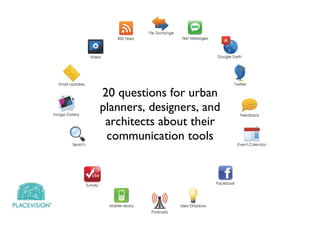
20 questions for urban planners, designers, and architects about their communication tools
•
5 gefällt mir•1,119 views


Empfohlen
Empfohlen
Weitere ähnliche Inhalte
Ähnlich wie 20 questions for urban planners, designers, and architects about their communication tools
Ähnlich wie 20 questions for urban planners, designers, and architects about their communication tools (20)
Mehr von PlaceVision Inc
Mehr von PlaceVision Inc (11)
Kürzlich hochgeladen
Kürzlich hochgeladen (20)
20 questions for urban planners, designers, and architects about their communication tools
- 1. 20 questions for urban planners, designers, and architects about their communication tools
- 2. What is your website capable of doing?
- 3. Does your site reflect your professionalism?
- 4. Can you easily map projects in Google Earth?
- 5. Is your portfolio Google Earth enabled?
- 6. Does your website facilitate a conversation?
- 7. Does your website drive traffic?
- 8. Are you measuring return on investment?
- 9. Are you generating interest on Twitter?
- 10. Can you visualize building data?
- 11. Is your building data mobile?
- 12. Can you visualize proposed development on the site?
- 13. Does your planning process include a citizen map?
- 14. Are you collecting citizen comments in real-time?
- 15. Are you able to mash-up comments with SCF?
- 16. Did you know podcast tours increase awareness?
- 17. Do you have a mobile map for local points of interest ?
- 18. Do you know when to use what tool?
- 19. Can you easily map your success stories?
- 20. Can you visualize development proposals in context?
- 21. Can you visualize streetscape improvements?
- 22. If you learned something, then you might need help communicating more effectively.
- 23. www.PlaceVision.net Creative Viewing of the Built Environment
Hinweis der Redaktion
- Does your website support everything you need? There are multiple apps that can expand the capabilities of your site.
- If you haven’t thought about your site in a while, now is the time. It should be easy to navigate, moble-enabled, linked to social networks, and provide robust portfolio management tools.
- Since your work is location-based, you can spice up your portfolio with SiteVista, a tool that enables you to manage your site and create a Google Earth map on-the-fly.
- Few tools exist for websie owners to easily map projects, that’s why PlaceVision created one.
- You should be able to publish content to your website and automatically distribute it to other environments that encourage feedback. The same can be accomplished for public engagement to save time.
- Does your site invite the exploration of its content? Do you update it frequently?
- There are several key ways to monitor the effectiveness of your online activities. You should have a plan and goals in place to measure ROI against.
- Twitter is more than a fad. You need a strategy to provide useful content and connect with others.
- Building information often lives in spreadsheet but can become geographic easily.
- Augmented reality browsers enable us to deliver geographic information on mobile devices depending on your location.
- Architectural renderings can be viewed on the development site through augmented reality.
- Citizen maps open up the opportunity for place-based communication. They can be used in community workshops to visualize feedback in real-time.
- Citizens can vote on comments and add images to place marks easily.
- Community Remarks(TM) can be visualized with comments from other sources, such as See Click Fix
- Podcast tours augment walking tours to tell a story about a places past, present, and future. It can present historical photographs, alternate views, and custom graphics to educate listeners.
- A podcast tour doesn’t have to be static. A smartphone app compliments the podcast tour to guide the listener along the stopping points and can even show participants where they are located on the map.
- There are many tools available on the market. How do you know what’s the most appropriate and affordable? We demystify that for you.
- You can embed a Google map on your website to tell a story about your projects. Think of it as a “mini” portfolio.
- We turn static graphics into interactive materials to help planners and developers commuicate about options in community meetings.
- Visualizing streetscape improvements is one of the toughest things to do. We make them interactive so we can flip between before and afters and even drill down to individual facade recommendations.