Met Office Google Earth Layer Shows 2C Warming by 2050
•
0 likes•524 views

The UK Met Office climate change Google Earth layer showing regional warming in a 2C world.

Recommended
More Related Content
What's hot
What's hot (20)
Viewers also liked
Similar to Met Office Google Earth Layer Shows 2C Warming by 2050
Similar to Met Office Google Earth Layer Shows 2C Warming by 2050 (20)
Met Office Google Earth Layer Shows 2C Warming by 2050
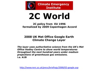
- 1. 2C World 2C policy from EU 1996 formalized by 2009 Copenhagen Accord 2008 UK Met Office Google Earth Climate Change Layer The layer uses authoritative science from the UK's Met Office Hadley Centre to show world temperatures throughout the next hundred years under medium projections of greenhouse gas emissions. i.e. A1B http://www.nerc.ac.uk/press/briefings/2008/02-google.asp
- 2. Deriving a 2C world from the UK Met Office Google Earth climate change layer Images are taken at September 2050 as being representative of 2° C global warming 2C 2050
- 3. Arid and semi-arid regions Arid and semi-arid climates comprise over one quarter of the land area of earth (more than any other climate type). Desert Meteorology, Thomas T. Warner, 2004, Cambridge University Press Semi-arid regions represent a significant portion of earth's surface. More than three- quarters of a billion people (more than one in eight) are estimated to live in dry lands.
- 4. Agriculture Crop productivity is projected to increase slightly at mid - to high latitudes for local mean temperature increases of up to 1.5-3.5 °C from pre-industrial depending on the crop, and then decrease beyond that. Global production potential, is threatened at +1.5 °C local temperature from pre-industrial IPC C 2007
- 5. Africa 2C
- 6. Asia 2C Russia China India
- 7. Europe 2C Russia Ukraine
- 8. North America 2C Canada USA
- 9. North American great grain belt 2C
- 10. South America 2C
- 11. South America 2C Amazon S America
- 12. Arctic Ocean
- 13. Arctic 2C Arctic Ocean
- 14. Arctic methane feedback sources Methane hydrate location
- 15. Antarctica 2C Antarctica