Update on MMDC's Nickel Resources in Surigao del Sur
•
1 gefällt mir•48,209 views

This report provides an updated mineral resource estimate for the MMDC Nickel Project located in Surigao del Sur, Philippines as of December 2012. A total of 1,289 drill holes were completed within the project area, with assay results indicating the presence of high-iron limonite ore and high-nickel saprolite ore. Using a polygon method and classification guidelines consistent with CIM and JORC standards, the total Measured and Indicated mineral resources are estimated to be 11.84 million tonnes averaging 1.52% nickel. Additionally, the total Inferred resources are estimated to be 17.94 million tonnes averaging 1.37% nickel. This represents an update from the 2010 resource estimate.

Empfohlen
Weitere ähnliche Inhalte
Was ist angesagt?
Was ist angesagt? (20)
Ähnlich wie Update on MMDC's Nickel Resources in Surigao del Sur
Ähnlich wie Update on MMDC's Nickel Resources in Surigao del Sur (20)
Mehr von No to mining in Palawan
Mehr von No to mining in Palawan (20)
Kürzlich hochgeladen
Kürzlich hochgeladen (20)
Update on MMDC's Nickel Resources in Surigao del Sur
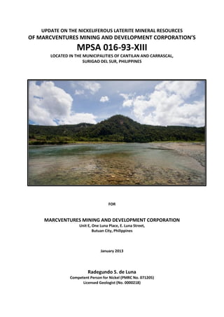
- 1. UPDATE ON THE NICKELIFEROUS LATERITE MINERAL RESOURCES OF MARCVENTURES MINING AND DEVELOPMENT CORPORATION’S MPSA 016-93-XIII LOCATED IN THE MUNICIPALITIES OF CANTILAN AND CARRASCAL, SURIGAO DEL SUR, PHILIPPINES FOR MARCVENTURES MINING AND DEVELOPMENT CORPORATION Unit E, One Luna Place, E. Luna Street, Butuan City, Philippines January 2013 Radegundo S. de Luna Competent Person for Nickel (PMRC No. 071205) Licensed Geologist (No. 0000218)
- 3. Update on the Mineral Resources of the MMDC Nickel Project Marcventures Mining & Development Corporation Radegundo S. de Luna, Competent Person for Geology TABLE OF CONTENTS 1. EXECUTIVE SUMMARY 1 2. INTRODUCTION 4 3. TENEMENT AND MINERAL RIGHTS 5 4. GEOGRAPHIC FEATURES 5 4.1 Location and Accessibility 5 4.2 Topography, Physiography and Drainage 6 4.3 Climate 7 4.4 Vegetation 7 5. PREVIOUS WORK 8 6. HISTORY OF PRODUCTION 10 7. GEOLOGIC SETTING 12 7.1 Regional Geology and Tectonic Setting 12 7.2 Local Geology 15 7.2.1 Dinagat Ophiolite Complex 15 7.2.2 Sohoton Greenschist 16 7.2.3 Alipao Andesite 16 7.2.4 Timamana Limestone 16 8. MINERALIZATION 18 9. EXPLORATION 21 10. DRILLING 22 10.1 Drilling Contractors 24 10.2 Drill hole Collar Survey 26 11. SAMPLING METHOD 26 12. SAMPLE PREPARATION, SECURITY AND ANALYSES 28 13. DATA VERIFICATION 30 14. MINERAL RESOURCE ESTIMATE 31 15. INTERPRETATION AND CONCLUSIONS 33 16. RECOMMENDATIONS 34 17. REFERENCES 35 i
- 4. Update on the Mineral Resources of the MMDC Nickel Project Marcventures Mining & Development Corporation Radegundo S. de Luna, Competent Person for Geology LIST OF TABLES Table 1: MMDC Mineral Resources as of December 2012 3 Table 2: Technical description of MPSA 016-93-XIII 4 Table 3: Resource estimates of previous exploration works 9 Table 4: MMDC’s production history from 2011 to 2012 11 Table 5: Summary of drilling activities conducted over Cabangahan, Sipangpang and Pili 22 Table 6: List of rigs of CDSI 24 Table 7: Relationship of accepted value and reassay of standard samples 30 Table 8: Summary of Mineral Resource estimate by polygon method 33 Table 9: Comparison of 2010 and 2012 resource estimates 33 LIST OF FIGURES Figure 1: Location Map of MMDC Tenement Area in Cantilan, Surigao del Sur 4 Figure 2: Road network from Surigao City and Butuan City to MMDC Tenement Area 6 Figure 3: Map showing location of Carac-an River 7 Figure 4: Climate map of the Philippines with relative location of MMDC Tenement Area 8 Figure 5: MMDC Tenement Map showing Cabangahan, Sipangpang and Pili Areas 10 Figure 6: Current Mine site in Cabangahan Area 11 Figure 7: General tectonic map of the Philippines 12 Figure 8: Close-up of the tectonic setting of northern Surigao Peninsula 13 Figure 9: Distribution of ophiolites in the Philippines 13 Figure 10: Updated stratigraphic column of the Northern Pacific Cordillera 15 Figure 11: Geologic map of MMDC Tenement Area 16 Figure 12: Graph of nickel and iron values versus depth 19 Figure 13: Frequency distribution graphs of Nickel and iron values of samples 20 Figure 14: Map showing dominant structures inferred in the vicinity of MMDC area 22 Figure 15: Location map of drill holes in Cabangahan, Sipangpang and Pili 23 Figure 16: Photograph of CDSI drill rig 24 Figure 17: Photograph of Georock drill rig 25 Figure 18: Photograph of portable mechanized auger used by Dr. Arcilla’s Team 25 Figure 19: Photograph of in-house drill rig, YBM 26 Figure 20: Sample of core photograph with label 27 Figure 21: Photograph of MMDC Sample Preparation Facility 28 ii
- 5. Update on the Mineral Resources of the MMDC Nickel Project Marcventures Mining & Development Corporation Radegundo S. de Luna, Competent Person for Geology Figure 22: Steel plate and electric oven used for sample preparation 28 Figure 23: Crusher and pulverizer used for sample preparation 29 Figure 24: AAS equipment and chemical used for titration 29 Figure 25: Scatter plot for standard samples 30 LIST OF APPENDICES Appendix 1: Daily Drilling Report, Core Log Form and Sample Submission Form Appendix 2: Assay results of standard samples Appendix 3: Sample database used in the resource estimation iii
- 6. Update on the Mineral Resources of the MMDC Nickel Project Marcventures Mining & Development Corporation Radegundo S. de Luna, Competent Person for Nickel 1. EXECUTIVE SUMMARY On December 2012, Marcventures Mining and Development Coporation (MMDC) requested the author to update the Competent Person Report on its mineral resource which was filed on August 2010. The first report was written by Dr. Carlo Arcilla, Competent Person for Geology and current Director of the National Institute of Geological Sciences. The previous resource estimate of Dr. Arcilla in 2010 reported a total of 3,867,000 dry metric tonnes of Indicated limonite resource at 1.0% nickel cut-off, averaging 1.3% nickel and 35.9% iron, and 5,635,000 metric tonnes of Indicated saprolite resource at 1.0% nickel cut-off, averaging 1.4% nickel, within a 120-hectare portion of the 4,799-hectare tenement area. This report discloses the result of exploration carried out by MMDC from 2010 to 2012 on its Nickel Project as well as the updated resource estimate. The tenement area is mostly underlain with serpentinized peridotite and dunite of the Dinagat Ophiolite. Geological mapping and exploratory drilling showed favourable development of iron-rich limonite ore north of Carac-an River and the occurrence of nickel-rich saprolite ore was observed south of the said river. The MPSA area is divided into three sub-areas, namely: 1) Cabangahan, 2) Sipangpang, and 3) Pili. A total of 1,289 drill holes with an aggregate depth of 21,266.98 meters have been drilled to date. Combination of compass and tape traverse, and Global Positioning System (GPS) were used primarily to locate holes at 50-m, 100-m and 200-m interval. Collar coordinates of drill holes at 25-m interval were obtained using total station. Assay results of Pili and Sipangpang drill holes indicate presence of high-iron limonite ore in these areas. Cabangahan samples yielded assay results indicative of high- nickel saprolite ore overlain by high-iron limonite ore. Core samples from the field were logged and prepared at MMDC Core House and Sample Preparation Facility located in Sition Banban, Cantilan. Whole-rock chemical analyses of the core samples were done by Atomic Absorption Spectroscopy (AAS) at MMDC’s Laboratory also located within the vicinity. Quality analysis/quality control program includes AAS calibration using in-house laterite standard samples prepared by titration. Statistical evaluation and graphical presentation of 1,059 standards showed excellent correlation for nickel and iron with R2 = 0.99. The Resources are classified purely as a function of the drilling density. Resource estimation used in this report is the polygon method in which the classification guidelines applied are consistent with the CIM or JORC classification standards, to wit: 1
- 7. Update on the Mineral Resources of the MMDC Nickel Project Marcventures Mining & Development Corporation Radegundo S. de Luna, Competent Person for Nickel Measured Resources - for limonite, where drilling is at a grid of 50m x 50m or less - for saprolite, where drilling is at a grid of 25m x 25m or less Indicated Resource - for limonite, where drilling is at a grid of up to 100m x 100m - for saprolite, where drilling is at a grid of up to 50m x 50m Inferred Resource - for limonite and saprolite, where drilling is at a grid of up to 300m x 300m Cut-off grade for saprolite estimation is ≥1.5% nickel and <20% iron. While for limonite ore, cut-off grade used was ≥0.7% nickel and ≥20% iron. Total Measured and Indicated Saprolite Resource with average 1.90% nickel and 11.81% iron is 2,883,000 WMT. For Limonite Ore, total Measured and Indicated Resource averaging 1.08% nickel and 44.48% iron is 15,991,000 WMT. Total Inferred Saprolite Resource with average 1.73% nickel and 13.08% iron is 4,490,000 WMT. For Limonite Ore, total Inferred Resource averaging 1.00% nickel and 47.93% iron is 21,960,000 WMT. Details of the Mineral Resource estimation are shown in Table 1. 2
- 8. Update on the Mineral Resources of the MMDC Nickel Project Marcventures Mining & Development Corporation Radegundo S. de Luna, Competent Person for Nickel Table 1. MMDC MINERAL RESOURCES as of December 2012. Tonnes Tonnes Area Class Type (Wet) (Dry) %Ni %Fe Ni Tonnes Cabangahan Measured Saprolite 2,400,000 1,580,000 1.91 11.77 30,152 Limonite 2,634,000 1,637,000 1.24 42.36 20,367 Total/Ave. 5,034,000 3,217,000 1.57 27.33 50,519 Indicated Saprolite 482,000 347,000 1.88 12.00 6,524 Limonite 12,512,000 7,758,000 1.06 44.61 82,299 Total/Ave. 12,994,000 8,105,000 1.47 28.31 88,822 Measured and Indicated 18,028,000 11,322,000 1.52 27.82 139,341 Inferred Saprolite 4,483,000 2,909,000 1.73 13.08 50,343 Limonite 4,699,000 2,914,000 1.08 46.64 31,561 Total/Ave. 9,182,000 5,823,000 1.41 29.86 81,905 Sipangpang Indicated Saprolite 0 0 0.00 0.00 0 Limonite 839,000 520,000 0.94 49.18 4,874 Total/Ave. 839,000 520,000 0.94 49.18 4,874 Inferred Saprolite 0 0 0.00 0.00 0 Limonite 9,770,000 6,058,000 1.01 47.49 60,958 Total/Ave. 9,770,000 6,058,000 1.01 47.49 60,958 Pili Inferred Saprolite 0 0 0.00 0.00 0 Limonite 7,493,000 6,058,000 0.95 49.35 57,661 Total/Ave. 7,493,000 6,058,000 0.95 49.35 57,661 Total Measured Saprolite 2,401,000 1,580,000 1.91 11.77 30,152 Limonite 2,640,000 1,637,000 1.24 42.36 20,367 Total/Ave. 5,041,000 3,217,000 1.58 27.07 50,519 Indicated Saprolite 482,000 347,000 1.88 12.00 6,524 Limonite 13,352,000 8,278,000 1.05 44.90 87,173 Total/Ave. 13,834,000 8,625,000 1.47 28.45 93,696 Measured and Indicated 18,875,000 11,842,000 1.52 27.76 144,215 Inferred Saprolite 4,484,000 2,909,000 1.73 13.08 50,343 Limonite 21,962,000 15,029,000 1.00 47.93 150,181 Total/Ave. 26,446,000 17,938,000 1.37 30.58 200,524 Measured + Indicated + Inferred contained nickel in tonnes 344,739 3
- 9. Update on the Mineral Resources of the MMDC Nickel Project Marcventures Mining & Development Corporation Radegundo S. de Luna, Competent Person for Nickel 2. INTRODUCTION This technical report was prepared at the request of Mr. Mario G. Vijungco, Chairman and President of Marcventures Mining and Development Corporation (MMDC), with the purpose of providing an updated nickeliferrous laterite resource estimate of the MMDC Nickel Project located within the Municipality of Cantilan and Carrascal in Surigao del Sur (Figure 1). MMDC Nickel Project Figure 1. Map showing location of the MMDC Nickel Project in the Municipality of Cantilan, Province of Surigao del Sur relative to adjacent provinces. The author was commissioned by MMDC to complete a review, site visit and technical report on the mining and exploration activities being undertaken by the company. This technical report, which complies with the requirements, guidelines and implementing rules and regulation of the Philippine Mineral Reporting Code (PMRC), relied on the technical reports, opinion and statement of geologists/consultants of MMDC. The report also provides detailed summary of the assessment of historical data and results of the exploration program carried out over the tenement area for the past 2 years after the last competent person report. This document is compiled from technical reports written by consultants of MMDC, published technical data and observations made by MMDC geologists. All sources of data used are herein cited and listed in Section 17. This technical report is compliant with the implementing rules and regulations of the Philippine Mineral Reporting Code (PMRC). 4
- 10. Update on the Mineral Resources of the MMDC Nickel Project Marcventures Mining & Development Corporation Radegundo S. de Luna, Competent Person for Nickel 3. TENEMENT AND MINERAL RIGHTS MMDC Nickel Project is located within Barangays Cabangahan and Panikian in the Municipalities of Cantilan and Carrascal, respectively. Cantilan and Carrascal are within the Province of Surigao del Sur. The project is covered by MPSA 016-93-XI. Table 2 shows the geographic coordinates of the boundary of the tenement area. Tabel 2. Technical description of MPSA 016-93-XI in Luzon-Mindanao Datum Corner Longitude Latitude 1 125°52'30" 9°20'00" 2 125°55'00" 9°20'00" 3 125°55'00" 9°19'00" 4 125°54'00" 9°19'00" 5 125°54'00" 9°15'30" 6 125°53'30" 9°15'30" 7 125°53'30" 9°14'00" 8 125°51'00" 9°14'00" 9 125°51'00" 9°15'00" 10 125°51'30" 9°15'00" 11 125°51'30" 9°19'00" 12 125°52'30" 9°19'00" The project area is within a logging concession that was operated by Ventura Timber Corporation since 1986. Realizing the potential of the area, Ventura Timber Corporation engaged the services of Geomin Management Corporation in May 1991 to explore the area for possible mineral deposits and in July 1991, applied for a Mineral Production Sharing Agreement (MPSA) over 4,799 hectares in accordance with the transitory provision of the 1987 Mining Law known as Executive Order No. 279 (E.O. 279). 4. GEOGRAPHIC FEATURES 4.1 Location and Accessibility The tenement area is located approximately 3 kilometers west of Cantilan along the Surigao City-Tandag National Highway and accessible through newly renovated logging roads westward from Barangay Panikian. Surigao del Sur is bordered by Surigao del Norte to the north, Agusan del Norte and Agusan del Sur to the west, and Davao Oriental to the south. 5
- 11. Update on the Mineral Resources of the MMDC Nickel Project Marcventures Mining & Development Corporation Radegundo S. de Luna, Competent Person for Nickel Cantilan is accessible from Surigao City by travelling 120 kilometers southward (Figure 2) and from Tandag by land travel for about 60 kilometers northward. Surigao City and Butuan City can be reached from Manila or Cebu City most conveniently by daily flights by all major airlines in the country. Figure 2. Map showing road network from Surigao City and Butuan City to MMDC tenement area. 4.2 Topography, Physiography and Drainage The tenement area is located at the north eastern fringe of the Diwata Mountain Range (also called the Pacific Cordillera), a 300-kilometer stretch of rugged mountains that extends all the way to Davao. To the west of the Diwata Mountain Range are topographic low areas, Tubay Valley and Lake Mainit. These areas are bordered to the west by a 70-kilometer long elevated terrain that runs parallel to the west coast of Surigao del Norte, the Malimono Ridge. Within the tenement area, the terrain is generally gently to moderately sloping and undulating with the exception of some portions in Cabangahan with steep slopes. The Carac-an River transects the tenement area from west to east (Figure 3). The portion of the tenement north of the river attain elevations up to 400 meters above sea level while the portion located south of the river reaches up to 650 meters above sea level. The 6
- 12. Update on the Mineral Resources of the MMDC Nickel Project Marcventures Mining & Development Corporation Radegundo S. de Luna, Competent Person for Nickel Carac-an River merges with the Taracan River to the south and empties into Lanuza Bay at the east. To the northeast and northwest of the MPSA is well-formed karst topography, indicative of limestone areas. The Eyamjo River appears to be the boundary between the karst topography and the other mountains. Figure 3. Map showing the Carac-an River transecting the tenement area. Also shown are the Eyamjo and Taracan Rivers. 4.3 Climate Surigao del Sur exhibits TYPE II Climate which has no pronounced dry and wet season (Figure 4). Maximum rainfall is experienced from November to February and minimum rainfall from May to April with annual rainfall not exceeding 4,500 millimeters (Kintanar, 1984). 4.4 Vegetation Dense growth of primary forest trees (e.g. narra, lauan, apitong, tangile) covers the mountainous portions of the tenement. Secondary growth plant covers the logged out portions of the area. Lowlands are used for agricultural purposes and are cultivated with 7
- 13. Update on the Mineral Resources of the MMDC Nickel Project Marcventures Mining & Development Corporation Radegundo S. de Luna, Competent Person for Nickel rice, corn, coconut and fruit trees. Mangroves are observed to grow along the lower sections of rivers and coastal areas. Figure 4. Climate map of the Philippines with relative location of MMDC tenement area represented by a red star (CORONA, 1920). 5. PREVIOUS WORK The potential of the tenement area for nickeliferrous laterite was first recognized in the 1950s when the Mines and Geosciences Bureau (MGB) delineated areas with potential for laterite in the Surigao Peninsula. Several companies had taken interest in the property including Surigao Nickel Mining and Industrial Corporation in a joint venture with Marcopper Mining Corporation (1970s); Ventura Timber Corporation (1990s) who engaged Geomin Management Corporation to explore the area in 1991, and Queensland Nickel Incorporated and Hinatuan Mining Corporation in 1992. Table 3 shows the previous exploration works and various resource estimates undertaken for MMDC. 8
- 14. Update on the Mineral Resources of the MMDC Nickel Project Marcventures Mining & Development Corporation Radegundo S. de Luna, Competent Person for Nickel Table 3. Resource estimates of previous exploration works. Period Proponent Area Auger drill Test pits Rotary drill Results / Resource Coverage holes holes Estimate 1970 Marcopper Mining 1,300 has. over 1,000 80 MMT of laterite; Corp / Surigao sampling average 1.2 percent nickel Nickel Mining and points and 0.1 percent cobalt Industrial Corp 1991 Geomin Area 1, Area 2 45 holes with 200-m grid 0.1 to 13% heavy mineral Management Corp aggregate spacing fraction, high anomaly in meterage of central northern part of 275 meters at the area; conducted 300-m grid geological mapping, petrographic and mineralogical studies 1992 Hinatuan Mining Area 2 (25 25 holes with 826kg of limonite at 0.9% has.) depth ranging Ni cut-off, averaging from 7 to 24 1.16% Ni and 50.7% Fe; meters 2,044kg of saprolite at 1.6% Ni cut-off, averaging 2.15% Ni 1994 Ventura Timber 1,500 has. 1,000 drill 111 test pits estimated potential holes ranigng from resource of 100MMT at 6.3 to 14.3 1.5% Ni, 24% Fe and meters 0.05% Co 2000 QNI Philippines 400 has. 412 drill holes 2009 Arcilla Area 2 (117 170 holes 3.8 MMT of Indicated has.) Limonite at 1% Ni cut-off, averaging 1.3% Ni and 35.9% Fe; 5.6 MMT of Indicated Saprolite at 1% Ni cut-off, averaging 1.4% Ni Initially, auger drilling and test-pitting was conducted to explore the area. In 1992, Hinatuan Mining Corporation used portable vibro drills to explore for saprolite and drilled at several random locations. The drilling program delineated a 120-hectare mineralized zone in Cabangahan, which was then referred to as ‘Area 2’. The result of this drilling became the basis for the first PMRC-compliant report of Arcilla in 2010. Figure 5 shows the location of Areas 1, 2, and 3 (or Pili, Cabangahan and Sipangpang, respectively). A systematic rotary in-fill drilling program was then conducted over Cabangahan, Sipangpang and Pili from 2010 to 2012. The second-phase exploration yielded 1,289 drill holes with a total meterage of 21,266.98 meters. A total of 21,247 samples were collected which constitute the basis for the updated resource report of 2012. 9
- 15. Update on the Mineral Resources of the MMDC Nickel Project Marcventures Mining & Development Corporation Radegundo S. de Luna, Competent Person for Nickel Figure 5. MMDC MPSA 016-93-XIII tenement map showing Cabangahan, Sipangpang and Pili areas. 6. HISTORY OF PRODUCTION MMDC has started its mining operation from the last quarter of 2010 which includes clearing, grabbing and stockpiling of limonite and saprolite ore from Area 2 (Cabangahan) which is covered by an ECC (120 has.). By the third quarter of 2011, MMDC was able to start shipping out limonite and saprolite ore up to the present. MMDC has already shipped nearly 1,300,000 WMT of limonite and saprolite. This indicates extensive mineralization in the MPSA. Nearly 30% of the shipped ore is saprolite with an average grade of 1.8% Ni. The rest are limonite with an average grade of 1.01% Ni and 48.44% Fe. Table 4 summarizes the shipment details of MMDC from 2011 to 2012. 10
- 16. Update on the Mineral Resources of the MMDC Nickel Project Marcventures Mining & Development Corporation Radegundo S. de Luna, Competent Person for Nickel Table 4. MMDC's Production History from 2011 to 2012. Quarter, Year Limonite Saprolite Grade Grade Tonnage (WMT) (% Fe) Tonnage (WMT) (% Ni) Q3, 2011 55,603.00 1.8 Q3, 2011 55,529.01 48 Q3, 2011 54,578.00 1.8 Q3, 2011 51,554.73 48 Q4, 2011 55,860.64 48 Q4, 2011 51,008.50 48 Q4, 2011 55,481.60 48 Q4, 2011 55,913.36 48 Q4, 2011 57,220.16 48 Q4, 2011 54,805.41 48 Q4, 2011 53,805.00 1.8 Q4, 2011 26,738.59 48 Subtotal 2011 464,112.00 48 163,986.00 1.8 Q2, 2012 55,517.00 48 Q2, 2012 49,560.00 1.8 Q2, 2012 50,201.00 49 Q2, 2012 52,100.04 49 Q2, 2012 52,215.00 49 Q3, 2012 48,000.00 49 Q3, 2012 55,000.35 1.8 Q3, 2012 54,999.99 49 Q3, 2012 55,000.00 49 Q4, 2012 53,145.52 1.8 Q4, 2012 37,193.91 49 Q4, 2012 55,000.01 49 Q4, 2012 20,000.00 1.8 Subtotal 2012 460,226.95 48.89 177,705.87 1.8 TOTAL 924,338.95 48.44 341,691.87 1.8 Figure 6. Photograph of the current mine site in Cababangahan area where high-nickel saprolite resource has been delineated. 11
- 17. Update on the Mineral Resources of the MMDC Nickel Project Marcventures Mining & Development Corporation Radegundo S. de Luna, Competent Person for Nickel 7. GEOLOGIC SETTING 7.1 Regional Geology and Tectonic Setting The principal tectonic element of the Philippine archipelago is the elongate Philippine Mobile Belt (Rangin, 1991) which is bound to the east and west by two major subduction zone systems, and bisected along its north-south axis by the Philippine Fault (Figure 7). Figure 7. General tectonic map of the Philippines with relative location of the tenement area (orange star). The Philippine Fault and its associated faults play an important role in the mineralization of the Surigao District. The trace of the Philippine Fault in Surigao is marked by the highly rectilinear NNW-SSE trending Tubay Valler, Lake Mainit and Maniayao Volcano (Figure 8). These structures were formed by a pull-apart mechanism associated with left-stepping left-lateral strike slip fault. 12
- 18. Update on the Mineral Resources of the MMDC Nickel Project Marcventures Mining & Development Corporation Radegundo S. de Luna, Competent Person for Nickel Figure 8. Close-up of the tectonic setting of northern Surigao Peninsula. Intense physical and chemical weathering of ultramafic rocks in ophiolite suites produces nickel-bearing laterite. The distribution of ophiolite belts in the Philippines is shown in Figure 9. Figure 9. Map showing distribution of ophiolites in the Philippines and relative location of MMDC tenement area (yellow star). 13
- 19. Update on the Mineral Resources of the MMDC Nickel Project Marcventures Mining & Development Corporation Radegundo S. de Luna, Competent Person for Nickel The basement rocks in the district are basalts and slabs of the Dinagat Ophiolite and metamorphic rocks of the Cretaceous Sohoton Greenschist. The ophiolite consists of amphibolite, peridotite, pyroxenite, gabbro and dunite. They are regionally serpentinized and can be found along Malimono Ridge and Northern Pacific Cordillera. These rocks were dated to be Cretaceous to Paleocene (MGB, 2010; Rohrlach, 2005). Overlying the basement rocks are calcareous conglomerates of the Upper Eocene Madanlog Formation in Surigao, and its equivalent terrigenous and calcareous sediments of the Nabanog Formation in Agusan. These formations are in turn overlain by the Late Oligocene to Early Miocene Bacuag Formation. The Bacuag Formation consists of basaltic flow and breccia, limestone, limestone conglomerate, wackes, siltstone, and muddy limestone. Intruding the Bacuag Formation and other older formations is the Asiga Diorite named after the river where most outcrops were to be found. The Early to Late Miocene Alipao Andesite also intrudes the Bacuag Formation in the vicinities of Alipao and Siana Mine Pits. The Bacuag Formation is overlain by the Lower to Middle Miocene Mabuhay Formation (Motherlode Turbidite by UNDP, 1987). The Middle Miocene Timamana Limestone inconformably overlies the Bacuag and Mabuhay Formations. This consists of massive coralline limestone (MGB, 2010). Andesitic pyroclastic eruption and lava flows formed the Tugunan Formation (Mabuhay Clastics by UNDP, 1987) during the Pliocene. Associated magmatism brought about the epithermal mineralization of the Surigao District (Rohrlach, 2005), and produced the andesites reported as the Andesite Group by Santos et.al. (1962) and as the Andesite Series by Santos-Ynigo (1944). These were separated by MGB (2010) into the Early to Late Pleistocene Ipil Andesite, Late Pliocene Bad-as Dacite and the Pleistocene Maniayao Andesite. Pleistocene deposits in the region are the Mainit Formation, Hinatigan Formation and Placer Conglomerate (MGB, 2010), all of which are dominated by conglomerates and sandstones. Figure 10 shows the updated stratigraphic column of the Northern Pacific Cordillera by MGB, 2010. 14
- 20. Update on the Mineral Resources of the MMDC Nickel Project Marcventures Mining & Development Corporation Radegundo S. de Luna, Competent Person for Nickel Figure 10. Updated stratigraphic column of the Northern Pacific Cordillera (MGB, 2010). 7.2 Local Geology In summer of 2012, students from the National Institute of Geological Sciences (NIGS) conducted geological and structural mapping within the MPSA area under the supervision of Dr. Carlo Arcilla. Figure 11 shows the location and inferred boundaries of the different lithologic units as mapped by the group. 7.2.1 Dinagat Ophiolite Complex The Dinagat Ophiolite Complex is composed of amphibolite, residual peridotite, cumulate peridotite, massive and layered gabbro, sheeted dike complex and pillow basalts of Cretaceous age. Serpentinized peridotite, pyroxenite and dunite are best exposed in landslide area, quarry site and road cuts along networks of logging roads in Barangay 15
- 21. Update on the Mineral Resources of the MMDC Nickel Project Marcventures Mining & Development Corporation Radegundo S. de Luna, Competent Person for Nickel Panikian. The rock units were also observed in Barangays Sipangpang and Cabangahan located south of the MPSA area. Section along Line A-A’ Figure 11. Geologic map produced by the UP-NIGS Team after conducting geologic mapping and sampling on April 2012. MMDC tenement is outlined by red. Fresh rock samples are greenish black to black. Dunite is predominantly composed of olive green-colored grains of olivine. Pyroxene occurs as fine to coarse black crystals in peridotite and pyroxenite. Bronzite is recognized by their bronze color and pronounced two-direction cleavage. It is scattered randomly with the pyroxene. All rock samples are serpentinized at varying degrees. Serpentine minerals occur in platy and fibrous varieties with whitish green to green platy varieties occuring as fracture-fillings along joints and fault planes. 7.2.2 Sohoton Greenschist The Sohoton Greenschist is composed of greenschist, phyllite, and low-grade metamorphic sedimentary and volcanic rocks with marble interbeds. Phyllite 16
- 22. Update on the Mineral Resources of the MMDC Nickel Project Marcventures Mining & Development Corporation Radegundo S. de Luna, Competent Person for Nickel and low grade metamorphic rocks are distributed over the northwestern part of Cabangahan in the vicinity of Sipangpang River. Metavolcanics and metasedimentary rocks have lower degree of metamorphism than Phyllites such that the protolith can still be inferred from the sample. Phyllites, on the other hand, show higher degree of metamorphism such that traces of the protolith are poorly expressed. Foliation and sheen produced by mica minerals are more pronounced. 7.2.3 Alipao Andesite The Alipao Andesite intrudes all older units and assigned to a Middle Miocene age by UNDP (1987). Outcrops are found in the northwestern part of the Cabangahan area, south of the metavolcanics and phyllite area. Minor andesite dikes and outcrops are found along the Carac-an River in Lubo near the metavolcanics zone. Rock samples are gray to greenish in color with no observed manifestation of metamorphism. Texture is aphanitic to porphyritic with long amphibole phenocrysts in fine-grained matrix. 7.2.4 Timamana Limestone The Middle Miocene Timamana Limestone is composed of massive coralline limestone and may contain oolites, coral and shell fragments. Well-bedded calcarenite, calcisiltite and gritty sandstone are found at the base of the unit. The limestone unit caps the ultramafic unit with outcrops found in Sitio Bagong Pili and Purok 5, Barangay Panikian, located in the northeastern part of the study area. Outcrops are generally cream to gray in color. Contact between the ultramafics and the limestone unit was observed in Parang near Sitio Bagong Pili. Hand samples are cream to gray in color and compose of sand to mud-sized calcareous sediments. Fossiliferous limestones contain foraminifera. Some samples are crystalline with coarse calcite crystals. 17
- 23. Update on the Mineral Resources of the MMDC Nickel Project Marcventures Mining & Development Corporation Radegundo S. de Luna, Competent Person for Nickel 8. MINERALIZATION Nickel/Iron deposits in the MMDC tenement area are in the form of laterite (limonite ore) and saprolite derived from the physical and chemical weathering in place of the underlying ultramafic rocks, the bulk of rock suites of the Dinagat Ophiolite Complex. Laterites are accumulation of the residual product of the upper oxidizing zone in the weathering profile. It is essentially made up of clay and other oxide minerals rich in iron. The lower reducing zone directly underlying the laterite is the saprolite, a secondary nickel enriched zone made up of rocks and clay in silicate form. They are surface and near surface deposits localized by topographic controls and geologic structures. The typical laterite deposit at Cabangahan mining pit shows distinct color variation with depth, to wit: 1) a pale yellowish and light brown upper to near surface laterite, 2) a middle section of a yellowish laterite, and 3) a multi-colored bottom laterite. The color described is the gross effect of several colors as viewed in its totality. However, a closer examination of the laterite would reveal various shades of red, brown, orange, yellow and gray. They appear as alternating bands, streaks, oolites, lenses and mottled colors. Occasional chromite, magnetite, manganese specks are noted. Underlying the laterite is saprolitic layer with grey to greenish brown color. It has low plasticity and consists of partly decomposed rocks, softly clayey rock, boulders rimmed by decomposed materials with fairly unweathered core and clast of bedrock. This is a zone characterized by rapid changes in physical properties and chemical composition. The saprolite layer may reach up to more than 8 meters thickness in some portion of the tenement area. Garnierite was also observed in the saprolite layer. It occurs as irregular fracture filling, lenses and paper thin coating in joints and layering structures. Results of X-ray Diffraction (XRD) of a garnierite sample taken from the tenement area showed that the garnierite consists mostly of lizardite (magnesium-dominant serpentine), remnants of forsterite (magnesium-dominant olivine), augite (calcic magnesium-iron clinopyroxene), and traces of magnetite. Geothite was also found as an alteration product of olivine. Nickel is relatively mobile over a wide range of environment. Its fixation in the laterite zone is in oxide form. Nickel is absorbed and included in the goethite and other oxide form. Its values generally increase with depth and attain maximum values at the saprolite layer. Its concentration in the laterite is not high compared to that in the saprolite. Iron content is highest in the laterite zone and remains so in the laterite column with small variation but decreases rapidly from the bottom of the laterite to the saprolite zone (Figure 12). 18
- 24. Update on the Mineral Resources of the MMDC Nickel Project Marcventures Mining & Development Corporation Radegundo S. de Luna, Competent Person for Nickel Figure 12. Graph of nickel (green) and iron (brown) values with respect to depth. Drill hole ID N1850-E2625 located west of the present mine site. Nickel and iron grade distributions shown in Figure 13 show that Cabangahan Area contains the most saprolite samples. This is manifested by higher number of iron values around 5 to 15 percent in Cabangahan distribution graph than at around 45 to 55 percent. Likewise, abundance of nickel values from 1.5 to 3 percent also denote high number of saprolite samples. The iron grade distribution shows the typical trend observed for most laterite deposits in the country. However, trend of nickel grade distribution observed so far in other laterite deposits in the country show normal or bell-shaped distribution with the peak at medium grades or around 1 percent. In the distribution graph above, there is an unusual peak at low nickel values of 0.2 to 0.5 percent. This does not indicate predominant low grades in the area, but instead indicates an unusually high number of bedrock samples drilled. 19
- 25. Update on the Mineral Resources of the MMDC Nickel Project Marcventures Mining & Development Corporation Radegundo S. de Luna, Competent Person for Nickel Cabangahan Area Cabangahan Area 1200 4000 1000 3000 Frequency Frequency 800 600 2000 400 1000 200 0 0 0.00 0.30 0.60 0.90 1.20 1.50 1.80 2.10 2.40 2.70 3.00 22.5 37.5 52.5 0 15 30 45 60 7.5 % Nickel % Iron Sipangpang Area Sipangpang Area 1200 1500 1000 Frequency Frequency 800 1000 600 400 500 200 0 0 1.50 0.00 0.30 0.60 0.90 1.20 1.80 2.10 2.40 22.5 37.5 52.5 0 7.5 15 30 45 60 % Nickel % Iron Pili Area Pili Area 150 600 500 Frequency Frequency 100 400 300 50 200 100 0 0 0.00 0.30 0.60 0.90 1.20 1.50 1.80 2.10 2.40 22.5 37.5 52.5 0 7.5 15 30 45 60 % Nickel % Iron Figure 13. Frequency distribution graphs of Nickel and Iron values of samples from Cabangahan, Sipangpang and Pili Areas. 20
- 26. Update on the Mineral Resources of the MMDC Nickel Project Marcventures Mining & Development Corporation Radegundo S. de Luna, Competent Person for Nickel 9. EXPLORATION The MMDC Nickel Project denominated as MPSA 016-93-XIII was registered on July 1993. Community information and education campaigns commenced and have continued since that time. All exploration work on the MMDC Nickel Project was carried out under the supervision of Mr. Mario G. Vijungco, Chairman and President of Marcventures Mining and Development Corporation. Assessment and review of related literature and available data on geology of the area was carried out initially. Detailed geologic mapping on a local scale was conducted by Dr. Arcilla’s Team in April 2012. The team consists of 58 students supervised by 10 faculty members, 2 of which are licensed geologists, and 2 representatives from MMDC. The activity included geologic mapping using 10,000-scale base map and sampling within the tenement area. The main purpose of the mapping activity is to identify different rock types and structures including fractures, joints and faults. Trend of structures were measured using brunton compass and plotted on map using coordinates derived from Global Positioning System (GPS) devices. Displacements were inferred by observing offset in the structures. Stress orientation was determined by plotting the structures on rose diagrams; thence, the prevailing stress regime in the area was determined. A northeast-southwest lineament that extends from the General Islands toward Panikian which appears to end southwest of Cabangahan was identified as the most prominent structure within the vicinity of the tenement area (Figure 14). The structure is inferred to be the contact between the limestone and ultramafics. Similar trending joints were found in the limestones while northwest- southeast joints were found to be more dominant in ultramafic rocks. While the sense of movement of several faults was difficult to ascertain due to lack of reference bedding planes, high degree of weathering of outcrop, and relatively thick gouge; analysis of a left- lateral fault in an outcrop south of Cabangahan together with faults with available rake data suggests a primary compressive stress trending along the NW-SE. 21
- 27. Update on the Mineral Resources of the MMDC Nickel Project Marcventures Mining & Development Corporation Radegundo S. de Luna, Competent Person for Nickel Figure 14. Map showing dominant structures inferred in the vicinity of MMDC tenement area (Arcilla et.al., 2012). 10. DRILLING Based on previous drilling by Hinatuan Mining Corp. and other exploration activities, MMDC conducted extensive diamond drilling on the whole tenement area from 2010 to the last quarter of 2012 to further increase its mineral resource. Three (3) drilling contractors utilizing at least 10 drill machines each, and 5 in-house YBM drill machines were used. For the current resource estimate update, a total of 1,289 vertical holes have been completed covering Cabangahan, Sipangpang, and Pili (Figure 15). Holes within Cabangahan area are located on 25-m to 100-m grid, in Sipangpang on 50-m to 100-m grid, and in Pili on 100-m to 200-m grid. Total meterage is 21,266.98 with an average depth of 16.50 meters per hole and maximum of 40.0 meters. Table 5. Summary of driling activities conducted over Cabangahan, Sipangpang and Pili Areas. Depth Samples Area No. of holes Total Min Max Average Total %Ni range %Fe range Cabangahan 1,009 17,095.88 3 34 16.56 17,080 0.01-3.16 0.01-57.48 Sipangpang 231 3,091.30 4 28 13.38 3,088 0.01-2.73 3.35-55.27 Pili 49 1,079.80 7 40 22.04 1,079 0.01-1.80 0.42-53.82 TOTAL 1,289 21,266.98 21,247 22
- 28. Update on the Mineral Resources of the MMDC Nickel Project Marcventures Mining & Development Corporation Radegundo S. de Luna, Competent Person for Nickel Figure 15. Location map showing 1,289 drill holes completed from 2010 to 2012. The blue outline within Cabangahan indicates the 120- hectare ECC Area where the current mining operations is located. 23
- 29. Update on the Mineral Resources of the MMDC Nickel Project Marcventures Mining & Development Corporation Radegundo S. de Luna, Competent Person for Nickel 10.1 Drilling Contractors CONSTRUCTION AND DRILLING SPECIALIST, INC. Construction and Drilling Specialist, Inc. (CDSI) was contracted to undertake coring using a minimum of ten (10) units of man-portable drilling machines complete with HQ or NQ triple-tube core barrels to ensure high percentage of core recovery. CDSI was able to complete 66 holes in Cabangahan, 49 holes in Pili and 32 holes in Sipangpang from June to September 2011. The table below lists the drill rigs used by CDSI during the activity. Table 6. List of rigs used by CDSI. Rigs used by CDSI Area GM-50 Cabangahan, Pili, Sipangpang GT80-1 Pili, Sipangpang GT80-2 Sipangpang LY-38 Pili TAS-3E Cabangahan, Pili, Sipangpang TOHO-1 Cabangahan, Pili, Sipangpang TOHO-2 Cabangahan, Pili, Sipangpang TS50 Cabangahan, Pili, Sipangpang TS50-1 Cabangahan, Sipangpang TS50-2 Cabangahan, Sipangpang YBM Cabangahan, Pili YBM-1 Cabangahan, Pili YBM-2 Cabangahan, Pili Figure 16. (LEFT) Photograph of drill hole location taken before drilling. (RIGHT) Sample of CDSI drill rig employed by the contractor. 24
- 30. Update on the Mineral Resources of the MMDC Nickel Project Marcventures Mining & Development Corporation Radegundo S. de Luna, Competent Person for Nickel GEOROCK CONSTRUCTION AND DEVELOPMENT CORPORATION A total of 215 drill holes were completed by Georock Construction and Development Corporation from July to November of 2011 covering Sipangpang area. The contractor employed 10 units of Koken Mechanical Drill Machine, YBM Hydraulic Drilling Machine, Kano Hydraulic Drilling Machine producing NQ size (45mm) core. Figure 17. (LEFT) Sample of drill rig used by the contractor, Georock, in Sipangpang area specifically drill hole ID Sip- 42. (RIGHT) Close-up photo of Georock drill rig. DR. C. ARCILLA DRILLING TEAM Dr. Arcilla conducted in-fill drilling within the Sipangpang and Cabangahan Area from April to November 2012. A total of 351 drill holes were completed during that period with a total of 5,420.00 meters. His team used 22 units of portable mechanized auger drill with NQ-sized single tube core barrel. Figure 18. Photograph of portable mechanized auger drill used by Dr. Arcilla’s Drilling Team. 25
- 31. Update on the Mineral Resources of the MMDC Nickel Project Marcventures Mining & Development Corporation Radegundo S. de Luna, Competent Person for Nickel MMDC IN-HOUSE DRILLING TEAM The in-house drilling team of MMDC conducted the in-fill drilling at 25-m interval over the saprolite-rich area within Cabangahan and completed 630 holes over the area. The team utilized 5 YBM drill units with BQ size single tube core barrel (Figure 19). Figure 19. Photograph of YBM drill machines used by MMDC for in-fill drilling. 10.2 Drill hole Collar Survey Collar data of holes at 50-m, 100-m and 200-m grid were gathered using a Geographic Positioning System (GPS) device. Drill hole collar data, including position and elevation, of holes spaced at 25-m grid was surveyed by MMDC surveyors using 2 units of Topcon total station (GPT-3107N and GTS-100N). Two bench marks were established by the surveyors to be used as tie point. Reference system used is PRS 92 or the Luzon-Mindanao datum. 11. SAMPLING METHOD Initial Drilling and Sampling Procedures was set up by MMDC personnel and was adapted from 2007. The protocols were re-evaluated and improvements were implemented by October 2012. The procedures for core handling, logging and sampling applied by MMDC are briefly described below. It is standard procedure that a representative from MMDC, either geologist or core checker, is present on every drill rig during coring operation. This is to record drilling activities such as core recovery, 26
- 32. Update on the Mineral Resources of the MMDC Nickel Project Marcventures Mining & Development Corporation Radegundo S. de Luna, Competent Person for Nickel drill run, type of material recovered including problems encountered during drilling. These data are recorded into the Daily Drilling Report (Appendix 1). Once a core box is filled, it is sealed with a wooden board then secured with rubber packing band. A specific vehicle is assigned to transfer core box from the field to the core house located within MMDC camp site in Sitio Banban. Upon arrival at the core house, core box filled with samples are received by the Core House Lead Man and recorded in a logbook. Meterage of core samples is checked against core blocks and the Daily Drilling Report. After checking, core boxes are photographed with the proper drill hole ID, project area, meterage and box number written on a white board label placed on top of the core box (Figure 20). Figure 20. Sample core photograph with drill hole ID, project area, meterage and box number indicated in the white board label. Core logging is carefully done in the core house by MMDC geologist. The geologist is guided by different codes for laterite horizon classification, weathering scale, boulder size and color which are readily available in the Core Log Sheet (Appendix 1). Once core logging is done, the geologist determines the sample interval and records it in the Core Log Sheet (Appendix 1) to be used as reference by the Samplers. Sampling is done at a nominal interval of one meter down the hole regardless of laterite horizon boundaries. The core house sampler uses spatula and sample pick to split the sample along the length and collect the samples from the left side. 27
- 33. Update on the Mineral Resources of the MMDC Nickel Project Marcventures Mining & Development Corporation Radegundo S. de Luna, Competent Person for Nickel Samples are placed into pre-labelled plastic sample bags and delivered to the Sample Preparation Facility of MMDC which is supervised by the company chemist. Figure 21. Photograph of MMDC Sample Preparation Facility in Sitio Banban. Sacks in front of the facility contains the samples that were submitted. 12. SAMPLE PREPARATION, SECURITY AND ANALYSES MMDC QA/QC procedures were also diligently followed in the sample preparation and security procedures. Split core samples from the core house are received by the Sample Prep Men and are verified from the Sample Submission Form (Appendix 1) submitted by the Core House Lead Man. Figure 22. (LEFT) Samples are manually crushed on steel plate installed on the floor of the Sample Preparation Facility. (RIGHT) Metal trays with samples are place into the electric oven to be heated at 105°C for 8 hours. 28
- 34. Update on the Mineral Resources of the MMDC Nickel Project Marcventures Mining & Development Corporation Radegundo S. de Luna, Competent Person for Nickel The sample is manually crushed on a steel plate using sledge hammer then placed on metal trays. To dry the samples, metal trays containing the samples are placed into the electric oven at 105°C for 8 hours or more if needed. Figure 23. (LEFT) Crusher used to reduce the size of the sample after drying. (RIGHT) Pulverizer used to further reduce the size of the sample after splitting. The sample is then passed through a crusher to crush “the lumps” that were formed while drying the sample. A riffle splitter is used to divide the sample into two parts. One part is retained and stored as coarse reject that can be used for check analysis in the future. The other part is pulverized to 150 mesh where about 1 gram sample is taken to be analysed. Analyses of core samples are performed by the MMDC Laboratory using Atomic Absorption Spectrometry (AAS). Figure 24. (LEFT) Atomic Absorption Spectrometry (AAS) equipment installed at the MMDC Laboratory in Sitio Banban. (RIGHT) Chemicals used for titration. 29
- 35. Update on the Mineral Resources of the MMDC Nickel Project Marcventures Mining & Development Corporation Radegundo S. de Luna, Competent Person for Nickel 13. DATA VERIFICATION The author has observed and verified the datasets provided by MMDC against original field sheets and official assay results. Core trays were visually inspected against core logs and selected drill hole collars were inspected in the field and cross checked against survey plans and topographic data. MMDC In-house laboratory regularly insert nickel standards for every 10 samples. A total of 1,059 standards, representing 5% of the total 21,247 core samples, were inserted. In-house standards were established through series of analysis by four (4) chemists using AAS and Titration methods. All assay results fall within the allowable range of ±0.03% for nickel and ±0.30% for iron were considered. Standards used for the whole drilling course to date range from 0.25 to 2.40% nickel. Figure 23 shows excellent correlation for nickel and iron of the standards that were analysed with R 2 being 0.99. % Ni standard sample (accepted vs reassay) % Fe standard samples (accepted vs reassay) 3.00 60.00 2.50 50.00 2.00 40.00 Reassay Reassay 1.50 30.00 1.00 20.00 y = 0.9992x - 3E-05 y = 0.9975x + 0.0493 0.50 R² = 0.9989 10.00 R² = 0.9997 0.00 0.00 0.00 1.00 2.00 3.00 0.00 10.00 20.00 30.00 40.00 50.00 60.00 accepted value Accepted value Figure 25. Scatter plot of % nickel and iron values of the standard samples used for QA/QC showing excellent correlation, R2 = 0.99 both for nickel and iron. Standards are inserted every 10 samples. Table 7. Relationship of accepted value and reassay of standard samples. Ni % Fe % Relative Percent Error -0.19 0.13 Accepted value = Assay result 208 19 Accepted value < Assay result 382 479 Accepted value > Assay result 438 550 The Relative Percent Errors shown in Table 7 are below 1%, showing consistent and high precision repeatability. A negative RE% value indicates that the accepted value is higher than the reassay. Therefore, standards suggest that the analyses of MMDC Laboratory are suitably precise. Further proof of the accuracy and precision of MMDC Laboratory and sampling practices is that purchasers of 30
- 36. Update on the Mineral Resources of the MMDC Nickel Project Marcventures Mining & Development Corporation Radegundo S. de Luna, Competent Person for Nickel the nickel ore conduct their own determination of grade and tonnage of materials transported in each shipment and the values determined by the purchasers agree with MMDC’s data. 14. MINERAL RESOURCE ESTIMATION The data set in Microsoft Excel format used as basis for the resource estimation was provided by MMDC in December 2012. The spreadsheets contained collar, survey and assay data which consists of drill hole ID, northing and easting, from and to depth of each sample, and nickel and iron percentage of each samples. All holes were drilled vertically. No downhole survey was carried out which is acceptable due to relatively short length of drill holes. Polygon method was used to estimate the mineral resource of MMDC’s MPSA 016-93-XIII. In this method, each drill hole is assigned a polygon that represents the extent of the area of influence of the drill hole. The assumption is that everywhere within the polygon, the thickness and grade of the resource material is uniform and more or less the same to the resource material of the drill hole enclosed by the polygon. The area of influence of each drill hole is based on the halfway rule, which states that the influence of a drill hole sample extends until halfway to other samples laterally adjacent to it. For saprolite, the Measured Mineral Resource was estimated using data of drill holes at 25-m interval and the Indicated Mineral Resource at 50-m interval while Inferred Mineral Resource was estimated for holes at 100-m and 200-m interval. In case of limonite, Measured Mineral Resource was estimated using data of drill holes at 25-m and 50-m interval. Indicated Mineral Resource was estimated using data of drill holes at 100-m interval while Inferred Mineral Resource was estimated for holes at 200-m interval. The volume of each block is the product of the area of influence and the combined thickness of samples that fall within the set cut-off grades of each ore type. To determine the Wet Total Tonnage, the total in-situ volume is multiplied to a swell factor of 1.35 and 1.37 for soft and hard materials, respectively, and to the bulk density of 1.11 and 1.46, again for soft and hard materials, respectively. The soft materials contain about 38% moisture while hard materials contain about 15% moisture. Cut-off used for saprolite ore estimation is ≥1.5% nickel and <20% iron while for limonite ore, cut-off grade used was ≥0.7% nickel and ≥20% iron. A total of 2,882,000 WMT (wet metric tonnes) of 31
- 37. Update on the Mineral Resources of the MMDC Nickel Project Marcventures Mining & Development Corporation Radegundo S. de Luna, Competent Person for Nickel Measured and Indicated Saprolite Resource with average 1.9% nickel and 11.88% iron was calculated. For limonite ore, Measured and Indicated Resource was estimated at 15,992,000 WMT averaging 1.08 percent nickel and 44.48 percent iron. Details of sample data used in the resource estimation are shown in Appendix 3. Table 1. MINERAL RESOURCES As of December 2012 (Inclusive of Mineral Reserves) Tonnes Tonnes Area Class Type (Wet) (Dry) %Ni %Fe Ni Tonnes Cabangahan Measured Saprolite 2,400,000 1,580,000 1.91 11.77 30,152 Limonite 2,634,000 1,637,000 1.24 42.36 20,367 Total/Ave. 5,034,000 3,217,000 1.57 27.33 50,519 Indicated Saprolite 482,000 347,000 1.88 12.00 6,524 Limonite 12,512,000 7,758,000 1.06 44.61 82,299 Total/Ave. 12,994,000 8,105,000 1.47 28.31 88,822 Measured and Indicated 18,028,000 11,322,000 1.52 27.82 139,341 Inferred Saprolite 4,483,000 2,909,000 1.73 13.08 50,343 Limonite 4,699,000 2,914,000 1.08 46.64 31,561 Total/Ave. 9,182,000 5,823,000 1.41 29.86 81,905 Sipangpang Indicated Saprolite 0 0 0.00 0.00 0 Limonite 839,000 520,000 0.94 49.18 4,874 Total/Ave. 839,000 520,000 0.94 49.18 4,874 Inferred Saprolite 0 0 0.00 0.00 0 Limonite 9,770,000 6,058,000 1.01 47.49 60,958 Total/Ave. 9,770,000 6,058,000 1.01 47.49 60,958 Pili Inferred Saprolite 0 0 0.00 0.00 0 Limonite 7,493,000 6,058,000 0.95 49.35 57,661 Total/Ave. 7,493,000 6,058,000 0.95 49.35 57,661 Total Measured Saprolite 2,401,000 1,580,000 1.91 11.77 30,152 Limonite 2,640,000 1,637,000 1.24 42.36 20,367 Total/Ave. 5,041,000 3,217,000 1.58 27.07 50,519 Indicated Saprolite 482,000 347,000 1.88 12.00 6,524 Limonite 13,352,000 8,278,000 1.05 44.90 87,173 Total/Ave. 13,834,000 8,625,000 1.47 28.45 93,696 Measured and Indicated 18,875,000 11,842,000 1.52 27.76 144,215 Inferred Saprolite 4,484,000 2,909,000 1.73 13.08 50,343 Limonite 21,962,000 15,029,000 1.00 47.93 150,181 Total/Ave. 26,446,000 17,938,000 1.37 30.58 200,524 32
- 38. Update on the Mineral Resources of the MMDC Nickel Project Marcventures Mining & Development Corporation Radegundo S. de Luna, Competent Person for Nickel 15. INTERPRETATION AND CONCLUSIONS Widespread occurrence of serpentinized peridotite and dunite comprise the lithology in the MMDC tenement area. High-iron limonite ore and high-nickel saprolite are present over most of the tenement area. The Cabangahan Area (Figure 13) hosts high-nickel saprolite and has been mined from 2011 up to present. Additional drilling outside the present mine site has delineated additional high-iron limonite ore. The summary of the mineral resource estimation results is presented in Table 8. Table 8. Summary of Mineral Resource estimate by polygon method. Million Million Nickel Class Type WMT DMT %Ni %Fe Tonnes Measured Saprolite I 2.06 1.30 1.97 12.03 26,577 Saprolite II 0.34 0.23 1.55 10.25 3,575 Limonite Low Iron 1.09 0.68 1.56 32.37 10,581 Limonite High Iron 1.55 0.96 1.02 49.39 9,785 Indicated Saprolite I 0.40 0.28 1.95 12.25 5,543 Saprolite II 0.08 0.06 1.55 10.88 980 Limonite Low Iron 3.00 1.86 1.51 29.50 27,982 Limonite High Iron 10.35 6.42 0.92 49.36 59,191 TOTAL MEASURED + INDICATED Saprolite I 2.46 1.58 1.96 12.14 32,120 Saprolite II 0.42 0.29 1.55 10.57 4,555 Limonite Low Iron 4.09 2.54 1.54 30.94 38,563 Limonite High Iron 11.90 7.38 0.97 49.38 68,976 Inferred Saprolite I 3.20 2.05 1.81 13.24 37,185 Saprolite II 1.29 0.86 1.54 12.70 13,158 Limonite Low Iron 1.93 1.19 1.56 32.05 18,631 Limonite High Iron 20.03 13.83 0.95 49.46 131,549 MEASURED + INDICATED + INFERRED Saprolite I 5.66 3.63 1.89 12.69 69,305 Saprolite II 1.71 1.15 1.55 11.63 17,713 Limonite Low Iron 6.02 3.73 1.55 31.49 57,194 Limonite High Iron 31.93 21.21 0.96 49.42 200,525 Table 9. Comparison of R. de Luna’s 2012 resource estimates with Dr. Arcilla's 2010 resource estimates. Area covered Saprolite Limonite Author, Year (hectares) No. of holes Class Million MT % Ni Million MT % Ni Arcilla, 2010 120 170 Indicated 5.64 1.40 3.87 1.30 de Luna, 2012 1,889 1,289 Measured + Indicated 2.88 1.90 15.99 1.08 Table 9 shows the comparison between the 2010 mineral resource estimate by Dr. Arcilla and 2012 mineral resource estimate by R. de Luna. There is notably a great increase in the high-iron limonite ore resource from 2010 with 3.87 Million metric tonnes (1.3% Ni and 35.9% Fe), to 15.99 Million 33
- 39. Update on the Mineral Resources of the MMDC Nickel Project Marcventures Mining & Development Corporation Radegundo S. de Luna, Competent Person for Nickel wet metric tonnes (1.08% Ni, 44.48% Fe) in 2012. This is primarily due to the extensive drilling that was done outside the 120-hectare ECC area. The decrease in the saprolite resource is due to higher nickel cut-off used during the 2012 estimation. Another factor is the reduction of saprolite resource due to production. Some of the saprolite resource from the 2010 estimation has already been mined and shipped out. The potential for obtaining substantially more saprolite ore tonnage is shown by the 4.48 Million WMT of Inferred Resource. More detailed drilling would increase the saprolite resource tonnage considerably. 16. RECOMMENDATIONS Additional exploration and drilling is recommended over the Pili and Sipangpang Areas to upgrade the resources from Indicated and Inferred to Measured and Indicated. This will increase the shippable high-iron limonite ore tonnage. In-fill drilling is needed in Cabangahan where high-nickel saprolite has been delineated to upgrade the 4.48 Million WMT Inferred saprolite resource into Measured and Indicated resource. Additional QA/QC method needs to be implemented to also check for accuracy of MMDC Laboratory given that standard samples only check for analytical precision. Other method that can check for accuracy is insertion of Certified Reference Materials and inter-laboratory check analysis. Insertion of geological Blank Sample should also be considered to check and monitor contamination during sample preparation. Coarse and Pulp Duplicate Samples will check for error in sample size reduction and error in analyses. 34