Geocoding in Geographic Information Retrieval Systems
•Als PPT, PDF herunterladen•
1 gefällt mir•1,127 views

This document discusses geocoding in geographic information retrieval systems. It begins by defining geocoding as assigning geographic coordinates to recognized locations. It then discusses how geocoding can involve addresses, objects, people, or animals/habitats. The document also notes that geocoding is sometimes called georeferencing or geotagging. It provides examples of how search engines like Google and Bing georeference the location of Knoxville, Tennessee. Other topics covered include gazetteers, ontologies for geographic information retrieval, and the need for specialized gazetteers and ontologies to enable spatial queries in domain-specific applications.

Empfohlen
Empfohlen
Weitere ähnliche Inhalte
Ähnlich wie Geocoding in Geographic Information Retrieval Systems
Ähnlich wie Geocoding in Geographic Information Retrieval Systems (20)
Mehr von Tanner Jessel
Mehr von Tanner Jessel (7)
Kürzlich hochgeladen
Kürzlich hochgeladen (20)
Geocoding in Geographic Information Retrieval Systems
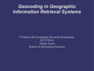
- 1. Geocoding in Geographic Information Retrieval Systems UT-Knoxville Geography Research Symposium 02/22/2014 Tanner Jessel School of Information Sciences
- 2. What is Geocoding? ➲ Geography + Code = Geocode Place + Space Assigning geographic coordinates to a recognized location. Location + Spatial Coordinates
- 3. What is Geocoding? Means different things to different practitioners Addresses Objects People Animals / Habitats
- 4. What is Geocoding? Sometimes referred to as “Georeferencing” or “Geotagging.” 1955 – 2008 Google “ngram” illustrates trend Interdisciplinary
- 5. Geocode (Blue) Georeference (Red)
- 7. Georeferencing Knoxville, Tennessee – what do you think of?
- 8. Georeferencing in IR Knoxville, Tennessee – what Google thinks
- 9. Georeferencing in IR Knoxville, Tennessee – what Bing thinks
- 10. Georeferencing in IR Knoxville, Tennessee – what Bing thinks you think
- 11. Georeferencing in IR ➲ How do we answer this question? What do we mean by “Edinburgh” What do we consider “near” Query: what castles are near Edinburgh?
- 12. Georeferencing in IR ➲ Which castle? Scotland? Jamaica?
- 13. Georeferencing in IR ➲ What is “near?” 1 km? 3 km? 20 km?
- 14. Georeferencing in IR ➲ Match text to known “footprint,” or space an object occupies Castle footprint is known City footprint is known Country footprint is known
- 15. Geoparsing ➲ Evaluate the geographic context of an item ➲ “Castles near Edinburgh” A physical place Implied location Edinburgh Scotland United Kingdom Europe
- 16. Geoparsing ➲ Possible castle names Craigmillar Castle Edinburgh Castle Lauriston Castle Tantallon Castle Chricton Castle Blackness Castle Dirleton Castle
- 17. Gazetteer ➲ Links a name to a footprint (point or area)
- 18. Gazetteer ➲ Links a name to a footprint (point or area)
- 19. Gazetteer ➲ Geographical Index or Dictionary
- 20. Ontology for Geo IR ➲ Pragmatic Ontology: how entities can be grouped in a hierarchy ➲ Nation ➲ State ➲ County ➲ City ➲ Neighborhood
- 21. Ontology for Geo IR ➲ Semantic Ontology ➲ words have different meanings to different groups “Skin Temperature” of Atmospheric Scientists “Surface Temperature” of Marine Scientists Both are same data point, but mean different things to different communities of scientists ➲ Technology can handle these differences ➲ “Semantic” mediation ➲ Applies to spatial domain
- 24. Metadata: Machine Friendly ➲ Place ➲ Time ➲ Geographic Coordinates ➲ Geographic Footprint (Area coverage) ➲ Relationships Parent Child Similarities
- 25. Geographical Information Retrieval System ➲ Spatially Aware ➲ Can handle spatial queries Castles Within 1 KM of Edinburg (Scotland)
- 27. Geographic Information Retrieval System Application
- 28. Geocoding Toolkit ➲ Research effort reviewed 53 citations Extracted tools mentioned across citations ➲ Categorized tools: Geographic IR Tools Disambiguation Tools Georeferencing Tools Error Calculation Tools Ontology Tools Algorithmic and Programming Tools Geographic IR Systems Visualization Tools Database Tools Thesauri Tools Extraction Tools
- 29. Need? ➲ Tools for automation of geocoding / georeferencing
- 30. Next Steps ➲ Specialized gazetteers for subject areas are needed These reliably link place to space They enable spatial queries ➲ Specialized ontologies for domain-specific applications are needed These establish relationships between objects in the real and virtual worlds They enable spatial queries
- 31. Questions?