LEED-ND 251: Principles of LEED for Neighborhood Development
•
19 gefällt mir•4,779 views

Presentation used for recent training provided on behalf of the US Green Building Council's Colorado chapter.

Empfohlen
Weitere ähnliche Inhalte
Was ist angesagt?
Was ist angesagt? (20)
Andere mochten auch
Andere mochten auch (20)
Ähnlich wie LEED-ND 251: Principles of LEED for Neighborhood Development
Ähnlich wie LEED-ND 251: Principles of LEED for Neighborhood Development (20)
Mehr von Conor Merrigan
LEED-ND 251: Principles of LEED for Neighborhood Development
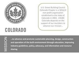
- 1. U.S. Green Building Council Colorado Chapter is a 501(c)3 non-profit organization established in the state of Colorado in 2003. USGBC Colorado depends on the support of our members to advance our mission… MISSION …to advance and promote sustainable planning, design, construction and operation of the built environment through education, improving industry guidelines, policy, advocacy, and information and resource sharing
- 2. Our Members Make A Difference! Access high quality continuing education Vote in Chapter Elections Eligibility to Run for Chapter and Branch Leadership Positions Attend Events and Activities throughout the State Have a voice in public policy issues Network with Colorado’s top green building experts Get the latest updates from USGBC and GBCI Receive the Chapter Newsletter 2012 Member Support the work of the Chapter MAKE A DIFFERENCE!!!! $50 National Member Employees $65 Regular $45 Emerging Professionals $25 Students Join Today
- 3. USGBC Colorado Chapter Principles of LEED ND + Course ID# (change Color) x.x
- 4. Principles of LEED-ND Journey • Introduction • Rating System: Section by Section • Practical Application • Interactive Discussion
- 5. Agenda 8:30 am – 9:00 Introductions, Rating System Basics 9:00 – 9:45 LEED-ND Fundamentals and Case Study Introductions 9:45 – 11:15 Smart Location and Linkages 11:15 – 11:30 Break 11:30 – 12:00pm LEED ND for Local Governments 12:00 – 1:00 Lunch (Developer Presentation from 12:30 – 1:00) 1:00 – 2:30 Neighborhood Pattern and Design 2:30 – 3:45 Green Building and Infrastructure 3:45 – 4:00 Break 4:00 – 4:30 Innovation and Regional Priority 4:30 – 5:00 Process of LEED-ND, Review, Wrap-Up
- 6. Learning Objectives • Learn the basic tenets and credit bundles of the LEED-ND rating system • Apply the knowledge of the LEED-ND rating system to a particular project • Describe the prerequisites and major credit requirements of the LEED for Neighborhood Development (LEED-ND) rating system • Explain the stages and process involved in the LEED-ND certification process • Describe the range of LEED-ND project types and strategies • Determine if a project is eligible for LEED-ND certification • Communicate unique aspects and limitations of LEED-ND
- 7. LEED for Neighborhood Development (LEED-ND) Joint effort of the US Green Building Council, the Congress for New Urbanism, and the Natural Resources Defense Council
- 8. US Green Building Council (USGBC)
- 9. Congress for the New Urbanism (CNU)
- 10. Natural Resources Defense Council (NRDC)
- 11. Why LEED-ND?
- 12. Building v. Transportation Energy (kBTUs/SF) Average Building Energy (43%) Transportation Energy (57%) Better Building (13%) Average American Office Building Better Building Energy Assumes ASHRAE 90.1-2004 Code Compliance Source: BuildingGreen,com http://www.buildinggreen.com/auth/article.cfm?fileName=160901a.xml
- 13. Urban v Suburban Energy Use Source: Jonathan Rose Companies, LLC for the EPA
- 14. Report: 98 Percent Of U.S. Commuters Favor Public Transportation For Others "With traffic congestion, pollution, and oil shortages all getting worse, now is the time to shift to affordable, efficient public transportation," APTA director Howard Collier said. "Fortunately, as this report shows, Americans have finally recognized the need for everyone else to do exactly that." Source: The Onion, November 29, 2000 | Issue 36•43
- 15. Values Less Bad More Good Energy Health and Wellness Water Fostering community Resources Economic growth Health Social Justice Land Use Connection with sources and Natural Systems disposal Connection with natural landscape and agriculture Beauty, civic pride, etc.
- 16. Levels of Certification Certified (40-49 points) Silver (50-59 points) Gold (60-79 points) Platinum (80 + points) Total Points = 110
- 17. LEED-ND: Quantifiable Sustainability Planning
- 19. Three Stages of Certification Stage 1 : Pre-Review (optional): Intended to assist with entitlement approvals Stage 2 : Certification of Approved Plan: Certification of what has been approved to build Stage 3 : Certification of a Completed Project: As construction is complete or near complete
- 20. LEED-ND: Timeline of a new rating system • Development started in 2004 • Pilot opened in May 2007 with 238 project registered • As of 8/8/12: 112 Certified Pilot Projects (29,70,13) • Switched to LEED-ND 2009 in 2009 • As of 1/30/13: 15 Certified LEED-ND 2009 Projects (109 Registered)
- 22. Costs of LEED-ND • $1500 flat fee for registration • $18,000 initial stage review under 20 acres • $350/acre over 20 • CIRs $220 • LEED Interpretations- $180/USGBC member, $380/non-USGBC member • Appeals- $500/appeal • Consultant fees • GIS • LEED Champion
- 23. SLL Prerequisite Review • Covers both the Project Information Forms and SLL Prerequisites • Additional fee: $2,250
- 25. Land Development and LEED-ND
- 26. Key Definitions • Previously Developed • Infill • Adjacent • Project Boundary • Buildable Land • Construction Impact Zone • Minor Improvements
- 27. Project Boundary
- 29. Adjacent Site
- 30. Buildable Land
- 35. Case Studies
- 36. Park Avenue Redevelopment Block 3B, Denver (Five Points) 2.41 Acres 51 DUs/ Acre 7,301 SF of Non-residential MU-30 Zoning Developer: Denver Housing Authority Architect: Studio Completiva LA: Studio Insite
- 37. Block 3 Site Plan
- 40. Washington Village Cohousing Project
- 44. Residential Pricing Residence Floors Finished Bedrms Baths Estimated Qty Building Type Living Sales Price Area sq. ft. Broadway Affordable* 1 605 1 1 $99,300 4 North 1 1,017 2 2 $138,000 3 East 2 1,379 3 2.5 $169,600 1 North, Moderate 1-2 1,017 - 1-2 1-2 $325,000 - 5 Historic & Affordable* 1,175 $350,000 East Broadway, Market 1-3 1,017 - 1-3 1-3 $525,000 - 21 North, 2,004 $1,125,000 Historic & East
- 51. Smart Locations and Linkages (SLL) 27 Points Possible 6 Prerequisites Location Water Imperiled Species Wetlands Ag. Land Floodplains Major Credit Bundles 9 credits Photo Credit: DenverInfill.com – Infill Redevelopment (10 pts) – Transit (7 pts)
- 52. SLLp1: Smart Location • ALL: Served by existing or planned water and wastewater infrastructure • Option 1 (Infill)A: 75% of site borders Previously Developed (PD) • Option 1B: 75% of site + adjacent parcels borders PD • Option 1C: 75% of ½ mile radius PD • Option 1D: 140 intersections/sq. mile in ½ mile radius • Option 2, Adjacent and Connected: 90 intersections/sq. mile AND minimum 600ft block distance in ½ mile radius • Option 3, Transit Corridor: 50% of units within ¼ mile of 60 weekday/40 weekend day transit rides • Option 4, Nearby Assets: ¼ mile from 7 diverse uses (project center)
- 54. SLLp2: Imperiled Species and Ecological Communities • Option 1: Negative Survey Results • Option 2: Habitat Conservation Plan • Option 3: Habitat Conservation Plan Equivalent
- 55. SLLp2: Imperiled Species and Ecological Communities
- 56. SLLp3: Wetland and Water Body Conservation • ALL: Comply with regulations • Option 1: No wetlands or land within 50 ft of wetlands, 100 ft of water bodies • Option 2: Wetlands or water bodies within those distances must only include minor improvements OR Earn at least 1 Stormwater Management point AND limit development impact based on density (higher=higher)
- 57. SLLp4: Agricultural Land Preservation • Option 1. Protected Soils Not impacted • Option 2. Infill Sites • Option 3. Sites Served by transit • Option 4. Development rights receiving area • Option 5. Sites with impacted soils
- 59. SLLp5: Floodplain Avoidance • Option 1. Sites without floodplains • Option 2. Infill or Previously Developed Sites with floodplains : Follow NFIP guidelines for any development • Option 3. All other Sites with floodplains: Only PD portions can be developed, in accordance with NFIP guidelines
- 61. SLLc1: Preferred Locations • 10 pts available • Option 1. Location Type (5 pts) • Option 2. Connectivity (5 pts) • Option 3. High Priority Redevelopment Area (3 pts)
- 63. SLLc2: Brownfields Redevelopment • 2 pts available • Option 1. Brownfield Site • Option 2. High-Priority Brownfield Site
- 64. SLLc3: Reduced Automobile Dependence • 7 pts available • Option 1. Transit-Served Location • Option 2. Metropolitan Planning Organization (MPO) location with Low VMT : % of average regional VMT per capita (80-90% for 1 pt, 30% or less for 7)
- 65. SLLc3: Reduced Automobile Dependence 3
- 68. SLLc4: Bicycle Network and Storage • 1 pt available • BICYCLE NETWORK: 1 of 3 – ¼ mile bicycling distance to 5 mile bicycle network – IF 100% Residential, ¼ mile to a bicycle network connecting to a school or employment center within 3 miles – ¼ mile to bicycle network connecting to 10 diverse uses within 3 miles • AND BICYCLE STORAGE: ALL – 1 enclosed space for 30% for MF residential plus 1 visitor parking per 10 DUs or 4 spaces min. – 1 enclosed space per 10% of workers for retail plus a shower/changing area once 100 workers are projected, plus 1 visitor parking for each 5,00 SF or 4 spaces min. – 1 enclosed space per 10% of planned occupancy for non-retail commercial plus 1 visitor parking space for each 10,000 SF plus 1 shower/changing room once 100 users are projected
- 69. SLLc5: Housing and Jobs Proximity • 3 pts available • Option 1. Project with affordable residential component (3 pts): 1/2 mile walk of 1:1 jobs based on Dwelling Units • Option 2. Project with residential component (2 pts): 1/2 mile walk of 1:1 jobs based on Dwelling Units • Option 3. Infill project with nonresidential component (1 pt): ½ walk of transit stop AND ½ mile walk of ½ the number of DUs as jobs created
- 70. SLLc5: Housing and Jobs Proximity 5
- 71. SLLc6: Steep Slope Protection • 1 pt available • Option 1. No disturbance of slopes over 15% • Option 2. Previously developed sites with slope over 15%: Restore % of slope area based on slope (Greater slope, greater restoration) AND follow Option 3 for any undeveloped slopes • Option 3. Undeveloped sites with slopes over 15%: Do not disturb any over 40%, see rating guide for additional guidance
- 73. SLLc7: Site Design for Habitat or Wetland Conservation • 1 pt available • Option 1. Sites without significant habitat or wetlands or water bodies • Option 2. Sites with significant habitat: don’t disturb, create management plan • Option 3. Sites with wetlands or water bodies: conserve all on site
- 74. SLLc8: Restoration of Habitat or Wetlands • 1 pt available • Restore 10% of development footprint and protect in perpetuity
- 75. SLLc9: Conservation Management of Habitat or Wetlands • 1 pt available • Create a minimum 10-year on site conservation management program with dedicated funding source for all sensitive areas
- 76. Neighborhood Pattern and Design (NPD) 44 Points Possible 3 Prerequisites Urban Design Density Connectivity Major Point Bundles 15 credits – Urban Design (12 pts) – Density (6 pts) – Mixed-Income AND/OR Diverse Housing Types (7 pts)
- 77. NPDp1: Walkable Streets • ALL: – 90% of principal entries must face a public space – 15% of street frontage must meet building height to street width ratio of 1:3 – 90% of streets bust have continuous sidewalks on both sides – No more than 20% of street frontages are faced with garages and service bays
- 78. NPDp3: Connected and Development NPDp2: Compact Open Community • Option 1. Projects in Transit Corridors: higher thresholds than Option • Option 1. Projects with Internal 2 for proximate dwelling units Streets : 140 intersections/ sq. mile, no gates AND at least • Option 2. All Otherevery 800 minimum residential density of 7 one throughway Projects: ft DUs/acre AND 0.5 FAR nonresidential • Option 2. Projects Without • EXCLUDES parking structures Internal Streets: existing connectivity within a ¼ mile must be at least 90 intersections/ sq. mile
- 79. NPDp3: Connected and Open Community
- 80. NPDc1: Walkable Streets • 12 points available • Urban Design credit
- 81. NPDc1: Walkable Streets; Facades (a, b, and c)
- 82. NPDc1: Walkable Streets; Entries (d and e)
- 83. NPDc1: Walkable Streets; Fenestration (f)
- 84. NPDc1: Walkable Streets; No Blank Walls (g)
- 85. NPDc1: Walkable Streets; Un-shuttered Retail (h) • Must be specified in CC&R or other binding documents
- 86. NPDc1: Walkable Streets; On-street Parking (i)
- 87. NPDc1: Walkable Streets; Sidewalks (j)
- 88. NPDc1: Walkable Streets; Elevated Finish Floor (k)
- 89. NPDc1: Walkable Streets; Street Level Retail (l) • 50% of office buildings include ground-floor retail along 60% of street-level façade for nonresidential or mixed-use projects • 100% of mixed-use buildings must have 60% of street-level façade with retail, residential or live/work spaces
- 90. NPDc1: Walkable Streets; Height-to-Width Ratio(m)
- 91. NPDc1: Walkable Streets; Target Speeds (n and o) • 75% of residential have a target speed of 20 MPH • 70% non-residential/mixed-use streets have a target speed of 25 MPH
- 93. NPDc3: Mixed-Use Neighborhood Centers 3
- 94. NPDc4: Mixed-income Diverse Communities 4
- 97. NPDc5: Reduced Parking Footprint • 1 pt available • Residential: If any lots, locate at the rear or side of buildings • AND use no more than 20% of development footprint for new off- street parking and no lot larger than 2 acres • AND provide bicycle facilities per the bicycle network credit
- 98. NPDc5: Reduced Parking Footprint 5
- 99. NPDc6: Street Network • 2 pts available • Through ways at every 400ft, 90% of cul-du-sacs having non- motorized connections • AND internal + external connectivity is over 300 (1 pt) or over 400 (2 pts) intersections/ sq. mile
- 101. NPDc7: Transit Facilities • 1 pt available • All working with local transit authority • Shelters must be covered and include seating and illumination • AND reserve spaces for future transit stops • AND provide kiosks etc.
- 102. NPDc8: Transportation Demand Management • 2 pts available (.5 pts per requirements met) • Option 1. TDM program • Option 2. Transit Passes • Option 3. Developer-sponsored transit • Option 4. Vehicle sharing • Option 5. Unbundling of parking
- 103. NPDc9: Access to Civic and Public Space • 1 pt available • 90% of dwelling units and nonresidential entrances be located within a ¼ mile walk distance of a street, square, or paseo greater than 1/6 of an acre • Under an acre? No narrow spaces! 1:4 width:length
- 104. NPDc10: Access to Recreation facilities • 1 pt available • 90% of dwelling units and nonresidential entrances be located within a 1/2 mile walk distance of an active recreation field at least one acre in size or publically accessible recreation center at least 25,000 SF
- 105. NPDc11: Universal Accessibility • 1 pt available • Option 1. Projects with dwelling units: See rating guide • Option 2. Projects with non-compliant public right-of-way or accessible travel routes: design and construct 100% of ROWs in accordance with ADA-ABA Accessibility Guidelines
- 106. NPDc12: Community Outreach and Involvement • 2 pts available • Option 1. Community Oureach: open meetings, modified design, ongoing communication • Option 2. Charrette: at least 2 day long charrette
- 107. NPDc13: Local Food Production • 1 pt available • ALL: Allow gardening in the project • Option 1. Neighborhood Farms and Gardens • Option 2. Community-Supported Agriculture • Option 3. Proximity to Farmer’s Market
- 108. NPDc14: Tree-lined and Shaded Streets • 2 pts available • Option 1. Tree-lined streets: 60% of new and existing streets should have 40 ft spacing (1 pt) • Option 2. Shaded streets: 40% of length of sidewalks shaded (1 pt)
- 109. NPDc15: Neighborhood Schools • 1 pt available • Locate or design the project so 50% of the dwelling units are within a ½ mile walk distance of a school
- 110. Green Infrastructure and Building (GIB) 29 Points Possible 4 Prerequisites Certified Green Building Energy Efficiency Water Efficiency Construction Pollution Plan Major Bundles 17 credits – Green Buildings (5 pts) – Stormwater Management (4pts)
- 111. GIBp1: Certified Green Building • Design, construct, or retrofit one whole building to be certified under LEED or equivalent (ISO/IEC 17021)
- 112. GIBp2: Minimum Building Energy Efficiency • 90% of nonresidential and/or multifamily buildings over three stories must show a 10% improvement over ASHRAE 90.1-2007 • 90% of residential buildings must meet ENERGY STAR
- 113. GIBp3: Minimum Building Water Efficiency • Indoor water usage in new and majorly renovated buildings must be 20% less than the referenced baseline
- 114. GIBp4: Construction Activity Pollution Prevention
- 115. GIBc1: Certified Green Buildings • 5 pts available • Option 1. Project with affordable residential component (3 pts): 1/2 mile walk of 1:1 jobs based on Dwelling Units • Option 2. Project with residential component (2 pts): 1/2 mile walk of 1:1 jobs based on Dwelling Units • Option 3. Infill project with nonresidential component (1 pt): ½ walk of transit stop AND ½ mile walk of ½ the number of DUs as jobs created
- 116. GIBc2: Building Energy Efficiency • 2 pts available • 90% of nonresidential and/or multifamily buildings over three stories must show a 18% (1 pt) or 26% (2 pt) improvement over ASHRAE 90.1-2007 • 90% of residential buildings must meet a HERS score of 75
- 117. GIBc3: Building Water Efficiency • 1 pt available • Indoor water usage in new and majorly renovated buildings must be 40% less than the referenced baseline
- 118. GIBc4: Water Efficient Landscaping • 1 pt available • 50% reduction in potable water from a baseline midsummer case • No irrigation automatically receives the credit
- 119. GIBc5: Existing Building Reuse • 1 pt available • Do not demolish ANY historic structures or cultural landscapes • AND the greater of the following: • a. 50% of one existing building structure (including structural floor and roof decking) and envelope (including exterior skin and framing but excluding window assemblies and nonstructural roofing material). • b. 20% of the total existing building stock (including structure and envelope, as defined above).
- 120. GIBc6: Historic Building Preservation and Adaptive Reuse • 1 pt available • Do not demolish ANY historic structures or cultural landscapes • Rehabilitate any historic structure to appropriate standards
- 121. GIBc7: Minimized Site Disturbance During Construction • 1 pt available • Option 1. Development footprint on previously developed land • Option 2. Undeveloped portion of project left undisturbed
- 122. GIBc8: Stormwater Management • 4 pts available • Retain water on site per the following table:
- 123. GIBc9: Heat Island Reduction • 1 pt available • Option 1. Nonroof measures: 50% of hardscape must employ heat island reduction measures (see rating guide) • Option 2. High-reflectance and vegetated roofs: 75% SRI value roofing in the project or 50% vegetated • Option 3. Mixed nonroof and roof measures
- 125. GIBc11: On-Site Renewable Energy • 3 pts available
- 126. GIBc12: District Heating and Cooling • 2 pts available • 80% of the buildings (excluding existing and single family residential) must be heated and/or cooled from a central plant • Additional efficiency requirements in Rating Guide
- 127. GIBc13: Infrastructure Energy Efficiency • 1 pt available • All water and wastewater pumps, street lights, and traffic lights must be 15% more efficient than the least-cost options
- 128. GIBc14: Wastewater Management • 2 pts available • Reuse wastewater on site per the following table:
- 129. GIBc15: Recycled Content in Infrastructure • 1 pt available • 50% of the total materials used in the following categories must be recycled: • Roadways, parking lots, sidewalks, unit paving, and curbs. • Water retention tanks and vaults. • Base and sub-base materials for the above. • Stormwater, sanitary sewer, steam energy distribution, and water piping.
- 130. GIBc16: Solid Waste Management Infrastructure • 1 pt available • Meet 4 of 5: • Include at least one recycling drop-off point • Include at least one hazardous materials drop-off point • Include a compost station • Include recycling containers on every block next to trash cans • Recycle/salvage 50% of construction waste
- 131. GIBc17: Light Pollution Reduction • 1 pt available • 50% of shared area lights have motion controls • AND all shared area lights must have daylight sensors • AND comply with lighting zone requirements
- 132. Innovation in Design (ID) 6 Points Possible Innovation Exemplary Performance LEED Professional
- 133. IDPc1: Innovation OR Exemplary Performance • Innovation: Not addressed by the rating system • Exemplary Performance: Typically a doubling of a threshold – ND specifies which credits can get exemplary status and at what threshold
- 134. Exemplary Performance • Available for: • SLL Credits 1 (Preferred Locations),3 (Locations with Reduced Automobile Dependence), and 8 (Restoration of Habitat or Wetlands) • NPD Credits 1(Walkable Streets),3(Mixed-use Neighborhood Centers),4 (Mixed-Income Diverse Communities),11(Visitability and Universal Design),13(Local Food Production), and 14(Tree- lined and Shaded Streets) • GIB Credits all except 7
- 136. IDPc2: LEED Accredited Professional • 1 point • Can be EITHER a LEED AP, CNU-A, or Smart Growth Accredited Through the NRDC (Does this exist?)
- 137. RPc1: Regional Priority Credit • Attempt to Regionalize LEED • Regional Priority Credit Viewer
- 138. Regional Priority (RP) 4 Points Possible (out of 6) For 80203 GIBc15 Recycled Content in Infrastructure GIBc4 Water-Efficient Landscaping NPDc2 Compact Development (>38 DUs/acre ) NPDc5 Reduced Parking Footprint NPDc8 Transportation Demand Management SLLc4 Bicycle Network and Storage
- 139. Learning Objectives • Learn the basic tenets and credit bundles of the LEED-ND rating system • Apply the knowledge of the LEED-ND rating system to a particular project • Describe the prerequisites and major credit requirements of the LEED for Neighborhood Development (LEED-ND) rating system • Explain the stages and process involved in the LEED-ND certification process • Describe the range of LEED-ND project types and strategies • Determine if a project is eligible for LEED-ND certification • Communicate unique aspects and limitations of LEED-ND
- 140. LEED ND Resources USGBC LEED ND Web Portal • new.usgbc.org/leed/rating-systems/neighborhoods • Download the free rating system and checklist documents • Download the free Government Guide to LEED ND at: • new.usgbc.org/resources/local-government-guide-leed-neighborhood-development NRDC LEED ND Web Portal • www.nrdc.org/cities/smartgrowth/leed.asp • Download the free Citizens Guide to LEED ND and a cool slideshow CNU LEED ND Web Portal • www.cnu.org/leednd
- 141. Thank You! C2 Sustainability Conor Merrigan | conor@c2sustainability.com www.c2sustainability.com Cliff Lind | cliff@c2sustainability.com
Hinweis der Redaktion
- This is an official slide given to USGBC Education Providers by the U.S. Green Building Council. This slide should be used in all courses approved by USGBC towards the Green Building Certification Institutes LEED Credential Maintenance Program. This slide may ONLY be used for currently approved courses and may never, under any condition be used in the materials for a course not approved by USGBC. Instructor should announce:This course is approved by the U.S. Green Building Council (USGBC) for [#] GBCI CE Hours towards the LEED Credential Maintenance Program. Upon successful completion of this course, LEED Professionals may submit their hours to Green Building Certification Institute (GBCI) under the “Professional Development/Continuing Education” activity type in “My credentials” at www.gbci.org. Some sections of this slide are left as editable. Education Providers should update this template as per the approved course. Font: “ARIAL The following sections should be edited:EDUCATION PROVIDERS NAME (Font: Arial Size: 18) COURSE NAME (Font: Arial Size: 17) [COURSE ID #] (Font: Arial Size: 17) “#” representing the official number of GBCI CE Hours granted. (Font: Arial Size 36)For additional reference, please see the document “Reporting GBCI CE Hours for USGBC Education Provider Courses” found at www.usgbc.org/ShowFile.aspx?DocumentID=6975. Education Providers may contact the USGBC Education Review team for additional questions regarding this slide at EdProvider@usgbc.org
- Office
- What it is.-Neighborhood Development Green Rating System-Broadly Measures Location, Urban Design, and Sustainable Infrastructure
- http://advocacy.britannica.com/blog/advocacy/wp-content/uploads/urban-sprawl-florida.jpgWe are developing land twice as fast as the population is growingVehicle use in America has doubled since 1970, offsetting all the fuel efficiency gainsClimate Change, etc.
- http://advocacy.britannica.com/blog/advocacy/wp-content/uploads/urban-sprawl-florida.jpgWe are developing land twice as fast as the population is growingVehicle use in America has doubled since 1970, offsetting all the fuel efficiency gainsClimate Change, etc.
- The rating system is divided into three categories: Smart Location & Linkage, Neighborhood Pattern & Design, and Green Infrastructure & Buildings. All three have prerequisites which are required of all projects and credits which reward performance. There also are ten additional points for Innovation and Design Process (exemplary performance and innovative performance) and Regional Priority Credits.
- Various Stages for various purposes, pre-approval assistance, plan certification, project certificationRange from single mixed-use building to huge citiesPre-review: Letter Approved Plan: Certificate Completed Project
- Started from Affordable Housing Grant ProgramBeing rolled out to all ND projects due to limited numberUpon registering a POC will be designated from the 5 ND staff Available for ongoing project assistanceQuarterly webcasts for all interested parties
- Statistices
- -2245 Blake, Infill between two existing buildings, proximate to LoDo , recreation and transit
- Picture: Cliff
- -previously developed nullifies-50 ft minimum buffer, 100 ft average buffer (if meet water retention goals)Picture: Wikipedia Wetland
- Picture: Wikipedia Floodplain
- Now done via intersections/ square mile, not grid Density
- Picture: Wikipedia Brownfield
- Picture: Wikipedia Mass Transport
- FOR ALL PROJECTSThe following features are not considered wetlands, water bodies, or buffer land that must be protected:a. Previously developed land.b. Man-made water bodies (such as industrial mining pits, concrete-lined canals, or stormwater retentionponds) that lack natural edges and floors or native ecological communities in the water and along the edgec. Man-made linear wetlands that result from the interruption of natural drainages by existing rights-of-way.d. Wetlands that were created incidentally by human activity and have been rated “poor” for all measuredwetland functions. Wetland quality assessment must be performed by a qualified biologist using a methodthat is accepted by state or regional permitting agencies.
- Picture: Wikipedia Wetland
- Picture: Wikipedia Wetland
- Wide Sidewalks required (4 ft residential, 8 ft non) and encouraged (5ft res, 10 ft non)Unshuttered grounf floor retail, build to lot lines, stoops for residential projects, mixed-use, variety of house sizes and types, no blank walls, multiple entrances, 60% clear glass façade minimum 3-8 ft above grade for non-res, Building height to street width ration of 1:3, Slow street speeds (20 mph res, 25 mph non-res)
- Picture: Cliff
- Picture: Cliff
- Exercise 1: Calculate the Density of the following mixed-use project:3 acres (net buildable)All designated Mixed-Use Zoning75 DUs average 800 SF each (60,000 SF)20,000 SF of commercial 75% residential = 25 Dus/acre= 4 points *75%= 3 points25% Commercial = 0.15 FAR = 2 points *25% =.5 points3.5 points
- Can include alleys
- Picture: Cliff
- RiverClay
- Museum in Salem, wikipedia
- Thank you and I hope we can all help create a more sustainable community.