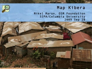
1. Map Kibera
Mikel Maron, OSM Foundation
SIPA/Columbia University
2009 Sep 28
photo: http://gallery.me.com/dbullington#100816&view=null&bgcolor=black&sel=12
2. Kibera 1 million, area size of Central park
is a blank spot on the map
3. Slum Clearance
How can change be discussed without knowing the present?
photo: http://en.wikipedia.org/wiki/File:Kibera,_Nairobi_May_2007.jpg
4. The Challenge of Slums
1 Billion people in slums today
Current Best Practice: Participatory Slum Upgrading
Very very few maps
5. High Speed Internet &
Nairobi Tech Community
photo: http://news.bbc.co.uk/2/hi/in_pictures/8259533.stm
6. November
Partner with community groups
Train movitated young Kiberans
to map Kibera themselves.
Volunteers from Nairobi tech
community
Data users invited to
participate
44. Map Kibera Details
* Oct 9 AfricaGathering Conference in UK
* Oct 14 CrisisMapping Conference in Cleveland
* Jubal travelling to region starting in October
* Oct 20 Mikel and Erica arrive Nairobi
* Oct 26 AfricaGIS
* Oct 30 WhereKampala
* Oct 31 Kelele
* Nov 1 Start Kibera
* Possible early completion and move to other
areas
* Nov 14(?) Orgazinational Outreach
Workshop/Symposium
* Nov 21 Finish
* Nov 25-27 AFRICOMM 2009, Mozambique
45. Potential Partners and Allies
Venue/Volunteers: Carolina for Kibera,
Kibera Community Youth
Media: Radio Kibera, Nairobits
InfoActivist NGOs: Wazimba, SodNET, Fahamu
Tech Community: Ushahidi, kelele, Mobile
Boot Camp, skunkwerks
Agencies: UNHCR, UNICEF, Google
AND...?
46. What do we collect?
* roads and paths and rail
* wells
* pit latrines / sewer
* medical facilities
* schools
* churches
* businesses
* community organizations
* administrative units
... and whatever else is useful?
47. Sustainability and Reproducibility
Workshops
One or two day workshop with CBOs, NGOs, international
orgs, govt, to raise awareness of Map Kibera, gather
requirements and the possibilities of open data and
open source. Gather needs, brainstorm and help spur
pilot projects. A select few easy wins may be quickly
implemented the local tech community.
Geeks
WhereCampAfrica
Focused Partnerships
48. What will happen when the invisible slums are made
visible? The tools for mapping these new geographies
are in hand .. not centralized or a tool of authority,
but empowering to all and making dialogue inevitable.
Will residents see mapping as a way to exert their
presence and protect themselves? Or is information
vulnerability? Will authorities react negatively,
seeing this as another attempt at legitimacy? Or
positively, as information gathering for invasions and
control?
Is it possible that geographical political situations
might improve if we all openly contribute to and
debate within an artifact, with data, in the map?