
Empfohlen
Empfohlen
Weitere ähnliche Inhalte
Was ist angesagt?
Was ist angesagt? (20)
Ähnlich wie Taking Citizen Science to Extremes: from the Arctic to the Rainforest
Ähnlich wie Taking Citizen Science to Extremes: from the Arctic to the Rainforest (20)
Kürzlich hochgeladen
Kürzlich hochgeladen (20)
Taking Citizen Science to Extremes: from the Arctic to the Rainforest
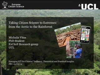
- 1. Taking Citizen Science to Extremes: from the Arctic to the Rainforest Michalis Vitos PhD Student ExCiteS Research group UCL Emerging ICT for Citizens’ Veillance: Theoretical and Practical Insights JRC, 21/03/14
- 2. Audubon: Christmas Bird Count “Scientific activities in which non-professional scientists volunteer to participate in data collection, analysis and dissemination of a scientific project” (Cohn 2008; Silvertown 2009).
- 3. Citizen Science: Volunteered Computing
- 4. Citizen Science: Volunteered Thinking
- 5. Citizen Science: Participatory Sensing
- 6. Levels of Citizen Science Level 4 ‘Extreme’ •Collaborative Science – problem definition, data collection and analysis Level 3 ‘Participatory science’ •Participation in problem definition and data collection Level 2 ‘Distributed Intelligence’ •Citizens as basic interpreters Level 1 ‘Crowdsourcing’ •Citizens as sensors Haklay (2013)
- 8. Our challenge is to provide communities with tools that empower them to take action, and protect their local environment and way of life.
- 9. Projects
- 10. Mapping for Change • Mapping platform which provides: – mapping, – geographical analysis – and community engagement services for all types of projects and entities. • Projects: – Community Air Quality Mapping – Community Noise Mapping Contact: Louise Francis
- 11. Citizen Science Games for Biodiversity and Conservation • In collaboration with ZSL. • It aims at the design of innovative citizen science games and methodologies for environmental monitoring and biodiversity conservation. Contact: Gianfranco Gliozzo
- 12. How can ICT assist Arctic hunters to adapt to climate change? • Aims to develop a mobile technology for Yupik and Iñupiaq coastal subsistence hunters who are adapting to the rapidly changing climate in Arctic Alaska. • The technology is co-designed with the local people, reflecting their ways of hunting, learning and knowing. Contact: Diana Mastracci
- 13. Community Mapping in the Brazilian Amazon • Aims to capitalise on the ExCiteS tools and methodology and apply them in the Brazilian Amazon. • Answering the question of how digital technology can help indigenous peoples to communicate their needs and their perceptions of the environment in order to improve their livelihoods in the forest. Contact: Carolina Comandulli
- 14. Participatory Monitoring in the Republic of the Congo
- 15. The Problem • extensive legal and illegal logging by artisan timber pirates and industrialised timber companies • rights of local population are often overlooked
- 16. Impact of logging activity on forest people. • Direct competition for resources – eg. Sapelli trees. • Roads make access easier for outsiders – commercial hunters and poachers.
- 17. Legal context • FLEGT VPA signed in May 2010. • Includes socio-economic obligations for the logging companies: • respect customs, practices and resources • have procedures for ongoing dialogue and compensation/dispute resolution.
- 18. • In 2013, we collaborated with Forests Monitor. • Participatory monitoring for forest management and measure social impact of logging.
- 19. The Challenges • Illiteracy & education ⁻ Language ⁻ Technology ⁻ Maps • Lack of network connectivity • Lack of electricity
- 20. • Robust Android touch- screen devices • Sapelli Data Collector: – Icon-based – Hierarchical decision tree – Easy to adapt in the field • ExCiteS methodology
- 22. Photo and Audio
- 25. Component Architecture Amazon Server Relay Phone Dropbox HTTP
- 26. Data Transmission via SMS and/or Wi-Fi/GPRS/3G • Efficient use of limited space (1 SMS = 160 7-bit characters = 140 Bytes) • Chaining of multiple SMS messages (“transmissions”) • Compression (GZIP, LZMA) & Encryption (AES) • (Optional) flight-mode cycling to preserve power • Dropbox upload for media files
- 27. Hatsuden Nabe
- 28. Iterative, Participatory Software Development Embedded within a wider participatory methodology that encompasses: • A detailed process of Free, Prior and Informed Consent (FPIC) • Building Community Protocols for engagement with: • The project itself • Other stakeholders in the problems local people have identified
- 34. Feeding data back to communities 000111110 101111111 010001010 111001110 001110001
- 35. Conclusion Opportunities • The ExCiteS approach worked well within the scope of the project – people were able to use and contribute to the design of the software, and found innovative ways to use it to meet their different needs. Challenges • However, the extent to which local people could participate in this process was limited by the goals and structure of the project itself. • Although the application was easy to use for some, other people required a lot of training and guidance.
- 36. Thank you for your attention. Any questions? References Lewis et al. (2007). “Logging in the Congo Basin: What hope for indigenous peoples’ resources and their environments?”. In: Indigenous Affairs 4/06, pp. 8–15. Lewis et al. (2012). “Accessible technologies and FPIC: independent monitoring with forest communities in Cameroon”. In: Biodiversity and culture: exploring community protocols, rights and consent (PLA 65), pp. 151–165. Vitos, Stevens, Lewis & Haklay (2013). “Making local knowledge matter. Supporting non-literate people to monitor poaching in Congo”. In: 3rd Annual ACM Symposium on Computing for Development (ACM DEV 2013; Jan. 11-12, 2013, Bangalore, India). Stevens, Vitos, Lewis & Haklay (2013). “Participatory monitoring of poaching in the Congo basin”. In: 21st GIS Research UK conference (GISRUK 2013, April 2-5, 2013, Liverpool, UK). Email: Michalis.Vitos.11@ucl.ac.uk Website: http://www.ucl.ac.uk/excites Blog: http://uclexcites.wordpress.com