Greenland - Part 2
•
3 gefällt mir•2,997 views

New improved, extended and corrected version in two parts - more than 500 slides. All thats fabulous about Greenland.
![[object Object],[object Object],[object Object],[object Object],[object Object],[object Object]](data:image/gif;base64,R0lGODlhAQABAIAAAAAAAP///yH5BAEAAAAALAAAAAABAAEAAAIBRAA7)
Empfohlen
Weitere ähnliche Inhalte
Was ist angesagt?
Was ist angesagt? (20)
Andere mochten auch
Andere mochten auch (20)
Ähnlich wie Greenland - Part 2
Ähnlich wie Greenland - Part 2 (20)
Mehr von Mario Ricca
Mehr von Mario Ricca (20)
Kürzlich hochgeladen
Kürzlich hochgeladen (20)
Greenland - Part 2
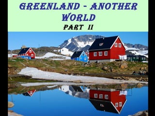
- 1. Greenland - Another World Part II
- 3. Because of sea ice, Greenland’s east coast is inaccessible by sea most of the year . 90% of the pack ice in the arctic basin outlet to the open sea here. This means hundreds of miles wide continuous drifting pack ice nearly all year around. The ice barrier stretches along the east coast except for 2-3 months in late summer and autumn.
- 4. Scoresby Sund fjord (Kangertittivaq) Ittoqortoormitt
- 5. Scoresby Sund fjord , the largest in the world, stretching for 350 km, and also one of the deepest (over 1500 m), is located in eastern Greenland at 70.447972 N, 21.789562 W
- 6. Huge glaciers flow from the Greenland Icecap into Scoresbysund Fjord
- 8. Glacier in Øfjord near Ittoqqortoormiit The Øfjord is bordered on both sides by steep, 2.000 meter high mountains from which plunge numerous glaciers.
- 10. Eielson Glacier in Rypefjord, Scoresby Sund
- 14. Plateau basalt along the southern coast of Scoresby Sund. The basalts result from the plate tectonic opening of the North Atlantic
- 20. Sunset in the fjord
- 22. Nordost Bugt in Spring. At the time of the melting ice, the small stream in the foreground would be in full flood, carrying water and pieces of ice into the fjord - here, in July, it provides a fertile soil for arctic flora .
- 23. Sermilik fjord A 10 km wide fjord at the east coast. At first glance, the icebergs in this fjord don’t look that large, but when you see the red helicopter in the foreground, taking off from the only piece of flat ground, you get a better idea of the grandiose scale of this landscape.
- 25. Ittoqqortoormiit
- 33. The church, overlooking the fjord
- 36. The church was finished in 1928.
- 48. Supplies are vital to the inhabitants; from September to June, the access is blocked by pack ice – so the arrival of the first cargo ship has been waited for long.
- 54. Kulusuk airport , easy access from Iceland
- 55. Kulusuk airport and … taxi!
- 59. Kulusuk is situated on the East coast, at 65º N. A truly remarkable place, because of its hostile nature and the fact that it has been cut off from the rest of the world for centuries.
- 61. The airport provides supplies, and danish teachers and medical staff give basic assistance to the mostly inuit inhabitants. It is a rather isolated town, lacking many basic infrastructure, with the majority lacking running water .
- 63. Many of the villagers depend upon tourism to supplement the more traditional pursuits of hunting and fishing. Kayak and dog sledging adventures are locally organized.
- 66. As there is no forest in Greenland, timber houses are imported from Denmark in kit form and assembled on site .
- 67. The elderly villagers of Kulusuk had only emerged from a primitive stone-age existence, when the international airport was created in 1958.
- 75. Icebreaker arrival. Boats are frequently immobilised by ice in winter.
- 76. Hotel Kulusuk , a fantastic location for ice adventure.
- 77. Kulusuk View from Kulusuk
- 79. Karale glacier, which feeds into Sermiligaq fjord near Kulusuk, almost in front of the Knud Rasmussen .
- 82. Karale, air view
- 83. Boat tours can approach Karale without danger.
- 87. East coast airview approaching Tasiilaq
- 89. Tasiilaq (Ammassalik) (population 1800)
- 95. House with a view on Ammassalik mountain and the fjord
- 102. The largest community on the east coast of Greenland, looking over its small port which is called Kong Oscars Havn, Tasiilaq receives supply ships only between June and September, because for the rest of the year the pack ice is too thick for ships to reach the port.
- 103. The supply ship from Arctic Line unloads at Kong Oskars Havn
- 104. Kong Oscars Havn and Ammassalik mountain
- 105. The football pitch in Tasiilaq with Ammassalik mountain in the background. Hotel Ammassalik Tasiilaq is not so isolated as other towns in Greenland: there's an hospital, ATM machines, a couple of supermarkets, a football field, a disco/bar, a tourist information center, a good hotel, a good museum, and a large variety of activities.
- 107. The "National" footwear of Greenland. These seal boots are a part of the greenlandic national suit. The black boots are for a boy, the white for a girl.
- 110. Sledges
- 119. Ivory decorated throwing sticks. These were used to propel spears better than they could be thrown.
- 122. Beware – Musk Oxen! They are frequently seen in Ammassalik area.
- 125. The fog is crawling in from the open sea to the fjord so fast that you can see it move. A beautiful scene as the low evening sunlight illuminated the houses..
- 126. Ammassalik mountains surround Tasiilaq
- 130. New Year in Tasiilaq. All Greenland´s main towns celebrate New Year.
- 132. Mountain scenery in the South of Greenland
- 133. Narsaq
- 135. Narsaq at 1 a.m.
- 137. An Air Greenland S61 lands at Narsaq
- 138. The valley and the mountains in Narsaq’s hinterland are a paradise for those interested in geology
- 141. Kayaking in Narsaq fjord
- 142. Narsaq Museum Artifacts from the Saqqaq culture (2500-800 BC) and still earlier Dorset cultures who occupied southern Greenland before the Inuit arrived.
- 143. Narsaq church
- 144. Narsaq church was e rected in 1926-27 by master carpenter Pavia Høegh
- 145. Narsaq in Spring Greenland’s most fertile town, Narsaq means "the plain" in Greenlandic, and the name is due to the large green plain on which the town lies.
- 147. Qaqortoq ( Julianehåb ) , a town of 3000 people near Narsaq
- 149. The old church Frelserens Kirke of Qaqortoq (1832)
- 151. The colonial buildings dating back to 1775, when the town was founded
- 157. Colour detail
- 159. On a Christmas night
- 170. Nowadays Brattahlíð has again some of the very best farmland in Greenland. This farm is close to Erik’s settlement, in Eriksfjord.
- 172. Rosenvinges tree plantation, near Qassiasurk. The oldest natural Greenland brushwoods are "Rosenvinges trees“, a local pine tree. Some deeper land allows trees to grow.
- 188. 4 Greenland Research
- 190. Danmarkshavn is a small weather and research station located in the Northeast Greenland. The station is an all-year facility with eight persons working and living at the site
- 192. Located in the very flat and beautiful area east of Kap Prins Knud, only 933 km away from the North Pole , Station Nord is n ow operated by the Danish Defense Command. There is accommodation for up to 20 scientists.
- 194. Global warming : The New Island Uunartoq Qeqertoq ( the warming island ) is a W shaped island that used to be covered by the ice cap. At 71° 28' N, 21° 50' W, 600Km north of the Polar Arctic Circle, it suddenly was re-found in 2005 detached from the mainland, as the ice cover melted.
- 200. Arctic Umiaq Line Sarfaq Ittuk
- 203. Kangerlussuaq Airport It was first established as a US Airbase. Today the airport is the busiest in Greenland and a major port of entry into the country for tourists, businessmen, and researchers. By air
- 204. It’s located about 50km north of the Arctic Circle.
- 206. Sikorsky S 61 heli , for internal cargo and passenger routes (25 seats)
- 207. de Havilland Dash 7 (50 seats) landing in Kulusuk
- 208. Bell 222U , 8 seats
- 209. The End