SlideShare ist ein Scribd-Unternehmen logo
1 von 15
Downloaden Sie, um offline zu lesen
CONSULTORÍA:

                                                CONSTRUCCIÓN DE BASE DE DATOS CARTOGRÁFICA Y
                                                    ELABORACIÓN DE MAPAS DE AMENAZAS Y
                                                     VULNERABILIDADES EN AMBIENTE SIG


                ALBUM DE
                  MAPAS
               ELABORADOS

                                        CUENCA DEL
                                            RÍO
                                       JEQUETEPEQUE


Consultor: Ing. Carlos Cerdán Moreno
Cajamarca, diciembre de 2007
CONSTRUCCIÓN DE BASE DE DATOS CARTOGRÁFICA Y ELABORACIÓN DE MAPAS DE AMENAZAS Y VULNERABILIDADES EN AMBIENTE SIG
                                                                                       CONSULTOR: Ing. Carlos Cerdán Moreno


                                                                                          Nº
                                                                                                     J-01

                                                                                          MAPA:
                                                                                                    BASE

                                                                                          DESCRIPCIÓN:
                                                                                          Mapa a curvas de nivel
                                                                                          (topográfico).
                                                                                          La cuenca media y alta
                                                                                          del río Jequetepeque se
                                                                                          ha delimitado con una
                                                                                          línea amarilla.
                                                                                          Las subcuencas
                                                                                          priorizadas están
                                                                                          resaltadas con fondos de
                                                                                          diversos colores.
                                                                                          Como referenica se
                                                                                          muestra la ciudad de
                                                                                          cajamarca y la propiedad
                                                                                          de la empresa minera
                                                                                          Yanacocha (polígonos de
                                                                                          color rojo y gris,
                                                                                          respectivamente).


                                                                                                                         1
CONSTRUCCIÓN DE BASE DE DATOS CARTOGRÁFICA Y ELABORACIÓN DE MAPAS DE AMENAZAS Y VULNERABILIDADES EN AMBIENTE SIG
                                                                                       CONSULTOR: Ing. Carlos Cerdán Moreno


                                                                                          Nº
                                                                                                      J-02

                                                                                          MAPA:
                                                                                           TEMPERATURA
                                                                                            MEDIA ANUAL

                                                                                          DESCRIPCIÓN:
                                                                                          Mapa de distribución de
                                                                                          la temperatura media
                                                                                          anual. El valor debe
                                                                                          cotejarse según el color,
                                                                                          comparando       con     la
                                                                                          leyenda de la izquierda.
                                                                                          Para la elaboración se
                                                                                          empleó la fórmula
                                                                                          empírica:

                                                                                          T = 21.95 - .0021H
                                                                                          T = Temp. en ºC
                                                                                          H = Altura terreno en m.


                                                                                          Se consideró la
                                                                                          temperatura promedio
                                                                                          anual de las estaciones
                                                                                          meteorológicas: Talla,
                                                                                          Montegrande
                                                                                          Chilete, Magdalena
                                                                                          Lives, Asunción,
                                                                                          San_Juan, Contumaza
                                                                                          Llapa, Huacraruro,
                                                                                          Granja_Porcón, Quilcate,
                                                                                          Quebrada Honda.

                                                                                          Fuente: Actualización del
                                                                                          Plan de Ordenamiento
                                                                                          Ambiental de la cuenca
                                                                                          del río Jequetepeque –
                                                                                          INRENA.


                                                                                                                         2
CONSTRUCCIÓN DE BASE DE DATOS CARTOGRÁFICA Y ELABORACIÓN DE MAPAS DE AMENAZAS Y VULNERABILIDADES EN AMBIENTE SIG
                                                                                       CONSULTOR: Ing. Carlos Cerdán Moreno


                                                                                          Nº
                                                                                                      J-03

                                                                                          MAPA:
                                                                                          TEMPERATURA
                                                                                          MÁXIMA ANUAL

                                                                                          DESCRIPCIÓN:
                                                                                          Mapa de distribución de
                                                                                          la temperatura máxima
                                                                                          media anual. El valor
                                                                                          debe cotejarse según el
                                                                                          color, comparando con la
                                                                                          leyenda de la izquierda.
                                                                                          Para la elaboración se
                                                                                          empleó la fórmula
                                                                                          empírica:

                                                                                          T = 28.9 - .0051H
                                                                                          T = Temp. en ºC
                                                                                          H = Altura terreno en m.


                                                                                          Se consideró la
                                                                                          temperatura máxima
                                                                                          promedio anual de las
                                                                                          estaciones
                                                                                          meteorológicas
                                                                                          Magdalena y Carachugo.

                                                                                          Fuentes:
                                                                                          • Modelamiento
                                                                                               Hidrológico de la
                                                                                               Cuenca del Río
                                                                                               Jequetepeque con
                                                                                               SWAT model –
                                                                                               Fernando López –
                                                                                               2006
                                                                                          • Estudio de Impacto
                                                                                               Ambiental – Minera
                                                                                               Yanacocha - 2003


                                                                                                                         3
CONSTRUCCIÓN DE BASE DE DATOS CARTOGRÁFICA Y ELABORACIÓN DE MAPAS DE AMENAZAS Y VULNERABILIDADES EN AMBIENTE SIG
                                                                                       CONSULTOR: Ing. Carlos Cerdán Moreno


                                                                                          Nº
                                                                                                     J-04

                                                                                          MAPA:
                                                                                           TEMPERATURA
                                                                                           MÍNIMA ANUAL

                                                                                          DESCRIPCIÓN:
                                                                                          Mapa de distribución de
                                                                                          la temperatura mínima
                                                                                          media anual. El valor
                                                                                          debe cotejarse según el
                                                                                          color, comparando con la
                                                                                          leyenda de la izquierda.
                                                                                          Para la elaboración se
                                                                                          empleó la fórmula
                                                                                          empírica:

                                                                                          T = 15.83 - 0.0059H

                                                                                          T = Temp. en ºC
                                                                                          H = Altura terreno en m.

                                                                                          Se consideró la
                                                                                          temperatura mínima
                                                                                          promedio anual de las
                                                                                          estaciones
                                                                                          meteorológicas
                                                                                          Magdalena y Carachugo.

                                                                                          Fuentes:
                                                                                          • Modelamiento
                                                                                               Hidrológico de la
                                                                                               Cuenca del Río
                                                                                               Jequetepeque con
                                                                                               SWAT model –
                                                                                               Fernando López –
                                                                                               2006
                                                                                          • Estudio de Impacto
                                                                                               Ambiental – Minera
                                                                                               Yanacocha - 2003


                                                                                                                         4
CONSTRUCCIÓN DE BASE DE DATOS CARTOGRÁFICA Y ELABORACIÓN DE MAPAS DE AMENAZAS Y VULNERABILIDADES EN AMBIENTE SIG
                                                                                       CONSULTOR: Ing. Carlos Cerdán Moreno


                                                                                          Nº
                                                                                                     J-05

                                                                                          MAPA:
                                                                                          PRECIPITACIÓN
                                                                                          MEDIA ANUAL –
                                                                                              AÑOS
                                                                                            NORMALES

                                                                                          DESCRIPCIÓN:
                                                                                          Mapa de distribución de
                                                                                          la precipitación promedio
                                                                                          anual para los años en
                                                                                          que no hubo ocurrencia
                                                                                          del fenómeno El Niño. El
                                                                                          valor de la precipitación
                                                                                          debe cotejarse según el
                                                                                          color, comparando con la
                                                                                          leyenda de la izquierda.
                                                                                          Para la elaboración se
                                                                                          empleó la fórmula
                                                                                          empírica:

                                                                                          PPn = 0.306 H1.078
                                                                                          PP = Precipitación en mm.
                                                                                          H = Altura terreno en m.


                                                                                          Fuente:
                                                                                          • Actualización del Plan
                                                                                               de Ordenamiento
                                                                                               Ambiental de la
                                                                                               cuenca del río
                                                                                               Jequetepeque –
                                                                                               INRENA.


                                                                                                                         5
CONSTRUCCIÓN DE BASE DE DATOS CARTOGRÁFICA Y ELABORACIÓN DE MAPAS DE AMENAZAS Y VULNERABILIDADES EN AMBIENTE SIG
                                                                                       CONSULTOR: Ing. Carlos Cerdán Moreno


                                                                                       Nº
                                                                                                  J-06

                                                                                       MAPA:
                                                                                       PRECIPITACIÓN
                                                                                         ANUAL FEN
                                                                                           1998


                                                                                       DESCRIPCIÓN:
                                                                                       Mapa de distribución de
                                                                                       la precipitación anual del
                                                                                       año 1,998, en el cual se
                                                                                       registró      el    último
                                                                                       fenómeno El Niño. El
                                                                                       valor de la precipitación
                                                                                       debe cotejarse según el
                                                                                       color, comparando con la
                                                                                       leyenda de la izquierda.
                                                                                       Para la elaboración se
                                                                                       interpoló y extrapoló las
                                                                                       curvas isoyetas del mapa
                                                                                       respectivo, preparado
                                                                                       por el INRENA para el
                                                                                       PEJEZA.

                                                                                       Fuente:
                                                                                       Actualización del Plan
                                                                                       de Ordenamiento
                                                                                       Ambiental de la cuenca
                                                                                       del río Jequetepeque –
                                                                                       INRENA.


                                                                                                                         6
CONSTRUCCIÓN DE BASE DE DATOS CARTOGRÁFICA Y ELABORACIÓN DE MAPAS DE AMENAZAS Y VULNERABILIDADES EN AMBIENTE SIG
                                                                                       CONSULTOR: Ing. Carlos Cerdán Moreno


                                                                                       Nº
                                                                                                  J-07

                                                                                       MAPA:
                                                                                       ZONAS DE VIDA


                                                                                       DESCRIPCIÓN:
                                                                                       Mapa de distribución de
                                                                                       zonas de vida, según la
                                                                                       clasificación de Leslie
                                                                                       Holdridge.

                                                                                       Fuente:
                                                                                       Actualización del Plan
                                                                                       de Ordenamiento
                                                                                       Ambiental de la cuenca
                                                                                       del río Jequetepeque –
                                                                                       INRENA.


                                                                                                                         7
CONSTRUCCIÓN DE BASE DE DATOS CARTOGRÁFICA Y ELABORACIÓN DE MAPAS DE AMENAZAS Y VULNERABILIDADES EN AMBIENTE SIG
                                                                                       CONSULTOR: Ing. Carlos Cerdán Moreno


                                                                                       Nº
                                                                                                  J-08

                                                                                       MAPA:
                                                                                            PENDIENTES


                                                                                       DESCRIPCIÓN:
                                                                                       Mapa de clasificación de
                                                                                       pendientes según el
                                                                                       cuadro-leyenda. En
                                                                                       general, predominan las
                                                                                       pendientes fuertemente
                                                                                       inclinadas y empinadas
                                                                                       (30% a 75% de
                                                                                       inclinación del terreno),
                                                                                       con algunas trazas de
                                                                                       terrenos muy empinados,
                                                                                       que en conjunto
                                                                                       representan zonas de
                                                                                       riesgo para la agricultura
                                                                                       y los asentamientos
                                                                                       poblacionales.


                                                                                       Fuente:
                                                                                       Elaboración propia en
                                                                                       base a la Carta
                                                                                       Nacional.


                                                                                                                         8
CONSTRUCCIÓN DE BASE DE DATOS CARTOGRÁFICA Y ELABORACIÓN DE MAPAS DE AMENAZAS Y VULNERABILIDADES EN AMBIENTE SIG
                                                                                       CONSULTOR: Ing. Carlos Cerdán Moreno


                                                                                       Nº
                                                                                                  J-09

                                                                                       MAPA:
                                                                                            GEOLÓGICO


                                                                                       DESCRIPCIÓN:
                                                                                       Mapa geológico de la
                                                                                       cuenca del río
                                                                                       Jequetepeque. Son de
                                                                                       especial interés las
                                                                                       unidades de formación
                                                                                       reciente, como son los
                                                                                       depósitos aluviales,
                                                                                       coluviales, fluviales y de
                                                                                       deslizamiento por cuanto
                                                                                       representan zonas de
                                                                                       riesgo para la integridad
                                                                                       física si presentan
                                                                                       actividad continua.

                                                                                       Fuente:
                                                                                       Actualización del Plan
                                                                                       de Ordenamiento
                                                                                       Ambiental de la cuenca
                                                                                       del río Jequetepeque –
                                                                                       INRENA.


                                                                                                                         9
CONSTRUCCIÓN DE BASE DE DATOS CARTOGRÁFICA Y ELABORACIÓN DE MAPAS DE AMENAZAS Y VULNERABILIDADES EN AMBIENTE SIG
                                                                                       CONSULTOR: Ing. Carlos Cerdán Moreno


                                                                                       Nº
                                                                                                     J-10

                                                                                       MAPA:
                                                                                       GEOMORFOLÓGICO


                                                                                       DESCRIPCIÓN:
                                                                                       Mapa geomorfológico de la
                                                                                       cuenca del río Jequetepeque.
                                                                                       Además de presentar las
                                                                                       formas del relieve de la
                                                                                       cuenca, presenta los procesos
                                                                                       morfodinámicos que se
                                                                                       desarrollan en el territorio, los
                                                                                       cuales en sí representan
                                                                                       amenazas latentes para la
                                                                                       población y/o los productos
                                                                                       que cultivan.


                                                                                       Fuente:
                                                                                       Actualización del Plan de
                                                                                       Ordenamiento Ambiental de la
                                                                                       cuenca del río Jequetepeque
                                                                                       – INRENA.


                                                                                                                        10
CONSTRUCCIÓN DE BASE DE DATOS CARTOGRÁFICA Y ELABORACIÓN DE MAPAS DE AMENAZAS Y VULNERABILIDADES EN AMBIENTE SIG
                                                                                       CONSULTOR: Ing. Carlos Cerdán Moreno


                                                                                      Nº
                                                                                                    J-11

                                                                                      MAPA:
                                                                                          PELIGROS
                                                                                      HIDROGEOLÓGICOS


                                                                                      DESCRIPCIÓN:
                                                                                      Mapa de peligros
                                                                                      hidrogeológicos, es decir
                                                                                      peligros que se presentan por
                                                                                      la acción del escurrimiento y/o
                                                                                      infiltración de agua asociados a
                                                                                      unidades geológicas
                                                                                      especialmente sensibles a esta
                                                                                      acción, generando así los tres
                                                                                      principales peligros
                                                                                      hidrogeológicos: huaycos,
                                                                                      inundaciones y deslizamientos.


                                                                                      Fuente:
                                                                                      Elaboración propia en base a
                                                                                      la actualización del Plan de
                                                                                      Ordenamiento Ambiental de la
                                                                                      cuenca del río Jequetepeque –
                                                                                      INRENA.


                                                                                                                        11
CONSTRUCCIÓN DE BASE DE DATOS CARTOGRÁFICA Y ELABORACIÓN DE MAPAS DE AMENAZAS Y VULNERABILIDADES EN AMBIENTE SIG
                                                                                       CONSULTOR: Ing. Carlos Cerdán Moreno


                                                                                       Nº
                                                                                                   J-12

                                                                                       MAPA:
                                                                                       VULNERABILIDAD


                                                                                       DESCRIPCIÓN:
                                                                                       Mapa de vulnerabilidad
                                                                                       estimada por distritos, en
                                                                                       base a los parámetros de
                                                                                       vulnerabilidad del Instituto
                                                                                       Nacional de Defensa Civil -
                                                                                       INDECI.


                                                                                       Fuente:
                                                                                       Curso SIG – INDECI -
                                                                                       2002.


                                                                                                                        12
CONSTRUCCIÓN DE BASE DE DATOS CARTOGRÁFICA Y ELABORACIÓN DE MAPAS DE AMENAZAS Y VULNERABILIDADES EN AMBIENTE SIG
                                                                                       CONSULTOR: Ing. Carlos Cerdán Moreno


                                                                              Nº
                                                                                               J-13

                                                                              MAPA:
                                                                                RIESGOS DE ORIGEN
                                                                              HIDROGEOMORFOLÓGICO


                                                                              DESCRIPCIÓN:
                                                                              Mapa de estimación de riesgos
                                                                              hidrogeomorfológicos, obtenido del cruce
                                                                              del mapa de peligros de origen
                                                                              hidrogeomorfologico con el mapa de
                                                                              vulnerabilidad general. La ponderación
                                                                              del nivel de riesgo está determinado por
                                                                              el tipo de peligro asociado al nivel de
                                                                              vulnerabilidad del distrito
                                                                              correspondiente. Un caso resaltante es
                                                                              el caserío Poquish, en el distrito San
                                                                              Luis, provincia San Pablo, que presenta
                                                                              una alto riesgo por deslizamiento y
                                                                              asentamiento debido a su ubicación en
                                                                              una unidad estratigráfica inestable.


                                                                              Fuente:
                                                                              Elaboración propia en base a la
                                                                              actualización del Plan de Ordenamiento
                                                                              Ambiental de la cuenca del río
                                                                              Jequetepeque – INRENA.


                                                                                                                        13
CONSTRUCCIÓN DE BASE DE DATOS CARTOGRÁFICA Y ELABORACIÓN DE MAPAS DE AMENAZAS Y VULNERABILIDADES EN AMBIENTE SIG
                                                                                       CONSULTOR: Ing. Carlos Cerdán Moreno


                                                                                       Nº
                                                                                                  J-14

                                                                                       MAPA:
                                                                                         RIESGO DE
                                                                                         HELADAS
                                                                                       ESTACIONALES
                                                                                         ANUALES

                                                                                       DESCRIPCIÓN:
                                                                                       Mapa de estimación deL
                                                                                       riesgo de ocurrencia de
                                                                                       heladas meteorológicas.
                                                                                       Fue elaborado en base a
                                                                                       los reportes de
                                                                                       ocurrencias de heladas
                                                                                       del INDECI: el mapeo se
                                                                                       hizo según la localidad
                                                                                       indicada en el reporte y
                                                                                       el tipo de cobertura
                                                                                       vegetal; y la magnitud se
                                                                                       estimó en función al
                                                                                       daño provocado.


                                                                                       Fuente:
                                                                                       Elaboración propia en
                                                                                       base los reportes de
                                                                                       emergencias atendidas
                                                                                       por el INDECI, años
                                                                                       2002 - 2007.


                                                                                                                        14

Weitere ähnliche Inhalte

Empfohlen

How Race, Age and Gender Shape Attitudes Towards Mental Health
How Race, Age and Gender Shape Attitudes Towards Mental HealthHow Race, Age and Gender Shape Attitudes Towards Mental Health
How Race, Age and Gender Shape Attitudes Towards Mental HealthThinkNow
 
AI Trends in Creative Operations 2024 by Artwork Flow.pdf
AI Trends in Creative Operations 2024 by Artwork Flow.pdfAI Trends in Creative Operations 2024 by Artwork Flow.pdf
AI Trends in Creative Operations 2024 by Artwork Flow.pdfmarketingartwork
 
PEPSICO Presentation to CAGNY Conference Feb 2024
PEPSICO Presentation to CAGNY Conference Feb 2024PEPSICO Presentation to CAGNY Conference Feb 2024
PEPSICO Presentation to CAGNY Conference Feb 2024Neil Kimberley
 
Content Methodology: A Best Practices Report (Webinar)
Content Methodology: A Best Practices Report (Webinar)Content Methodology: A Best Practices Report (Webinar)
Content Methodology: A Best Practices Report (Webinar)contently
 
How to Prepare For a Successful Job Search for 2024
How to Prepare For a Successful Job Search for 2024How to Prepare For a Successful Job Search for 2024
How to Prepare For a Successful Job Search for 2024Albert Qian
 
Social Media Marketing Trends 2024 // The Global Indie Insights
Social Media Marketing Trends 2024 // The Global Indie InsightsSocial Media Marketing Trends 2024 // The Global Indie Insights
Social Media Marketing Trends 2024 // The Global Indie InsightsKurio // The Social Media Age(ncy)
 
Trends In Paid Search: Navigating The Digital Landscape In 2024
Trends In Paid Search: Navigating The Digital Landscape In 2024Trends In Paid Search: Navigating The Digital Landscape In 2024
Trends In Paid Search: Navigating The Digital Landscape In 2024Search Engine Journal
 
5 Public speaking tips from TED - Visualized summary
5 Public speaking tips from TED - Visualized summary5 Public speaking tips from TED - Visualized summary
5 Public speaking tips from TED - Visualized summarySpeakerHub
 
ChatGPT and the Future of Work - Clark Boyd
ChatGPT and the Future of Work - Clark Boyd ChatGPT and the Future of Work - Clark Boyd
ChatGPT and the Future of Work - Clark Boyd Clark Boyd
 
Getting into the tech field. what next
Getting into the tech field. what next Getting into the tech field. what next
Getting into the tech field. what next Tessa Mero
 
Google's Just Not That Into You: Understanding Core Updates & Search Intent
Google's Just Not That Into You: Understanding Core Updates & Search IntentGoogle's Just Not That Into You: Understanding Core Updates & Search Intent
Google's Just Not That Into You: Understanding Core Updates & Search IntentLily Ray
 
Time Management & Productivity - Best Practices
Time Management & Productivity -  Best PracticesTime Management & Productivity -  Best Practices
Time Management & Productivity - Best PracticesVit Horky
 
The six step guide to practical project management
The six step guide to practical project managementThe six step guide to practical project management
The six step guide to practical project managementMindGenius
 
Beginners Guide to TikTok for Search - Rachel Pearson - We are Tilt __ Bright...
Beginners Guide to TikTok for Search - Rachel Pearson - We are Tilt __ Bright...Beginners Guide to TikTok for Search - Rachel Pearson - We are Tilt __ Bright...
Beginners Guide to TikTok for Search - Rachel Pearson - We are Tilt __ Bright...RachelPearson36
 
Unlocking the Power of ChatGPT and AI in Testing - A Real-World Look, present...
Unlocking the Power of ChatGPT and AI in Testing - A Real-World Look, present...Unlocking the Power of ChatGPT and AI in Testing - A Real-World Look, present...
Unlocking the Power of ChatGPT and AI in Testing - A Real-World Look, present...Applitools
 
12 Ways to Increase Your Influence at Work
12 Ways to Increase Your Influence at Work12 Ways to Increase Your Influence at Work
12 Ways to Increase Your Influence at WorkGetSmarter
 

Empfohlen (20)

How Race, Age and Gender Shape Attitudes Towards Mental Health
How Race, Age and Gender Shape Attitudes Towards Mental HealthHow Race, Age and Gender Shape Attitudes Towards Mental Health
How Race, Age and Gender Shape Attitudes Towards Mental Health
 
AI Trends in Creative Operations 2024 by Artwork Flow.pdf
AI Trends in Creative Operations 2024 by Artwork Flow.pdfAI Trends in Creative Operations 2024 by Artwork Flow.pdf
AI Trends in Creative Operations 2024 by Artwork Flow.pdf
 
Skeleton Culture Code
Skeleton Culture CodeSkeleton Culture Code
Skeleton Culture Code
 
PEPSICO Presentation to CAGNY Conference Feb 2024
PEPSICO Presentation to CAGNY Conference Feb 2024PEPSICO Presentation to CAGNY Conference Feb 2024
PEPSICO Presentation to CAGNY Conference Feb 2024
 
Content Methodology: A Best Practices Report (Webinar)
Content Methodology: A Best Practices Report (Webinar)Content Methodology: A Best Practices Report (Webinar)
Content Methodology: A Best Practices Report (Webinar)
 
How to Prepare For a Successful Job Search for 2024
How to Prepare For a Successful Job Search for 2024How to Prepare For a Successful Job Search for 2024
How to Prepare For a Successful Job Search for 2024
 
Social Media Marketing Trends 2024 // The Global Indie Insights
Social Media Marketing Trends 2024 // The Global Indie InsightsSocial Media Marketing Trends 2024 // The Global Indie Insights
Social Media Marketing Trends 2024 // The Global Indie Insights
 
Trends In Paid Search: Navigating The Digital Landscape In 2024
Trends In Paid Search: Navigating The Digital Landscape In 2024Trends In Paid Search: Navigating The Digital Landscape In 2024
Trends In Paid Search: Navigating The Digital Landscape In 2024
 
5 Public speaking tips from TED - Visualized summary
5 Public speaking tips from TED - Visualized summary5 Public speaking tips from TED - Visualized summary
5 Public speaking tips from TED - Visualized summary
 
ChatGPT and the Future of Work - Clark Boyd
ChatGPT and the Future of Work - Clark Boyd ChatGPT and the Future of Work - Clark Boyd
ChatGPT and the Future of Work - Clark Boyd
 
Getting into the tech field. what next
Getting into the tech field. what next Getting into the tech field. what next
Getting into the tech field. what next
 
Google's Just Not That Into You: Understanding Core Updates & Search Intent
Google's Just Not That Into You: Understanding Core Updates & Search IntentGoogle's Just Not That Into You: Understanding Core Updates & Search Intent
Google's Just Not That Into You: Understanding Core Updates & Search Intent
 
How to have difficult conversations
How to have difficult conversations How to have difficult conversations
How to have difficult conversations
 
Introduction to Data Science
Introduction to Data ScienceIntroduction to Data Science
Introduction to Data Science
 
Time Management & Productivity - Best Practices
Time Management & Productivity -  Best PracticesTime Management & Productivity -  Best Practices
Time Management & Productivity - Best Practices
 
The six step guide to practical project management
The six step guide to practical project managementThe six step guide to practical project management
The six step guide to practical project management
 
Beginners Guide to TikTok for Search - Rachel Pearson - We are Tilt __ Bright...
Beginners Guide to TikTok for Search - Rachel Pearson - We are Tilt __ Bright...Beginners Guide to TikTok for Search - Rachel Pearson - We are Tilt __ Bright...
Beginners Guide to TikTok for Search - Rachel Pearson - We are Tilt __ Bright...
 
Unlocking the Power of ChatGPT and AI in Testing - A Real-World Look, present...
Unlocking the Power of ChatGPT and AI in Testing - A Real-World Look, present...Unlocking the Power of ChatGPT and AI in Testing - A Real-World Look, present...
Unlocking the Power of ChatGPT and AI in Testing - A Real-World Look, present...
 
12 Ways to Increase Your Influence at Work
12 Ways to Increase Your Influence at Work12 Ways to Increase Your Influence at Work
12 Ways to Increase Your Influence at Work
 
ChatGPT webinar slides
ChatGPT webinar slidesChatGPT webinar slides
ChatGPT webinar slides
 

Construcción Base Datos Cartográfica Mapas Amenazas Vulnerabilidades Cuenca Río Jequetepeque

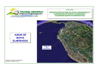
  • 1. CONSULTORÍA: CONSTRUCCIÓN DE BASE DE DATOS CARTOGRÁFICA Y ELABORACIÓN DE MAPAS DE AMENAZAS Y VULNERABILIDADES EN AMBIENTE SIG ALBUM DE MAPAS ELABORADOS CUENCA DEL RÍO JEQUETEPEQUE Consultor: Ing. Carlos Cerdán Moreno Cajamarca, diciembre de 2007
  • 2. CONSTRUCCIÓN DE BASE DE DATOS CARTOGRÁFICA Y ELABORACIÓN DE MAPAS DE AMENAZAS Y VULNERABILIDADES EN AMBIENTE SIG CONSULTOR: Ing. Carlos Cerdán Moreno Nº J-01 MAPA: BASE DESCRIPCIÓN: Mapa a curvas de nivel (topográfico). La cuenca media y alta del río Jequetepeque se ha delimitado con una línea amarilla. Las subcuencas priorizadas están resaltadas con fondos de diversos colores. Como referenica se muestra la ciudad de cajamarca y la propiedad de la empresa minera Yanacocha (polígonos de color rojo y gris, respectivamente). 1
  • 3. CONSTRUCCIÓN DE BASE DE DATOS CARTOGRÁFICA Y ELABORACIÓN DE MAPAS DE AMENAZAS Y VULNERABILIDADES EN AMBIENTE SIG CONSULTOR: Ing. Carlos Cerdán Moreno Nº J-02 MAPA: TEMPERATURA MEDIA ANUAL DESCRIPCIÓN: Mapa de distribución de la temperatura media anual. El valor debe cotejarse según el color, comparando con la leyenda de la izquierda. Para la elaboración se empleó la fórmula empírica: T = 21.95 - .0021H T = Temp. en ºC H = Altura terreno en m. Se consideró la temperatura promedio anual de las estaciones meteorológicas: Talla, Montegrande Chilete, Magdalena Lives, Asunción, San_Juan, Contumaza Llapa, Huacraruro, Granja_Porcón, Quilcate, Quebrada Honda. Fuente: Actualización del Plan de Ordenamiento Ambiental de la cuenca del río Jequetepeque – INRENA. 2
  • 4. CONSTRUCCIÓN DE BASE DE DATOS CARTOGRÁFICA Y ELABORACIÓN DE MAPAS DE AMENAZAS Y VULNERABILIDADES EN AMBIENTE SIG CONSULTOR: Ing. Carlos Cerdán Moreno Nº J-03 MAPA: TEMPERATURA MÁXIMA ANUAL DESCRIPCIÓN: Mapa de distribución de la temperatura máxima media anual. El valor debe cotejarse según el color, comparando con la leyenda de la izquierda. Para la elaboración se empleó la fórmula empírica: T = 28.9 - .0051H T = Temp. en ºC H = Altura terreno en m. Se consideró la temperatura máxima promedio anual de las estaciones meteorológicas Magdalena y Carachugo. Fuentes: • Modelamiento Hidrológico de la Cuenca del Río Jequetepeque con SWAT model – Fernando López – 2006 • Estudio de Impacto Ambiental – Minera Yanacocha - 2003 3
  • 5. CONSTRUCCIÓN DE BASE DE DATOS CARTOGRÁFICA Y ELABORACIÓN DE MAPAS DE AMENAZAS Y VULNERABILIDADES EN AMBIENTE SIG CONSULTOR: Ing. Carlos Cerdán Moreno Nº J-04 MAPA: TEMPERATURA MÍNIMA ANUAL DESCRIPCIÓN: Mapa de distribución de la temperatura mínima media anual. El valor debe cotejarse según el color, comparando con la leyenda de la izquierda. Para la elaboración se empleó la fórmula empírica: T = 15.83 - 0.0059H T = Temp. en ºC H = Altura terreno en m. Se consideró la temperatura mínima promedio anual de las estaciones meteorológicas Magdalena y Carachugo. Fuentes: • Modelamiento Hidrológico de la Cuenca del Río Jequetepeque con SWAT model – Fernando López – 2006 • Estudio de Impacto Ambiental – Minera Yanacocha - 2003 4
  • 6. CONSTRUCCIÓN DE BASE DE DATOS CARTOGRÁFICA Y ELABORACIÓN DE MAPAS DE AMENAZAS Y VULNERABILIDADES EN AMBIENTE SIG CONSULTOR: Ing. Carlos Cerdán Moreno Nº J-05 MAPA: PRECIPITACIÓN MEDIA ANUAL – AÑOS NORMALES DESCRIPCIÓN: Mapa de distribución de la precipitación promedio anual para los años en que no hubo ocurrencia del fenómeno El Niño. El valor de la precipitación debe cotejarse según el color, comparando con la leyenda de la izquierda. Para la elaboración se empleó la fórmula empírica: PPn = 0.306 H1.078 PP = Precipitación en mm. H = Altura terreno en m. Fuente: • Actualización del Plan de Ordenamiento Ambiental de la cuenca del río Jequetepeque – INRENA. 5
  • 7. CONSTRUCCIÓN DE BASE DE DATOS CARTOGRÁFICA Y ELABORACIÓN DE MAPAS DE AMENAZAS Y VULNERABILIDADES EN AMBIENTE SIG CONSULTOR: Ing. Carlos Cerdán Moreno Nº J-06 MAPA: PRECIPITACIÓN ANUAL FEN 1998 DESCRIPCIÓN: Mapa de distribución de la precipitación anual del año 1,998, en el cual se registró el último fenómeno El Niño. El valor de la precipitación debe cotejarse según el color, comparando con la leyenda de la izquierda. Para la elaboración se interpoló y extrapoló las curvas isoyetas del mapa respectivo, preparado por el INRENA para el PEJEZA. Fuente: Actualización del Plan de Ordenamiento Ambiental de la cuenca del río Jequetepeque – INRENA. 6
  • 8. CONSTRUCCIÓN DE BASE DE DATOS CARTOGRÁFICA Y ELABORACIÓN DE MAPAS DE AMENAZAS Y VULNERABILIDADES EN AMBIENTE SIG CONSULTOR: Ing. Carlos Cerdán Moreno Nº J-07 MAPA: ZONAS DE VIDA DESCRIPCIÓN: Mapa de distribución de zonas de vida, según la clasificación de Leslie Holdridge. Fuente: Actualización del Plan de Ordenamiento Ambiental de la cuenca del río Jequetepeque – INRENA. 7
  • 9. CONSTRUCCIÓN DE BASE DE DATOS CARTOGRÁFICA Y ELABORACIÓN DE MAPAS DE AMENAZAS Y VULNERABILIDADES EN AMBIENTE SIG CONSULTOR: Ing. Carlos Cerdán Moreno Nº J-08 MAPA: PENDIENTES DESCRIPCIÓN: Mapa de clasificación de pendientes según el cuadro-leyenda. En general, predominan las pendientes fuertemente inclinadas y empinadas (30% a 75% de inclinación del terreno), con algunas trazas de terrenos muy empinados, que en conjunto representan zonas de riesgo para la agricultura y los asentamientos poblacionales. Fuente: Elaboración propia en base a la Carta Nacional. 8
  • 10. CONSTRUCCIÓN DE BASE DE DATOS CARTOGRÁFICA Y ELABORACIÓN DE MAPAS DE AMENAZAS Y VULNERABILIDADES EN AMBIENTE SIG CONSULTOR: Ing. Carlos Cerdán Moreno Nº J-09 MAPA: GEOLÓGICO DESCRIPCIÓN: Mapa geológico de la cuenca del río Jequetepeque. Son de especial interés las unidades de formación reciente, como son los depósitos aluviales, coluviales, fluviales y de deslizamiento por cuanto representan zonas de riesgo para la integridad física si presentan actividad continua. Fuente: Actualización del Plan de Ordenamiento Ambiental de la cuenca del río Jequetepeque – INRENA. 9
  • 11. CONSTRUCCIÓN DE BASE DE DATOS CARTOGRÁFICA Y ELABORACIÓN DE MAPAS DE AMENAZAS Y VULNERABILIDADES EN AMBIENTE SIG CONSULTOR: Ing. Carlos Cerdán Moreno Nº J-10 MAPA: GEOMORFOLÓGICO DESCRIPCIÓN: Mapa geomorfológico de la cuenca del río Jequetepeque. Además de presentar las formas del relieve de la cuenca, presenta los procesos morfodinámicos que se desarrollan en el territorio, los cuales en sí representan amenazas latentes para la población y/o los productos que cultivan. Fuente: Actualización del Plan de Ordenamiento Ambiental de la cuenca del río Jequetepeque – INRENA. 10
  • 12. CONSTRUCCIÓN DE BASE DE DATOS CARTOGRÁFICA Y ELABORACIÓN DE MAPAS DE AMENAZAS Y VULNERABILIDADES EN AMBIENTE SIG CONSULTOR: Ing. Carlos Cerdán Moreno Nº J-11 MAPA: PELIGROS HIDROGEOLÓGICOS DESCRIPCIÓN: Mapa de peligros hidrogeológicos, es decir peligros que se presentan por la acción del escurrimiento y/o infiltración de agua asociados a unidades geológicas especialmente sensibles a esta acción, generando así los tres principales peligros hidrogeológicos: huaycos, inundaciones y deslizamientos. Fuente: Elaboración propia en base a la actualización del Plan de Ordenamiento Ambiental de la cuenca del río Jequetepeque – INRENA. 11
  • 13. CONSTRUCCIÓN DE BASE DE DATOS CARTOGRÁFICA Y ELABORACIÓN DE MAPAS DE AMENAZAS Y VULNERABILIDADES EN AMBIENTE SIG CONSULTOR: Ing. Carlos Cerdán Moreno Nº J-12 MAPA: VULNERABILIDAD DESCRIPCIÓN: Mapa de vulnerabilidad estimada por distritos, en base a los parámetros de vulnerabilidad del Instituto Nacional de Defensa Civil - INDECI. Fuente: Curso SIG – INDECI - 2002. 12
  • 14. CONSTRUCCIÓN DE BASE DE DATOS CARTOGRÁFICA Y ELABORACIÓN DE MAPAS DE AMENAZAS Y VULNERABILIDADES EN AMBIENTE SIG CONSULTOR: Ing. Carlos Cerdán Moreno Nº J-13 MAPA: RIESGOS DE ORIGEN HIDROGEOMORFOLÓGICO DESCRIPCIÓN: Mapa de estimación de riesgos hidrogeomorfológicos, obtenido del cruce del mapa de peligros de origen hidrogeomorfologico con el mapa de vulnerabilidad general. La ponderación del nivel de riesgo está determinado por el tipo de peligro asociado al nivel de vulnerabilidad del distrito correspondiente. Un caso resaltante es el caserío Poquish, en el distrito San Luis, provincia San Pablo, que presenta una alto riesgo por deslizamiento y asentamiento debido a su ubicación en una unidad estratigráfica inestable. Fuente: Elaboración propia en base a la actualización del Plan de Ordenamiento Ambiental de la cuenca del río Jequetepeque – INRENA. 13
  • 15. CONSTRUCCIÓN DE BASE DE DATOS CARTOGRÁFICA Y ELABORACIÓN DE MAPAS DE AMENAZAS Y VULNERABILIDADES EN AMBIENTE SIG CONSULTOR: Ing. Carlos Cerdán Moreno Nº J-14 MAPA: RIESGO DE HELADAS ESTACIONALES ANUALES DESCRIPCIÓN: Mapa de estimación deL riesgo de ocurrencia de heladas meteorológicas. Fue elaborado en base a los reportes de ocurrencias de heladas del INDECI: el mapeo se hizo según la localidad indicada en el reporte y el tipo de cobertura vegetal; y la magnitud se estimó en función al daño provocado. Fuente: Elaboración propia en base los reportes de emergencias atendidas por el INDECI, años 2002 - 2007. 14