Weitere ähnliche Inhalte Ähnlich wie Whm Group Quals Ähnlich wie Whm Group Quals (20) 1. Statement of Corporate Qualifications
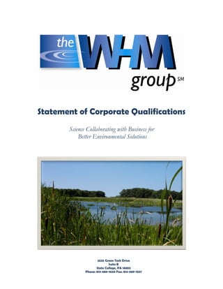
Science Collaborating with Business for
Better Environmental Solutions
2525 Green Tech Drive
Suite B
State College, PA 16803
Phone: 814-689-1650 Fax: 814-689-1557
2. o Company Overview
Company Profile
The WHM Advantage
Summary of Services
o Service Profiles
Natural Resource Management
Biological and Ecological Studies
Permitting
Streams
Wetlands
GIS
Other
o Projects
Detailed Project Profiles
o Professional Staff of WHM
Directors and Professional Staff
Associates of WHM
Strategic Alliances
Contact Information
© The WHM GroupSM Page 2 of 49
3. COMPANY PROFILE
The WHM GroupSM is a multi-discipline company committed to delivering
environmental resource solutions. WHM is proud of its record in solving environmental
problems.
The WHM GroupSM – along with its wholly owned subsidiaries, WHM Consulting, Inc.
and WHM Solutions, Inc. – emerged from the successful business experiences of
Wetlands Habitat Management, Inc. The WHM family of companies offers
comprehensive resolutions to difficult environmental problems.
Founded in 1996 Wetlands Habitat Management provided third-party professional
support to clients dealing with complex wetland, stream and other highly regulated
environmental issues.
Both companies in the new family are owned by the founders and certain senior
employees with an expertise that extends far beyond water resources. All owners are
professionals with backgrounds in government and government relations,
environmental permitting, environmental engineering, the natural sciences,
construction, hydrology, business development in the United States and abroad, as well
as economic development, marketing and project management.
The WHM GroupSM provides the overall business and science guidance for WHM
Consulting and WHM Solutions. The Group follows a carefully balanced strategy
emphasizing a collaboration of good environmental science and sound business
practices in providing cost-effective solutions and services for clients.
WHM Solutions, Inc. offers turnkey packages at an attractive fixed price to provide our
clients with the most cost effective and technically sound projects. From conceptual
planning and permitting to task implementation, The WHM GroupSM provides a total
package and a high degree of confidence of project success.
WHM Consulting, Inc. provides support for a wide array of business and environmental
interests. We have a proven record of expertise and success in wetland determinations
and delineations; biological surveys, studies and assessments for threatened and
endangered species; complete environmental permitting for large, complex projects;
ground-water and surface-water quality studies; site assessments and remediations.
© The WHM GroupSM Page 3 of 49
4. THE WHM ADVANTAGE
PERFORMANCE
A Comprehensive Resource…
WHM approaches environmental problems with a business strategy that maintains a
balance between private sector resources and public regulations. WHM believes that
environmental impacts offer business opportunities for the private sector while at the
same time presenting solutions which strengthen the quality and integrity of our natural
resources. There is no need to seek out experts for each step of the process.
Expertise…
The Directors of WHM have all been involved with important corporate projects of all
sizes since the mid-1970s. The Directors have also been active with many local, state
and federal governmental activities for the same period of time. Because of this unique
experience, WHM brings a competitive advantage in assisting business and
government to solve environmental problems.
Operational Business Excellence…
Because WHM, through its operating affiliate, has considerable practical experience in
providing environmental solutions for government and private interests, the Company
offers unique insight and approach to its projects which are not available through other
parties.
Confidentiality…
WHM assures confidentiality in all of its activities.
© The WHM GroupSM Page 4 of 49
5. SERVICE SUMMARY
The WHM team services client needs for a multitude of timely environmental issues. We are
proud of our long history of providing a complete range of environmental and engineering
consulting services from the early stages of planning and defining project objectives to the
implementing stages of construction management, inspection and certification. Once a
project is complete, our team provides the operational and follow-up services to assist you
to insure your objectives are being met. The WHM team’s comprehensive expertise is
broadly separated into the following categories:
PERMITTING
WHM coordinates with regulatory agencies on a variety of environmental projects and
provides expert assistance with obtaining all necessary permits and completing designs to
complete your project.
• Air Quality Permits
• National Pollutant Discharge
• Water Quality Permits
Elimination System
• Stormwater Discharge Permitting
• Soil Erosion and Sediment Control
• Waste Management Permitting
• Post Construction Stormwater
• Pennsylvania Act 2
Management.
• Abandoned Mine Reclamation
• Water Obstruction and
• Oil and Gas
Encroachment
• General Permitting
NATURAL RESOURCES MANAGEMENT
We provide restoration, protection and conservation in areas of air, water, soils, agronomy,
geology and hydrogeology. This includes management of wetlands and watercourse issues
including accurate boundary determination, property acquisition for development
mitigation, computer-aided conceptual wetland and stream restoration design.
Additionally, we work with jurisdictional agencies for the management of threatened and
species issues including habitat assessments, presence/absence surveys, research, habitat
management plans, and construction monitoring services for species such as the Timber
Rattlesnake, Allegheny Woodrat, Northeast Bulrush and other specially regulated species.
• Threatened and Endangered • Archeology
Species • Watershed Assessments,
• Wildlife Management Restoration, and Protection Plans
• Wildlife Habitat • Stormwater Management
Creation/Enhancement • Natural Channel Design
• Biological and Ecological • Water Quality
Assessments • Hydrological/Geological Studies
• Macroinvertebrate Surveys • On-lot Waste Water Management
• Radio Telemetry • Coal/Natural Gas
• Soil Evaluations • Nutrient Credits
• Wetland Delineations, Mitigation,
and Treatment
© The WHM GroupSM Page 5 of 49
6. SITE DESIGN MODELING AND MAPPING TECHNOLOGIES
WHM/BAI has developed visual aids to help regulators and the public understand the scope
and visual impact of a project through design and site location mapping, in addition to 3D
project visualization. Additionally, hydrology and hydraulic design softwares can be used to
design appropriately sized infrastructure. These software tools help clients for planning,
managing, and decision making. Below are some of the commonly used software packages.
Mapping Software Hydraulic Design Software
• AutoCAD Civil 3D 2011 – Used for • HY-8 – Used for road overtopping
grading design for design work
• AutoCAD Land Desktop 2004– • VT/PSUHM – Determine flows for
Used for grading design pipes and channels.
• ArcGIS – Used for a variety of • HEC-RAS - Used to model water
mapping and analyses flow
• Trimble Terrasync – Used on the Hydrologic Design Software
GeoXH GPS Unit • TR-55 Software – Used for smaller
• Trimble GPS Pathfinder Office – watershed runoff calculations.
Used for the GeoXH GPS Unit • USGS-WRIR – Used for larger
• Visual Nature Studio – Used for 3d watershed runoff calculations.
Video Animation utilizing GIS data. • PSU-IV - Used for larger watershed
runoff calculations.
ENERGY DEVELOPMENT
Energy will remain high on the nation's list of priorities for many years, and this is a key
area of our practice. As the nation searches for new sources, we offer:
• Strategic Planning • Carbon Credits
• Site Assessments and Development • Solar
• Risk Management • Government Relations
• Biogas • Uniting Partners and Clients
• Wind to Energy
WASTE MANAGEMENT
We have demonstrated innovation in nearly all sectors of waste management, including
liner technology, leachate management, bioreactors and landfill gas utilization. Our
personnel are skilled at the art of balancing environmental considerations with economics
and potential liability.
• Brine Water Treatment & Disposal • Soils and Geosynthetic Materials
• Landfill Disposal • Spill Prevention & Management
• Permitting & Planning Services • Hazardous Waste Treatment
• Regulatory Coordination • Hazardous Waste Recovery
• Environmental Remediation • Reclamation
• Emergency Response • Operation
• Beneficial Use Projects • Closure
• Hazardous Waste Collection • Monitoring
• Construction Management • Post Closure
• Quality Assurance • Impoundments
7. NATURAL RESOURCE MANAGEMENT
THE PNDI PROCESS
In recent times, regulatory agencies, municipalities and corporations have become
increasingly concerned about ecological issues. The investigation and appropriate
identification of biological and natural resources are the foundation of any ecological
project. WHM personnel have the knowledge, skills, and experience to identify any
area’s flora and fauna. Regardless of whether the project requires a one-day site
assessment or a long-term advanced research study involving a complete biological
inventory, WHM has the ability to prepare an ecological or biological evaluation plan
that meets the project’s needs and provides a feasible solution.
The Pennsylvania Department of Conservation and Natural Resources describes PNDI in
the following manner:
The Pennsylvania Natural Diversity Inventory (PNDI) is a partnership between the
Pennsylvania Bureau of Forestry, the Nature Conservancy, and the Western
Pennsylvania Conservancy to conduct inventories and to collect data to describe the
Commonwealth's rarest and most significant ecological features. These features include
plant and animal species of special concern, rare and exemplary natural communities
and outstanding geologic features. Site-specific information describing these features is
stored in an integrated data management system created from map, manual, and
computer files. The PNDI information system is continually refined and updated to
include recently discovered locations and to describe environmental changes affecting
known sites. The goal is to build, maintain and provide accurate and accessible
ecological information needed for conservation, development planning and natural
resource management. http://www.naturalheritage.state.pa.us/
WHM believes that through advanced planning and minor modifications to
development plans, it is feasible to work with PNDI and developers to prevent losses of
biological diversity without consequence to the economy.
8. ECOLOGICAL
Threatened and Endangered Species
Biological Assessments
Ecological Assessments
Macroinvertebrate Surveys
Wildlife Management
Radio Telemetry
Wildlife Habitat Creation/Enhancement
THREATENED AND ENDANGERED SPECIES
Issues of threatened and endangered
species often arise during the planning
review by county conservation districts, the
Pennsylvania Department of Environmental
Protection, the Department of Conservation
and Natural Resources, the Pennsylvania
Fish & Boat Commission and the U.S. Fish &
Wildlife Service. If a database reveals that
such species may be present in or within
close proximity of the project area, the
permit applicant is required to retain a
qualified biologist to investigate the area.
Early consultation with jurisdictional agencies prior to project development is critical.
WHM and our associates have certified professionals to deal with “hits.”
The bog turtle, the red-bellied turtle, the timber rattlesnake, the eastern massasauga
rattlesnake, the Indiana bat, the green salamander, the bald eagle, the Allegheny
woodrat, and the northeastern bulrush are among a group of species that generate
concern in Pennsylvania and in some neighboring states. WHM staff and associates
include personnel that are recognized by State and Federal agencies as qualified
surveyors/biologists for the above mentioned species.
WHM staff and associates have conducted numerous habitat assessments and
presence/absence surveys for many plant and animal species of concern for various
developers, engineering firms, non-profit organizations, universities, and government
agencies in:
Pennsylvania Maryland Florida South Carolina
New Jersey Virginia Florida Keys Georgia
New York Ohio Alaska Upper Mid West
Delaware New England California North Carolina
© The WHM GroupSM Page 8 of 49
9. These studies allowed projects to go forward without negatively impacting the habitats
of threatened and endangered species.
The expertise and experience of our staff and associates includes, but is not limited to
other species such as: the wood turtle, map turtles, spotted turtles, box turtles,
canebrake rattlesnake, eastern hognose snake, corn snake, northern pine snake,
northern copperhead, eastern fence lizard, five-lined skink, pine barrens tree frog,
eastern spadefoot toad, western spadefoot toad, green salamander, Jefferson
salamanders, marbled salamander, spotted salamanders, American alligator, American
crocodile, spectacled caiman, Aleutian canada goose, red-headed woodpeckers, semi-
palmated sandpipers, upland sandpiper, piping plovers, loggerhead shrike, burrowing
owl, barred owls, grasshopper sparrow, black crowned night heron, American bittern,
bobolink, eastern small footed bat, northern myotis bat, many species of freshwater
mussels, Stephen’s kangaroo rat, coronet blue butterfly, edith’s checkerspot butterfly,
damselflies, dragonflies, eared false foxglove, swamp honeysuckle, swamp pink,
Hartford fern, pitcher plants, sundews, and broom crowberry.
BIOLOGICAL/ECOLOGICAL ASSESSMENTS
Biological and ecological assessments are
generally an inventory of all plant and
animal life within an assigned area, and the
overall environmental quality of that area
relating abiotic factors (temperature, light,
moisture) to biotic components, the living
things that shape an ecosystem.
MACROINVERTEBRATE SURVEYS
The condition of aquatic habitat is an
indicator of the overall health of a
watershed. WHM has experienced staff
that can perform aquatic habitat
assessments, including macroinvertebrate
surveys, and is familiar with leading
assessment protocols required in
Pennsylvania and elsewhere.
© The WHM GroupSM Page 9 of 49
10. WILDLIFE MANAGEMENT
We have expertise/experience in
environmental impact statements, surveys
and technical reports for many species of
threatened and endangered plants and
wildlife, natural resource/biological
inventories, herptile inventories and
surveys, construction monitoring services
for threatened and endangered species,
vernal pool surveys and evaluations, drift
fence trapping for threatened and
endangered species, and bog turtle
trapping.
RADIO TELEMETRY
Radio telemetry is a mechanism used by
biologists to track wildlife in the field,
usually for the purpose of obtaining activity
range and daily movement data, as well as
habitat use. Radio transmitters can be
safely attached to wildlife through a variety
of procedures depending on the species.
The data can be used to develop an
appropriate wildlife management or habitat
management plan. An example would be
habitat management at a known bog turtle site. Particular portions of wetlands where
bog turtles are known to occur may be managed differently based on the activity range
and habitat use data provided through radio telemetry.
WILDLIFE HABITAT CREATION/ENHANCEMENT
Habitat creation involves the construction of
appropriate habitat for a given wildlife or
plant species through activities such as
prescribed burning, exotic/invasive
vegetation removal, vernal pool
construction, waterway enhancement, and
introduction of native vegetation.
© The WHM GroupSM Page 10 of 49
11. PERMITTING
Local, State and Federal
NPDES
Erosion and Sediment Control
Water Obstruction and Encroachment
Department of Environmental Protection
LOCAL, STATE AND FEDERAL PERMITTING
We provide complete environmental permitting for large and complex projects. WHM
has experienced staff that works closely with our clients to develop realistic strategies
that comply with local, state and federal governmental relations.
NATIONAL POLLUTANT DISCHARGE ELIMINATION SYSTEM
As authorized by the Clean Water Act, the National Pollutant Discharge Elimination
System permit program controls water pollution by regulating point sources that
discharge pollutants into waters of the United States. Point sources are conveyances
such as pipes or man-made ditches. Industrial, municipal and other facilities must
obtain permits if their discharges go directly to surface waters.
EROSION AND SEDIMENT CONTROL
Erosion is the natural process by which the surface of the land is worn away by water,
wind or chemical action. Permits are required for plans to minimize erosion and
sedimentation. This can include timber harvesting, road construction and maintenance,
agriculture, construction of buildings and dozens of other activities.
WATER OBSTRUCTION AND ENCROACHMENT
Water obstruction and encroachment permits are required for any structure or activity
that changes, expands or diminishes the course, current or cross section of a
watercourse, floodway, stream, creek, river, lake, pond, reservoir, swamp, marsh,
wetland or other body of water. This involves the state, the Corps of Engineers, and
possibly municipalities and other federal agencies. You don’t want to try this on your
own.
DEPARTMENT OF ENVIRONMENTAL PROTECTION
Your state’s Department of Environmental Protection regulates air quality, water quality,
acid mine drainage, flood protection, hazardous-waste sites, alternative fuels programs,
oil and gas wells, brownfield redevelopment, erosion control, municipal waste and
landfills, storage tanks and dozens of other things. Obtaining all necessary permits can
be nearly impossible without expert assistance.
© The WHM GroupSM Page 11 of 49
12. STREAMS
Restoration
Natural Channel Design
Abandoned Mine Drainage
Water Quality
Assessments
RESTORATION
Stream channels that are impaired can become unstable and cause damage to
infrastructure such as roads, bridges and houses. In addition, unstable streams can
produce high sediment loads that impact aquatic habitat and stability of downstream
reaches.
WHM has assessed hundreds of miles of streams to determine "pinch points" that
affect channel stability. Bank erosion surveys determine the rate of channel movement
and sediment production, leading to the development of plans to remediate the
problems.
We also have expertise in riparian zones – the transitional areas between land and
water environments. For many streams, there is little or no riparian zone, due to
clearing, paving or neglect. This may result in increased flooding and erosion, and may
cause property damage. The establishment of the riparian zone of streams and
wetlands is vital to the health of water resources. The vegetation of the riparian zone
provides habitat, streambank protection, shading and filtering of stormwater runoff.
WHM evaluates riparian vegetation and provides solutions to improve or restore these
vital areas.
Stream restoration includes returning a stream, its floodplain and riparian area to its
natural and stable condition, as well as re-establishing its biological habitat and
function.
NATURAL CHANNEL DESIGN
Today, many stream channels are impaired due to development, sprawl and agricultural
practices. It is important to restore impaired waterways not only for water quality,
recreation and aesthetics, but also because streams provide habitat for complex
ecosystems and are critical to the overall health of any watershed.
© The WHM GroupSM Page 12 of 49
13. Natural channel design is a method of restoring or creating a stable stream channel by
using a natural system as a model. WHM has successfully designed stream restoration
projects using these methods in Pennsylvania, New York, Maryland, North Carolina and
West Virginia. We offer full-service solutions: background data collection, design,
permitting and construction.
ABANDONED MINE DRAINAGE
Constructed wetlands provide a cost-effective and long-term alternative solution for the
treatment of acid mine drainage, stormwater and various industrial wastewaters. WHM
has designed and developed wetlands that utilize naturally occurring chemical and
biological processes to remove contaminants prior to entering the watershed. This
cutting-edge technology is typically developed through the design and construction of a
series of aerobic and anaerobic wetlands. WHM has been successful in providing our
clients with passive treatment systems that meet effluent discharge limits and
treatment goals.
Passive wetland treatment also can be utilized to gain credits in nutrient management
programs, such as the Chesapeake Bay Strategy.
WATER QUALITY
Pollution degrades surface waters making them unsafe for drinking, fishing, swimming,
and other activities. We have experienced staff that specializes in the evaluation of
water resources. The intention of a watershed assessment is to collect data that
characterize the health of the watershed. The assessment results will identify areas that
are impaired or areas that have valuable resources. This information can then be used
for planning, obtaining grants, preservation and restoration. Typically, the watershed
assessment is the initial phase of planning to prioritize stream improvement projects.
Through our strategic relationship with our associate ESG, we are able to pursue grant
assistance through state and federal programs.
ASSESSMENTS
Geomorphic stream classification is a system of defining streams based on
morphological characteristics and functions. With our staff specializing in fluvial
geomorphology, WHM is able to provide stream channel classifications as a useful tool
for identifying areas of impairment and to predict future stream problems before they
occur.
© The WHM GroupSM Page 13 of 49
14. WETLANDS
Delineations
Mitigation
Design
Construction
DELINEATIONS
During the initiation of any project, it is wise to have your site evaluated for wetlands.
Avoiding this step can be costly, time consuming and may inhibit the development of
the project. WHM has experienced professionals who can determine whether
jurisdictional wetlands and waters exist within your project location.
Wetlands are those areas on the landscape that experience saturation or ponding for at
least 5% of the growing season, contain plants that are tolerant to periods of saturated
conditions, and display evidence of hydric soils. These areas are subject to varying
local, state and federal regulations.
WHM utilizes the most up-to-date technical methods to delineate wetland boundaries
and prepare technical data and mapping for your project. Additionally, our professionals
will provide recommendations to avoid and minimize water resource impacts in order to
achieve your goals.
MITIGATION
We have developed successful wetland mitigation sites throughout Pennsylvania. We
carefully select properties suitable for wetland development by utilizing the most up-to-
date Geographic Information Systems databases and software. Potential sites are
identified through an examination of hydrology, soils and the probability of being a
wetland historically. Selecting the best mitigation site translates into a high probability
of success using less construction effort. Selection of the best mitigation site is well
worth the effort to save substantial funds. Our view, refreshingly different from most
others is to examine the lifecycle costs of the mitigation site.
© The WHM GroupSM Page 14 of 49
15. DESIGN
Once a suitable site has been determined, WHM will create a conceptual design based
on the overall shape of the landscape and the development of a hydrological water
budget. Through computer-aided design, construction drawings are then developed.
The final design illustrates phased construction activities, erosion-control practices and
a complete planting and re-vegetation schedule.
CONSTRUCTION
WHM is able to provide wetland mitigation as a turnkey project with a full list of
services, including GIS property searches, on-site resource evaluations for potential
wetland mitigation, permitting from the state and U.S. Army Corps of Engineers,
construction, construction management and professional engineering certification,
preparation of bid documents and project specifications, and wetland monitoring and
maintenance.
© The WHM GroupSM Page 15 of 49
16. GEOGRAPHIC INFORMATION SYSTEMS
Mapping
Surveying
Land Analysis
Project Planning
MAPPING
A geographic information system (GIS) is most often associated with a map. A map,
however, is only one way we work with geographic data. A geographic information
system holds great problem-solving capabilities, integrating hardware, software and
data. GIS improves the speed and accuracy with which you uncover trends and patterns
hidden in your data. We’ve employed GIS in stream channel and wetland design, wind
resource analysis, topographic mapping and other areas.
SURVEYING
Our staff uses data acquired by our team using GPS technology, as well as data that’s
available through spatial databases. By integrating these services, as well as computer-
aided design, our firm has had great success determining the suitability of a site for a
specific project. The products we generate fulfill our clients’ needs in planning,
managing and decision-making.
LAND ANALYSIS
WHM helps you answer questions and solve problems by looking at your data in a way
that is quickly understood and easily shared. We’ve assisted numerous clients with
analysis using the most up-to-date technology and data. Our staff can help you
visualize spatial relationships and determine environmental concerns.
PROJECT PLANNING
Our geographic information system team helps you succeed, using less construction
effort and saving substantial funds through our efficient and effective use of
technology. We’ve used this technology to assist our clients with site selection, property
acquisition, environmental management, project planning and development, and
feasibility studies for a wide range of projects.
© The WHM GroupSM Page 16 of 49
17. OTHER
Grant Writing
Construction Oversite/Monitoring
Nutrient Trading
GRANT WRITING
WHM has the background and knowledge to assist non-profit organizations with grant
writing to pursue funding from private, state and federal sources for various projects
desired by the organization. We have high success rate for receiving funding for the
organizations, especially through Growing Greener which is the largest single
investment of state funds in Pennsylvania history to address critical environmental
problems. Funds are available for innovative projects, energy related projects, public
parks, and projects that restore, conserve and preserve our valuable resources.
CONSTRUCTION OVERSITE/MONITORING
WHM provides construction oversight on wetland construction, stream restoration and
AMD projects for its clients. WHM ensures that all of the design parameters and QA/QC
specifications are met during the construction process. WHM also has a qualified timber
rattle snake biologist and bog turtle surveyor that can be used to provide construction
monitoring when habitats of these two species are being encroached upon.
NUTRIENT TRADING
With nutrient loading becoming such a high priority watershed problem, WHM has
experience in helping clients manage their problems with nutrient loading. These
clients range from municipal waste point source dischargers to agricultural non-point
source dischargers of nutrients. WHM provides answers to nutrient management for
the clients. Nutrient trading becomes an option when sequestering the nutrients
becomes too costly or if the client has sequestered nutrients in excess opening them to
the market.
© The WHM GroupSM Page 17 of 49
18. Stony Creek Wind Farm
Somerset County, Pennsylvania
WHM provided E.ON (formally known as Airtricity, Inc.)
with wetland and engineering services in connection with
the Stony Creek Wind Project. The Stony Creek Wind
Project is a 35 turbine wind farm proposed on 3,000 acres
of reclaimed and forested land along the Allegheny Plateau
of southwestern Pennsylvania.
WHM performed a preliminary desktop analysis utilizing up
to date GIS data layers to identify potential wetland
locations. Based on this review, WHM performed a series
of field investigations which identified the size, extent, and
classification of water resources present within the project
area. Wetland delineations were performed on a total of
1500 acres of project area and 1.85 miles of transmission
line in accordance with methods outlined in the 1987 U.S.
Army Corps of Engineers Manual and other subsequent guidance documents. Wetland and
watercourse boundaries were marked with blue and pink flagging and numbered accordingly.
During our onsite investigation, USACE wetland data forms and photograph documentation
were completed for each identified wetland and adjacent upland area. The wetland delineation
phase of the project took 20 field crew days to complete.
The wetland boundaries were surveyed concurrent with the wetland delineation. Each wetland
flag was surveyed with a Trimble GeoXH GPS receiver in a coordinate system specified by
Airtricity, Inc. The post processing correction of this data was sub foot accuracy.
Following the completion of the field work, wetland findings were presented in a wetland
delineation report that included wetland descriptions, mapping, data forms, photograph
documentation and resumes. This documentation was presented in a format in accordance with
the USACE and PaDEP review standards. WHM coordinated 3 onsite meetings with agency
representatives from the USACE and PaDEP for field verification of wetland boundaries.
WHM coordinated with E.ON engineers in the selection of access roads in attempt to avoid and
minimize wetland impacts. This coordination consisted of communicating to the client areas to
be avoided thus minimizing permitting issues.
WHM prepared a Water Obstruction and Encroachment Joint Permit application for the Stony
Creek Wind Project. Key elements of the permit application included Pennsylvania Natural
Diversity Inventory (PNDI) Coordination, Cultural Resources Notice, a Project Description
Narrative, an Environmental Assessment form, an Erosion and Sediment Control Plan and
approval letter, and a written narrative and figures detailing practicable alternatives to the
proposed activities, including alternative locations, routings, designs, etc., that show avoidance
and minimization of environmental impacts.
© The WHM GroupSM Page 18 of 49
19. Allegheny Power – Albright-Bethelboro Transmission Line Upgrade
Fayette County, Pennsylvania and Preston County, West Virginia
Tackling the sheer length of large-scale linear projects
– whether overhead utility lines or underground gas
pipelines – is a unique challenge. WHM Consulting,
Inc. (WHM) and Blazosky Associates, Inc. (BAI) have
been very successful in providing permitting and
environmental consulting services for these types of
projects.
When Allegheny Power needed to rehabilitate a long
32+ mile stretch of transmission line spanning from
Pennsylvania into West Virginia and involving
numerous regulatory agencies, they contracted with
the WHM/BAI Team. In all, the project included the
removal and replacement of 73 wire support towers, access roads for each tower to the nearest
public road, and nearly 400 total project acres. Receiving streams of the project area include 5 High
Quality Cold Water Fishery streams, creating additional challenges.
An initial site visit occurred throughout all areas to be impacted as a result of this project. This was
to characterize the site conditions for existing infrastructure (i.e. roads, culverts, etc…), wetlands
and other environmentally sensitive features that may be impacted as a result of this project.
The extensive mapping required for this linear project area was achieved in various manners
utilizing our AutoCAD and ArcGIS mapping capabilities. In Pennsylvania, LIDAR (Light Detection and
Ranging) topography is available for the project area, while other site features were obtained from
USGS sources and color orthophotos. In West Virginia, mapping was compiled from USGS
quadrangles, orthophotos, and U.S. census Bureau Tiger Line data. Field investigation data were
added which included site notes and GPS surveyed information. Key maps on the drawings depicted
the organization of numerous plan sheets to facilitate overall understanding of the project site for
reviewers.
Due to the large size and overall scope of the project, numerous engineering, reporting and
permitting efforts were required, including:
PA NPDES Individual Permit for Stormwater Pennsylvania Natural Diversity Inventory
Discharges Associated with Construction Review
Activities Cultural Resource Notice
WV NPDES General Permit for Construction Erosion and Sedimentation Control Plans
Stormwater Activity Post-Construction Stormwater Management
PA General Permit for Minor Road Crossings Plans
PA General Permit for Utility Line Stream Wetland Delineation Report
Crossings Riparian Buffer Waiver Request
In order to keep to its planning and construction schedule, Allegheny Power desired quick
turnaround on permit preparation and agency review. WHM/BAI was able to complete the
application for each state within the schedules defined by Allegheny. West Virginia permits were
obtained within one month of submission. Pennsylvania permit applications were recently submitted
and are under review. These are anticipated to be obtained in time for Allegheny’s planned
construction schedule.
© The WHM GroupSM Page 19 of 49
20. Pipeline – Sediment Control Plans &
Threatened/ Endangered Species Monitoring
Clinton and Lycoming Counties, Pennsylvania
WHM provided a confidential Pipeline company
assistance in the preparation on Soil Erosion and
Sediment Control Plans (SESC) and
Threatened/Endangered Species monitoring in
relationship to the Anomaly Dig Locations in Clinton
and Lycoming Counties, Pennsylvania.
During this project, WHM drafted and submitted SESC
plans, showing the locations of each dig location and
the Best Management Practices that may be used.
The project also required Water Obstruction and
Encroachment Permits that involved coordination with
both the County Conservation Districts and the Pennsylvania Department of Environmental
Protection. Both of these government agencies issued separate permits for the project, since
permitting delegation in Pennsylvania can be issued by both county and state agencies. Project
location determines delegation. Some of these sites were located in special protection
watersheds, which create a more in-depth permitting process, since these watersheds require
the highest standards of protection and the least intrusive construction practices.
To complete the permits, WHM performed wetland delineations on the subject areas. While
delineating the anomaly dig locations, the areas that were found to be wetlands were then
surveyed using WHM owned GPS equipment that has accuracy standards that meet the
accuracy and quality requirements. This data was then used to map out the wetland
boundaries using ArcMap, Terrasync, and AutoCAD software packages. All work performed was
completed by WHM for these SESC Plans and Permitting. WHM completed onsite field visits with
regulatory staff to review the areas where permits were required.
A large portion of this project was located in the Sproul State Forest, which is located in the
least developed portion of the state. During the maintenance digs, issues arose with State
Forester concerning the practices and materials being used to re-stabilize disturbed areas.
However, through coordination and meetings with the client, WHM and the Sproul State Forest,
the issues were resolved and the construction practices were refined to satisfy the needs of the
State Forester.
This project was located in a portion of Pennsylvania that has a large population of Timber
Rattlesnakes, which are a candidate threatened species regulated through the Pennsylvania Fish
and Boat Commission (PFBC). As a result of this status, construction projects in known Timber
Rattlesnake habitat require monitoring by a PFBC approved specialist. This specialist monitors
the construction, and when a rattlesnake is present on the site, the specialist removes the
rattlesnake and places it far off the project site, protecting both the construction staff and
rattlesnake. WHM and its associates were able to staff this project requirement throughout the
project.
© The WHM GroupSM Page 20 of 49
21. Bald Eagle Wetland Mitigation Site
Centre County, Pennsylvania
Few issues have polarized the business community
and environmentalists more than the balance
between development and protecting wetlands. WHM
has developed a highly innovative approach that
creates new wetlands while allowing projects to move
ahead. An example is the Bald Eagle Wetland
Mitigation Site, the first of its kind in Pennsylvania.
Although avoidance of wetland damage is a goal in
highway construction, some impact is unavoidable.
The Pennsylvania Department of Transportation hired
WHM to provide mitigation for such situations. We
utilize a non-traditional methodology, assembling a team to handle everything at no risk to the
client. We find a site, purchase the property, acquire the permits, deal with regulatory agencies
and construct replacement wetlands – all at a per-acre fixed cost.
Through careful field and desktop evaluations, followed by numerous discussions with property
owners, WHM located several potential properties in the Bald Eagle Valley in Centre County,
Pa. These properties were selected based on their ability to create wetlands as determined by
an examination of hydrology and soils, as well as other environmental and non-environmental
factors. Larger contiguous properties create a more diverse habitat than smaller unwanted
parcels. Properties that retained a high possibility of success were ranked for acquisition.
After clearances were issued and sites were selected, WHM began to create a design for the
Bald Eagle project based on the overall shape of the landscape and the development of a
hydrologic water budget. The concept was presented to the U.S. Army Corps of Engineers, U.S.
Environmental Protection Agency, U.S. Fish and Wildlife Service, Pennsylvania Department of
Environmental Protection, Pennsylvania Fish and Boat Commission, and other state and local
agencies. The final design was based on input from each of these agencies, and then used to
obtain regulatory approvals necessary for the construction of wetlands.
As the project progressed, a series of construction drawings was developed, resulting in a final,
detailed design illustrating phased construction activities, erosion control practices and a
complete planting and re-vegetation schedule. As part of the regulatory permits and approvals,
WHM developed a monitoring plan to ensure long-term site maintenance and success. Funding
for the project includes provisions for ongoing and long-term management of the wetlands by a
non-profit organization.
WHM will have provided PennDOT with 50 acres of wetland mitigation credits. In addition,
wetland preservation, restoration and upland habitat are part of this project.
© The WHM GroupSM Page 21 of 49
22. Phoenix Resources, Inc.
Landfill Expansion Project, Tioga County, Pennsylvania
When Phoenix Resources, Inc. needed to expand its
construction/demolition landfill in Tioga County,
Pennsylvania, WHM was retained to avoid or
minimize impact to aquatic resources. Delineations
were conducted throughout 1,200 acres, despite a
number of challenges. First, this required prompt
field activity and a huge effort to cover a large
amount of land in a relatively short time, even when
weather made delineations difficult. Second,
numerous small "pothole" wetlands were
inadvertently created by human activities, particularly
in forested areas. This increased the degree of
difficulty associated with the delineation process. Third, a number of state and federal
regulatory agencies were involved. WHM worked with the owner and all regulatory groups to
avoid those wetlands with the highest value. By working with all groups, including the landfill
designers, the need for mitigation was reduced from the initial designs to permittable
quantities.
Once all of the alternatives had been exhausted, several low-quality wetland impacts became
unavoidable. These impacts were compensated through effective mitigation programs
developed by WHM. Such mitigation includes the creation of larger, high-quality wetlands. With
the approach that large wetlands bring more value than many smaller ones, WHM attempts to
match functions and values to meet agency expectations. Our wetland replacement plan was
prepared based on procedures and guidelines from the Pennsylvania Department of
Environmental Protection and the U.S. Army Corps of Engineers. Prior to conducting field
investigations, we completed a review of natural resource data associated with the project site.
Specifically, WHM reviewed mapping by the U.S. Geological Survey, U.S. Fish and Wildlife
National Wetland Inventory and the U.S.D.A. Soil Conservation Service.
Our goal was to create approximately 5 acres of mixed open-water, emergent and scrub-
shrub/forested wetland systems within the Phoenix Resources property. In addition, this
mitigation site aimed to provide expanded wetland and upland habitat, enhanced aesthetic
conditions and improved quality of water runoff into Babb Creek through increased nutrient and
toxicant sequestration. Land use within the property boundary consisted of the existing
construction/demolition landfill, its adjacent soil borrow area, idle forest, reclaimed strip mines
and deep mined areas. Wetlands and watercourses located on the property were delineated by
WHM and evaluated using the Ohio Rapid Assessment Method. This evaluation characterized
wetland habitats ranging from low to high quality habitat and function.
Our investigations on the subject property followed a three-pronged approach to characterizing
wetlands. This involved hydrophytic vegetation, hydric soils and wetland hydrology. Upon
completing our investigations, areas exhibiting all three criteria presented above were
characterized as jurisdictional wetlands. In addition, adjacent waterways were identified and
flagged as regulated waters of the United States. The monitoring involved periodic inspections
by a qualified wetland specialist for a period of not less than five years.
© The WHM GroupSM Page 22 of 49
23. Engineered Rock Placement Area
I-99 Acid Rock Remediation
Centre County, Pennsylvania
We solved a critical environmental problem that halted
construction of an interstate highway, and we did it
ahead of schedule, under budget, with no risk to our
client.
During construction of a key stretch of I-99 in central
Pennsylvania, pyritic rock was exposed when large
volumes of earth were excavated. When exposed to
water, pyrite creates sulfuric acid, which contaminates
water supplies, kills aquatic life, degrades concrete and
corrodes steel. Iron, aluminum and other metals also
are released to ground water and an environmentally
sensitive watershed.
WHM was selected by the Pennsylvania Department of Transportation to develop and
implement a solution for the most controversial, complex environmental problem faced by the
agency: the disposition of 1.5 million cubic yards of what is often called acid rock. We
proposed a turnkey solution: Using the best science, WHM would design, engineer, oversee
construction, operate and monitor the success of a lined disposal site known as an engineered
rock placement area.
WHM and its team secured permits, overcame public objections, presented the solution to a
variety of local and state government officials, worked closely with regulators and participated
in a variety of interactions with scientists and the media. The detailed design of the engineered
rock placement area (or ERPA, pronounced URP-uh) incorporated landfill engineering principles
including: subsurface investigations, surface water management, placement operations,
infiltrate management, construction quality assurance and control, public relations, as well as
monitoring, closure and post-closure plans. We did it at a fixed price, per cubic yard of
material, so risks were minimized for the Department of Transportation– which had limited
expertise to cope with this situation.
The WHM team selected the disposal site and constructed all layers of the lined facility. The
pyritic rock was mixed with baghouse lime to neutralize the acid, then capped with a unique
final cover system – a geomembrane welded to the lining system so the pyritic material is
completely sealed off from the environment in a “dry tomb.” Finally, there is a unique 4-foot
soil cap appropriate for native vegetation of grasses, shrubs and small trees. A thicker than
normal cap (4 feet instead of 2) allows use of a more diverse native vegetation, which in turn
visually blends the site into its surroundings.
Our reputation, creativity, expertise, partnerships and relationships with the Pennsylvania
Department of Environmental Protection and other regulators allowed a massive project to be
completed ahead of schedule and under budget. WHM continues to monitor the progress of
the water quality and vegetation in the vicinity.
© The WHM GroupSM Page 23 of 49
24. Laurel Valley Golf Club
Ligonier, Pennsylvania
WHM completed a natural channel design
project on a stream running through the Laurel
Valley Golf Course, saving the owners some
money in the process.
One condition of the design was that the stream
banks had to remain grass. This presented a
challenge because grass has shallow roots and is
not effective in preventing erosion. Another
condition was that the channel had to
complement the aesthetic of the course, which
was designed by Arnold Palmer. This condition
limited the approaches that could be used.
Eroding stream banks are a common problem on golf courses. Not only are they are
unattractive, but they can cause ponds to fill with sediment, resulting in costly dredging.
Traditionally, golf courses have stabilized streams with retaining walls or wire baskets filled with
rock, both of which are unsightly, expensive and prone to failure. Natural channel design is a
method of restoring or creating a stable stream channel by using a natural system as a model.
WHM has designed successful stream restoration projects in Pennsylvania, New York, Maryland,
North Carolina and West Virginia. We offer full-service solutions that include background data
collection, design, permitting and construction.
WHM’s techniques transform an unappealing stream into a beautiful golf-course asset that
requires little maintenance and is environmentally friendly. This is accomplished by reshaping
the eroding channel into a more natural condition. We use our knowledge of natural channels to
offer a cost-effective alternative to eroding waterways.
The stabilization technique we chose for the Laurel Valley project incorporated methods used in
natural channel design. This approach employs stable natural channels as a model for
developing channel pattern, profile and hydraulic dimensions. Another key component of this
technique uses in-stream structures to protect sections of the stream that are vulnerable to
erosion.
The final project consisted of grading a new channel pattern and dimensions to decrease the
channel slope and bank height. This decreased the power of the stream and the potential for
erosion. In addition, j-hook log vanes were installed to protect the stream’s banks.
We obtained permit approvals in a timely manner, so construction began on schedule. Through
our relationships with regulators, we know how to prepare permit applications that the agencies
will consider complete in the first submission.
© The WHM GroupSM Page 24 of 49
25. Orchard Club Subdivision Site
Clearfield County, Pennsylvania
During the spring of 2008, North American Land
Corporation (NALC) commissioned Stan Boder of
WHM to conduct a Phase I timber rattlesnake
habitat assessment and a Phase II timber
rattlesnake presence/absence survey at the
Orchard Club Subdivision Site (herein referred to
as site) in Clearfield County, Pennsylvania. The
Orchard Club Site is comprised of 1,285 acres
and is surrounded primarily by Moshannon State
Forest Lands and Pennsylvania State Game
Lands No. 34.
The property consisted of vacant wooded land with the exception of a hunting camp/vacation
home in the southwest portion of the site with a driveway connecting the property to a road to
the west. A subdivision plan had been approved to divide the site into 55 lots intended for
residential use. It was intended that development will be restricted to protect the wooded
nature of the site.
The habitat assessment was conducted in May of 2008 and in accordance with the PA Fish and
Boat Commission (PFBC) assessment protocol (revised July 2001) for determining the presence
of potential timber rattlesnake habitat. The PFBC habitat assessment form was completed.
During the habitat assessment, it was determined that potential timber rattlesnake over-
wintering (denning) and basking (gestating/rookery) habitat occurs on and in immediate
proximity to the site. Therefore, in May of 2008, NALC commissioned WHM to conduct a
timber rattlesnake presence/absence survey at the site. The timber rattlesnake
presence/absence survey took place during May and June of 2008 and was conducted in
accordance with the PFBC "Timber Rattlesnake Presence-Absence Survey Guidelines" (revised
March 2004).
Timber rattlesnakes were found to be present on the site. The rattlesnakes were primarily
observed in a 30 acre basking habitat area found in the northcentral portion of the site a
significant distance from any proposed development. Through collaboration with the PFBC, the
PFBC and WHM decided to develop a plan to distribute signs at the property which will alert
and educate future lot owners of the potential of interactions with timber rattlesnakes on the
project site. In addition, a timber rattlesnake educational package for lot owners was
produced. These signs and educational package materials will provide lot owners with
instructions on how to safely deal with timber rattlesnakes that might wander through their
properties and with education regarding the protected status of the timber rattlesnake in PA.
The timber rattlesnake habitat in the northcentral portion of the property will be set aside as a
natural area. The facilitation of the educational signs and educational packages allowed for the
project to be permitted as planned.
© The WHM GroupSM Page 25 of 49
26. Oley Mountain Estates
Oley Township, Berks County, Pennsylvania
Haines and Kibblehouse (HK) commissioned Stanley
J. Boder (SJB) on November 8, 2007, to conduct a
Phase I Bog Turtle (Glyptemys muhlenbergii) Habitat
Assessment at the proposed Oley Mountain Estates
development in Oley Township, Berks County,
Pennsylvania. The property is a 57.6 acre tract of
mostly undeveloped agricultural land located on an
agricultural hill-side. Scattered private residences,
woodlands, agricultural fields, and small businesses
currently surround the site. The construction of a
twelve (12) lot residential subdivision is proposed for
the property. All lots were to use on-lot water and
on-lot sewer systems.
Based on coordination with the Pennsylvania Natural Diversity Inventory (PNDI) database,
regarding species of concern, the potential for the future land development of the tract to affect
the bog turtle was identified. In response to this concern, a Phase I bog turtle habitat
assessment was conducted to determine the presence/absence of conditions suitable for
species support. This summary provides the findings of a Phase I species habitat assessment
conducted on wetland areas associated with the subject tract.
The survey was performed on November 24, 2007 by USFWS-Qualified Bog Turtle Surveyor
Stanley J. Boder. A site reconnaissance was conducted to determine if suitable soils, hydrology,
and vegetation for bog turtles were met in a narrow watercourse and its fringe wetlands
associated with the east-central portion of the property. A US Fish and Wildlife Service
(USFWS) and PA Fish & Boat Commission (PFBC) Bog Turtle Habitat Evaluation – Field Form
(revised 1/12/2005) was completed for the site. Photographs were taken during the survey to
provide a visual of key parameters that indicate whether a site has wetlands containing
potential bog turtle habitat. Photo documentation of the soils, vegetation and hydrology were
provided in the phase I report. Soil conditions in the wetland areas were not mucky and soils
could not be probed to a depth greater than 1-2 inches in any on-site wetland area. Based on
the field investigation, it was concluded that no potential core habitat for the Bog Turtle is
present on the subject property due to the lack of mucky soils found within the on-site wetland
area. In addition, potential core Bog Turtle habitat did not appear to occur immediately
adjacent to the project site. Therefore, it was concluded by SJB that the proposed project
would not negatively impact the Bog Turtle. The USFWS and the PFBC both concurred with
SJB’s findings and the project was permitted to proceed as planned.
© The WHM GroupSM Page 26 of 49
27. Warriors Mark Run
Huntingdon County, Pennsylvania
ATC Associates Inc. contracted WHM
Consulting, Inc. (WHM) to perform
macroinvertebrate sampling and a habitat
assessment on Warriors Mark Run in
Huntingdon County, Pennsylvania. The stream
segment was assessed in response to a motor
vehicle accident which involved a spill of
hazardous material the stream. The study
involved charactering the stream segment
upstream, downstream and within the area
where the spill occurred (impact zone) to
determine potential impacts from the spill.
WHM performed all work in accordance with the outlined Pennsylvania Department of
Environmental Protection (DEP) Protocol, “Standardized Biological Field Collection and
Laboratory Methods” and “Index of Biological Integrity for Wadeable, Freestone Streams in
Pennsylvania” to complete the assessment and survey.
These guidance documents outlined field procedures used to conduct the habitat assessment,
collect macroinvertebrate, and procedures to perform laboratory methods and identification.
The habitat assessment conducted characterized the stream segments and provided insight on
the various physical conditions of the stream within the stream reach, such as embeddedness
and riffle/run prevalence. Sampling of the macroinvertebrates followed the Semi-Quantitative
Method using a D-frame net. Macroinveretbrates were identified to the genus species, in most
case. This data was used to determine an Index of Biological Integrity (IBI), developed by DEP,
was determined based on six different biological metrics calculated for each assessed stream
segment. The IBI was used to determine if stream has been impacted from the spill based on
the upstream IBI scoring. Based on the IBI and habitat assessment, there is has been no
negative ecological impact on Warriors Mark Run.
© The WHM GroupSM Page 27 of 49
28. Dayton Dam Removal Project
Rush Township
Centre County, PA
This dam removal design was performed by a not-
for-profit organization and the Pennsylvania Fish and
Boat Commission. Preliminary work included a
review of the PNDI (Pennsylvania Natural Diversity
Index) for threatened and endangered species along
with a cultural resources review.
Mapping was performed by WHM. The design
included a drawdown permit, sediment analyses and
an erosion control Plan. The primary objective of
this design was to re-establish the historic floodplain to pre-dam conditions. In addition the
design also will restore stream habitat and ecosystem functions and improve water quality. The
stream channel design incorporates cross vanes and other natural channel design installations.
The hydrology and hydraulics for the project was performed in conjunction with Blazosky
Associates Inc.
Removed sediment will be used on site such that a cut and fill balance is achieved. A natural
stream channel design will be used to route the headwaters of Sixmile Run through the once
inundated portions of the dam and reconnect native brook trout habitat to the downstream
portion.
Post construction planting will include vegetation which mimics the surrounding Moshannon
State Forest. Native species are the targeted for there ability to survive within the valley in
addition to matching the natural habitat. The plantings will provide habitat for birds and
animals throughout the forest in addition to providing shade over Sixmile Run. This will keep
water levels cool and promote brook trout migration throughout.
All work was performed in an expedited schedule to facilitate the needs of the client.
© The WHM GroupSM Page 28 of 49
29. McCoy-Linn Dam Stream Restoration Project
Spring and Boggs Townships
Centre County, PA
The McCoy-Linn Dam was removed to allow for fish
passage throughout the lower reaches of Spring
Creek, a high-quality cold water fishery. Once the
dam was removed, remnant sediments remained on
the banks and the creek flowed through a constricted
channel. The stream had high water velocities
throughout the reach as a result of the narrow
channel. Erosive conditions existed throughout the
reach due to the high water velocity, contributing
sediments into the Spring Creek watershed. The
Pennsylvania Fish and Boat Commission and a not-for-profit organization retained WHM to
design a stream channel that stabilize the banks throughout the reach and design a channel
that better suits the site needs.
Site surveying and mapping was performed by WHM together with BluAcres, LLC to base the
design of the stream channel. The site survey gathered information of the existing conditions
and various stream channel features that are necessary in the design portion of the project.
The final design of this stream reach creates a stable stream segment with rock vanes that
stabilize the stream bed and banks. Wood structures are to be placed throughout the reach
within the stream channel to add additional habitat for aquatic species. Both the rock and
wooden structures increase the habitat within the stream, which promotes a healthy aquatic
community. In addition, a riparian planting creates streamside habitat that formerly was not
present while the dam existed.
An improved aquatic and riparian habitat exists at the former dam location. The healthy stream
reach not only benefits aquatic and terrestrial species, but increases the recreational
opportunities throughout for anglers and boaters alike. WHM was able to complete all
necessary measures for this project quickly in order to fulfill the clients needs to reconstruct this
portion of Spring Creek.
© The WHM GroupSM Page 29 of 49
30. L.K. Metzger Dam Rehabilitation Project
Ferguson Township
Centre County, PA
A private landowner had a desire to repair and
make necessary upgrades to the 2.0 acre Class C
dam on his property. After receiving an inspection
report from the DEP, the landowner contacted WHM
to provide him with services to rehabilitate and
upgrade the dam. The project will improve water
quality in Spruce Creek by bank grading reducing
erosion and sedimentation. The project will also
improve safety and aesthetic value of the dam
providing needed upgrades to ensure a properly
functioning and aesthetically pleasing dam for future
generations.
The project addressed concerns in the DEP inspection report and other goals set forth by the
landowner. A summary of work includes: the repair of the primary spillway, backfill animal
burrows or holes and patch with low permeability soil (LPS) to prevent seepage, grading and
armoring the banks surrounding the impoundment to prevent erosion, dredging, backfilling
downstream face of dam to eliminate backwater area, and the installation of a bridge spanning
spillway to allow access to north side of landowners’ property..
During the design and permitting process, the flowing work was performed:
• Set up and attend a pre-application meeting with regulatory agencies to review project
goals;
• Prepare appropriate permit applications required by regulatory agencies;
• Assist with field topographic survey;
• Conduct bathometric survey;
• GIS and CAD mapping;
• Review of PNDI (Pennsylvania Natural Diversity Index) for threatened and endangered
species and review of cultural resources; and
• Develop plans for construction including, grading, spillway and bridge design, erosion
and sediment control, cut and fill volumes.
The completed permits are currently being reviewed by the PaDEP and pending approval. WHM
has maintained close contact with the client to suit his need. Construction of the rehabilitation
project will begin in the Spring of 2010.
© The WHM GroupSM Page 30 of 49
31. B. Michael Schaul
President, WHM Solutions, Inc.
Vice President, WHM Consulting, Inc.
B. Michael Schaul has extensive experience with American and European corporate activities.
For more than 16 years, he served three Pennsylvania governors, promoting and developing
domestic and international business investment in the commonwealth.
He served as Pennsylvania deputy secretary of commerce and coordinated interagency
economic development initiatives. Mr. Schaul managed and directed offices in Tokyo, London,
Brussels and Frankfurt, and has traveled extensively in efforts to induce business investment
and promote the sale of goods and services.
He also has been director of the Governor’s Response Team, special assistant to the secretary
and director of legislative affairs, and special assistant to the secretary of commerce.
For the last 15 years, Mr. Schaul has been the president and managing director of Economic
Strategies Group, Ltd. (formerly The ESCEM Group, Ltd.). He provided confidential support to
companies considering expansion, diversification, joint ventures, relocation of manufacturing
and distribution operations, and market development or product distribution support in the
United States and abroad.
Through Economic Strategies Group and ESCEM, Mr. Schaul has done significant work for many
large corporations and organizations, including LG&E, PPL, Marconi plc (London), Marconi BBRS
(North America), Fore Systems, Knouse Foods, MAXIMIS Inc., Air Products and Chemicals,
Deloitte (Amsterdam), Telcove Inc., J&L Structural, Franklin Steel and Glenshaw Glass Inc.
He also established The Spruce Creek Group, Ltd., a company dedicated to industrial real estate
development.
Mr. Schaul serves on the board of directors of several not-for-profit or government-related
organizations, including the Pennsylvania Industrial Development Authority, Pennsylvania
Wetlands Protection Advisory Committee, Pennsylvania Learning Network, Shippensburg
University and the State System of Higher Education.
He served on a team appointed by the governor to assist with separate recovery efforts for the
cities of Chester, Johnstown and Pittsburgh.
Mr. Schaul provides overall management direction and strategic leadership to The WHM Group,
WHM Solutions and WHM Consulting .
Education
Post-graduate (non-matriculating) courses: Emphasis in Public Policy Systems Building:
Accounting; Organization Behavior, Policy Development Seminars in Management; Community
Relations; Industrial and Economic Development Seminars; Business Development and
Planning; Education; Health Care Systems, and Effective Lobbying.
© The WHM GroupSM Page 31 of 49
32. M.A., public administration, Shippensburg State University, May 1972. Emphasis in public
opinion, systems and procedures of management, inter-government relations, economics and
finance.
B.S., political science, social science, finance, Shippensburg State University, February, 1971,
emphasis in government and finance.
Professional Experience
1990 to Present President and managing director, The ESCEM Group, Ltd.
1994 to Present President and managing director, Wetlands Habitat Management, Inc.
Pennsylvania Department of Commerce
1988 to 1989 Deputy secretary of commerce and director, Governor’s Response Team
1987 to 1988 Director, Governor’s Response Team
1983 to 1986 Special assistant to the secretary and director of legislative affairs
1981 to 1983 Special assistant to the secretary of commerce
1980 to 1981 Special assistant to the secretary of commerce for the Governor’s Cabinet
Committee on Economic Development
1974 to 1980 Assistant director of the Department of Commerce Appalachian Bureau
Pennsylvania Research Institute
1972-1973 Assistant director of marketing & research
Southern Alleghenies Commission
1971-1972 Regional program planner/project coordinator
Shippensburg State University
1971-1972 Graduate Assistant
United States Army
1965 to 1967 U.S. Army/Vietnam - honorable discharge
Memberships/Boards
• Board of directors, Pennsylvania Industrial Development Authority
• Pennsylvania Wetlands Protection Advisory Committee
• Industrial Development Congress (U.S. and European)
• Pennsylvania Society
• Governor’s Club, Friends of Governor Tom Ridge Committee
• Board of Governors, State System of Higher Education
• Association of Governing Boards of Universities and Colleges
• Board of Trustees, Shippensburg University
• Advocacy Committee, Heart Association
• Make A Wish Foundation
© The WHM GroupSM Page 32 of 49
33. John J. Blazosky, P.E.
WHM Consulting, Inc., President
WHM Solutions, Inc., Vice President
John J. Blazosky, P.E. has more than 37 years of experience in environmental engineering
projects in every major area of practice. As an engineer, he has worked for the regulatory
community in a permitting capacity, and as a consultant performing major project assignments
for corporations of all sizes, municipalities and government entities, attorneys, and other
organizations.
As founder of Blazosky Associates, Inc., Mr. Blazosky established a successful and highly
reputable consulting firm serving the waste management and environmental consulting needs
of a growing list of clients. He expanded this consulting practice to three offices to provide
environmental consulting services throughout Pennsylvania and the surrounding states.
Although the business was sold in 2008, Mr. Blazosky remains as an active consultant to the
firm.
In addition, he is founder of Wetlands Habitat Management, Inc., a company dedicated to
seeking responsible solutions to wetland issues. The WHM Group SM – along with its wholly
owned subsidiaries, WHM Consulting and WHM Solutions – emerged from the successful
business experiences of Wetlands Habitat Management, Inc. As president of WHM Consulting,
Inc. and vice president of WHM Solutions, Inc., he provides third-party professional support to
clients dealing with complex wetland, stream and other highly regulated environmental issues.
Education
B.S., Civil Engineering, The Pennsylvania State University (PSU), University Park, PA, 1973.
Graduate Courses and Research, Sanitary Engineering. PSU, University Park, PA, 1976 - 1977.
Training Certificate, 40-Hour OSHA Hazardous Materials Health and Safety Training, 1986.
Training Certificate, 8-Hour OSHA Hazardous Materials Health and Safety Refresher Training.
Training Certificate, 8-Hour Overview of Wetland Delineation Protocols and the Interim NC/NE
Regional Supplement to the USACE Delineation Manual, 2011.
Registrations
Registered Professional Engineer: Pennsylvania, Ohio, New Jersey, Maryland, Virginia, West
Virginia, and New York.
Registered Professional Surveyor: Pennsylvania.
Advisory Boards
Industrial & Professional Advisory Council (IPAC)
The Pennsylvania State University College of Engineering
PA Coal Ash Reclamation Group (PCARG)
Professional Affiliations
Chi Epsilon, Civil Engineering Honor Society
American Academy of Environmental Engineers with specialty in Solid Waste Management
(DEE)
© The WHM GroupSM Page 33 of 49
34. Project Experience
Engineering Design and Permitting
• Planning, design, permitting, and implementation of numerous municipal and industrial
waste landfills.
• Provide coal ash disposal and acid mine drainage solutions.
• Develop solutions for landfill methane gas including pipeline gas quality.
• Design, permitting, and implementation of numerous closure plans for waste disposal
facilities, impoundments, and waste storage facilities.
• Design, permitting and implementation of landfill gas management systems.
• Solving landfill leachate treatment problems, and design, permitting of sewage and
industrial wastewater treatment facilities.
• Implementation of unique leachate recirculation (bioreactor) techniques.
• Performing remediation design, permitting, and construction certification for hazardous
waste remediation sites.
• Preparing air, water, and waste monitoring plans.
• Serving as expert witness for a variety of environmental engineering matters.
• Permitting land application and reclamation utilizing municipal and residual sludges.
• Implementing best available, cost-effective construction and remediation techniques.
• Specification writing and complete construction management for large environmental
projects.
• Managing Act 2 Brownfields projects and remediation.
• Design and permitting of waste transfer stations.
• Certifying Construction Quality Assurance for landfill projects.
• Participating in public hearings and meetings.
Industrial Compliance
• Providing innovative strategies to beneficially utilize residual waste.
• Preparing industrial compliance and operation audits (P2/E2).
• Preparing SPCC, PPC and various other industrial compliance plans.
• Developing waste minimization planning and implementation strategies.
• Providing expert testimony for local, state and federal litigation.
• Managing complex site remediation projects.
• Negotiating legal consent orders and agreements for environmental compliance.
Wetland and Stream Restoration Projects
• Oversight of wetland mitigation permitting.
• Constructing advanced compensation wetlands for PaDOT highway projects.
• Managing wetland-monitoring programs.
• Utilizing wetlands as treatment system.
• Evaluating sites for suitability of wetland construction.
• Technical advisor for dam removal projects.
• Use of wetlands for mine drainage treatment.
• Planning stream restoration projects.
• Evaluating sites for suitability of wetland construction.
© The WHM GroupSM Page 34 of 49
35. Conferences and Seminars
Brownfields 2011 “Sustainable Communities Start Here” Sponsored by United States
Environmental Protection Agency (EPA) and the International City/County Management
Association (ICMA) Julie Butler, Brownfield 2011 Conference Manager
• “Seeing in 3-D: Put on These Glasses for Faster Cleanups”, Moderator Stephen Dyment,
EPA, Speaker James Mack, NJ Institute of Technology, Credit Hours - 1
• “Community Impact of Coal Slurry Injection and a Successful Redevelopment Project”,
Moderators Bill Price, Sierra Club and Rick Chapla, The Right Place, Inc., Credit Hours-1
• “Energizing Local Governments: The Solar America Communities Partnership”, Speakers
Andrea Luecke, The Solar Foundation, Joseph MacDonald, American Planning
Association, Kristin Heery, National Association of Regional Councils, Lura Matthews,
OSWER - Lura Matthews leads EPA’s RE-Powering America’s Land, Credit Hours - 1
GSE Technical Seminars, “Geosynthetics for Success – Containment Systems for Frac Waters”,
Dr. Robert Koerner, from the Geosynthetic Institute, Presented “Design of Liquid
Containment (Ponds & Reservoirs) Liner Systems”, Crowne Plaza Hotel, Harrisburg, PA –
September 29th, 2010
PWIA/SWANA/DEP/PA HMI Technical Meeting, “Building Solid Partnerships – Twelfth Annual
Fall Conference”, Harrisburg Hilton Hotel Harrisburg, PA, September 8th and 9th, 2010.
Pennsylvania Environmental Council, “Marcellus Shale & Sustainability”, Duquesne University
Union Ballroom, Pittsburgh, PA, May 3, 2010
SWANA, NJ Chapter Spring Conference “Getting Green While Going Green”, Hilton Casino,
Atlantic City, New Jersey – April 12th& 13th, 2010
Industrial and Professional Advisory Committee, The Pennsylvania State University 2009-2011
Mid-Atlantic Stream Restoration Conference 2009 – Morgantown, WV Presented by the
Steering Committee, Canaan Valley Institute – 16 Hours of Instruction, November 3rd -5th,
2009
Technical Seminar, “Brownfields 2009–Sustainable Communities Start Here”– Presented by
Environmental Protection Agency-Morial Convention Center, New Orleans November 16th -
18th , 2009
The Pennsylvania State University, University Park, Pennsylvania - Solar Energy Conference, 9
Hours of Instruction – May 7th, 2009
SWANA, NJ Chapter Spring Conference “The Cost of Being Green”, Hilton Casino, Atlantic City,
New Jersey – April 20th& 21st, 2009
Technical Seminar, “Saving the Planet One Landfill at a Time – 12th Annual LMOP Conference
and Project Expo”, Hilton Baltimore Hotel Baltimore, MD, January 12-14, 2009.
PWIA/SWANA/DEP/PA HMI Technical Meeting, “Building Solid Partnerships – Eleventh Annual
Fall Conference- Waste Industry Priorities 2008”, Penn Stater Conference Center Hotel,
State College, PA, September 3 and 4, 2008.
Technical Seminar, “Saving the Planet One Landfill at a Time – 11th Annual LMOP Conference
and Project Expo”, Hyatt Regency Capitol Hill, Washington, DC, January 9 and 10, 2008.
© The WHM GroupSM Page 35 of 49
36. D. Josh Lincoln
COO, Chief Operating Officer
Mr. Lincoln has over 11 years of experience providing professional environmental
and natural resource consulting services to private, industrial and institutional
landowners; nonprofit organizations, and all levels of government. He has
implemented eclectic blends of regulatory strategies and restoration practices to
support land development, energy, transportation, mining, solid waste, and
community infrastructure. Technical proficiencies include resource assessment,
impact analysis, permitting and compliance, ground and surface water quality,
ecosystem restoration design, environmental monitoring, watershed assessments,
stream monitoring, stream design, wetland delineation, and construction
management. Mr. Lincoln’s diverse background in this field allows him to provide
turnkey services for water resources projects.
As Chief Operating Officer at WHM Consulting, Inc., Mr. Lincoln coordinates and
manages scientists, engineers, and environmental experts to oversee
environmental projects from planning through construction.
Education
B.S. Environmental Resource Management, The Pennsylvania State University, University Park,
PA, 1998.
Professional Training
Training, “Applied Fluvial Geomorphology”, Canaan Valley Institute, WV, 2000.
Training, “River Morphology and Applications” Wildland Hydrology, Pagosa Springs, CO, 2000.
Training Certificate, “Macroinvertebrate monitoring for North Carolina stream restoration”
Raleigh, NC, 2001.
Training, “River Assessment and Monitoring”, Wildland Hydrology, Pagosa Springs, CO, 2001
Training, “River Restoration and Natural Channel Design”, Wildland Hydrology, Pagosa Springs,
CO, 2002
Training, “AutoCAD use for Stream Restoration and Monitoring”, The North Carolina State
University, University Park, PA, 2005
Project Experience
Wetlands Projects
• Managed wetland investigation teams for large site development projects throughout
the Mid-Atlantic.
• Permitting of development projects involving regulated water resources, e.g., landfill
expansions, interstate road alignments, wind farms, and residential developments.
• Selection and design of wetland replacement sites.
• Manager of wetland replacement construction projects
• Operator of heavy equipment for the construction of wetland replacement projects.
© The WHM GroupSM Page 36 of 49
37. Stream Restoration
• Monitored stream bank erosion rates and calculated sediment loading curves for several
watersheds in Pennsylvania, West Virginia, Maryland, New York and North Carolina.
• Developed regression relations for bankfull stream characteristics based on drainage
area used for natural channel design.
• Selected and surveyed reference reach streams to develop natural channel design
criteria based on bankfull stage channel dimensions.
• Designer of several miles of stream restoration projects using natural channel design
methods in Pennsylvania, North Carolina, New York, Maryland, and West Virginia.
• Manager of several miles of stream restoration projects.
• Operator of heavy equipment to construct cross rock vanes and j-hooks vanes structures
for stream restoration project.
Watershed Management
• Manager of several watershed assessments conducted throughout Pennsylvania. The
projects included developing GIS data bases that inventoried assessment results.
• Developed watershed management plans for nonprofit watershed groups.
• Prepared grants for nonprofit watershed groups.
© The WHM GroupSM Page 37 of 49
38. Casey D. Clapsaddle
Hydrologist/Fluvial Geomorphologist
Mr. Capsaddle has over eighteen years of experience in hydrology, hydraulic studies, geologic
hazards, and geomorphology related to restoration and resource management in rivers,
streams, and wetlands. This experience includes the development, management and completion
of comprehensive technical and planning studies for a full range of private and public sector
clients. Mr. Clapsaddle specializes in the development of technically and environmentally sound
management and restoration plans for rivers and watersheds. These studies often involve the
coordination of many disciplines by including biological sciences, hydraulic engineering, land use
planning, economics, landscape architecture and environmental planning.
In the present era of conflict between environmental regulation and society's need for flood
control and utilization of water resources, Mr. Clapsaddle has become an expert in conflict
resolution between governmental agencies, and public and private interests. Mr. Clapsaddle has
first hand knowledge of management techniques used by public water resource agencies in the
Mid Atlantic Region to help resolve problems faced by flood control engineers and resource
agencies.
Education
Colorado State University, Fort Collins, CO,
Master’s Degree Candidate in Watershed Science, Emphasis: Fluvial Geomorphology, GPA:
3.5
Colorado State University, Fort Collins, CO, May 1997
Bachelor of Science, Major: Watershed Science, GPA: 3.5
Colorado College, Colorado Spring, CO, May 1991
Bachelor of Arts, Major: Religion, Thematic Minor: India Studies
Fergusson College, Pune, India, 1988
India Studies, Emphasis: Philosophy, Religion, Language, and Culture
Steamboat Springs High School, Steamboat Springs, CO, June 1986
Professional Training
Training, “Natural Rivers: Mechanics, Morphology, and Management, Wildland Hydrology
Consultants”, Richard Hey, 3/03
Training, “Process Based Channel Design, Inter-Fluve Inc.”, 10/99
Training, “River Restoration Design, Wildland Hydrology Consultants”, Dave Rosgen, 10/98
Training, “Proper Functioning Condition, Bureau of Land Management”, Brenda Mitchell, 8/97
Training, “Applied Fluvial Geomorphology, Wildland Hydrology Consultants”, Dave Rosgen, 8/96
Training, “Hydrologic Engineering Center 1 (HEC-1)”, University of Wyoming, Tony
Anderson/Dan Eastwood, 8/96
Training, “Hydrologic Engineering Center 2 (HEC-2)”, University of Wyoming, Victor R.
Hasfurther, 8/96
Training, “River Assessment and Monitoring, Wildland Hydrology Consultants”, Dave Rosgen,
9/96
Training, “River Channels”, Central Wyoming College, Bill Trush, 8/93
Training, “Stream Health Assessment (T-Walk)”, USFS, Coryel Ohlander, 5/93
© The WHM GroupSM Page 38 of 49
39. Training, “Enforcement Law II, USFS”, Tom Healy/Craig Endicott, 6/92
Training, “Basic Supervision, USFS”, Rosalind Newton, 5/92
Professional Affiliations
Active member of the Pennsylvania Keystone Stream Team
DOI Fish and Wildlife Service, Ecological Services, Pennsylvania Field Office, State College, PA,
1998 to March 2002
Project Experience
Hydrologist/Fluvial Geomorphologist
• Watershed data collection for assessment of stream and watershed conditions to
develop restoration plans.
• Design and permitting of streambank stabilization projects.
• Responsible for federal, state, and local permit applications for all projects
• Monitoring of all stream restoration projects
• Grant writing to fund projects for local and non-profit organizations
• Submission of 6 successful Pennsylvania Growing Greener Grant Applications
• Hydrologist/Fluvial Geomorphologist
• Watershed data collection for assessment of stream and watershed conditions to
develop restoration plans (site survey, pebble counts, velocity profiles, bar samples,
pavement samples, sub-pavement samples, identification of bankfull geomorphic
features)
• Development of regional curves, and collection of reference reach data for stream
restoration projects
• Stream restoration designs
• Construction permit applications and project coordination for stream restoration projects
• Responsible for federal, state, and local permit applications
• Construction supervision and coordination
• Budget monitoring for Stream restoration projects
• Hydrolologic and geomorphic technical support provided to all Fish and Wildlife Service
staff members
• Monitoring of all stream restoration projects
• Providing education and technical assistance to federal, state, county, and local
governments for stream restoration and watershed restoration plans
• Writing grant proposals for stream restoration projects in Pennsylvania
• Supervision of college intern
Hydrological Technician
• Conducted watershed measurements
• Compiled and analyzed watershed data
• Assessment of stream geomorphic and habitat condition
• Development of burn rehabilitation monitoring plan
• Developed watershed monitoring plans
• Supervision of burn restoration contract
• Supervision of bank stabilization at Buffalo Creek
• Provided technical data to District Ranger and Forest Hydrologist
• Utilization of computer systems, software applications, and hydrologic models
• Compiled, reorganized, and verified water rights data
• Designed GPS watershed database and collected GPS data
© The WHM GroupSM Page 39 of 49
40. Publication and Presentations
• Stream Restoration Design and Construction short course instructor for the Canaan
Valley Institute in Thomas, WV
• Sediment Transport and Bank Erosion Monitoring short course instructor for the Canaan
Valley Institute in Thomas, WV
© The WHM GroupSM Page 40 of 49
41. Kevin Clark
Environmental Specialist
Mr. Clark graduated from The Pennsylvania State University with a degree in Environmental
Studies. Since graduation, he has been associated with numerous projects at many different
levels and has gained a vast knowledge of all aspects of environmental permitting. He has
been professionally trained to conduct wetland delineations and has completed and assisted
numerous delineations throughout the northeast. He has been involved with the design and
permitting of constructed wetlands, stream restoration projects and the treatment of
abandoned mine drainage. Mr. Clark also has also been successful in acquiring state and federal
grants for non-profit organizations to secure funding for beneficial projects.
Education
B.A. Environmental Studies, The Pennsylvania State University, Altoona, PA, 2006.
Professional Training
“Overview of Wetland Delineation Protocols and the Interim NC/NE Regional Supplement to the
USACE Delineation Manual”, State College, PA – M.N. Gilbert Environmental April 03, 2011
PaDEP—Technical Review of the revised Chapter 102 Regulations, Penn Tech Campus,
Williamsport, PA - December 14th, 2010
“Interim Regional Supplement to the Corps of Engineers Wetland Delineation Manual”:
Pennsylvania Association of Professional Soil Scientists, DCNR Bureau of Forestry, Loyalsock
State Forest Resource Mgt Center, Laporte, PA - April 8, 2010
Department of Environmental Protection “Regulatory Requirements Seminar for Marcellus
Shale”; Rachel Carson State Office Building, 2nd Floor Auditorium, 400 Market Street,
Harrisburg, PA - March 31, 2010
Wetland Delineator Training, Institute for Wetland and Environmental Education and Research,
Inc., Tiner and Veneman, Albany, New York - July 2008.
Plant ID: Wetlands and Their Borders, Institute for Wetland and Environmental Education and
Research, Inc., Weldy, Albany, New York - July 2008.
DEP Stormwater Best Management Practices Manual Training Session, State College,
Pennsylvania - May 2007.
Professional Experience
Environmental Permitting
• Completed local, state, and federal environmental permitting for various types of
development and water quality improvement projects, which included detail
studies/reports and thorough coordination with regulatory agencies;
• Completed and assisted with NPDES permit applications, Erosion and Sedimentation
Control Plans, and Post-Construction Stormwater Management Plans;
• Produced detailed ArcGIS and AutoCAD maps of various projects.
© The WHM GroupSM Page 41 of 49
42. Water Resource Projects
• Completed and assisted with wetland and stream mitigation plans, including designs, in
accordance with USACE’s Compensatory Losses of Aquatic Resources guidance
document;
• Construction oversight and monitoring of wetland construction project;
• Completed small scale wetland delineations and assisted with large scale delineations
throughout the northeast in accordance with 1997 USACE Wetland Delineation Manual
and subsequent guidance documents.
• Completed numerous watershed assessments to determine point and non-point source
pollution with a main focus on Abandoned Mine Lands (AML) and Abandoned Mine
Drainage (AMD) impacted streams;
• Assisted with treatment system design and restoration plans for watersheds impacted by
AMD;
• Conducted water quality analysis’s including: macroinvertebrate sampling and
identification and habitat assessment.
• Obtained numerous Growing Greener and Chesapeake Bay Small Watershed Grant
awards for several non-profit organizations for AMD related issues.
© The WHM GroupSM Page 42 of 49
43. Ryan Nelson
Environmental Specialist
Mr. Nelson is a graduate from The Pennsylvania State University, where he gained a Bachelors
degree in Environmental Resource Management with minors in Watershed/Water Resources and
Environmental Soil Science. He has experience dealing with abandoned mine drainage, wetland
and stream projects, mapping, and biological surveys. He has continuously gained skills
through his academic and work experience in various environmental projects dealing with water
quality, land development and use.
Education
Environmental Resource Management, Bachelors of Science with Minors in Watersheds/Water
Resources and Environmental Soil Science. The Pennsylvania State University, University Park,
Pennsylvania, 2008.
Professional Training
“Overview of Wetland Delineation Protocols and the Interim NC/NE Regional Supplement to the
USACE Delineation Manual”, State College, PA – M.N. Gilbert Environmental April 03, 2011
PaDEP—Technical Review of the revised Chapter 102 Regulations, Rachel Carson Building,
Harrisburg, PA, February 12th, 2011.
Natural Channel Design Review Methodology: U.S. Fish & Wildlife Service National Conservation
Training Center, Shepherdstown, WV October 12-15, 2010
“Interim Regional Supplement to the Corps of Engineers Wetland Delineation Manual”:
Pennsylvania Association of Professional Soil Scientists, DCNR Bureau of Forestry, Loyalsock
State Forest Resource Mgt Center, Laporte, PA April 8, 2010
Stream Restoration: Elements of Design Workshop II
University Park, PA. August 12-14 2008
Seminar for Hardwood Forest Reforestation on Abandoned Mine Sites.
Ebensburg, Pennsylvania, June 2007
Conferences
The 4th Annual Northwest Pennsylvania GIS Conference October 15-16, 2009 at Clarion
University of Pennsylvania
Professional Experience
Wetland and Stream Restoration Projects
• Performed wetland delineations on small and large scale projects;
• Performed wetland monitoring and maintenance on mitigation wetland sites;
• Environmental Permitting for the PA DEP and U.S. Army Corp of Engineers including, but
not limited to NPDES, E&S Plans, Joint Permits, and General Permits;
• Conducted watershed assessments for multiple streams impaired by AMD and
sedimentation;
• Collected water samples and analyzed the water quality in determining high priority
restoration sites impacted by AMD;
• Worked with local watershed groups in watershed assessments and assisted volunteers
© The WHM GroupSM Page 43 of 49
44. • Collected surface water samples and monitored tributary flows.
• Analyzed water sample data in determining high priority monitoring and restoration sites
impacted by AMD;
• Collected and analyzed all data associated with stream restoration projects including,
but not limited to, Stream Profile and Cross section data, bar sampling, and pebble
counts.
Mapping and Surveying
• Used GIS software for compiling field collected data, land use data, tabular data, and
other data to produce figures for analysis and to calculate statistics of various
environmental projects;
• Utilized GPS units for surveying various points and boundaries for mapping purposes;
• AutoCAD mapping for various projects utilizing field collected data and other associated
data;
• Performed land analysis’s using GIS Software for determining suitable areas for
development based on environmental parameters;
• Use of survey equipment in characterizing stream profiles for mapping and design
purposes.
Biological Surveys
• Assisted in Timber Rattlesnake Phase I and II surveys on multiple development projects;
• Completed macroinvertebrate sampling and identified individuals down to the family
level.
© The WHM GroupSM Page 44 of 49