SlideShare a Scribd company logo
1 of 44
WHAT IS WHERE

AND WHY IS IT THERE?
And why there?
TOPOGRAPHY
A Derbyshire Map,   1579


              Rivers,
              bridges.
              No roads.
The world
 changes
  and so
 does the
  map…
Map what
you know?
1900
GeoTagging my world
Where is the border?
Is it a creek or a ditch?
A tree or not a tree?
• All of geography
  starts with location

• A map is just an
  image of reality

• Some maps will
  never become reality
And why there?
GEOGRAPHIC ANALYSIS
Famous maps


          Minard’s Map of Napoleon’s army
Famous visualisations


Snow
(not Regmarad)


                            Beck’s Tube map
• Why there? can be
  the start of many
  more questions
  (and answers)

• It is a good sign
  when you need
  more time to
  understand a map

• Sorry, some maps
  are just meaningless
And why there?
Frameworked geographic questions

                Manage


Capture                      Analysis


    Integrate            Publish
For example

where do my LinkedIn
 connections live?
Make a plan


Open: proces, feedback, tools, community….

Gesloten: code, interne conflicten, negativiteit…
Get some help from a few friends
Final result
Geo analysis
In your home theater starting December 6
Who works where
             and why is it there


Connecting the Offices
Wereld GIS Dag
November 16th, 2011

More Related Content

More from Jan Willem van Eck

Op reis naar de (geo) toekomst - Geotrends 2018
Op reis naar de (geo) toekomst - Geotrends 2018Op reis naar de (geo) toekomst - Geotrends 2018
Op reis naar de (geo) toekomst - Geotrends 2018Jan Willem van Eck
 
On Spatial, Data and Mapping myopia
On Spatial, Data and Mapping myopiaOn Spatial, Data and Mapping myopia
On Spatial, Data and Mapping myopiaJan Willem van Eck
 
GIS Trend 2025: data, data, data - at Tensing innoveert
GIS Trend 2025: data, data, data - at Tensing innoveertGIS Trend 2025: data, data, data - at Tensing innoveert
GIS Trend 2025: data, data, data - at Tensing innoveertJan Willem van Eck
 
Open data a la hollandaise, at Techday, Bern.
Open data a la hollandaise, at Techday, Bern.Open data a la hollandaise, at Techday, Bern.
Open data a la hollandaise, at Techday, Bern.Jan Willem van Eck
 
The future of GIS as we know it
The future of GIS as we know itThe future of GIS as we know it
The future of GIS as we know itJan Willem van Eck
 
Breaking barriers for open data
Breaking barriers for open dataBreaking barriers for open data
Breaking barriers for open dataJan Willem van Eck
 
ArcGIS als platform voor innovatie
ArcGIS als platform voor innovatieArcGIS als platform voor innovatie
ArcGIS als platform voor innovatieJan Willem van Eck
 
On the esri contribution to the gis edu community
On the esri contribution to the gis edu communityOn the esri contribution to the gis edu community
On the esri contribution to the gis edu communityJan Willem van Eck
 
Where is the value of open innovation
Where is the value of open innovationWhere is the value of open innovation
Where is the value of open innovationJan Willem van Eck
 
Zelf aan de slag met open data
Zelf aan de slag met open dataZelf aan de slag met open data
Zelf aan de slag met open dataJan Willem van Eck
 

More from Jan Willem van Eck (20)

Unearthing our spatial gene
Unearthing our spatial geneUnearthing our spatial gene
Unearthing our spatial gene
 
Op reis naar de (geo) toekomst - Geotrends 2018
Op reis naar de (geo) toekomst - Geotrends 2018Op reis naar de (geo) toekomst - Geotrends 2018
Op reis naar de (geo) toekomst - Geotrends 2018
 
A Spatial Journey
A Spatial JourneyA Spatial Journey
A Spatial Journey
 
On Spatial, Data and Mapping myopia
On Spatial, Data and Mapping myopiaOn Spatial, Data and Mapping myopia
On Spatial, Data and Mapping myopia
 
Get Big Geo Data
Get Big Geo DataGet Big Geo Data
Get Big Geo Data
 
GIS Trend 2025: data, data, data - at Tensing innoveert
GIS Trend 2025: data, data, data - at Tensing innoveertGIS Trend 2025: data, data, data - at Tensing innoveert
GIS Trend 2025: data, data, data - at Tensing innoveert
 
Duurzaam open data in almere
Duurzaam open data in almereDuurzaam open data in almere
Duurzaam open data in almere
 
Inzoomen op de kaart
Inzoomen op de kaartInzoomen op de kaart
Inzoomen op de kaart
 
Open data a la hollandaise, at Techday, Bern.
Open data a la hollandaise, at Techday, Bern.Open data a la hollandaise, at Techday, Bern.
Open data a la hollandaise, at Techday, Bern.
 
The future of GIS as we know it
The future of GIS as we know itThe future of GIS as we know it
The future of GIS as we know it
 
Breaking barriers for open data
Breaking barriers for open dataBreaking barriers for open data
Breaking barriers for open data
 
Kennis maken met GIS
Kennis maken met GISKennis maken met GIS
Kennis maken met GIS
 
The location factor
The location factorThe location factor
The location factor
 
ArcGIS als platform voor innovatie
ArcGIS als platform voor innovatieArcGIS als platform voor innovatie
ArcGIS als platform voor innovatie
 
On the esri contribution to the gis edu community
On the esri contribution to the gis edu communityOn the esri contribution to the gis edu community
On the esri contribution to the gis edu community
 
Where is the value of open innovation
Where is the value of open innovationWhere is the value of open innovation
Where is the value of open innovation
 
Zelf aan de slag met open data
Zelf aan de slag met open dataZelf aan de slag met open data
Zelf aan de slag met open data
 
Recap open geo data workshop
Recap open geo data workshopRecap open geo data workshop
Recap open geo data workshop
 
On data mapping stories
On data mapping storiesOn data mapping stories
On data mapping stories
 
Open Geodata Workshop
Open Geodata WorkshopOpen Geodata Workshop
Open Geodata Workshop
 

Understanding Location Through Maps and Geographic Analysis
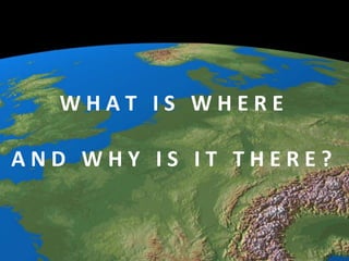
Editor's Notes

  1. Presentation at Connecting the Offices, 16 november, 2011
  2. Threeparts
  3. What is where is what professionalscalltopography
  4. DERBYS: GENERAL MAP:Saxton/Hole.V.Decorative.c16x13.NC.(Universi.)Includesparts of Lancashire.Chestershire.Staffordshire.Nottinghamshire and Leicestershire.http://www.antiquemapsandprints.com/scans/SCANS18.htmFrom “Earlychart succes” http://www.amazon.co.uk/Exploring-History-Around-Derbyshire-Richard/dp/1859837050
  5. 1850 map of the surroundings of Amsterdam. Pleasenote the Lake of Haarlem and thatthere is not open connection to the NorthSea
  6. Texel at the time. A “best effort” bycartographers of the time.
  7. 3d views of the worldbounderiesbydiscoveries
  8. On the floor of the RoyalPalace, Amsterdam (byBlaue)
  9. Onlyoneside of New Zeelandmapped.
  10. http://www.flickr.com/photos/state-records-nsw/4010230662/sizes/z/in/photostream/State Records, NSWhttp://www.records.nsw.gov.au/
  11. You have to really lookforgeodeticlandmarks, butplentyexist
  12. GIS to the rescue.Thankyou Esri Germany!
  13. Note: there is hardlyanynorth-southtraffic in the world…
  14. Typicalquestions of a topographer
  15. Itgetinterestingwhenyouget to askquestionsaboutyoursurroundings. Solvepuzzles, level IV.
  16. Howmanypeople go to the dentist?Less in the biggercities and in the north of Holland. Why?
  17. Howmany millimeters is this building moving down?
  18. Atlas of last names
  19. Where do peoplewithyour last name live?
  20. Nowit is up to all of us to deliver content forpossiblegeographicquestions
  21. Iamhere and having lunch.
  22. The cafesurelywouldlike to knowwhocheckedintohis bar
  23. Consumersgiving feedback
  24. Find the bar with more man or more women
  25. Askquestions (and possiblegetanswers)
  26. http://www.newscientist.com/article/dn19200-twitter-mood-maps-reveal-emotional-states-of-america.html
  27. Getsome help!
  28. Sample of end results
  29. More info:http://weblogs.vpro.nl/nederlandvanboven/files/2011/01/nederland-van-boven-reader-v4high.pdf