SlideShare ist ein Scribd-Unternehmen logo
1 von 50
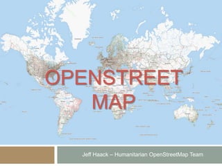
OPENSTREET
MAP
Jeff Haack – Humanitarian OpenStreetMap Team
Colombo, August 16, 2013
1. What is OpenStreetMap?
2. How and Why OSM Began
3. A Year of Edits
4. How it Works
5. Mapping in OSM
6. The Data
7. The OpenStreetMap Community
8. Using OSM Data
9. Humanitarian OpenStreetMap Team
10.Successful Communities
11.Government and OpenStreetMap
12.Potential in Sri Lanka
1. What is OpenStreetMap?
• Geodata
• Roads
• Waterways
• POIs
• Buildings
• … and more
• Thousands of Users Editing
• Open, Free Data
1. What is OpenStreetMap?
• Geodata
• Roads
• Waterways
• POIs
• Buildings
• … and more
• Thousands of Users Editing
• Open, Free Data
1. What is OpenStreetMap?
• Geodata
• Roads
• Waterways
• POIs
• Buildings
• … and more
• Thousands of Users Editing
• Open, Free Data
1. What is OpenStreetMap?
• Geodata
• Roads
• Waterways
• POIs
• Buildings
• … and more
• Thousands of Users Editing
• Open, Free Data
1. What is OpenStreetMap?
• Geodata
• Roads
• Waterways
• POIs
• Buildings
• … and more
• Thousands of Users Editing
• Open, Free Data
1. What is OpenStreetMap?
• Geodata
• Roads
• Waterways
• POIs
• Buildings
• … and more
• Thousands of Users Editing
• Open, Free Data (ODbL)
2. History of OpenStreetMap
• Founded in 2004 in the UK
• 2006 Yahoo! provides satellite imagery
• 2007 First OSM Conference in Europe
• 2009 100,000 Users Registered
• 2010 Bing provides satellite imagery
• 2013 1,000,000 Users Registered
OSM and Ordnance Survey
£many
£0
Low quality High quality
OS
OSM
OSM and Ordnance Survey
£many
£0
Low quality High quality
OS MasterMap
OSM
OS StreetView
OS Landranger
2. History of OpenStreetMap
• Founded in 2004 in the UK
• 2006 Yahoo! provides satellite imagery
• 2007 First OSM Conference in Europe
• 2009 100,000 Users Registered
• 2010 Bing provides satellite imagery
• 2013 1,000,000 Users Registered
bing Aerial Imagery
2. History of OpenStreetMap
• Founded in 2004 in the UK
• 2006 Yahoo! provides satellite imagery
• 2007 First OSM Conference in Europe
• 2009 100,000 Users Registered
• 2010 Bing provides satellite imagery
• 2013 1,000,000 Users Registered
3. A Year of Edits
4. How it Works
• Central Database
• Editing API (Data transmitted over
XML)
• Multiple Editing Applications
4. How it Works
• Central Database
• Multiple Editing Applications
• Editing API (Data transmitted over
XML)
4. How it Works
• Central Database
• Multiple Editing Applications
• Editing API (Data transmitted over
XML)
5. How do People Map?
• Trace Imagery
• Go Outside
• Report Bugs
• Divide Tasks
5. How do People Map?
• Trace Imagery
• Go Outside
• Report Bugs
• Divide Tasks
5. How do People Map?
• Trace Imagery
• Go Outside
• Report Bugs
• Divide Tasks
5. How do People Map?
• Trace Imagery
• Go Outside
• Report Bugs
• Divide Tasks
6. The Data
• All Vector Data
• Free-tagging system
• (meaning every object in the database can
carry an unlimited number of attributes)
amenity=pub
name=Hare & Hounds
highway=residential
name=Court Street
7. The OSM Community
• Wiki
• Mapping Parties
• Mailing Lists
• IRC
7. The OSM Community
8. Integrating OSM Data
• OSM as a base map
• Integrate into ArcGIS
• Integrate into QGIS
• Integrate into Web Maps
• Use on Many Devices
8. Integrating OSM Data
• OSM as a base map
• Integrate into ArcGIS
• Integrate into QGIS
• Integrate into Web Maps
• Use on Many Devices
8. Integrating OSM Data
• ODbL License
• Copyright!
9. Humanitarian OpenStreetMap
Team
 hot.openstreetmap.org
 Coordinating remote mapping
 Brokering release of imagery
 On-the ground deployment follow up
 Mapping in the developing world
 Getting organized
9. HOT in Haiti
 Good detailed map
 Fast!
9. HOT in Haiti
 Ushahidi
 Using OSM in a
mashup
9. HOT in Haiti
 Garmin downloads
 (converted raw
data)
 Search & Rescue
teams
 “Please be assured
that we are using
your data - I just
wish we knew
about this earlier.”
9. HOT in Haiti
 “Without a doubt,
 OpenStreetMap has
 helped to save lives.”
 “We used OpenStreetMap on a
 daily basis... Usually it is
impossible
 to get this information.”
9. HOT in Kibera
 Largest slum in Africa
 Mikel Maron
Photo CCBY2: St. Aloysius Gonzaga High School Journalism Club
http://www.flickr.com/photos/newbeatphoto/3726803818/
Photo CCNCBY2: Erica 'junipermarie' on flickr
http://www.flickr.com/photos/junipermarie/4098163220/
9. HOT in Kibera
 Training local people to contribute
 Take ownership of their map
9. OSM in Gaza
Pakistan
Floods
 Larger more rural area
 SPOT imagery
Pre-flood
limited resolution
10. Successful Communities
 Users from diverse areas and interests
 Communication & Collaboration
 Organizers
 Individuals
 Institutions (schools, universities)
 Government
 Diverse Applications
London Riots Map
11. Government in
OpenStreetMap
 United States
 State Department releases Aerial imagery to HOT
during emergencies
 Fire departments
 National Park service
 U.S. Census Bureau
 Municipalities
11. Government in
OpenStreetMap
 Indonesia
 Disaster Management Agency
 Local Development Organizers
 Health Department
12. OSM in Sri Lanka
 Opportunities
 Collaborate on base data
 Reduce duplication of work
 A single canonical source
 Challenges
 Organizing
 Integrating new processes
 Accepting Open Data
THANK YOU
Jeff Haack – Humanitarian OpenStreetMap Team

Weitere ähnliche Inhalte

Was ist angesagt?

OpenStreetMap : Open Licensed GeoData
OpenStreetMap : Open Licensed GeoDataOpenStreetMap : Open Licensed GeoData
OpenStreetMap : Open Licensed GeoDataHarry Wood
 
JRC OpenStreetMap, editing and tasking mechanisms, 20130326
JRC OpenStreetMap, editing and tasking mechanisms, 20130326JRC OpenStreetMap, editing and tasking mechanisms, 20130326
JRC OpenStreetMap, editing and tasking mechanisms, 20130326Severin Menard
 
Sinsai.info - Global ICT Summit
Sinsai.info - Global ICT SummitSinsai.info - Global ICT Summit
Sinsai.info - Global ICT SummitHal Seki
 
Space Entrepreneurship
Space EntrepreneurshipSpace Entrepreneurship
Space EntrepreneurshipBrian Lim
 
GeOng presentation about OpenStreetMap
GeOng presentation about OpenStreetMapGeOng presentation about OpenStreetMap
GeOng presentation about OpenStreetMapchippy
 
Openstreetmap and its value during emergencies
Openstreetmap and its value during emergenciesOpenstreetmap and its value during emergencies
Openstreetmap and its value during emergenciesErvin Malicdem
 
Introduction to OpenStreetMap, its extracts, and relation to Project NOAH
Introduction to OpenStreetMap, its extracts, and relation to Project NOAHIntroduction to OpenStreetMap, its extracts, and relation to Project NOAH
Introduction to OpenStreetMap, its extracts, and relation to Project NOAHErvin Malicdem
 
Ieee 2014 tech_training_open_streetmap_20121011
Ieee 2014 tech_training_open_streetmap_20121011Ieee 2014 tech_training_open_streetmap_20121011
Ieee 2014 tech_training_open_streetmap_20121011ALCE Samuel Paul
 
Introduction to OpenStreetMap
Introduction to OpenStreetMapIntroduction to OpenStreetMap
Introduction to OpenStreetMapJeff Haack
 
shift2010 - 17apr2010 - OpenStreetMap: a free map for our world
shift2010 - 17apr2010 - OpenStreetMap: a free map for our worldshift2010 - 17apr2010 - OpenStreetMap: a free map for our world
shift2010 - 17apr2010 - OpenStreetMap: a free map for our worldSimone Cortesi
 
Haiti HOT OSM éducation 15/02/2012 (FR)
Haiti HOT OSM éducation 15/02/2012 (FR)Haiti HOT OSM éducation 15/02/2012 (FR)
Haiti HOT OSM éducation 15/02/2012 (FR)Severin Menard
 
H.O.T at UNGIWG 10
H.O.T at UNGIWG 10H.O.T at UNGIWG 10
H.O.T at UNGIWG 10mikel_maron
 
Participatory mapping with OSM in Ulan Bator, Mongolia: general presentation ...
Participatory mapping with OSM in Ulan Bator, Mongolia: general presentation ...Participatory mapping with OSM in Ulan Bator, Mongolia: general presentation ...
Participatory mapping with OSM in Ulan Bator, Mongolia: general presentation ...Severin Menard
 
HOT OSM Community mapping in Lower Shire, Malawi
HOT OSM Community mapping in Lower Shire, MalawiHOT OSM Community mapping in Lower Shire, Malawi
HOT OSM Community mapping in Lower Shire, MalawiSeverin Menard
 
OpenStreetMap, an introduction
OpenStreetMap, an introductionOpenStreetMap, an introduction
OpenStreetMap, an introductionFrédéric Rodrigo
 
Open streetmap response-to-ebola-crisis-geong-2014-09-23
Open streetmap response-to-ebola-crisis-geong-2014-09-23Open streetmap response-to-ebola-crisis-geong-2014-09-23
Open streetmap response-to-ebola-crisis-geong-2014-09-23Pierre Béland
 
How Crowdsourcing Changed Disaster Relief Forever (Web 2.0 Summit Ignite vers...
How Crowdsourcing Changed Disaster Relief Forever (Web 2.0 Summit Ignite vers...How Crowdsourcing Changed Disaster Relief Forever (Web 2.0 Summit Ignite vers...
How Crowdsourcing Changed Disaster Relief Forever (Web 2.0 Summit Ignite vers...Schuyler Erle
 
IASC Asteroid Discovery: CK12
IASC Asteroid Discovery: CK12IASC Asteroid Discovery: CK12
IASC Asteroid Discovery: CK12David Golynskiy
 
DSD-INT 2016 A crowd-sourced spatial database can change the way we work - Va...
DSD-INT 2016 A crowd-sourced spatial database can change the way we work - Va...DSD-INT 2016 A crowd-sourced spatial database can change the way we work - Va...
DSD-INT 2016 A crowd-sourced spatial database can change the way we work - Va...Deltares
 
OpenStreetMap Past, Present and Future
OpenStreetMap Past, Present and FutureOpenStreetMap Past, Present and Future
OpenStreetMap Past, Present and FuturePeter Batty
 

Was ist angesagt? (20)

OpenStreetMap : Open Licensed GeoData
OpenStreetMap : Open Licensed GeoDataOpenStreetMap : Open Licensed GeoData
OpenStreetMap : Open Licensed GeoData
 
JRC OpenStreetMap, editing and tasking mechanisms, 20130326
JRC OpenStreetMap, editing and tasking mechanisms, 20130326JRC OpenStreetMap, editing and tasking mechanisms, 20130326
JRC OpenStreetMap, editing and tasking mechanisms, 20130326
 
Sinsai.info - Global ICT Summit
Sinsai.info - Global ICT SummitSinsai.info - Global ICT Summit
Sinsai.info - Global ICT Summit
 
Space Entrepreneurship
Space EntrepreneurshipSpace Entrepreneurship
Space Entrepreneurship
 
GeOng presentation about OpenStreetMap
GeOng presentation about OpenStreetMapGeOng presentation about OpenStreetMap
GeOng presentation about OpenStreetMap
 
Openstreetmap and its value during emergencies
Openstreetmap and its value during emergenciesOpenstreetmap and its value during emergencies
Openstreetmap and its value during emergencies
 
Introduction to OpenStreetMap, its extracts, and relation to Project NOAH
Introduction to OpenStreetMap, its extracts, and relation to Project NOAHIntroduction to OpenStreetMap, its extracts, and relation to Project NOAH
Introduction to OpenStreetMap, its extracts, and relation to Project NOAH
 
Ieee 2014 tech_training_open_streetmap_20121011
Ieee 2014 tech_training_open_streetmap_20121011Ieee 2014 tech_training_open_streetmap_20121011
Ieee 2014 tech_training_open_streetmap_20121011
 
Introduction to OpenStreetMap
Introduction to OpenStreetMapIntroduction to OpenStreetMap
Introduction to OpenStreetMap
 
shift2010 - 17apr2010 - OpenStreetMap: a free map for our world
shift2010 - 17apr2010 - OpenStreetMap: a free map for our worldshift2010 - 17apr2010 - OpenStreetMap: a free map for our world
shift2010 - 17apr2010 - OpenStreetMap: a free map for our world
 
Haiti HOT OSM éducation 15/02/2012 (FR)
Haiti HOT OSM éducation 15/02/2012 (FR)Haiti HOT OSM éducation 15/02/2012 (FR)
Haiti HOT OSM éducation 15/02/2012 (FR)
 
H.O.T at UNGIWG 10
H.O.T at UNGIWG 10H.O.T at UNGIWG 10
H.O.T at UNGIWG 10
 
Participatory mapping with OSM in Ulan Bator, Mongolia: general presentation ...
Participatory mapping with OSM in Ulan Bator, Mongolia: general presentation ...Participatory mapping with OSM in Ulan Bator, Mongolia: general presentation ...
Participatory mapping with OSM in Ulan Bator, Mongolia: general presentation ...
 
HOT OSM Community mapping in Lower Shire, Malawi
HOT OSM Community mapping in Lower Shire, MalawiHOT OSM Community mapping in Lower Shire, Malawi
HOT OSM Community mapping in Lower Shire, Malawi
 
OpenStreetMap, an introduction
OpenStreetMap, an introductionOpenStreetMap, an introduction
OpenStreetMap, an introduction
 
Open streetmap response-to-ebola-crisis-geong-2014-09-23
Open streetmap response-to-ebola-crisis-geong-2014-09-23Open streetmap response-to-ebola-crisis-geong-2014-09-23
Open streetmap response-to-ebola-crisis-geong-2014-09-23
 
How Crowdsourcing Changed Disaster Relief Forever (Web 2.0 Summit Ignite vers...
How Crowdsourcing Changed Disaster Relief Forever (Web 2.0 Summit Ignite vers...How Crowdsourcing Changed Disaster Relief Forever (Web 2.0 Summit Ignite vers...
How Crowdsourcing Changed Disaster Relief Forever (Web 2.0 Summit Ignite vers...
 
IASC Asteroid Discovery: CK12
IASC Asteroid Discovery: CK12IASC Asteroid Discovery: CK12
IASC Asteroid Discovery: CK12
 
DSD-INT 2016 A crowd-sourced spatial database can change the way we work - Va...
DSD-INT 2016 A crowd-sourced spatial database can change the way we work - Va...DSD-INT 2016 A crowd-sourced spatial database can change the way we work - Va...
DSD-INT 2016 A crowd-sourced spatial database can change the way we work - Va...
 
OpenStreetMap Past, Present and Future
OpenStreetMap Past, Present and FutureOpenStreetMap Past, Present and Future
OpenStreetMap Past, Present and Future
 

Andere mochten auch

Tours les jours2
Tours les jours2Tours les jours2
Tours les jours2chanpinqi
 
Past, Present and Future of WebMapping Application
Past, Present and Future of WebMapping ApplicationPast, Present and Future of WebMapping Application
Past, Present and Future of WebMapping Applicationarno974
 
OpenStreetMap work in humanitarian response to 12-Jan 2010 Haiti Earthquake a...
OpenStreetMap work in humanitarian response to 12-Jan 2010 Haiti Earthquake a...OpenStreetMap work in humanitarian response to 12-Jan 2010 Haiti Earthquake a...
OpenStreetMap work in humanitarian response to 12-Jan 2010 Haiti Earthquake a...chavent nicolas
 
Teaching Open Web Mapping - AutoCarto 2016
Teaching Open Web Mapping - AutoCarto 2016Teaching Open Web Mapping - AutoCarto 2016
Teaching Open Web Mapping - AutoCarto 2016Carl Sack
 
A Brief History of Web Mapping
A Brief History of Web MappingA Brief History of Web Mapping
A Brief History of Web MappingSteven Feldman
 

Andere mochten auch (7)

Bb geodatabase
Bb geodatabaseBb geodatabase
Bb geodatabase
 
Tours les jours2
Tours les jours2Tours les jours2
Tours les jours2
 
Past, Present and Future of WebMapping Application
Past, Present and Future of WebMapping ApplicationPast, Present and Future of WebMapping Application
Past, Present and Future of WebMapping Application
 
OpenStreetMap work in humanitarian response to 12-Jan 2010 Haiti Earthquake a...
OpenStreetMap work in humanitarian response to 12-Jan 2010 Haiti Earthquake a...OpenStreetMap work in humanitarian response to 12-Jan 2010 Haiti Earthquake a...
OpenStreetMap work in humanitarian response to 12-Jan 2010 Haiti Earthquake a...
 
Web mapping
Web mappingWeb mapping
Web mapping
 
Teaching Open Web Mapping - AutoCarto 2016
Teaching Open Web Mapping - AutoCarto 2016Teaching Open Web Mapping - AutoCarto 2016
Teaching Open Web Mapping - AutoCarto 2016
 
A Brief History of Web Mapping
A Brief History of Web MappingA Brief History of Web Mapping
A Brief History of Web Mapping
 

Ähnlich wie OpenStreetMap Sri Lanka

Talk: "Using Open Data and Crowdsourcing to develop CycleStreets"
Talk: "Using Open Data and Crowdsourcing to develop CycleStreets"Talk: "Using Open Data and Crowdsourcing to develop CycleStreets"
Talk: "Using Open Data and Crowdsourcing to develop CycleStreets"CycleStreets
 
OpenStreetMap 101
OpenStreetMap 101OpenStreetMap 101
OpenStreetMap 101CASA, UCL
 
IRLOGI openstreetmap presentation
IRLOGI openstreetmap presentationIRLOGI openstreetmap presentation
IRLOGI openstreetmap presentationCiaran Staunton
 
Introduction to OpenStreetMap
Introduction to OpenStreetMapIntroduction to OpenStreetMap
Introduction to OpenStreetMapdbdean
 
Sinsaiinfo4techlionAsKeynote
Sinsaiinfo4techlionAsKeynoteSinsaiinfo4techlionAsKeynote
Sinsaiinfo4techlionAsKeynoteTaichi Furuhashi
 
Sinsaiinfo4earthlingAsKeynote
Sinsaiinfo4earthlingAsKeynoteSinsaiinfo4earthlingAsKeynote
Sinsaiinfo4earthlingAsKeynoteTaichi Furuhashi
 
OpenStreetMap and CycleStreets: collaborative map-making and cartography in t...
OpenStreetMap and CycleStreets: collaborative map-making and cartography in t...OpenStreetMap and CycleStreets: collaborative map-making and cartography in t...
OpenStreetMap and CycleStreets: collaborative map-making and cartography in t...CycleStreets
 
Utilization of OpenAerialMap for Mapping in OSM
Utilization of OpenAerialMap for Mapping in OSM Utilization of OpenAerialMap for Mapping in OSM
Utilization of OpenAerialMap for Mapping in OSM Ervin Malicdem
 
CreativeLab : Opendata presentation
CreativeLab : Opendata presentationCreativeLab : Opendata presentation
CreativeLab : Opendata presentationCreative-Lab
 
13th UNGIWG Plenary Meeting - Introduction to OpenStreetMap
13th UNGIWG Plenary Meeting - Introduction to OpenStreetMap13th UNGIWG Plenary Meeting - Introduction to OpenStreetMap
13th UNGIWG Plenary Meeting - Introduction to OpenStreetMapOrkut Murat Yılmaz
 
Humanitarian OpenStreetMap Team [H.O.T.] Training for SBTF
Humanitarian OpenStreetMap Team [H.O.T.] Training for SBTFHumanitarian OpenStreetMap Team [H.O.T.] Training for SBTF
Humanitarian OpenStreetMap Team [H.O.T.] Training for SBTFStandby Task Force
 
Data Collection with OSM
Data Collection with OSMData Collection with OSM
Data Collection with OSMYantisa Akhadi
 
Short Intro to OSM [Gnome Asia 2015]
Short Intro to OSM [Gnome Asia 2015]Short Intro to OSM [Gnome Asia 2015]
Short Intro to OSM [Gnome Asia 2015]Yantisa Akhadi
 
Kano GIS Day 2014 - Opening remarks
Kano GIS Day 2014 - Opening remarksKano GIS Day 2014 - Opening remarks
Kano GIS Day 2014 - Opening remarkseHealth Africa
 
Open Data: General Concepts and Applications
Open Data: General Concepts and ApplicationsOpen Data: General Concepts and Applications
Open Data: General Concepts and ApplicationsO D
 

Ähnlich wie OpenStreetMap Sri Lanka (20)

Talk: "Using Open Data and Crowdsourcing to develop CycleStreets"
Talk: "Using Open Data and Crowdsourcing to develop CycleStreets"Talk: "Using Open Data and Crowdsourcing to develop CycleStreets"
Talk: "Using Open Data and Crowdsourcing to develop CycleStreets"
 
OpenStreetMap 101
OpenStreetMap 101OpenStreetMap 101
OpenStreetMap 101
 
Article25
Article25Article25
Article25
 
IRLOGI openstreetmap presentation
IRLOGI openstreetmap presentationIRLOGI openstreetmap presentation
IRLOGI openstreetmap presentation
 
Introduction to OpenStreetMap
Introduction to OpenStreetMapIntroduction to OpenStreetMap
Introduction to OpenStreetMap
 
Sinsaiinfo4techlionAsKeynote
Sinsaiinfo4techlionAsKeynoteSinsaiinfo4techlionAsKeynote
Sinsaiinfo4techlionAsKeynote
 
Sinsaiinfo4earthlingAsKeynote
Sinsaiinfo4earthlingAsKeynoteSinsaiinfo4earthlingAsKeynote
Sinsaiinfo4earthlingAsKeynote
 
OpenStreetMap and CycleStreets: collaborative map-making and cartography in t...
OpenStreetMap and CycleStreets: collaborative map-making and cartography in t...OpenStreetMap and CycleStreets: collaborative map-making and cartography in t...
OpenStreetMap and CycleStreets: collaborative map-making and cartography in t...
 
OpenStreetMap
OpenStreetMapOpenStreetMap
OpenStreetMap
 
Utilization of OpenAerialMap for Mapping in OSM
Utilization of OpenAerialMap for Mapping in OSM Utilization of OpenAerialMap for Mapping in OSM
Utilization of OpenAerialMap for Mapping in OSM
 
CreativeLab : Opendata presentation
CreativeLab : Opendata presentationCreativeLab : Opendata presentation
CreativeLab : Opendata presentation
 
OSM HOT SBTF 2013_03_16
OSM HOT SBTF 2013_03_16OSM HOT SBTF 2013_03_16
OSM HOT SBTF 2013_03_16
 
13th UNGIWG Plenary Meeting - Introduction to OpenStreetMap
13th UNGIWG Plenary Meeting - Introduction to OpenStreetMap13th UNGIWG Plenary Meeting - Introduction to OpenStreetMap
13th UNGIWG Plenary Meeting - Introduction to OpenStreetMap
 
Humanitarian OpenStreetMap Team [H.O.T.] Training for SBTF
Humanitarian OpenStreetMap Team [H.O.T.] Training for SBTFHumanitarian OpenStreetMap Team [H.O.T.] Training for SBTF
Humanitarian OpenStreetMap Team [H.O.T.] Training for SBTF
 
OSM mass awareness programme
OSM mass awareness programmeOSM mass awareness programme
OSM mass awareness programme
 
Data Collection with OSM
Data Collection with OSMData Collection with OSM
Data Collection with OSM
 
Short Intro to OSM [Gnome Asia 2015]
Short Intro to OSM [Gnome Asia 2015]Short Intro to OSM [Gnome Asia 2015]
Short Intro to OSM [Gnome Asia 2015]
 
Introduction to OSM
Introduction to OSMIntroduction to OSM
Introduction to OSM
 
Kano GIS Day 2014 - Opening remarks
Kano GIS Day 2014 - Opening remarksKano GIS Day 2014 - Opening remarks
Kano GIS Day 2014 - Opening remarks
 
Open Data: General Concepts and Applications
Open Data: General Concepts and ApplicationsOpen Data: General Concepts and Applications
Open Data: General Concepts and Applications
 

Kürzlich hochgeladen

Science 7 - LAND and SEA BREEZE and its Characteristics
Science 7 - LAND and SEA BREEZE and its CharacteristicsScience 7 - LAND and SEA BREEZE and its Characteristics
Science 7 - LAND and SEA BREEZE and its CharacteristicsKarinaGenton
 
MENTAL STATUS EXAMINATION format.docx
MENTAL     STATUS EXAMINATION format.docxMENTAL     STATUS EXAMINATION format.docx
MENTAL STATUS EXAMINATION format.docxPoojaSen20
 
Kisan Call Centre - To harness potential of ICT in Agriculture by answer farm...
Kisan Call Centre - To harness potential of ICT in Agriculture by answer farm...Kisan Call Centre - To harness potential of ICT in Agriculture by answer farm...
Kisan Call Centre - To harness potential of ICT in Agriculture by answer farm...Krashi Coaching
 
BASLIQ CURRENT LOOKBOOK LOOKBOOK(1) (1).pdf
BASLIQ CURRENT LOOKBOOK  LOOKBOOK(1) (1).pdfBASLIQ CURRENT LOOKBOOK  LOOKBOOK(1) (1).pdf
BASLIQ CURRENT LOOKBOOK LOOKBOOK(1) (1).pdfSoniaTolstoy
 
Alper Gobel In Media Res Media Component
Alper Gobel In Media Res Media ComponentAlper Gobel In Media Res Media Component
Alper Gobel In Media Res Media ComponentInMediaRes1
 
Grant Readiness 101 TechSoup and Remy Consulting
Grant Readiness 101 TechSoup and Remy ConsultingGrant Readiness 101 TechSoup and Remy Consulting
Grant Readiness 101 TechSoup and Remy ConsultingTechSoup
 
A Critique of the Proposed National Education Policy Reform
A Critique of the Proposed National Education Policy ReformA Critique of the Proposed National Education Policy Reform
A Critique of the Proposed National Education Policy ReformChameera Dedduwage
 
Organic Name Reactions for the students and aspirants of Chemistry12th.pptx
Organic Name Reactions  for the students and aspirants of Chemistry12th.pptxOrganic Name Reactions  for the students and aspirants of Chemistry12th.pptx
Organic Name Reactions for the students and aspirants of Chemistry12th.pptxVS Mahajan Coaching Centre
 
Separation of Lanthanides/ Lanthanides and Actinides
Separation of Lanthanides/ Lanthanides and ActinidesSeparation of Lanthanides/ Lanthanides and Actinides
Separation of Lanthanides/ Lanthanides and ActinidesFatimaKhan178732
 
Industrial Policy - 1948, 1956, 1973, 1977, 1980, 1991
Industrial Policy - 1948, 1956, 1973, 1977, 1980, 1991Industrial Policy - 1948, 1956, 1973, 1977, 1980, 1991
Industrial Policy - 1948, 1956, 1973, 1977, 1980, 1991RKavithamani
 
POINT- BIOCHEMISTRY SEM 2 ENZYMES UNIT 5.pptx
POINT- BIOCHEMISTRY SEM 2 ENZYMES UNIT 5.pptxPOINT- BIOCHEMISTRY SEM 2 ENZYMES UNIT 5.pptx
POINT- BIOCHEMISTRY SEM 2 ENZYMES UNIT 5.pptxSayali Powar
 
Mastering the Unannounced Regulatory Inspection
Mastering the Unannounced Regulatory InspectionMastering the Unannounced Regulatory Inspection
Mastering the Unannounced Regulatory InspectionSafetyChain Software
 
Micromeritics - Fundamental and Derived Properties of Powders
Micromeritics - Fundamental and Derived Properties of PowdersMicromeritics - Fundamental and Derived Properties of Powders
Micromeritics - Fundamental and Derived Properties of PowdersChitralekhaTherkar
 
Crayon Activity Handout For the Crayon A
Crayon Activity Handout For the Crayon ACrayon Activity Handout For the Crayon A
Crayon Activity Handout For the Crayon AUnboundStockton
 
Hybridoma Technology ( Production , Purification , and Application )
Hybridoma Technology  ( Production , Purification , and Application  ) Hybridoma Technology  ( Production , Purification , and Application  )
Hybridoma Technology ( Production , Purification , and Application ) Sakshi Ghasle
 
Paris 2024 Olympic Geographies - an activity
Paris 2024 Olympic Geographies - an activityParis 2024 Olympic Geographies - an activity
Paris 2024 Olympic Geographies - an activityGeoBlogs
 
SOCIAL AND HISTORICAL CONTEXT - LFTVD.pptx
SOCIAL AND HISTORICAL CONTEXT - LFTVD.pptxSOCIAL AND HISTORICAL CONTEXT - LFTVD.pptx
SOCIAL AND HISTORICAL CONTEXT - LFTVD.pptxiammrhaywood
 
Software Engineering Methodologies (overview)
Software Engineering Methodologies (overview)Software Engineering Methodologies (overview)
Software Engineering Methodologies (overview)eniolaolutunde
 
Employee wellbeing at the workplace.pptx
Employee wellbeing at the workplace.pptxEmployee wellbeing at the workplace.pptx
Employee wellbeing at the workplace.pptxNirmalaLoungPoorunde1
 

Kürzlich hochgeladen (20)

Science 7 - LAND and SEA BREEZE and its Characteristics
Science 7 - LAND and SEA BREEZE and its CharacteristicsScience 7 - LAND and SEA BREEZE and its Characteristics
Science 7 - LAND and SEA BREEZE and its Characteristics
 
MENTAL STATUS EXAMINATION format.docx
MENTAL     STATUS EXAMINATION format.docxMENTAL     STATUS EXAMINATION format.docx
MENTAL STATUS EXAMINATION format.docx
 
Kisan Call Centre - To harness potential of ICT in Agriculture by answer farm...
Kisan Call Centre - To harness potential of ICT in Agriculture by answer farm...Kisan Call Centre - To harness potential of ICT in Agriculture by answer farm...
Kisan Call Centre - To harness potential of ICT in Agriculture by answer farm...
 
BASLIQ CURRENT LOOKBOOK LOOKBOOK(1) (1).pdf
BASLIQ CURRENT LOOKBOOK  LOOKBOOK(1) (1).pdfBASLIQ CURRENT LOOKBOOK  LOOKBOOK(1) (1).pdf
BASLIQ CURRENT LOOKBOOK LOOKBOOK(1) (1).pdf
 
Alper Gobel In Media Res Media Component
Alper Gobel In Media Res Media ComponentAlper Gobel In Media Res Media Component
Alper Gobel In Media Res Media Component
 
Grant Readiness 101 TechSoup and Remy Consulting
Grant Readiness 101 TechSoup and Remy ConsultingGrant Readiness 101 TechSoup and Remy Consulting
Grant Readiness 101 TechSoup and Remy Consulting
 
Model Call Girl in Tilak Nagar Delhi reach out to us at 🔝9953056974🔝
Model Call Girl in Tilak Nagar Delhi reach out to us at 🔝9953056974🔝Model Call Girl in Tilak Nagar Delhi reach out to us at 🔝9953056974🔝
Model Call Girl in Tilak Nagar Delhi reach out to us at 🔝9953056974🔝
 
A Critique of the Proposed National Education Policy Reform
A Critique of the Proposed National Education Policy ReformA Critique of the Proposed National Education Policy Reform
A Critique of the Proposed National Education Policy Reform
 
Organic Name Reactions for the students and aspirants of Chemistry12th.pptx
Organic Name Reactions  for the students and aspirants of Chemistry12th.pptxOrganic Name Reactions  for the students and aspirants of Chemistry12th.pptx
Organic Name Reactions for the students and aspirants of Chemistry12th.pptx
 
Separation of Lanthanides/ Lanthanides and Actinides
Separation of Lanthanides/ Lanthanides and ActinidesSeparation of Lanthanides/ Lanthanides and Actinides
Separation of Lanthanides/ Lanthanides and Actinides
 
Industrial Policy - 1948, 1956, 1973, 1977, 1980, 1991
Industrial Policy - 1948, 1956, 1973, 1977, 1980, 1991Industrial Policy - 1948, 1956, 1973, 1977, 1980, 1991
Industrial Policy - 1948, 1956, 1973, 1977, 1980, 1991
 
POINT- BIOCHEMISTRY SEM 2 ENZYMES UNIT 5.pptx
POINT- BIOCHEMISTRY SEM 2 ENZYMES UNIT 5.pptxPOINT- BIOCHEMISTRY SEM 2 ENZYMES UNIT 5.pptx
POINT- BIOCHEMISTRY SEM 2 ENZYMES UNIT 5.pptx
 
Mastering the Unannounced Regulatory Inspection
Mastering the Unannounced Regulatory InspectionMastering the Unannounced Regulatory Inspection
Mastering the Unannounced Regulatory Inspection
 
Micromeritics - Fundamental and Derived Properties of Powders
Micromeritics - Fundamental and Derived Properties of PowdersMicromeritics - Fundamental and Derived Properties of Powders
Micromeritics - Fundamental and Derived Properties of Powders
 
Crayon Activity Handout For the Crayon A
Crayon Activity Handout For the Crayon ACrayon Activity Handout For the Crayon A
Crayon Activity Handout For the Crayon A
 
Hybridoma Technology ( Production , Purification , and Application )
Hybridoma Technology  ( Production , Purification , and Application  ) Hybridoma Technology  ( Production , Purification , and Application  )
Hybridoma Technology ( Production , Purification , and Application )
 
Paris 2024 Olympic Geographies - an activity
Paris 2024 Olympic Geographies - an activityParis 2024 Olympic Geographies - an activity
Paris 2024 Olympic Geographies - an activity
 
SOCIAL AND HISTORICAL CONTEXT - LFTVD.pptx
SOCIAL AND HISTORICAL CONTEXT - LFTVD.pptxSOCIAL AND HISTORICAL CONTEXT - LFTVD.pptx
SOCIAL AND HISTORICAL CONTEXT - LFTVD.pptx
 
Software Engineering Methodologies (overview)
Software Engineering Methodologies (overview)Software Engineering Methodologies (overview)
Software Engineering Methodologies (overview)
 
Employee wellbeing at the workplace.pptx
Employee wellbeing at the workplace.pptxEmployee wellbeing at the workplace.pptx
Employee wellbeing at the workplace.pptx
 

OpenStreetMap Sri Lanka

  • 1. OPENSTREET MAP Jeff Haack – Humanitarian OpenStreetMap Team
  • 2. Colombo, August 16, 2013 1. What is OpenStreetMap? 2. How and Why OSM Began 3. A Year of Edits 4. How it Works 5. Mapping in OSM 6. The Data 7. The OpenStreetMap Community 8. Using OSM Data 9. Humanitarian OpenStreetMap Team 10.Successful Communities 11.Government and OpenStreetMap 12.Potential in Sri Lanka
  • 3. 1. What is OpenStreetMap? • Geodata • Roads • Waterways • POIs • Buildings • … and more • Thousands of Users Editing • Open, Free Data
  • 4. 1. What is OpenStreetMap? • Geodata • Roads • Waterways • POIs • Buildings • … and more • Thousands of Users Editing • Open, Free Data
  • 5. 1. What is OpenStreetMap? • Geodata • Roads • Waterways • POIs • Buildings • … and more • Thousands of Users Editing • Open, Free Data
  • 6. 1. What is OpenStreetMap? • Geodata • Roads • Waterways • POIs • Buildings • … and more • Thousands of Users Editing • Open, Free Data
  • 7. 1. What is OpenStreetMap? • Geodata • Roads • Waterways • POIs • Buildings • … and more • Thousands of Users Editing • Open, Free Data
  • 8. 1. What is OpenStreetMap? • Geodata • Roads • Waterways • POIs • Buildings • … and more • Thousands of Users Editing • Open, Free Data (ODbL)
  • 9. 2. History of OpenStreetMap • Founded in 2004 in the UK • 2006 Yahoo! provides satellite imagery • 2007 First OSM Conference in Europe • 2009 100,000 Users Registered • 2010 Bing provides satellite imagery • 2013 1,000,000 Users Registered
  • 10. OSM and Ordnance Survey £many £0 Low quality High quality OS OSM
  • 11. OSM and Ordnance Survey £many £0 Low quality High quality OS MasterMap OSM OS StreetView OS Landranger
  • 12. 2. History of OpenStreetMap • Founded in 2004 in the UK • 2006 Yahoo! provides satellite imagery • 2007 First OSM Conference in Europe • 2009 100,000 Users Registered • 2010 Bing provides satellite imagery • 2013 1,000,000 Users Registered
  • 14. 2. History of OpenStreetMap • Founded in 2004 in the UK • 2006 Yahoo! provides satellite imagery • 2007 First OSM Conference in Europe • 2009 100,000 Users Registered • 2010 Bing provides satellite imagery • 2013 1,000,000 Users Registered
  • 15. 3. A Year of Edits
  • 16. 4. How it Works • Central Database • Editing API (Data transmitted over XML) • Multiple Editing Applications
  • 17. 4. How it Works • Central Database • Multiple Editing Applications • Editing API (Data transmitted over XML)
  • 18. 4. How it Works • Central Database • Multiple Editing Applications • Editing API (Data transmitted over XML)
  • 19. 5. How do People Map? • Trace Imagery • Go Outside • Report Bugs • Divide Tasks
  • 20. 5. How do People Map? • Trace Imagery • Go Outside • Report Bugs • Divide Tasks
  • 21. 5. How do People Map? • Trace Imagery • Go Outside • Report Bugs • Divide Tasks
  • 22. 5. How do People Map? • Trace Imagery • Go Outside • Report Bugs • Divide Tasks
  • 23. 6. The Data • All Vector Data • Free-tagging system • (meaning every object in the database can carry an unlimited number of attributes) amenity=pub name=Hare & Hounds highway=residential name=Court Street
  • 24. 7. The OSM Community • Wiki • Mapping Parties • Mailing Lists • IRC
  • 25. 7. The OSM Community
  • 26. 7. The OSM Community
  • 27. 8. Integrating OSM Data • OSM as a base map • Integrate into ArcGIS • Integrate into QGIS • Integrate into Web Maps • Use on Many Devices
  • 28. 8. Integrating OSM Data • OSM as a base map • Integrate into ArcGIS • Integrate into QGIS • Integrate into Web Maps • Use on Many Devices
  • 29. 8. Integrating OSM Data • ODbL License • Copyright!
  • 30. 9. Humanitarian OpenStreetMap Team  hot.openstreetmap.org  Coordinating remote mapping  Brokering release of imagery  On-the ground deployment follow up  Mapping in the developing world  Getting organized
  • 31. 9. HOT in Haiti
  • 32.
  • 33.
  • 34.
  • 35.
  • 36.  Good detailed map  Fast!
  • 37. 9. HOT in Haiti  Ushahidi  Using OSM in a mashup
  • 38.
  • 39. 9. HOT in Haiti  Garmin downloads  (converted raw data)  Search & Rescue teams  “Please be assured that we are using your data - I just wish we knew about this earlier.”
  • 40. 9. HOT in Haiti  “Without a doubt,  OpenStreetMap has  helped to save lives.”  “We used OpenStreetMap on a  daily basis... Usually it is impossible  to get this information.”
  • 41. 9. HOT in Kibera  Largest slum in Africa  Mikel Maron Photo CCBY2: St. Aloysius Gonzaga High School Journalism Club http://www.flickr.com/photos/newbeatphoto/3726803818/ Photo CCNCBY2: Erica 'junipermarie' on flickr http://www.flickr.com/photos/junipermarie/4098163220/
  • 42. 9. HOT in Kibera  Training local people to contribute  Take ownership of their map
  • 43. 9. OSM in Gaza
  • 44. Pakistan Floods  Larger more rural area  SPOT imagery Pre-flood limited resolution
  • 45. 10. Successful Communities  Users from diverse areas and interests  Communication & Collaboration  Organizers  Individuals  Institutions (schools, universities)  Government  Diverse Applications
  • 47. 11. Government in OpenStreetMap  United States  State Department releases Aerial imagery to HOT during emergencies  Fire departments  National Park service  U.S. Census Bureau  Municipalities
  • 48. 11. Government in OpenStreetMap  Indonesia  Disaster Management Agency  Local Development Organizers  Health Department
  • 49. 12. OSM in Sri Lanka  Opportunities  Collaborate on base data  Reduce duplication of work  A single canonical source  Challenges  Organizing  Integrating new processes  Accepting Open Data
  • 50. THANK YOU Jeff Haack – Humanitarian OpenStreetMap Team