Results of a 2006-2007 citizen science monitoring project. Citizen volunteers contributed data on road kill wildlife locations in Iowa for the Iowa NatureMapping Program.
HTML Injection Attacks: Impact and Mitigation Strategies
NatureMapping Lrtf Roadkill 07
1. Iowa NatureMapping:
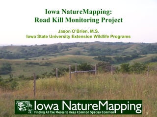
Road Kill Monitoring Project
Jason O’Brien, M.S.
Iowa State University Extension Wildlife Programs
2. Iowa NatureMapping:
Road Kill Monitoring Project
Thank you to the Living Roadway Trust Fund of
Iowa for completely funding this project
and all the NatureMapping volunteers who
contributed to this project!
3. What is NatureMapping?
• A Citizen Science
Program
• Monitor wildlife species
• Trained citizen
volunteers
• Standard set of
protocols, of which the
basic idea is…
7. Early planning stages of a road kill study… while
promising, we scrapped this idea in favor of a more tested
approach.
8. Living Roadway Trust Fund
Road Kill Study
• Use trained NatureMapping
volunteers, using basic
NatureMapping wildlife
monitoring protocols, to
answer a question for the
Iowa Department of
Transportation.
10. LRTF Road Kill Study
• The Questions:
Do the roadsides
provide good wildlife
habitat? or
do they “siphon” off
species only to have
them killed on the
roadway?
11. Methods
• Preliminary Survey to
test NatureMapping as a
sampling method
• Used pre-existing
NatureMapping
Protocols
12. Methods
• Volunteers picked 1 or
more roadsides they
travel often (1, 2, or 5
mile segments)
• Monitor as often as they
can or whenever they
see road kill
13. Methods
• Roadside vegetation
documented using
NatureMapping
Habitat Codes
(i.e. Cool Season Grass –
brome, KY Bluegrass;
Tallgrass prairie; Woody
Fencerow; etc.)
Entered as Habitat type
(up to 6 different habitats,
beginning with most
abundant) in data form
14. Methods
• Adjacent habitats
described in
“Comments” section of
data form
Riparian corridors,
waterways, forest,
wetlands, fencerows
intersecting roadways,
etc.
19. Aerial view of some road kill study sites –
note the different kinds of habitat adjacent
to roadways
20.
21.
22.
23.
24.
25. Conclusions
• Top road kill species
typical of most roads in
Iowa
• Roadside habitat typical
of most roads
• Prairie roadsides under
represented!
26. Conclusions
• Course Dataset – not
fine enough to detect an
effect from Roadside
vegetation
• However, data seems to
indicate that adjacent
habitat greatly impacts
wildlife
27. Round Two: What we would
do differently
• Results Indicate need
to fine-tune protocols
28. Round Two: What we would
do differently
• Assign Roadsides:
Control for:
Prairie roadsides
Non-prairie roadsides
Length & Width
Adjacent Habitat
Type of Roadway
29. Round Two: What we would
do differently
• Control for Time of
Year
Set definite sampling
timeframes
30. Round Two: What we would
do differently
• Develop specific data
entry forms for this
project…
31. Round Two: What we would
do differently
…Integrating newest
mapping technology with
data submission and
retrieval
32.
33. Iowa NatureMapping GIS
Mapping Tool
Currently in test phase:
• Will be making available
in 2008.
34. Contact
Jason P. O’Brien, M.S.
Coordinator
Iowa State University
Dept. of NREM
339 Science II
Ames, IA 50011-3221
515/294-6440
jpobrien@iastate.edu
www.extension.iastate.edu/naturemapping