COMPLETE STREETS in FRANKLIN, WI
•
1 gefällt mir•744 views

Presentation to Franklin Plan Commission introducing proposed COMPLETE STREETS policy and ordinance.

Empfohlen
Empfohlen
Weitere ähnliche Inhalte
Andere mochten auch
Andere mochten auch (13)
Ähnlich wie COMPLETE STREETS in FRANKLIN, WI
Ähnlich wie COMPLETE STREETS in FRANKLIN, WI (20)
Kürzlich hochgeladen
Kürzlich hochgeladen (20)
COMPLETE STREETS in FRANKLIN, WI
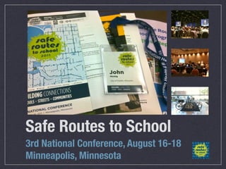
- 1. Safe Routes to School 3rd National Conference, August 16-18 Minneapolis, Minnesota
- 2. Safe Routes to School HISTORY
- 3. Safe Routes to School HISTORY Federal transportation legislation Safe, Accountable, Flexible, and Efficient Transportation Equity Act — a Legacy for Users (SAFETEA-LU), passed in August 2005
- 4. Safe Routes to School HISTORY Federal transportation legislation Safe, Accountable, Flexible, and Efficient Transportation Equity Act — a Legacy for Users (SAFETEA-LU), passed in August 2005 Included funds to start a new national program called Safe Routes to School (SRTS)
- 5. Safe Routes to School HISTORY Federal transportation legislation Safe, Accountable, Flexible, and Efficient Transportation Equity Act — a Legacy for Users (SAFETEA-LU), passed in August 2005 Included funds to start a new national program called Safe Routes to School (SRTS) $612 million program was to support projects to improve safety on walking and bicycling routes to school and to encourage children and families to travel between home and school using these modes
- 6. Safe Routes to School PURPOSE
- 7. Safe Routes to School PURPOSE Enable and encourage children, including those with disabilities, to walk and bicycle to school
- 8. Safe Routes to School PURPOSE Enable and encourage children, including those with disabilities, to walk and bicycle to school Make bicycling and walking to school a safer and more appealing transportation alternative, thereby encouraging a healthy and active lifestyle from an early age
- 9. Safe Routes to School PURPOSE Enable and encourage children, including those with disabilities, to walk and bicycle to school Make bicycling and walking to school a safer and more appealing transportation alternative, thereby encouraging a healthy and active lifestyle from an early age Facilitate the planning, development, and implementation of projects and activities that will improve safety and reduce traffic, fuel consumption, and air pollution in the vicinity (approximately two miles) of primary and middle schools (Grades K-8)
- 10. Safe Routes to School: HEALTH ISSUE?
- 11. Safe Routes to School: HEALTH ISSUE? Blue Cross and Blue Shield of Minnesota
- 12. Safe Routes to School: HEALTH ISSUE? Blue Cross and Blue Shield of Minnesota
- 13. Safe Routes to School: HEALTH ISSUE?
- 14. Safe Routes to School: HEALTH ISSUE? Kaiser Permanente - California
- 15. Safe Routes to School: HEALTH ISSUE? Kaiser Permanente - California
- 16. Safe Routes to School: HEALTH ISSUE?
- 17. Safe Routes to School: HEALTH ISSUE? Northwestern Mutual
- 18. Safe Routes to School: HEALTH ISSUE? ? Northwestern Mutual
- 19. Safe Routes to School: HEALTH ISSUE? Source: U.S. Department of Health and Human Services, Health Resources and Services Administration, Maternal and Child Health Bureau. The National Survey of Children's Health 2003. Rockville, Maryland: U.S. Department of Health and Human Services, 2005. Retrieved 12/01/2009 from http://mchb.hrsa.gov/overweight/state.htm.
- 20. Safe Routes to School: HEALTH ISSUE? 1970’S: 4-6% Source: U.S. Department of Health and Human Services, Health Resources and Services Administration, Maternal and Child Health Bureau. The National Survey of Children's Health 2003. Rockville, Maryland: U.S. Department of Health and Human Services, 2005. Retrieved 12/01/2009 from http://mchb.hrsa.gov/overweight/state.htm.
- 21. Safe Routes to School: HEALTH ISSUE? 1970’S: 4-6% 2008: 19.6% Source: U.S. Department of Health and Human Services, Health Resources and Services Administration, Maternal and Child Health Bureau. The National Survey of Children's Health 2003. Rockville, Maryland: U.S. Department of Health and Human Services, 2005. Retrieved 12/01/2009 from http://mchb.hrsa.gov/overweight/state.htm.
- 22. Safe Routes to School: HEALTH ISSUE? 1970’S: 4-6% 2008: 19.6% WISCONSIN 2003: Source: U.S. Department of Health and Human Services, Health Resources and Services Administration, Maternal and Child Health Bureau. The National Survey of Children's Health 2003. Rockville, Maryland: U.S. Department of Health and Human Services, 2005. Retrieved 12/01/2009 from http://mchb.hrsa.gov/overweight/state.htm.
- 23. Safe Routes to School: HEALTH ISSUE? 1970’S: 4-6% 2008: 19.6% WISCONSIN 2003: 13.5% Source: U.S. Department of Health and Human Services, Health Resources and Services Administration, Maternal and Child Health Bureau. The National Survey of Children's Health 2003. Rockville, Maryland: U.S. Department of Health and Human Services, 2005. Retrieved 12/01/2009 from http://mchb.hrsa.gov/overweight/state.htm.
- 24. Safe Routes to School: HEALTH ISSUE? 1970’S: 4-6% 2008: 19.6% WISCONSIN 2003: 13.5% WISCONSIN 2008: Source: U.S. Department of Health and Human Services, Health Resources and Services Administration, Maternal and Child Health Bureau. The National Survey of Children's Health 2003. Rockville, Maryland: U.S. Department of Health and Human Services, 2005. Retrieved 12/01/2009 from http://mchb.hrsa.gov/overweight/state.htm.
- 25. Safe Routes to School: HEALTH ISSUE? 1970’S: 4-6% 2008: 19.6% WISCONSIN 2003: 13.5% WISCONSIN 2008: 31%!! Source: U.S. Department of Health and Human Services, Health Resources and Services Administration, Maternal and Child Health Bureau. The National Survey of Children's Health 2003. Rockville, Maryland: U.S. Department of Health and Human Services, 2005. Retrieved 12/01/2009 from http://mchb.hrsa.gov/overweight/state.htm.
- 26. Safe Routes to School: HEALTH ISSUE? OBESITY TRENDS* AMONG US ADULTS (BMI ABOUT 30 LBS. OVERWEIGHT FOR 5’4” PERSON)
- 27. Safe Routes to School FRANKLIN
- 28. Safe Routes to School FRANKLIN Emerged from TRAILS COMMITTEE, formed to address citizen requests for increased bicycle and pedestrian facilities
- 29. Safe Routes to School FRANKLIN Emerged from TRAILS COMMITTEE, formed to address citizen requests for increased bicycle and pedestrian facilities SRTS grants offer no-match planning and infrastructure funding opportunities - IF we have a plan in place
- 30. Safe Routes to School FRANKLIN
- 31. Safe Routes to School FRANKLIN GRANT AWARD: Walking Workshop April 17, 2010 -- $2,500
- 32. Safe Routes to School FRANKLIN GRANT AWARD: Walking Workshop April 17, 2010 -- $2,500 GRANT AWARD: Planning Assistance Grant -- $18,000
- 33. Safe Routes to School FRANKLIN GRANT AWARD: Walking Workshop April 17, 2010 -- $2,500 GRANT AWARD: Planning Assistance Grant -- $18,000 PUBLIC INFO MEETING: April 12, 2011 (input for plan)
- 34. Safe Routes to School FRANKLIN
- 35. Safe Routes to School FRANKLIN ASSESS
- 36. Safe Routes to School FRANKLIN ASSESS Funded Walking Workshop
- 37. Safe Routes to School FRANKLIN ASSESS PLAN Funded Walking Workshop
- 38. Safe Routes to School FRANKLIN ASSESS PLAN Funded Funded Planning Grant; Walking Workshop Public Information meeting 1
- 39. Safe Routes to School FRANKLIN RE- ASSESS PLAN ASSESS PLAN Funded Funded Planning Grant; Walking Workshop Public Information meeting 1
- 40. Safe Routes to School FRANKLIN RE- ASSESS PLAN ASSESS PLAN Funded Funded Funded FURTHER ENGAGEMENT Planning Grant; Public Walking Information Workshop Public Planning Grant meetings/ Information workshops meeting 1 Attend SRTS conference Mini-Grant ($1000)
- 41. Safe Routes to School FRANKLIN RE- ASSESS PLAN ASSESS APPLY PLAN Funded Funded Funded FURTHER ENGAGEMENT Planning Grant; Public Walking Information Workshop Public Planning Grant meetings/ Information workshops meeting 1 Attend SRTS conference Mini-Grant ($1000)
- 42. Safe Routes to School FRANKLIN RE- ASSESS PLAN ASSESS APPLY PLAN Funded Funded Funded FURTHER ENGAGEMENT MAJOR GRANT Planning Grant; Public Engineering Walking Information Education Workshop Public Planning Grant meetings/ Enforcement Information workshops Encouragement meeting 1 Attend SRTS conference INFRASTRUCTURE Mini-Grant ($1000)
- 43. 2011 SAFE ROUTES TO SCHOOL CONFERENCE SESSIONS ATTENDED Roadway Design: The Standards. They Connecting Your Community with are a’Changin’ SRTS Designing for Safety • The Role of Neighborhood Partnerships in Successful SRTS Programs Complete Streets Advocacy in Predominantly Rural States • What’s in Your Toolbox? Creating Community Collaboration for a How Complete Streets and Successful SRTS Program Wayfinding Fit with SRTS (Engineering) Analyzing Streets and Speeds (Engineering) • Complete Streets and Safe Routes to School • GIS Tools to Help Allocate Infrastructure Funds • Wayfinding Signage: Building Connections to Schools and other Community Destinations • Edina Speed Zone Study and Implementation
- 44. 2011 SAFE ROUTES TO SCHOOL CONFERENCE SESSIONS ATTENDED Roadway Design: The Standards. They Connecting Your Community with are a’Changin’ SRTS Designing for Safety • The Role of Neighborhood Partnerships in Successful SRTS Programs Complete Streets Advocacy in Predominantly Rural States • What’s in Your Toolbox? Creating Community Collaboration for a How Complete Streets and Successful SRTS Program Wayfinding Fit with SRTS (Engineering) Analyzing Streets and Speeds (Engineering) • Complete Streets and Safe Routes to School • GIS Tools to Help Allocate Infrastructure Funds • Wayfinding Signage: Building Connections to Schools and other Community Destinations • Edina Speed Zone Study and Implementation
- 45. SRTS PLANNING GRANT APPLICATION
- 46. SRTS PLANNING GRANT APPLICATION
- 47. SRTS PLANNING GRANT APPLICATION
- 48. SRTS PLANNING GRANT APPLICATION
- 49. SRTS PLANNING GRANT APPLICATION
- 66. COMPLETE STREETS
- 67. COMPLETE STREETS Complete Streets are designed and operated to enable safe access for all users.
- 68. COMPLETE STREETS Complete Streets are designed and operated to enable safe access for all users. Pedestrians, bicyclists, motorists and transit riders of all ages and abilities are able to safely move along and across a complete street.
- 69. COMPLETE STREETS
- 70. COMPLETE STREETS WISCONSIN STATE LAW
- 71. COMPLETE STREETS WISCONSIN STATE LAW “...the department shall ensure that bikeways and pedestrian ways are established in all new highway construction and reconstruction projects funded in whole or in part from state funds or federal funds . . .”
- 72. COMPLETE STREETS NOT A NEW CONCEPT 2000 FHWA Guidance: “Bicycling and walking facilities will be incorporated into all transportation projects unless exceptional circumstances exist.”
- 73. COMPLETE STREETS
- 76. COMPLETE STREETS ELEMENTS Context Sensitive Solutions (CSS) Road Diets
- 77. COMPLETE STREETS ELEMENTS Context Sensitive Solutions (CSS) Road Diets
- 78. COMPLETE STREETS Context Sensitive Solutions (CSS) CSS is the result of developing transportation projects that serve all users and are compatible with the surroundings through which they pass—the community and environment.
- 79. COMPLETE STREETS Context Sensitive Solutions (CSS) PROJECT ORIENTED LOCATION SPECIFIC
- 80. COMPLETE STREETS Context Sensitive Solutions (CSS)
- 81. COMPLETE STREETS Context Sensitive Solutions (CSS)
- 85. COMPLETE STREETS Benefits Safety
- 86. COMPLETE STREETS Benefits Safety Options
- 87. COMPLETE STREETS Benefits Safety Options Health
- 88. COMPLETE STREETS Benefits Safety Options Health Community & Economic Development
- 89. COMPLETE STREETS Community & Economic Development
- 90. COMPLETE STREETS Community & Economic Development
- 91. COMPLETE STREETS Community & Economic Development
- 92. COMPLETE STREETS POPULARITY Community & Economic Development
- 93. COMPLETE STREETS POPULARITY National Complete Streets Coalition (Includes AARP, American Planning Association, etc.) Community & Economic Development
- 94. COMPLETE STREETS POPULARITY National Complete Streets Coalition (Includes AARP, American Planning Association, etc.) National support and resource network Community & Economic Development
- 95. COMPLETE STREETS POPULARITY National Complete Streets Coalition (Includes AARP, American Planning Association, etc.) National support and resource network Metropolitan Builders Association endorsed (Scott Mathey) Community & Economic Development
- 96. COMPLETE STREETS POPULARITY National Complete Streets Coalition (Includes AARP, American Planning Association, etc.) National support and resource network Metropolitan Builders Association endorsed (Scott Mathey) Endorsed by American Society of Civil Engineers (ASCE) Community & Economic Development
- 97. COMPLETE STREETS POPULARITY National Complete Streets Coalition (Includes AARP, American Planning Association, etc.) National support and resource network Metropolitan Builders Association endorsed (Scott Mathey) Endorsed by American Society of Civil Engineers (ASCE) Wisconsin State Law as of June, 2009 Community & Economic Development
- 98. COMPLETE STREETS POPULARITY National Complete Streets Coalition (Includes AARP, American Planning Association, etc.) National support and resource network Metropolitan Builders Association endorsed (Scott Mathey) Endorsed by American Society of Civil Engineers (ASCE) Wisconsin State Law as of June, 2009 Over 200 state and local Complete Streets policies in force Community & Economic Development
- 99. COMPLETE STREETS POPULARITY
- 100. COMPLETE STREETS POPULARITY Community & Economic Development
- 101. COMPLETE STREETS POPULARITY Community & Economic Development
- 102. COMPLETE STREETS THE OLD SUBURBAN ECONOMY Community & Economic Development
- 103. COMPLETE STREETS THE OLD SUBURBAN ECONOMY PONZI SCHEME Community & Economic Development
- 104. COMPLETE STREETS THE NEW ECONOMY Community & Economic Development
- 105. COMPLETE STREETS THE NEW ECONOMY Demand EFFICIENCY and VALUE CREATION in already-built areas rather than unchecked expansion Community & Economic Development
- 106. COMPLETE STREETS Community & Economic Development
- 107. COMPLETE STREETS Community & Economic Development
- 108. COMPLETE STREETS Community & Economic Development
- 109. COMPLETE STREETS WHAT ARE STREETS? Community & Economic Development
- 110. COMPLETE STREETS ROADS VS STREETS Community & Economic Development
- 111. COMPLETE STREETS ROADS VS STREETS ROAD Community & Economic Development
- 112. COMPLETE STREETS ROADS VS STREETS ROAD • Speed Community & Economic Development
- 113. COMPLETE STREETS ROADS VS STREETS ROAD • Speed • Lack of intersections Community & Economic Development
- 114. COMPLETE STREETS ROADS VS STREETS ROAD • Speed • Lack of intersections • Curves, not corners Community & Economic Development
- 115. COMPLETE STREETS ROADS VS STREETS ROAD • Speed • Lack of intersections • Curves, not corners • Away from residential Community & Economic Development
- 116. COMPLETE STREETS ROADS VS STREETS Community & Economic Development
- 117. COMPLETE STREETS ROADS VS STREETS STREETS Community & Economic Development
- 118. COMPLETE STREETS ROADS VS STREETS STREETS • Not only move cars Community & Economic Development
- 119. COMPLETE STREETS ROADS VS STREETS STREETS • Not only move cars • Accommodate parked cars Community & Economic Development
- 120. COMPLETE STREETS ROADS VS STREETS STREETS • Not only move cars • Accommodate parked cars • Accommodate walking and biking people Community & Economic Development
- 121. COMPLETE STREETS ROADS VS STREETS STREETS • Not only move cars • Accommodate parked cars • Accommodate walking and biking people • Accommodate people in wheel chairs Community & Economic Development
- 122. COMPLETE STREETS ROADS VS STREETS Community & Economic Development
- 123. COMPLETE STREETS ROADS VS STREETS A STREET IS... Community & Economic Development
- 124. COMPLETE STREETS ROADS VS STREETS A STREET IS... A network within a place that allows you to get around and serves as a framework for capturing value. Community & Economic Development
- 125. COMPLETE STREETS ROADS VS STREETS A STREET IS... A network within a place that allows you to get around and serves as a framework for capturing value. Community & Economic Development
- 126. COMPLETE STREETS ROADS VS STREETS CAPTURING VALUE Tax base from businesses, houses, office buildings, hotels, restaurants, etc. Community & Economic Development
- 127. COMPLETE STREETS ROADS VS STREETS CAPTURING VALUE Tax base from businesses, houses, office buildings, hotels, restaurants, etc. NOT FROM MOVING & STORING CARS! Community & Economic Development
- 128. COMPLETE STREETS ROADS VS STREETS Community & Economic Development
- 129. COMPLETE STREETS ROADS VS STREETS A STREET IS (for our purposes)... Community & Economic Development
- 130. COMPLETE STREETS ROADS VS STREETS A STREET IS (for our purposes)... Function: Connect useful destinations to better capture value: Community & Economic Development
- 131. COMPLETE STREETS ROADS VS STREETS A STREET IS (for our purposes)... Function: Connect useful destinations to better capture value: • Literal street or road Community & Economic Development
- 132. COMPLETE STREETS ROADS VS STREETS A STREET IS (for our purposes)... Function: Connect useful destinations to better capture value: • Literal street or road • Trail Community & Economic Development
- 133. COMPLETE STREETS ROADS VS STREETS A STREET IS (for our purposes)... Function: Connect useful destinations to better capture value: • Literal street or road • Trail • Sidewalk Community & Economic Development
- 134. COMPLETE STREETS ROADS VS STREETS A STREET IS (for our purposes)... Function: Connect useful destinations to better capture value: • Literal street or road • Trail • Sidewalk Community & • Path Economic Development
- 135. COMPLETE STREETS ROADS VS STREETS Community & Economic Development
- 136. COMPLETE STREETS ROADS VS STREETS Streets Community & Economic Development
- 137. COMPLETE STREETS ROADS VS STREETS Streets Roads Community & Economic Development
- 138. COMPLETE STREETS ROADS VS STREETS Streets Roads Paths Community & Economic Development
- 139. COMPLETE STREETS ROADS VS STREETS Streets Roads Paths Sidewalks Community & Economic Development
- 140. COMPLETE STREETS ROADS VS STREETS Streets Roads Paths Sidewalks Trails Community & Economic Development
- 141. COMPLETE STREETS ROADS VS STREETS Community & Economic Development
- 142. COMPLETE STREETS ROADS VS STREETS Community & Economic Development
- 143. COMPLETE STREETS ROADS VS STREETS INFRASTRUCTURE Community & Economic Development
- 144. COMPLETE STREETS ROADS VS STREETS PROBLEM: We in the U.S. have started to reconfigure our STREETS so they have characteristics of ROADS. Community & Economic Development
- 151. COMPLETE STREETS ROADS VS STREETS Community & Economic Development
- 152. COMPLETE STREETS ROADS VS STREETS RESULT: Community & Economic Development
- 153. COMPLETE STREETS ROADS VS STREETS RESULT: No longer able to capture maximum value Community & Economic Development
- 154. COMPLETE STREETS ROADS VS STREETS RESULT: No longer able to capture maximum value Development flees the area Community & Economic Development
- 155. COMPLETE STREETS ROADS VS STREETS RESULT: No longer able to capture maximum value Development flees the area Financially unproductive space Community & Economic Development
- 156. COMPLETE STREETS PERCEIVED BARRIERS
- 157. COMPLETE STREETS PERCEIVED BARRIERS • Slower speeds reduce mobility & increase costs for all vehicles
- 158. COMPLETE STREETS PERCEIVED BARRIERS • Slower speeds reduce mobility & increase costs for all vehicles • Conflicts with Federal highway standards & guidelines
- 159. COMPLETE STREETS PERCEIVED BARRIERS • Slower speeds reduce mobility & increase costs for all vehicles • Conflicts with Federal highway standards & guidelines • “Level of Service C” requirement for the peak half-hour 20 years from opening day
- 160. COMPLETE STREETS PERCEIVED BARRIERS • Slower speeds reduce mobility & increase costs for all vehicles • Conflicts with Federal highway standards & guidelines • “Level of Service C” requirement for the peak half-hour 20 years from opening day • Expensive
- 161. COMPLETE STREETS PERCEIVED BARRIERS • Slower speeds reduce mobility & increase costs for all vehicles • Conflicts with Federal highway standards & guidelines • “Level of Service C” requirement for the peak half-hour 20 years from opening day • Expensive ALL MYTHS!
- 162. COMPLETE STREETS PERCEIVED BARRIERS: COSTS & TIME
- 163. COMPLETE STREETS PERCEIVED BARRIERS: COSTS & TIME “If a roadway is being reconstructed, rebuilding the roadway with 10-foot lanes and timing the traffic signals for 30mph will control speeds and can actually result in a reduction in costs by using a narrower overall roadway structure.”
- 164. COMPLETE STREETS PERCEIVED BARRIERS: COSTS & TIME “If a roadway is being reconstructed, rebuilding the roadway with 10-foot lanes and timing the traffic signals for 30mph will control speeds and can actually result in a reduction in costs by using a narrower overall roadway structure.” – John LaPlante, PE, PTOE Director of Traffic Engineering for T.Y. Lin International, former City Traffic Engineer with the City of Chicago
- 165. COMPLETE STREETS PERCEIVED BARRIERS: “LOS C” AASHTO “GREEN BOOK” American Association of State Highway & Transportation Officials •First Edition – 1984 •Current Version – 2004 •Impending 6th Ed. – 2011
- 166. COMPLETE STREETS AASHTO “GREEN BOOK” Design Speed: 2004 “The assumed design speed should be a logical one with respect to the topography, anticipated operating speed, the adjacent land use, and the functional classification of the highway.” “...every effort should be made to use as high a design speed as practical to attain a desired degree of safety, mobility and efficiency...”
- 167. COMPLETE STREETS AASHTO “GREEN BOOK” Design Speed: 2011 “The assumed design speed should be a logical one with respect to the topography, anticipated operating speed, the adjacent land use, and the functional classification of the highway.” “...every effort should be made to use as high a design speed as practical to attain a desired degree of safety, mobility and efficiency...”
- 168. COMPLETE STREETS AASHTO “GREEN BOOK” Level of Service (LOS) “…characterizes the operating conditions on the facility in terms of traffic performance measures related to speed and travel time, freedom to maneuver, traffic interruptions, and comfort and convenience.”
- 169. COMPLETE STREETS AASHTO “GREEN BOOK” Level of Service LOS Operating Conditions A Free flow B Reasonably free flow C Stable flow D Approaching unstable flow E Unstable flow F Forced or breakdown flow
- 170. COMPLETE STREETS AASHTO “GREEN BOOK” 2004 Green Book Functional Level of Service Class Freeway C Arterial C Collector D Local D
- 171. COMPLETE STREETS AASHTO “GREEN BOOK” 2011 Green Book Functional Level of Service Class Freeway C or D Arterial C or D Collector D Local D
- 172. COMPLETE STREETS AASHTO “GREEN BOOK” Lane Widths: 2004
- 173. COMPLETE STREETS AASHTO “GREEN BOOK” Lane Widths: 2004 “Lane widths may vary from 10 to 12 ft. Lane widths of 10 ft may be used in highly restricted areas having little or no truck traffic. Lane widths of 11 ft are used quite extensively for urban arterial street designs. The 12-ft lane widths are most desirable and should be used, where practical, on higher speed, free-flowing, principal arterials.”
- 174. COMPLETE STREETS AASHTO “GREEN BOOK”
- 175. COMPLETE STREETS AASHTO “GREEN BOOK” Relationship of Lane Width to Safety for Urban and Suburban Arterials (2007)
- 176. COMPLETE STREETS AASHTO “GREEN BOOK” Relationship of Lane Width to Safety for Urban and Suburban Arterials (2007) “The research found no general indication that the use of lanes narrower than 12 ft on urban and suburban arterials increases crash frequencies. This finding suggests that geometric design policies should provide substantial flexibility for use of lane widths narrower than 12 ft.”
- 177. COMPLETE STREETS AASHTO “GREEN BOOK” Lane Widths: 2011
- 178. COMPLETE STREETS AASHTO “GREEN BOOK” Lane Widths: 2011 “Lane widths may vary from 10 to 12 ft. Lane widths of 10 ft may be used in highly restricted more constrained areas where truck and bus volumes are relatively low and speeds are less than 35 mph having little or no truck traffic. Lane widths of 11 ft are used quite extensively for urban arterial street designs. The 12-ft lane widths are most desirable and should be used, where practical, on higher speed, free-flowing, principal arterials.”
- 179. COMPLETE STREETS PERCEIVED BARRIERS: COSTS
- 180. COMPLETE STREETS PERCEIVED BARRIERS: COSTS Incorporate complete streets elements into new street designs and resurfacing plans for low-cost implementation.
- 181. COMPLETE STREETS PERCEIVED BARRIERS: COSTS Incorporate complete streets elements into new street designs and resurfacing plans for low-cost implementation. Implement complete streets incrementally, as a full scale change over the course of years.
- 182. COMPLETE STREETS PERCEIVED BARRIERS: COSTS Incorporate complete streets elements into new street designs and resurfacing plans for low-cost implementation. Implement complete streets incrementally, as a full scale change over the course of years. There are actual cost savings in ROAD DIETS.
- 183. COMPLETE STREETS ROAD DIETS
- 184. COMPLETE STREETS ROAD DIETS
- 185. COMPLETE STREETS ROAD DIETS
- 186. COMPLETE STREETS ROAD DIETS
- 187. COMPLETE STREETS ROAD DIETS
- 188. COMPLETE STREETS ROAD DIETS
- 189. COMPLETE STREETS ROAD DIETS
- 190. COMPLETE STREETS ROAD DIETS
- 191. COMPLETE STREETS ROAD DIETS MINNESOTA ROAD DIET: Done during regular resurfacings
- 192. COMPLETE STREETS ROAD DIETS MINNESOTA ROAD DIET: Done during regular resurfacings COST SAVINGS: Less asphalt, less surface area for plowing, etc.
- 193. COMPLETE STREETS ROAD DIETS MINNESOTA ROAD DIET: Done during regular resurfacings COST SAVINGS: Less asphalt, less surface area for plowing, etc.
- 194. COMPLETE STREETS ROAD DIETS
- 195. COMPLETE STREETS ROAD DIETS MINNESOTA ROAD DIET STUDY:
- 196. COMPLETE STREETS ROAD DIETS MINNESOTA ROAD DIET STUDY: Crash reductions between seven sites varied from 37.3% to 54.3%
- 197. COMPLETE STREETS ROAD DIETS MINNESOTA ROAD DIET STUDY: Crash reductions between seven sites varied from 37.3% to 54.3% Overall total crash reduction of 44.2%
- 198. COMPLETE STREETS ROAD DIETS
- 199. COMPLETE STREETS ROAD DIETS The Old Paradigm: Roads must GROW and WIDEN to accommodate MORE AND MORE DRIVERS
- 200. Americans DRIVING
- 201. Americans DRIVING
- 203. Americans DRIVING
- 205. YOUNGER Americans DRIVING LESS
- 206. COMPLETE STREETS WALKABILITY ROI Community & Economic Development
- 207. COMPLETE STREETS WALKABILITY ROI Carol Coletta, President and CEO of CEOs for Cities: Community & Economic Development
- 208. COMPLETE STREETS WALKABILITY ROI Carol Coletta, President and CEO of CEOs for Cities: Redeveloping for walkability will “not only enhance the local tax base but will also contribute to individual wealth by increasing the value of what is, for most people, their biggest asset.” Community & Economic Development
- 209. COMPLETE STREETS WALKABILITY ROI Community & Economic Development
- 210. COMPLETE STREETS WALKABILITY ROI STUDY: In a typical metropolitan area, a one-point increase in Walk Score was associated with an increase in value ranging from $700 to $3,000 depending on the market. Community & Economic Development
- 211. COMPLETE STREETS
- 212. COMPLETE STREETS • Wide acceptance
- 213. COMPLETE STREETS • Wide acceptance • Consistent with engineering standards and requirements
- 214. COMPLETE STREETS • Wide acceptance • Consistent with engineering standards and requirements • Increase value of homes and businesses
- 215. COMPLETE STREETS • Wide acceptance • Consistent with engineering standards and requirements • Increase value of homes and businesses • 29% reduction in total crashes/mile with Road Diets
- 216. COMPLETE STREETS • Wide acceptance • Consistent with engineering standards and requirements • Increase value of homes and businesses • 29% reduction in total crashes/mile with Road Diets • Inexpensive to implement; actually SAVES money
- 217. COMPLETE STREETS • Wide acceptance • Consistent with engineering standards and requirements • Increase value of homes and businesses • 29% reduction in total crashes/mile with Road Diets • Inexpensive to implement; actually SAVES money • PROMOTABLE as a “Forward Franklin” initiative
- 218. COMPLETE STREETS
- 222. COMPLETE STREETS Parks Comm. Engineering Trails Comm. Economic Dev.
- 223. COMPLETE STREETS Planning Parks Comm. Engineering Trails Comm. Economic Dev.
- 224. COMPLETE STREETS Planning Parks Comm. Engineering Trails Comm. Economic Dev. School District
- 225. COMPLETE STREETS Planning Parks Comm. Elderly Engineering Trails Comm. Economic Dev. School District
- 226. COMPLETE STREETS Planning Parks Comm. Elderly Engineering Disabled Trails Comm. Economic Dev. School District
- 227. COMPLETE STREETS Planning Parks Comm. Elderly Engineering Disabled Trails Comm. Homeowners Economic Dev. School District
- 228. COMPLETE STREETS Planning Parks Comm. Elderly Engineering Disabled Trails Comm. Homeowners Economic Dev. Children School District
- 229. COMPLETE STREETS Planning Homeowners Assoc. Parks Comm. Elderly Engineering Disabled Trails Comm. Homeowners Economic Dev. Children School District
- 230. COMPLETE STREETS Business Planning Homeowners Assoc. Parks Comm. Elderly Engineering Disabled Trails Comm. Homeowners Economic Dev. Children School District
- 231. COMPLETE STREETS Business Police and Fire Planning Homeowners Assoc. Parks Comm. Elderly Engineering Disabled Trails Comm. Homeowners Economic Dev. Children School District
- 232. COMPLETE STREETS Business Police and Fire Planning Homeowners Assoc. Parks Comm. Elderly Engineering City Budget Disabled Trails Comm. Homeowners Economic Dev. Children School District
- 233. COMPLETE STREETS Business Police and Fire Planning Homeowners Assoc. Parks Comm. Elderly Engineering City Budget Disabled Trails Comm. Grants Homeowners Economic Dev. Children School District
- 234. COMPLETE STREETS Business Police and Fire Planning Homeowners Assoc. Parks Comm. Elderly Engineering City Budget Disabled Trails Comm. Grants Homeowners Economic Dev. Impact Fees Children School District
- 235. COMPLETE STREETS Business Police and Fire Planning Homeowners Assoc. Parks Comm. Elderly DOT Transportation Engineering City Budget Disabled Trails Comm. Grants Homeowners Economic Dev. Impact Fees Children School District
- 236. COMPLETE STREETS Business Police and Fire Planning Homeowners Assoc. Developers Parks Comm. Elderly DOT Transportation Engineering City Budget Disabled Trails Comm. Grants Homeowners Economic Dev. Impact Fees Children School District
- 237. COMPLETE STREETS
- 238. COMPLETE STREETS PROPOSAL:
- 239. COMPLETE STREETS PROPOSAL: FRANKLIN COMPLETE STREETS
- 240. COMPLETE STREETS PROPOSAL: FRANKLIN COMPLETE STREETS POLICY & ORDINANCE
- 241. FRANKLIN COMPLETE STREETS POLICY
- 242. FRANKLIN COMPLETE STREETS POLICY Create a municipal entity incorporating Planning, Engineering, Trails Committee, Parks Commission, Economic Development, etc.
- 243. FRANKLIN COMPLETE STREETS POLICY Create a municipal entity incorporating Planning, Engineering, Trails Committee, Parks Commission, Economic Development, etc. Regularly engage with community groups (elderly, differently-abled, Neighborhood associations, etc.)
- 244. FRANKLIN COMPLETE STREETS POLICY Create a municipal entity incorporating Planning, Engineering, Trails Committee, Parks Commission, Economic Development, etc. Regularly engage with community groups (elderly, differently-abled, Neighborhood associations, etc.) Construct and promote a vision for how and why we want to complete our streets.
- 245. FRANKLIN COMPLETE STREETS POLICY Create a municipal entity incorporating Planning, Engineering, Trails Committee, Parks Commission, Economic Development, etc. Regularly engage with community groups (elderly, differently-abled, Neighborhood associations, etc.) Construct and promote a vision for how and why we want to complete our streets. Specify that “all users” includes pedestrians and bicyclists of all ages and abilities, as well as vehicles.
- 246. FRANKLIN COMPLETE STREETS POLICY Create a municipal entity incorporating Planning, Engineering, Trails Committee, Parks Commission, Economic Development, etc. Regularly engage with community groups (elderly, differently-abled, Neighborhood associations, etc.) Construct and promote a vision for how and why we want to complete our streets. Specify that “all users” includes pedestrians and bicyclists of all ages and abilities, as well as vehicles. Apply policy to both new and retrofit projects, including design, planning, and maintenance.
- 247. FRANKLIN COMPLETE STREETS POLICY Create a municipal entity incorporating Planning, Engineering, Trails Committee, Parks Commission, Economic Development, etc. Regularly engage with community groups (elderly, differently-abled, Neighborhood associations, etc.) Construct and promote a vision for how and why we want to complete our streets. Specify that “all users” includes pedestrians and bicyclists of all ages and abilities, as well as vehicles. Apply policy to both new and retrofit projects, including design, planning, and maintenance. Make any exceptions specific and set a clear, developer-friendly procedure.
- 248. FRANKLIN COMPLETE STREETS POLICY
- 249. FRANKLIN COMPLETE STREETS POLICY Create a comprehensive, integrated, connected network for all modes that maximizes value.
- 250. FRANKLIN COMPLETE STREETS POLICY Create a comprehensive, integrated, connected network for all modes that maximizes value. Policy adoptable by all city entities to cover all roads, trails, paths, sidewalks, site plans, etc.
- 251. FRANKLIN COMPLETE STREETS POLICY Create a comprehensive, integrated, connected network for all modes that maximizes value. Policy adoptable by all city entities to cover all roads, trails, paths, sidewalks, site plans, etc. Direct the use of the latest and best design criteria and guidelines while recognizing the need for flexibility in balancing user needs.
- 252. FRANKLIN COMPLETE STREETS POLICY Create a comprehensive, integrated, connected network for all modes that maximizes value. Policy adoptable by all city entities to cover all roads, trails, paths, sidewalks, site plans, etc. Direct the use of the latest and best design criteria and guidelines while recognizing the need for flexibility in balancing user needs. Establish performance standards with measurable outcomes.
- 253. FRANKLIN COMPLETE STREETS POLICY Create a comprehensive, integrated, connected network for all modes that maximizes value. Policy adoptable by all city entities to cover all roads, trails, paths, sidewalks, site plans, etc. Direct the use of the latest and best design criteria and guidelines while recognizing the need for flexibility in balancing user needs. Establish performance standards with measurable outcomes. Define specific next steps for implementation of the policy.
- 254. FRANKLIN COMPLETE STREETS POLICY
- 255. FRANKLIN COMPLETE STREETS POLICY IF YOU WANT TO GO FAST, GO ALONE.
- 256. FRANKLIN COMPLETE STREETS POLICY IF YOU WANT TO GO FAST, GO ALONE. IF YOU WANT TO GO FAR, GO TOGETHER.
Hinweis der Redaktion
- \n
- \n
- \n
- \n
- \n
- \n
- \n
- In case you weren’t clear on the HEALTH implications...\n
- In case you weren’t clear on the HEALTH implications...\n
- In case you weren’t clear on the HEALTH implications...\n
- \n
- \n
- \n
- \n
- \n
- \n
- \n
- \n
- This is how quickly childhood obesity is growing.\nWant to guess what the number is for Franklin?\n
- This is how quickly childhood obesity is growing.\nWant to guess what the number is for Franklin?\n
- This is how quickly childhood obesity is growing.\nWant to guess what the number is for Franklin?\n
- This is how quickly childhood obesity is growing.\nWant to guess what the number is for Franklin?\n
- This is how quickly childhood obesity is growing.\nWant to guess what the number is for Franklin?\n
- This is how quickly childhood obesity is growing.\nWant to guess what the number is for Franklin?\n
- So now you know why insurance companies are so very interested in SRTS\n
- \n
- \n
- Grants paid for Walking Workshop - GREAT outreach opportuniyu, tremendous input.\n
- Grants paid for Walking Workshop - GREAT outreach opportuniyu, tremendous input.\n
- Grants paid for Walking Workshop - GREAT outreach opportuniyu, tremendous input.\n
- Grants paid for Walking Workshop - GREAT outreach opportuniyu, tremendous input.\n
- Grants paid for Walking Workshop - GREAT outreach opportuniyu, tremendous input.\n
- Grants paid for Walking Workshop - GREAT outreach opportuniyu, tremendous input.\n
- Grants paid for Walking Workshop - GREAT outreach opportuniyu, tremendous input.\n
- Grants paid for Walking Workshop - GREAT outreach opportuniyu, tremendous input.\n
- Grants paid for Walking Workshop - GREAT outreach opportuniyu, tremendous input.\n
- Grants paid for Walking Workshop - GREAT outreach opportuniyu, tremendous input.\n
- Grants paid for Walking Workshop - GREAT outreach opportuniyu, tremendous input.\n
- Grants paid for Walking Workshop - GREAT outreach opportuniyu, tremendous input.\n
- Grants paid for Walking Workshop - GREAT outreach opportuniyu, tremendous input.\n
- Grants paid for Walking Workshop - GREAT outreach opportuniyu, tremendous input.\n
- Grants paid for Walking Workshop - GREAT outreach opportuniyu, tremendous input.\n
- Grants paid for Walking Workshop - GREAT outreach opportuniyu, tremendous input.\n
- Grants paid for Walking Workshop - GREAT outreach opportuniyu, tremendous input.\n
- Grants paid for Walking Workshop - GREAT outreach opportuniyu, tremendous input.\n
- Grants paid for Walking Workshop - GREAT outreach opportuniyu, tremendous input.\n
- Grants paid for Walking Workshop - GREAT outreach opportuniyu, tremendous input.\n
- Grants paid for Walking Workshop - GREAT outreach opportuniyu, tremendous input.\n
- Grants paid for Walking Workshop - GREAT outreach opportuniyu, tremendous input.\n
- Grants paid for Walking Workshop - GREAT outreach opportuniyu, tremendous input.\n
- Grants paid for Walking Workshop - GREAT outreach opportuniyu, tremendous input.\n
- Grants paid for Walking Workshop - GREAT outreach opportuniyu, tremendous input.\n
- \n
- \n
- \n
- \n
- \n
- \n
- \n
- \n
- \n
- \n
- \n
- \n
- \n
- \n
- \n
- \n
- Sessions were 3 hours each on average, so I am paraphrasing a lot of information.Common theme: Adopting a POLICY that will allow for connectivity for ALL AGES in the city or town.\n
- The common thread: COMPLETE STREETS as an ongoing city and state policy that springs from SRTS\n
- Let’s review the grant application\n
- \n
- \n
- \n
- \n
- \n
- \n
- \n
- \n
- \n
- \n
- \n
- \n
- \n
- \n
- \n
- \n
- \n
- \n
- \n
- \n
- \n
- \n
- \n
- 2000 Federal Highway Administration Guidance. THIS ADVICE IS NOT FOLLOWED BY MOST STATES.PICTURE: Rawson crossing to street that leads to Pleasant View Elementary\n
- There are a huge amount of elements, here are two that I will merely TOCH ON THE SURFACE\n
- There are a huge amount of elements, here are two that I will merely TOCH ON THE SURFACE\n
- There are a huge amount of elements, here are two that I will merely TOCH ON THE SURFACE\n
- There are a huge amount of elements, here are two that I will merely TOCH ON THE SURFACE\n
- 76th street at Rawson is different than 76th Street by the Little League fields.\nLOWER SPEED in commercial and residential areas to BUILD VALUE\n\n
- \nPROJECT ORIENTED\nLOCATION SPECIFIC\n\n\n
- \nExample\nCurb radius that is friendly to walkers\n\n\n
- \n“Refuge Islands” - 27the street?\n\n\n
- EXAMPLE: \n- Lane narrowing\n- Striping\n- Street plantings\n- Islands\n
- Safety. Currently, people do not feel safe walking or biking in Franklin. In many neighborhoods, there is no dedicated space for pedestrians and bicyclists and cars travel too fast and too close. Providing for adequate spaces for all users will reduce accidents and increase a sense of security. \nProviding options. Not everyone uses a personal vehicle as their means of transportation. Some Franklinites are too young, too old, cannot afford a car, have a disability or choose not to drive. It is important to provide alternative and reasonable choices for everyone. \nHealth. As the reliance on the personal vehicle has increased, so has the rate of obesity. Currently, more than 60% of Minnesotans are overweight, which, if left unchecked will result in $3.7 billion additional health care costs by 2020. By providing residents and workers with options to bike and walk, more may be willing to do so, possibly helping to reduce health care costs and obesity rates. \nCommunity and Economic Development. The desire to live and work in highly walkable neighborhoods, especially by both empty nesters and young professionals, is a highly documented phenomenon that occurred in the last two decades. In fact, now major real estate agencies provide “walkability scores” on home listings as this has become such an important aspect of finding a home to homebuyers. Homeowners are searching for neighborhoods with great accessibility, local amenities and attractions and exciting, lively commercial areas. In fact, a national study has shown that home values in more walkable neighborhoods have higher values. Additionally, businesses that provide access to all users and a safe design attract more business. \n\n
- Safety. Currently, people do not feel safe walking or biking in Franklin. In many neighborhoods, there is no dedicated space for pedestrians and bicyclists and cars travel too fast and too close. Providing for adequate spaces for all users will reduce accidents and increase a sense of security. \nProviding options. Not everyone uses a personal vehicle as their means of transportation. Some Franklinites are too young, too old, cannot afford a car, have a disability or choose not to drive. It is important to provide alternative and reasonable choices for everyone. \nHealth. As the reliance on the personal vehicle has increased, so has the rate of obesity. Currently, more than 60% of Minnesotans are overweight, which, if left unchecked will result in $3.7 billion additional health care costs by 2020. By providing residents and workers with options to bike and walk, more may be willing to do so, possibly helping to reduce health care costs and obesity rates. \nCommunity and Economic Development. The desire to live and work in highly walkable neighborhoods, especially by both empty nesters and young professionals, is a highly documented phenomenon that occurred in the last two decades. In fact, now major real estate agencies provide “walkability scores” on home listings as this has become such an important aspect of finding a home to homebuyers. Homeowners are searching for neighborhoods with great accessibility, local amenities and attractions and exciting, lively commercial areas. In fact, a national study has shown that home values in more walkable neighborhoods have higher values. Additionally, businesses that provide access to all users and a safe design attract more business. \n\n
- Safety. Currently, people do not feel safe walking or biking in Franklin. In many neighborhoods, there is no dedicated space for pedestrians and bicyclists and cars travel too fast and too close. Providing for adequate spaces for all users will reduce accidents and increase a sense of security. \nProviding options. Not everyone uses a personal vehicle as their means of transportation. Some Franklinites are too young, too old, cannot afford a car, have a disability or choose not to drive. It is important to provide alternative and reasonable choices for everyone. \nHealth. As the reliance on the personal vehicle has increased, so has the rate of obesity. Currently, more than 60% of Minnesotans are overweight, which, if left unchecked will result in $3.7 billion additional health care costs by 2020. By providing residents and workers with options to bike and walk, more may be willing to do so, possibly helping to reduce health care costs and obesity rates. \nCommunity and Economic Development. The desire to live and work in highly walkable neighborhoods, especially by both empty nesters and young professionals, is a highly documented phenomenon that occurred in the last two decades. In fact, now major real estate agencies provide “walkability scores” on home listings as this has become such an important aspect of finding a home to homebuyers. Homeowners are searching for neighborhoods with great accessibility, local amenities and attractions and exciting, lively commercial areas. In fact, a national study has shown that home values in more walkable neighborhoods have higher values. Additionally, businesses that provide access to all users and a safe design attract more business. \n\n
- Safety. Currently, people do not feel safe walking or biking in Franklin. In many neighborhoods, there is no dedicated space for pedestrians and bicyclists and cars travel too fast and too close. Providing for adequate spaces for all users will reduce accidents and increase a sense of security. \nProviding options. Not everyone uses a personal vehicle as their means of transportation. Some Franklinites are too young, too old, cannot afford a car, have a disability or choose not to drive. It is important to provide alternative and reasonable choices for everyone. \nHealth. As the reliance on the personal vehicle has increased, so has the rate of obesity. Currently, more than 60% of Minnesotans are overweight, which, if left unchecked will result in $3.7 billion additional health care costs by 2020. By providing residents and workers with options to bike and walk, more may be willing to do so, possibly helping to reduce health care costs and obesity rates. \nCommunity and Economic Development. The desire to live and work in highly walkable neighborhoods, especially by both empty nesters and young professionals, is a highly documented phenomenon that occurred in the last two decades. In fact, now major real estate agencies provide “walkability scores” on home listings as this has become such an important aspect of finding a home to homebuyers. Homeowners are searching for neighborhoods with great accessibility, local amenities and attractions and exciting, lively commercial areas. In fact, a national study has shown that home values in more walkable neighborhoods have higher values. Additionally, businesses that provide access to all users and a safe design attract more business. \n\n
- Safety. Currently, people do not feel safe walking or biking in Franklin. In many neighborhoods, there is no dedicated space for pedestrians and bicyclists and cars travel too fast and too close. Providing for adequate spaces for all users will reduce accidents and increase a sense of security. \nProviding options. Not everyone uses a personal vehicle as their means of transportation. Some Franklinites are too young, too old, cannot afford a car, have a disability or choose not to drive. It is important to provide alternative and reasonable choices for everyone. \nHealth. As the reliance on the personal vehicle has increased, so has the rate of obesity. Currently, more than 60% of Minnesotans are overweight, which, if left unchecked will result in $3.7 billion additional health care costs by 2020. By providing residents and workers with options to bike and walk, more may be willing to do so, possibly helping to reduce health care costs and obesity rates. \nCommunity and Economic Development. The desire to live and work in highly walkable neighborhoods, especially by both empty nesters and young professionals, is a highly documented phenomenon that occurred in the last two decades. In fact, now major real estate agencies provide “walkability scores” on home listings as this has become such an important aspect of finding a home to homebuyers. Homeowners are searching for neighborhoods with great accessibility, local amenities and attractions and exciting, lively commercial areas. In fact, a national study has shown that home values in more walkable neighborhoods have higher values. Additionally, businesses that provide access to all users and a safe design attract more business. \n\n
- Safety. Currently, people do not feel safe walking or biking in Franklin. In many neighborhoods, there is no dedicated space for pedestrians and bicyclists and cars travel too fast and too close. Providing for adequate spaces for all users will reduce accidents and increase a sense of security. \nProviding options. Not everyone uses a personal vehicle as their means of transportation. Some Franklinites are too young, too old, cannot afford a car, have a disability or choose not to drive. It is important to provide alternative and reasonable choices for everyone. \nHealth. As the reliance on the personal vehicle has increased, so has the rate of obesity. Currently, more than 60% of Minnesotans are overweight, which, if left unchecked will result in $3.7 billion additional health care costs by 2020. By providing residents and workers with options to bike and walk, more may be willing to do so, possibly helping to reduce health care costs and obesity rates. \nCommunity and Economic Development. The desire to live and work in highly walkable neighborhoods, especially by both empty nesters and young professionals, is a highly documented phenomenon that occurred in the last two decades. In fact, now major real estate agencies provide “walkability scores” on home listings as this has become such an important aspect of finding a home to homebuyers. Homeowners are searching for neighborhoods with great accessibility, local amenities and attractions and exciting, lively commercial areas. In fact, a national study has shown that home values in more walkable neighborhoods have higher values. Additionally, businesses that provide access to all users and a safe design attract more business. \n\n
- Safety. Currently, people do not feel safe walking or biking in Franklin. In many neighborhoods, there is no dedicated space for pedestrians and bicyclists and cars travel too fast and too close. Providing for adequate spaces for all users will reduce accidents and increase a sense of security. \nProviding options. Not everyone uses a personal vehicle as their means of transportation. Some Franklinites are too young, too old, cannot afford a car, have a disability or choose not to drive. It is important to provide alternative and reasonable choices for everyone. \nHealth. As the reliance on the personal vehicle has increased, so has the rate of obesity. Currently, more than 60% of Minnesotans are overweight, which, if left unchecked will result in $3.7 billion additional health care costs by 2020. By providing residents and workers with options to bike and walk, more may be willing to do so, possibly helping to reduce health care costs and obesity rates. \nCommunity and Economic Development. The desire to live and work in highly walkable neighborhoods, especially by both empty nesters and young professionals, is a highly documented phenomenon that occurred in the last two decades. In fact, now major real estate agencies provide “walkability scores” on home listings as this has become such an important aspect of finding a home to homebuyers. Homeowners are searching for neighborhoods with great accessibility, local amenities and attractions and exciting, lively commercial areas. In fact, a national study has shown that home values in more walkable neighborhoods have higher values. Additionally, businesses that provide access to all users and a safe design attract more business. \n\n
- Safety. Currently, people do not feel safe walking or biking in Franklin. In many neighborhoods, there is no dedicated space for pedestrians and bicyclists and cars travel too fast and too close. Providing for adequate spaces for all users will reduce accidents and increase a sense of security. \nProviding options. Not everyone uses a personal vehicle as their means of transportation. Some Franklinites are too young, too old, cannot afford a car, have a disability or choose not to drive. It is important to provide alternative and reasonable choices for everyone. \nHealth. As the reliance on the personal vehicle has increased, so has the rate of obesity. Currently, more than 60% of Minnesotans are overweight, which, if left unchecked will result in $3.7 billion additional health care costs by 2020. By providing residents and workers with options to bike and walk, more may be willing to do so, possibly helping to reduce health care costs and obesity rates. \nCommunity and Economic Development. The desire to live and work in highly walkable neighborhoods, especially by both empty nesters and young professionals, is a highly documented phenomenon that occurred in the last two decades. In fact, now major real estate agencies provide “walkability scores” on home listings as this has become such an important aspect of finding a home to homebuyers. Homeowners are searching for neighborhoods with great accessibility, local amenities and attractions and exciting, lively commercial areas. In fact, a national study has shown that home values in more walkable neighborhoods have higher values. Additionally, businesses that provide access to all users and a safe design attract more business. \n\n
- Why is this policy so popular? IT PAYS \n\n
- Why is this policy so popular? IT PAYS \n\n
- Embraced by a wide spectrum of groups, bit professional and demographic \n
- Embraced by a wide spectrum of groups, bit professional and demographic \n
- Embraced by a wide spectrum of groups, bit professional and demographic \n
- Embraced by a wide spectrum of groups, bit professional and demographic \n
- Embraced by a wide spectrum of groups, bit professional and demographic \n
- Embraced by a wide spectrum of groups, bit professional and demographic \n
- Just a few examples of cities and states who have adopted Complete Streets ordinances statutes, or guidelines\n
- MICHIGAN is not in any position to fool around. Look at how many communities have adopted COMPLETE STREETS as a means of shoring up their economic situation\n
- The OLD ECONOMY: We take anticipated revenue from new growth to pay off liabilities from past growth. \n\nThere’s a NAME FOR THAT\n
- Demand EFFICIENCY and VALUE CREATION in already-built areas rather than unchecked expansion \nCOMPLETELY CONSISTENT WITH COMPLETE STREETS\n
- \nTHE NEW ECONOMY - Housing Starts are WAY DOWN - \n
- \nHOME VALUES are WAY DOWN - \n
- \nFederal and State contributions to infrastructure development and repair will soon DISAPPEAR\n
- From an economic standpoint - WHAT ARE STREETS?\nWE OFTEN CONFUSE ROADS AND STREETS\n
- The OLD ECONOMY: Financing that takes place when additional revenue from new growth is used to pay off liabilities from past growth\n
- The OLD ECONOMY: Financing that takes place when additional revenue from new growth is used to pay off liabilities from past growth\n
- The OLD ECONOMY: Financing that takes place when additional revenue from new growth is used to pay off liabilities from past growth\n
- The OLD ECONOMY: Financing that takes place when additional revenue from new growth is used to pay off liabilities from past growth\n
- The OLD ECONOMY: Financing that takes place when additional revenue from new growth is used to pay off liabilities from past growth\n
- The OLD ECONOMY: Financing that takes place when additional revenue from new growth is used to pay off liabilities from past growth\n
- The OLD ECONOMY: Financing that takes place when additional revenue from new growth is used to pay off liabilities from past growth\n
- The OLD ECONOMY: Financing that takes place when additional revenue from new growth is used to pay off liabilities from past growth\n
- The OLD ECONOMY: Financing that takes place when additional revenue from new growth is used to pay off liabilities from past growth\n
- The OLD ECONOMY: Financing that takes place when additional revenue from new growth is used to pay off liabilities from past growth\n
- The OLD ECONOMY: Financing that takes place when additional revenue from new growth is used to pay off liabilities from past growth\n
- The OLD ECONOMY: Financing that takes place when additional revenue from new growth is used to pay off liabilities from past growth\n
- The OLD ECONOMY: Financing that takes place when additional revenue from new growth is used to pay off liabilities from past growth\n
- We capture value from businesses, houses, office buildings, hotels, restaurants, etc.(step) NOT FROM MOVING AND STORING CARS!\n
- Expanded definition of street\n
- Expanded definition of street\n
- Expanded definition of street\n
- Expanded definition of street\n
- Expanded definition of street\n
- Expanded definition of street\n
- So, for now we will say streets are ... But think of them as ....\n
- So, for now we will say streets are ... But think of them as ....\n
- So, for now we will say streets are ... But think of them as ....\n
- So, for now we will say streets are ... But think of them as ....\n
- So, for now we will say streets are ... But think of them as ....\n
- So, for now we will say streets are ... But think of them as ....\n
- INFRASTRUCTURE to BUILD VALUE\n
- \n
- 76th and rawson\n
- 76th and rawson\n
- 76th and rawson\n
- 76th and rawson\n
- 76th and rawson\n
- The OLD ECONOMY: Financing that takes place when additional revenue from new growth is used to pay off liabilities from past growth\n
- The OLD ECONOMY: Financing that takes place when additional revenue from new growth is used to pay off liabilities from past growth\n
- The OLD ECONOMY: Financing that takes place when additional revenue from new growth is used to pay off liabilities from past growth\n
- The OLD ECONOMY: Financing that takes place when additional revenue from new growth is used to pay off liabilities from past growth\n
- Walkability return on investment\n
- Walkability return on investment\n
- Walkability return on investment\n
- Walkability return on investment\n
- Walkability return on investment\n
- FURTHERMORE: timing the traffic signals for 30mph will actually make travel from A to B faster - less wait times, etc.\n
- FURTHERMORE: timing the traffic signals for 30mph will actually make travel from A to B faster - less wait times, etc.\n
- Engineering Obstacles - THE BIBLE For traffic engineers\n
- “...every effort should be made to use as high a design speed as practical to attain a desired degree of safety, mobility and efficiency...”\n
- Walkability return on investment\n
- What is Level of Service\n
- Level of service grades. C is the target\n
- \n
- Level of service target is now more reasonable\n
- WIDENING ROADS: Lane widths of 10 ft may be used in highly restricted areas having little or no truck traffic. Lane widths of 11 ft are used quite extensively for urban arterial street designs. The 12-ft lane widths are most desirable\n
- RESEARCH says ... no general indication that the use of lanes narrower than 12 ft on urban and suburban arterials increases crash frequencies.\n
- RESEARCH says ... no general indication that the use of lanes narrower than 12 ft on urban and suburban arterials increases crash frequencies.\n
- CHANGE to allow for narrower lanes\n
- Inexpensive when:\n\n
- Inexpensive when:\n\n
- Inexpensive when:\n\n
- Speaking of narrrow roads, one cost saving measure that has aided walkability is ROAD DIETS\n- Three part picture\n
- Speaking of narrrow roads, one cost saving measure that has aided walkability is ROAD DIETS\n- Three part picture\n
- This shows CONCEPT and then EXECUTION\n
- This shows CONCEPT and then EXECUTION\n
- Side by side. Slower traffic. Safer for bikes, and throughput is not hindered.\n
- Road Diet in practice\n
- Road Diet in practice\n
- Road Diet in practice\n
- SAFETY\n
- SAFETY\n
- SAFETY\n
- All roads are “babies” that want to grow up.\n
- Driving, upward climb, BUT\n\n[press]\n\nas measured by national VMT, began to plateau as far back as 2004 and dropped in 2007 for the first time since 1980\n
- Driving, upward climb, BUT\n\n[press]\n\nas measured by national VMT, began to plateau as far back as 2004 and dropped in 2007 for the first time since 1980\n
- Driving, upward climb, BUT\n\n[press]\n\nas measured by national VMT, began to plateau as far back as 2004 and dropped in 2007 for the first time since 1980\n
- Driving, upward climb, BUT\n\n[press]\n\nas measured by national VMT, began to plateau as far back as 2004 and dropped in 2007 for the first time since 1980\n
- Another look\n
- GENERATIONAL SHIFT IN DRIVING? BLUE is 2001; RED is 2008.\n
- Walkability return on investment - greater home values\n
- Walkability return on investment - greater home values\n
- REALTORS use WALK SCORE to sell houses.\n
- \n
- \n
- \n
- \n
- \n
- \n
- ONE: Competing independent entities\nTWO: Constituencies that need to be addressed\nTHREE: Limited Funding sources\n\nSilos: Competing for limited funding sources.\n\nParks Commission gets rebuffed by citizen groups when trying to create a trail\n\nHigh School Trail\n
- ONE: Competing independent entities\nTWO: Constituencies that need to be addressed\nTHREE: Limited Funding sources\n\nSilos: Competing for limited funding sources.\n\nParks Commission gets rebuffed by citizen groups when trying to create a trail\n\nHigh School Trail\n
- ONE: Competing independent entities\nTWO: Constituencies that need to be addressed\nTHREE: Limited Funding sources\n\nSilos: Competing for limited funding sources.\n\nParks Commission gets rebuffed by citizen groups when trying to create a trail\n\nHigh School Trail\n
- ONE: Competing independent entities\nTWO: Constituencies that need to be addressed\nTHREE: Limited Funding sources\n\nSilos: Competing for limited funding sources.\n\nParks Commission gets rebuffed by citizen groups when trying to create a trail\n\nHigh School Trail\n
- ONE: Competing independent entities\nTWO: Constituencies that need to be addressed\nTHREE: Limited Funding sources\n\nSilos: Competing for limited funding sources.\n\nParks Commission gets rebuffed by citizen groups when trying to create a trail\n\nHigh School Trail\n
- ONE: Competing independent entities\nTWO: Constituencies that need to be addressed\nTHREE: Limited Funding sources\n\nSilos: Competing for limited funding sources.\n\nParks Commission gets rebuffed by citizen groups when trying to create a trail\n\nHigh School Trail\n
- ONE: Competing independent entities\nTWO: Constituencies that need to be addressed\nTHREE: Limited Funding sources\n\nSilos: Competing for limited funding sources.\n\nParks Commission gets rebuffed by citizen groups when trying to create a trail\n\nHigh School Trail\n
- ONE: Competing independent entities\nTWO: Constituencies that need to be addressed\nTHREE: Limited Funding sources\n\nSilos: Competing for limited funding sources.\n\nParks Commission gets rebuffed by citizen groups when trying to create a trail\n\nHigh School Trail\n
- ONE: Competing independent entities\nTWO: Constituencies that need to be addressed\nTHREE: Limited Funding sources\n\nSilos: Competing for limited funding sources.\n\nParks Commission gets rebuffed by citizen groups when trying to create a trail\n\nHigh School Trail\n
- ONE: Competing independent entities\nTWO: Constituencies that need to be addressed\nTHREE: Limited Funding sources\n\nSilos: Competing for limited funding sources.\n\nParks Commission gets rebuffed by citizen groups when trying to create a trail\n\nHigh School Trail\n
- ONE: Competing independent entities\nTWO: Constituencies that need to be addressed\nTHREE: Limited Funding sources\n\nSilos: Competing for limited funding sources.\n\nParks Commission gets rebuffed by citizen groups when trying to create a trail\n\nHigh School Trail\n
- ONE: Competing independent entities\nTWO: Constituencies that need to be addressed\nTHREE: Limited Funding sources\n\nSilos: Competing for limited funding sources.\n\nParks Commission gets rebuffed by citizen groups when trying to create a trail\n\nHigh School Trail\n
- ONE: Competing independent entities\nTWO: Constituencies that need to be addressed\nTHREE: Limited Funding sources\n\nSilos: Competing for limited funding sources.\n\nParks Commission gets rebuffed by citizen groups when trying to create a trail\n\nHigh School Trail\n
- ONE: Competing independent entities\nTWO: Constituencies that need to be addressed\nTHREE: Limited Funding sources\n\nSilos: Competing for limited funding sources.\n\nParks Commission gets rebuffed by citizen groups when trying to create a trail\n\nHigh School Trail\n
- ONE: Competing independent entities\nTWO: Constituencies that need to be addressed\nTHREE: Limited Funding sources\n\nSilos: Competing for limited funding sources.\n\nParks Commission gets rebuffed by citizen groups when trying to create a trail\n\nHigh School Trail\n
- ONE: Competing independent entities\nTWO: Constituencies that need to be addressed\nTHREE: Limited Funding sources\n\nSilos: Competing for limited funding sources.\n\nParks Commission gets rebuffed by citizen groups when trying to create a trail\n\nHigh School Trail\n
- ONE: Competing independent entities\nTWO: Constituencies that need to be addressed\nTHREE: Limited Funding sources\n\nSilos: Competing for limited funding sources.\n\nParks Commission gets rebuffed by citizen groups when trying to create a trail\n\nHigh School Trail\n
- ONE: Competing independent entities\nTWO: Constituencies that need to be addressed\nTHREE: Limited Funding sources\n\nSilos: Competing for limited funding sources.\n\nParks Commission gets rebuffed by citizen groups when trying to create a trail\n\nHigh School Trail\n
- If you want to go fast, go alone. \nIf you want to go far, go together.\n
- If you want to go fast, go alone. \nIf you want to go far, go together.\n
- If you want to go fast, go alone. \nIf you want to go far, go together.\n
- Recommended elements of the entity\n
- Recommended elements of the entity\n
- Recommended elements of the entity\n
- Recommended elements of the entity\n
- Recommended elements of the entity\n
- Recommended elements of the entity\n
- \n
- \n
- \n
- \n
- \n
- If you want to go fast, go alone. \nIf you want to go far, go together.\n
- If you want to go fast, go alone. \nIf you want to go far, go together.\n