Map Styling Tools and Interactive maps on the web with OpenLayers - Addy Pope, GoGeo
•Als PPT, PDF herunterladen•
4 gefällt mir•3,170 views

Presentation given as part of the DevCSI/JISC GECO Open Mapping Workshop which was held at the Electron Club, CCA, Glasgow on Thursday 25th August 2011. The event was connected to the OpenStreetMap State of the Map Scotland event.
![What is EDINA ,[object Object],OSM Workshop 2011 EDINA has extensive experience in delivering and manipulating spatial data and is an active member of the OSGeo foundation providing persistent test beds for various packages. GECO Geospatial Outreach and Community Outreach, EDINA coordinate this JISC funded project and aim to facilitate the use of geospatial data and tech beyond core user groups http://geco.blogs.edina.ac.uk/](data:image/gif;base64,R0lGODlhAQABAIAAAAAAAP///yH5BAEAAAAALAAAAAABAAEAAAIBRAA7)
Empfohlen
Weitere ähnliche Inhalte
Was ist angesagt?
Was ist angesagt? (20)
Andere mochten auch
Andere mochten auch (20)
Ähnlich wie Map Styling Tools and Interactive maps on the web with OpenLayers - Addy Pope, GoGeo
Ähnlich wie Map Styling Tools and Interactive maps on the web with OpenLayers - Addy Pope, GoGeo (20)
Mehr von JISC GECO
Mehr von JISC GECO (20)
Kürzlich hochgeladen
Kürzlich hochgeladen (20)
Map Styling Tools and Interactive maps on the web with OpenLayers - Addy Pope, GoGeo
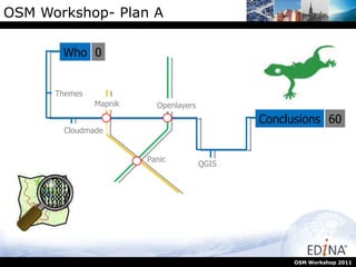
- 1. OSM Workshop- Plan A OSM Workshop 2011 Who Themes Cloudmade QGIS Conclusions 0 60 Panic Openlayers Mapnik
- 5. OSM - Pompeii OSM Workshop 2011
- 6. OSM - CERN OSM Workshop 2011
- 7. OSM - Bern OSM Workshop 2011
- 9. OSM – Edinburgh Zoo OSM Workshop 2011
- 10. OSM – Edinburgh Southside OSM Workshop 2011
- 11. Cloudmade OSM Workshop 2011 You will have seen the blue plus sign on the right hand side of the map window. This allows you to alter the look of the map. This is called altering the theme. Cloudmade is a company that spun out from OSM and they do consultancy work on and around OSM data. In addition they offer some neat tools for OSM.
- 12. Cloudmade OSM Workshop 2011 Cloudmade is a company that spun out from OSM and they do consultancy work on and around OSM data. In addition they offer some neat tools for OSM.
- 13. Cloudmade OSM Workshop 2011 Lets have a closer look at some of the themes that Cloudmade offer. To do this, we need to look at http://maps.cloudmade.com/
- 14. Cloudmade - themes OSM Workshop 2011
- 24. Shameful Plug I OSM Workshop 2011 All the data that i am going to overlay on OSM is available through www.sharegeo.ac.uk ShareGeo is a spatial data repository fro open data
- 25. QGIS main screen Add vector layer Layer list Map Window IWMW 2011
- 27. OGR2Layer Set an output folder Set map size IWMW 2011
- 34. Shameful plug II IWMW 2011
- 36. Campus Maps - Plan A IWMW 2011 Who Digimap ROAM Questions Conclusions 0 90 Confession Next Steps Practical
- 42. Google Earth IWMW 2011
- 46. Edinburgh Central Campus IWMW 2011
- 47. Kings Buildings IWMW 2011
- 48. Western General Hospital IWMW 2011
- 49. Easter Bush Issue with the buildings here, they are new and don’t appear on OS maps yet. IWMW 2011