![What is a Stream? … a body of water with a current, confined within a bed and streambanks Synonyms: bayou, beck, branch, brook, burn, creek, crick, kill, lick, rill, river, rivulet, run, slough, syke A stream is: ,[object Object]](data:image/gif;base64,R0lGODlhAQABAIAAAAAAAP///yH5BAEAAAAALAAAAAABAAEAAAIBRAA7)
Empfohlen
Empfohlen
Weitere ähnliche Inhalte
Was ist angesagt?
Was ist angesagt? (19)
Andere mochten auch
Andere mochten auch (14)
Ähnlich wie STREAM ASSESSMENT
Ähnlich wie STREAM ASSESSMENT (20)
Kürzlich hochgeladen
Kürzlich hochgeladen (20)
STREAM ASSESSMENT
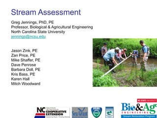
- 1. Stream Assessment Greg Jennings, PhD, PE Professor, Biological & Agricultural Engineering North Carolina State University jennings@ncsu.edu Jason Zink, PE Zan Price, PE Mike Shaffer, PE Dave Penrose Barbara Doll, PE Kris Bass, PE Karen Hall Mitch Woodward
- 5. Water Cycle Components: Precipitation Runoff Infiltration Evapotranspiration Groundwater flow
- 6. Average annual precipitation is highly variable and the timing of rainfall each year is unpredictable
- 8. Watershed: “Area of land that drains water, sediment, and dissolved materials to a common outlet at some point along a stream channel” Dunne and Leopold, 1978 Watershed form is influenced by: Climate Geology & Soils Fluvial Geomorphology Vegetation Land Uses
- 9. Watersheds include many land uses affecting flow and water quality
- 10. From Webster's Revised Unabridged Dictionary (1913) : Watershed, n [Cf. G. wasserscheide; wasserwater + scheidea place where two things separate, fr. scheidento separate.] The whole region or extent of country which contributes to the supply of a river or lake. The line of division between two adjacent rivers or lakes with respect to the flow of water by natural channels into them; the natural boundary of a basin. Other Terms: Catchment, Drainage basin, River basin
- 11. North Carolina River Basins River basins include watersheds of varying sizes and shapes, each with a network of streams delivering water to an outlet
- 12. Watershed Stream Network Neuse River Basin, NC
- 13. Watershed Functions: Transport & Storage: Water Sediment Dissolved Materials Habitat: Animals Plants Humans
- 14. Water Transport to Streams Rainfall moves across the land as runoff or through the ground toward streams to provide baseflow Stream Corridor Restoration: Principles, Processes, and Practices. 1998. Federal Interagency Stream Restoration Working Group.
- 15. Groundwater Influences Streamflow Losing Stream Gaining Stream Groundwater Recharge Groundwater Discharge Stream Corridor Restoration: Principles, Processes, and Practices. 1998. Federal Interagency Stream Restoration Working Group.
- 16. Streamflow Duration and Frequency: Classification based on connection to groundwater Perennial (gaining stream) Ephemeral (losing stream) Intermittent (sometimes losing)
- 18. Strahler Stream Order: Classification system describing position within the drainage network First order streams may be ephemeral, intermittent, or perennial in relation to groundwater connection Stream Corridor Restoration: Principles, Processes, and Practices. 1998. Federal Interagency Stream Restoration Working Group.
- 19. Stream Functions Transport water Transport sediment Habitat (aquatic & terrestrial) Recreation Aesthetics Safe Water Supply
- 20. Water Transport & Storage Hydrology: The study of the flow of the earth’s waters through the hydrologic cycle Hydrograph: Displays change in flow (discharge, Q, over time) Peak Flow Rising Limb Falling Limb Mean Daily Flow www.Geology.com
- 21. Hydrologic Responses to Urbanization Increased discharge Increased peak discharge Increased velocities Shorter time to peak flow More frequent bankfull events Increased flooding Lower baseflow Less ground water recharge
- 22. Hydrograph Changes Due to Urbanization Increased impervious surface results in more runoff and higher peak flow Urban Rural
- 23. Stream Condition Related to Impervious Surface Water quality and stream health decline in relation to impervious surface percentage Good Fair Poor Protected Impaired Urban Drainage Network Degraded Source: Center for Watershed Protection
- 24. Channel incision and bank erosion increase due to channelization and increased stormwater runoff
- 25. Urban streams have special challenges due to urban infrastructure (storm sewer and sanitary sewer)
- 26. In addition to stormwater and sewer systems, urban streams are also challenged by confinement
- 27. Fluvial Geomorphology: study of landforms and the fluvial processes that shape them
- 28. Fluvial Processes: associated with flowing water, including sediment erosion, transport, and deposition
- 30. Floodplain
- 31. Water
- 32. Sediment
- 33. Plants & animalsPhoto Credit: Eve Brantley, Auburn University
- 35. Channel
- 36. Confluence
- 37. Cutoff channel
- 38. Delta
- 39. Floodplain
- 40. Gorge
- 41. Gully
- 42. Meander
- 43. Oxbow lake
- 44. Pool
- 45. Riffle
- 46. Stream
- 47. Valley
- 48. Waterfall
- 51. Stream Ecosystems Mostly downstream fluxes of energy and matter Lateral and vertical connections to the riparian and hyporheic zones Courtesy of Francois Birgand, NCSU
- 53. Biological communities upstream and downstreamStream Corridor Restoration: Principles, Processes, and Practices. 1998. Federal Interagency Stream Restoration Working Group.
- 54. Hyporheic Zone
- 55. Field Investigations What is living in the stream? What are the physical and chemical conditions of the stream?
- 57. Regulating – climate, waste, nutrients
- 58. Supporting – water quality, pest control
- 59. Cultural – recreation, inspiration
- 61. What makes a stream healthy? Bed stability & diversity Sediment transport balance In-stream habitat & flow diversity Bank stability (native plant roots) Riparian buffer (streamside forest) Active floodplain Healthy watershed
- 63. Riffle/Pool sequences in alluvial streams
- 64. Step/Pool sequences in high-gradient streamsPhoto Credit: Eve Brantley, Auburn University
- 66. Plane bed – filling of pools
- 68. Alluvial bars and benches
- 71. Stream Habitats Macrohabitats: riffles, runs, pools, glides, steps, side channels Microhabitats: roots, leaf packs, wood, rocks, plants, hyporheic zone
- 72. Food Web
- 74. What habitats do you see? Pool Leaf Pack Wood Rocks Roots Riffle
- 76. Lack of wood, leaves, roots
- 81. Invasive plants
- 88. Point and nonpoint source pollution
- 95. Buffer removal
- 98. Habitat loss
- 100. Land loss
- 101. Safety concerns
- 103. Flooding
- 105. Stream Functions Transport water Transport sediment Habitat (aquatic & terrestrial) Recreation & aesthetics Safe Water Supply
- 106. Velocity & Discharge Q = VA = Discharge (cfs) V = Velocity (ft/s) A = Cross-Section Area (ft2) V related to slope, channel shape, and channel roughness Stream Corridor Restoration: Principles, Processes, and Practices. 1998. Federal Interagency Stream Restoration Working Group.
- 107. Manning Formula
- 109. A = 40 sq ft W = 22 ft R = 1.7 ft S = 0.010 ft/ft n = 0.040 V = 5.0 ft/s Q = 200 cfs A = 220 sq ft W = 55 ft R = 3.5 ft S = 0.004 ft/ft n = 0.035 V = 6.1 ft/s Q = 1350 cfs
- 111. Stream Corridor Longitudinal Profile Stream Corridor Restoration: Principles, Processes, and Practices. 1998. Federal Interagency Stream Restoration Working Group.
- 113. Transportation
- 117. Abrasion of heavy materials rolling on bottomhttp://www.uwsp.edu/gEo/faculty/ritter/geog101/textbook/fluvial_systems/geologic_work_of_streams.html
- 118. Transportation: Movement of material by water Stream Load includes: dissolved + suspended + bed load Capacity: maximum load that can be transported for a given discharge (increases with velocity and turbulence) Competence: largest size material that can be transported for a given discharge http://www.uwsp.edu/gEo/faculty/ritter/geog101/textbook/fluvial_systems/geologic_work_of_streams.html
- 119. Bedload is related to Discharge for Each River
- 120. Deposition: Aggradation: Raising the bed elevation Bars: Depositional areas that may change flow directions http://www.uwsp.edu/gEo/faculty/ritter/geog101/textbook/fluvial_systems/geologic_work_of_streams.html
- 121. Bed Material (Substrate) Silt/Clay: < 0.062 mm Sand: 0.062 – 2 mm Gravel: 2 – 64 mm Cobble: 64 – 256 mm Boulder: 256 – 2048 mm
- 122. Substrate CharacterizationWolman Pebble Count
- 123. High Slope Moderate Slope Low Slope Stream Corridor Restoration: Principles, Processes, and Practices. 1998. Federal Interagency Stream Restoration Working Group.
- 124. Velocity & Particle Size Determine Process V = 5 ft/s V = 1 ft/s http://www.uwsp.edu/gEo/faculty/ritter/geog101/textbook/fluvial_systems/geologic_work_of_streams.html
- 125. Shear Stress: fluid force per unit area acting on the streambed = Rs = Shear Stress (lb/ft2) = Unit Weight of Water = 62.4 lb/ft3 R = Hydraulic Radius (ft) = A / P S = Average Water Surface Slope (ft/ft) A = Riffle Cross-Section Area (ft2) P = Wetted Perimeter (ft) P = Wbkf +2*Dbkf (approx)
- 130. Lateral bar
- 131. Mid-channel bar
- 132. Transverse bar
- 134. Point Bars: Inside meander bends
- 135. Lateral Bars: Formed in straight channels
- 136. Lateral Bars: Formed in straight channels
- 137. Mid-channel Bars: Formed in over-wide channels
- 138. Transverse Bars: Formed in straight channels
- 139. Meandering Stream: Alluvial Forms Flow Downstream Floodplain Scarp Bankfull Stage Point Bar Pool Left Bank Right Bank Riffle Thalweg
- 140. Bankfull Stage “corresponds to the discharge at which channel maintenance is the most effective, that is, the discharge at which moving sediment, forming or removing bars, forming or changing bends and meanders, and generally doing work results in the average morphologic characteristics” (Dunne and Leopold,1978) Stream Corridor Restoration: Principles, Processes, and Practices. 1998. Federal Interagency Stream Restoration Working Group.
- 141. Bankfull
- 142. Channel Evolution (Succession) Response to incising forces Stream Corridor Restoration: Principles, Processes, and Practices. 1998. Federal Interagency Stream Restoration Working Group.
- 143. Terrace Bankfull
- 144. Incised System: Floodplain Creation Terrace Floodplain
- 145. Stream Morphology:size and shape of channel & floodplain (dimension, pattern, profile)
- 147. Valley type affects stream morphology Colluvium is loose sediment transported by gravity and deposited at the bottom of a slope. Alluvium is sediment deposited by a river in the channel or floodplain Alluvial valleys occur where sediment particles are dropped by slow-moving water.
- 148. Valley Types: (www.epa.gov/watertrain/stream_class) Valley Type II Moderately steep, gentle sloping side slopes often in colluvial valleys From EPA Watershed Academy: Fundamentals of the Rosgen Stream Classification System
- 149. Valley Types: (www.epa.gov/watertrain/stream_class) Valley Type VIII Wide, gentle valley slope with well-developed floodplain adjacent to river terraces From EPA Watershed Academy: Fundamentals of the Rosgen Stream Classification System
- 150. Stream Corridor Lateral Profile Stream Corridor Restoration: Principles, Processes, and Practices. 1998. Federal Interagency Stream Restoration Working Group.
- 151. Floodplains: Critical Stream Components
- 153. Reducing peak flows
- 154. Erosion prevention
- 155. Water quality
- 156. Groundwater recharge
- 157. Food & shade
- 159. Terrace Floodplain Left Bank Right Bank Thalweg Streambed Downstream
- 160. Terrace Floodplain Right Bank Left Bank Thalweg Streambed Downstream
- 161. Pool Cross-Section (Meandering Stream) Stream Corridor Restoration: Principles, Processes, and Practices. 1998. Federal Interagency Stream Restoration Working Group.
- 162. Natural Stream Channel Stability (from Leopold) River has a stable dimension, pattern and profile Maintains channel features (riffles, pools, steps) Does not aggrade (fills) or degrade (erodes)
- 164. Width
- 165. Depth
- 166. Width/Depth Ratio
- 167. Entrenchment Ratio
- 169. Terrace Bankfull
- 171. Riffle Dimensions Wbkf Bankfull Abkf dbkf Measure Bankfull Width (Wbkf) and Bankfull Area (Abkf) Mean Depth, dbkf = Abkf / Wbkf Width to Depth Ratio, W/d = Wbkf / dbkf
- 172. Bankfull Width, Wbkf = 9.3 ft; Bankfull Area, Abkf = 13.9 ft2 Mean Depth, dbkf= Abkf / Wbkf= 13.9 / 9.3 = 1.5 ft Width to Depth Ratio, W/d = Wbkf / dbkf = 9.3/ 1.5 = 6.2 Wbkf dbkf Abkf
- 173. Bankfull Width, Wbkf = 36 ft; Bankfull Area, Abkf = 112 ft2 Mean Depth, dbkf= Abkf / Wbkf= 112 / 36 = 3.1 ft Width to Depth Ratio, W/d = Wbkf / dbkf = 36/ 3.1 = 11.5 Wbkf Abkf dbkf
- 174. Entrenchment Ratio ER = Wfpa / Wbkf Wfpa= Width of Flood Prone Area measured at the elevation twice bankfull max depth above thalweg Wbkf= Width of Bankfull Channel Wfpa Bankfull 2 x dmbkf above thalweg dmbkf Wbkf
- 175. ER = Wfpa / Wbkf = 75/ 15 = 5.0 Wfpa Wbkf
- 176. Rocky Branch Phase II Reach 2: Priority 2 (floodplain excavation, C channel) Entrenchment Ratio = Wfpa / Wbkf = 90/20 = 4.5 Wfpa Wbkf Flood water flows onto floodplain several times each year
- 177. Rocky Branch Phase II Reach 1: Priority 3 (floodplain excavation, Bc channel) Entrenchment Ratio = Wfpa / Wbkf = 40/20 = 2 Wfpa Wbkf
- 178. Bank Height Ratio BHR = LBH / dmbkf LBH= Low Bank Height (Max Depth to thalweg) dmbkf= Max Depth from bankfull stage to thalweg Bankfull LBH dmbkf
- 179. BHR = 5.3 / 2.5 = 2.1 Top of Bank Bankfull dmax tob dmax
- 182. Pattern (plan form) Alluvial (low-gradient) streams naturally meander across a valley with a somewhat predictable pattern
- 183. Meandering Stream: Alluvial Forms Riffle Point Bar (deposition) Run Glide Pool
- 184. Stream Corridor Restoration: Principles, Processes, and Practices. 1998. Federal Interagency Stream Restoration Working Group.
- 185. Oxbow Formation in Meandering Streams Stream Corridor Restoration: Principles, Processes, and Practices. 1998. Federal Interagency Stream Restoration Working Group.
- 186. Chute cutoff across tight meander bend
- 187. Oxbows
- 188. Oxbows
- 189. Sinuosity = stream length / valley length K = 1850 / 980 = 1.9 Valley Length
- 191. Meander Length Ratio = meander length / width = 78/15 = 5.2 Meander Width Ratio = belt width / width = 57/15 = 3.8 Radius of Curvature Ratio = radius / width = 23/15 = 1.5 Belt Width Meander Length
- 192. Profile (bedform) Water Surface Riffle Slope Run Slope Glide Slope Pool Slope Thalweg Pool Spacing, Lp-p Riffle Slope Ratio, Srif / Sav Pool Slope Ratio, Spool/ Sav Pool-to-Pool Spacing Ratio, Lp-p/ Wbkf
- 193. Stream Bedform Variability:Slope Substrate size Velocity OxygenationShear stress Habitats
- 195. High velocity
- 196. High shear stress
- 197. Large substrate
- 200. Low velocity
- 201. Low shear stress
- 202. Small substrate
- 204. River Dimensions
- 205. Velocities:Low flow and Flood flow Little Garvin Creek, Clemson, SC
- 206. Channel dimensions in a meandering stream www.uwsp.edu/gEo/faculty/lemke/geomorphology/lecture_outlines/04_fluvial_landforms.html
- 207. Profile is related to Pattern
- 208. Stream Corridor Restoration: Principles, Processes, and Practices. 1998. Federal Interagency Stream Restoration Working Group.
- 209. Step Pool Streams (high gradient) Stream Corridor Restoration: Principles, Processes, and Practices. 1998. Federal Interagency Stream Restoration Working Group.
- 212. Steps
- 215. Depth
- 216. Slope
- 217. Velocity
- 218. Discharge
- 219. Flow resistance
- 220. Sediment size
- 221. Sediment loadLeopold et al (1964)
- 222. Channel Forming Discharges and Regional Curves
- 224. Bankfull discharge
- 226. Bankfull Discharge Flow fills active channel and spreads onto floodplain Represents break between channel & floodplain processes For channel in equilibrium, assumed to equal the effective discharge Return Period typically 1 to 2 years
- 227. Bankfull Stage “corresponds to the discharge at which channel maintenance is the most effective, that is, the discharge at which moving sediment, forming or removing bars, forming or changing bends and meanders, and generally doing work results in the average morphologic characteristics” (Dunne and Leopold,1978) Stream Corridor Restoration: Principles, Processes, and Practices. 1998. Federal Interagency Stream Restoration Working Group.
- 228. Bankfull
- 230. Break in slope on streambank
- 231. Top of point barBankfull Bankfull
- 232. Bankfull
- 233. Bankfull
- 234. Bankfull
- 235. Bankfull
- 236. Channel Evolution (Succession) Response to incising forces Stream Corridor Restoration: Principles, Processes, and Practices. 1998. Federal Interagency Stream Restoration Working Group.
- 237. Terrace Bankfull
- 238. Bankfull
- 240. Bankfull
- 241. Bankfull