SlideShare ist ein Scribd-Unternehmen logo
1 von 69
Near-Real Time Automatic MODIS Fire Information System for Active Fire Monitoring in Southeast Asia Geoinformatics Center School of Engineering & Technology (SET) Asian Institute of Technology (AIT) Bangkok, Thailand August  2010 Vivarad Phonekeo Ph. D. Senior Research Associate and MODIS Ground Receiving Stations Manager Geoinformatics Center (GIC) Asian Institute of Technology Affiliated Faculty Remote Sensing & GIS Field of Study Asian Institute of Technology vivarad@ait.ac.th, vivarad@gmail.com http://www.geoinfo.ait.ac.th/ web.ait.ac.th/~vivarad/
Contents ,[object Object],[object Object],[object Object]
[object Object]
[object Object],[object Object],[object Object]
www.geoinfo.ait.ac.th/modis
Brief about Terra/Aqua MODIS Program in GIC/AIT Terra  and  Aqua   MODIS  have been receiving and archiving at the Geoinformatics Center,AIT since  May 2001   and   June 2003 , respectively.  MODIS Program is the collaboration between  Geoinformatics Center in AIT ,  Yasuoka Laboratory  of Institute of Industrial Science (IIS) from University of Tokyo (Japan) and  Geo-Informatics and Space Technology Development Agency  or  GISTDA  (Thailand). MODIS data that daily receive at Geoinformatics Center are about  3  –  5 GB  in size for the  Level0  and about  7-10  GB after processing  to  Level1B . MODIS data are sending through the high speed Internet of  Thaisarn  network to  National Institute of Informatics (NII)  of Japan in  Level 0  and in  Level 1B  to  GISTDA   for archiving and distributing to users in Thailand  MODIS Data has  36  Bands from Visible to Thermal wavelength, and 3 spatial resolutions:  250m, 500m  and  1000m
Collaboration between AIT, IIS and GISTDA in MODIS Program GIC Terra/Aqua MODIS Collaboration Program
Terra/Aqua MODIS Receiving System in AIT  GIC/AIT
8.0 Terabytes Archiving and Processing System (since 2003) Terra/Aqua MODIS Processing System in AIT ,[object Object],[object Object],[object Object]
MODIS users in South and Southeast Asian Region Global/Regional Earth Environment Monitoring GIC/AIT Near Real time Automatic MODIS  Receiving, Processing and Transferring System MODIS Products Level 1B,  Level2,  Level 3
Terra/Aqua MODIS Receiving Coverage in AIT 2330 Km ,[object Object],[object Object],[object Object]
NII GISTDA IIS/U-Tokyo NECTEC AIT Thai, Asian, European users MAFFIN NIES Iwate-U Chiba-U Hirosaki-U Keio-U Thaisarn  (1Gbps) Terra/Aqua MODIS NOAA AVHRR Thaisarn   (50 Mbps) Terra/Aqua MODIS Data Transferring System  between Thailand and Japan via Thaisarn Network
Source: thaisarn.nectec.or.th
1. MODIS True Color 250m resolution 2. Active Fire and Thermal Anomalies (MOD14) 3. Ocean Color : 3.1 Sea Surface Temperature (MOD28) 3.2 Chlorophyll-a Concentration (MOD21) 4. Cloud Masking (MOD35) 5. NDVI 10-Day Composite MODIS Products available in Geoinformatics Center, AIT (MOD14) (MOD28) (MOD21) (MOD35) MODIS True Color  NDVI 10-Day Composite
MODIS Products under development in Geoinformatics Center, AIT ,[object Object],[object Object],[object Object],(MOD11) (MOD04)
Disaster Monitoring using MODIS data
Typhoon Monitoring using MODIS near the Philippines
Typhoon Conson  Aqua MODIS July 17, 2010 06:11 GMT (Source: GIC/AIT, Thailand) Typhoon Chanthu  Aqua MODIS July 22, 2010 06:29 GMT (Source: GIC/AIT, Thailand)
Tropical Typhoon – NARGIS (May 2008) April 03, 2008 04:13 GMT  May 05, 2008 04:13 GMT  The red arrow indicates one of the affected areas by Nargis
Flood Monitoring using MODIS in Laos and Thailand with comparison to JAXA ALOS PALSAR of August 18, 2008  August 15, 2008 06:42 GMT  April 09, 2008 03:36 GMT
Flooding in Pakistan (Terra MODIS on July 30, 2010 05:45 GMT ) Flooding in Bangladesh & India (Terra MODIS on Aug 02, 2010 04:43 GMT )
[object Object],[object Object],[object Object],[object Object]
Near Real-Time MODIS Fire Information System www.geoinfo.ait.ac.th/mod14/ MODIS Fire Product Generation System  MODIS Fire Validation  System  Concept, Structure & Modules ,[object Object],[object Object],[object Object],[object Object],on the internet NASA MODIS  Active Fire Product (MOD14) Production Code, version 4.3.2 MODIS Fire  Visualization  System  MODIS  Database & Statistical Analysis  System
Near Real-Time Automatic MODIS Fire Information System
Global Environmental Research using MODIS – MODIS Products –  MODIS Fire Product  (MOD14)
Global Environmental Research using MODIS – MODIS Products –  MODIS   Fire Product  (MOD14)
Global Environmental Research using MODIS – MODIS Products –  MODIS Fire Product  (MOD14)
Near Real-Time MODIS Fire Information System Laos, Thailand & Myanmar Mar 11,2007 06:59GMT AIT MODIS Fire Visualization System using MODIS True Color 250m & Google Earth
Near Real-Time MODIS Fire Information System Sumatra (Indonesia) Aqua MODIS Oct. 06, 2006 06:34 GMT Strong smoke from the wild fire location (shown by red arrow) are clearly visible Sumatra
Near Real-Time MODIS Fire Information System Kalimantan (Indonesia) Terra MODIS Nov. 04, 2006 02:59 Central Kalimantan
Near Real-Time MODIS Fire Information System Cambodia - Aqua MODIS January 20, 2008 06:40 GMT Cambodia Vietnam Mekong River
Thailand Myanmar Near Real-Time MODIS Fire Information System Myanmar & Thailand - Aqua MODIS March 22, 2008 06:52 GMT
 
Laos & Thailand - Aqua MODIS March 14, 2009 06:43 GMT
Russia - Terra MODIS August 03, 2010 08: 30 GMT
Forest Fire Risk Zone Mapping, Quang Ninh Province,  Vietnam Using MODIS Fire Product, ALOS AVNIR and Landsat ETM+ AIT JAXA Mini-Project 2007  Forest Fire Risk Zone Mapping
AMOUNT OF FIRE HOTSPOT DISTRIBUTION IN CENTRAL KALIMANTAN PROVINCE 2001 2002 2003 2004 2005 2006 Influence of Climate Variation and Vegetation Greenness on Fire Occurrence – A Case Study in Central Kalimantan Province,  Indonesia   AIT JAXA Mini-Project 2008-2009
[object Object],[object Object],[object Object],[object Object]
Near Real-time Automatic Active Fire and Thermal Anomalies Monitoring System for   Laos related to Forest Fire, Slash-and-burn and Shifting Cultivation Keywords :  forest fire, shifting cultivation, slash-burn cultivation, Daily  near real-time  automatic  fire monitoring using MODIS  1. Introduction: Shifting cultivation is the big problem  in Laos which links with poverty eradication. Therefore, the study on The forest fire and slash-burn using remote sensing and GIS technology will bring great benefit for Ministry of Agriculture and Forestry (MAF) and also for the Government of Laos. 2. Problem Can not indentify the  location of fire  in the uplands of the Northern part of Laos, which is  difficult for decision making  for development programs. 3. Objectives: 3.1 Demonstration of the Existing System for Southeast Asian Region. 3.2 Development of the  Extended System  for Laos 3.3 Application of the  Extended System  for  burn area estimation 4. Methodology See the flowchart of the system in next slide ,[object Object],[object Object],[object Object],[object Object],[object Object]
Developed & opened to public Terra ASTER  specifications MODIS RGB 721 ASTER, Landsat      Under development Flowchart of the Development System for Monitoring in Regional Level System for Monitoring in Country Level Burning Area Estimation
Allocation of nearest villages to the detected active fire pixels  (under development)
MODIS Fire Monitoring System for Laos  Thailand Cambodia Vietnam China
MODIS Fire Monitoring System for Laos


Locations of Active Fire Detected by MODIS in Laos for March 2008, 2009 and 2010 (fire confidence 90-100%) March 01-31, 2008 March 01-31, 2009 March 01-31, 2010
MODIS Fire Product – Visualization of Burning Area
Location of the study area  in Chomphet (orange) and Xieng-Ngeun (green) districts with field survey sites of burned area (yellow point) and active fire (fire icon) conducted in March 2010 Chomphet Luang Prabang Province, Laos Xieng-Ngeun Thailand Vietnam Cambodia China Laos
Burning area and active fires detected on March 23-24, 2010 by MODIS
Burning area and active fires detected on March 23-24, 2010 by MODIS  (zoom-in to surveyed sites a1,a2,a3 and a4)
Possible matching between MODIS active fire pixels (1km x 1km) , burning area (250m x 250m) and surveyed burned area
 
 
Smoke and Haze in Luang Prabang city, Laos March 2010 – urban air pollution March 25, 2010 March 26, 2010 Surveyed sites for active forest fire and burned area in Chomphet district, Luang Prabang province , Laos. March 24, 2010 March 24, 2010 15:05 – site a6 March 24, 2010 10:24 – site a1
[object Object],[object Object],[object Object],[object Object],[object Object],[object Object],[object Object],[object Object],[object Object],[object Object],[object Object],[object Object],[object Object],[object Object],[object Object],[object Object],[object Object],[object Object],[object Object],[object Object],[object Object],[object Object],[object Object],[object Object],[object Object]
International MODIS Education, Training and Collaborations Activities MODIS Ocean Color for Sri Lanka (Apr. 2008) MODIS processing for South-Africa (Apr. 2008) Training on MODIS Data Usage for Information Computer Center (ICC) of Mongolia (Mar. 03 – 28, 2008 ) International EOS/NPP Direct Readout Meeting (Mar. 2008)  Indonesia Forest Fire group Presentation on Fire Monitoring in Laos,  Mar. 2010
Further Collaboration on Fire Monitoring in Thailand ,[object Object],[object Object],[object Object],Fire Control Station at Doitung Royal area, Chiang Rai province, Thailand
END OF PRESENTATION [email_address] [email_address]

Weitere ähnliche Inhalte

Ähnlich wie Near-Real Time MODIS Fire Monitoring System for Southeast Asia

EODATASERVICE.ORG - Digital Earth Platform to enable Muti-disciplinary Geospa...
EODATASERVICE.ORG - Digital Earth Platform to enable Muti-disciplinary Geospa...EODATASERVICE.ORG - Digital Earth Platform to enable Muti-disciplinary Geospa...
EODATASERVICE.ORG - Digital Earth Platform to enable Muti-disciplinary Geospa...EUDAT
 
Cambridge University Geospatial Metadata Workshop 20110524
Cambridge University Geospatial Metadata Workshop 20110524Cambridge University Geospatial Metadata Workshop 20110524
Cambridge University Geospatial Metadata Workshop 20110524EDINA, University of Edinburgh
 
Northumbria University Geospatial Metadata Workshop 20110505
Northumbria University Geospatial Metadata Workshop 20110505Northumbria University Geospatial Metadata Workshop 20110505
Northumbria University Geospatial Metadata Workshop 20110505EDINA, University of Edinburgh
 
Oxford University Geospatial Metadata Workshop 20110415
Oxford University Geospatial Metadata Workshop 20110415Oxford University Geospatial Metadata Workshop 20110415
Oxford University Geospatial Metadata Workshop 20110415EDINA, University of Edinburgh
 
RAIDEG Presentation Gillie Cheelo_FINAL_DRAFT2
RAIDEG Presentation Gillie Cheelo_FINAL_DRAFT2RAIDEG Presentation Gillie Cheelo_FINAL_DRAFT2
RAIDEG Presentation Gillie Cheelo_FINAL_DRAFT2Gillie Cheelo
 
Leeds University Geospatial Metadata Workshop 20110617
Leeds University Geospatial Metadata Workshop 20110617Leeds University Geospatial Metadata Workshop 20110617
Leeds University Geospatial Metadata Workshop 20110617EDINA, University of Edinburgh
 
Module 10 - Section 6 ICTs for climate change adaptation 20110904
Module 10 - Section 6 ICTs for climate change adaptation 20110904Module 10 - Section 6 ICTs for climate change adaptation 20110904
Module 10 - Section 6 ICTs for climate change adaptation 20110904Richard Labelle
 
WaPOR version 3 - Annemarie Klaasse - eLeaf - 05 May 2023.pdf
WaPOR version 3 - Annemarie Klaasse - eLeaf - 05 May 2023.pdfWaPOR version 3 - Annemarie Klaasse - eLeaf - 05 May 2023.pdf
WaPOR version 3 - Annemarie Klaasse - eLeaf - 05 May 2023.pdfWaPOR
 
Workshop usgs brasil_2015_01
Workshop usgs brasil_2015_01Workshop usgs brasil_2015_01
Workshop usgs brasil_2015_01Terra-i
 
5.3 Produits & Services en Observation de la Terre au service de la coopérati...
5.3 Produits & Services en Observation de la Terre au service de la coopérati...5.3 Produits & Services en Observation de la Terre au service de la coopérati...
5.3 Produits & Services en Observation de la Terre au service de la coopérati...grisicap
 
GEO Expert Advisory Group - ESA Thematic Exploitation Platforms - Geohazards
GEO Expert Advisory Group - ESA Thematic Exploitation Platforms - GeohazardsGEO Expert Advisory Group - ESA Thematic Exploitation Platforms - Geohazards
GEO Expert Advisory Group - ESA Thematic Exploitation Platforms - Geohazardsterradue
 
Modis Product Extractor Turorial
Modis Product Extractor TurorialModis Product Extractor Turorial
Modis Product Extractor TurorialSohrab Kolsoumi
 
DSD-SEA 2023 Global to local multi-hazard forecasting - Yan
DSD-SEA 2023 Global to local multi-hazard forecasting - YanDSD-SEA 2023 Global to local multi-hazard forecasting - Yan
DSD-SEA 2023 Global to local multi-hazard forecasting - YanDeltares
 
Application packaging and systematic processing in earth observation exploita...
Application packaging and systematic processing in earth observation exploita...Application packaging and systematic processing in earth observation exploita...
Application packaging and systematic processing in earth observation exploita...terradue
 

Ähnlich wie Near-Real Time MODIS Fire Monitoring System for Southeast Asia (20)

Spce technologies for disaster in thailand
Spce technologies for disaster in thailandSpce technologies for disaster in thailand
Spce technologies for disaster in thailand
 
EODATASERVICE.ORG - Digital Earth Platform to enable Muti-disciplinary Geospa...
EODATASERVICE.ORG - Digital Earth Platform to enable Muti-disciplinary Geospa...EODATASERVICE.ORG - Digital Earth Platform to enable Muti-disciplinary Geospa...
EODATASERVICE.ORG - Digital Earth Platform to enable Muti-disciplinary Geospa...
 
Cambridge University Geospatial Metadata Workshop 20110524
Cambridge University Geospatial Metadata Workshop 20110524Cambridge University Geospatial Metadata Workshop 20110524
Cambridge University Geospatial Metadata Workshop 20110524
 
Northumbria University Geospatial Metadata Workshop 20110505
Northumbria University Geospatial Metadata Workshop 20110505Northumbria University Geospatial Metadata Workshop 20110505
Northumbria University Geospatial Metadata Workshop 20110505
 
Oxford University Geospatial Metadata Workshop 20110415
Oxford University Geospatial Metadata Workshop 20110415Oxford University Geospatial Metadata Workshop 20110415
Oxford University Geospatial Metadata Workshop 20110415
 
RAIDEG Presentation Gillie Cheelo_FINAL_DRAFT2
RAIDEG Presentation Gillie Cheelo_FINAL_DRAFT2RAIDEG Presentation Gillie Cheelo_FINAL_DRAFT2
RAIDEG Presentation Gillie Cheelo_FINAL_DRAFT2
 
Geospatial Metadata Workshop
Geospatial Metadata WorkshopGeospatial Metadata Workshop
Geospatial Metadata Workshop
 
Geospatial Metadata Workshop
Geospatial Metadata WorkshopGeospatial Metadata Workshop
Geospatial Metadata Workshop
 
Geospatial Metadata Workshop
Geospatial Metadata WorkshopGeospatial Metadata Workshop
Geospatial Metadata Workshop
 
Leeds University Geospatial Metadata Workshop 20110617
Leeds University Geospatial Metadata Workshop 20110617Leeds University Geospatial Metadata Workshop 20110617
Leeds University Geospatial Metadata Workshop 20110617
 
EOSC-hub & Geohazards TEP
EOSC-hub & Geohazards TEPEOSC-hub & Geohazards TEP
EOSC-hub & Geohazards TEP
 
Module 10 - Section 6 ICTs for climate change adaptation 20110904
Module 10 - Section 6 ICTs for climate change adaptation 20110904Module 10 - Section 6 ICTs for climate change adaptation 20110904
Module 10 - Section 6 ICTs for climate change adaptation 20110904
 
WaPOR version 3 - Annemarie Klaasse - eLeaf - 05 May 2023.pdf
WaPOR version 3 - Annemarie Klaasse - eLeaf - 05 May 2023.pdfWaPOR version 3 - Annemarie Klaasse - eLeaf - 05 May 2023.pdf
WaPOR version 3 - Annemarie Klaasse - eLeaf - 05 May 2023.pdf
 
Glasgow University Geo Metadata Workshop
Glasgow University Geo Metadata WorkshopGlasgow University Geo Metadata Workshop
Glasgow University Geo Metadata Workshop
 
Workshop usgs brasil_2015_01
Workshop usgs brasil_2015_01Workshop usgs brasil_2015_01
Workshop usgs brasil_2015_01
 
5.3 Produits & Services en Observation de la Terre au service de la coopérati...
5.3 Produits & Services en Observation de la Terre au service de la coopérati...5.3 Produits & Services en Observation de la Terre au service de la coopérati...
5.3 Produits & Services en Observation de la Terre au service de la coopérati...
 
GEO Expert Advisory Group - ESA Thematic Exploitation Platforms - Geohazards
GEO Expert Advisory Group - ESA Thematic Exploitation Platforms - GeohazardsGEO Expert Advisory Group - ESA Thematic Exploitation Platforms - Geohazards
GEO Expert Advisory Group - ESA Thematic Exploitation Platforms - Geohazards
 
Modis Product Extractor Turorial
Modis Product Extractor TurorialModis Product Extractor Turorial
Modis Product Extractor Turorial
 
DSD-SEA 2023 Global to local multi-hazard forecasting - Yan
DSD-SEA 2023 Global to local multi-hazard forecasting - YanDSD-SEA 2023 Global to local multi-hazard forecasting - Yan
DSD-SEA 2023 Global to local multi-hazard forecasting - Yan
 
Application packaging and systematic processing in earth observation exploita...
Application packaging and systematic processing in earth observation exploita...Application packaging and systematic processing in earth observation exploita...
Application packaging and systematic processing in earth observation exploita...
 

Mehr von Institute of Space Knowledge Development

Disease Epidemic and Severity of Rice Blast, Rice Brown Spot and Rice Narrow...
Disease Epidemic and Severity of  Rice Blast, Rice Brown Spot and Rice Narrow...Disease Epidemic and Severity of  Rice Blast, Rice Brown Spot and Rice Narrow...
Disease Epidemic and Severity of Rice Blast, Rice Brown Spot and Rice Narrow...Institute of Space Knowledge Development
 
An application of theos data for the encroachment of agriculture on forest re...
An application of theos data for the encroachment of agriculture on forest re...An application of theos data for the encroachment of agriculture on forest re...
An application of theos data for the encroachment of agriculture on forest re...Institute of Space Knowledge Development
 
Progress of land ecosystem studies with geo information and space technology ...
Progress of land ecosystem studies with geo information and space technology ...Progress of land ecosystem studies with geo information and space technology ...
Progress of land ecosystem studies with geo information and space technology ...Institute of Space Knowledge Development
 

Mehr von Institute of Space Knowledge Development (17)

Flood hazard mapping four provinces of cambodia
Flood hazard mapping four provinces of cambodiaFlood hazard mapping four provinces of cambodia
Flood hazard mapping four provinces of cambodia
 
Future direction of geoinfomatics
Future direction of geoinfomaticsFuture direction of geoinfomatics
Future direction of geoinfomatics
 
Drought risk and crisis management cambodia
Drought risk and crisis management cambodiaDrought risk and crisis management cambodia
Drought risk and crisis management cambodia
 
Rain triggered landslide hazard analysis
Rain triggered landslide hazard analysisRain triggered landslide hazard analysis
Rain triggered landslide hazard analysis
 
Current trends of disasters in the asia pacific region
Current trends of disasters in the asia pacific regionCurrent trends of disasters in the asia pacific region
Current trends of disasters in the asia pacific region
 
Realixing a national disaster risk reduction program
Realixing a national disaster risk reduction programRealixing a national disaster risk reduction program
Realixing a national disaster risk reduction program
 
Summery of project outcome
Summery of project outcomeSummery of project outcome
Summery of project outcome
 
ADRC Activities & Project introduction
ADRC Activities & Project introductionADRC Activities & Project introduction
ADRC Activities & Project introduction
 
Geo informatics for land suitability in growing certain crops
Geo  informatics for land suitability in growing certain cropsGeo  informatics for land suitability in growing certain crops
Geo informatics for land suitability in growing certain crops
 
Accurate satellite mapping for government agricultural management
Accurate satellite mapping for government agricultural managementAccurate satellite mapping for government agricultural management
Accurate satellite mapping for government agricultural management
 
Application of satellite imagery
Application of satellite imageryApplication of satellite imagery
Application of satellite imagery
 
Disease Epidemic and Severity of Rice Blast, Rice Brown Spot and Rice Narrow...
Disease Epidemic and Severity of  Rice Blast, Rice Brown Spot and Rice Narrow...Disease Epidemic and Severity of  Rice Blast, Rice Brown Spot and Rice Narrow...
Disease Epidemic and Severity of Rice Blast, Rice Brown Spot and Rice Narrow...
 
An application of theos data for the encroachment of agriculture on forest re...
An application of theos data for the encroachment of agriculture on forest re...An application of theos data for the encroachment of agriculture on forest re...
An application of theos data for the encroachment of agriculture on forest re...
 
Polarization signature analysis of paddy rice in southern china
Polarization signature analysis of paddy rice in southern chinaPolarization signature analysis of paddy rice in southern china
Polarization signature analysis of paddy rice in southern china
 
Agriculture drought with remote sensing
Agriculture drought with remote sensingAgriculture drought with remote sensing
Agriculture drought with remote sensing
 
Approaches to exploring drought using satellite data
Approaches to exploring drought using satellite dataApproaches to exploring drought using satellite data
Approaches to exploring drought using satellite data
 
Progress of land ecosystem studies with geo information and space technology ...
Progress of land ecosystem studies with geo information and space technology ...Progress of land ecosystem studies with geo information and space technology ...
Progress of land ecosystem studies with geo information and space technology ...
 

Near-Real Time MODIS Fire Monitoring System for Southeast Asia

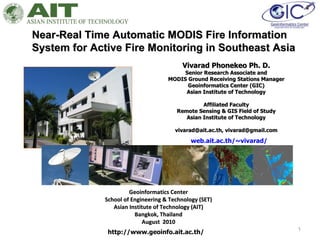
  • 1. Near-Real Time Automatic MODIS Fire Information System for Active Fire Monitoring in Southeast Asia Geoinformatics Center School of Engineering & Technology (SET) Asian Institute of Technology (AIT) Bangkok, Thailand August 2010 Vivarad Phonekeo Ph. D. Senior Research Associate and MODIS Ground Receiving Stations Manager Geoinformatics Center (GIC) Asian Institute of Technology Affiliated Faculty Remote Sensing & GIS Field of Study Asian Institute of Technology vivarad@ait.ac.th, vivarad@gmail.com http://www.geoinfo.ait.ac.th/ web.ait.ac.th/~vivarad/
  • 2.
  • 3.
  • 4.
  • 6. Brief about Terra/Aqua MODIS Program in GIC/AIT Terra and Aqua MODIS have been receiving and archiving at the Geoinformatics Center,AIT since May 2001 and June 2003 , respectively. MODIS Program is the collaboration between Geoinformatics Center in AIT , Yasuoka Laboratory of Institute of Industrial Science (IIS) from University of Tokyo (Japan) and Geo-Informatics and Space Technology Development Agency or GISTDA (Thailand). MODIS data that daily receive at Geoinformatics Center are about 3 – 5 GB in size for the Level0 and about 7-10 GB after processing to Level1B . MODIS data are sending through the high speed Internet of Thaisarn network to National Institute of Informatics (NII) of Japan in Level 0 and in Level 1B to GISTDA for archiving and distributing to users in Thailand MODIS Data has 36 Bands from Visible to Thermal wavelength, and 3 spatial resolutions: 250m, 500m and 1000m
  • 7. Collaboration between AIT, IIS and GISTDA in MODIS Program GIC Terra/Aqua MODIS Collaboration Program
  • 8. Terra/Aqua MODIS Receiving System in AIT GIC/AIT
  • 9.
  • 10. MODIS users in South and Southeast Asian Region Global/Regional Earth Environment Monitoring GIC/AIT Near Real time Automatic MODIS Receiving, Processing and Transferring System MODIS Products Level 1B, Level2, Level 3
  • 11.
  • 12. NII GISTDA IIS/U-Tokyo NECTEC AIT Thai, Asian, European users MAFFIN NIES Iwate-U Chiba-U Hirosaki-U Keio-U Thaisarn (1Gbps) Terra/Aqua MODIS NOAA AVHRR Thaisarn (50 Mbps) Terra/Aqua MODIS Data Transferring System between Thailand and Japan via Thaisarn Network
  • 14. 1. MODIS True Color 250m resolution 2. Active Fire and Thermal Anomalies (MOD14) 3. Ocean Color : 3.1 Sea Surface Temperature (MOD28) 3.2 Chlorophyll-a Concentration (MOD21) 4. Cloud Masking (MOD35) 5. NDVI 10-Day Composite MODIS Products available in Geoinformatics Center, AIT (MOD14) (MOD28) (MOD21) (MOD35) MODIS True Color NDVI 10-Day Composite
  • 15.
  • 17. Typhoon Monitoring using MODIS near the Philippines
  • 18. Typhoon Conson Aqua MODIS July 17, 2010 06:11 GMT (Source: GIC/AIT, Thailand) Typhoon Chanthu Aqua MODIS July 22, 2010 06:29 GMT (Source: GIC/AIT, Thailand)
  • 19. Tropical Typhoon – NARGIS (May 2008) April 03, 2008 04:13 GMT May 05, 2008 04:13 GMT The red arrow indicates one of the affected areas by Nargis
  • 20. Flood Monitoring using MODIS in Laos and Thailand with comparison to JAXA ALOS PALSAR of August 18, 2008 August 15, 2008 06:42 GMT April 09, 2008 03:36 GMT
  • 21. Flooding in Pakistan (Terra MODIS on July 30, 2010 05:45 GMT ) Flooding in Bangladesh & India (Terra MODIS on Aug 02, 2010 04:43 GMT )
  • 22.
  • 23.
  • 24. Near Real-Time Automatic MODIS Fire Information System
  • 25. Global Environmental Research using MODIS – MODIS Products – MODIS Fire Product (MOD14)
  • 26. Global Environmental Research using MODIS – MODIS Products – MODIS Fire Product (MOD14)
  • 27. Global Environmental Research using MODIS – MODIS Products – MODIS Fire Product (MOD14)
  • 28. Global Environmental Research using MODIS – MODIS Products – MODIS Fire Product (MOD14)
  • 29. Global Environmental Research using MODIS – MODIS Products – MODIS Fire Product (MOD14)
  • 30. Global Environmental Research using MODIS – MODIS Products – MODIS Fire Product (MOD14)
  • 31. Near Real-Time MODIS Fire Information System Laos, Thailand & Myanmar Mar 11,2007 06:59GMT AIT MODIS Fire Visualization System using MODIS True Color 250m & Google Earth
  • 32. Near Real-Time MODIS Fire Information System Laos, Thailand & Myanmar Mar 11,2007 06:59GMT AIT MODIS Fire Visualization System using MODIS True Color 250m & Google Earth
  • 33. Near Real-Time MODIS Fire Information System Laos, Thailand & Myanmar Mar 11,2007 06:59GMT AIT MODIS Fire Visualization System using MODIS True Color 250m & Google Earth
  • 34. Near Real-Time MODIS Fire Information System Laos, Thailand & Myanmar Mar 11,2007 06:59GMT AIT MODIS Fire Visualization System using MODIS True Color 250m & Google Earth
  • 35. Near Real-Time MODIS Fire Information System Laos, Thailand & Myanmar Mar 11,2007 06:59GMT AIT MODIS Fire Visualization System using MODIS True Color 250m & Google Earth
  • 36. Near Real-Time MODIS Fire Information System Sumatra (Indonesia) Aqua MODIS Oct. 06, 2006 06:34 GMT Strong smoke from the wild fire location (shown by red arrow) are clearly visible Sumatra
  • 37. Near Real-Time MODIS Fire Information System Kalimantan (Indonesia) Terra MODIS Nov. 04, 2006 02:59 Central Kalimantan
  • 38. Near Real-Time MODIS Fire Information System Cambodia - Aqua MODIS January 20, 2008 06:40 GMT Cambodia Vietnam Mekong River
  • 39. Thailand Myanmar Near Real-Time MODIS Fire Information System Myanmar & Thailand - Aqua MODIS March 22, 2008 06:52 GMT
  • 40.  
  • 41. Laos & Thailand - Aqua MODIS March 14, 2009 06:43 GMT
  • 42. Russia - Terra MODIS August 03, 2010 08: 30 GMT
  • 43. Forest Fire Risk Zone Mapping, Quang Ninh Province, Vietnam Using MODIS Fire Product, ALOS AVNIR and Landsat ETM+ AIT JAXA Mini-Project 2007 Forest Fire Risk Zone Mapping
  • 44. AMOUNT OF FIRE HOTSPOT DISTRIBUTION IN CENTRAL KALIMANTAN PROVINCE 2001 2002 2003 2004 2005 2006 Influence of Climate Variation and Vegetation Greenness on Fire Occurrence – A Case Study in Central Kalimantan Province, Indonesia AIT JAXA Mini-Project 2008-2009
  • 45.
  • 46.
  • 47. Developed & opened to public Terra ASTER specifications MODIS RGB 721 ASTER, Landsat      Under development Flowchart of the Development System for Monitoring in Regional Level System for Monitoring in Country Level Burning Area Estimation
  • 48. Allocation of nearest villages to the detected active fire pixels (under development)
  • 49. MODIS Fire Monitoring System for Laos Thailand Cambodia Vietnam China
  • 50. MODIS Fire Monitoring System for Laos
  • 51.  
  • 52.  
  • 53.  
  • 54.  
  • 55. Locations of Active Fire Detected by MODIS in Laos for March 2008, 2009 and 2010 (fire confidence 90-100%) March 01-31, 2008 March 01-31, 2009 March 01-31, 2010
  • 56. MODIS Fire Product – Visualization of Burning Area
  • 57. MODIS Fire Product – Visualization of Burning Area
  • 58. Location of the study area in Chomphet (orange) and Xieng-Ngeun (green) districts with field survey sites of burned area (yellow point) and active fire (fire icon) conducted in March 2010 Chomphet Luang Prabang Province, Laos Xieng-Ngeun Thailand Vietnam Cambodia China Laos
  • 59. Burning area and active fires detected on March 23-24, 2010 by MODIS
  • 60. Burning area and active fires detected on March 23-24, 2010 by MODIS (zoom-in to surveyed sites a1,a2,a3 and a4)
  • 61. Burning area and active fires detected on March 23-24, 2010 by MODIS (zoom-in to surveyed sites a1,a2,a3 and a4)
  • 62. Possible matching between MODIS active fire pixels (1km x 1km) , burning area (250m x 250m) and surveyed burned area
  • 63.  
  • 64.  
  • 65. Smoke and Haze in Luang Prabang city, Laos March 2010 – urban air pollution March 25, 2010 March 26, 2010 Surveyed sites for active forest fire and burned area in Chomphet district, Luang Prabang province , Laos. March 24, 2010 March 24, 2010 15:05 – site a6 March 24, 2010 10:24 – site a1
  • 66.
  • 67. International MODIS Education, Training and Collaborations Activities MODIS Ocean Color for Sri Lanka (Apr. 2008) MODIS processing for South-Africa (Apr. 2008) Training on MODIS Data Usage for Information Computer Center (ICC) of Mongolia (Mar. 03 – 28, 2008 ) International EOS/NPP Direct Readout Meeting (Mar. 2008) Indonesia Forest Fire group Presentation on Fire Monitoring in Laos, Mar. 2010
  • 68.
  • 69. END OF PRESENTATION [email_address] [email_address]