SlideShare ist ein Scribd-Unternehmen logo
1 von 16
Downloaden Sie, um offline zu lesen
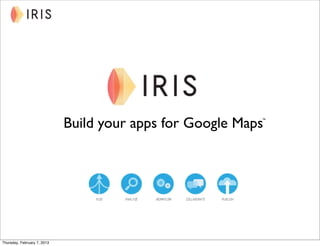
Build your apps for Google Maps
                                                           ™


Thursday, February 7, 2013
Problems to solve

                             Information infrastructure dilemma
                              Related business & geospatial data spread across systems
                              Access to data and applications limited to siloed users
                              Pace of technology change outstrips current installed


                             Wants and needs
                              Integrated data from GIS and business systems
                              Publish curated views of data to a wider audience
                              Initiate action based on combined data
                              Leverage new technology


Thursday, February 7, 2013
Google + IRIS = business direction

                             Power of Google Maps Technology
                              Computing power: unsurpassed ability to deliver cloud infrastructure
                              Content: unmatched quantity, quality, and diverse data types
                              Access: available on tablet, browser, portable, and smartphone
                              Easy to use, everyone knows how to use Google Maps


                             IRIS Platform-as-a-Service (PaaS)
                              Integrate data from disparate business and geospatial sources and systems
                              Configure (not code) use-case apps to address your business problems
                              Customized to your design and your controls
                              Leverage your current data, applications, and people


                                      Next Generation geospatial business solutions


Thursday, February 7, 2013
Google Maps Engine


                             Organizing the world’s information
                             geographically

                             Most widely understood geospatial
                             product in the world

                             Scale of Google is unrivaled


Thursday, February 7, 2013
Easy to use services to configure IRIS apps

                             Fuse
                             Fuse business and geo-located data sets from different internal systems and
                             external sources to create an integrated data set that can be actioned


                             Analyze
                             Extract meaning and insight from your integrated data sets with easy to use query
                             and geospatial tools


                             Workflow
                             Define workflows and rule sets that support business processes and enforce
                             business rules that enhance productivity and improves decision making


                             Collaborate
                             Create audience specific views and push new information to interested parties
                             using notifications to keep everyone on the same page and up to date


                             Publish
                             Publish views and perspectives of maps and business data to a variety of audiences
                             using the same data sets
Thursday, February 7, 2013
Configuring an IRIS app (four steps)

                             Step 1
                             Choose and import the desire business and geospatial data sets you wish to work
                             with and make actionable


                             Step 2
                             Configure what you want to see on the IRIS app from the integrated data sets.


                             Step 3
                             Configure how you want to analyze the data and what collaboration and
                             workflow services you wish to apply to the integrated data sets


                             Step 4
                             Publish the views or perspectives you wish to share with different internal and
                             external audiences


Thursday, February 7, 2013
Iris apps use-cases

                             Distribution
                              Marketing smart meters
                              Evacuation safety monitoring program
                              Utility project notification


                             Transmission
                              Transmission line encroachment
                              High consequence area and change detection
                              Coordination of multiple division projects


                             Other
                              Municipal consent / notice of intent
                              Public or citizens view


Thursday, February 7, 2013
Marketing smart meters


Thursday, February 7, 2013
Evacuation safety monitoring program


Thursday, February 7, 2013
Utility project notification


Thursday, February 7, 2013
Transmission line encroachment


Thursday, February 7, 2013
High consequence areas


Thursday, February 7, 2013
Coordination of multiple division projects


Thursday, February 7, 2013
Municipal consent / notice of intent


Thursday, February 7, 2013
Public or citizens view


Thursday, February 7, 2013
Learn more

                             Website
                              www.irismaps.com


                             YouTube Channel
                              http://www.youtube.com/user/EnvistaIRIS


                             Twitter
                              @irismaps


Thursday, February 7, 2013

Weitere ähnliche Inhalte

Ähnlich wie Build apps for Google Maps with IRIS

GIS Technology & Mobile Applications - MTASC 2011 Conference
GIS Technology & Mobile Applications - MTASC 2011 ConferenceGIS Technology & Mobile Applications - MTASC 2011 Conference
GIS Technology & Mobile Applications - MTASC 2011 ConferenceJim Tochterman
 
BK2015 åpningen Esri uk - dominic stubbins - the geographic renaissance
BK2015 åpningen   Esri uk - dominic stubbins - the geographic renaissanceBK2015 åpningen   Esri uk - dominic stubbins - the geographic renaissance
BK2015 åpningen Esri uk - dominic stubbins - the geographic renaissanceGeodata AS
 
The Changing Face of Asia's Geospatial Intelligence
The Changing Face of Asia's Geospatial Intelligence The Changing Face of Asia's Geospatial Intelligence
The Changing Face of Asia's Geospatial Intelligence Darwin Jayson Mariano
 
Webinar: The Enterrpise Appstore - What is it and why you need it.
Webinar: The Enterrpise Appstore - What is it and why you need it.Webinar: The Enterrpise Appstore - What is it and why you need it.
Webinar: The Enterrpise Appstore - What is it and why you need it.Appear
 
Visually enabled business processes to enrich the user experience
Visually enabled business processes to enrich the user experienceVisually enabled business processes to enrich the user experience
Visually enabled business processes to enrich the user experiencerobgirvan
 
Service & assets news and solutions
Service & assets news and solutionsService & assets news and solutions
Service & assets news and solutionsIFS
 
Mobilizing Enterprise Data - Strategies to succeed in enterprise mobile
Mobilizing Enterprise Data - Strategies to succeed in enterprise mobileMobilizing Enterprise Data - Strategies to succeed in enterprise mobile
Mobilizing Enterprise Data - Strategies to succeed in enterprise mobileAlex Zaltsman
 
Geo location based augmented reality application
Geo location based augmented reality applicationGeo location based augmented reality application
Geo location based augmented reality applicationeSAT Journals
 
UXT Chicago - Designing Mobile Apps for Enterprise Use
UXT Chicago - Designing Mobile Apps for Enterprise UseUXT Chicago - Designing Mobile Apps for Enterprise Use
UXT Chicago - Designing Mobile Apps for Enterprise UseJeff Steffgen
 
Enterprise Appstore webinar FEB13
Enterprise Appstore webinar FEB13Enterprise Appstore webinar FEB13
Enterprise Appstore webinar FEB13Peter J. Melander
 
Open Data Open Innovation and The Cloud gayler berlin nov12
Open Data Open Innovation and The Cloud   gayler berlin nov12Open Data Open Innovation and The Cloud   gayler berlin nov12
Open Data Open Innovation and The Cloud gayler berlin nov12Mark Gayler
 
InfoSphere BigInsights
InfoSphere BigInsightsInfoSphere BigInsights
InfoSphere BigInsightsWilfried Hoge
 
Sdi technologies and implementation patterns (compress)
Sdi technologies and implementation patterns (compress)Sdi technologies and implementation patterns (compress)
Sdi technologies and implementation patterns (compress)Marco Wagemakers
 
Mobile Enterprise Dashboards by RapidValue Solutions
Mobile Enterprise Dashboards by RapidValue SolutionsMobile Enterprise Dashboards by RapidValue Solutions
Mobile Enterprise Dashboards by RapidValue SolutionsRapidValue
 
GIS framework for developing countries
GIS framework for developing countriesGIS framework for developing countries
GIS framework for developing countriesAchini Samuditha
 
Mobilizing Enterprise Data for mobile apps and platforms
Mobilizing Enterprise Data for mobile apps and platformsMobilizing Enterprise Data for mobile apps and platforms
Mobilizing Enterprise Data for mobile apps and platformsAlex Zaltsman
 
Volume 2-issue-6-2030-2033
Volume 2-issue-6-2030-2033Volume 2-issue-6-2030-2033
Volume 2-issue-6-2030-2033Editor IJARCET
 
Volume 2-issue-6-2030-2033
Volume 2-issue-6-2030-2033Volume 2-issue-6-2030-2033
Volume 2-issue-6-2030-2033Editor IJARCET
 
Effective Data Collection and Management through Mobile Phone Applications
Effective Data Collection and Management through Mobile Phone ApplicationsEffective Data Collection and Management through Mobile Phone Applications
Effective Data Collection and Management through Mobile Phone ApplicationsMichael Baker Jr., Inc.
 

Ähnlich wie Build apps for Google Maps with IRIS (20)

GIS Technology & Mobile Applications - MTASC 2011 Conference
GIS Technology & Mobile Applications - MTASC 2011 ConferenceGIS Technology & Mobile Applications - MTASC 2011 Conference
GIS Technology & Mobile Applications - MTASC 2011 Conference
 
BK2015 åpningen Esri uk - dominic stubbins - the geographic renaissance
BK2015 åpningen   Esri uk - dominic stubbins - the geographic renaissanceBK2015 åpningen   Esri uk - dominic stubbins - the geographic renaissance
BK2015 åpningen Esri uk - dominic stubbins - the geographic renaissance
 
The Changing Face of Asia's Geospatial Intelligence
The Changing Face of Asia's Geospatial Intelligence The Changing Face of Asia's Geospatial Intelligence
The Changing Face of Asia's Geospatial Intelligence
 
Webinar: The Enterrpise Appstore - What is it and why you need it.
Webinar: The Enterrpise Appstore - What is it and why you need it.Webinar: The Enterrpise Appstore - What is it and why you need it.
Webinar: The Enterrpise Appstore - What is it and why you need it.
 
Visually enabled business processes to enrich the user experience
Visually enabled business processes to enrich the user experienceVisually enabled business processes to enrich the user experience
Visually enabled business processes to enrich the user experience
 
Service & assets news and solutions
Service & assets news and solutionsService & assets news and solutions
Service & assets news and solutions
 
Mobilizing Enterprise Data - Strategies to succeed in enterprise mobile
Mobilizing Enterprise Data - Strategies to succeed in enterprise mobileMobilizing Enterprise Data - Strategies to succeed in enterprise mobile
Mobilizing Enterprise Data - Strategies to succeed in enterprise mobile
 
Geo location based augmented reality application
Geo location based augmented reality applicationGeo location based augmented reality application
Geo location based augmented reality application
 
UXT Chicago - Designing Mobile Apps for Enterprise Use
UXT Chicago - Designing Mobile Apps for Enterprise UseUXT Chicago - Designing Mobile Apps for Enterprise Use
UXT Chicago - Designing Mobile Apps for Enterprise Use
 
Enterprise Appstore webinar FEB13
Enterprise Appstore webinar FEB13Enterprise Appstore webinar FEB13
Enterprise Appstore webinar FEB13
 
Open Data Open Innovation and The Cloud gayler berlin nov12
Open Data Open Innovation and The Cloud   gayler berlin nov12Open Data Open Innovation and The Cloud   gayler berlin nov12
Open Data Open Innovation and The Cloud gayler berlin nov12
 
InfoSphere BigInsights
InfoSphere BigInsightsInfoSphere BigInsights
InfoSphere BigInsights
 
Sdi technologies and implementation patterns (compress)
Sdi technologies and implementation patterns (compress)Sdi technologies and implementation patterns (compress)
Sdi technologies and implementation patterns (compress)
 
Mobile Enterprise Dashboards by RapidValue Solutions
Mobile Enterprise Dashboards by RapidValue SolutionsMobile Enterprise Dashboards by RapidValue Solutions
Mobile Enterprise Dashboards by RapidValue Solutions
 
GIS framework for developing countries
GIS framework for developing countriesGIS framework for developing countries
GIS framework for developing countries
 
Mobilizing Enterprise Data for mobile apps and platforms
Mobilizing Enterprise Data for mobile apps and platformsMobilizing Enterprise Data for mobile apps and platforms
Mobilizing Enterprise Data for mobile apps and platforms
 
GRM general presentation
GRM general presentationGRM general presentation
GRM general presentation
 
Volume 2-issue-6-2030-2033
Volume 2-issue-6-2030-2033Volume 2-issue-6-2030-2033
Volume 2-issue-6-2030-2033
 
Volume 2-issue-6-2030-2033
Volume 2-issue-6-2030-2033Volume 2-issue-6-2030-2033
Volume 2-issue-6-2030-2033
 
Effective Data Collection and Management through Mobile Phone Applications
Effective Data Collection and Management through Mobile Phone ApplicationsEffective Data Collection and Management through Mobile Phone Applications
Effective Data Collection and Management through Mobile Phone Applications
 

Build apps for Google Maps with IRIS

  • 1. Build your apps for Google Maps ™ Thursday, February 7, 2013
  • 2. Problems to solve Information infrastructure dilemma Related business & geospatial data spread across systems Access to data and applications limited to siloed users Pace of technology change outstrips current installed Wants and needs Integrated data from GIS and business systems Publish curated views of data to a wider audience Initiate action based on combined data Leverage new technology Thursday, February 7, 2013
  • 3. Google + IRIS = business direction Power of Google Maps Technology Computing power: unsurpassed ability to deliver cloud infrastructure Content: unmatched quantity, quality, and diverse data types Access: available on tablet, browser, portable, and smartphone Easy to use, everyone knows how to use Google Maps IRIS Platform-as-a-Service (PaaS) Integrate data from disparate business and geospatial sources and systems Configure (not code) use-case apps to address your business problems Customized to your design and your controls Leverage your current data, applications, and people Next Generation geospatial business solutions Thursday, February 7, 2013
  • 4. Google Maps Engine Organizing the world’s information geographically Most widely understood geospatial product in the world Scale of Google is unrivaled Thursday, February 7, 2013
  • 5. Easy to use services to configure IRIS apps Fuse Fuse business and geo-located data sets from different internal systems and external sources to create an integrated data set that can be actioned Analyze Extract meaning and insight from your integrated data sets with easy to use query and geospatial tools Workflow Define workflows and rule sets that support business processes and enforce business rules that enhance productivity and improves decision making Collaborate Create audience specific views and push new information to interested parties using notifications to keep everyone on the same page and up to date Publish Publish views and perspectives of maps and business data to a variety of audiences using the same data sets Thursday, February 7, 2013
  • 6. Configuring an IRIS app (four steps) Step 1 Choose and import the desire business and geospatial data sets you wish to work with and make actionable Step 2 Configure what you want to see on the IRIS app from the integrated data sets. Step 3 Configure how you want to analyze the data and what collaboration and workflow services you wish to apply to the integrated data sets Step 4 Publish the views or perspectives you wish to share with different internal and external audiences Thursday, February 7, 2013
  • 7. Iris apps use-cases Distribution Marketing smart meters Evacuation safety monitoring program Utility project notification Transmission Transmission line encroachment High consequence area and change detection Coordination of multiple division projects Other Municipal consent / notice of intent Public or citizens view Thursday, February 7, 2013
  • 9. Evacuation safety monitoring program Thursday, February 7, 2013
  • 13. Coordination of multiple division projects Thursday, February 7, 2013
  • 14. Municipal consent / notice of intent Thursday, February 7, 2013
  • 15. Public or citizens view Thursday, February 7, 2013
  • 16. Learn more Website www.irismaps.com YouTube Channel http://www.youtube.com/user/EnvistaIRIS Twitter @irismaps Thursday, February 7, 2013