SlideShare ist ein Scribd-Unternehmen logo
1 von 18
Using GIS to Teach Wildfire Safety
Denise Laitinen
Firewise Communities Hawaii Coordinator
Hawaii Island HIGICC Geospatial Expo
May 20, 2014
What/who is
Firewise?
 Created in 1985 by NFPA & USDA after a horrific fire
season
 Part of the National Wildland/Urban Interface Fire
Program
 Overseen by the WUI Working Team of the National
Wildfire Coordinating Group
 Sponsored by:
 USDA Forest Service
 Department of the Interior, National Park Service
 National Fire Protection Association
 US Fire Administration/FEMA
 National Association of State Foresters
National: (too many to list)
 American Planning Association
 American Red Cross
 American Society of Landscape
Architects
 Community Associations Institute
 Congressional Fire Services
Institute
 Environmental Systems Research
Institute (ESRI)
 Institute for Business & Home
Safety
 Insurance Services Office
 International Association of Fire
Chiefs
 International Association of
Wildland Fire
Local: 80+ groups including:
 Hawaii Fire Dept.
 Maui County Fire Dept.
 Kauai Fire Dept.
 City & County of Honolulu Fire
Dept.
 DOFAW
 Maui Association of Landscape
Professionals
 U.S. Fish & Wildfire Service
 Hui O Laka, Kokee Museum
 Pohakuloa Training Area, U.S.
Army
 Grove Farm
 Dept. of Hawaiian Home Lands
 Hawaii Volcanoes National Park
 Kona-Kohala Chamber of
Commerce
Cooperators and Allies
Ocean View
The Firewise Goal
Homes are designed, built, and
maintained to withstand a wildfire
WITHOUT
the intervention of the fire department.
A Vision for the Future
A Vision for the Future:
Wildland fires occur in the future without
the loss of homes and structures.
For homeowners being Firewise means:
1. Having defensible space and
2. Using fire-resistant building materials.
This house has a triple
fuel break (gravel,
grass, rocks).
3,000-acre fire in
Launiupoko, Maui
Firewise Activities 2002-Present
‘What does Firewise do in Hawaii?”
 Community Outreach/Presentations
 Media Relations
 Meetings
 Trainings/Workshops
 Community Work Days
 Alert Communities to Grant Opportunities
Create educational
tools
Examine wildfire
behavior
What burns? What doesn’t? Why?
Community Outreach
Firewise hazard
assessments of
West Hawaii
subdivisions
with Hawaii Fire
Dept.
Field work:
Wildfire Hazard Assessment
 Standardized method to determine a community’s risk
 Part of NFPA 1144 (Appendix A)
 Gives you a look at the good, the bad, and the
really scary.
Why is road width
important?
Why is vertical
clearance important?
Gasoline
Charcoal
Hazard assessments are important because they discover
issues that can be rectified BEFORE a fire strikes.
How do you teach wildfire
safety using GIS?
Firewise Communities and ESRI
 Education has always been a key
element of spreading the Firewise
message about wildfire behavior and
prevention.
 Early on Firewise partnered with ESRI
on a national level to create standard
training model that could be used
nationwide.
 The result was the creation of a GIS-
based model that reflects many of the
situations faced by communities across
the country.
 Using a standardized model for full-day
workshops ensures consistency in
training nationwide whether training
firefighters, planners, or civilians.
Firewise Workshops
 Firewise workshops educate folks
about wildfire, its behavior, and how
to reduce the risk of wildfire to their
home and community.
 A key part of this training is learning
how to conduct a wildfire hazard
assessment (part of NFPA 1142, a
national standard.)
 By using the GIS-based maps and
tools, participants learn about
wildfire mitigation.
 These workshops are usually the
first time participants have ever
heard of GIS, never mind using it.
Using GIS to teach fire safety &
community planning
 GIS as a learning tool:
multiple data layers enable non-
technical people to easily grasp the
importance of wildfire safety on an
individual and community level.
* Learn how to reduce wildfire risks as
well as identify them.
The importance of
community planning:
People understand the
importance of planning
with fire safety in mind
and learn strategies to
reduce their risk.
Ocean View
Why is Firewise important?
Being Firewise saves lives and homes.
The Waikoloa Firewise committee held a regularly scheduled community work
day and cleared the fuel break just 3 WEEKS before this 2005 fire. The cleared
fuel break is credited with preventing the 25,000 acre wildfire from spreading
into the community.
(Extra credit: Any idea why this picture represents
completely backward planning?)
Mahalo!
For more info:
Denise Laitinen
(808) 281-3497
firewisehawaii@yahoo.com
Facebook: Firewise
Communities Hawaii
Twitter: @FirewiseHawaii
Google+: Firewise
Communities Hawaii

Weitere ähnliche Inhalte

Ähnlich wie Using GIS to Teach Wildfire Safety

July-August 2006 Roadrunner Newsletter, Kern-Kaweah Sierrra Club
July-August 2006 Roadrunner Newsletter, Kern-Kaweah Sierrra ClubJuly-August 2006 Roadrunner Newsletter, Kern-Kaweah Sierrra Club
July-August 2006 Roadrunner Newsletter, Kern-Kaweah Sierrra Club
Kern-Kaweah Chapter, Sierrra Club
 
UNDP (2015) Mt EbA report FINAL2 web vs (041215)
UNDP (2015) Mt EbA report FINAL2 web vs (041215)UNDP (2015) Mt EbA report FINAL2 web vs (041215)
UNDP (2015) Mt EbA report FINAL2 web vs (041215)
Tine Rossing
 
Baker_APA PA Central HMP Workshop Presentation 5.15.15_Final
Baker_APA PA Central HMP Workshop Presentation 5.15.15_FinalBaker_APA PA Central HMP Workshop Presentation 5.15.15_Final
Baker_APA PA Central HMP Workshop Presentation 5.15.15_Final
Kelly Pflicke (Bickers)
 
Post storm2012
Post storm2012Post storm2012
Post storm2012
nacaa
 
Nepal disaster risk_case_study
Nepal disaster risk_case_studyNepal disaster risk_case_study
Nepal disaster risk_case_study
DIPECHO Nepal
 
Fire Adaptive Communities
Fire Adaptive CommunitiesFire Adaptive Communities
Fire Adaptive Communities
Allison Segrest
 
Community Fire Safety Advocates
Community Fire Safety AdvocatesCommunity Fire Safety Advocates
Community Fire Safety Advocates
SeattleFireDept
 
Marine Debris Awareness Grant Application Summary
Marine Debris Awareness Grant Application SummaryMarine Debris Awareness Grant Application Summary
Marine Debris Awareness Grant Application Summary
Jillian Wirt
 
GFW_Deforestation Exposed Using High Resolution Satellite Imagery to Investig...
GFW_Deforestation Exposed Using High Resolution Satellite Imagery to Investig...GFW_Deforestation Exposed Using High Resolution Satellite Imagery to Investig...
GFW_Deforestation Exposed Using High Resolution Satellite Imagery to Investig...
Global Forest Watch
 

Ähnlich wie Using GIS to Teach Wildfire Safety (20)

Project Bernie
Project BernieProject Bernie
Project Bernie
 
BushfireConf2015 - 14. Vegetation management in peri-urban landscapes: Percep...
BushfireConf2015 - 14. Vegetation management in peri-urban landscapes: Percep...BushfireConf2015 - 14. Vegetation management in peri-urban landscapes: Percep...
BushfireConf2015 - 14. Vegetation management in peri-urban landscapes: Percep...
 
Facing floods rowena soriaga
Facing floods rowena soriagaFacing floods rowena soriaga
Facing floods rowena soriaga
 
2720 Ch 11 PowerPoint.pptx
2720 Ch 11 PowerPoint.pptx2720 Ch 11 PowerPoint.pptx
2720 Ch 11 PowerPoint.pptx
 
Ivlp miguel galante_US forests technical report_dez2011
Ivlp miguel galante_US forests technical report_dez2011Ivlp miguel galante_US forests technical report_dez2011
Ivlp miguel galante_US forests technical report_dez2011
 
July-August 2006 Roadrunner Newsletter, Kern-Kaweah Sierrra Club
July-August 2006 Roadrunner Newsletter, Kern-Kaweah Sierrra ClubJuly-August 2006 Roadrunner Newsletter, Kern-Kaweah Sierrra Club
July-August 2006 Roadrunner Newsletter, Kern-Kaweah Sierrra Club
 
Terry Hayes
Terry HayesTerry Hayes
Terry Hayes
 
FPE at 25: Celebrating Connectedness through Conservation
FPE at 25: Celebrating Connectedness through ConservationFPE at 25: Celebrating Connectedness through Conservation
FPE at 25: Celebrating Connectedness through Conservation
 
Challenges and opportunities present and future of ESD, RCE Western Jalisco
Challenges and opportunities present and future of ESD, RCE Western JaliscoChallenges and opportunities present and future of ESD, RCE Western Jalisco
Challenges and opportunities present and future of ESD, RCE Western Jalisco
 
1793 Ch 8 PowerPoint.pptx
1793 Ch 8 PowerPoint.pptx1793 Ch 8 PowerPoint.pptx
1793 Ch 8 PowerPoint.pptx
 
UNDP (2015) Mt EbA report FINAL2 web vs (041215)
UNDP (2015) Mt EbA report FINAL2 web vs (041215)UNDP (2015) Mt EbA report FINAL2 web vs (041215)
UNDP (2015) Mt EbA report FINAL2 web vs (041215)
 
Baker_APA PA Central HMP Workshop Presentation 5.15.15_Final
Baker_APA PA Central HMP Workshop Presentation 5.15.15_FinalBaker_APA PA Central HMP Workshop Presentation 5.15.15_Final
Baker_APA PA Central HMP Workshop Presentation 5.15.15_Final
 
Burn injury prevention in kenya and the world kw 12052015
Burn injury prevention in kenya and the world   kw 12052015Burn injury prevention in kenya and the world   kw 12052015
Burn injury prevention in kenya and the world kw 12052015
 
Post storm2012
Post storm2012Post storm2012
Post storm2012
 
Nepal disaster risk_case_study
Nepal disaster risk_case_studyNepal disaster risk_case_study
Nepal disaster risk_case_study
 
Fire Adaptive Communities
Fire Adaptive CommunitiesFire Adaptive Communities
Fire Adaptive Communities
 
Community Fire Safety Advocates
Community Fire Safety AdvocatesCommunity Fire Safety Advocates
Community Fire Safety Advocates
 
Marine Debris Awareness Grant Application Summary
Marine Debris Awareness Grant Application SummaryMarine Debris Awareness Grant Application Summary
Marine Debris Awareness Grant Application Summary
 
GFW_Deforestation Exposed Using High Resolution Satellite Imagery to Investig...
GFW_Deforestation Exposed Using High Resolution Satellite Imagery to Investig...GFW_Deforestation Exposed Using High Resolution Satellite Imagery to Investig...
GFW_Deforestation Exposed Using High Resolution Satellite Imagery to Investig...
 
Enhancing community resilience to climate change in Mountain Watersheds
Enhancing community resilience to climate change in Mountain WatershedsEnhancing community resilience to climate change in Mountain Watersheds
Enhancing community resilience to climate change in Mountain Watersheds
 

Mehr von Hawaii Geographic Information Coordinating Council

Mehr von Hawaii Geographic Information Coordinating Council (20)

Taking 3D to the next Level with 3D Streaming Maps
Taking 3D to the next Level with 3D Streaming MapsTaking 3D to the next Level with 3D Streaming Maps
Taking 3D to the next Level with 3D Streaming Maps
 
US Army Real Estate Holdings in Hawaii
US Army Real Estate Holdings in HawaiiUS Army Real Estate Holdings in Hawaii
US Army Real Estate Holdings in Hawaii
 
NOAA's Coastal Change Analysis Program
NOAA's Coastal Change Analysis ProgramNOAA's Coastal Change Analysis Program
NOAA's Coastal Change Analysis Program
 
Hawaii and US Pacific Basin Orthoimagery Update
Hawaii and US Pacific Basin Orthoimagery UpdateHawaii and US Pacific Basin Orthoimagery Update
Hawaii and US Pacific Basin Orthoimagery Update
 
The ArcGIS Platform: Appyling Geography Everywhere
The ArcGIS Platform: Appyling Geography EverywhereThe ArcGIS Platform: Appyling Geography Everywhere
The ArcGIS Platform: Appyling Geography Everywhere
 
Web based Data and Tools for Coastal Management
Web based Data and Tools for Coastal ManagementWeb based Data and Tools for Coastal Management
Web based Data and Tools for Coastal Management
 
Ecosystem Vulnerability and Cumulative Impacts on th eOceans of hawaii
Ecosystem Vulnerability and Cumulative Impacts on th eOceans of hawaiiEcosystem Vulnerability and Cumulative Impacts on th eOceans of hawaii
Ecosystem Vulnerability and Cumulative Impacts on th eOceans of hawaii
 
Using GIS to Connect Communities
Using GIS to Connect CommunitiesUsing GIS to Connect Communities
Using GIS to Connect Communities
 
Assessing Reef Health Using a Low Altitude Sensing Platform
Assessing Reef Health Using a Low Altitude Sensing PlatformAssessing Reef Health Using a Low Altitude Sensing Platform
Assessing Reef Health Using a Low Altitude Sensing Platform
 
Hawaii DOT Monitoring Stations Versus National Performance Measurement Resear...
Hawaii DOT Monitoring Stations Versus National Performance Measurement Resear...Hawaii DOT Monitoring Stations Versus National Performance Measurement Resear...
Hawaii DOT Monitoring Stations Versus National Performance Measurement Resear...
 
Use of GIS Technology to Inform Planning Efforts Through Visualization of Com...
Use of GIS Technology to Inform Planning Efforts Through Visualization of Com...Use of GIS Technology to Inform Planning Efforts Through Visualization of Com...
Use of GIS Technology to Inform Planning Efforts Through Visualization of Com...
 
Expanding GIS Access to Technical and Non-Technical Users to Enhance Project ...
Expanding GIS Access to Technical and Non-Technical Users to Enhance Project ...Expanding GIS Access to Technical and Non-Technical Users to Enhance Project ...
Expanding GIS Access to Technical and Non-Technical Users to Enhance Project ...
 
STEMworks: K12 Education in Hawaii in Science Technology Engineering and Math
STEMworks: K12 Education in Hawaii in Science Technology Engineering and MathSTEMworks: K12 Education in Hawaii in Science Technology Engineering and Math
STEMworks: K12 Education in Hawaii in Science Technology Engineering and Math
 
Planning for Technological Change
Planning for Technological ChangePlanning for Technological Change
Planning for Technological Change
 
Now & the Future of geodesy in Hawaii for the GIS Users
Now & the Future of geodesy in Hawaii for the GIS UsersNow & the Future of geodesy in Hawaii for the GIS Users
Now & the Future of geodesy in Hawaii for the GIS Users
 
314 woods- uav mapping history
314   woods- uav mapping history314   woods- uav mapping history
314 woods- uav mapping history
 
314 smith 2015 higicc-final
314  smith 2015 higicc-final314  smith 2015 higicc-final
314 smith 2015 higicc-final
 
Real Time Corrections for GNSS Receivers
Real Time Corrections for GNSS ReceiversReal Time Corrections for GNSS Receivers
Real Time Corrections for GNSS Receivers
 
Honolulu Board of Water Supply: Enterprise GIS
Honolulu Board of Water Supply: Enterprise GISHonolulu Board of Water Supply: Enterprise GIS
Honolulu Board of Water Supply: Enterprise GIS
 
State of Hawaii Digital Leveling Project
State of Hawaii Digital Leveling ProjectState of Hawaii Digital Leveling Project
State of Hawaii Digital Leveling Project
 

Kürzlich hochgeladen

The basics of sentences session 3pptx.pptx
The basics of sentences session 3pptx.pptxThe basics of sentences session 3pptx.pptx
The basics of sentences session 3pptx.pptx
heathfieldcps1
 
Jual Obat Aborsi Hongkong ( Asli No.1 ) 085657271886 Obat Penggugur Kandungan...
Jual Obat Aborsi Hongkong ( Asli No.1 ) 085657271886 Obat Penggugur Kandungan...Jual Obat Aborsi Hongkong ( Asli No.1 ) 085657271886 Obat Penggugur Kandungan...
Jual Obat Aborsi Hongkong ( Asli No.1 ) 085657271886 Obat Penggugur Kandungan...
ZurliaSoop
 

Kürzlich hochgeladen (20)

Accessible Digital Futures project (20/03/2024)
Accessible Digital Futures project (20/03/2024)Accessible Digital Futures project (20/03/2024)
Accessible Digital Futures project (20/03/2024)
 
How to Give a Domain for a Field in Odoo 17
How to Give a Domain for a Field in Odoo 17How to Give a Domain for a Field in Odoo 17
How to Give a Domain for a Field in Odoo 17
 
The basics of sentences session 3pptx.pptx
The basics of sentences session 3pptx.pptxThe basics of sentences session 3pptx.pptx
The basics of sentences session 3pptx.pptx
 
UGC NET Paper 1 Mathematical Reasoning & Aptitude.pdf
UGC NET Paper 1 Mathematical Reasoning & Aptitude.pdfUGC NET Paper 1 Mathematical Reasoning & Aptitude.pdf
UGC NET Paper 1 Mathematical Reasoning & Aptitude.pdf
 
How to Manage Global Discount in Odoo 17 POS
How to Manage Global Discount in Odoo 17 POSHow to Manage Global Discount in Odoo 17 POS
How to Manage Global Discount in Odoo 17 POS
 
On National Teacher Day, meet the 2024-25 Kenan Fellows
On National Teacher Day, meet the 2024-25 Kenan FellowsOn National Teacher Day, meet the 2024-25 Kenan Fellows
On National Teacher Day, meet the 2024-25 Kenan Fellows
 
HMCS Max Bernays Pre-Deployment Brief (May 2024).pptx
HMCS Max Bernays Pre-Deployment Brief (May 2024).pptxHMCS Max Bernays Pre-Deployment Brief (May 2024).pptx
HMCS Max Bernays Pre-Deployment Brief (May 2024).pptx
 
REMIFENTANIL: An Ultra short acting opioid.pptx
REMIFENTANIL: An Ultra short acting opioid.pptxREMIFENTANIL: An Ultra short acting opioid.pptx
REMIFENTANIL: An Ultra short acting opioid.pptx
 
Holdier Curriculum Vitae (April 2024).pdf
Holdier Curriculum Vitae (April 2024).pdfHoldier Curriculum Vitae (April 2024).pdf
Holdier Curriculum Vitae (April 2024).pdf
 
Basic Civil Engineering first year Notes- Chapter 4 Building.pptx
Basic Civil Engineering first year Notes- Chapter 4 Building.pptxBasic Civil Engineering first year Notes- Chapter 4 Building.pptx
Basic Civil Engineering first year Notes- Chapter 4 Building.pptx
 
Python Notes for mca i year students osmania university.docx
Python Notes for mca i year students osmania university.docxPython Notes for mca i year students osmania university.docx
Python Notes for mca i year students osmania university.docx
 
Sensory_Experience_and_Emotional_Resonance_in_Gabriel_Okaras_The_Piano_and_Th...
Sensory_Experience_and_Emotional_Resonance_in_Gabriel_Okaras_The_Piano_and_Th...Sensory_Experience_and_Emotional_Resonance_in_Gabriel_Okaras_The_Piano_and_Th...
Sensory_Experience_and_Emotional_Resonance_in_Gabriel_Okaras_The_Piano_and_Th...
 
FSB Advising Checklist - Orientation 2024
FSB Advising Checklist - Orientation 2024FSB Advising Checklist - Orientation 2024
FSB Advising Checklist - Orientation 2024
 
2024-NATIONAL-LEARNING-CAMP-AND-OTHER.pptx
2024-NATIONAL-LEARNING-CAMP-AND-OTHER.pptx2024-NATIONAL-LEARNING-CAMP-AND-OTHER.pptx
2024-NATIONAL-LEARNING-CAMP-AND-OTHER.pptx
 
Unit-V; Pricing (Pharma Marketing Management).pptx
Unit-V; Pricing (Pharma Marketing Management).pptxUnit-V; Pricing (Pharma Marketing Management).pptx
Unit-V; Pricing (Pharma Marketing Management).pptx
 
Making communications land - Are they received and understood as intended? we...
Making communications land - Are they received and understood as intended? we...Making communications land - Are they received and understood as intended? we...
Making communications land - Are they received and understood as intended? we...
 
Understanding Accommodations and Modifications
Understanding  Accommodations and ModificationsUnderstanding  Accommodations and Modifications
Understanding Accommodations and Modifications
 
Mehran University Newsletter Vol-X, Issue-I, 2024
Mehran University Newsletter Vol-X, Issue-I, 2024Mehran University Newsletter Vol-X, Issue-I, 2024
Mehran University Newsletter Vol-X, Issue-I, 2024
 
Google Gemini An AI Revolution in Education.pptx
Google Gemini An AI Revolution in Education.pptxGoogle Gemini An AI Revolution in Education.pptx
Google Gemini An AI Revolution in Education.pptx
 
Jual Obat Aborsi Hongkong ( Asli No.1 ) 085657271886 Obat Penggugur Kandungan...
Jual Obat Aborsi Hongkong ( Asli No.1 ) 085657271886 Obat Penggugur Kandungan...Jual Obat Aborsi Hongkong ( Asli No.1 ) 085657271886 Obat Penggugur Kandungan...
Jual Obat Aborsi Hongkong ( Asli No.1 ) 085657271886 Obat Penggugur Kandungan...
 

Using GIS to Teach Wildfire Safety

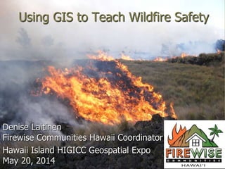
  • 1. Using GIS to Teach Wildfire Safety Denise Laitinen Firewise Communities Hawaii Coordinator Hawaii Island HIGICC Geospatial Expo May 20, 2014
  • 2. What/who is Firewise?  Created in 1985 by NFPA & USDA after a horrific fire season  Part of the National Wildland/Urban Interface Fire Program  Overseen by the WUI Working Team of the National Wildfire Coordinating Group  Sponsored by:  USDA Forest Service  Department of the Interior, National Park Service  National Fire Protection Association  US Fire Administration/FEMA  National Association of State Foresters
  • 3. National: (too many to list)  American Planning Association  American Red Cross  American Society of Landscape Architects  Community Associations Institute  Congressional Fire Services Institute  Environmental Systems Research Institute (ESRI)  Institute for Business & Home Safety  Insurance Services Office  International Association of Fire Chiefs  International Association of Wildland Fire Local: 80+ groups including:  Hawaii Fire Dept.  Maui County Fire Dept.  Kauai Fire Dept.  City & County of Honolulu Fire Dept.  DOFAW  Maui Association of Landscape Professionals  U.S. Fish & Wildfire Service  Hui O Laka, Kokee Museum  Pohakuloa Training Area, U.S. Army  Grove Farm  Dept. of Hawaiian Home Lands  Hawaii Volcanoes National Park  Kona-Kohala Chamber of Commerce Cooperators and Allies
  • 4. Ocean View The Firewise Goal Homes are designed, built, and maintained to withstand a wildfire WITHOUT the intervention of the fire department.
  • 5. A Vision for the Future A Vision for the Future: Wildland fires occur in the future without the loss of homes and structures.
  • 6. For homeowners being Firewise means: 1. Having defensible space and 2. Using fire-resistant building materials. This house has a triple fuel break (gravel, grass, rocks). 3,000-acre fire in Launiupoko, Maui
  • 7. Firewise Activities 2002-Present ‘What does Firewise do in Hawaii?”  Community Outreach/Presentations  Media Relations  Meetings  Trainings/Workshops  Community Work Days  Alert Communities to Grant Opportunities
  • 10. Firewise hazard assessments of West Hawaii subdivisions with Hawaii Fire Dept. Field work:
  • 11. Wildfire Hazard Assessment  Standardized method to determine a community’s risk  Part of NFPA 1144 (Appendix A)  Gives you a look at the good, the bad, and the really scary. Why is road width important? Why is vertical clearance important?
  • 12. Gasoline Charcoal Hazard assessments are important because they discover issues that can be rectified BEFORE a fire strikes.
  • 13. How do you teach wildfire safety using GIS?
  • 14. Firewise Communities and ESRI  Education has always been a key element of spreading the Firewise message about wildfire behavior and prevention.  Early on Firewise partnered with ESRI on a national level to create standard training model that could be used nationwide.  The result was the creation of a GIS- based model that reflects many of the situations faced by communities across the country.  Using a standardized model for full-day workshops ensures consistency in training nationwide whether training firefighters, planners, or civilians.
  • 15. Firewise Workshops  Firewise workshops educate folks about wildfire, its behavior, and how to reduce the risk of wildfire to their home and community.  A key part of this training is learning how to conduct a wildfire hazard assessment (part of NFPA 1142, a national standard.)  By using the GIS-based maps and tools, participants learn about wildfire mitigation.  These workshops are usually the first time participants have ever heard of GIS, never mind using it.
  • 16. Using GIS to teach fire safety & community planning  GIS as a learning tool: multiple data layers enable non- technical people to easily grasp the importance of wildfire safety on an individual and community level. * Learn how to reduce wildfire risks as well as identify them. The importance of community planning: People understand the importance of planning with fire safety in mind and learn strategies to reduce their risk.
  • 17. Ocean View Why is Firewise important? Being Firewise saves lives and homes. The Waikoloa Firewise committee held a regularly scheduled community work day and cleared the fuel break just 3 WEEKS before this 2005 fire. The cleared fuel break is credited with preventing the 25,000 acre wildfire from spreading into the community. (Extra credit: Any idea why this picture represents completely backward planning?)
  • 18. Mahalo! For more info: Denise Laitinen (808) 281-3497 firewisehawaii@yahoo.com Facebook: Firewise Communities Hawaii Twitter: @FirewiseHawaii Google+: Firewise Communities Hawaii