SlideShare a Scribd company logo
1 of 11
FEMA Flood Mapping
County of Hawaii
Department of Public Works
Engineering Division
Presenter: Frank DeMarco, P.E.
1 of 11
FEMA Flood Mapping
 Presentation Overview
 Nation Flood Insurance Program (NFIP)
 Current Flood Insurance Rate Maps (FIRMs) &
Special Flood Hazard Areas (SFHA)
 FEMA’s Map Modernization Program & Digital Flood
Insurance Rate Maps (DFIRMs)
 DFIRMs for Hawaii County
2 of 11
FEMA Flood Mapping
 Nation Flood Insurance Program (NFIP)
 Created by Congress in 1968.
 Enables property owners in participating
communities to purchase Federal flood insurance.
 Nationally, ~21,000 communities participate, ~5.5
million structures insured, worth ~$1.1 trillion in
coverage.
 County of Hawaii, ~4,000 structures insured
~$900,000 in coverage.
3 of 11
 The NFIP is based on an agreement between the
community and the federal government:
 Community adopts and enforces a floodplain management
ordinance (e.g., Hawaii County Code Chapter 27
http://www.hawaiicounty.gov/lb-countycode#countycode) to reduce
future flood risks to new construction in Special Flood
Hazard Areas (SFHA).
 Federal government makes Federal flood insurance
available to the community.
 NFIP has three parts: Floodplain Management, Insurance &
Mapping (i.e., Flood Insurance Rate Map).
FEMA Flood Mapping
4 of 11
FEMA Flood Mapping
 Official community flood map that delineates the
special flood hazard areas (SFHA), or 1-
percent-annual chance flood areas (aka. 100-
year floodplains).
 Current FIRMs are based on 1970’s mapping
technology.
 Single layer of map information.
 Separate paper maps for individual
communities.
 Difficult and costly to change and distribute.
5 of 11
 Flood Insurance Rate Map (FIRMs)
FEMA Flood Mapping
 Upgrade to GIS based digital flood
insurance rate map (DFIRM) format.
 Create 1 seamless community DFIRM.
 Incorporate Letters of Map Revisions.
 Convert the vertical reference datum for
flood elevation data (NGVD 29 to NAVD
88). For State of Hawaii, LTD.
 Most Map Modernization projects were
completed by 2010.
 In 2003, FEMA initiated a national five year $1 billion Flood
Map Modernization program to upgrade the paper FIRMs.
6 of 11
FEMA Flood Mapping
 County protested/appealed FEMA’s 2008 & 2011 Preliminary
Digital Flood Insurance Rate Maps (Pre-DFIRMs)
 Insufficient time for review (i.e., 90-days):
 113 panels.
 Four volume Flood Insurance Study (110
pages on mapping basis & 384 flood
profiles).
 SFHA georeferencing onto the satellite
imagery does not comply with FEMA’s
horizonal accurancy criteria.
 Map Scale: 1:500 is 19 feet; 1:1000 is 38 feet
and 1:2000 is 45.6 feet. 7 of 11
FEMA Flood Mapping
8 of 11
160 feet
FEMA Flood Mapping
 Feb 2013, FEMA & County agree to improve the
Pre-DFIRMs (Technical Cooperative Partnership)
 FEMA agreed to use 2010 NCRS imagery as the
base map and update Pre-DFIRM base on
County’s GIS data.
 Using ESRI ArcGIS Ver. 10, County agreed to:
 Digitize (*.tif or*.png) the current FIRMs, Letter of
Map Revisions (LOMRs) and Engineer’s LOMR work
maps (work maps).
 Georeference SFHA’s, LOMRs & work maps to the
2010 NRCS imagery.
 Deliverables based on 4 - 100 working days.
9 of 11
FEMA Flood Mapping
 Waiakea Stream SFHAs, LOMRs & Engineer’s Work Maps
10 of 11
FEMA Flood Mapping
11 of 11
Questions?

More Related Content

What's hot

09 fri 0930 protecting florida's aviation assets
09 fri 0930 protecting florida's aviation assets09 fri 0930 protecting florida's aviation assets
09 fri 0930 protecting florida's aviation assetsAPA Florida
 
Growing Smart, Table 7-5 (Part 18 of 19)
Growing Smart, Table 7-5 (Part 18 of 19)Growing Smart, Table 7-5 (Part 18 of 19)
Growing Smart, Table 7-5 (Part 18 of 19)Chuck Thompson
 
Fossoway Community Strategy Group: Strategy for Blairingone 2010
Fossoway Community Strategy Group: Strategy for Blairingone 2010Fossoway Community Strategy Group: Strategy for Blairingone 2010
Fossoway Community Strategy Group: Strategy for Blairingone 2010Jimp87
 
Impact of land use and land cover changes on disaster risk
Impact of land use and land cover changes on disaster riskImpact of land use and land cover changes on disaster risk
Impact of land use and land cover changes on disaster riskVarma Myla
 

What's hot (7)

09 fri 0930 protecting florida's aviation assets
09 fri 0930 protecting florida's aviation assets09 fri 0930 protecting florida's aviation assets
09 fri 0930 protecting florida's aviation assets
 
Growing Smart, Table 7-5 (Part 18 of 19)
Growing Smart, Table 7-5 (Part 18 of 19)Growing Smart, Table 7-5 (Part 18 of 19)
Growing Smart, Table 7-5 (Part 18 of 19)
 
Fossoway Community Strategy Group: Strategy for Blairingone 2010
Fossoway Community Strategy Group: Strategy for Blairingone 2010Fossoway Community Strategy Group: Strategy for Blairingone 2010
Fossoway Community Strategy Group: Strategy for Blairingone 2010
 
Impact of land use and land cover changes on disaster risk
Impact of land use and land cover changes on disaster riskImpact of land use and land cover changes on disaster risk
Impact of land use and land cover changes on disaster risk
 
Updating the Strategies for State Policies and Spending
Updating the Strategies for State Policies and SpendingUpdating the Strategies for State Policies and Spending
Updating the Strategies for State Policies and Spending
 
Hazard map
Hazard mapHazard map
Hazard map
 
Appendix A Economic Analysis
Appendix A   Economic AnalysisAppendix A   Economic Analysis
Appendix A Economic Analysis
 

Similar to FEMA Flood Mapping

Executive Summary: Flood Insurance in NYC
Executive Summary: Flood Insurance in NYCExecutive Summary: Flood Insurance in NYC
Executive Summary: Flood Insurance in NYCRose Klein
 
Consent 301 Project Agreement with Natural Resources Conservation Service
Consent 301 Project Agreement with Natural Resources Conservation ServiceConsent 301 Project Agreement with Natural Resources Conservation Service
Consent 301 Project Agreement with Natural Resources Conservation ServiceVictoriaColangelo
 
GAO-04-417 FLOOD MAP MODERNIZATION: Program Strategy Shows Promise, but Chal...
GAO-04-417 FLOOD MAP MODERNIZATION:  Program Strategy Shows Promise, but Chal...GAO-04-417 FLOOD MAP MODERNIZATION:  Program Strategy Shows Promise, but Chal...
GAO-04-417 FLOOD MAP MODERNIZATION: Program Strategy Shows Promise, but Chal...Brian James
 
Land Surveyors, FEMA and Other Flood Zone Issues
Land Surveyors, FEMA and Other Flood Zone IssuesLand Surveyors, FEMA and Other Flood Zone Issues
Land Surveyors, FEMA and Other Flood Zone Issuesgfquinn
 
Is Your Flood Insurance Going Up
Is Your Flood Insurance Going UpIs Your Flood Insurance Going Up
Is Your Flood Insurance Going UpJohn D Parce
 
8KatherineGreig__NICHI_BusinessSummit
8KatherineGreig__NICHI_BusinessSummit8KatherineGreig__NICHI_BusinessSummit
8KatherineGreig__NICHI_BusinessSummitNICHI_USA
 
ADAM PARRISHowHurricane SandyTamed tneBureaucracy.docx
ADAM PARRISHowHurricane SandyTamed tneBureaucracy.docxADAM PARRISHowHurricane SandyTamed tneBureaucracy.docx
ADAM PARRISHowHurricane SandyTamed tneBureaucracy.docxcoubroughcosta
 
Georgia Geospatial Network for GIO presentation 2014
Georgia Geospatial Network for GIO presentation 2014Georgia Geospatial Network for GIO presentation 2014
Georgia Geospatial Network for GIO presentation 2014State of Georgia
 
Nmsz Earthquake Planning
Nmsz Earthquake PlanningNmsz Earthquake Planning
Nmsz Earthquake Planningctalford
 
GEOG501_Cairo_Poster_Final
GEOG501_Cairo_Poster_FinalGEOG501_Cairo_Poster_Final
GEOG501_Cairo_Poster_FinalShekhar Mote
 
FEMA Region III Introduction to the Regional Emergency ...
FEMA Region III Introduction to the Regional Emergency ...FEMA Region III Introduction to the Regional Emergency ...
FEMA Region III Introduction to the Regional Emergency ...Videoguy
 
FEMA Region III Introduction to the Regional Emergency ...
FEMA Region III Introduction to the Regional Emergency ...FEMA Region III Introduction to the Regional Emergency ...
FEMA Region III Introduction to the Regional Emergency ...Videoguy
 
FEMA Region III Introduction to the Regional Emergency ...
FEMA Region III Introduction to the Regional Emergency ...FEMA Region III Introduction to the Regional Emergency ...
FEMA Region III Introduction to the Regional Emergency ...Videoguy
 
FEMA Region III Introduction to the Regional Emergency ...
FEMA Region III Introduction to the Regional Emergency ...FEMA Region III Introduction to the Regional Emergency ...
FEMA Region III Introduction to the Regional Emergency ...Videoguy
 
FEMA Region III Introduction to the Regional Emergency ...
FEMA Region III Introduction to the Regional Emergency ...FEMA Region III Introduction to the Regional Emergency ...
FEMA Region III Introduction to the Regional Emergency ...Videoguy
 
Flood Control Law In California’s Central Valley
Flood Control Law In California’s Central ValleyFlood Control Law In California’s Central Valley
Flood Control Law In California’s Central ValleyJoel Ellinwood, AICP
 
2/10/10 - Kent State Intergovernmental Collaboration Forum - Stark County Sto...
2/10/10 - Kent State Intergovernmental Collaboration Forum - Stark County Sto...2/10/10 - Kent State Intergovernmental Collaboration Forum - Stark County Sto...
2/10/10 - Kent State Intergovernmental Collaboration Forum - Stark County Sto...EfficientGovNow
 
Moving Towards Resilience in Vermont
Moving Towards Resilience in VermontMoving Towards Resilience in Vermont
Moving Towards Resilience in VermontRPO America
 

Similar to FEMA Flood Mapping (20)

Executive Summary: Flood Insurance in NYC
Executive Summary: Flood Insurance in NYCExecutive Summary: Flood Insurance in NYC
Executive Summary: Flood Insurance in NYC
 
Consent 301 Project Agreement with Natural Resources Conservation Service
Consent 301 Project Agreement with Natural Resources Conservation ServiceConsent 301 Project Agreement with Natural Resources Conservation Service
Consent 301 Project Agreement with Natural Resources Conservation Service
 
FLOOD ZONES, SEARCHES, INSURANCE
FLOOD ZONES, SEARCHES, INSURANCEFLOOD ZONES, SEARCHES, INSURANCE
FLOOD ZONES, SEARCHES, INSURANCE
 
GAO-04-417 FLOOD MAP MODERNIZATION: Program Strategy Shows Promise, but Chal...
GAO-04-417 FLOOD MAP MODERNIZATION:  Program Strategy Shows Promise, but Chal...GAO-04-417 FLOOD MAP MODERNIZATION:  Program Strategy Shows Promise, but Chal...
GAO-04-417 FLOOD MAP MODERNIZATION: Program Strategy Shows Promise, but Chal...
 
Land Surveyors, FEMA and Other Flood Zone Issues
Land Surveyors, FEMA and Other Flood Zone IssuesLand Surveyors, FEMA and Other Flood Zone Issues
Land Surveyors, FEMA and Other Flood Zone Issues
 
Is Your Flood Insurance Going Up
Is Your Flood Insurance Going UpIs Your Flood Insurance Going Up
Is Your Flood Insurance Going Up
 
8KatherineGreig__NICHI_BusinessSummit
8KatherineGreig__NICHI_BusinessSummit8KatherineGreig__NICHI_BusinessSummit
8KatherineGreig__NICHI_BusinessSummit
 
ADAM PARRISHowHurricane SandyTamed tneBureaucracy.docx
ADAM PARRISHowHurricane SandyTamed tneBureaucracy.docxADAM PARRISHowHurricane SandyTamed tneBureaucracy.docx
ADAM PARRISHowHurricane SandyTamed tneBureaucracy.docx
 
Georgia Geospatial Network for GIO presentation 2014
Georgia Geospatial Network for GIO presentation 2014Georgia Geospatial Network for GIO presentation 2014
Georgia Geospatial Network for GIO presentation 2014
 
FLOOD MAP MODERNIZATION
FLOOD MAP MODERNIZATION FLOOD MAP MODERNIZATION
FLOOD MAP MODERNIZATION
 
Nmsz Earthquake Planning
Nmsz Earthquake PlanningNmsz Earthquake Planning
Nmsz Earthquake Planning
 
GEOG501_Cairo_Poster_Final
GEOG501_Cairo_Poster_FinalGEOG501_Cairo_Poster_Final
GEOG501_Cairo_Poster_Final
 
FEMA Region III Introduction to the Regional Emergency ...
FEMA Region III Introduction to the Regional Emergency ...FEMA Region III Introduction to the Regional Emergency ...
FEMA Region III Introduction to the Regional Emergency ...
 
FEMA Region III Introduction to the Regional Emergency ...
FEMA Region III Introduction to the Regional Emergency ...FEMA Region III Introduction to the Regional Emergency ...
FEMA Region III Introduction to the Regional Emergency ...
 
FEMA Region III Introduction to the Regional Emergency ...
FEMA Region III Introduction to the Regional Emergency ...FEMA Region III Introduction to the Regional Emergency ...
FEMA Region III Introduction to the Regional Emergency ...
 
FEMA Region III Introduction to the Regional Emergency ...
FEMA Region III Introduction to the Regional Emergency ...FEMA Region III Introduction to the Regional Emergency ...
FEMA Region III Introduction to the Regional Emergency ...
 
FEMA Region III Introduction to the Regional Emergency ...
FEMA Region III Introduction to the Regional Emergency ...FEMA Region III Introduction to the Regional Emergency ...
FEMA Region III Introduction to the Regional Emergency ...
 
Flood Control Law In California’s Central Valley
Flood Control Law In California’s Central ValleyFlood Control Law In California’s Central Valley
Flood Control Law In California’s Central Valley
 
2/10/10 - Kent State Intergovernmental Collaboration Forum - Stark County Sto...
2/10/10 - Kent State Intergovernmental Collaboration Forum - Stark County Sto...2/10/10 - Kent State Intergovernmental Collaboration Forum - Stark County Sto...
2/10/10 - Kent State Intergovernmental Collaboration Forum - Stark County Sto...
 
Moving Towards Resilience in Vermont
Moving Towards Resilience in VermontMoving Towards Resilience in Vermont
Moving Towards Resilience in Vermont
 

More from Hawaii Geographic Information Coordinating Council

More from Hawaii Geographic Information Coordinating Council (20)

Taking 3D to the next Level with 3D Streaming Maps
Taking 3D to the next Level with 3D Streaming MapsTaking 3D to the next Level with 3D Streaming Maps
Taking 3D to the next Level with 3D Streaming Maps
 
US Army Real Estate Holdings in Hawaii
US Army Real Estate Holdings in HawaiiUS Army Real Estate Holdings in Hawaii
US Army Real Estate Holdings in Hawaii
 
NOAA's Coastal Change Analysis Program
NOAA's Coastal Change Analysis ProgramNOAA's Coastal Change Analysis Program
NOAA's Coastal Change Analysis Program
 
Hawaii and US Pacific Basin Orthoimagery Update
Hawaii and US Pacific Basin Orthoimagery UpdateHawaii and US Pacific Basin Orthoimagery Update
Hawaii and US Pacific Basin Orthoimagery Update
 
The ArcGIS Platform: Appyling Geography Everywhere
The ArcGIS Platform: Appyling Geography EverywhereThe ArcGIS Platform: Appyling Geography Everywhere
The ArcGIS Platform: Appyling Geography Everywhere
 
Web based Data and Tools for Coastal Management
Web based Data and Tools for Coastal ManagementWeb based Data and Tools for Coastal Management
Web based Data and Tools for Coastal Management
 
Ecosystem Vulnerability and Cumulative Impacts on th eOceans of hawaii
Ecosystem Vulnerability and Cumulative Impacts on th eOceans of hawaiiEcosystem Vulnerability and Cumulative Impacts on th eOceans of hawaii
Ecosystem Vulnerability and Cumulative Impacts on th eOceans of hawaii
 
Using GIS to Connect Communities
Using GIS to Connect CommunitiesUsing GIS to Connect Communities
Using GIS to Connect Communities
 
Assessing Reef Health Using a Low Altitude Sensing Platform
Assessing Reef Health Using a Low Altitude Sensing PlatformAssessing Reef Health Using a Low Altitude Sensing Platform
Assessing Reef Health Using a Low Altitude Sensing Platform
 
Hawaii DOT Monitoring Stations Versus National Performance Measurement Resear...
Hawaii DOT Monitoring Stations Versus National Performance Measurement Resear...Hawaii DOT Monitoring Stations Versus National Performance Measurement Resear...
Hawaii DOT Monitoring Stations Versus National Performance Measurement Resear...
 
Use of GIS Technology to Inform Planning Efforts Through Visualization of Com...
Use of GIS Technology to Inform Planning Efforts Through Visualization of Com...Use of GIS Technology to Inform Planning Efforts Through Visualization of Com...
Use of GIS Technology to Inform Planning Efforts Through Visualization of Com...
 
Expanding GIS Access to Technical and Non-Technical Users to Enhance Project ...
Expanding GIS Access to Technical and Non-Technical Users to Enhance Project ...Expanding GIS Access to Technical and Non-Technical Users to Enhance Project ...
Expanding GIS Access to Technical and Non-Technical Users to Enhance Project ...
 
STEMworks: K12 Education in Hawaii in Science Technology Engineering and Math
STEMworks: K12 Education in Hawaii in Science Technology Engineering and MathSTEMworks: K12 Education in Hawaii in Science Technology Engineering and Math
STEMworks: K12 Education in Hawaii in Science Technology Engineering and Math
 
Planning for Technological Change
Planning for Technological ChangePlanning for Technological Change
Planning for Technological Change
 
Now & the Future of geodesy in Hawaii for the GIS Users
Now & the Future of geodesy in Hawaii for the GIS UsersNow & the Future of geodesy in Hawaii for the GIS Users
Now & the Future of geodesy in Hawaii for the GIS Users
 
314 woods- uav mapping history
314   woods- uav mapping history314   woods- uav mapping history
314 woods- uav mapping history
 
314 smith 2015 higicc-final
314  smith 2015 higicc-final314  smith 2015 higicc-final
314 smith 2015 higicc-final
 
Real Time Corrections for GNSS Receivers
Real Time Corrections for GNSS ReceiversReal Time Corrections for GNSS Receivers
Real Time Corrections for GNSS Receivers
 
Honolulu Board of Water Supply: Enterprise GIS
Honolulu Board of Water Supply: Enterprise GISHonolulu Board of Water Supply: Enterprise GIS
Honolulu Board of Water Supply: Enterprise GIS
 
State of Hawaii Digital Leveling Project
State of Hawaii Digital Leveling ProjectState of Hawaii Digital Leveling Project
State of Hawaii Digital Leveling Project
 

Recently uploaded

Double Revolving field theory-how the rotor develops torque
Double Revolving field theory-how the rotor develops torqueDouble Revolving field theory-how the rotor develops torque
Double Revolving field theory-how the rotor develops torqueBhangaleSonal
 
A Study of Urban Area Plan for Pabna Municipality
A Study of Urban Area Plan for Pabna MunicipalityA Study of Urban Area Plan for Pabna Municipality
A Study of Urban Area Plan for Pabna MunicipalityMorshed Ahmed Rahath
 
Generative AI or GenAI technology based PPT
Generative AI or GenAI technology based PPTGenerative AI or GenAI technology based PPT
Generative AI or GenAI technology based PPTbhaskargani46
 
GEAR TRAIN- BASIC CONCEPTS AND WORKING PRINCIPLE
GEAR TRAIN- BASIC CONCEPTS AND WORKING PRINCIPLEGEAR TRAIN- BASIC CONCEPTS AND WORKING PRINCIPLE
GEAR TRAIN- BASIC CONCEPTS AND WORKING PRINCIPLEselvakumar948
 
Computer Lecture 01.pptxIntroduction to Computers
Computer Lecture 01.pptxIntroduction to ComputersComputer Lecture 01.pptxIntroduction to Computers
Computer Lecture 01.pptxIntroduction to ComputersMairaAshraf6
 
Design For Accessibility: Getting it right from the start
Design For Accessibility: Getting it right from the startDesign For Accessibility: Getting it right from the start
Design For Accessibility: Getting it right from the startQuintin Balsdon
 
Unit 4_Part 1 CSE2001 Exception Handling and Function Template and Class Temp...
Unit 4_Part 1 CSE2001 Exception Handling and Function Template and Class Temp...Unit 4_Part 1 CSE2001 Exception Handling and Function Template and Class Temp...
Unit 4_Part 1 CSE2001 Exception Handling and Function Template and Class Temp...drmkjayanthikannan
 
NO1 Top No1 Amil Baba In Azad Kashmir, Kashmir Black Magic Specialist Expert ...
NO1 Top No1 Amil Baba In Azad Kashmir, Kashmir Black Magic Specialist Expert ...NO1 Top No1 Amil Baba In Azad Kashmir, Kashmir Black Magic Specialist Expert ...
NO1 Top No1 Amil Baba In Azad Kashmir, Kashmir Black Magic Specialist Expert ...Amil baba
 
AIRCANVAS[1].pdf mini project for btech students
AIRCANVAS[1].pdf mini project for btech studentsAIRCANVAS[1].pdf mini project for btech students
AIRCANVAS[1].pdf mini project for btech studentsvanyagupta248
 
Engineering Drawing focus on projection of planes
Engineering Drawing focus on projection of planesEngineering Drawing focus on projection of planes
Engineering Drawing focus on projection of planesRAJNEESHKUMAR341697
 
Thermal Engineering -unit - III & IV.ppt
Thermal Engineering -unit - III & IV.pptThermal Engineering -unit - III & IV.ppt
Thermal Engineering -unit - III & IV.pptDineshKumar4165
 
Hostel management system project report..pdf
Hostel management system project report..pdfHostel management system project report..pdf
Hostel management system project report..pdfKamal Acharya
 
Moment Distribution Method For Btech Civil
Moment Distribution Method For Btech CivilMoment Distribution Method For Btech Civil
Moment Distribution Method For Btech CivilVinayVitekari
 
data_management_and _data_science_cheat_sheet.pdf
data_management_and _data_science_cheat_sheet.pdfdata_management_and _data_science_cheat_sheet.pdf
data_management_and _data_science_cheat_sheet.pdfJiananWang21
 
"Lesotho Leaps Forward: A Chronicle of Transformative Developments"
"Lesotho Leaps Forward: A Chronicle of Transformative Developments""Lesotho Leaps Forward: A Chronicle of Transformative Developments"
"Lesotho Leaps Forward: A Chronicle of Transformative Developments"mphochane1998
 
1_Introduction + EAM Vocabulary + how to navigate in EAM.pdf
1_Introduction + EAM Vocabulary + how to navigate in EAM.pdf1_Introduction + EAM Vocabulary + how to navigate in EAM.pdf
1_Introduction + EAM Vocabulary + how to navigate in EAM.pdfAldoGarca30
 
COST-EFFETIVE and Energy Efficient BUILDINGS ptx
COST-EFFETIVE  and Energy Efficient BUILDINGS ptxCOST-EFFETIVE  and Energy Efficient BUILDINGS ptx
COST-EFFETIVE and Energy Efficient BUILDINGS ptxJIT KUMAR GUPTA
 
Introduction to Serverless with AWS Lambda
Introduction to Serverless with AWS LambdaIntroduction to Serverless with AWS Lambda
Introduction to Serverless with AWS LambdaOmar Fathy
 

Recently uploaded (20)

Double Revolving field theory-how the rotor develops torque
Double Revolving field theory-how the rotor develops torqueDouble Revolving field theory-how the rotor develops torque
Double Revolving field theory-how the rotor develops torque
 
A Study of Urban Area Plan for Pabna Municipality
A Study of Urban Area Plan for Pabna MunicipalityA Study of Urban Area Plan for Pabna Municipality
A Study of Urban Area Plan for Pabna Municipality
 
Cara Menggugurkan Sperma Yang Masuk Rahim Biyar Tidak Hamil
Cara Menggugurkan Sperma Yang Masuk Rahim Biyar Tidak HamilCara Menggugurkan Sperma Yang Masuk Rahim Biyar Tidak Hamil
Cara Menggugurkan Sperma Yang Masuk Rahim Biyar Tidak Hamil
 
Generative AI or GenAI technology based PPT
Generative AI or GenAI technology based PPTGenerative AI or GenAI technology based PPT
Generative AI or GenAI technology based PPT
 
GEAR TRAIN- BASIC CONCEPTS AND WORKING PRINCIPLE
GEAR TRAIN- BASIC CONCEPTS AND WORKING PRINCIPLEGEAR TRAIN- BASIC CONCEPTS AND WORKING PRINCIPLE
GEAR TRAIN- BASIC CONCEPTS AND WORKING PRINCIPLE
 
Computer Lecture 01.pptxIntroduction to Computers
Computer Lecture 01.pptxIntroduction to ComputersComputer Lecture 01.pptxIntroduction to Computers
Computer Lecture 01.pptxIntroduction to Computers
 
Integrated Test Rig For HTFE-25 - Neometrix
Integrated Test Rig For HTFE-25 - NeometrixIntegrated Test Rig For HTFE-25 - Neometrix
Integrated Test Rig For HTFE-25 - Neometrix
 
Design For Accessibility: Getting it right from the start
Design For Accessibility: Getting it right from the startDesign For Accessibility: Getting it right from the start
Design For Accessibility: Getting it right from the start
 
Unit 4_Part 1 CSE2001 Exception Handling and Function Template and Class Temp...
Unit 4_Part 1 CSE2001 Exception Handling and Function Template and Class Temp...Unit 4_Part 1 CSE2001 Exception Handling and Function Template and Class Temp...
Unit 4_Part 1 CSE2001 Exception Handling and Function Template and Class Temp...
 
NO1 Top No1 Amil Baba In Azad Kashmir, Kashmir Black Magic Specialist Expert ...
NO1 Top No1 Amil Baba In Azad Kashmir, Kashmir Black Magic Specialist Expert ...NO1 Top No1 Amil Baba In Azad Kashmir, Kashmir Black Magic Specialist Expert ...
NO1 Top No1 Amil Baba In Azad Kashmir, Kashmir Black Magic Specialist Expert ...
 
AIRCANVAS[1].pdf mini project for btech students
AIRCANVAS[1].pdf mini project for btech studentsAIRCANVAS[1].pdf mini project for btech students
AIRCANVAS[1].pdf mini project for btech students
 
Engineering Drawing focus on projection of planes
Engineering Drawing focus on projection of planesEngineering Drawing focus on projection of planes
Engineering Drawing focus on projection of planes
 
Thermal Engineering -unit - III & IV.ppt
Thermal Engineering -unit - III & IV.pptThermal Engineering -unit - III & IV.ppt
Thermal Engineering -unit - III & IV.ppt
 
Hostel management system project report..pdf
Hostel management system project report..pdfHostel management system project report..pdf
Hostel management system project report..pdf
 
Moment Distribution Method For Btech Civil
Moment Distribution Method For Btech CivilMoment Distribution Method For Btech Civil
Moment Distribution Method For Btech Civil
 
data_management_and _data_science_cheat_sheet.pdf
data_management_and _data_science_cheat_sheet.pdfdata_management_and _data_science_cheat_sheet.pdf
data_management_and _data_science_cheat_sheet.pdf
 
"Lesotho Leaps Forward: A Chronicle of Transformative Developments"
"Lesotho Leaps Forward: A Chronicle of Transformative Developments""Lesotho Leaps Forward: A Chronicle of Transformative Developments"
"Lesotho Leaps Forward: A Chronicle of Transformative Developments"
 
1_Introduction + EAM Vocabulary + how to navigate in EAM.pdf
1_Introduction + EAM Vocabulary + how to navigate in EAM.pdf1_Introduction + EAM Vocabulary + how to navigate in EAM.pdf
1_Introduction + EAM Vocabulary + how to navigate in EAM.pdf
 
COST-EFFETIVE and Energy Efficient BUILDINGS ptx
COST-EFFETIVE  and Energy Efficient BUILDINGS ptxCOST-EFFETIVE  and Energy Efficient BUILDINGS ptx
COST-EFFETIVE and Energy Efficient BUILDINGS ptx
 
Introduction to Serverless with AWS Lambda
Introduction to Serverless with AWS LambdaIntroduction to Serverless with AWS Lambda
Introduction to Serverless with AWS Lambda
 

FEMA Flood Mapping

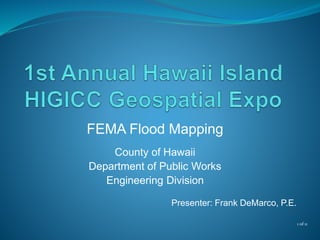
  • 1. FEMA Flood Mapping County of Hawaii Department of Public Works Engineering Division Presenter: Frank DeMarco, P.E. 1 of 11
  • 2. FEMA Flood Mapping  Presentation Overview  Nation Flood Insurance Program (NFIP)  Current Flood Insurance Rate Maps (FIRMs) & Special Flood Hazard Areas (SFHA)  FEMA’s Map Modernization Program & Digital Flood Insurance Rate Maps (DFIRMs)  DFIRMs for Hawaii County 2 of 11
  • 3. FEMA Flood Mapping  Nation Flood Insurance Program (NFIP)  Created by Congress in 1968.  Enables property owners in participating communities to purchase Federal flood insurance.  Nationally, ~21,000 communities participate, ~5.5 million structures insured, worth ~$1.1 trillion in coverage.  County of Hawaii, ~4,000 structures insured ~$900,000 in coverage. 3 of 11
  • 4.  The NFIP is based on an agreement between the community and the federal government:  Community adopts and enforces a floodplain management ordinance (e.g., Hawaii County Code Chapter 27 http://www.hawaiicounty.gov/lb-countycode#countycode) to reduce future flood risks to new construction in Special Flood Hazard Areas (SFHA).  Federal government makes Federal flood insurance available to the community.  NFIP has three parts: Floodplain Management, Insurance & Mapping (i.e., Flood Insurance Rate Map). FEMA Flood Mapping 4 of 11
  • 5. FEMA Flood Mapping  Official community flood map that delineates the special flood hazard areas (SFHA), or 1- percent-annual chance flood areas (aka. 100- year floodplains).  Current FIRMs are based on 1970’s mapping technology.  Single layer of map information.  Separate paper maps for individual communities.  Difficult and costly to change and distribute. 5 of 11  Flood Insurance Rate Map (FIRMs)
  • 6. FEMA Flood Mapping  Upgrade to GIS based digital flood insurance rate map (DFIRM) format.  Create 1 seamless community DFIRM.  Incorporate Letters of Map Revisions.  Convert the vertical reference datum for flood elevation data (NGVD 29 to NAVD 88). For State of Hawaii, LTD.  Most Map Modernization projects were completed by 2010.  In 2003, FEMA initiated a national five year $1 billion Flood Map Modernization program to upgrade the paper FIRMs. 6 of 11
  • 7. FEMA Flood Mapping  County protested/appealed FEMA’s 2008 & 2011 Preliminary Digital Flood Insurance Rate Maps (Pre-DFIRMs)  Insufficient time for review (i.e., 90-days):  113 panels.  Four volume Flood Insurance Study (110 pages on mapping basis & 384 flood profiles).  SFHA georeferencing onto the satellite imagery does not comply with FEMA’s horizonal accurancy criteria.  Map Scale: 1:500 is 19 feet; 1:1000 is 38 feet and 1:2000 is 45.6 feet. 7 of 11
  • 8. FEMA Flood Mapping 8 of 11 160 feet
  • 9. FEMA Flood Mapping  Feb 2013, FEMA & County agree to improve the Pre-DFIRMs (Technical Cooperative Partnership)  FEMA agreed to use 2010 NCRS imagery as the base map and update Pre-DFIRM base on County’s GIS data.  Using ESRI ArcGIS Ver. 10, County agreed to:  Digitize (*.tif or*.png) the current FIRMs, Letter of Map Revisions (LOMRs) and Engineer’s LOMR work maps (work maps).  Georeference SFHA’s, LOMRs & work maps to the 2010 NRCS imagery.  Deliverables based on 4 - 100 working days. 9 of 11
  • 10. FEMA Flood Mapping  Waiakea Stream SFHAs, LOMRs & Engineer’s Work Maps 10 of 11
  • 11. FEMA Flood Mapping 11 of 11 Questions?