Virtual Worlds and NWS Operations
•Als PPTX, PDF herunterladen•
2 gefällt mir•507 views

Virtual worlds can be used as an extension of the traditional 2D web to address societal issues through forecasting virtual hurricanes, understanding drought effects, and situational awareness. NOAA is exploring using virtual worlds like Second Life to create a virtual forecasting office populated with data objects and analyzed by thousands to leverage crowdsourcing games and simulations that reward successful players and create repeat customers for NOAA's data. This allows for interactive learning and cloud-based visualizations of large datasets.

Empfohlen
Empfohlen
Weitere ähnliche Inhalte
Was ist angesagt?
Was ist angesagt? (19)
Andere mochten auch
Andere mochten auch (10)
Ähnlich wie Virtual Worlds and NWS Operations
Ähnlich wie Virtual Worlds and NWS Operations (20)
Mehr von Eric Hackathorn
Mehr von Eric Hackathorn (20)
Kürzlich hochgeladen
Kürzlich hochgeladen (20)
Virtual Worlds and NWS Operations
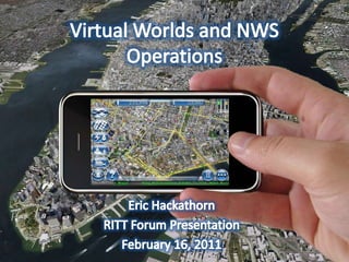
- 1. Virtual Worlds and NWS Operations Eric Hackathorn RITT Forum Presentation February 16, 2011
- 2. what are virtual worlds? an extension of the traditional 2-D web
- 5. mitigating societal impacts forecasting a virtual hurricane understanding the effects of droughts situational awareness
- 8. Imagine a vast virtual work area…. http://im-tel.org/
- 9. Populated with millions of data objects…
- 10. Analyzed by thousands of people…
- 12. “The integration of human visual problem-solving and strategy development capabilities with traditional computational algorithms through interactive multiplayer games is a powerful new approach to solving computationally-limited scientific problems.” http://www.nature.com/nature/journal/v466/n7307/full/nature09304.html
- 14. Leveraging the crowds in games and simulations
- 15. Competition awards successful “players”
- 19. cloud-based visualizations of large data sets http://fim.noaa.gov/
- 23. An Executive Guide for Keeping Up with Virtual Worlds Contact me! Join a virtual world and create an avatar Ask your kids about virtual worlds Attend the Federal Consortium for Virtual Worlds: http://www.ndu.edu/iCollege/fcvw/index.htm Bookmark several virtual world news sites Check out: http://www.esrl.noaa.gov/gsd/tob/virtualworlds.html
- 24. Questions? Eric Hackathorn Eric.J.Hackathorn@noaa.gov
Hinweis der Redaktion
- Augmented reality holds an interesting future for data in contextThe ability to disseminate large amounts of data to a caring public and to solicit their feedback and input
- In this example we created a mockup of a P3 hurricane hunter and flew through a virtual hurricaneOutreach and educationTransition to operations => the power of GIS software with the community of weather briefings
- First island opened Jan 2007First person experience of NOAA scienceNOAA has over 20 islands now, part of Scilands that has over 70Heavy focus on education and outreach
- There are a lot of other VW activities in the government. vGov was born out of the Federal Consortium for Virtual WorldsvGov is a federal government virtual world project. Sponsored by the OCIO office in the USDA it has tremendous high level support. The purpose of the project is to provide a secure virtual world environment. Watch the movie at the URL for a brief project overview and the founding member’s experimentations.vGov is actively seeking new memberships and your agency could be next!
- http://www.ncdc.noaa.gov/img/reports/billion/billion2010.pdfIts not enough to just model impacts, how do you make people care?Situational awareness is about comprehension of meaning
- The power of GIS software with the community of weather briefings
- Combining a virtual world tool like Second Life with a more traditional data visualization application like Google Earth.
- A virtual canvas can be as large as you need, only bounded by computational limits.
- What would happen if all the regional forecast offices could operate in the same “space?”What would happen if members of the public could contribute to that space?
- Foldit is a revolutionary new computer game enabling you to contribute to important scientific research surrounding protein folding.Knowing the structure of a protein is key to understanding how it works and to targeting it with drugs. Figuring out which of the many, many possible structures is the best one is regarded as one of the hardest problems in biology today and current methods take a lot of money and time, even for computers.The best players had no background in chemistry or biologyThe best players out performed the best models
- University of Washington computer science departmentWritten up in nature, strong evidence to support than introducing a human component into the computer models improves our scientific understanding.“Computationally-limited scientific problems” “integration of human visual problem-solving”
- “Computationally-limited scientific problems” “integration of human visual problem-solving”Anecdotal evidence of the old farmer whose knee starts to hurt when it’s going to rain.How do we visualize raw weather data in a way to allow massive public input?How do we make it fun?How do we reward successful players?
- It is important to note that once again all these images are renderings, not actual photographs.Hhopefullyyou can tell where NOAA is headed.
- Unity3d.comA traditional game engine that you can write once and compile for desktops, web streaming, mobile, and even video game consolesThis implies a huge and basically untapped market for NOAA
- Lets see if we can visit!Could potentially be used in emergency response trainingA great way to show high resolution dataImpact of severe weatherOil plume models, ecosystems etc.
- Moving on to a related topic… Some unique challenges!large data setsCloud-based load balancing of the data96 TB per week from NIM G12 which is 167,772,162 points 128 levels vertical resolution Output every 3 hours 20 3D variablesAmount of data:85,899,346,944 bytes per file (one 3D variable)1,717,986,938,880 bytes per output (20 3D variables)13,743,895,511,040 bytes per day (output every 3 hours)96,207,268,577,280 bytes per run (7 day run)
- 3D offers original ways of visualizing dataImagine walking through the streets while picking out a place to liveTranslate this type of visualization to severe weather impact in decision support
- Same sort of visualization but with carbon data
- Mobile technology has a great potential not only to visualize complex information in a 3D “real world” context…but to ingest data either as a remote sensor or ultimately in a massively multiplayer scientific game
- Virtual.worlds@noaa.gov