SlideShare ist ein Scribd-Unternehmen logo
1 von 29
Terra Aqua Aura IGARSS 2010 July 28, 2010 TERRA, AQUA, AND AURA DIRECT BROADCAST- PROVIDING EARTH SCIENCE DATA FOR REAL-TIME APPLICATIONS Angelita C. Kelly, NASA Goddard Space Flight Center Patrick L. Coronado, NASA Goddard Space Flight Center Warren F. Case, SGT Inc., NASA Goddard Space Flight Center Amelia Franklin, NASA Goddard Space Flight Center 1
2 Purpose Provide an overview of the Earth Observing Missions Describe the EOS Direct Broadcast (DB) and DB/Direct Readout (DR) ground stations Discuss the benefits of DB and examples of how it is being used
3 Earth Observing Missions NASA and other space agencies have invested in Earth observing missions, including NASA’s Earth Observing System (EOS), consisting of Terra, Aqua, andAura: Sun-synchronous polar orbits 705 km altitude 98.2 degree inclination Terra Aqua Aura
4 Earth Observing Constellations Landsat-5 Afternoon Constellation Morning Constellation OCO-2 (A-Train) GCOM-W1 Terra Aqua SAC-C CloudSat CALIPSO EO-1 Glory Aura PARASOL Landsat-7 2010 07 27
5 EOS Data EOS science data are available two ways: All science data are recorded onboard and downlinked every orbit at 150 Mbps via: TDRSS (Terra) EOS Ground Stations at Norway, Alaska, and Wallops (Aqua and Aura) The data are processed, archived, and distributed (free of charge) to users worldwide Realtime science data are sent at 15 Mbps to DB stations Terra also has a Direct Downlink (DDL) capability for the ASTER instrument, but this has not been used operationally
EOS End-to-End System Overview Flight Operations, Data Capture, Initial Processing, Backup Archive Data Transport to Data Centers/ SIPSs Mission Operations Science Operations Science Data Processing, Data Mgmt, Interoperable Data Archive, & Distribution Data Acquisition Distribution and Data Access Spacecraft Terra Tracking & Data Relay Satellite (TDRS) Research Aqua Education Aura Value-Added Providers Internet EOS Data and Operations System (EDOS)  Data Processing White SandsComplex(WSC) (Search, order, distribution) Interagency Data Centers EOSDIS Data Centers DB data EOS Operations Center (EOC) Mission Control Earth System Models DirectBroadcast(DB) International Partners NASA Integrated Services Network (NISN) Mission Services EOS PolarGround Stations Decision Support  Systems Data backup Schedules Instrument Teamsand Science Investigator-ledProcessing Systems (SIPS) Direct Broadcast/ Direct Readout Stations
7 AIRS OMI MODIS CERES HSB AMSU AMSR-E What is Direct Broadcast? ,[object Object]
The latest estimate is that there are ~3,000 individual DB users associated with over 200 ground stations worldwide.Aura Aqua Terra MODIS
8 Registered EOS Direct Broadcast Sites Worldwide
9 Direct Readout Station ,[object Object]
The ground station can be
Developed in-house using relatively inexpensive hardware, or
Purchased from a commercial provider (currently ~ $ 200K)
Hardware (see below) and software for receiving the data,
Access to science application algorithms, and
A decision-making infrastructure.Minimum Hardware ,[object Object]
 Antenna control unit
 Frequency downconverter
 Satellite receiver
 Input/output boardSource: http://directreadout.sci.gsfc.nasa.gov/index.cfm?section=portal%20info&page=faqs_subject& topic=Terra
10 Direct Readout Laboratory (DRL) ,[object Object]
The DRL acts as an intermediary between the missions and the DB community members that can make use of the science algorithms
Provides the algorithms (software) for processing the EOS data free of charge.  See next slide.
Holds periodic meetings for the entire international DB community
Provides training (as requested) ,[object Object]
IPOPP enables ground stations to create several products (MODIS, AIRS/AMSU) for near real-time applications such as environmental monitoring and forecasting, fire monitoring, etc.
Several U.S. organizations (Oregon State University, University of South Florida, Univ. of Miami, Florida International University, and University of Wisconsin) and many international organizations also provide DB processing software based on the software used by the EOS Science Teams
Training is provided, as requested.,[object Object]
Provides easy and cost-effective access when broadband internet service is unavailable, restricted, or cost-prohibitive

Weitere ähnliche Inhalte

Was ist angesagt?

groundtruth collection for remotesensing support
groundtruth collection for remotesensing supportgroundtruth collection for remotesensing support
groundtruth collection for remotesensing supportThiruvengadam .
 
Digital Soil Mapping steps
Digital Soil Mapping stepsDigital Soil Mapping steps
Digital Soil Mapping stepsFAO
 
Introduction to Geoinformatics
Introduction to GeoinformaticsIntroduction to Geoinformatics
Introduction to GeoinformaticsKU Leuven
 
Environmental Remote Sensing
 Environmental Remote Sensing  Environmental Remote Sensing
Environmental Remote Sensing Ghassan Hadi
 
Regression kriging
Regression krigingRegression kriging
Regression krigingFAO
 
Effect of chemical compotion of plant residues on nitrogen minealalization
Effect of chemical compotion of plant residues on nitrogen minealalizationEffect of chemical compotion of plant residues on nitrogen minealalization
Effect of chemical compotion of plant residues on nitrogen minealalizationJAU, JUNAGADH, GUJARAT( INDIA)
 
Thermal remote sensing and its applications
Thermal remote sensing and its applicationsThermal remote sensing and its applications
Thermal remote sensing and its applicationschandan00781
 
Rs in agriculture & soil
Rs in agriculture & soilRs in agriculture & soil
Rs in agriculture & soilMuhammad Asim
 
GEOMATIC WORLD WITH A SPECIAL LOOK TO GIS
GEOMATIC WORLDWITH A SPECIAL LOOK TO GISGEOMATIC WORLDWITH A SPECIAL LOOK TO GIS
GEOMATIC WORLD WITH A SPECIAL LOOK TO GISMary Adel
 
Introduction to gis and arc gis
Introduction to gis and arc gis Introduction to gis and arc gis
Introduction to gis and arc gis Saad Raja
 
GIS application in Natural Resource Management
GIS application in Natural Resource ManagementGIS application in Natural Resource Management
GIS application in Natural Resource ManagementAchal Gupta
 
Remote sensing and its applications, DIP, GIS, GPS
Remote sensing and its applications, DIP, GIS, GPSRemote sensing and its applications, DIP, GIS, GPS
Remote sensing and its applications, DIP, GIS, GPSUniversity of Jammu
 
3. Technical introduction to the Digital Soil Mapping
3. Technical introduction to the Digital Soil Mapping3. Technical introduction to the Digital Soil Mapping
3. Technical introduction to the Digital Soil MappingFAO
 
Environmental Applications of GIS.pptx
Environmental Applications of GIS.pptxEnvironmental Applications of GIS.pptx
Environmental Applications of GIS.pptxthanga2
 
Remote Sensing And GIS Application In Wetland Mapping
Remote Sensing And GIS Application In Wetland MappingRemote Sensing And GIS Application In Wetland Mapping
Remote Sensing And GIS Application In Wetland MappingSwetha A
 
Geoinformatics
GeoinformaticsGeoinformatics
Geoinformaticsgeovino
 

Was ist angesagt? (20)

Geoinformatics(nce 402)
Geoinformatics(nce 402)Geoinformatics(nce 402)
Geoinformatics(nce 402)
 
groundtruth collection for remotesensing support
groundtruth collection for remotesensing supportgroundtruth collection for remotesensing support
groundtruth collection for remotesensing support
 
Digital Soil Mapping steps
Digital Soil Mapping stepsDigital Soil Mapping steps
Digital Soil Mapping steps
 
Introduction to Geoinformatics
Introduction to GeoinformaticsIntroduction to Geoinformatics
Introduction to Geoinformatics
 
Environmental Remote Sensing
 Environmental Remote Sensing  Environmental Remote Sensing
Environmental Remote Sensing
 
Remote sensing & gis
Remote sensing & gisRemote sensing & gis
Remote sensing & gis
 
Stereoscopic vision
Stereoscopic visionStereoscopic vision
Stereoscopic vision
 
Regression kriging
Regression krigingRegression kriging
Regression kriging
 
Effect of chemical compotion of plant residues on nitrogen minealalization
Effect of chemical compotion of plant residues on nitrogen minealalizationEffect of chemical compotion of plant residues on nitrogen minealalization
Effect of chemical compotion of plant residues on nitrogen minealalization
 
Thermal remote sensing and its applications
Thermal remote sensing and its applicationsThermal remote sensing and its applications
Thermal remote sensing and its applications
 
Rs in agriculture & soil
Rs in agriculture & soilRs in agriculture & soil
Rs in agriculture & soil
 
GEOMATIC WORLD WITH A SPECIAL LOOK TO GIS
GEOMATIC WORLDWITH A SPECIAL LOOK TO GISGEOMATIC WORLDWITH A SPECIAL LOOK TO GIS
GEOMATIC WORLD WITH A SPECIAL LOOK TO GIS
 
My ppt on gis
My ppt on gisMy ppt on gis
My ppt on gis
 
Introduction to gis and arc gis
Introduction to gis and arc gis Introduction to gis and arc gis
Introduction to gis and arc gis
 
GIS application in Natural Resource Management
GIS application in Natural Resource ManagementGIS application in Natural Resource Management
GIS application in Natural Resource Management
 
Remote sensing and its applications, DIP, GIS, GPS
Remote sensing and its applications, DIP, GIS, GPSRemote sensing and its applications, DIP, GIS, GPS
Remote sensing and its applications, DIP, GIS, GPS
 
3. Technical introduction to the Digital Soil Mapping
3. Technical introduction to the Digital Soil Mapping3. Technical introduction to the Digital Soil Mapping
3. Technical introduction to the Digital Soil Mapping
 
Environmental Applications of GIS.pptx
Environmental Applications of GIS.pptxEnvironmental Applications of GIS.pptx
Environmental Applications of GIS.pptx
 
Remote Sensing And GIS Application In Wetland Mapping
Remote Sensing And GIS Application In Wetland MappingRemote Sensing And GIS Application In Wetland Mapping
Remote Sensing And GIS Application In Wetland Mapping
 
Geoinformatics
GeoinformaticsGeoinformatics
Geoinformatics
 

Andere mochten auch

Terra presentation
Terra presentationTerra presentation
Terra presentationNimra Butt
 
Utilization f LiDAR and IKONOS for Security Hotspot Analysis based on Realism...
Utilization f LiDAR and IKONOS for Security Hotspot Analysis based on Realism...Utilization f LiDAR and IKONOS for Security Hotspot Analysis based on Realism...
Utilization f LiDAR and IKONOS for Security Hotspot Analysis based on Realism...Beniamino Murgante
 
Aqua Life Water | Water from Air Machine | Derrick Strode
Aqua Life Water | Water from Air Machine | Derrick StrodeAqua Life Water | Water from Air Machine | Derrick Strode
Aqua Life Water | Water from Air Machine | Derrick StrodeTurnkey Consulting LLC
 
NASA-NOAA Cooperative Supports for Aqua and Aura Missions
NASA-NOAA Cooperative Supports for Aqua and Aura MissionsNASA-NOAA Cooperative Supports for Aqua and Aura Missions
NASA-NOAA Cooperative Supports for Aqua and Aura Missionsledlow
 
Chris Spry Ikonos
Chris Spry IkonosChris Spry Ikonos
Chris Spry IkonosWuzzy13
 
Fort Wayne Presentation on Aqua Indiana
Fort Wayne Presentation on Aqua IndianaFort Wayne Presentation on Aqua Indiana
Fort Wayne Presentation on Aqua Indianaguest9183d5
 
Open Sources for Satellite Imagery 2016
Open Sources for Satellite Imagery 2016Open Sources for Satellite Imagery 2016
Open Sources for Satellite Imagery 2016Atiqa khan
 
Glacier and snow
Glacier and snowGlacier and snow
Glacier and snowSwetha A
 
Chile's Puyehue Volcano Erupts2011
Chile's Puyehue Volcano Erupts2011Chile's Puyehue Volcano Erupts2011
Chile's Puyehue Volcano Erupts2011Nubia **
 
Using Satellite Imagery to Measure Pasture Production
Using Satellite Imagery to Measure Pasture ProductionUsing Satellite Imagery to Measure Pasture Production
Using Satellite Imagery to Measure Pasture ProductionPastureTech
 
IGARSS2011(OkiKazuo110726).ppt
IGARSS2011(OkiKazuo110726).pptIGARSS2011(OkiKazuo110726).ppt
IGARSS2011(OkiKazuo110726).pptgrssieee
 
Biosight: Quantitative Methods for Policy Analysis: Stochastic Dynamic Progra...
Biosight: Quantitative Methods for Policy Analysis: Stochastic Dynamic Progra...Biosight: Quantitative Methods for Policy Analysis: Stochastic Dynamic Progra...
Biosight: Quantitative Methods for Policy Analysis: Stochastic Dynamic Progra...IFPRI-EPTD
 

Andere mochten auch (20)

Terra presentation
Terra presentationTerra presentation
Terra presentation
 
Test 70MB
Test 70MBTest 70MB
Test 70MB
 
Utilization f LiDAR and IKONOS for Security Hotspot Analysis based on Realism...
Utilization f LiDAR and IKONOS for Security Hotspot Analysis based on Realism...Utilization f LiDAR and IKONOS for Security Hotspot Analysis based on Realism...
Utilization f LiDAR and IKONOS for Security Hotspot Analysis based on Realism...
 
Aqua Life Water | Water from Air Machine | Derrick Strode
Aqua Life Water | Water from Air Machine | Derrick StrodeAqua Life Water | Water from Air Machine | Derrick Strode
Aqua Life Water | Water from Air Machine | Derrick Strode
 
Clase 04 radarsat
Clase 04 radarsatClase 04 radarsat
Clase 04 radarsat
 
NASA-NOAA Cooperative Supports for Aqua and Aura Missions
NASA-NOAA Cooperative Supports for Aqua and Aura MissionsNASA-NOAA Cooperative Supports for Aqua and Aura Missions
NASA-NOAA Cooperative Supports for Aqua and Aura Missions
 
SPOT
SPOTSPOT
SPOT
 
Satellite systems landsat 7 compatibility mode
Satellite systems landsat 7 compatibility modeSatellite systems landsat 7 compatibility mode
Satellite systems landsat 7 compatibility mode
 
Chris Spry Ikonos
Chris Spry IkonosChris Spry Ikonos
Chris Spry Ikonos
 
Fort Wayne Presentation on Aqua Indiana
Fort Wayne Presentation on Aqua IndianaFort Wayne Presentation on Aqua Indiana
Fort Wayne Presentation on Aqua Indiana
 
Rapid eye gs
Rapid eye gsRapid eye gs
Rapid eye gs
 
RADARSAT
RADARSATRADARSAT
RADARSAT
 
Open Sources for Satellite Imagery 2016
Open Sources for Satellite Imagery 2016Open Sources for Satellite Imagery 2016
Open Sources for Satellite Imagery 2016
 
Glacier and snow
Glacier and snowGlacier and snow
Glacier and snow
 
Landsat program
Landsat programLandsat program
Landsat program
 
Landsat seminar
Landsat seminarLandsat seminar
Landsat seminar
 
Chile's Puyehue Volcano Erupts2011
Chile's Puyehue Volcano Erupts2011Chile's Puyehue Volcano Erupts2011
Chile's Puyehue Volcano Erupts2011
 
Using Satellite Imagery to Measure Pasture Production
Using Satellite Imagery to Measure Pasture ProductionUsing Satellite Imagery to Measure Pasture Production
Using Satellite Imagery to Measure Pasture Production
 
IGARSS2011(OkiKazuo110726).ppt
IGARSS2011(OkiKazuo110726).pptIGARSS2011(OkiKazuo110726).ppt
IGARSS2011(OkiKazuo110726).ppt
 
Biosight: Quantitative Methods for Policy Analysis: Stochastic Dynamic Progra...
Biosight: Quantitative Methods for Policy Analysis: Stochastic Dynamic Progra...Biosight: Quantitative Methods for Policy Analysis: Stochastic Dynamic Progra...
Biosight: Quantitative Methods for Policy Analysis: Stochastic Dynamic Progra...
 

Ähnlich wie WE1.L10 - TERRA, AQUA, AND AURA DIRECT BROADCAST – PROVIDING EARTH SCIENCE DATA FOR REALTIME APPLICATIONS

The Emerging Cyberinfrastructure for Earth and Ocean Sciences
The Emerging Cyberinfrastructure for Earth and Ocean SciencesThe Emerging Cyberinfrastructure for Earth and Ocean Sciences
The Emerging Cyberinfrastructure for Earth and Ocean SciencesLarry Smarr
 
NICE_DRS_presentation_060710 (1)
NICE_DRS_presentation_060710 (1)NICE_DRS_presentation_060710 (1)
NICE_DRS_presentation_060710 (1)Stefano Coltellacci
 
Monitoring Oceans - Chris Atherton - SRD23
Monitoring Oceans - Chris Atherton - SRD23Monitoring Oceans - Chris Atherton - SRD23
Monitoring Oceans - Chris Atherton - SRD23SURFevents
 
Cyberinfrastructure to Support Ocean Observatories
Cyberinfrastructure to Support Ocean ObservatoriesCyberinfrastructure to Support Ocean Observatories
Cyberinfrastructure to Support Ocean ObservatoriesLarry Smarr
 
1 IGARSS 2011 JPSS Monday Goldberg.pptx
1 IGARSS 2011 JPSS Monday Goldberg.pptx1 IGARSS 2011 JPSS Monday Goldberg.pptx
1 IGARSS 2011 JPSS Monday Goldberg.pptxgrssieee
 
Toward a Global Interactive Earth Observing Cyberinfrastructure
Toward a Global Interactive Earth Observing CyberinfrastructureToward a Global Interactive Earth Observing Cyberinfrastructure
Toward a Global Interactive Earth Observing CyberinfrastructureLarry Smarr
 
Free and open source software for remote sensing and GIS
Free and open source software for remote sensing and GISFree and open source software for remote sensing and GIS
Free and open source software for remote sensing and GISNopphawanTamkuan
 
PosterDryden2011txt
PosterDryden2011txtPosterDryden2011txt
PosterDryden2011txtMichelle Wen
 
Seftas.george
Seftas.georgeSeftas.george
Seftas.georgeNASAPMC
 
MODIS (Moderate Resolution Imaging Spectrometer)
MODIS (Moderate Resolution Imaging Spectrometer)MODIS (Moderate Resolution Imaging Spectrometer)
MODIS (Moderate Resolution Imaging Spectrometer)Nepal Flying Labs
 
Smr Fastnet Presentation Take2 Pubs
Smr Fastnet Presentation Take2 PubsSmr Fastnet Presentation Take2 Pubs
Smr Fastnet Presentation Take2 PubsRudolf Husar
 
Knapp, wilkins 2018 - gridded satellite (grid sat) goes and conus data-anno...
Knapp, wilkins   2018 - gridded satellite (grid sat) goes and conus data-anno...Knapp, wilkins   2018 - gridded satellite (grid sat) goes and conus data-anno...
Knapp, wilkins 2018 - gridded satellite (grid sat) goes and conus data-anno...Hiram Abif Meza Landero
 
Sensornets and Global Change
Sensornets and Global ChangeSensornets and Global Change
Sensornets and Global ChangeLarry Smarr
 
Adam Lewis–SPEDDEXES 2014
Adam Lewis–SPEDDEXES 2014Adam Lewis–SPEDDEXES 2014
Adam Lewis–SPEDDEXES 2014aceas13tern
 
Embry Riddle Final
Embry Riddle FinalEmbry Riddle Final
Embry Riddle Finaljschrell
 

Ähnlich wie WE1.L10 - TERRA, AQUA, AND AURA DIRECT BROADCAST – PROVIDING EARTH SCIENCE DATA FOR REALTIME APPLICATIONS (20)

CLIM Program: Remote Sensing Workshop, Satellites and Stovepipes - Jay Morris...
CLIM Program: Remote Sensing Workshop, Satellites and Stovepipes - Jay Morris...CLIM Program: Remote Sensing Workshop, Satellites and Stovepipes - Jay Morris...
CLIM Program: Remote Sensing Workshop, Satellites and Stovepipes - Jay Morris...
 
6%2E2017-2021
6%2E2017-20216%2E2017-2021
6%2E2017-2021
 
The Emerging Cyberinfrastructure for Earth and Ocean Sciences
The Emerging Cyberinfrastructure for Earth and Ocean SciencesThe Emerging Cyberinfrastructure for Earth and Ocean Sciences
The Emerging Cyberinfrastructure for Earth and Ocean Sciences
 
NICE_DRS_presentation_060710 (1)
NICE_DRS_presentation_060710 (1)NICE_DRS_presentation_060710 (1)
NICE_DRS_presentation_060710 (1)
 
Monitoring Oceans - Chris Atherton - SRD23
Monitoring Oceans - Chris Atherton - SRD23Monitoring Oceans - Chris Atherton - SRD23
Monitoring Oceans - Chris Atherton - SRD23
 
Cyberinfrastructure to Support Ocean Observatories
Cyberinfrastructure to Support Ocean ObservatoriesCyberinfrastructure to Support Ocean Observatories
Cyberinfrastructure to Support Ocean Observatories
 
1 IGARSS 2011 JPSS Monday Goldberg.pptx
1 IGARSS 2011 JPSS Monday Goldberg.pptx1 IGARSS 2011 JPSS Monday Goldberg.pptx
1 IGARSS 2011 JPSS Monday Goldberg.pptx
 
ORNL DAAC MODIS Land Product Subsets
ORNL DAAC MODIS Land Product SubsetsORNL DAAC MODIS Land Product Subsets
ORNL DAAC MODIS Land Product Subsets
 
Toward a Global Interactive Earth Observing Cyberinfrastructure
Toward a Global Interactive Earth Observing CyberinfrastructureToward a Global Interactive Earth Observing Cyberinfrastructure
Toward a Global Interactive Earth Observing Cyberinfrastructure
 
Free and open source software for remote sensing and GIS
Free and open source software for remote sensing and GISFree and open source software for remote sensing and GIS
Free and open source software for remote sensing and GIS
 
NPOESS Program Overview
NPOESS Program OverviewNPOESS Program Overview
NPOESS Program Overview
 
PosterDryden2011txt
PosterDryden2011txtPosterDryden2011txt
PosterDryden2011txt
 
Seftas.george
Seftas.georgeSeftas.george
Seftas.george
 
MODIS (Moderate Resolution Imaging Spectrometer)
MODIS (Moderate Resolution Imaging Spectrometer)MODIS (Moderate Resolution Imaging Spectrometer)
MODIS (Moderate Resolution Imaging Spectrometer)
 
Smr Fastnet Presentation Take2 Pubs
Smr Fastnet Presentation Take2 PubsSmr Fastnet Presentation Take2 Pubs
Smr Fastnet Presentation Take2 Pubs
 
Knapp, wilkins 2018 - gridded satellite (grid sat) goes and conus data-anno...
Knapp, wilkins   2018 - gridded satellite (grid sat) goes and conus data-anno...Knapp, wilkins   2018 - gridded satellite (grid sat) goes and conus data-anno...
Knapp, wilkins 2018 - gridded satellite (grid sat) goes and conus data-anno...
 
EOSDIS Status
EOSDIS StatusEOSDIS Status
EOSDIS Status
 
Sensornets and Global Change
Sensornets and Global ChangeSensornets and Global Change
Sensornets and Global Change
 
Adam Lewis–SPEDDEXES 2014
Adam Lewis–SPEDDEXES 2014Adam Lewis–SPEDDEXES 2014
Adam Lewis–SPEDDEXES 2014
 
Embry Riddle Final
Embry Riddle FinalEmbry Riddle Final
Embry Riddle Final
 

Mehr von grssieee

Tangent height accuracy of Superconducting Submillimeter-Wave Limb-Emission S...
Tangent height accuracy of Superconducting Submillimeter-Wave Limb-Emission S...Tangent height accuracy of Superconducting Submillimeter-Wave Limb-Emission S...
Tangent height accuracy of Superconducting Submillimeter-Wave Limb-Emission S...grssieee
 
SEGMENTATION OF POLARIMETRIC SAR DATA WITH A MULTI-TEXTURE PRODUCT MODEL
SEGMENTATION OF POLARIMETRIC SAR DATA WITH A MULTI-TEXTURE PRODUCT MODELSEGMENTATION OF POLARIMETRIC SAR DATA WITH A MULTI-TEXTURE PRODUCT MODEL
SEGMENTATION OF POLARIMETRIC SAR DATA WITH A MULTI-TEXTURE PRODUCT MODELgrssieee
 
TWO-POINT STATISTIC OF POLARIMETRIC SAR DATA TWO-POINT STATISTIC OF POLARIMET...
TWO-POINT STATISTIC OF POLARIMETRIC SAR DATA TWO-POINT STATISTIC OF POLARIMET...TWO-POINT STATISTIC OF POLARIMETRIC SAR DATA TWO-POINT STATISTIC OF POLARIMET...
TWO-POINT STATISTIC OF POLARIMETRIC SAR DATA TWO-POINT STATISTIC OF POLARIMET...grssieee
 
THE SENTINEL-1 MISSION AND ITS APPLICATION CAPABILITIES
THE SENTINEL-1 MISSION AND ITS APPLICATION CAPABILITIESTHE SENTINEL-1 MISSION AND ITS APPLICATION CAPABILITIES
THE SENTINEL-1 MISSION AND ITS APPLICATION CAPABILITIESgrssieee
 
GMES SPACE COMPONENT:PROGRAMMATIC STATUS
GMES SPACE COMPONENT:PROGRAMMATIC STATUSGMES SPACE COMPONENT:PROGRAMMATIC STATUS
GMES SPACE COMPONENT:PROGRAMMATIC STATUSgrssieee
 
PROGRESSES OF DEVELOPMENT OF CFOSAT SCATTEROMETER
PROGRESSES OF DEVELOPMENT OF CFOSAT SCATTEROMETERPROGRESSES OF DEVELOPMENT OF CFOSAT SCATTEROMETER
PROGRESSES OF DEVELOPMENT OF CFOSAT SCATTEROMETERgrssieee
 
DEVELOPMENT OF ALGORITHMS AND PRODUCTS FOR SUPPORTING THE ITALIAN HYPERSPECTR...
DEVELOPMENT OF ALGORITHMS AND PRODUCTS FOR SUPPORTING THE ITALIAN HYPERSPECTR...DEVELOPMENT OF ALGORITHMS AND PRODUCTS FOR SUPPORTING THE ITALIAN HYPERSPECTR...
DEVELOPMENT OF ALGORITHMS AND PRODUCTS FOR SUPPORTING THE ITALIAN HYPERSPECTR...grssieee
 
EO-1/HYPERION: NEARING TWELVE YEARS OF SUCCESSFUL MISSION SCIENCE OPERATION A...
EO-1/HYPERION: NEARING TWELVE YEARS OF SUCCESSFUL MISSION SCIENCE OPERATION A...EO-1/HYPERION: NEARING TWELVE YEARS OF SUCCESSFUL MISSION SCIENCE OPERATION A...
EO-1/HYPERION: NEARING TWELVE YEARS OF SUCCESSFUL MISSION SCIENCE OPERATION A...grssieee
 
test 34mb wo animations
test  34mb wo animationstest  34mb wo animations
test 34mb wo animationsgrssieee
 
2011_Fox_Tax_Worksheets.pdf
2011_Fox_Tax_Worksheets.pdf2011_Fox_Tax_Worksheets.pdf
2011_Fox_Tax_Worksheets.pdfgrssieee
 
DLR open house
DLR open houseDLR open house
DLR open housegrssieee
 
DLR open house
DLR open houseDLR open house
DLR open housegrssieee
 
DLR open house
DLR open houseDLR open house
DLR open housegrssieee
 
Tana_IGARSS2011.ppt
Tana_IGARSS2011.pptTana_IGARSS2011.ppt
Tana_IGARSS2011.pptgrssieee
 
Solaro_IGARSS_2011.ppt
Solaro_IGARSS_2011.pptSolaro_IGARSS_2011.ppt
Solaro_IGARSS_2011.pptgrssieee
 
Sakkas.ppt
Sakkas.pptSakkas.ppt
Sakkas.pptgrssieee
 

Mehr von grssieee (20)

Tangent height accuracy of Superconducting Submillimeter-Wave Limb-Emission S...
Tangent height accuracy of Superconducting Submillimeter-Wave Limb-Emission S...Tangent height accuracy of Superconducting Submillimeter-Wave Limb-Emission S...
Tangent height accuracy of Superconducting Submillimeter-Wave Limb-Emission S...
 
SEGMENTATION OF POLARIMETRIC SAR DATA WITH A MULTI-TEXTURE PRODUCT MODEL
SEGMENTATION OF POLARIMETRIC SAR DATA WITH A MULTI-TEXTURE PRODUCT MODELSEGMENTATION OF POLARIMETRIC SAR DATA WITH A MULTI-TEXTURE PRODUCT MODEL
SEGMENTATION OF POLARIMETRIC SAR DATA WITH A MULTI-TEXTURE PRODUCT MODEL
 
TWO-POINT STATISTIC OF POLARIMETRIC SAR DATA TWO-POINT STATISTIC OF POLARIMET...
TWO-POINT STATISTIC OF POLARIMETRIC SAR DATA TWO-POINT STATISTIC OF POLARIMET...TWO-POINT STATISTIC OF POLARIMETRIC SAR DATA TWO-POINT STATISTIC OF POLARIMET...
TWO-POINT STATISTIC OF POLARIMETRIC SAR DATA TWO-POINT STATISTIC OF POLARIMET...
 
THE SENTINEL-1 MISSION AND ITS APPLICATION CAPABILITIES
THE SENTINEL-1 MISSION AND ITS APPLICATION CAPABILITIESTHE SENTINEL-1 MISSION AND ITS APPLICATION CAPABILITIES
THE SENTINEL-1 MISSION AND ITS APPLICATION CAPABILITIES
 
GMES SPACE COMPONENT:PROGRAMMATIC STATUS
GMES SPACE COMPONENT:PROGRAMMATIC STATUSGMES SPACE COMPONENT:PROGRAMMATIC STATUS
GMES SPACE COMPONENT:PROGRAMMATIC STATUS
 
PROGRESSES OF DEVELOPMENT OF CFOSAT SCATTEROMETER
PROGRESSES OF DEVELOPMENT OF CFOSAT SCATTEROMETERPROGRESSES OF DEVELOPMENT OF CFOSAT SCATTEROMETER
PROGRESSES OF DEVELOPMENT OF CFOSAT SCATTEROMETER
 
DEVELOPMENT OF ALGORITHMS AND PRODUCTS FOR SUPPORTING THE ITALIAN HYPERSPECTR...
DEVELOPMENT OF ALGORITHMS AND PRODUCTS FOR SUPPORTING THE ITALIAN HYPERSPECTR...DEVELOPMENT OF ALGORITHMS AND PRODUCTS FOR SUPPORTING THE ITALIAN HYPERSPECTR...
DEVELOPMENT OF ALGORITHMS AND PRODUCTS FOR SUPPORTING THE ITALIAN HYPERSPECTR...
 
EO-1/HYPERION: NEARING TWELVE YEARS OF SUCCESSFUL MISSION SCIENCE OPERATION A...
EO-1/HYPERION: NEARING TWELVE YEARS OF SUCCESSFUL MISSION SCIENCE OPERATION A...EO-1/HYPERION: NEARING TWELVE YEARS OF SUCCESSFUL MISSION SCIENCE OPERATION A...
EO-1/HYPERION: NEARING TWELVE YEARS OF SUCCESSFUL MISSION SCIENCE OPERATION A...
 
EO-1/HYPERION: NEARING TWELVE YEARS OF SUCCESSFUL MISSION SCIENCE OPERATION A...
EO-1/HYPERION: NEARING TWELVE YEARS OF SUCCESSFUL MISSION SCIENCE OPERATION A...EO-1/HYPERION: NEARING TWELVE YEARS OF SUCCESSFUL MISSION SCIENCE OPERATION A...
EO-1/HYPERION: NEARING TWELVE YEARS OF SUCCESSFUL MISSION SCIENCE OPERATION A...
 
Test
TestTest
Test
 
test 34mb wo animations
test  34mb wo animationstest  34mb wo animations
test 34mb wo animations
 
Test 70MB
Test 70MBTest 70MB
Test 70MB
 
2011_Fox_Tax_Worksheets.pdf
2011_Fox_Tax_Worksheets.pdf2011_Fox_Tax_Worksheets.pdf
2011_Fox_Tax_Worksheets.pdf
 
DLR open house
DLR open houseDLR open house
DLR open house
 
DLR open house
DLR open houseDLR open house
DLR open house
 
DLR open house
DLR open houseDLR open house
DLR open house
 
Tana_IGARSS2011.ppt
Tana_IGARSS2011.pptTana_IGARSS2011.ppt
Tana_IGARSS2011.ppt
 
Solaro_IGARSS_2011.ppt
Solaro_IGARSS_2011.pptSolaro_IGARSS_2011.ppt
Solaro_IGARSS_2011.ppt
 
Sakkas.ppt
Sakkas.pptSakkas.ppt
Sakkas.ppt
 

WE1.L10 - TERRA, AQUA, AND AURA DIRECT BROADCAST – PROVIDING EARTH SCIENCE DATA FOR REALTIME APPLICATIONS

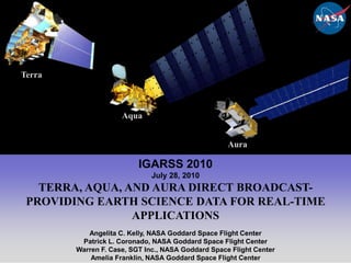
  • 1. Terra Aqua Aura IGARSS 2010 July 28, 2010 TERRA, AQUA, AND AURA DIRECT BROADCAST- PROVIDING EARTH SCIENCE DATA FOR REAL-TIME APPLICATIONS Angelita C. Kelly, NASA Goddard Space Flight Center Patrick L. Coronado, NASA Goddard Space Flight Center Warren F. Case, SGT Inc., NASA Goddard Space Flight Center Amelia Franklin, NASA Goddard Space Flight Center 1
  • 2. 2 Purpose Provide an overview of the Earth Observing Missions Describe the EOS Direct Broadcast (DB) and DB/Direct Readout (DR) ground stations Discuss the benefits of DB and examples of how it is being used
  • 3. 3 Earth Observing Missions NASA and other space agencies have invested in Earth observing missions, including NASA’s Earth Observing System (EOS), consisting of Terra, Aqua, andAura: Sun-synchronous polar orbits 705 km altitude 98.2 degree inclination Terra Aqua Aura
  • 4. 4 Earth Observing Constellations Landsat-5 Afternoon Constellation Morning Constellation OCO-2 (A-Train) GCOM-W1 Terra Aqua SAC-C CloudSat CALIPSO EO-1 Glory Aura PARASOL Landsat-7 2010 07 27
  • 5. 5 EOS Data EOS science data are available two ways: All science data are recorded onboard and downlinked every orbit at 150 Mbps via: TDRSS (Terra) EOS Ground Stations at Norway, Alaska, and Wallops (Aqua and Aura) The data are processed, archived, and distributed (free of charge) to users worldwide Realtime science data are sent at 15 Mbps to DB stations Terra also has a Direct Downlink (DDL) capability for the ASTER instrument, but this has not been used operationally
  • 6. EOS End-to-End System Overview Flight Operations, Data Capture, Initial Processing, Backup Archive Data Transport to Data Centers/ SIPSs Mission Operations Science Operations Science Data Processing, Data Mgmt, Interoperable Data Archive, & Distribution Data Acquisition Distribution and Data Access Spacecraft Terra Tracking & Data Relay Satellite (TDRS) Research Aqua Education Aura Value-Added Providers Internet EOS Data and Operations System (EDOS) Data Processing White SandsComplex(WSC) (Search, order, distribution) Interagency Data Centers EOSDIS Data Centers DB data EOS Operations Center (EOC) Mission Control Earth System Models DirectBroadcast(DB) International Partners NASA Integrated Services Network (NISN) Mission Services EOS PolarGround Stations Decision Support Systems Data backup Schedules Instrument Teamsand Science Investigator-ledProcessing Systems (SIPS) Direct Broadcast/ Direct Readout Stations
  • 7.
  • 8. The latest estimate is that there are ~3,000 individual DB users associated with over 200 ground stations worldwide.Aura Aqua Terra MODIS
  • 9. 8 Registered EOS Direct Broadcast Sites Worldwide
  • 10.
  • 12. Developed in-house using relatively inexpensive hardware, or
  • 13. Purchased from a commercial provider (currently ~ $ 200K)
  • 14. Hardware (see below) and software for receiving the data,
  • 15. Access to science application algorithms, and
  • 16.
  • 20. Input/output boardSource: http://directreadout.sci.gsfc.nasa.gov/index.cfm?section=portal%20info&page=faqs_subject& topic=Terra
  • 21.
  • 22. The DRL acts as an intermediary between the missions and the DB community members that can make use of the science algorithms
  • 23. Provides the algorithms (software) for processing the EOS data free of charge. See next slide.
  • 24. Holds periodic meetings for the entire international DB community
  • 25.
  • 26. IPOPP enables ground stations to create several products (MODIS, AIRS/AMSU) for near real-time applications such as environmental monitoring and forecasting, fire monitoring, etc.
  • 27. Several U.S. organizations (Oregon State University, University of South Florida, Univ. of Miami, Florida International University, and University of Wisconsin) and many international organizations also provide DB processing software based on the software used by the EOS Science Teams
  • 28.
  • 29. Provides easy and cost-effective access when broadband internet service is unavailable, restricted, or cost-prohibitive
  • 30. Provides a secondary path for data to reach the ground with virtually no time delay
  • 31. Serves as a back-up to the primary store and forward method and can be used to fill in data gaps for science processing
  • 32. Real-time applications can be derived using NASA-provided software algorithms
  • 34.
  • 41.
  • 42. Detects and monitors forest fires
  • 43. Provides data to Forest Service and other agencies for resource management and environmental monitoring
  • 44. Provides assistance in applying the most advanced geospatial technology toward improved monitoring and mapping of natural resourcesMODIS image of Wolf and Copper fires near Los Angeles provided by RSAC http://www.fs.fed.us/eng/rsac/
  • 45.
  • 46.
  • 48. Increase the quality of fish for export
  • 49. Reduce the operational costs (search time and fuel) of multi-day fishing fleets
  • 50. The initial experiments have shown positive results with fisheries corporation vessels netting large catches.  http://www.nara.ac.lk/ 15
  • 51.
  • 52. The stations collect data from more than a dozen satellites (including Aqua and Terra) covering all of Russia and the nearby territories
  • 53. The MODIS DB data are used to observe the weather, map ice and vegetation, and monitor floods and fireshttp://www.scanex.com/en/stations/default.asp?submenu=uniscan&id=index  ScanEx Station
  • 54.
  • 55. FMI DB station produces near realtime ozone and ultraviolet OMI data products
  • 56. Available via the internet 15 minutes after a pass since the end of 2004
  • 57. Covers central Europe from the North Pole to the Mediterranean area.
  • 58. OMI data were recently used by various volcanology centers in the U.S. and Europe following the Iceland volcano eruption.
  • 59. Also receives MODIS DB data from Terra and Aqua:
  • 60. Re-broadcast by the Finnish Meteorological Institute since March 2003
  • 61. Delivered to other Finnish governmental institutes for scientific purposes and to NOAA’sNational Environmental Satellite, Data, and Information Service (NESDIS) in cooperation with the University of Wisconsin-Madison. http://fmiarc.fmi.fi/fmiarc_new/ozone.html
  • 62.
  • 63. Maintains an up-to-date archive of images from NOAA, SeaStar, Terra, and Aqua polar orbiting satellites.
  • 64. Receives and archives MODIS data providing much-improved spatial and spectral resolution. The archive is kept on tape and CD- ROM, with a photographic archive kept for quick browsing
  • 65. Can supply either enhanced photographic images produced from the data, or the data itself via the internet, tape, or disk. http://www.sat.dundee.ac.uk/
  • 66. 19 Examples of DB Data MODIS true color image displayed using Google Earth offers a different perspective of the oil slick.* *Courtesy of Liam Gumley, CIMSS
  • 67. 20 Examples of DB Data MODIS Observation of the Jesusita Fire near Santa Barbara, California on May 8, 2009
  • 68. 21 Examples of DB Data Terra MODIS image of yellow rust infection of crop lands in the Middle East – April 2010 Aqua MODIS image of the Arctic region June 28, 2010 Aqua MODIS image of the Great Escarpment, South Africa, April 2010 Aqua MODIS image of a phytoplankton bloom off the coast of Iceland – June 2010
  • 69. 22 Examples of DB Data Iceland’s Eyjafjallajökull Volcano observed by MODIS on May 12, 2010
  • 70.
  • 71. National Polar-orbiting Operational Environmental Satellite System (NPOESS) Preparatory Project (NPP)
  • 72. Joint Polar Satellite System (part of the former NPOESS)
  • 73. Global Change Observation Missions (follow-on to AMSR-E)
  • 74.
  • 75. The DB community appreciates having the data and the software
  • 76. The use of EOS DB data is increasing every year
  • 77. The free software and data access from NASA makes DB an attractive and cost-effective option, particularly for developing countries
  • 78. The continued availability of realtime EOS-type data for operational use is needed
  • 79.
  • 81.
  • 82. DRL technologies developed for the NPP In-Situ Ground System (NISGS) will provide the IPOPP framework:
  • 84. Portable to Linux x86 platforms
  • 85. Can be run efficiently on modest hardware
  • 86. Simple to install and easy to use
  • 87. Able to ingest and process DB overpasses of arbitrary size
  • 88.
  • 89.
  • 90. Management is mainly based on the total allowable catch, calculated from the allowable biological catch.
  • 91. Terra and Aqua DB data help determine the time period, location, and abundance of the target fish (taking onto account migration routes), which must be recorded in near-real time.Priority species Several species have been selected for management because of their importance and popularity as a food resource, and also because of concerns about their abundance Japanese common squid (Todarodes pacificus) Mackerel (Trachurus japonicus) Pacific saury (Cololabis saira) Pollack (Theragra chalcogramma) Queen crab (Chionoecetes opilio) Laboratory of Marine Bioresource and Environment Sensing , Graduate School of Fisheries Sciences, Hokkaido University , Japan