SlideShare ist ein Scribd-Unternehmen logo
1 von 28
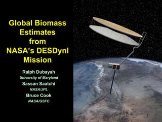
Global Biomass Estimates from NASA’s DESDynI Mission  Ralph Dubayah University of Maryland Sassan Saatchi NASA/JPL Bruce Cook NASA/GSFC 1
2 How are the Earth's carbon cycle and ecosystems changing, and what are the consequences for the Earth's carbon budget, ecosystem sustainability, and biodiversity?
Outline DESDynI Biomass Goals and Requirements Science and Measurement Objectives Science Rationale  Measurement Approach MultibeamLidar Synthetic Aperture Radar Fusion Approaches Radar/lidar Ecosystem modeling Current Biomass Science Activities Summary 3
Science Objective 1: Biomass Characterize global distribution of aboveground vegetation biomass Desired Final Data Products  Global biomass  at 250 m with accuracy of 10 MgC/ha (or 20%, not to exceed  50 Mg/ha) at 3 years. Forest canopy height and profiles, spatial and vertical structure, biomass from SAR Measurement Objectives Multi-beam lidar, polarimetric L-band SAR Instruments
Global Biomass and Carbon Accurate estimate of forest biomass critical Role of forests in global carbon cycle and relation to atmospheric CO2 requires knowledge of stocks, disturbance and recovery Potential pool when burned or cleared DESDynI biomass reduces uncertainty in these terms
Why These Requirements? Biomass Accuracy Need to reduce uncertainty in terrestrial carbon components to level of oceans/atmosphere Use of data for climate treaties requires high accuracy Biomass Resolution Match scale of environmental gradients Match scale of disturbances Significant improvement over existing and planned methods of global biomass estimation 6
DESDynI Measurement Approach Combine beauty of vertical structure measurements of lidar with powerful coverage potential of radar 7 Radar Beam Laser Beam Lidar Waveform Signal Start HV Tree Height HHVV  Backscatter Ground Peak HH        VV        HV
Lidar Measurement Radar Measurement Radar Mapping DESDynI Ecosystems Structure Measurement Concept Lidar Backscatter Vertical Structure Medium to high biomass Lidar Sampling   GLOBAL BIOMASS, FLUXES & BIODIVERSITY MODELS/  FUSION Radar Backscatter Volume Structure Disturbance Low to medium biomass   Vegetated Ecosystems
Forest Structure from Lidar DIRECT ,[object Object]
Waveform metrics
Canopy cover profile
Vertical/spatial variation metrics (e.g. entropy)MODELED ,[object Object]
Vertical foliage profile
Tree density
Basal area
LAIBIOMASS
Lidar-Based Approaches Lidar heights and metrics combined with field data to predict biomass Footprint-level biomass estimates Use existing relationships because of geolocation errors Grid cell based biomass estimates Average biomass or average lidar metrics  10 Lidar Metrics EAGB = f(lidar metrics) Field Biomass Statistical Models Machine Learning Models Ecosystem Models
m1 m1 m2 Stratification by landcover type (e.g. from Landsat or radar) greatly facilitates areal mean estimation 1 km m4 m3 Biomass Stocks from Lidar ,[object Object],[object Object]
Lidar Observations By Biome Lidar by itself does not meet resolution requirements for all biomes. Fusion with radar, passive optical required * SE = 			§ Assuming 1 m tree height = 15 Mg ha-1
L-band Measurement of Structure 14 PolarimetricImage of La Selva LHH, LHV, LVV Image Segmentation
L-band Sensitivity to Biomass 15 Low or no sensitivity above 100 Mg/ha  Fusion with lidar samples may extend this range Highest biomass areas estimated using dense grid of lidar samples alone at coarser resolutions Many different studies achieved 10-20% accuracy for biomass below < 100 Mg/ha
 Total Biomass Estimation Errors LiDAR: ,[object Object],Radar: ,[object Object],Fusion: ,[object Object],[object Object]
Approaches to Fusion For DESDynI Geostatistical/Covariance Methods Use radar to extend estimates of sparser lidar samples e.g. kriging, spatially-explicit regressions Statistical Methods Bayesian and other techniques to predict forest structure Use lidar estimates of structure as independent and validation data  Machine-Learning Methods Non-parametric techniques that discover complex relationships between radar, other environmental data and structure Use lidar estimates of structure as training and validation data Physically-based (radiative transfer) methods Radar backscatter models incorporate canopy structure from lidar e.g. derive foliage area volume density from lidar profiles 18
Example: ALOS/PALSAR & ICESat/GLAS 1.  RADAR mosaic 2.  LIDAR track 3. Segmentation (could include historic multi-source data) Generate LIDAR Segment Means 5. Map Segments 6. Predict Unmapped Segments from Models:      - statistical &      - location-based 7. Repeat with every new acquisitions J. Kellndorfer WHRC
L-band Radar & LVIS data Inventory Plot Data Random Sampling 25 m Resolution 0.25 ha plots
Distribution of Aboveground Forest Biomass in Borneo AGLB Mg/ha  Bare Savanna 0-25 3 4 5 6 7 8 9 10 11 12 13 Validation: 69% Overall Accuracy (95% CI) over all biomass classes  25-50 50-75 0-150 75-100 100-150 150-200 200-250 250-300 300-350 350-400 > 400 Maximum entropy approach with ICEAST and ALOS
Biomass From Ecosystem Modeling ,[object Object]
Consistent framework

Weitere ähnliche Inhalte

Was ist angesagt?

Air pollution Assessment (GIS,RS Approach)
Air pollution Assessment (GIS,RS Approach)Air pollution Assessment (GIS,RS Approach)
Air pollution Assessment (GIS,RS Approach)Ehsan Hamzei
 
Application Of Nirs In Feed Industry
Application Of Nirs In Feed IndustryApplication Of Nirs In Feed Industry
Application Of Nirs In Feed IndustryFerosekhan Shajahan
 
Significance of long-term environmental and physiological records for underst...
Significance of long-term environmental and physiological records for underst...Significance of long-term environmental and physiological records for underst...
Significance of long-term environmental and physiological records for underst...Integrated Carbon Observation System (ICOS)
 
Andy Jarvis PARASID Near Real Time Monitoring Of Habitat Change Using A Neur...
Andy  Jarvis PARASID Near Real Time Monitoring Of Habitat Change Using A Neur...Andy  Jarvis PARASID Near Real Time Monitoring Of Habitat Change Using A Neur...
Andy Jarvis PARASID Near Real Time Monitoring Of Habitat Change Using A Neur...CIAT
 
Evaluation of near infrared (NIR) spectroscopy as a tool for determination of...
Evaluation of near infrared (NIR) spectroscopy as a tool for determination of...Evaluation of near infrared (NIR) spectroscopy as a tool for determination of...
Evaluation of near infrared (NIR) spectroscopy as a tool for determination of...SLOPE Project
 
CALPUFF versus AERMOD comparison
CALPUFF versus AERMOD comparisonCALPUFF versus AERMOD comparison
CALPUFF versus AERMOD comparisonkonder71
 
1504ACS-UCSD Murphy-Brown-Pradel Abstract 150304 mm wt
1504ACS-UCSD Murphy-Brown-Pradel Abstract 150304 mm wt1504ACS-UCSD Murphy-Brown-Pradel Abstract 150304 mm wt
1504ACS-UCSD Murphy-Brown-Pradel Abstract 150304 mm wtMegan Murphy
 
study and analysis of hy si data in 400 to 500
study and analysis of hy si data in 400 to 500study and analysis of hy si data in 400 to 500
study and analysis of hy si data in 400 to 500IJAEMSJORNAL
 
Quality Measurements Using NIR/MIR Spectroscopy: A Rotten Apple Could Turn Yo...
Quality Measurements Using NIR/MIR Spectroscopy: A Rotten Apple Could Turn Yo...Quality Measurements Using NIR/MIR Spectroscopy: A Rotten Apple Could Turn Yo...
Quality Measurements Using NIR/MIR Spectroscopy: A Rotten Apple Could Turn Yo...TechRentals
 

Was ist angesagt? (12)

Near infrared spectroscopy 2
Near infrared spectroscopy 2Near infrared spectroscopy 2
Near infrared spectroscopy 2
 
172 nir spectroscopy
172 nir spectroscopy172 nir spectroscopy
172 nir spectroscopy
 
Air pollution Assessment (GIS,RS Approach)
Air pollution Assessment (GIS,RS Approach)Air pollution Assessment (GIS,RS Approach)
Air pollution Assessment (GIS,RS Approach)
 
Application Of Nirs In Feed Industry
Application Of Nirs In Feed IndustryApplication Of Nirs In Feed Industry
Application Of Nirs In Feed Industry
 
Significance of long-term environmental and physiological records for underst...
Significance of long-term environmental and physiological records for underst...Significance of long-term environmental and physiological records for underst...
Significance of long-term environmental and physiological records for underst...
 
Andy Jarvis PARASID Near Real Time Monitoring Of Habitat Change Using A Neur...
Andy  Jarvis PARASID Near Real Time Monitoring Of Habitat Change Using A Neur...Andy  Jarvis PARASID Near Real Time Monitoring Of Habitat Change Using A Neur...
Andy Jarvis PARASID Near Real Time Monitoring Of Habitat Change Using A Neur...
 
Evaluation of near infrared (NIR) spectroscopy as a tool for determination of...
Evaluation of near infrared (NIR) spectroscopy as a tool for determination of...Evaluation of near infrared (NIR) spectroscopy as a tool for determination of...
Evaluation of near infrared (NIR) spectroscopy as a tool for determination of...
 
CALPUFF versus AERMOD comparison
CALPUFF versus AERMOD comparisonCALPUFF versus AERMOD comparison
CALPUFF versus AERMOD comparison
 
1504ACS-UCSD Murphy-Brown-Pradel Abstract 150304 mm wt
1504ACS-UCSD Murphy-Brown-Pradel Abstract 150304 mm wt1504ACS-UCSD Murphy-Brown-Pradel Abstract 150304 mm wt
1504ACS-UCSD Murphy-Brown-Pradel Abstract 150304 mm wt
 
The GEO initiative on Carbon and Greenhouse Gases: Integration across domains
The GEO initiative on Carbon and Greenhouse Gases: Integration across domainsThe GEO initiative on Carbon and Greenhouse Gases: Integration across domains
The GEO initiative on Carbon and Greenhouse Gases: Integration across domains
 
study and analysis of hy si data in 400 to 500
study and analysis of hy si data in 400 to 500study and analysis of hy si data in 400 to 500
study and analysis of hy si data in 400 to 500
 
Quality Measurements Using NIR/MIR Spectroscopy: A Rotten Apple Could Turn Yo...
Quality Measurements Using NIR/MIR Spectroscopy: A Rotten Apple Could Turn Yo...Quality Measurements Using NIR/MIR Spectroscopy: A Rotten Apple Could Turn Yo...
Quality Measurements Using NIR/MIR Spectroscopy: A Rotten Apple Could Turn Yo...
 

Andere mochten auch

Cyprus national report- Biomass Cyprus
Cyprus national report- Biomass CyprusCyprus national report- Biomass Cyprus
Cyprus national report- Biomass CyprusSeanergies
 
BioPotentials_Oslo2009
BioPotentials_Oslo2009BioPotentials_Oslo2009
BioPotentials_Oslo2009riviet
 
La suma de fracciones
La suma de fraccionesLa suma de fracciones
La suma de fraccionesmarceherca
 
2012 05 08 eu asia biomass conference malaysia 9 may 2012 dwa
2012 05 08 eu asia biomass conference malaysia 9 may 2012 dwa2012 05 08 eu asia biomass conference malaysia 9 may 2012 dwa
2012 05 08 eu asia biomass conference malaysia 9 may 2012 dwaAtkinderek
 
Composition analysis of biomass for biofuels
Composition analysis of biomass for biofuels Composition analysis of biomass for biofuels
Composition analysis of biomass for biofuels ICRISAT
 
Road2Ideas_Biomass_Gasifier_Team_Renegade (MICA-II)
Road2Ideas_Biomass_Gasifier_Team_Renegade (MICA-II)Road2Ideas_Biomass_Gasifier_Team_Renegade (MICA-II)
Road2Ideas_Biomass_Gasifier_Team_Renegade (MICA-II)team_renegade
 
Biotechnological Routes to Biomass Conversion
Biotechnological Routes to Biomass ConversionBiotechnological Routes to Biomass Conversion
Biotechnological Routes to Biomass ConversionBiorefineryEPC™
 
Biomass Success Factors And Opportunities In Asia
Biomass Success Factors And Opportunities In AsiaBiomass Success Factors And Opportunities In Asia
Biomass Success Factors And Opportunities In AsiaYoung Yang
 
Emerson Power plant applications
Emerson Power plant applicationsEmerson Power plant applications
Emerson Power plant applicationsmirfanm
 
15 energy from_biomass_p_paul
15 energy from_biomass_p_paul15 energy from_biomass_p_paul
15 energy from_biomass_p_paulanandonliner
 

Andere mochten auch (14)

Cyprus national report- Biomass Cyprus
Cyprus national report- Biomass CyprusCyprus national report- Biomass Cyprus
Cyprus national report- Biomass Cyprus
 
BioPotentials_Oslo2009
BioPotentials_Oslo2009BioPotentials_Oslo2009
BioPotentials_Oslo2009
 
La suma de fracciones
La suma de fraccionesLa suma de fracciones
La suma de fracciones
 
2012 05 08 eu asia biomass conference malaysia 9 may 2012 dwa
2012 05 08 eu asia biomass conference malaysia 9 may 2012 dwa2012 05 08 eu asia biomass conference malaysia 9 may 2012 dwa
2012 05 08 eu asia biomass conference malaysia 9 may 2012 dwa
 
Composition analysis of biomass for biofuels
Composition analysis of biomass for biofuels Composition analysis of biomass for biofuels
Composition analysis of biomass for biofuels
 
Road2Ideas_Biomass_Gasifier_Team_Renegade (MICA-II)
Road2Ideas_Biomass_Gasifier_Team_Renegade (MICA-II)Road2Ideas_Biomass_Gasifier_Team_Renegade (MICA-II)
Road2Ideas_Biomass_Gasifier_Team_Renegade (MICA-II)
 
Biotechnological Routes to Biomass Conversion
Biotechnological Routes to Biomass ConversionBiotechnological Routes to Biomass Conversion
Biotechnological Routes to Biomass Conversion
 
Biomass gassifier
Biomass gassifierBiomass gassifier
Biomass gassifier
 
Biomass Pyrolysis
Biomass PyrolysisBiomass Pyrolysis
Biomass Pyrolysis
 
Biomass Success Factors And Opportunities In Asia
Biomass Success Factors And Opportunities In AsiaBiomass Success Factors And Opportunities In Asia
Biomass Success Factors And Opportunities In Asia
 
Emerson Power plant applications
Emerson Power plant applicationsEmerson Power plant applications
Emerson Power plant applications
 
Biodiesel
BiodieselBiodiesel
Biodiesel
 
Bio mass Energy
Bio mass EnergyBio mass Energy
Bio mass Energy
 
15 energy from_biomass_p_paul
15 energy from_biomass_p_paul15 energy from_biomass_p_paul
15 energy from_biomass_p_paul
 

Ähnlich wie WE1.L09 - GLOBAL BIOMASS ESTIMATES FROM DESDYNI

cartus_TH4.T02.3.ppt
cartus_TH4.T02.3.pptcartus_TH4.T02.3.ppt
cartus_TH4.T02.3.pptgrssieee
 
Measuring Individual Tree Height and Crown Diameter for Mangrove Trees with A...
Measuring Individual Tree Height and Crown Diameter for Mangrove Trees with A...Measuring Individual Tree Height and Crown Diameter for Mangrove Trees with A...
Measuring Individual Tree Height and Crown Diameter for Mangrove Trees with A...INFOGAIN PUBLICATION
 
kellndorfer_WE3.T05.4.pptx
kellndorfer_WE3.T05.4.pptxkellndorfer_WE3.T05.4.pptx
kellndorfer_WE3.T05.4.pptxgrssieee
 
WE1.L09 - DESDYNI BIODIVERSITY AND HABITAT KEY VARIABLES AND IMPLICATIONS FOR...
WE1.L09 - DESDYNI BIODIVERSITY AND HABITAT KEY VARIABLES AND IMPLICATIONS FOR...WE1.L09 - DESDYNI BIODIVERSITY AND HABITAT KEY VARIABLES AND IMPLICATIONS FOR...
WE1.L09 - DESDYNI BIODIVERSITY AND HABITAT KEY VARIABLES AND IMPLICATIONS FOR...grssieee
 
MONITORING FOREST MANAGEMENT ACTIVTIES USING AIRBORNE LIDAR AND ALOS PALSAR.pptx
MONITORING FOREST MANAGEMENT ACTIVTIES USING AIRBORNE LIDAR AND ALOS PALSAR.pptxMONITORING FOREST MANAGEMENT ACTIVTIES USING AIRBORNE LIDAR AND ALOS PALSAR.pptx
MONITORING FOREST MANAGEMENT ACTIVTIES USING AIRBORNE LIDAR AND ALOS PALSAR.pptxgrssieee
 
4_bindlish_igarss2011.pptx
4_bindlish_igarss2011.pptx4_bindlish_igarss2011.pptx
4_bindlish_igarss2011.pptxgrssieee
 
Alexander vega 2019_iop_conf._ser.__mater._sci._eng._603_022010
Alexander vega 2019_iop_conf._ser.__mater._sci._eng._603_022010Alexander vega 2019_iop_conf._ser.__mater._sci._eng._603_022010
Alexander vega 2019_iop_conf._ser.__mater._sci._eng._603_022010jalexvega
 
Constraining terrestrial carbon balance through assimilation of remotely sens...
Constraining terrestrial carbon balance through assimilation of remotely sens...Constraining terrestrial carbon balance through assimilation of remotely sens...
Constraining terrestrial carbon balance through assimilation of remotely sens...Integrated Carbon Observation System (ICOS)
 
MO4.L09 - DIGITAL BEAMFORMING SAR (DBSAR) FOR BIOMASS ESTIMATION
MO4.L09 - DIGITAL BEAMFORMING SAR (DBSAR) FOR BIOMASS ESTIMATIONMO4.L09 - DIGITAL BEAMFORMING SAR (DBSAR) FOR BIOMASS ESTIMATION
MO4.L09 - DIGITAL BEAMFORMING SAR (DBSAR) FOR BIOMASS ESTIMATIONgrssieee
 
Reeves: Modelling & Estimating Forest Structure Attributes Using LiDAR
Reeves: Modelling & Estimating Forest Structure Attributes Using LiDARReeves: Modelling & Estimating Forest Structure Attributes Using LiDAR
Reeves: Modelling & Estimating Forest Structure Attributes Using LiDARCOGS Presentations
 
EcoTas13 BradEvans e-MAST framework
EcoTas13 BradEvans e-MAST frameworkEcoTas13 BradEvans e-MAST framework
EcoTas13 BradEvans e-MAST frameworkTERN Australia
 
Hydrological mapping of the vegetation using remote sensing products
Hydrological mapping of the vegetation using remote sensing productsHydrological mapping of the vegetation using remote sensing products
Hydrological mapping of the vegetation using remote sensing productsNycoSat
 
ASSESSING THE LIMITATIONS AND CAPABILITIES OF LIDAR AND LANDSAT 8 TO ESTIMATE...
ASSESSING THE LIMITATIONS AND CAPABILITIES OF LIDAR AND LANDSAT 8 TO ESTIMATE...ASSESSING THE LIMITATIONS AND CAPABILITIES OF LIDAR AND LANDSAT 8 TO ESTIMATE...
ASSESSING THE LIMITATIONS AND CAPABILITIES OF LIDAR AND LANDSAT 8 TO ESTIMATE...Shital Dhakal
 
ChuePoh_IGARSS2011.ppt
ChuePoh_IGARSS2011.pptChuePoh_IGARSS2011.ppt
ChuePoh_IGARSS2011.pptgrssieee
 
ChuePoh_IGARSS2011.ppt
ChuePoh_IGARSS2011.pptChuePoh_IGARSS2011.ppt
ChuePoh_IGARSS2011.pptgrssieee
 
RemoteSensingProjectPaper
RemoteSensingProjectPaperRemoteSensingProjectPaper
RemoteSensingProjectPaperJames Sherwood
 

Ähnlich wie WE1.L09 - GLOBAL BIOMASS ESTIMATES FROM DESDYNI (20)

cartus_TH4.T02.3.ppt
cartus_TH4.T02.3.pptcartus_TH4.T02.3.ppt
cartus_TH4.T02.3.ppt
 
TREE BIOMASS ESTIMATION USING AIRBORNE LASER SCANNING
TREE BIOMASS ESTIMATION USING AIRBORNE LASER SCANNINGTREE BIOMASS ESTIMATION USING AIRBORNE LASER SCANNING
TREE BIOMASS ESTIMATION USING AIRBORNE LASER SCANNING
 
Measuring Individual Tree Height and Crown Diameter for Mangrove Trees with A...
Measuring Individual Tree Height and Crown Diameter for Mangrove Trees with A...Measuring Individual Tree Height and Crown Diameter for Mangrove Trees with A...
Measuring Individual Tree Height and Crown Diameter for Mangrove Trees with A...
 
Measuring Individual Tree Height and Crown Diameter for Mangrove Trees with A...
Measuring Individual Tree Height and Crown Diameter for Mangrove Trees with A...Measuring Individual Tree Height and Crown Diameter for Mangrove Trees with A...
Measuring Individual Tree Height and Crown Diameter for Mangrove Trees with A...
 
kellndorfer_WE3.T05.4.pptx
kellndorfer_WE3.T05.4.pptxkellndorfer_WE3.T05.4.pptx
kellndorfer_WE3.T05.4.pptx
 
WE1.L09 - DESDYNI BIODIVERSITY AND HABITAT KEY VARIABLES AND IMPLICATIONS FOR...
WE1.L09 - DESDYNI BIODIVERSITY AND HABITAT KEY VARIABLES AND IMPLICATIONS FOR...WE1.L09 - DESDYNI BIODIVERSITY AND HABITAT KEY VARIABLES AND IMPLICATIONS FOR...
WE1.L09 - DESDYNI BIODIVERSITY AND HABITAT KEY VARIABLES AND IMPLICATIONS FOR...
 
MONITORING FOREST MANAGEMENT ACTIVTIES USING AIRBORNE LIDAR AND ALOS PALSAR.pptx
MONITORING FOREST MANAGEMENT ACTIVTIES USING AIRBORNE LIDAR AND ALOS PALSAR.pptxMONITORING FOREST MANAGEMENT ACTIVTIES USING AIRBORNE LIDAR AND ALOS PALSAR.pptx
MONITORING FOREST MANAGEMENT ACTIVTIES USING AIRBORNE LIDAR AND ALOS PALSAR.pptx
 
4_bindlish_igarss2011.pptx
4_bindlish_igarss2011.pptx4_bindlish_igarss2011.pptx
4_bindlish_igarss2011.pptx
 
Alexander vega 2019_iop_conf._ser.__mater._sci._eng._603_022010
Alexander vega 2019_iop_conf._ser.__mater._sci._eng._603_022010Alexander vega 2019_iop_conf._ser.__mater._sci._eng._603_022010
Alexander vega 2019_iop_conf._ser.__mater._sci._eng._603_022010
 
LiDAR Technology & IT’s Application on Forestry
LiDAR Technology & IT’s Application on ForestryLiDAR Technology & IT’s Application on Forestry
LiDAR Technology & IT’s Application on Forestry
 
Constraining terrestrial carbon balance through assimilation of remotely sens...
Constraining terrestrial carbon balance through assimilation of remotely sens...Constraining terrestrial carbon balance through assimilation of remotely sens...
Constraining terrestrial carbon balance through assimilation of remotely sens...
 
MO4.L09 - DIGITAL BEAMFORMING SAR (DBSAR) FOR BIOMASS ESTIMATION
MO4.L09 - DIGITAL BEAMFORMING SAR (DBSAR) FOR BIOMASS ESTIMATIONMO4.L09 - DIGITAL BEAMFORMING SAR (DBSAR) FOR BIOMASS ESTIMATION
MO4.L09 - DIGITAL BEAMFORMING SAR (DBSAR) FOR BIOMASS ESTIMATION
 
Reeves: Modelling & Estimating Forest Structure Attributes Using LiDAR
Reeves: Modelling & Estimating Forest Structure Attributes Using LiDARReeves: Modelling & Estimating Forest Structure Attributes Using LiDAR
Reeves: Modelling & Estimating Forest Structure Attributes Using LiDAR
 
EcoTas13 BradEvans e-MAST framework
EcoTas13 BradEvans e-MAST frameworkEcoTas13 BradEvans e-MAST framework
EcoTas13 BradEvans e-MAST framework
 
Hydrological mapping of the vegetation using remote sensing products
Hydrological mapping of the vegetation using remote sensing productsHydrological mapping of the vegetation using remote sensing products
Hydrological mapping of the vegetation using remote sensing products
 
ASSESSING THE LIMITATIONS AND CAPABILITIES OF LIDAR AND LANDSAT 8 TO ESTIMATE...
ASSESSING THE LIMITATIONS AND CAPABILITIES OF LIDAR AND LANDSAT 8 TO ESTIMATE...ASSESSING THE LIMITATIONS AND CAPABILITIES OF LIDAR AND LANDSAT 8 TO ESTIMATE...
ASSESSING THE LIMITATIONS AND CAPABILITIES OF LIDAR AND LANDSAT 8 TO ESTIMATE...
 
ChuePoh_IGARSS2011.ppt
ChuePoh_IGARSS2011.pptChuePoh_IGARSS2011.ppt
ChuePoh_IGARSS2011.ppt
 
ChuePoh_IGARSS2011.ppt
ChuePoh_IGARSS2011.pptChuePoh_IGARSS2011.ppt
ChuePoh_IGARSS2011.ppt
 
RemoteSensingProjectPaper
RemoteSensingProjectPaperRemoteSensingProjectPaper
RemoteSensingProjectPaper
 

Mehr von grssieee

Tangent height accuracy of Superconducting Submillimeter-Wave Limb-Emission S...
Tangent height accuracy of Superconducting Submillimeter-Wave Limb-Emission S...Tangent height accuracy of Superconducting Submillimeter-Wave Limb-Emission S...
Tangent height accuracy of Superconducting Submillimeter-Wave Limb-Emission S...grssieee
 
SEGMENTATION OF POLARIMETRIC SAR DATA WITH A MULTI-TEXTURE PRODUCT MODEL
SEGMENTATION OF POLARIMETRIC SAR DATA WITH A MULTI-TEXTURE PRODUCT MODELSEGMENTATION OF POLARIMETRIC SAR DATA WITH A MULTI-TEXTURE PRODUCT MODEL
SEGMENTATION OF POLARIMETRIC SAR DATA WITH A MULTI-TEXTURE PRODUCT MODELgrssieee
 
TWO-POINT STATISTIC OF POLARIMETRIC SAR DATA TWO-POINT STATISTIC OF POLARIMET...
TWO-POINT STATISTIC OF POLARIMETRIC SAR DATA TWO-POINT STATISTIC OF POLARIMET...TWO-POINT STATISTIC OF POLARIMETRIC SAR DATA TWO-POINT STATISTIC OF POLARIMET...
TWO-POINT STATISTIC OF POLARIMETRIC SAR DATA TWO-POINT STATISTIC OF POLARIMET...grssieee
 
THE SENTINEL-1 MISSION AND ITS APPLICATION CAPABILITIES
THE SENTINEL-1 MISSION AND ITS APPLICATION CAPABILITIESTHE SENTINEL-1 MISSION AND ITS APPLICATION CAPABILITIES
THE SENTINEL-1 MISSION AND ITS APPLICATION CAPABILITIESgrssieee
 
GMES SPACE COMPONENT:PROGRAMMATIC STATUS
GMES SPACE COMPONENT:PROGRAMMATIC STATUSGMES SPACE COMPONENT:PROGRAMMATIC STATUS
GMES SPACE COMPONENT:PROGRAMMATIC STATUSgrssieee
 
PROGRESSES OF DEVELOPMENT OF CFOSAT SCATTEROMETER
PROGRESSES OF DEVELOPMENT OF CFOSAT SCATTEROMETERPROGRESSES OF DEVELOPMENT OF CFOSAT SCATTEROMETER
PROGRESSES OF DEVELOPMENT OF CFOSAT SCATTEROMETERgrssieee
 
DEVELOPMENT OF ALGORITHMS AND PRODUCTS FOR SUPPORTING THE ITALIAN HYPERSPECTR...
DEVELOPMENT OF ALGORITHMS AND PRODUCTS FOR SUPPORTING THE ITALIAN HYPERSPECTR...DEVELOPMENT OF ALGORITHMS AND PRODUCTS FOR SUPPORTING THE ITALIAN HYPERSPECTR...
DEVELOPMENT OF ALGORITHMS AND PRODUCTS FOR SUPPORTING THE ITALIAN HYPERSPECTR...grssieee
 
EO-1/HYPERION: NEARING TWELVE YEARS OF SUCCESSFUL MISSION SCIENCE OPERATION A...
EO-1/HYPERION: NEARING TWELVE YEARS OF SUCCESSFUL MISSION SCIENCE OPERATION A...EO-1/HYPERION: NEARING TWELVE YEARS OF SUCCESSFUL MISSION SCIENCE OPERATION A...
EO-1/HYPERION: NEARING TWELVE YEARS OF SUCCESSFUL MISSION SCIENCE OPERATION A...grssieee
 
test 34mb wo animations
test  34mb wo animationstest  34mb wo animations
test 34mb wo animationsgrssieee
 
2011_Fox_Tax_Worksheets.pdf
2011_Fox_Tax_Worksheets.pdf2011_Fox_Tax_Worksheets.pdf
2011_Fox_Tax_Worksheets.pdfgrssieee
 
DLR open house
DLR open houseDLR open house
DLR open housegrssieee
 
DLR open house
DLR open houseDLR open house
DLR open housegrssieee
 
DLR open house
DLR open houseDLR open house
DLR open housegrssieee
 
Tana_IGARSS2011.ppt
Tana_IGARSS2011.pptTana_IGARSS2011.ppt
Tana_IGARSS2011.pptgrssieee
 
Solaro_IGARSS_2011.ppt
Solaro_IGARSS_2011.pptSolaro_IGARSS_2011.ppt
Solaro_IGARSS_2011.pptgrssieee
 

Mehr von grssieee (20)

Tangent height accuracy of Superconducting Submillimeter-Wave Limb-Emission S...
Tangent height accuracy of Superconducting Submillimeter-Wave Limb-Emission S...Tangent height accuracy of Superconducting Submillimeter-Wave Limb-Emission S...
Tangent height accuracy of Superconducting Submillimeter-Wave Limb-Emission S...
 
SEGMENTATION OF POLARIMETRIC SAR DATA WITH A MULTI-TEXTURE PRODUCT MODEL
SEGMENTATION OF POLARIMETRIC SAR DATA WITH A MULTI-TEXTURE PRODUCT MODELSEGMENTATION OF POLARIMETRIC SAR DATA WITH A MULTI-TEXTURE PRODUCT MODEL
SEGMENTATION OF POLARIMETRIC SAR DATA WITH A MULTI-TEXTURE PRODUCT MODEL
 
TWO-POINT STATISTIC OF POLARIMETRIC SAR DATA TWO-POINT STATISTIC OF POLARIMET...
TWO-POINT STATISTIC OF POLARIMETRIC SAR DATA TWO-POINT STATISTIC OF POLARIMET...TWO-POINT STATISTIC OF POLARIMETRIC SAR DATA TWO-POINT STATISTIC OF POLARIMET...
TWO-POINT STATISTIC OF POLARIMETRIC SAR DATA TWO-POINT STATISTIC OF POLARIMET...
 
THE SENTINEL-1 MISSION AND ITS APPLICATION CAPABILITIES
THE SENTINEL-1 MISSION AND ITS APPLICATION CAPABILITIESTHE SENTINEL-1 MISSION AND ITS APPLICATION CAPABILITIES
THE SENTINEL-1 MISSION AND ITS APPLICATION CAPABILITIES
 
GMES SPACE COMPONENT:PROGRAMMATIC STATUS
GMES SPACE COMPONENT:PROGRAMMATIC STATUSGMES SPACE COMPONENT:PROGRAMMATIC STATUS
GMES SPACE COMPONENT:PROGRAMMATIC STATUS
 
PROGRESSES OF DEVELOPMENT OF CFOSAT SCATTEROMETER
PROGRESSES OF DEVELOPMENT OF CFOSAT SCATTEROMETERPROGRESSES OF DEVELOPMENT OF CFOSAT SCATTEROMETER
PROGRESSES OF DEVELOPMENT OF CFOSAT SCATTEROMETER
 
DEVELOPMENT OF ALGORITHMS AND PRODUCTS FOR SUPPORTING THE ITALIAN HYPERSPECTR...
DEVELOPMENT OF ALGORITHMS AND PRODUCTS FOR SUPPORTING THE ITALIAN HYPERSPECTR...DEVELOPMENT OF ALGORITHMS AND PRODUCTS FOR SUPPORTING THE ITALIAN HYPERSPECTR...
DEVELOPMENT OF ALGORITHMS AND PRODUCTS FOR SUPPORTING THE ITALIAN HYPERSPECTR...
 
EO-1/HYPERION: NEARING TWELVE YEARS OF SUCCESSFUL MISSION SCIENCE OPERATION A...
EO-1/HYPERION: NEARING TWELVE YEARS OF SUCCESSFUL MISSION SCIENCE OPERATION A...EO-1/HYPERION: NEARING TWELVE YEARS OF SUCCESSFUL MISSION SCIENCE OPERATION A...
EO-1/HYPERION: NEARING TWELVE YEARS OF SUCCESSFUL MISSION SCIENCE OPERATION A...
 
EO-1/HYPERION: NEARING TWELVE YEARS OF SUCCESSFUL MISSION SCIENCE OPERATION A...
EO-1/HYPERION: NEARING TWELVE YEARS OF SUCCESSFUL MISSION SCIENCE OPERATION A...EO-1/HYPERION: NEARING TWELVE YEARS OF SUCCESSFUL MISSION SCIENCE OPERATION A...
EO-1/HYPERION: NEARING TWELVE YEARS OF SUCCESSFUL MISSION SCIENCE OPERATION A...
 
Test
TestTest
Test
 
test 34mb wo animations
test  34mb wo animationstest  34mb wo animations
test 34mb wo animations
 
Test 70MB
Test 70MBTest 70MB
Test 70MB
 
Test 70MB
Test 70MBTest 70MB
Test 70MB
 
2011_Fox_Tax_Worksheets.pdf
2011_Fox_Tax_Worksheets.pdf2011_Fox_Tax_Worksheets.pdf
2011_Fox_Tax_Worksheets.pdf
 
DLR open house
DLR open houseDLR open house
DLR open house
 
DLR open house
DLR open houseDLR open house
DLR open house
 
DLR open house
DLR open houseDLR open house
DLR open house
 
Tana_IGARSS2011.ppt
Tana_IGARSS2011.pptTana_IGARSS2011.ppt
Tana_IGARSS2011.ppt
 
Solaro_IGARSS_2011.ppt
Solaro_IGARSS_2011.pptSolaro_IGARSS_2011.ppt
Solaro_IGARSS_2011.ppt
 

WE1.L09 - GLOBAL BIOMASS ESTIMATES FROM DESDYNI

  • 1. Global Biomass Estimates from NASA’s DESDynI Mission Ralph Dubayah University of Maryland Sassan Saatchi NASA/JPL Bruce Cook NASA/GSFC 1
  • 2. 2 How are the Earth's carbon cycle and ecosystems changing, and what are the consequences for the Earth's carbon budget, ecosystem sustainability, and biodiversity?
  • 3. Outline DESDynI Biomass Goals and Requirements Science and Measurement Objectives Science Rationale Measurement Approach MultibeamLidar Synthetic Aperture Radar Fusion Approaches Radar/lidar Ecosystem modeling Current Biomass Science Activities Summary 3
  • 4. Science Objective 1: Biomass Characterize global distribution of aboveground vegetation biomass Desired Final Data Products Global biomass at 250 m with accuracy of 10 MgC/ha (or 20%, not to exceed 50 Mg/ha) at 3 years. Forest canopy height and profiles, spatial and vertical structure, biomass from SAR Measurement Objectives Multi-beam lidar, polarimetric L-band SAR Instruments
  • 5. Global Biomass and Carbon Accurate estimate of forest biomass critical Role of forests in global carbon cycle and relation to atmospheric CO2 requires knowledge of stocks, disturbance and recovery Potential pool when burned or cleared DESDynI biomass reduces uncertainty in these terms
  • 6. Why These Requirements? Biomass Accuracy Need to reduce uncertainty in terrestrial carbon components to level of oceans/atmosphere Use of data for climate treaties requires high accuracy Biomass Resolution Match scale of environmental gradients Match scale of disturbances Significant improvement over existing and planned methods of global biomass estimation 6
  • 7. DESDynI Measurement Approach Combine beauty of vertical structure measurements of lidar with powerful coverage potential of radar 7 Radar Beam Laser Beam Lidar Waveform Signal Start HV Tree Height HHVV Backscatter Ground Peak HH VV HV
  • 8. Lidar Measurement Radar Measurement Radar Mapping DESDynI Ecosystems Structure Measurement Concept Lidar Backscatter Vertical Structure Medium to high biomass Lidar Sampling GLOBAL BIOMASS, FLUXES & BIODIVERSITY MODELS/ FUSION Radar Backscatter Volume Structure Disturbance Low to medium biomass Vegetated Ecosystems
  • 9.
  • 12.
  • 17. Lidar-Based Approaches Lidar heights and metrics combined with field data to predict biomass Footprint-level biomass estimates Use existing relationships because of geolocation errors Grid cell based biomass estimates Average biomass or average lidar metrics 10 Lidar Metrics EAGB = f(lidar metrics) Field Biomass Statistical Models Machine Learning Models Ecosystem Models
  • 18.
  • 19. Lidar Observations By Biome Lidar by itself does not meet resolution requirements for all biomes. Fusion with radar, passive optical required * SE = § Assuming 1 m tree height = 15 Mg ha-1
  • 20. L-band Measurement of Structure 14 PolarimetricImage of La Selva LHH, LHV, LVV Image Segmentation
  • 21. L-band Sensitivity to Biomass 15 Low or no sensitivity above 100 Mg/ha Fusion with lidar samples may extend this range Highest biomass areas estimated using dense grid of lidar samples alone at coarser resolutions Many different studies achieved 10-20% accuracy for biomass below < 100 Mg/ha
  • 22.
  • 23. Approaches to Fusion For DESDynI Geostatistical/Covariance Methods Use radar to extend estimates of sparser lidar samples e.g. kriging, spatially-explicit regressions Statistical Methods Bayesian and other techniques to predict forest structure Use lidar estimates of structure as independent and validation data Machine-Learning Methods Non-parametric techniques that discover complex relationships between radar, other environmental data and structure Use lidar estimates of structure as training and validation data Physically-based (radiative transfer) methods Radar backscatter models incorporate canopy structure from lidar e.g. derive foliage area volume density from lidar profiles 18
  • 24. Example: ALOS/PALSAR & ICESat/GLAS 1. RADAR mosaic 2. LIDAR track 3. Segmentation (could include historic multi-source data) Generate LIDAR Segment Means 5. Map Segments 6. Predict Unmapped Segments from Models: - statistical & - location-based 7. Repeat with every new acquisitions J. Kellndorfer WHRC
  • 25. L-band Radar & LVIS data Inventory Plot Data Random Sampling 25 m Resolution 0.25 ha plots
  • 26. Distribution of Aboveground Forest Biomass in Borneo AGLB Mg/ha Bare Savanna 0-25 3 4 5 6 7 8 9 10 11 12 13 Validation: 69% Overall Accuracy (95% CI) over all biomass classes 25-50 50-75 0-150 75-100 100-150 150-200 200-250 250-300 300-350 350-400 > 400 Maximum entropy approach with ICEAST and ALOS
  • 27.
  • 29. Allows for prognostic and diagnostic estimates
  • 30. DESDynI structure estimates used to initialize modelsEcosystem Model Biomass Maps Old Growth Forest DESDynI Structure Data 1° x 1° ED Model Carbon Flux Initialized Using ICESAT Heights Older Secondary Forest Height Young Secondary Forest Pasture More Biomass
  • 31. Current Biomass Science Activities Algorithm Development Lidar/SAR vegetation structure Impacts of noise, topography, geolocation LIDAR/SAR Fusion Airborne LIDAR and SAR, ICESAT Sampling Strategies Field Studies Ongoing data collection and analysis at legacy West Coast, East Coast, Boreal, Tropical sites Ecosystem Modeling Studies Modeling requirements for biomass, flux & habitat Global modeling frameworks 23
  • 32. Field Activities 24 ICESAT LIDAR ALOS SAR LVIS Large Footprint LIDAR UAVSAR Small Footprint LIDAR Field Measurements Ground LIDAR
  • 33. ECHIDNA Ground LIDAR 25 Alan Strahler – Boston University
  • 34. Cal/Val: Hubbard Brook, NH 26 LVIS Waveform Lidar Discrete Return Lidar UAVSAR
  • 35. Summary 27 DESDynI revolutionary mission for biomass Provide vertical and spatial structure at fine scales globally Address critical environmental issues on the effects of changing climate and land use on biomass Plenty of work remains before 2017 launch JGR and RSE special issues desdyni.jpl.nasa.gov

Hinweis der Redaktion

  1. NOTE: For this exercise, woody savannas were considered deciduous