

Empfohlen
Weitere ähnliche Inhalte
Andere mochten auch
Andere mochten auch (16)
Ähnlich wie Jiee Geospatial Intergration Esri Uc
Ähnlich wie Jiee Geospatial Intergration Esri Uc (20)
Mehr von Todd Barr
Mehr von Todd Barr (12)
Jiee Geospatial Intergration Esri Uc
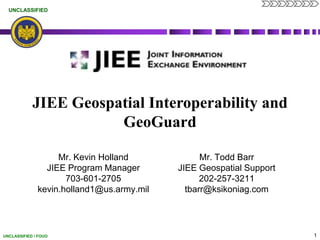
- 1. JIEE Geospatial Interoperability and GeoGuard Mr. Todd Barr JIEE Geospatial Support 202-257-3211 tbarr@ksikoniag.com Mr. Kevin Holland JIEE Program Manager 703-601-2705 kevin.holland1@us.army.mil
- 2. Agenda What is JIEE? JIEE Geospatial Data Viewing JIEE Geospatial Data JIEE - GeoGuard Architecture Principles JIEE & GeoGuard – The Future
- 3. JIEE Introduction JIEE is NGB’s web-based, near real-time information sharing solution used by the Joint Operations Coordination Center (JoCC) and all Joint Force Headquarters (JF-HQs) in each state JIEE provides extensive information sharing and collaboration capabilities for an enhanced Common Operational Picture (COP) and increased situational awareness (SA) Flexible and scalable architecture that supports more than 11,000+ users and state-level customization for information sharing and archiving Single Sign-On (SSO) supported through Army Knowledge Online (AKO) account Includes three (3) Production environments – Training, Exercise, & Operational
- 4. JIEE Capabilities Event Tracking Mission Management Request for Information (RFI) Request for Assistance (RFA) COP/Mapping
- 5. NG System of Record: Events, Missions, RFIs, RFAs
- 7. Tracks Information and activities at a Tactical Level
- 8. Symbolology for the Event is auto selected by the type of event (IE Select a Hurricane event and the Hurricane Icon is automatically selected, new as of JIEE release 5.0.3)
- 9. Data can be entered by anyone trained to use JIEE, Geospatial data being generated by a non GIS professional
- 12. Start Map based on User’s Group location (Texas starts with Texas)
- 13. Multiple Layers (Open and Closed Events and Missions, Incidents, Core Group Layers, the Common Layer Set are Visible as per Permissions and NorthCOM’s Blue Friendly Force Tracker)
- 15. Not an ArcGIS Service, but a direct pull from the JIEE Database
- 18. JIEE Core ComponentsCommon Operational Picture (COP) – Geospatial Viewers
- 20. Not an ArcGIS Service, but a direct pull from the JIEE Database
- 22. Built in the Flex Framework
- 23. Pulls in Multiple Feeds including JIEE, WSDOT, State EOC and others
- 25. JIEE – GeoGuard Architectural Principles GeoGuard architectural principles Leverage the existing portfolio of solutions and data JIEE is based on requirements collected by the Guard since 2005 Standards-based not standardized JIEE is a .NET application that produces OGC Compliant Geographic Web Services Application and data interoperability Any Viewer can consume and visualize JIEE Geospatial Data
- 26. JIEE – GeoGuard Architectural Principles GeoGuard architectural principles Inventory existing capabilities and resources, re-use where possible JIEE is a prime example of this Share best practices addressing implementation challenges Just ask us Establish “to-be” architectural “patterns” (blueprints) for new innovation Established Change Request Group for enhancements and advancements for JIEE
- 27. JIEE – The Future The Future of JIEE’s Geospatial Capabilities are Defined by YOU
- 29. JIEE Links JIEE Online Training http://www.jiee.info JIEE Training Environment https://jieeexercise.ngb.army.mil JIEE Exercise Environment https://jieeexercise.ngb.army.mil JIEE Operational Environment https://jiee.ngb.army.mil
Hinweis der Redaktion
- Event Management:Allows users to create an Event in response to a natural disaster (e.g. earthquake, hurricane, flood, etc.), a special security event (e.g. Presidential Inauguration, G-8 summit, etc.) , or an exerciseFacilitates information sharing by allowing users to define which entities the event is shared withJIEE users update events as the situation progresses, thereby providing near-real time situational awareness (SA)Event changes are archived and presented in an ‘Audit Log’ showing all updates, who entered the update, and other detailsEvent reports enable post-situation analysis of the response and facilitates the completion of AARsMission Management:Missions are associated with an Event and focus on specific objectives related to an eventMissions can also be linked to or created in response to an RFI/RFAJIEE missions support the tasking of NGB resources and allows users to identify Points of Contact (POCs)JIEE supports the identification of multiple Mission locations, which are automatically updated in the Common Operational Picture (COP)Mission changes are archived and presented in an ‘Audit Log’ showing all updates, who entered the update, and other detailsRequests for Information (RFIs)Initiates the information sharing process and can precede the creation of an EventRFI/RFA’s can be directly tied to an Event and/or Mission so that information, personnel and assets can easily be tracked. Requests for Action (RFAs)RFA’s are used to facilitate coordination between NGB and states and must be associated with an Event or MissionRFI/RFA DetailJIEE provides controlled RFI/RFA sharing and tracking from initiation to closure. Core Group Mapping: Each Core Group can build their own Map Layers that stay within that particular Core Group which can, if desired, be shared with other Core Groups. Common Layer Set (CLS): As needed on a national basis, a Map Layer can be included in the CLS which is available to ALL Core Groups. Each Map Layer is identified by the following categories: Personnel, Information, Operations, Logistics, Civilian Support, Communications, Training and Funding.Icon Builder: Location Icons are based on DHS symbology and are built by the user to reflect 4-status levels of either Incident, Natural, Operations or Infrastructure standard icons.
- The flow of an RFI or RFA through JIEE resembles the Emergency Management Assistance Compact (EMAC) process.First the RFI or Event & RFA are entered into JIEE. NGB Joint Staff provides coordination. The requested is then sourced, committed, and filled. Information at each stage in the process can be recorded in JIEE. JIEE serves like an automated EMAC.
- JIEE also provides the capability to create custom layers of points to produce and share feeds of persistent data. Each core group can build their own layers in the JIEE layer manager. Those layers can be made available through feeds on a national basis for all core groups through the common layer set.