SlideShare a Scribd company logo
1 of 15
Download to read offline
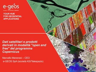
YOUR HUB
FOR GEOSPATIAL
APPLICATIONS
Marcello Maranesi – CEO
e-GEOS SpA (società ASI/Telespazio)
Dati satellitari e prodotti
derivati in modalità "open and
free" del programma
Copernicus
“The year 2014 marks the 20th anniversary of the creation of the Open Geospatial
Consortium (OGC). After two decades, OGC standards have become a key enabler
of geospatial interoperability, delivering significant societal, economic and
scientific benefits by integrating digital location resources into commercial and
institutional processes worldwide.”
Dr. Steve H.L. Liang
Chair of ISPRS Working Group IV/6
“Sensor Web and Internet of
Things”
I dati OPEN sono disponibili ma poco conosciuti
138.201 datasets 10.962 datasets
I dati OPEN GEO in Italia
Un po` di numeri
Chiunque voglia usare il servizio
WMS di e-GEOS può farlo
gratuitamente, anche per uso
commerciale, citando la fonte.
RealVista è la prima base
nazionale OPEN
offerta da un’azienda privata.
Copertura ortofo mutlispettrali
di tutta l’Italia a 20 e 50 cm di
risoluzione
RealVista
770
Utenti registrati e attivi
21.820
Visitatori Unici
Chi usa RealVista e per quale scopo
…
Il Programma Copernicus
Core
services
Sentinels
Sentinel-2: lancio Giugno 2015
13 spectral bands, swath width of 290 km:
• 4 bands @ 10 m res.
• 6 bands @ 20 m res.
• 3 bands @ 60 m res. (dedicated to atmospheric
corrections and cloud screening),
DISEGNINO
Esempi
prodotti, con
risoluzione
Sentinel 1: operativa in orbita
Instrument: C-band SAR
Operational modes:
• Interferometric wide-swath: 250 km @ 5×20 m res.
• Wave-mode: 20×20 km @ 5×5 m res. (100 km intervals)
• Strip map: 80 km swath @ 5×5 m res.
• Extra wide-swath: 400 km @ 20×40 m res.
Sentinel-3: lancio Ottobre-Dicembre 2015
• Sea and Land Surface Temperature Radiometer
(SLSTR), 11 spectral bands:
– 500 m res. in the visible and shortwave infrared
channels
– 1 km res. in the thermal infrared channels.
• Ocean Color Instrument:
– 21 bands @ 300m res. over all surfaces,
• A dual-frequency (Ku and C band) advanced
Synthetic Aperture Radar Altimeter (SRAL) @
300m res. in SAR mode along track.
Licenza ESA
User rights
• non-exclusive, time-unlimited right
• The User may use, alter and modify it in any way, and thereby produce Altered
Products and/ or Derivative Works.
• Altered Products: retaining a clear correlation to the original sensor information
• Derivative Products: contain a significant intellectual or creative achievement made by
the User
• The User may make an unlimited number of copies as necessary for the use of the data.
• The User may publish Sentinel data, Altered Products and Derivative Works in printed
or digital media. Digital publishing shall not allow the download or reconstruction of
Sentinel data or Altered Products.
• The User may distribute the Sentinel data, Altered Products and Derivative Works
created by the User to any other natural or legal person. Whenever distributing or
making available Primary or Altered Products, the User shall make sure, that the
recipient takes note of ESA license Terms and Conditions.
Accesso ai dati Sentinel
https://sentinel.esa.int/web/se
ntinel/sentinel-data-access
Licenza d’uso ESA
https://sentinel.esa.int/documents/247904
/690755/TC_Sentinel_Data_31072014.pdf
Il Programma Copernicus
Matera Space Center
ESA - Sentinels
USGS - Landsat-8
ASI - COSMO-SkyMed
ASI Sentinel Collaborative Ground Segment
Realizzazione di un “national mirror site” @Matera per
complementare le funzioni del Core Ground Segment dell’ESA e
offrire soluzioni/servizi a supporto degli utenti nazionali italiani
(Istituzioni Pubbliche, Enti di Ricerca, Società Private; inclusi scopi commerciali)
– Sviluppo di applicazioni e tools innovativi, anche per il grande pubblico,
che, in funzione del budget disponibile potrebbe includere anche User
Exploitation Platforms, capacità di processing tramite hosting di HW & SW e
dati aggiuntivi (e.g. in-situ).
– Supporto all’R&D di applicazioni e tools applicativi tramite tecnologie di
processing on demand con infrastrutture di tipo cloud
– Alcuni prodotti: INSAR (anche in NRT), prodotti sui vulcani e di tipo sismico,
parametri della superficie terrestre, sorveglianza della qualità delle acque
– Studio di un possibile accesso integrato a dati Sentinel e third parties (e.g.
COSMO-SkyMed); capacità di generare prodotti derivati dall’uso combinato
delle due missioni
Il Programma Copernicus
6 aree tematiche:
 Land Monitoring
 Marine Monitoring
 Atmosphere Monitoring
 Emergency Management
 Security
 Climate Change
What happened, When, Where Based on disaster type and cloud cover Proprietary, public and open data
Make it available on the web site Data processing and analysis Make it available on the web site
HOW IT WORKS
Emergency Management Service
Emergency Management
1 Service activation 2 Plan satellite images 3 Find available data/info
5 Acquire 1st Satellite image4 Prepare pre-event map 6 Prepare post-event map
@asi
Landsat-8 – Mosaico Italia
Mosaico ortorettificato (data fusion):
• OLI multispectral bands 1-7,9: 30-meters
• OLI panchromatic band 8: 15-meters
www.realvista.it
Thank you for your attention !

More Related Content

What's hot

EDF2014: Talk of Axel Polleres, Full Professor, WU - Vienna University of Eco...
EDF2014: Talk of Axel Polleres, Full Professor, WU - Vienna University of Eco...EDF2014: Talk of Axel Polleres, Full Professor, WU - Vienna University of Eco...
EDF2014: Talk of Axel Polleres, Full Professor, WU - Vienna University of Eco...European Data Forum
 
DISCOVERY DAY 2017: MAKE IT HAPPEN!
DISCOVERY DAY 2017: MAKE IT HAPPEN!DISCOVERY DAY 2017: MAKE IT HAPPEN!
DISCOVERY DAY 2017: MAKE IT HAPPEN!FAO
 
Sensor SDI in PDOK with Smart Emission Platform
Sensor SDI in PDOK with Smart Emission PlatformSensor SDI in PDOK with Smart Emission Platform
Sensor SDI in PDOK with Smart Emission PlatformJust van den Broecke
 
Orthophoto Coverage & Data Management System
Orthophoto Coverage & Data Management SystemOrthophoto Coverage & Data Management System
Orthophoto Coverage & Data Management SystemRolta
 
Catch! Workshop concept 1 - Using data to minimise the disruption of infrastr...
Catch! Workshop concept 1 - Using data to minimise the disruption of infrastr...Catch! Workshop concept 1 - Using data to minimise the disruption of infrastr...
Catch! Workshop concept 1 - Using data to minimise the disruption of infrastr...Peter Lindgren
 
Cities as digital platforms challenges and opportunities in the municipality ...
Cities as digital platforms challenges and opportunities in the municipality ...Cities as digital platforms challenges and opportunities in the municipality ...
Cities as digital platforms challenges and opportunities in the municipality ...citybrandinggr
 
EDF2014: Talk of European Data Innovator Award Winner: Johann Mittheisz, form...
EDF2014: Talk of European Data Innovator Award Winner: Johann Mittheisz, form...EDF2014: Talk of European Data Innovator Award Winner: Johann Mittheisz, form...
EDF2014: Talk of European Data Innovator Award Winner: Johann Mittheisz, form...European Data Forum
 
Open Data policy implementations: Creating economic value
Open Data policy implementations: Creating economic valueOpen Data policy implementations: Creating economic value
Open Data policy implementations: Creating economic valueAngeles Navarro Rueda
 
GNSS Opportunities in Agriculture, Mapping and Surveying
GNSS Opportunities in Agriculture, Mapping and SurveyingGNSS Opportunities in Agriculture, Mapping and Surveying
GNSS Opportunities in Agriculture, Mapping and SurveyingThe European GNSS Agency (GSA)
 
2014 Future Cities Conference / Ana Aguiar "The Future Cities Crowdsensor"
2014 Future Cities Conference / Ana Aguiar "The Future Cities Crowdsensor"2014 Future Cities Conference / Ana Aguiar "The Future Cities Crowdsensor"
2014 Future Cities Conference / Ana Aguiar "The Future Cities Crowdsensor"Future Cities Project
 
Seeking the candidate technology to drive the Automated Vehicles market
Seeking the candidate technology to drive the Automated Vehicles marketSeeking the candidate technology to drive the Automated Vehicles market
Seeking the candidate technology to drive the Automated Vehicles marketThe European GNSS Agency (GSA)
 
PLS 2019: From streetlights to urban data: how can local authorities collect,...
PLS 2019: From streetlights to urban data: how can local authorities collect,...PLS 2019: From streetlights to urban data: how can local authorities collect,...
PLS 2019: From streetlights to urban data: how can local authorities collect,...Institution of Lighting Professionals
 
SFScon 2020 - Stefano Tondini - Low-cost high-res GNSS technology in combinat...
SFScon 2020 - Stefano Tondini - Low-cost high-res GNSS technology in combinat...SFScon 2020 - Stefano Tondini - Low-cost high-res GNSS technology in combinat...
SFScon 2020 - Stefano Tondini - Low-cost high-res GNSS technology in combinat...South Tyrol Free Software Conference
 

What's hot (20)

EDF2014: Talk of Axel Polleres, Full Professor, WU - Vienna University of Eco...
EDF2014: Talk of Axel Polleres, Full Professor, WU - Vienna University of Eco...EDF2014: Talk of Axel Polleres, Full Professor, WU - Vienna University of Eco...
EDF2014: Talk of Axel Polleres, Full Professor, WU - Vienna University of Eco...
 
smart safe city modelling
smart safe city modellingsmart safe city modelling
smart safe city modelling
 
DISCOVERY DAY 2017: MAKE IT HAPPEN!
DISCOVERY DAY 2017: MAKE IT HAPPEN!DISCOVERY DAY 2017: MAKE IT HAPPEN!
DISCOVERY DAY 2017: MAKE IT HAPPEN!
 
FIWARE Smart City cases 2014
FIWARE Smart City cases  2014FIWARE Smart City cases  2014
FIWARE Smart City cases 2014
 
Sensor SDI in PDOK with Smart Emission Platform
Sensor SDI in PDOK with Smart Emission PlatformSensor SDI in PDOK with Smart Emission Platform
Sensor SDI in PDOK with Smart Emission Platform
 
Orthophoto Coverage & Data Management System
Orthophoto Coverage & Data Management SystemOrthophoto Coverage & Data Management System
Orthophoto Coverage & Data Management System
 
Catch! Workshop concept 1 - Using data to minimise the disruption of infrastr...
Catch! Workshop concept 1 - Using data to minimise the disruption of infrastr...Catch! Workshop concept 1 - Using data to minimise the disruption of infrastr...
Catch! Workshop concept 1 - Using data to minimise the disruption of infrastr...
 
Cities as digital platforms challenges and opportunities in the municipality ...
Cities as digital platforms challenges and opportunities in the municipality ...Cities as digital platforms challenges and opportunities in the municipality ...
Cities as digital platforms challenges and opportunities in the municipality ...
 
Technology Trends Impacting the GNSS R&D
Technology Trends Impacting the GNSS R&DTechnology Trends Impacting the GNSS R&D
Technology Trends Impacting the GNSS R&D
 
GNSS Opportunities in Road
GNSS Opportunities in RoadGNSS Opportunities in Road
GNSS Opportunities in Road
 
EDF2014: Talk of European Data Innovator Award Winner: Johann Mittheisz, form...
EDF2014: Talk of European Data Innovator Award Winner: Johann Mittheisz, form...EDF2014: Talk of European Data Innovator Award Winner: Johann Mittheisz, form...
EDF2014: Talk of European Data Innovator Award Winner: Johann Mittheisz, form...
 
From Taxisat to inLane
From Taxisat to inLane From Taxisat to inLane
From Taxisat to inLane
 
Open Data policy implementations: Creating economic value
Open Data policy implementations: Creating economic valueOpen Data policy implementations: Creating economic value
Open Data policy implementations: Creating economic value
 
GNSS Opportunities in Agriculture, Mapping and Surveying
GNSS Opportunities in Agriculture, Mapping and SurveyingGNSS Opportunities in Agriculture, Mapping and Surveying
GNSS Opportunities in Agriculture, Mapping and Surveying
 
Standards, Mapping and Switching
Standards, Mapping and SwitchingStandards, Mapping and Switching
Standards, Mapping and Switching
 
2014 Future Cities Conference / Ana Aguiar "The Future Cities Crowdsensor"
2014 Future Cities Conference / Ana Aguiar "The Future Cities Crowdsensor"2014 Future Cities Conference / Ana Aguiar "The Future Cities Crowdsensor"
2014 Future Cities Conference / Ana Aguiar "The Future Cities Crowdsensor"
 
Seeking the candidate technology to drive the Automated Vehicles market
Seeking the candidate technology to drive the Automated Vehicles marketSeeking the candidate technology to drive the Automated Vehicles market
Seeking the candidate technology to drive the Automated Vehicles market
 
PLS 2019: From streetlights to urban data: how can local authorities collect,...
PLS 2019: From streetlights to urban data: how can local authorities collect,...PLS 2019: From streetlights to urban data: how can local authorities collect,...
PLS 2019: From streetlights to urban data: how can local authorities collect,...
 
SFScon 2020 - Stefano Tondini - Low-cost high-res GNSS technology in combinat...
SFScon 2020 - Stefano Tondini - Low-cost high-res GNSS technology in combinat...SFScon 2020 - Stefano Tondini - Low-cost high-res GNSS technology in combinat...
SFScon 2020 - Stefano Tondini - Low-cost high-res GNSS technology in combinat...
 
GNSS Opportunities in Location Based Systems (LBS)
GNSS Opportunities in Location Based Systems (LBS)GNSS Opportunities in Location Based Systems (LBS)
GNSS Opportunities in Location Based Systems (LBS)
 

Viewers also liked

StatLomb: Un sistema web che riusa i dati statistici open per l’analisi geo s...
StatLomb: Un sistema web che riusa i dati statistici open per l’analisi geo s...StatLomb: Un sistema web che riusa i dati statistici open per l’analisi geo s...
StatLomb: Un sistema web che riusa i dati statistici open per l’analisi geo s...giovannibiallo
 
Luigi Guastamacchia - Innovazione Tecnologica nella redazione dei Piani: il c...
Luigi Guastamacchia - Innovazione Tecnologica nella redazione dei Piani: il c...Luigi Guastamacchia - Innovazione Tecnologica nella redazione dei Piani: il c...
Luigi Guastamacchia - Innovazione Tecnologica nella redazione dei Piani: il c...Planetek Italia Srl
 
GWT 2014: Energy Conference - 05 Infrastructure Real-time Monitoring
GWT 2014: Energy Conference - 05 Infrastructure Real-time MonitoringGWT 2014: Energy Conference - 05 Infrastructure Real-time Monitoring
GWT 2014: Energy Conference - 05 Infrastructure Real-time MonitoringPlanetek Italia Srl
 
Conoscenza e condivisione: una prospettiva possibile nel campo delle geoscien...
Conoscenza e condivisione: una prospettiva possibile nel campo delle geoscien...Conoscenza e condivisione: una prospettiva possibile nel campo delle geoscien...
Conoscenza e condivisione: una prospettiva possibile nel campo delle geoscien...giovannibiallo
 
[Webinar] Il telerilevamento da droni aerei: Le soluzioni Hexagon Geospatial ...
[Webinar] Il telerilevamento da droni aerei: Le soluzioni Hexagon Geospatial ...[Webinar] Il telerilevamento da droni aerei: Le soluzioni Hexagon Geospatial ...
[Webinar] Il telerilevamento da droni aerei: Le soluzioni Hexagon Geospatial ...Planetek Italia Srl
 
Big data ibm
Big data ibmBig data ibm
Big data ibmgmrinaldi
 
IBM Enterprise 2.0 / Valori Distintivi della soluzione
IBM Enterprise 2.0 / Valori Distintivi della soluzioneIBM Enterprise 2.0 / Valori Distintivi della soluzione
IBM Enterprise 2.0 / Valori Distintivi della soluzioneMax Ardigó 🇦🇷
 
Regione Umbria: dalle produzioni agli open geodata - Ambra Ciarapica (Regione...
Regione Umbria: dalle produzioni agli open geodata - Ambra Ciarapica (Regione...Regione Umbria: dalle produzioni agli open geodata - Ambra Ciarapica (Regione...
Regione Umbria: dalle produzioni agli open geodata - Ambra Ciarapica (Regione...giovannibiallo
 

Viewers also liked (9)

StatLomb: Un sistema web che riusa i dati statistici open per l’analisi geo s...
StatLomb: Un sistema web che riusa i dati statistici open per l’analisi geo s...StatLomb: Un sistema web che riusa i dati statistici open per l’analisi geo s...
StatLomb: Un sistema web che riusa i dati statistici open per l’analisi geo s...
 
Luigi Guastamacchia - Innovazione Tecnologica nella redazione dei Piani: il c...
Luigi Guastamacchia - Innovazione Tecnologica nella redazione dei Piani: il c...Luigi Guastamacchia - Innovazione Tecnologica nella redazione dei Piani: il c...
Luigi Guastamacchia - Innovazione Tecnologica nella redazione dei Piani: il c...
 
Market Update 6 23 11
Market Update 6 23 11Market Update 6 23 11
Market Update 6 23 11
 
GWT 2014: Energy Conference - 05 Infrastructure Real-time Monitoring
GWT 2014: Energy Conference - 05 Infrastructure Real-time MonitoringGWT 2014: Energy Conference - 05 Infrastructure Real-time Monitoring
GWT 2014: Energy Conference - 05 Infrastructure Real-time Monitoring
 
Conoscenza e condivisione: una prospettiva possibile nel campo delle geoscien...
Conoscenza e condivisione: una prospettiva possibile nel campo delle geoscien...Conoscenza e condivisione: una prospettiva possibile nel campo delle geoscien...
Conoscenza e condivisione: una prospettiva possibile nel campo delle geoscien...
 
[Webinar] Il telerilevamento da droni aerei: Le soluzioni Hexagon Geospatial ...
[Webinar] Il telerilevamento da droni aerei: Le soluzioni Hexagon Geospatial ...[Webinar] Il telerilevamento da droni aerei: Le soluzioni Hexagon Geospatial ...
[Webinar] Il telerilevamento da droni aerei: Le soluzioni Hexagon Geospatial ...
 
Big data ibm
Big data ibmBig data ibm
Big data ibm
 
IBM Enterprise 2.0 / Valori Distintivi della soluzione
IBM Enterprise 2.0 / Valori Distintivi della soluzioneIBM Enterprise 2.0 / Valori Distintivi della soluzione
IBM Enterprise 2.0 / Valori Distintivi della soluzione
 
Regione Umbria: dalle produzioni agli open geodata - Ambra Ciarapica (Regione...
Regione Umbria: dalle produzioni agli open geodata - Ambra Ciarapica (Regione...Regione Umbria: dalle produzioni agli open geodata - Ambra Ciarapica (Regione...
Regione Umbria: dalle produzioni agli open geodata - Ambra Ciarapica (Regione...
 

Similar to Dati satellitari e prodotti derivati in modalità open and free del programma Copernicus - Marcello Maranesi (e-GEOS) - Conferenza OpenGeoData Italia 2015

Artificial Intelligence in the Earth Observation Domain: Current European Res...
Artificial Intelligence in the Earth Observation Domain: Current European Res...Artificial Intelligence in the Earth Observation Domain: Current European Res...
Artificial Intelligence in the Earth Observation Domain: Current European Res...ExtremeEarth
 
Artificial Intelligence and Big Data Technologies for Copernicus Data: the Ex...
Artificial Intelligence and Big Data Technologies for Copernicus Data: the Ex...Artificial Intelligence and Big Data Technologies for Copernicus Data: the Ex...
Artificial Intelligence and Big Data Technologies for Copernicus Data: the Ex...ExtremeEarth
 
2017 01-12 esa-gep_overview
2017 01-12 esa-gep_overview2017 01-12 esa-gep_overview
2017 01-12 esa-gep_overviewESA
 
Free and open source software for remote sensing and GIS
Free and open source software for remote sensing and GISFree and open source software for remote sensing and GIS
Free and open source software for remote sensing and GISNopphawanTamkuan
 
ExtremeEarth Open Workshop - Overview and Achievements
ExtremeEarth Open Workshop - Overview and AchievementsExtremeEarth Open Workshop - Overview and Achievements
ExtremeEarth Open Workshop - Overview and AchievementsExtremeEarth
 
Application packaging and systematic processing in earth observation exploita...
Application packaging and systematic processing in earth observation exploita...Application packaging and systematic processing in earth observation exploita...
Application packaging and systematic processing in earth observation exploita...terradue
 
MDIS workshop 2015
MDIS workshop 2015MDIS workshop 2015
MDIS workshop 2015terradue
 
Big data from space technology 150611 @ spaceops 2015
Big data from space technology 150611 @ spaceops 2015Big data from space technology 150611 @ spaceops 2015
Big data from space technology 150611 @ spaceops 2015Pier Giorgio Marchetti
 
Servitization Daniel Vander Vorst
Servitization Daniel Vander VorstServitization Daniel Vander Vorst
Servitization Daniel Vander VorstOrkestra
 
Use of satellite imagery for the generation of an aquaculture atlas : a case ...
Use of satellite imagery for the generation of an aquaculture atlas : a case ...Use of satellite imagery for the generation of an aquaculture atlas : a case ...
Use of satellite imagery for the generation of an aquaculture atlas : a case ...Blue BRIDGE
 
SC7 Workshop 3: Copernicus Data and Information Access Services (DIAS)
SC7 Workshop 3: Copernicus Data and Information Access Services (DIAS)SC7 Workshop 3: Copernicus Data and Information Access Services (DIAS)
SC7 Workshop 3: Copernicus Data and Information Access Services (DIAS)BigData_Europe
 
2017 esa gep_overview
2017 esa gep_overview2017 esa gep_overview
2017 esa gep_overviewESA
 
EODATASERVICE.ORG - Digital Earth Platform to enable Muti-disciplinary Geospa...
EODATASERVICE.ORG - Digital Earth Platform to enable Muti-disciplinary Geospa...EODATASERVICE.ORG - Digital Earth Platform to enable Muti-disciplinary Geospa...
EODATASERVICE.ORG - Digital Earth Platform to enable Muti-disciplinary Geospa...EUDAT
 
ACC-2012, Bangalore, India, 28 July, 2012
ACC-2012, Bangalore, India, 28 July, 2012ACC-2012, Bangalore, India, 28 July, 2012
ACC-2012, Bangalore, India, 28 July, 2012Charith Perera
 
DSD-INT 2015 -EU FP7 project “FAST” introduction - Mindert de Vries
DSD-INT 2015 -EU FP7 project “FAST” introduction - Mindert de VriesDSD-INT 2015 -EU FP7 project “FAST” introduction - Mindert de Vries
DSD-INT 2015 -EU FP7 project “FAST” introduction - Mindert de VriesDeltares
 
Intelligent satellites
Intelligent satellitesIntelligent satellites
Intelligent satellitesClifford Stone
 
SC7 Workshop 2: Big Data pilots for Secure Societies
SC7 Workshop 2: Big Data pilots for Secure SocietiesSC7 Workshop 2: Big Data pilots for Secure Societies
SC7 Workshop 2: Big Data pilots for Secure SocietiesBigData_Europe
 

Similar to Dati satellitari e prodotti derivati in modalità open and free del programma Copernicus - Marcello Maranesi (e-GEOS) - Conferenza OpenGeoData Italia 2015 (20)

EOSC-hub & Geohazards TEP
EOSC-hub & Geohazards TEPEOSC-hub & Geohazards TEP
EOSC-hub & Geohazards TEP
 
Artificial Intelligence in the Earth Observation Domain: Current European Res...
Artificial Intelligence in the Earth Observation Domain: Current European Res...Artificial Intelligence in the Earth Observation Domain: Current European Res...
Artificial Intelligence in the Earth Observation Domain: Current European Res...
 
Extreme earth overview
Extreme earth overviewExtreme earth overview
Extreme earth overview
 
Artificial Intelligence and Big Data Technologies for Copernicus Data: the Ex...
Artificial Intelligence and Big Data Technologies for Copernicus Data: the Ex...Artificial Intelligence and Big Data Technologies for Copernicus Data: the Ex...
Artificial Intelligence and Big Data Technologies for Copernicus Data: the Ex...
 
2017 01-12 esa-gep_overview
2017 01-12 esa-gep_overview2017 01-12 esa-gep_overview
2017 01-12 esa-gep_overview
 
Free and open source software for remote sensing and GIS
Free and open source software for remote sensing and GISFree and open source software for remote sensing and GIS
Free and open source software for remote sensing and GIS
 
ExtremeEarth Open Workshop - Overview and Achievements
ExtremeEarth Open Workshop - Overview and AchievementsExtremeEarth Open Workshop - Overview and Achievements
ExtremeEarth Open Workshop - Overview and Achievements
 
Application packaging and systematic processing in earth observation exploita...
Application packaging and systematic processing in earth observation exploita...Application packaging and systematic processing in earth observation exploita...
Application packaging and systematic processing in earth observation exploita...
 
MDIS workshop 2015
MDIS workshop 2015MDIS workshop 2015
MDIS workshop 2015
 
Big data from space technology 150611 @ spaceops 2015
Big data from space technology 150611 @ spaceops 2015Big data from space technology 150611 @ spaceops 2015
Big data from space technology 150611 @ spaceops 2015
 
Servitization Daniel Vander Vorst
Servitization Daniel Vander VorstServitization Daniel Vander Vorst
Servitization Daniel Vander Vorst
 
Use of satellite imagery for the generation of an aquaculture atlas : a case ...
Use of satellite imagery for the generation of an aquaculture atlas : a case ...Use of satellite imagery for the generation of an aquaculture atlas : a case ...
Use of satellite imagery for the generation of an aquaculture atlas : a case ...
 
SC7 Workshop 3: Copernicus Data and Information Access Services (DIAS)
SC7 Workshop 3: Copernicus Data and Information Access Services (DIAS)SC7 Workshop 3: Copernicus Data and Information Access Services (DIAS)
SC7 Workshop 3: Copernicus Data and Information Access Services (DIAS)
 
DGalfonsi
DGalfonsiDGalfonsi
DGalfonsi
 
2017 esa gep_overview
2017 esa gep_overview2017 esa gep_overview
2017 esa gep_overview
 
EODATASERVICE.ORG - Digital Earth Platform to enable Muti-disciplinary Geospa...
EODATASERVICE.ORG - Digital Earth Platform to enable Muti-disciplinary Geospa...EODATASERVICE.ORG - Digital Earth Platform to enable Muti-disciplinary Geospa...
EODATASERVICE.ORG - Digital Earth Platform to enable Muti-disciplinary Geospa...
 
ACC-2012, Bangalore, India, 28 July, 2012
ACC-2012, Bangalore, India, 28 July, 2012ACC-2012, Bangalore, India, 28 July, 2012
ACC-2012, Bangalore, India, 28 July, 2012
 
DSD-INT 2015 -EU FP7 project “FAST” introduction - Mindert de Vries
DSD-INT 2015 -EU FP7 project “FAST” introduction - Mindert de VriesDSD-INT 2015 -EU FP7 project “FAST” introduction - Mindert de Vries
DSD-INT 2015 -EU FP7 project “FAST” introduction - Mindert de Vries
 
Intelligent satellites
Intelligent satellitesIntelligent satellites
Intelligent satellites
 
SC7 Workshop 2: Big Data pilots for Secure Societies
SC7 Workshop 2: Big Data pilots for Secure SocietiesSC7 Workshop 2: Big Data pilots for Secure Societies
SC7 Workshop 2: Big Data pilots for Secure Societies
 

More from giovannibiallo

Dati open statici e dinamici per l’Infomobilità. keynote introduttiva - Fabri...
Dati open statici e dinamici per l’Infomobilità. keynote introduttiva - Fabri...Dati open statici e dinamici per l’Infomobilità. keynote introduttiva - Fabri...
Dati open statici e dinamici per l’Infomobilità. keynote introduttiva - Fabri...giovannibiallo
 
Il Comune di Cesena e gli open geo data sugli incidenti stradali - Morena Mor...
Il Comune di Cesena e gli open geo data sugli incidenti stradali - Morena Mor...Il Comune di Cesena e gli open geo data sugli incidenti stradali - Morena Mor...
Il Comune di Cesena e gli open geo data sugli incidenti stradali - Morena Mor...giovannibiallo
 
Opendata dinamici per i servizi di infomobilità della smartcity a Bari - Fran...
Opendata dinamici per i servizi di infomobilità della smartcity a Bari - Fran...Opendata dinamici per i servizi di infomobilità della smartcity a Bari - Fran...
Opendata dinamici per i servizi di infomobilità della smartcity a Bari - Fran...giovannibiallo
 
Smart Cities e Big Data: Vodafone Mobile Analytics - SUPERHUB e altri proget...
Smart Cities e Big Data: Vodafone Mobile Analytics -  SUPERHUB e altri proget...Smart Cities e Big Data: Vodafone Mobile Analytics -  SUPERHUB e altri proget...
Smart Cities e Big Data: Vodafone Mobile Analytics - SUPERHUB e altri proget...giovannibiallo
 
Muoversi a Roma come piattaforma open: dati e servizi - Marco Cagnoli (Agenzi...
Muoversi a Roma come piattaforma open: dati e servizi - Marco Cagnoli (Agenzi...Muoversi a Roma come piattaforma open: dati e servizi - Marco Cagnoli (Agenzi...
Muoversi a Roma come piattaforma open: dati e servizi - Marco Cagnoli (Agenzi...giovannibiallo
 
Open data: un impegno verso la società civile - Paola Palmieri (Comune di Ra...
Open data: un impegno verso la società  civile - Paola Palmieri (Comune di Ra...Open data: un impegno verso la società  civile - Paola Palmieri (Comune di Ra...
Open data: un impegno verso la società civile - Paola Palmieri (Comune di Ra...giovannibiallo
 
Sviluppare le competenze digitali per e con gli open data - Giuseppe Iacono ...
Sviluppare le  competenze digitali per e con gli open data - Giuseppe Iacono ...Sviluppare le  competenze digitali per e con gli open data - Giuseppe Iacono ...
Sviluppare le competenze digitali per e con gli open data - Giuseppe Iacono ...giovannibiallo
 
Open data: bilancio e prospettive - Francesco Tortorelli (AgID) - Conferenza ...
Open data: bilancio e prospettive - Francesco Tortorelli (AgID) - Conferenza ...Open data: bilancio e prospettive - Francesco Tortorelli (AgID) - Conferenza ...
Open data: bilancio e prospettive - Francesco Tortorelli (AgID) - Conferenza ...giovannibiallo
 
Dati geografici: l'open data consapevole - Giovanni Biallo - Conferenza OpenG...
Dati geografici: l'open data consapevole - Giovanni Biallo - Conferenza OpenG...Dati geografici: l'open data consapevole - Giovanni Biallo - Conferenza OpenG...
Dati geografici: l'open data consapevole - Giovanni Biallo - Conferenza OpenG...giovannibiallo
 
OpenGeoData Italia 2014 - Ernesto Lastres "Terzo modulo del Corso: StatPortal...
OpenGeoData Italia 2014 - Ernesto Lastres "Terzo modulo del Corso: StatPortal...OpenGeoData Italia 2014 - Ernesto Lastres "Terzo modulo del Corso: StatPortal...
OpenGeoData Italia 2014 - Ernesto Lastres "Terzo modulo del Corso: StatPortal...giovannibiallo
 
OpenGeoData Italia 2014 - Giovanni Biallo "Stradari open"
OpenGeoData Italia 2014 - Giovanni Biallo "Stradari open"OpenGeoData Italia 2014 - Giovanni Biallo "Stradari open"
OpenGeoData Italia 2014 - Giovanni Biallo "Stradari open"giovannibiallo
 
OpenGeoData Italia 2014 - Piergiorgio Cipriano "Modelli dati per stradari e n...
OpenGeoData Italia 2014 - Piergiorgio Cipriano "Modelli dati per stradari e n...OpenGeoData Italia 2014 - Piergiorgio Cipriano "Modelli dati per stradari e n...
OpenGeoData Italia 2014 - Piergiorgio Cipriano "Modelli dati per stradari e n...giovannibiallo
 
OpenGeoData Italia 2014 - Luca Gentili e Duccio Fanetti "Modelli dati per str...
OpenGeoData Italia 2014 - Luca Gentili e Duccio Fanetti "Modelli dati per str...OpenGeoData Italia 2014 - Luca Gentili e Duccio Fanetti "Modelli dati per str...
OpenGeoData Italia 2014 - Luca Gentili e Duccio Fanetti "Modelli dati per str...giovannibiallo
 
OpenGeoData Italia 2014 - Giovanni Campanile "Terzo modulo del Corso: Geoport...
OpenGeoData Italia 2014 - Giovanni Campanile "Terzo modulo del Corso: Geoport...OpenGeoData Italia 2014 - Giovanni Campanile "Terzo modulo del Corso: Geoport...
OpenGeoData Italia 2014 - Giovanni Campanile "Terzo modulo del Corso: Geoport...giovannibiallo
 
OpenGeoData Italia 2014 - Daniele Crespi "Terzo modulo del Corso: la piattafo...
OpenGeoData Italia 2014 - Daniele Crespi "Terzo modulo del Corso: la piattafo...OpenGeoData Italia 2014 - Daniele Crespi "Terzo modulo del Corso: la piattafo...
OpenGeoData Italia 2014 - Daniele Crespi "Terzo modulo del Corso: la piattafo...giovannibiallo
 
OpenGeoData Italia 2014 - Maurizio Napolitano "Terzo modulo del Corso: Panora...
OpenGeoData Italia 2014 - Maurizio Napolitano "Terzo modulo del Corso: Panora...OpenGeoData Italia 2014 - Maurizio Napolitano "Terzo modulo del Corso: Panora...
OpenGeoData Italia 2014 - Maurizio Napolitano "Terzo modulo del Corso: Panora...giovannibiallo
 
OpenGeoData Italia 2014 - Emanuele Geri "Secondo modulo del corso: esperienza...
OpenGeoData Italia 2014 - Emanuele Geri "Secondo modulo del corso: esperienza...OpenGeoData Italia 2014 - Emanuele Geri "Secondo modulo del corso: esperienza...
OpenGeoData Italia 2014 - Emanuele Geri "Secondo modulo del corso: esperienza...giovannibiallo
 
OpenGeoData Italia 2014 - Gianfranco Andriola "primo modulo del corso: dati a...
OpenGeoData Italia 2014 - Gianfranco Andriola "primo modulo del corso: dati a...OpenGeoData Italia 2014 - Gianfranco Andriola "primo modulo del corso: dati a...
OpenGeoData Italia 2014 - Gianfranco Andriola "primo modulo del corso: dati a...giovannibiallo
 
OpenGeoData Italia 2014 - Piergiorgio Cipriano "Infrastrutture di dati territ...
OpenGeoData Italia 2014 - Piergiorgio Cipriano "Infrastrutture di dati territ...OpenGeoData Italia 2014 - Piergiorgio Cipriano "Infrastrutture di dati territ...
OpenGeoData Italia 2014 - Piergiorgio Cipriano "Infrastrutture di dati territ...giovannibiallo
 
OpenGeoData Italia 2014 - Marco Fago "Infrastrutture di dati territoriali, IN...
OpenGeoData Italia 2014 - Marco Fago "Infrastrutture di dati territoriali, IN...OpenGeoData Italia 2014 - Marco Fago "Infrastrutture di dati territoriali, IN...
OpenGeoData Italia 2014 - Marco Fago "Infrastrutture di dati territoriali, IN...giovannibiallo
 

More from giovannibiallo (20)

Dati open statici e dinamici per l’Infomobilità. keynote introduttiva - Fabri...
Dati open statici e dinamici per l’Infomobilità. keynote introduttiva - Fabri...Dati open statici e dinamici per l’Infomobilità. keynote introduttiva - Fabri...
Dati open statici e dinamici per l’Infomobilità. keynote introduttiva - Fabri...
 
Il Comune di Cesena e gli open geo data sugli incidenti stradali - Morena Mor...
Il Comune di Cesena e gli open geo data sugli incidenti stradali - Morena Mor...Il Comune di Cesena e gli open geo data sugli incidenti stradali - Morena Mor...
Il Comune di Cesena e gli open geo data sugli incidenti stradali - Morena Mor...
 
Opendata dinamici per i servizi di infomobilità della smartcity a Bari - Fran...
Opendata dinamici per i servizi di infomobilità della smartcity a Bari - Fran...Opendata dinamici per i servizi di infomobilità della smartcity a Bari - Fran...
Opendata dinamici per i servizi di infomobilità della smartcity a Bari - Fran...
 
Smart Cities e Big Data: Vodafone Mobile Analytics - SUPERHUB e altri proget...
Smart Cities e Big Data: Vodafone Mobile Analytics -  SUPERHUB e altri proget...Smart Cities e Big Data: Vodafone Mobile Analytics -  SUPERHUB e altri proget...
Smart Cities e Big Data: Vodafone Mobile Analytics - SUPERHUB e altri proget...
 
Muoversi a Roma come piattaforma open: dati e servizi - Marco Cagnoli (Agenzi...
Muoversi a Roma come piattaforma open: dati e servizi - Marco Cagnoli (Agenzi...Muoversi a Roma come piattaforma open: dati e servizi - Marco Cagnoli (Agenzi...
Muoversi a Roma come piattaforma open: dati e servizi - Marco Cagnoli (Agenzi...
 
Open data: un impegno verso la società civile - Paola Palmieri (Comune di Ra...
Open data: un impegno verso la società  civile - Paola Palmieri (Comune di Ra...Open data: un impegno verso la società  civile - Paola Palmieri (Comune di Ra...
Open data: un impegno verso la società civile - Paola Palmieri (Comune di Ra...
 
Sviluppare le competenze digitali per e con gli open data - Giuseppe Iacono ...
Sviluppare le  competenze digitali per e con gli open data - Giuseppe Iacono ...Sviluppare le  competenze digitali per e con gli open data - Giuseppe Iacono ...
Sviluppare le competenze digitali per e con gli open data - Giuseppe Iacono ...
 
Open data: bilancio e prospettive - Francesco Tortorelli (AgID) - Conferenza ...
Open data: bilancio e prospettive - Francesco Tortorelli (AgID) - Conferenza ...Open data: bilancio e prospettive - Francesco Tortorelli (AgID) - Conferenza ...
Open data: bilancio e prospettive - Francesco Tortorelli (AgID) - Conferenza ...
 
Dati geografici: l'open data consapevole - Giovanni Biallo - Conferenza OpenG...
Dati geografici: l'open data consapevole - Giovanni Biallo - Conferenza OpenG...Dati geografici: l'open data consapevole - Giovanni Biallo - Conferenza OpenG...
Dati geografici: l'open data consapevole - Giovanni Biallo - Conferenza OpenG...
 
OpenGeoData Italia 2014 - Ernesto Lastres "Terzo modulo del Corso: StatPortal...
OpenGeoData Italia 2014 - Ernesto Lastres "Terzo modulo del Corso: StatPortal...OpenGeoData Italia 2014 - Ernesto Lastres "Terzo modulo del Corso: StatPortal...
OpenGeoData Italia 2014 - Ernesto Lastres "Terzo modulo del Corso: StatPortal...
 
OpenGeoData Italia 2014 - Giovanni Biallo "Stradari open"
OpenGeoData Italia 2014 - Giovanni Biallo "Stradari open"OpenGeoData Italia 2014 - Giovanni Biallo "Stradari open"
OpenGeoData Italia 2014 - Giovanni Biallo "Stradari open"
 
OpenGeoData Italia 2014 - Piergiorgio Cipriano "Modelli dati per stradari e n...
OpenGeoData Italia 2014 - Piergiorgio Cipriano "Modelli dati per stradari e n...OpenGeoData Italia 2014 - Piergiorgio Cipriano "Modelli dati per stradari e n...
OpenGeoData Italia 2014 - Piergiorgio Cipriano "Modelli dati per stradari e n...
 
OpenGeoData Italia 2014 - Luca Gentili e Duccio Fanetti "Modelli dati per str...
OpenGeoData Italia 2014 - Luca Gentili e Duccio Fanetti "Modelli dati per str...OpenGeoData Italia 2014 - Luca Gentili e Duccio Fanetti "Modelli dati per str...
OpenGeoData Italia 2014 - Luca Gentili e Duccio Fanetti "Modelli dati per str...
 
OpenGeoData Italia 2014 - Giovanni Campanile "Terzo modulo del Corso: Geoport...
OpenGeoData Italia 2014 - Giovanni Campanile "Terzo modulo del Corso: Geoport...OpenGeoData Italia 2014 - Giovanni Campanile "Terzo modulo del Corso: Geoport...
OpenGeoData Italia 2014 - Giovanni Campanile "Terzo modulo del Corso: Geoport...
 
OpenGeoData Italia 2014 - Daniele Crespi "Terzo modulo del Corso: la piattafo...
OpenGeoData Italia 2014 - Daniele Crespi "Terzo modulo del Corso: la piattafo...OpenGeoData Italia 2014 - Daniele Crespi "Terzo modulo del Corso: la piattafo...
OpenGeoData Italia 2014 - Daniele Crespi "Terzo modulo del Corso: la piattafo...
 
OpenGeoData Italia 2014 - Maurizio Napolitano "Terzo modulo del Corso: Panora...
OpenGeoData Italia 2014 - Maurizio Napolitano "Terzo modulo del Corso: Panora...OpenGeoData Italia 2014 - Maurizio Napolitano "Terzo modulo del Corso: Panora...
OpenGeoData Italia 2014 - Maurizio Napolitano "Terzo modulo del Corso: Panora...
 
OpenGeoData Italia 2014 - Emanuele Geri "Secondo modulo del corso: esperienza...
OpenGeoData Italia 2014 - Emanuele Geri "Secondo modulo del corso: esperienza...OpenGeoData Italia 2014 - Emanuele Geri "Secondo modulo del corso: esperienza...
OpenGeoData Italia 2014 - Emanuele Geri "Secondo modulo del corso: esperienza...
 
OpenGeoData Italia 2014 - Gianfranco Andriola "primo modulo del corso: dati a...
OpenGeoData Italia 2014 - Gianfranco Andriola "primo modulo del corso: dati a...OpenGeoData Italia 2014 - Gianfranco Andriola "primo modulo del corso: dati a...
OpenGeoData Italia 2014 - Gianfranco Andriola "primo modulo del corso: dati a...
 
OpenGeoData Italia 2014 - Piergiorgio Cipriano "Infrastrutture di dati territ...
OpenGeoData Italia 2014 - Piergiorgio Cipriano "Infrastrutture di dati territ...OpenGeoData Italia 2014 - Piergiorgio Cipriano "Infrastrutture di dati territ...
OpenGeoData Italia 2014 - Piergiorgio Cipriano "Infrastrutture di dati territ...
 
OpenGeoData Italia 2014 - Marco Fago "Infrastrutture di dati territoriali, IN...
OpenGeoData Italia 2014 - Marco Fago "Infrastrutture di dati territoriali, IN...OpenGeoData Italia 2014 - Marco Fago "Infrastrutture di dati territoriali, IN...
OpenGeoData Italia 2014 - Marco Fago "Infrastrutture di dati territoriali, IN...
 

Recently uploaded

Six Myths about Ontologies: The Basics of Formal Ontology
Six Myths about Ontologies: The Basics of Formal OntologySix Myths about Ontologies: The Basics of Formal Ontology
Six Myths about Ontologies: The Basics of Formal Ontologyjohnbeverley2021
 
Connector Corner: Accelerate revenue generation using UiPath API-centric busi...
Connector Corner: Accelerate revenue generation using UiPath API-centric busi...Connector Corner: Accelerate revenue generation using UiPath API-centric busi...
Connector Corner: Accelerate revenue generation using UiPath API-centric busi...DianaGray10
 
Platformless Horizons for Digital Adaptability
Platformless Horizons for Digital AdaptabilityPlatformless Horizons for Digital Adaptability
Platformless Horizons for Digital AdaptabilityWSO2
 
Cloud Frontiers: A Deep Dive into Serverless Spatial Data and FME
Cloud Frontiers:  A Deep Dive into Serverless Spatial Data and FMECloud Frontiers:  A Deep Dive into Serverless Spatial Data and FME
Cloud Frontiers: A Deep Dive into Serverless Spatial Data and FMESafe Software
 
AWS Community Day CPH - Three problems of Terraform
AWS Community Day CPH - Three problems of TerraformAWS Community Day CPH - Three problems of Terraform
AWS Community Day CPH - Three problems of TerraformAndrey Devyatkin
 
Boost Fertility New Invention Ups Success Rates.pdf
Boost Fertility New Invention Ups Success Rates.pdfBoost Fertility New Invention Ups Success Rates.pdf
Boost Fertility New Invention Ups Success Rates.pdfsudhanshuwaghmare1
 
Vector Search -An Introduction in Oracle Database 23ai.pptx
Vector Search -An Introduction in Oracle Database 23ai.pptxVector Search -An Introduction in Oracle Database 23ai.pptx
Vector Search -An Introduction in Oracle Database 23ai.pptxRemote DBA Services
 
Architecting Cloud Native Applications
Architecting Cloud Native ApplicationsArchitecting Cloud Native Applications
Architecting Cloud Native ApplicationsWSO2
 
Strategies for Landing an Oracle DBA Job as a Fresher
Strategies for Landing an Oracle DBA Job as a FresherStrategies for Landing an Oracle DBA Job as a Fresher
Strategies for Landing an Oracle DBA Job as a FresherRemote DBA Services
 
Mcleodganj Call Girls 🥰 8617370543 Service Offer VIP Hot Model
Mcleodganj Call Girls 🥰 8617370543 Service Offer VIP Hot ModelMcleodganj Call Girls 🥰 8617370543 Service Offer VIP Hot Model
Mcleodganj Call Girls 🥰 8617370543 Service Offer VIP Hot ModelDeepika Singh
 
FWD Group - Insurer Innovation Award 2024
FWD Group - Insurer Innovation Award 2024FWD Group - Insurer Innovation Award 2024
FWD Group - Insurer Innovation Award 2024The Digital Insurer
 
Corporate and higher education May webinar.pptx
Corporate and higher education May webinar.pptxCorporate and higher education May webinar.pptx
Corporate and higher education May webinar.pptxRustici Software
 
Apidays New York 2024 - The value of a flexible API Management solution for O...
Apidays New York 2024 - The value of a flexible API Management solution for O...Apidays New York 2024 - The value of a flexible API Management solution for O...
Apidays New York 2024 - The value of a flexible API Management solution for O...apidays
 
Apidays New York 2024 - Accelerating FinTech Innovation by Vasa Krishnan, Fin...
Apidays New York 2024 - Accelerating FinTech Innovation by Vasa Krishnan, Fin...Apidays New York 2024 - Accelerating FinTech Innovation by Vasa Krishnan, Fin...
Apidays New York 2024 - Accelerating FinTech Innovation by Vasa Krishnan, Fin...apidays
 
MS Copilot expands with MS Graph connectors
MS Copilot expands with MS Graph connectorsMS Copilot expands with MS Graph connectors
MS Copilot expands with MS Graph connectorsNanddeep Nachan
 
Polkadot JAM Slides - Token2049 - By Dr. Gavin Wood
Polkadot JAM Slides - Token2049 - By Dr. Gavin WoodPolkadot JAM Slides - Token2049 - By Dr. Gavin Wood
Polkadot JAM Slides - Token2049 - By Dr. Gavin WoodJuan lago vázquez
 
Elevate Developer Efficiency & build GenAI Application with Amazon Q​
Elevate Developer Efficiency & build GenAI Application with Amazon Q​Elevate Developer Efficiency & build GenAI Application with Amazon Q​
Elevate Developer Efficiency & build GenAI Application with Amazon Q​Bhuvaneswari Subramani
 
Biography Of Angeliki Cooney | Senior Vice President Life Sciences | Albany, ...
Biography Of Angeliki Cooney | Senior Vice President Life Sciences | Albany, ...Biography Of Angeliki Cooney | Senior Vice President Life Sciences | Albany, ...
Biography Of Angeliki Cooney | Senior Vice President Life Sciences | Albany, ...Angeliki Cooney
 
[BuildWithAI] Introduction to Gemini.pdf
[BuildWithAI] Introduction to Gemini.pdf[BuildWithAI] Introduction to Gemini.pdf
[BuildWithAI] Introduction to Gemini.pdfSandro Moreira
 
Why Teams call analytics are critical to your entire business
Why Teams call analytics are critical to your entire businessWhy Teams call analytics are critical to your entire business
Why Teams call analytics are critical to your entire businesspanagenda
 

Recently uploaded (20)

Six Myths about Ontologies: The Basics of Formal Ontology
Six Myths about Ontologies: The Basics of Formal OntologySix Myths about Ontologies: The Basics of Formal Ontology
Six Myths about Ontologies: The Basics of Formal Ontology
 
Connector Corner: Accelerate revenue generation using UiPath API-centric busi...
Connector Corner: Accelerate revenue generation using UiPath API-centric busi...Connector Corner: Accelerate revenue generation using UiPath API-centric busi...
Connector Corner: Accelerate revenue generation using UiPath API-centric busi...
 
Platformless Horizons for Digital Adaptability
Platformless Horizons for Digital AdaptabilityPlatformless Horizons for Digital Adaptability
Platformless Horizons for Digital Adaptability
 
Cloud Frontiers: A Deep Dive into Serverless Spatial Data and FME
Cloud Frontiers:  A Deep Dive into Serverless Spatial Data and FMECloud Frontiers:  A Deep Dive into Serverless Spatial Data and FME
Cloud Frontiers: A Deep Dive into Serverless Spatial Data and FME
 
AWS Community Day CPH - Three problems of Terraform
AWS Community Day CPH - Three problems of TerraformAWS Community Day CPH - Three problems of Terraform
AWS Community Day CPH - Three problems of Terraform
 
Boost Fertility New Invention Ups Success Rates.pdf
Boost Fertility New Invention Ups Success Rates.pdfBoost Fertility New Invention Ups Success Rates.pdf
Boost Fertility New Invention Ups Success Rates.pdf
 
Vector Search -An Introduction in Oracle Database 23ai.pptx
Vector Search -An Introduction in Oracle Database 23ai.pptxVector Search -An Introduction in Oracle Database 23ai.pptx
Vector Search -An Introduction in Oracle Database 23ai.pptx
 
Architecting Cloud Native Applications
Architecting Cloud Native ApplicationsArchitecting Cloud Native Applications
Architecting Cloud Native Applications
 
Strategies for Landing an Oracle DBA Job as a Fresher
Strategies for Landing an Oracle DBA Job as a FresherStrategies for Landing an Oracle DBA Job as a Fresher
Strategies for Landing an Oracle DBA Job as a Fresher
 
Mcleodganj Call Girls 🥰 8617370543 Service Offer VIP Hot Model
Mcleodganj Call Girls 🥰 8617370543 Service Offer VIP Hot ModelMcleodganj Call Girls 🥰 8617370543 Service Offer VIP Hot Model
Mcleodganj Call Girls 🥰 8617370543 Service Offer VIP Hot Model
 
FWD Group - Insurer Innovation Award 2024
FWD Group - Insurer Innovation Award 2024FWD Group - Insurer Innovation Award 2024
FWD Group - Insurer Innovation Award 2024
 
Corporate and higher education May webinar.pptx
Corporate and higher education May webinar.pptxCorporate and higher education May webinar.pptx
Corporate and higher education May webinar.pptx
 
Apidays New York 2024 - The value of a flexible API Management solution for O...
Apidays New York 2024 - The value of a flexible API Management solution for O...Apidays New York 2024 - The value of a flexible API Management solution for O...
Apidays New York 2024 - The value of a flexible API Management solution for O...
 
Apidays New York 2024 - Accelerating FinTech Innovation by Vasa Krishnan, Fin...
Apidays New York 2024 - Accelerating FinTech Innovation by Vasa Krishnan, Fin...Apidays New York 2024 - Accelerating FinTech Innovation by Vasa Krishnan, Fin...
Apidays New York 2024 - Accelerating FinTech Innovation by Vasa Krishnan, Fin...
 
MS Copilot expands with MS Graph connectors
MS Copilot expands with MS Graph connectorsMS Copilot expands with MS Graph connectors
MS Copilot expands with MS Graph connectors
 
Polkadot JAM Slides - Token2049 - By Dr. Gavin Wood
Polkadot JAM Slides - Token2049 - By Dr. Gavin WoodPolkadot JAM Slides - Token2049 - By Dr. Gavin Wood
Polkadot JAM Slides - Token2049 - By Dr. Gavin Wood
 
Elevate Developer Efficiency & build GenAI Application with Amazon Q​
Elevate Developer Efficiency & build GenAI Application with Amazon Q​Elevate Developer Efficiency & build GenAI Application with Amazon Q​
Elevate Developer Efficiency & build GenAI Application with Amazon Q​
 
Biography Of Angeliki Cooney | Senior Vice President Life Sciences | Albany, ...
Biography Of Angeliki Cooney | Senior Vice President Life Sciences | Albany, ...Biography Of Angeliki Cooney | Senior Vice President Life Sciences | Albany, ...
Biography Of Angeliki Cooney | Senior Vice President Life Sciences | Albany, ...
 
[BuildWithAI] Introduction to Gemini.pdf
[BuildWithAI] Introduction to Gemini.pdf[BuildWithAI] Introduction to Gemini.pdf
[BuildWithAI] Introduction to Gemini.pdf
 
Why Teams call analytics are critical to your entire business
Why Teams call analytics are critical to your entire businessWhy Teams call analytics are critical to your entire business
Why Teams call analytics are critical to your entire business
 

Dati satellitari e prodotti derivati in modalità open and free del programma Copernicus - Marcello Maranesi (e-GEOS) - Conferenza OpenGeoData Italia 2015

  • 1. YOUR HUB FOR GEOSPATIAL APPLICATIONS Marcello Maranesi – CEO e-GEOS SpA (società ASI/Telespazio) Dati satellitari e prodotti derivati in modalità "open and free" del programma Copernicus
  • 2. “The year 2014 marks the 20th anniversary of the creation of the Open Geospatial Consortium (OGC). After two decades, OGC standards have become a key enabler of geospatial interoperability, delivering significant societal, economic and scientific benefits by integrating digital location resources into commercial and institutional processes worldwide.” Dr. Steve H.L. Liang Chair of ISPRS Working Group IV/6 “Sensor Web and Internet of Things” I dati OPEN sono disponibili ma poco conosciuti 138.201 datasets 10.962 datasets
  • 3. I dati OPEN GEO in Italia
  • 4. Un po` di numeri Chiunque voglia usare il servizio WMS di e-GEOS può farlo gratuitamente, anche per uso commerciale, citando la fonte. RealVista è la prima base nazionale OPEN offerta da un’azienda privata. Copertura ortofo mutlispettrali di tutta l’Italia a 20 e 50 cm di risoluzione RealVista 770 Utenti registrati e attivi 21.820 Visitatori Unici
  • 5. Chi usa RealVista e per quale scopo …
  • 7. Sentinels Sentinel-2: lancio Giugno 2015 13 spectral bands, swath width of 290 km: • 4 bands @ 10 m res. • 6 bands @ 20 m res. • 3 bands @ 60 m res. (dedicated to atmospheric corrections and cloud screening), DISEGNINO Esempi prodotti, con risoluzione Sentinel 1: operativa in orbita Instrument: C-band SAR Operational modes: • Interferometric wide-swath: 250 km @ 5×20 m res. • Wave-mode: 20×20 km @ 5×5 m res. (100 km intervals) • Strip map: 80 km swath @ 5×5 m res. • Extra wide-swath: 400 km @ 20×40 m res. Sentinel-3: lancio Ottobre-Dicembre 2015 • Sea and Land Surface Temperature Radiometer (SLSTR), 11 spectral bands: – 500 m res. in the visible and shortwave infrared channels – 1 km res. in the thermal infrared channels. • Ocean Color Instrument: – 21 bands @ 300m res. over all surfaces, • A dual-frequency (Ku and C band) advanced Synthetic Aperture Radar Altimeter (SRAL) @ 300m res. in SAR mode along track.
  • 8. Licenza ESA User rights • non-exclusive, time-unlimited right • The User may use, alter and modify it in any way, and thereby produce Altered Products and/ or Derivative Works. • Altered Products: retaining a clear correlation to the original sensor information • Derivative Products: contain a significant intellectual or creative achievement made by the User • The User may make an unlimited number of copies as necessary for the use of the data. • The User may publish Sentinel data, Altered Products and Derivative Works in printed or digital media. Digital publishing shall not allow the download or reconstruction of Sentinel data or Altered Products. • The User may distribute the Sentinel data, Altered Products and Derivative Works created by the User to any other natural or legal person. Whenever distributing or making available Primary or Altered Products, the User shall make sure, that the recipient takes note of ESA license Terms and Conditions. Accesso ai dati Sentinel https://sentinel.esa.int/web/se ntinel/sentinel-data-access Licenza d’uso ESA https://sentinel.esa.int/documents/247904 /690755/TC_Sentinel_Data_31072014.pdf
  • 10. Matera Space Center ESA - Sentinels USGS - Landsat-8 ASI - COSMO-SkyMed
  • 11. ASI Sentinel Collaborative Ground Segment Realizzazione di un “national mirror site” @Matera per complementare le funzioni del Core Ground Segment dell’ESA e offrire soluzioni/servizi a supporto degli utenti nazionali italiani (Istituzioni Pubbliche, Enti di Ricerca, Società Private; inclusi scopi commerciali) – Sviluppo di applicazioni e tools innovativi, anche per il grande pubblico, che, in funzione del budget disponibile potrebbe includere anche User Exploitation Platforms, capacità di processing tramite hosting di HW & SW e dati aggiuntivi (e.g. in-situ). – Supporto all’R&D di applicazioni e tools applicativi tramite tecnologie di processing on demand con infrastrutture di tipo cloud – Alcuni prodotti: INSAR (anche in NRT), prodotti sui vulcani e di tipo sismico, parametri della superficie terrestre, sorveglianza della qualità delle acque – Studio di un possibile accesso integrato a dati Sentinel e third parties (e.g. COSMO-SkyMed); capacità di generare prodotti derivati dall’uso combinato delle due missioni
  • 12. Il Programma Copernicus 6 aree tematiche:  Land Monitoring  Marine Monitoring  Atmosphere Monitoring  Emergency Management  Security  Climate Change
  • 13. What happened, When, Where Based on disaster type and cloud cover Proprietary, public and open data Make it available on the web site Data processing and analysis Make it available on the web site HOW IT WORKS Emergency Management Service Emergency Management 1 Service activation 2 Plan satellite images 3 Find available data/info 5 Acquire 1st Satellite image4 Prepare pre-event map 6 Prepare post-event map @asi
  • 14. Landsat-8 – Mosaico Italia Mosaico ortorettificato (data fusion): • OLI multispectral bands 1-7,9: 30-meters • OLI panchromatic band 8: 15-meters www.realvista.it
  • 15. Thank you for your attention !