Laser Scanning: The Future Trend
•
1 gefällt mir•1,145 views

Three-dimensional (3D) laser scanning uses light detection and ranging (LIDAR) measurement techniques to quickly and accurately collect data on the size and shape of an object or environment. Through the years, the cost to purchase and operate stationary and mobile scanning has decreased and is now changing the way 3D data is captured and interpreted.

Empfohlen
Empfohlen
Weitere ähnliche Inhalte
Was ist angesagt?
Was ist angesagt? (20)
Ähnlich wie Laser Scanning: The Future Trend
Ähnlich wie Laser Scanning: The Future Trend (20)
Mehr von Fishbeck, Thompson, Carr & Huber, Inc.
Mehr von Fishbeck, Thompson, Carr & Huber, Inc. (13)
Kürzlich hochgeladen
Kürzlich hochgeladen (20)
Laser Scanning: The Future Trend
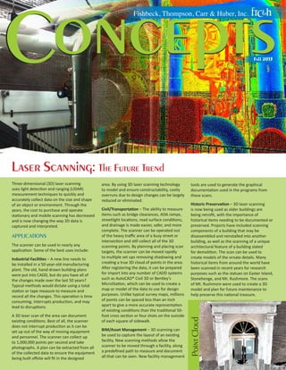
- 1. oncepts C Fishbeck, Thompson, Carr & Huber, Inc. Fall 2013 Laser Scanning: The Future Trend APPLICATIONS The scanner can be used in nearly any application. Some of the best uses include: ndustrial Facilities – A new line needs to I be installed in a 50-year-old manufacturing plant. The old, hand-drawn building plans were put into CADD, but do you have all of the changes made over the last 50 years? Typical methods would dictate using a total station or tape measure to measure and record all the changes. This operation is time consuming, interrupts production, and may lead to disruptions. A 3D laser scan of the area can document existing conditions. Best of all, the scanner does not interrupt production as it can be set up out of the way of moving equipment and personnel. The scanner can collect up to 1,000,000 points per second and take photographs. A plan can be extracted from all of the collected data to ensure the equipment being built offsite will fit in the designed area. By using 3D laser scanning technology to model and ensure constructability, costly overruns due to design changes can be largely reduced or eliminated. Civil/Transportation – The ability to measure items such as bridge clearances, ADA ramps, streetlight locations, road surface conditions, and drainage is made easier, safer, and more complete. The scanner can be operated out of the heavy traffic area of a busy street or intersection and still collect all of the 3D scanning points. By planning and placing scan targets, the scanner can be moved rapidly to multiple set ups removing shadowing and creating a true 3D cloud of points in the area. After registering the data, it can be prepared for import into any number of CADD systems such as AutoCAD® Civil 3D or Bentley’s MicroStation, which can be used to create a map or model of the data to use for design purposes. Unlike typical survey maps, millions of points can be spaced less than an inch apart to give a more accurate representation of existing conditions than the traditional 50foot cross section or four shots on the outside of each square of sidewalk. BIM/Asset Management – 3D scanning can be used to capture the layout of an existing facility. New scanning methods allow the scanner to be moved through a facility, along a predefined path to measure and document all that can be seen. New facility management tools are used to generate the graphical documentation used in the programs from these scans. Historic Preservation – 3D laser scanning is now being used as older buildings are being retrofit, with the importance of historical items needing to be documented or preserved. Projects have included scanning components of a building that may be disassembled and reinstalled into another building, as well as the scanning of a unique architectural feature of a building slated for demolition. The scan can be used to create models of the ornate details. Many historical items from around the world have been scanned in recent years for research purposes such as the statues on Easter Island, Stonehenge, and Mt. Rushmore. The scans of Mt. Rushmore were used to create a 3D model and plan for future maintenance to help preserve this national treasure. Point Cloud Three-dimensional (3D) laser scanning uses light detection and ranging (LIDAR) measurement techniques to quickly and accurately collect data on the size and shape of an object or environment. Through the years, the cost to purchase and operate stationary and mobile scanning has decreased and is now changing the way 3D data is captured and interpreted.
- 2. Progress without Interruption You are a large manufacturer and, because of your great success, you need to expand your facilities. You have already expanded several times in the past. You have structural plans from each of these additions, but they do not seem to fit together as you thought. Production continues at a very fast pace, and you cannot afford interruptions to the facility or production. This was the situation faced by Bradford White, the largest American manufacturer of hot water systems. In the spring of 2013, Bradford White completed a new shipping and receiving facility on the north end of their property in Middleville, Michigan. They are now looking to remove and replace the vacated areas. The major problem was accurately locating the columns and truss systems from two separate additions divided by a large courtyard. The civil engineer needed a survey of the columns completed. Instead of a conventional survey, FTCH used 3D laser scanning. This was a better option because the volume of survey data could be safely collected without interrupting the plant’s normal operation. During the next two weeks, FTCH survey crews began setting control and scanning the facility. A model of all of the information gathered was put together in an AutoCAD drawing along with a point cloud consisting of more than a billion scan points and supplied to the structural engineers. The structural engineers were able to use the point cloud to extract information not included in their current resource information by making use of the collected data. The project was then able to move forward. ADVANTAGES There are many advantages to 3D laser scanning, and the applications are only limited by your imagination. Worker Safety – Since safety should always be the most important aspect of any project, 3D laser scanning is a perfect option for many applications. The scanner can be located in a non-hazardous area and is able to collect data at varying distances. Entering roadways, climbing ladders, or dodging heavy equipment can be largely eliminated. Pipes with asbestos insulation can be measured, and the location documented, without coming into physical contact with the pipes. Versatility – Scanning is being used in surveying, 3D modeling, facility and building information systems, industrial and mechanical applications, architectural and structural applications, and civil and transportation applications. New uses include as-built documentation, historical preservation, forensic investigation, and asset management. These all help to broaden the use and acceptance of the technology. Compatibility – All major drafting software developers are including the ability to work with the point cloud (the collection of x, y, and z points) generated by 3D laser scanners. Nonintrusive – As with worker safety, the scanner can be set up in an out-of-the-way area while collecting data. The process is very fast. Normal operations can be maintained while the scan occurs. There will be no return trips necessary since the scanner collects every visible surface with in-depth detail. CONCLUSION 3D laser scanning offers many advantages when compared to traditional data collection methods. Improved worker safety, greater accuracy, and compatibility are compelling reasons to use this versatile technology for comprehensive data capture. FTCH continually searches for innovative ways to help our clients achieve success – 3D laser scanning is an important tool we use to make their project visions reality. For more information regarding laser scanning, please contact Tim Platz, P.S., taplatz@ftch.com. Scan of Room Photo of Room Accuracy – Due to the sheer number of points typically collected, a true best fit can be computed to locate features such as the size and shape of an object. Instead of designs relying on information interpolated from cross sections surveyed every 50 feet or a digital terrain model created on a 50-feet grid, data can be quickly and easily collected at one-foot intervals creating a more accurate model of existing conditions. Comprehensive – Data is captured from all of the surfaces within the scanner field of view, including poorly lit areas. By moving the scan locations and registering the scan data from each location together, a complete model of all visible areas can be obtained. This model can then be used or reused at a later date to extract information. This is very important because costly revisits to a site can be eliminated for projects requiring travel. www.ftch.com/concepts