

Empfohlen
Empfohlen
Weitere ähnliche Inhalte
Was ist angesagt?
Was ist angesagt? (17)
Ähnlich wie 코펜하겐의 보행자 전략
Ähnlich wie 코펜하겐의 보행자 전략 (20)
Mehr von Seongwon Kim
Mehr von Seongwon Kim (20)
Kürzlich hochgeladen
Kürzlich hochgeladen (20)
코펜하겐의 보행자 전략
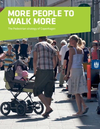
- 1. MORE PEOPLE TO WALK MORE The Pedestrian strategy of Copenhagen
- 2. ... you protect the environment ... it’s free ... it’s healthy ... you contribute to a living city ... you meet other people ... you discover more ... you get new ideas More People to Walk More... 2
- 3. PREFACE We are all pedestrians – every day. Sometimes we’re just out for a walk, other times we have a specific goal in mind. Even when we take our bike or car, go by bus, train or metro the trip usually starts and ends on foot. Most of us can walk in the city with no problems, whereas some of us need a bit of help on our walk. If you use a walking stick, a walker, a wheelchair or something similar, then you’re particularly dependent on the pavements, roads and so on being easy to access. This, however, does not change the fact that we are all pedestrians. In Copenhagen, we are very keen to focus on pedestrians so we can achieve an even better city life for everybody even more healthy citizens and a better environment. It is essential for us to create an even more interesting, exciting and safe city. For this reason, I would like to introduce here one of the goals in the City of Copenha- gen’s proposal for city life entitled “Metropolis for People”: ”More People to Walk More”. The pedestrian strategy “ More People to Walk More” contains a number of proposals as to how Copenhagen can become an even better city for pedestrians, showing how to achieve the goal of 20 % more pedestrians by 2015. Considerable investment will be needed to get more people to walk more, so the pede- strian strategy suggests a number of initiatives in order to reach the goal. Clearly, we can make no promises as to whether all the initiatives will be implemented instantly. In order for us to fulfil our high ambitions of more pedestrians in Copenhagen, we have to make the appropriate investments. This is why we are striving to realise the initiati- ves we have prioritised in the strategy which will make Copenhagen an even better city to walk in and to spend time in. Ayfer Baykal Mayor, Technical and Environmental Administration City of Copenhagen 3
- 4. VISION Copenhagen has a vision. We want to become the world’smostliveablecity:asustainablecitywithurban space which invites people to a unique and varied urbanlife.Wewanttobecomeametropolisforpeople. We want to plan the city so that people choose to walk and so contribute to a living city with a good urban environment. At the same time, people’s health will improve if more people move around actively in their daily life. A METROPOLIS FOR PEOPLE 4
- 5. WHY ARE PEDESTRIANS A PRIORITY? MORE PEOPLE TO WALK MORE “More people to walk more” is one of the three main objectives of the city’s urban life vision “A Metropolis for People”. A metropolis for people is a great city to walk in. Walking is our most basic form of movement. It is easy, healthy and free, and it is more sustainable to walk than to take the car. It offers us the opportunity to use our senses, to go on a voyage of discovery and to meet other people. Walking is urban life. So, Copenhagen invites you to walk – in greater comfort and safety, and with less congestion. OUR GOAL IS: The pedestrian strategy will contribute to achieving the goal of the municipality’s urban life strategy “Metropolis for People”: “More People to Walk More”. 20% increase in pedestrian traffic by 2015 compared to 2009. THEY CREATE A BETTER URBAN LIFE Pedestrians contribute to a liveable city. The more people walk and partici- pate in different events, the more vital and diverse a city life will emerge. The presence of pedestrians contributes to the creation of a good urban life for the citizens and the tourists. THEY ARE ENVIRONMENTALLY FRIENDLY Pedestrians contribute to a better environment. The more pedestrians, bicycles and public transport, the better the urban environment. We want to take the non-motorised actors in today’s traffic into account and thus strengthen green mobility in the city. IT IS HEALTHY Walking is healthy for all people of all ages. Daily exercise can easily be incorporated into everyday life, giving it positive significance with regards to social, mental and physical health. That’s why experiencing the city on foot needs to be made even more attractive for Copenhageners in their daily lives. MORE PEOPLE TO WALK MORE 5
- 6. HOW MUCH DO COPENHAGENERS WALK? SOURCE: Transport Goods Survey 2009 COPENHAGENERS’ CHOICE OF MAIN MODE OF TRANSPORT PER PERSON PER DAY. 25% of daily trips are on foot. WALKING 25 % CYCLING 30 % CAR 27 % PUBLIC TRANSPORT 15 % OTHER 2 % THE DEPARTMENT OF HEALTH RECOMMENDS children are active at least 60 minutes per day adults are active at least 30 minutes per day. Less than 30 min 30 – 60 min More than 60 min 50 40 30 20 10 0 Weekend/holiday Every day SOURCE: Citizen Survey Interviews 2010 41% walk less than half an hour a day. Goal for 2015 12 min 10 min 8 min 6 min 4 min 2 min 0 min 2010 2011 TRIPS WHERE WALKING IS THE MAIN MODE OF TRANSPORT In 2009, Copenhageners walked 9.86 minutes a day on average. The goal is that by 2015 Copenhageners walk 12 minutes a day SOURCE: Transport Goods Survey 2009 MINUTES AVERAGE COPENHAGENER WALKS A DAY 6
- 7. WHAT MOTIVATES COPENHAGENERS? Moregreenroutesandpaths Greensurroundings Acleanercity Betterairquality Amorepedestrian-friendlycity Lesstraffic Morelocalcafés,shopsetc. Betterlighting Lowerspeedlimits Bettersenseofsecurityinrelationtocrime Bettersenseoftrafficsafety Improvedsenseofsafetyinpedestriantunnels Betterinformationconcerningdestinations,pathsandroutes Morelocalarrangements Morepedestriancrossings Bettersurfacesonpathsandpavements Improvedintersections Betteraccesstopublictransport Easytocrosstheroads 70 60 50 40 30 20 10 0 WHAT MAKES COPENHAGENERS WALK IN THEIR NEIGHBOURHOOD? WHAT CAN MOTIVATE THE COPENHAGENERS TO WALK EVEN MORE? 13 % - other reasons 19 % - because it’s good for me 18 % - because I enjoy being outdoors 13 % - because I enjoy the surrounding and the scenery 11 % - because it’s easy and convenient 8 % - I find it relaxing 7 % - for the joy of walking 7 % - when I haven’t other means 5 % - because it’s faster SOURCE: Citizen Survey Interviews 2009 and 2010 7
- 8. HOW WILL COPENHAGEN LOOK IN THE FUTURE? POTENTIAL FOR GROWTH We have a goal to develop the walking culture in Copenhagen so the inhabitants will choose to walk because it is healthy, because they take part in urban life and because it benefits the environment. We have to develop a walking culture in Copen- hagen as we did with the cycling culture. It is a good sign of “a good city” when people want to walk. HOW CAN THE CITY BE PLANNED TO MAKE MORE PEOPLE WALK MORE? From the many possible initiatives, the City of Copenhagen has chosen four focus areas where the potential for growth in pe- destrian traffic is estimated to be greatest: the development of a walking culture, pedestrian routes and meeting places, main shopping streets and traffic nodal points. In the first period, 2011– 2015, initiatives within the four focuses will be selected and implemented. These focus areas will be supported by and can create a synergy with other ongoing muni- cipal strategies and initiatives. The focus areas are furthermore chosen on the basis of survey interviews etc THE CITY FAMOUS FOR ITS HIGH-QUALITY PEDESTRIAN AREAS – with even, clean pavements with areas to sit down in THE CITY WITH SAFE TRAFFIC – with fewer accidents involving pedestrians THE CITY WHERE IT IS EASY TO GET AROUND IN – with fewer obstacles for pedestrians THE CITY ON THE MOVE – with the possibility of exciting experiences in all districts of the city THE SAFE CITY – where people feel safe walking in their neighbourhood THE COMMUNICATIVE CITY – informing and engaging its citizens in traffic and activities THE ACCESSIBLE CITY – designed for everybody; children, adults and the elderly THE GREEN CITY – with green routes and surroundings BY 2015, COPENHAGEN WILL BE... 8
- 9. FOCUS AREAS DEVELOPMENT OF A WALKING CULTURE In many ways, the fact that Copenhageners walk in their daily life is obvious, something we don’t reflect upon. The walking cul- ture can be developed by us becoming more conscious about the benefits related to walking rather than for example, using a car for a short trip. It can also be encouraged by providing better informa- tion about different events which encourage us to walk with other people and by ourselves, on the job and privately. There are lots of opportunities to encourage people to walk. PEDESTRIAN PRIORITY MAIN SHOPPING STREETS See info box on pedestrian priority main shopping streets on page 16. As far as business goes, the connecting links in the city are the pedestrian priority main shopping streets. In this sort of street you can find a lot of retail and grocery stores as well as cafés and restaurants, all served by mixed modes of transport. Getting to your destination on foot is often difficult on the narrow pave- ments, with their bus stops, display stalls, and outdoor services and other fixtures in urban life. If pedestrian comfort is increased, there is considerable potential for growth in the pedestrian priority main shopping streets. TRAFFIC NODAL POINTS PEDESTRIAN ROUTES AND MEETING PLACES Copenhagen has an extensive network of streets and paths where the inhabitants can walk. In many cases however, there are bar- riers, and this, combined with a lack of connecting links, makes it more difficult to be a pedestrian. In other areas, there is a lack of meeting places and recreational areas connected to the pedestrian routes. A connecting pedestrian route would offer further encoura- gement to walk and make it easier to find alternative routes. In Copenhagen, the many train stations and bus terminals constitute traffic nodal points. They are important locations for everybody who uses different kinds of public transport but also important points of reference in Copenhageners’ mental map of the city. These are places of reference, which allow you to orientate yourself and possibly change direction. Everything is clustered into these nodal points, parking for bikes, hotdog stands, stalls, ticket offices, waiting areas and much more. A better connection with the pedestrian routes and more accessible squares would increase pedestrian comfort. 9
- 10. WHAT IS A WALKING CULTURE? A walking culture covers all the ways in which the inhabitants get around on foot, including recreational and necessary daily errands. The walking culture is a reflection of a diverse urban life which unfolds when Copenhageners of all ages walk around. As with other cultures, the walking culture can be further developed. It can be supported through campaigns and events encouraging new forms of activity. A new local fair or other event can encourage citizens to go for a walk and explore the new activities. The walking culture can be influenced by different actors who inspire others to walk more, along new paths or even further than they used to. A walking culture can also be influenced by information causing a change of habit, resulting in a healthy walk replacing a short trip in the car. If the surface of the path or pavement encourages walking, it will influence the amount the pedestrian route is used. Conversely, if the quality of the surface is poor, people will be less inclined to use it. Is walking an enjoyable experience or an unpleasant duty resul- ting in people walking only when absolutely necessary? The pedestrian strategy supports local initiatives, encouraging walking and a subsequent improvement in citizens’ health. The city contains many hidden op- portunities to stimulate the walking culture. WALKING CULTURE 10
- 11. Experiencing the city on foot can start at an early age and is an important part of the development of a walking culture. 11
- 12. “It’s lovely to walk – try it yourself...” “We walk together...” “Take a walk with a friend and get experiences on the way...” “Take care of children who are alone in the traffic”. VISION FOR THE FUTURE WALKING CULTURE IMAGINE THE WALKING CULTURE IN COPENHAGEN IN THE FUTURE THE CITIZENS HAVE BECOME INVOLVED The residents in the city are the most important actors and creative fellow players in the many new activities and campaigns. Campaigns that have made young and old walk more. Walking has become the natural choice of transport in many of the daily trips. The citizens have been active in pointing out where the local pedestrian routes should go. They have seen where connections are missing and where new shortcuts can be established. In working with the walking culture new suggestions have emer- ged from collaboration with the local citizens. A new awareness that the city is a special place for pedestrians has spread among the citizens; this has been achieved due to the quality that has been reached through the years. Copenhageners are proud of their city, not only as a world famous city for cyclists but also as a lovely city where you can enjoy life as a pedestrian. It is a quality that children can be in the streets safely and can cycle or walk to school. The Copenhageners are the city’s pedestrian ambas- sadors who willingly tell visitors about the splendours of the city. MORE WALKING ON A DAILY BASIS Walking campaigns have become a fixed part of the year’s acti- vities in Copenhagen. Organizations and companies are involved in the different events. Large-scale events like “Lady Walk” and “Walkathon” are supplemented by local activities, where the citizens join Nordic walking groups or a “Get to know your city” trip with cultural input. It is “in” to walk. Campaigns like “Do you realize it doesn’t take any longer to walk” have worked, and short car trips have been replaced by walking or going by bike. Day-care centres are active in communicating the joys of walking to the city’s youngest pedestrians and in this way, plant the seeds of good habits for the future. In many districts, children are stimulated to movement through play and games on the city’s pedestrian routes. Some institutions and private compa- nies have introduced initiatives designed to promote walking, for example “Walk and Talk” where a group of people hold their meetings while they are walking around, and so ensure they get some exercise in an otherwise passive day on the job. NEW ADVENTUROUS PEDESTRIAN ACTIVITIES The improvements for pedestrians which have been put in place have made citizens’ daily chores easier; some walking initiatives however, encourage people to walk for enjoyment or for their health. New, interesting and exciting routes have been built for the citizens, where it is a pleasure to walk and where you can get both information and experiences. School children can take the safe road to school, which is a “path of crumbs” where “crumbs” have been embedded in the pavement – thereby of- fering an experience and guiding the children safely to school on foot. See info box about path of crumbs. In this way, the urban space becomes part of the learning space. The municipality is working to take into account the needs of different age groups and different citizens’ behaviour. Copenha- gen has room for the pedestrian who is active, creative, medita- tive or just enjoys being a spectator. WALKING CULTURE VIA NEW TECHNOLOGY New maps show pedestrian route networks as well as the shortest route on foot. The map exists in a pocket version or as a download to a computer or smart phone. The municipality supports the GPS-based direction systems which indicate the fastest route on foot via mobile phone. PATH OF CRUMBS - DK KRUMMESTI Translated literally this means a ‘path of crumbs.’ The idea is taken from a story by the Brothers Grimm, in which a trail of crumbs is meant to lead Hansel and Gretel to safety. The ‘crumbs’ in Copenhagen are pictures of for example, Max the Cat, embedded into paving stones which lead children safely from for example, their school gate to a pedestrian crossing. 12
- 13. Experiences and activities for schools, institutions and the entire family can encourage more people to walk more in their local district - performance on Vanløse Square, Copenhagen Ladywalk 2010, a walking arrangement encouraging more people to walk more, promoting health and exercise, the lakes of Copenhagen PROPOSALS FOR INITIATIVES UP TO 2015 Public dialogue in all districts about the continuing development of the walking culture Behavioural campaigns, aiming at minimising the number of short car trips Support for local and amateur sporting events Information in the districts about the local activities “Walking busses” and other activities encouraging children to walk to school Support the offer of more events and experiences alongside pedestrian routes. Behavioural campaigns directed at avoiding conflicts between pedestrian and cyclists as well as cyclists and bus passengers. 13
- 14. Sign from the Lakes in Copenhagen Nordic walking Walking in winter WALKING CULTURE 14
- 15. Children in the traffic Schoolchildren School crossing patrol 15
- 16. PEDESTRIAN ROUTES AND MEETING PLACES WHAT ARE PEDESTRIAN ROUTES AND MEETING PLACES? Pedestrian routes are the districts’ local network of connections between the most important local destinations, for example, schools, libraries and centres. They are made up of paths, pave- ments etc, where pedestrians are prioritized. The routes are some- times intertwined with the green walking and cycling routes, and are connected to exercise paths, pedestrian priority main shopping streets and other pedestrian networks. The pedestrian routes are also experience routes, where there can be an emphasis on the qualities pedestrians can appreciate due to their leisurely pace and their closeness to the surroundings. You can carry out your daily tasks and do your shopping while enjoying nature, green surroundings and culture along the way. Experiences along the way can be livened up by interaction with other people and the opportunity to take a short break at the small meeting places along the pedestrian routes. Almost all trips have an element of walking in them because a trip or journey always starts and ends on foot. Short trips can often be done on foot in the same time as it would take using a combina- tion of bus and car, especially when you include the time spent on finding a parking space. Pedestrians can often choose the shortest route to their destination. Where this is not the case, there is probably the potential for improving the pedestrian route network. The function of the pedestrian route network is also to create a connection with the pedestrian priority main shopping streets and traffic nodal points, so that life as a pedestrian is easy and fast. Network of pedestrian routes pamphlet made by Valby local committee. PEDESTRIAN PRIORITY MAIN SHOPPING STREET DK STRØGGADE In Copenhagen, a strøggade was originally an important shopping street and arterial road. The City of Copenhagen has now designated 12 streets in 12 different districts in the city as strøggade with a much broader functional definition. They will function as a central urban element based on acces- sibility for pedestrians, cyclists, users of public transport etc. The streets have wide pavements, low speed limits for cars, outdoor cafès and high level of bus flow. They have mixed forms of traffic and are the shopping centre for the district. In the text they are referred to as pedestrian priority main shopping streets. A strøggade is now an officially recognised road category. 16
- 17. Pedestrian routes can be designed to provide a mixture of walking and having a break, Sønder Boulevard Copenhagen. 17
- 18. “It makes it really easy with pauses and meeting places on the way...”VISION FOR THE FUTURE PEDESTRIAN ROUTES AND MEETING PLACES IMAGINE THE PEDESTRIAN ROUTES AND MEETING PLACES OF THE FUTURE IN COPENHAGEN A COHERENT NETWORK The pedestrian routes have been expanded as a coherent local network of walking and jogging routes, which makes it easy to get around on foot. The comfort level is high, it is easy to get to your destination and you really feel you want to start walking or jogging. GREEN ROUTES AND NEW SHORT CUTS The network of pedestrian routes are not just for the trips you have got to make, but also for pleasure. You will experience a lot of different things on the routes, which also offer alternati- ves for both longer and shorter trips. New short cuts as well as interesting and charming detours have been built. The routes often run through green streets, they are part of the park and cemetery footpath network, joined to the children and adults play and activity areas. New pedestrian bridges over the harbour have created a lively pedestrian and cycle traffic across previously separated city districts. The pedestrian routes are so varied and complex that no one can resist the invitation to take a walk down a green route. Pedestrian routes are very accessible and comfortable. Along certain stretches the pedestrian routes form part of the munici- pal accessibility route network. MANY NEW MEETING PLACES A lot of different meeting places have been built into the network: a rest bench on a street corner that splits the trip up a bit and provides an opportunity for a little break, an exercise pa- vilion, a small covered space with a few benches where you can chat or a little local place for small get-togethers, for a barbecue for example. Several locations in the city have turned into new meeting places with the help of mobile, temporary installati- ons, which spotlighted previously unused areas. ATTRACTIVE, PLAY AND LEARNING ROUTES Here and there, pedestrian routes are provided with opportu- nities for games and learning. Attractions for pedestrians are given high priority and boring, closed facades and other less attractive stretches have been given a makeover, so that they have become more interesting to walk along. Artists, schools and institutions have contributed with their own creative solutions, so that people are invited to walk down new avenues. Places that were previously sad, can now be experienced in new ways as a result of the many permanent and temporary installations, which have appeared. LIGHTING AND CLEANING The network of pedestrian routes has been lit in various ways, adapted to the route's location and terrain. This has made people feel safer. Pedestrian routes are given priority with regard to maintenance and cleanliness. This is a must, if the routes and not least, the meeting places are going to look inviting. Rubbish and graffiti are removed quickly. 18
- 19. PROPOSALS FOR INITIATIVES UP TO 2015 Local networks of pedestrian routes and meeting places are designated in all districts by the local committee in collabo- ration with the municipality. New shortcuts and building “missing links” in order to create coherence in the pedestrian route network. Pedestrian routes coordinated with jogging paths, green cycle routes and pocket parks. Good lightning on pedestrian routes and meeting places so people feel safe and comfortable. Exercise pavilions, fitness and games to create experience routes. Trying out different designs and layouts of new sorts of small meeting places on the route network. High standard of street cleaning and snow clearance. More green pedestrian routes. Putting up more benches along pedestrian routes and at meeting places. All pedestrian routes to be made accessible for citizens with low mobility. Pedestrian routes can encourage activity and movement i.e. Nordic walking. Lersøparken Copenhagen. Motion and exercise pavilions can be meeting places on a pedestrian route and contribute to an increased level of movement on a daily basis for every age group, old and young, Fredens Park Copenhagen. 19
- 20. PEDESTRIAN ROUTES AND MEETING PLACES Shortcuts, here Lane-way art project, Melbourne Australia. A bench to chat on, Vancouver Canada. Drinking water and different urban furniture, Stuttgart Germany. A new meeting place, Vartov, Copenhagen. 20
- 21. Pedestrian routes in winter, Prag Boulevard. 21
- 22. Frederikssundsvej Nørrebrogade Østerbrogade N drFrihavnsg. JernbaneAllé Valby L angg. Holmbladsgade Amagerbrogade Mozartsvej Borgbjergsvej Istedgade Torveg. Pedestrian priority main shopping street (SOURCE: The municipality plan of Copenhagen 2009) PEDESTRIAN PRIORITY MAIN SHOPPING STREETS PEDESTRIAN PRIORITY MAIN SHOPPING STREETS Pedestrian priority main shopping streets (dk strøggade) are the commercial streets of each district in Copenhagen. Twelve streets were so designated in the Municipality Plan of 2009. A white book has been written with suggestions as to how to develop these pedestrian priority main shopping streets. The aim is to improve urban life by improving conditions for pedestrians. Pedestrian priority main shopping streets have a high concentration of shops, cafes, restaurants etc, which leads to a high concentration of pe- destrians, cyclists, busses and other kinds of traffic in these stre- ets. Car traffic must be kept at a low speed to take into account the street environment as well as to facilitate the flow of bus traf- fic. Only streets where there are alternative routes for traffic have been designated pedestrian priority main shopping streets. Pedestrian priority main shopping streets are important public spaces which many citizens visit on a regular basis. All the things on offer on both sides of the street tempt the pedestrians to cross the street frequently, although it is not completely traffic-free. There should be enough room in these pedestrian priority main shopping streets to walk in comfort, and to window shop while other people walk by. There should also be room to wait for the bus or sit at a pavement cafe. The limited space must therefore be shared in a reasonable way, taking everybody involved into consi- deration as far as possible. The identity of the neighbourhood and its diversity is important to the special charm these streets have. Today, pedestrians often have to share the sidewalks with the shops displays, signage etc. There is limited space for pedestri- ans to move along and this also has to be shared with “pede- strians on wheels” - walkers, wheelchairs and prams for twins. The room on the pavement must therefore be enlarged so that pedestrians and other users of the pedestrian priority main shopping streets can reach their destinations. This must not affect the shopping activity or meeting places adversely. 22
- 23. Urban space in connection with pedestrian priority main shopping streets (here seen from Gunnar Nu Hansens Square at Østerbrogade). 23
- 24. VISION FOR THE FUTURE PEDESTRIAN PRIORITY MAIN SHOPPING STREETS “A lovely place to shop, wait for the bus, walk and interact with others...” PEDESTRIAN PRIORITY MAIN SHOPPING STREETS HAVE DEVELOPED INTO NEIGHBOURHOODS The pedestrian priority main shopping streets have been rein- vented by prioritising pedestrians and cyclists and by enhan- cing the special charm of the streets. Pedestrian priority main shopping streets are intertwined with the neighbourhood and the side streets have become part of the overall neighbourhood. The side streets and smaller squares supplement the main street so that shopping, spending time, play and public trans- port take place parallel to cafés and exhibitions. The identity of the neighbourhood and the juxtaposition of shops and resi- dents arise naturally from their design - in such a way that the special feel of the neighbourhood around the pedestrian priority main shopping streets is enhanced. INCREASED ACCESSIBILITY AND LOWER SPEED Pedestrians are clearly prioritised through the provision of more comfort and by ensuring that they can get around easily. The pavement space is expanded, ensuring a free zone of 2 – 2.5 m. Pedestrian routes are prioritised as accessibility routes, ensu- ring that all groups of pedestrians can reach their destination easily. The pavements are expanded in some places to provide room for different activities for example, meeting places, out- door cafés and parking for bikes. The traffic has been calmed and the speed limit reduced to 30 km/h – crossing the street is easier. THE GREEN BOULEVARD. Trees are planted on the pedestrian priority main shopping stre- ets, in order to give the feeling of a boulevard. You can walk under airy tree branches which provide shade from the sun, while being tempted by what the area has to offer. Green walls and small “green pockets” are included in the street design so that the green can be spotted even where there is only limited space for trees. The streets have new lightning, which enhances their charac- ter as the neighbourhood’s main shopping street. The lighting meets the pedestrians’ need for a true reflection of colours and faces without diminishing the positive contribution lightning can also make on traffic safety. INCLUSION. Shop owners and other actors have been included in a construc- tive collaboration about the spaces for cafés, other recreational spaces and displays for shops in the street. The municipality regulates the conditions in a flexible way in order to ensure pedestrians can get where they want to go easily. AWARDS FOR BEAUTIFUL AND OPEN SHOP FRONTS. Awards will be made annually by the shop owners’ associations and the Association for Aesthetics in Copenhagen for outstan- ding renovations of shop facades which will result in more inte- resting and open facades – night and day. Through the years, the level has increased and the character and shop designs have been enhanced in each part of the city. NEW MAPS OF THE CITY DISTRICTS AND INFORMATION Maps showing the local areas and the routes to the important attractions already exist in most places. The maps shows di- stances measured in time: “it only takes four minutes” to walk to the bus stop, to the playground, to the next small square or the next pedestrian-prioritised main shopping street in the neighbourhood. HIGH LEVEL OF STREET CLEANING AND MAINTENANCE STANDARD Pedestrian priority main shopping streets have many different user groups and a lot of drinks and different types of takeaway food are consumed. There are a lot of smokers on the streets, so the litter bins and other equipment have been adjusted to the increased need and are emptied more often. Maintenance of benches and others elements along the paths is also a high priority. IMAGINE THE PEDESTRIAN PRIORITY MAIN SHOPPING STREETS OF THE FUTURE IN COPENHAGEN 24
- 25. PROPOSALS FOR INITIATIVES UP TO 2015 Transformation of a selected main shopping street by prioritising pedestrians, cyclists and public transport. Introduction of 30 km/h speed limit in the pedestrian priority main shopping streets. Pavements are enlarged, giving greater comfort and making them more accessible to everybody. Connecting pavement with adjacent streets. Obstacle-free paths on pavements - minimum width of 2 – 2.5 m. Pedestrian-friendly surfacing on pavements, high standard of street cleaning and snow clearance. More toilets, water faucets and benches on the pedestrian priority main shopping streets. Pedestrian priority main shopping streets, Amagerbrogade Copenhagen Testing of the pedestrian priority main shopping streets concept with outdoor cafés, meeting places, and space for shop displays, Nørrebrogade, Copenhagen. 25
- 26. PEDESTRIAN PRIORITY MAIN SHOPPING STREETS Example of a pedestrian priority main shopping street, Paris, France. Example of a pedestrian priority main shopping street, Melbourne, Australia. Example of a pedestrian priority main shopping street, Barcelona, Spain. 26
- 27. Example of a pedestrian priority main shopping street, Valby Langgade, Copenhagen. Example of a pedestrian priority main shopping street, Lyon, France. 27
- 28. b b b b b b b b b b b b b b b b b b b b b b b b b b b S S S S S SS S S S S S S S S S S S S S S S S S S S S S S S S S SS M M M M M M M M M M M M M M M S S b b b Train stations TRACKS AND TRAFFIC NODAL POINTS IN COPENHAGEN Metro stations Metro city line 2018 Bus terminals S M b WHAT IS A TRAFFIC NODAL POINT? Traffic nodal points are places where people switch between dif- ferent modes of transport. They can be railway stations, bus ter- minals and bus stops, resulting in many pedestrians in a limited amount of space. Traffic nodal points are the last stop for many people and they become pedestrians for the last part of their journey. Here you will find movement and quick changes between modes of transport but there is also a need for places to wait and rest. Information about traffic and connections in the neighbour- hood are other important elements in the urban design. Traffic nodal points are places for changing between different modes of transport but also places with many other offers on view because of the many streams of people whose paths cross. Stalls with tempting offers are mixed with parked bikes and a throbbing pulse of people rushing from A to B. TRAFFIC NODAL POINTS 28
- 29. Traffic nodal points can be designed so that they are easy to use and helpful to the travelling public, Flintholm St. Copenhagen. 29
- 30. MORE SPACE, EASIER TO USE The important traffic nodal points and bus stops of each district have been renewed with a focus on comfort, ease of use and improved pedestrian flow. It’s become easier to find your way around and the stations and the squares in front of the stations are in several cases more open with more space to use. TRAFFIC NODAL POINTS AND THE PEDESTRIAN ROUTE NETWORK ARE CONNECTED The traffic nodal points have been renewed and connected directly to the rest of the pedestrian network. Traffic nodal points are important destinations for the pedestrian routes. To walk to the station or the bus stop is easier and because of the good places to spend time in, the wait does not feel nearly as long.Traffic nodal points are also central points of reference in the accessibility routes, where consideration for the visually impaired, blind and challenged citizens is a high priority. ENSURING YOU CAN GET TO YOUR DESTINATION EASILY The design of the parking areas for bikes is well thought through and they have sufficient capacity. The municipality often clears up abandoned bikes in order to ensure everybody in the city can get where they want to easily. HIGH QUALITY LIGHTING Lightning has been improved so pedestrians experience walking to and from the traffic nodal points as being safe and comfor- table. The location and design of the lightning underlines the character of a traffic nodal point and makes it easy to get an overview. It creates a feeling of safety, while the actual traffic safety is high. NEW CITY MAPS AND SYSTEM OF ROAD SIGNS It is easier to navigate around in the city with the new system of road signs for pedestrians. Maps of each district tell how long it takes to find the most important points of reference within the district. Maps and road signs show the shortest route to a nodal point from the central places in the district. In many cases, the surfacing on paths and sidewalks show the way with different information embedded in the surfacing. New types of internet and mobile phone-based “travel plans” are accessible. These plans show the best pedestrian route for the entire trip - or in combination with public transport. When waiting for a long time e.g. at a bus stop, the time on foot is shown connecting to the next stop on the journey or to the end of the journey. HIGH LEVEL OF MAINTENANCE, CLEANING AND SNOW CLEARANCE Maintenance and cleaning are high priorities at the traffic nodal points all the year round. Snow clearing is also a high priority in order to ensure accessibility during the winter season. THE METRO SQUARES HAVE BECOME MEETING PLACES The existing squares by the metro stations have been improved by the addition of new relaxation areas, while spaces to and from the squares have been cleared to create more space for pedestrians. The future squares of the new metro line will be more comfortable, especially in regards to spending time there, so they can become new meeting places in the city. “it’s easy to reach your destination, find your way and use the public transport...” IMAGINE THE TRAFFIC NODAL POINTS IN COPENHAGEN OF THE FUTURE VISION FOR THE FUTURE TRAFFIC NODAL POINTS 30
- 31. PROPOSALS FOR INITIATIVES UP TO 2015 Good accessibility around traffic nodal points with pedestrian- friendly surfacing and easy crossing of streets etc. Integration of traffic nodal points into a network of pedestrian routes and accessibility routes. Longer “green time” for pedestrians at traffic signals. Putting up benches and covered relaxation areas with good lighting and waiting areas at stations and bus stops. Signage of walking distances with time indication to local destinations by S-train and Metro stations. Pedestrian accessibility and places to sit down are incorpo rated into all metro square projects. It is important to design traffic nodal points so that they are easy to navigate and simple for pedestrians, Farum station, Copenhagen Traffic nodal points must be designed in order to be accessible to pedestrians. Nørreport station, Copenhagen 31
- 32. TRAFFIC NODAL POINTS Good accessibility, Ikebukuro Station, Tokyo, Japan. Good places to sit down at the bus stops, Bourke street Melbourne, Australia. 32
- 33. Busstop, Østerbrogade, Copenhagen. Local road map for pedestrians, London, England. Sign showing a 15 min walking-distance zone, London, England. 33
- 34. VWe are rolling out the red carpet for the pedestrians. THE ONGOING PROCESS THE ONGOING PROCESS On 22 August, 2011 the Technical and Environmental Committee approved the final pedestrian strategy “More People to Walk More – the Pedestrian Strategy of Copenhagen”. On this basis, the Technical and Environmental Ad- ministration is continuing to develop the pedestrian strategy in the daily work of the administration and to make more specific proposals in order to apply for financing in future budgets. Initially, the administration is prioritising a pedestrian route project based upon the answers obtained in the consultation. The pedestrian route project is a proposal for “Better Connectivity for Pedestrians in Copenhagen”. It will cover the establishment of two specific connecting pedestrian routes in two districts of Copenhagen: Valby and Østerbro, as well as the making of plans for pedestrian routes in the rest of the districts. This work will be done in collaboration with local committees in Valby and Østerbro. The local committees in these two districts have, on their own initiative, prepared plans for a connecting pedestrian route network in the two districts. The initiative from the administration will include the selection of parts of these networks and the establishment of improve- ments such as making crossover points safe, better surfacing, better lighting, shrubberies and flower beds, benches, activities etc. 34
- 35. Public participation in the citizens’ pedestrian routes on Østerbro, Copenhagen, at Eco-Point Østerbro. Public participation in the design of the new Nørrebro Park, Copenhagen. Public participation in the traffic study on Nørrebrogade, Copenhagen. Public participation in the identification of pedestrian routes in Valby by Valby Local Committee. Public participation in the traffic study on Nørrebrogade, Copenhagen. Public participation at Eco-Point Østerbro. 35
- 36. EXISTING PROJECTS THE INTERNATIONAL TREATY FOR PEDESTRIANS In the International Treaty for Pedestrians, which Copenhagen committed to in 2008, a statement of several principles for pedestrians’ rights in public spaces in the city, can be found. The pedestrian treaty defines how we can create healthy, appropriate, and sustainable local communities where people choose to walk. The pedestrian treaty includes: actual safety perceived safety accessibility ease of movement in reaching ones destination comfort network of pedestrian routes development of the walking culture WHAT ARE WE ALREADY DOING? A number of the municipality strategies, plans and projects contain goals and initia- tives which support the overall goals of the pedestrian strategy. Through coordination with these projects, a new synergy is created which can lead to the achievement of mutually beneficial goals. Parts of the initiatives in the projects would be able to sup- plement each other. 36
- 37. 37
- 38. NOTES 38
- 39. 39
- 40. PUBLISHED BY The municipality of Copenhagen, Technical and Environmental Administration LAYOUT TMF Design CONSULTANT Gehl Architects PHOTOS Troels Heien, Gehl Architects APS, Jan Mørch, Klaus Hjerrild, Municipality of Copenhagen VISUALIZATION Gehl Architects TRANSLATION TRIPLE A communication in English 05.07.11