Belle View/New Alexandria/River Towers-Flood Risk Management Status Update
•
1 gefällt mir•1,245 views

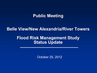
Belle View/New Alexandria/River Towers-Flood Risk Management Status Update Public Meeting October 25, 2012

Empfohlen
Empfohlen
Weitere ähnliche Inhalte
Was ist angesagt?
Was ist angesagt? (20)
Andere mochten auch
Andere mochten auch (20)
Ähnlich wie Belle View/New Alexandria/River Towers-Flood Risk Management Status Update
Ähnlich wie Belle View/New Alexandria/River Towers-Flood Risk Management Status Update (20)
Mehr von Fairfax County
Mehr von Fairfax County (20)
Kürzlich hochgeladen
Kürzlich hochgeladen (9)
Belle View/New Alexandria/River Towers-Flood Risk Management Status Update
- 1. Public Meeting Belle View/New Alexandria/River Towers Flood Risk Management Study Status Update October 25, 2012
- 2. Purposes of Meeting • Review the Belle View/New Alexandria/River Towers flood risk management study • Initiate a discussion with residents about the alignment of a flood wall/levee • Start to create consensus among residents about the best location of the proposed floodwall/levee 2
- 3. Agenda • Welcome • Presentation by the U.S. Army Corps of Engineers (Corps) • Question/Answers and Feedback • Final Steps 3
- 4. Communities are at Risk of Flooding 1% Annual Chance Floodplain* Based on Storm Surge Elevation 11.2 ft (NGVD29) *1% annual chance flood is the flood that has a 1% chance of occurring in any given year, sometimes referred to as the 100-year flood 4
- 5. Flood Inundation Areas to Elev. 14 Ft. • Sea Level Rise will increase chance of flooding • Floods higher than the 1% chance flood DO occur 5
- 6. Elevation Data • Many low openings/first floors: elevation 6-11 feet • Majority of ground elevation is 8-9 feet in Belle View, 4-9 feet in New Alexandria • 2% annual chance (50 year/Hurricane Isabel) storm surge: 9.6 feet • 1% annual chance (100 year) storm surge: 11.2 feet • 0.2% annual chance (500 year) storm surge: 16.2 feet 6
- 7. Previous Study • Completed Feb 2008 – Flood Damage Reduction Analysis for Belle Haven Watershed (by Corps) – Fairfax County requested that Corps conduct a study to evaluate various flood damage reduction alternatives to determine if they are technically feasible – Conducted under technical services program; was not a Corps project study authorized by Congress – County asked Corps to conduct preliminary economic analysis to determine if a project might meet the federal economic justification requirements – Evaluated alternatives to protect entire study area, and New Alexandria/Belle View independently 7
- 8. Project Goals and Objectives • Goal – Provide adequate flood risk management measures that are technically feasible and financially prudent for the safety of communities • Objectives – Examine various alternatives for reducing flood risk and damages – primarily from storm surge – Minimize risk to the community – Minimize environmental impacts – Incorporate needs/desires of the communities to the degree possible 8
- 9. 2008 Study - Most Cost Effective, Plan 1b • Preliminary concept plan assumed top of levee/floodwall at elevation 12.0’ (0.8’ above 1% annual chance elevation; no risk and uncertainty analysis was conducted; cannot say will provide “100-year protection” and no sea level rise considered) • Approx. 6600 feet long; 4-6 feet above ground 9
- 10. Plan 1b (2008 Study) - Levee/Floodwall Alternative 10
- 11. Plan 1b (cont.) • Requires 2 closure structures – along Belle Haven Road and Belle View Blvd • Minimizes impacts to wetlands • Impacts many trees • Is partially located on NPS and River Towers property • Requires 1 pumping station • Estimated costs Plan 1b - Levee/Wall 12’ – Construction Cost = $12.7M – Benefit to Cost Ratio (BCR) = 2.5 – Current cost and BCR: $13.7M and 2.2 11
- 12. NPS Concerns Regarding Plan 1b • Impact to GW Memorial Parkway • Impact to trees • Impact to view/aesthetics • Would prefer project to be off their property (if on federal property, need NEPA process, Congressional authorization, etc.) 12
- 13. River Towers Concerns Regarding Plan 1b • Impacts to Dykes Marsh • Impacts to River Towers property • Impacts to view/aesthetics • Impact of pump station on their property • Requested that the project be moved off their property 13
- 14. Community Concerns Regarding Plan 1b • Impacts to view/aesthetics & trees • Impacts to Dyke Marsh • Impacts to private property • Level of protection & want it to fix the problem • FEMA certification & the need for insurance • Global warming/sea level rise • Environmental impacts 14
- 15. Study Progress • 2009 – County conducted field survey and tree survey for study • 2010 – 2012 – Development and evaluation of new alternatives – Team identified various new alignments – Coordinated alignments with NPS and made revisions – Investigated portable flood barriers – Developed concept plans, costs and benefits for the new plans – Completed a preliminary sea level rise analysis – Coordinated with community leaders 15
- 16. Previous and New/Modified Floodwall/Levee Alignments
- 17. Height of Protection Overview • 1% annual chance flood elevation (100-yr elevation based on storm surge) = 11.2 feet • FEMA - for certification of project (no flood insurance requirement), FEMA requires the project be 3 feet higher than the 1% annual chance elevation = 14.2 feet • CORPS – for Corps built projects, wall must be built higher than the design event to account for risk and uncertainty (varies per project, but for the 1% annual chance flood design, typically 3-4 feet higher than the 1% annual chance flood elevation) plus sea level rise must be considered = 14.2-15.2 feet + SLR consideration 17
- 18. Height of Protection (Cont.) • Sea level rise predictions by the year 2100 – Based on historic rate = 1 foot – Based on Intergovernmental Panel on Climate Change (IPCC) study = between 0.6 - 1.9 feet – Based on National Research Council (NRC study) = between 1.5 – 4.7 feet • Height of floodwall/levee has not been decided; initially top of protection at elevation 12 feet has been used for concept plan so that is can be compared with original plan. However, 3 heights of protection will eventually be evaluated and compared for the final alignment; higher protection is recommended to account for risk and uncertainty and sea level rise 18
- 19. Corps’ Vegetation/Tree Setback Requirements • Trees can adversely impact floodwalls and levees and cause the flood protection system to fail • Vegetation/tree-free zone (except grass) extends 15 feet on each side of a floodwall • If a large tree has the potential to damage the wall if it overturns, then it should be removed. General rule of thumb - trees should be a minimum distance of half their height from a floodwall • County surveyed trees along potential alignments; arborist preliminarily identified highest priority trees based on species/condition • Tree setback will be based on tree height and risk; we are currently showing a 40-foot setback 19
- 21. Boulevard View South (South of Belle View Blvd) • Alternative BVS1 – Wall along eastern edge of Boulevard View (original alignment) • Alternative BVS2 – Wall along center of Boulevard View • Alternative BVS3 – Wall along western edge of Boulevard View 21
- 22. Boulevard View South 22
- 23. Alternative BVS1 23
- 24. Boulevard View South Looking South 24
- 25. Concept View of BVS1 Looking South Floodwall Elevation 12 Feet Wall approximately 4 feet high 25
- 26. Concept View of BVS1Looking South Floodwall Elevation 14.5 Feet Wall approximately 6.5 feet high 26
- 27. Alternative BVS2 27
- 28. Alternative BVS3 28
- 29. Revised Alternative BVS3 29
- 30. Concept View of BVS3 Looking South Floodwall Elevation 12 Feet Wall approximately 4 feet high; Revised BVS3 wall would be constructed further west, closer to BV buildings 30
- 31. Concept View of BVS3 Looking South Floodwall Elevation 14.5 Feet Wall approximately 6.5 feet high; Revised BVS3 wall would be constructed further west, closer to BV buildings 31
- 32. Boulevard View South Looking West 32
- 33. Concept View of BVS3 Looking West Floodwall Elevation 12 Feet Closure structure for access Wall approximately 4 feet high; Revised BVS3 wall would be closer to buildings 33
- 34. Concept View of BVS3 Looking West Floodwall Elevation 14.5 Feet Wall approximately 6.5 feet high; Revised BVS3 wall would be closer to buildings 34
- 35. Sample Closure Structures 35
- 36. 36
- 37. 37
- 38. 38
- 39. Boulevard View Central (From Belle View Blvd north to Old Towne Rd) • Alternative BVC1 – Wall along eastern edge of Boulevard View (original alignment) • Alternative BVC2 – Move Boulevard View to the west; wall along eastern edge of Boulevard View • Alternative BVC3 – Wall on west side of Boulevard View • Revised Alternative BVC3 – Wall on west side of Boulevard View south of I Street; north of I Street – shift road west and wall on east side 39
- 40. Boulevard View Central 40
- 41. Alternative BVC1 41
- 42. Boulevard View Central Looking Southeast Along Road Near H Street 42
- 43. Concept View of BVC1 Looking Southeast Floodwall Elevation 12 Feet Wall approximately 3 feet high 43
- 44. Concept View of BVC1 Looking East Floodwall Elevation 14.5 Feet Wall approximately 5.5 feet high 44
- 45. Boulevard View Central Looking West 45
- 46. Concept View of BVC1 Looking West Floodwall Elevation 12 Feet Wall approximately 3 feet high 46
- 47. Concept View of BVC1 Looking West Floodwall Elevation 14.5 Feet Wall approximately 5.5 feet high 47
- 48. Alternative BVC2 48
- 49. Alternative BVC3 49
- 50. Revised Alternative BVC3 50
- 51. 51
- 52. 52
- 53. 53
- 54. 54
- 55. 55
- 56. Boulevard View North (From Old Towne Rd to Belle Haven Rd) • Alternative BVN1 - Wall behind houses along NPS property (original alignment) • Alternative BVN2 – Wall behind houses on private property • Alternative BVN3 – Wall runs along Old Towne Rd and 10th Street; 7 houses outside protection 56
- 57. Boulevard View North 57
- 58. Alternative BVN1 58
- 59. Alternative BVN2 59
- 60. Boulevard View North BVN1 and BVN2 - Wall would run near existing fence (existing wood fence is approx. 4’4” high) 60
- 61. Alternative BVN3 61
- 62. 62
- 63. 63
- 64. 64
- 65. 65
- 66. 66
- 67. New Alignment – Floodwall along GWMP 67
- 68. 68
- 69. Southern Area (near River Towers) • Alternative S1 – Levee/wall along south side of River Towers (original alignment) • Alternative S1A – Levee/wall along south side of River Towers closer to building • Alternative S2 – Wall adjacent to Belle View Condo north of West channel • Alternative S3 – Wall along southern curb of BV parking lot north of West channel • Alternative S4 – Wall along northern curb of parking lot south of West channel 69
- 70. Southern Area 70
- 71. Alternative S1 71
- 72. Looking South from River Towers 72
- 73. Concept View of S1 Looking South Levee Elevation 12 Feet Levee approximately 7 feet high 73
- 74. Concept View of S1 Looking South Levee Elevation 14.5 Feet Levee approximately 9.5 feet high 74
- 75. New Alignment - Alternative S1A 75
- 76. Looking West Behind Eastern River Tower 76
- 77. Looking South Behind Eastern River Tower 77
- 78. Looking West Behind Center River Tower 78
- 79. Looking South Behind Center River Tower 79
- 80. Alternatives S2, S3, and S4 80
- 81. Alternative S2 – Western Part 81
- 82. Southern Area Looking East Between Belle View Condo and West Channel 82
- 83. Concept View of S2 Looking East Floodwall Elevation 12 Feet Wall approximately 4 feet high 83
- 84. Concept View of S2 Looking East Floodwall Elevation 14.5 Feet Wall approximately 6.5 feet high 84
- 85. Alternative S3 – Western Part 85
- 86. Concept View of S3 Looking East Floodwall Elevation 12 Feet Wall approximately 4 feet high 86
- 87. Concept View of S3 Looking East Floodwall Elevation 14.5 Feet Wall approximately 6.5 feet high 87
- 88. Alternative S4 – Western Part 88
- 89. Southern Area Looking Northwest across West Channel 89
- 90. Eastern Part of Alternative S2, S3, S4 90
- 91. Southern Area (Eastern Part) Looking North from River Towers S2, S3 and S4 - Wall would replace existing fences 91
- 92. Southern Area (Far Eastern Part) S2, S3 and S4 - Wall would extend along this area 92
- 93. Closure Structures/Increased Risk • The more closure structures a project has, the higher the risk of possible failure • Original alignment (S1, BVS1, BVC1, BVN1) = 2 road closures • Innermost alignment (S2, BVS3, BVC3, BVN3) = approx. 50 closures (roads, sidewalks, and driveways) 93
- 94. Evaluation of New Plans
- 95. New Plan 1 • BVN3, BVC3, BVS3, S1a • No impacts to NPS property • River Towers within line of protection; project on River Towers property • Houses near 10th St. outside line of protection • Estimated cost: $26.5 M • BCR 1.2
- 96. New Plan 2 • BVN3, BVC3, BVS3, S2 • No impacts to NPS property • River Towers and houses near 10th St. outside line of protection • Not on River Towers property • Estimated cost: $31.4 M • BCR 1.0
- 97. New Plan 3 • BVN3, BVC3, BVS3, S4 • No impacts to NPS property • River Towers and houses near 10th St. outside line of protection • S4 section on River Towers property • Estimated cost: $28.6 M • BCR 1.1
- 98. New Plan 4 • BVN1, BVC3, BVS3, Sa1 • On NPS and River Towers property • All structures are within line of protection • Estimated cost: $22.5 M • BCR 1.4
- 99. New Plan 5 • GWMP, Sa1 • On NPS and River Towers property • All structures are within line of protection • Estimated cost: $35.2 M • BCR 0.9
- 100. Challenges • Except for original plan (that will have major impact to NPS trees), all BCR’s are less than 1.4 • Majority of alternatives would include numerous closure structures that County would be responsible for maintaining and closing • Innermost alignments would impact Boulevard View – many large trees in front of condos would have to be removed – roadway would have to be realigned in sections – significant impact to utilities 100
- 101. Challenges (Cont’d) • BVN3 would not protect houses near 10th street; many challenges with aligning wall down 10th street • Alignments off of River Towers property – plans are more expensive – cross roads and tributary, cross utilities, may need additional pump station – RT property would be outside line of protection and would be flooded if floodwaters were higher than elev. 11-12 ft. (HVAC, elevators, utilities, parking lots, etc.) – would need to leave one closure gate open for emergency vehicles; would have to close just before flooding 101
- 102. Challenges (Cont’d) • GWMP alignment – has less impacts to trees and utilities and less closures than other alignments (however closures will be large) – road will be partially closed during/after closure installation – project cost will be high – will have significant review process due to NPS land (Congressional approval, NEPA, etc.), and may likely be considered an “impairment”, which would prevent the construction of the project 102
- 103. Potential Next Steps • Based on feedback from public, County may select a project alignment for further analysis and design • Corps will develop, evaluate and compare concept plans for the selected alignment for 3 different heights of protection and County will select a final height of protection • If alignment impacts NPS property, formal NEPA process will be initiated concurrently • Corps will develop more detailed design for the final project • Depending on many factors, the earliest project construction would occur would be 4-5 years after completion of 65% design 103
- 104. Minimize Your Flood Risk! • Purchase flood insurance, even if you are not required to • Sign up for flood alerts through the County’s RiverWatch Program (www.fairfaxcounty.gov/cean) • Move critical and valuable items from the basement or the first floor (documents, old photographs, computer, etc.) • Consider elevating new utilities when they are being installed since they are expensive to replace (hot water heater, air conditioning/heating unit) • Have an evacuation plan for you and your family 104
- 105. For More Information Contact: Donald Demetrius, P.E., PhD., Chief Watershed Projects Evaluation Branch, Stormwater Planning Division Fairfax County Department of Public Works and Environmental Services 12000 Government Center Parkway Fairfax, VA 22035 703-324-5500, TTy 711 donald.demetrius@fairfaxcounty.gov Presentation will be available on-line at: http://www.slideshare.net/fairfaxcounty 105